The Mountains of Utah
• www.surgent.net
|
| Shinob Kibe |
• Virgin River Canyon • City of Washington • Washington County |
|
Date: May 30, 2021
• Elevation: 3,306 feet
• Prominence: 566 feet
• Distance: 1.4 miles
• Time: 75 minutes
• Gain: 631 feet
• Conditions: Very nice but warming fast
Utah
•
PB
Overview: I spent three days in the St. George area, hiking anything that looked interesting, fun or both. I was not picky, and I was an opportunist, tagging a few hilltops simply because they were convenient. I visited nine ranked summits in the region, all short hikes, but cumulatively hiked about 15 miles and about 4,500 feet of elevation gain.
My agenda:
Today would be my second day (and only full day) in the St. George area, tagging peaks and hilltops as opprtunities arose. I had a pleasant night camping in the desert south inside Arizona, under a mostly-full moon, sleeping in the open on my cot. The lows were tolerable, in the 60s. But the daytime highes were hovering in the mid-90s. I wanted an early start, and deliberately arranged my peaks by how they may be impacted by the heat. Thus, I placed the ones that appeared to require the most effort first, so that the heat would be mitigated.
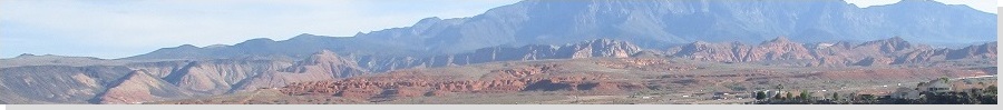
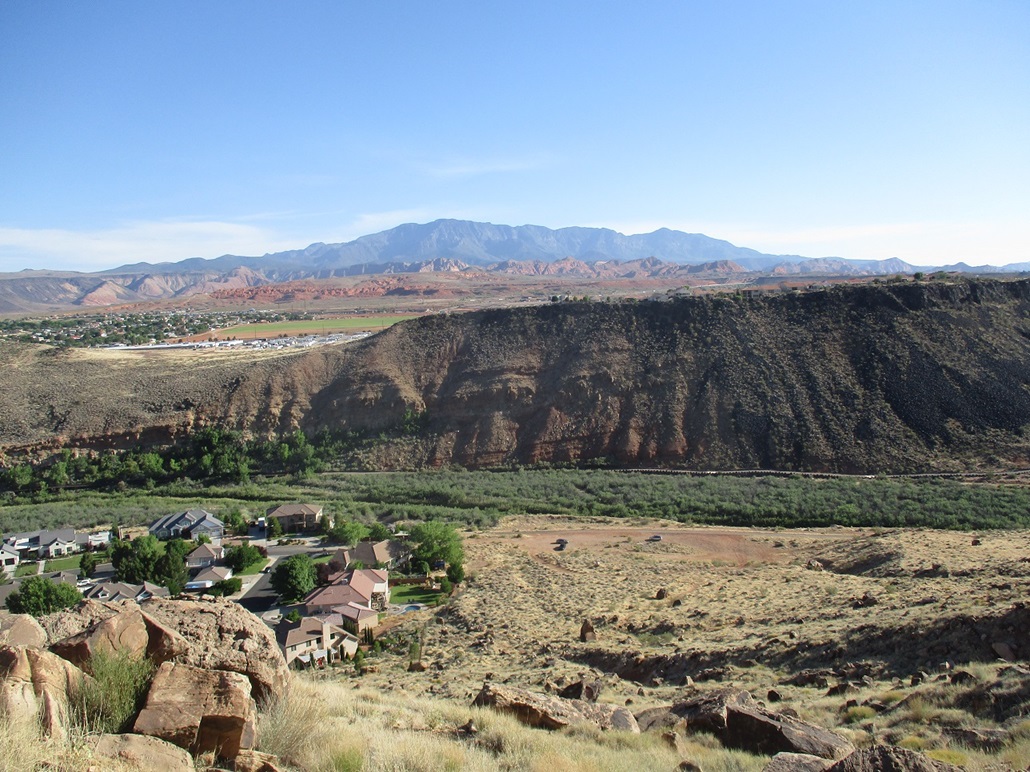
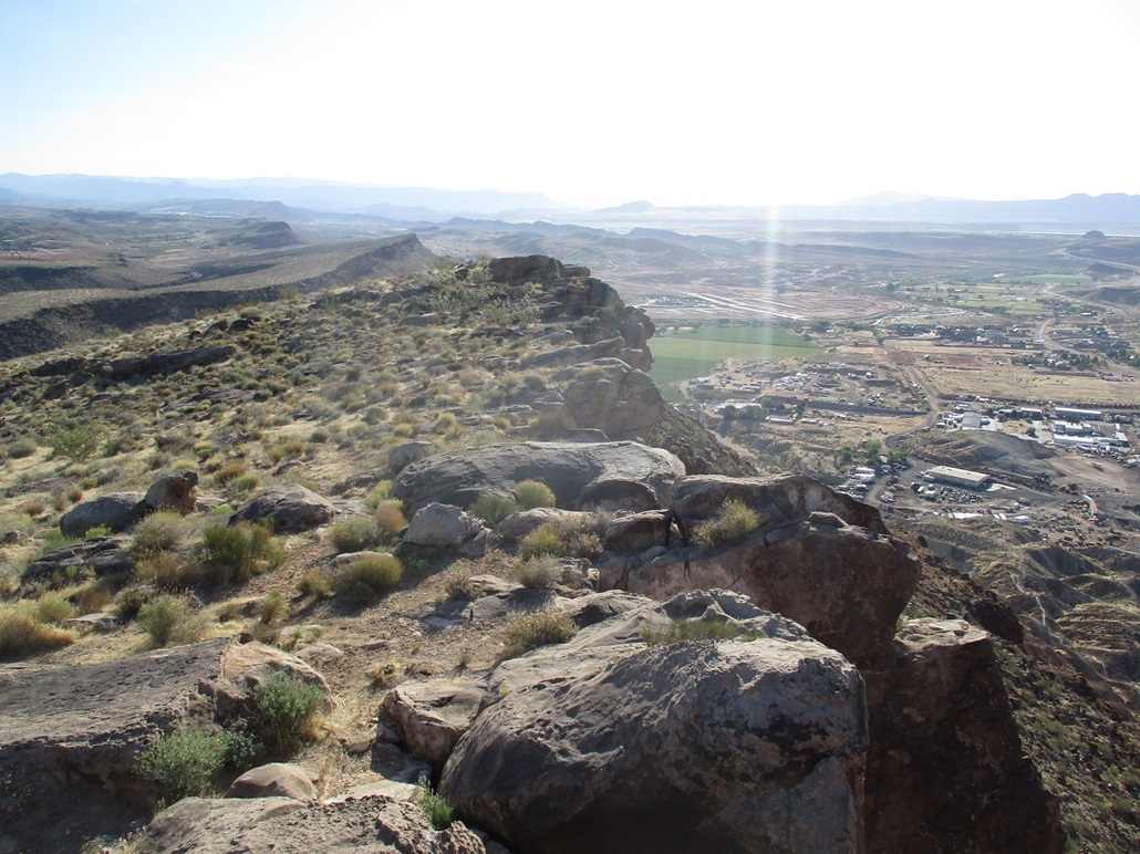
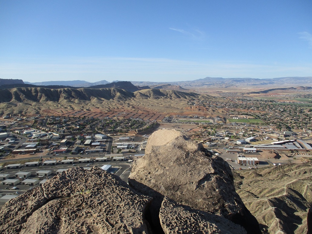
Shinob Kibe is a mesa with a pallisade of cliffs around its top, but apparently used by the Indians of the past as a lookout. It lies in the city of Washington, a suburb of St. George and fronts the Virgin River, which meanders through the cities creating steep-walled cliff banks (and gorgeous scenery). To get to the trailhead means driving through a maze of residential streets, and I won't describe what I did, but looking at an online map, it's easy to reverse-engineer the route. With map in hand (the paper kind, I printed off), it was easy, and there were no confusing bits.
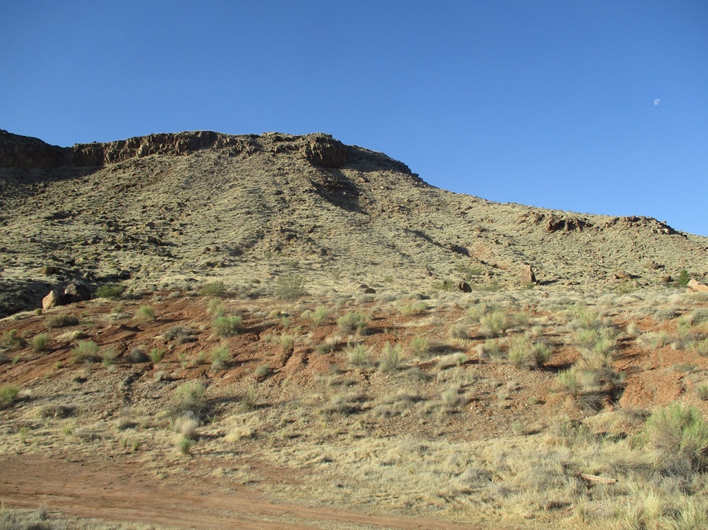
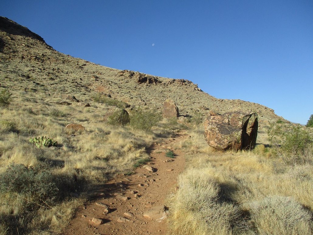
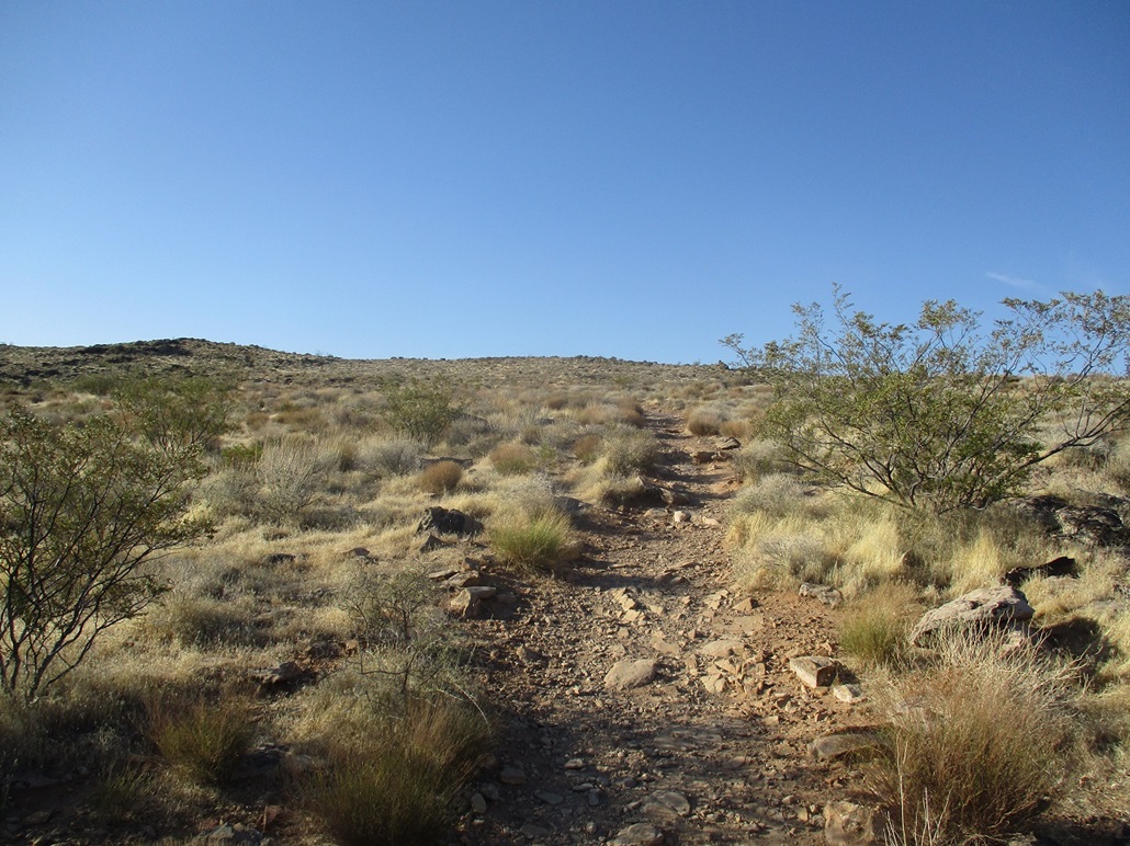
I was the first car in the "lot", which is just an open area of dirt, mere feet from the end of the last paved road. The trail is obvious, and after getting myself squared away, I locked the car and started hiking. It was about 6:30 a.m., sunny with temperatures in the low 70s for now, but the sun was already intense and the thermal effect could be felt. Yesterday had been cloudy, but today was clear and promised better photography conditions (and more heat).
The trail wastes no time going upward, making a few nominal switchbacks to lessen the grade, but for the most part it just barges uphill. The trail mainly stays on the north slopes but then swings west to make its final push toward the cliffs. Here, the trail is eroded and scant, steep and loose, and not pleasant at all. Going up, I just leaned in and kept a low center of gravity, and quickly was above it and now on the mesa's top. The last little segment was an easy, nearly-flat uphill stroll to the rocks up ahead. The one-way hike had taken me a half hour.
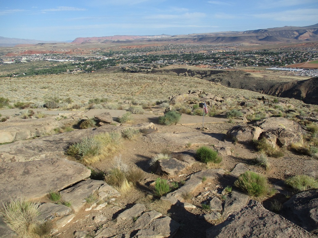
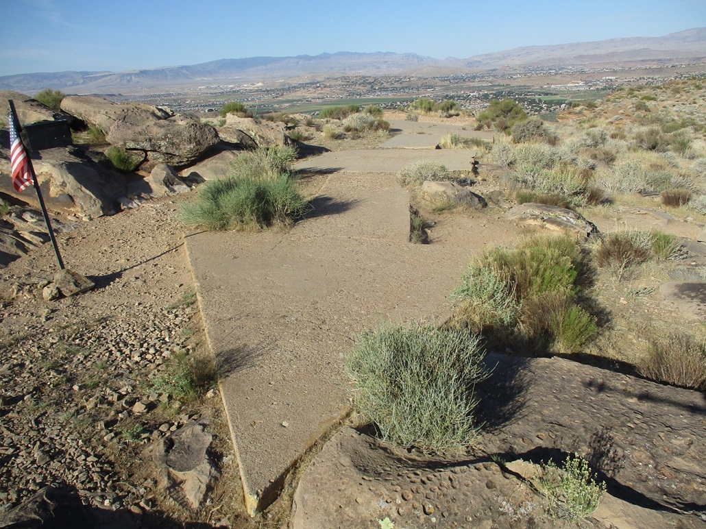
The summit rocks were easy to identify and I tagged them. There is also a large concrete arrow here for navigational purposes for pilots back about 80-100 years ago. This arrow was identical in style to the one I saw on Harrisburg Bench yesterday. I wonder how many there are in the area. There was also a mailbox and a flag. The whole area looks tended. Later, I learned there is a Facebook page for Shinob Kibe, where a local person has assembled the history on this peak, plus probably does a lot of the upkeep too. Kudos to that person (or persons).
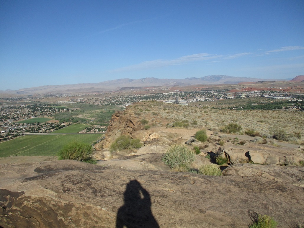
I spent fifteen minutes up top, enjoying the views and the sunny but still pleasant weather. The sun was still low in the East so photos in that direction were not possible. Hiking down, I found a large circular rock design, which the website says is a medicine wheel. Going down that eroded section was challenging. I felt like I had no solid footing, so for one short stretch, I used the five points of contact method, then just very carefully inched down the rest until I was on firmer trail. Here, a couple of couples (4 people) were coming up. They were the only people I saw on the hike. I stopped and chatted. One of the guys grew up in Tempe, it turns out. They were all really cool.
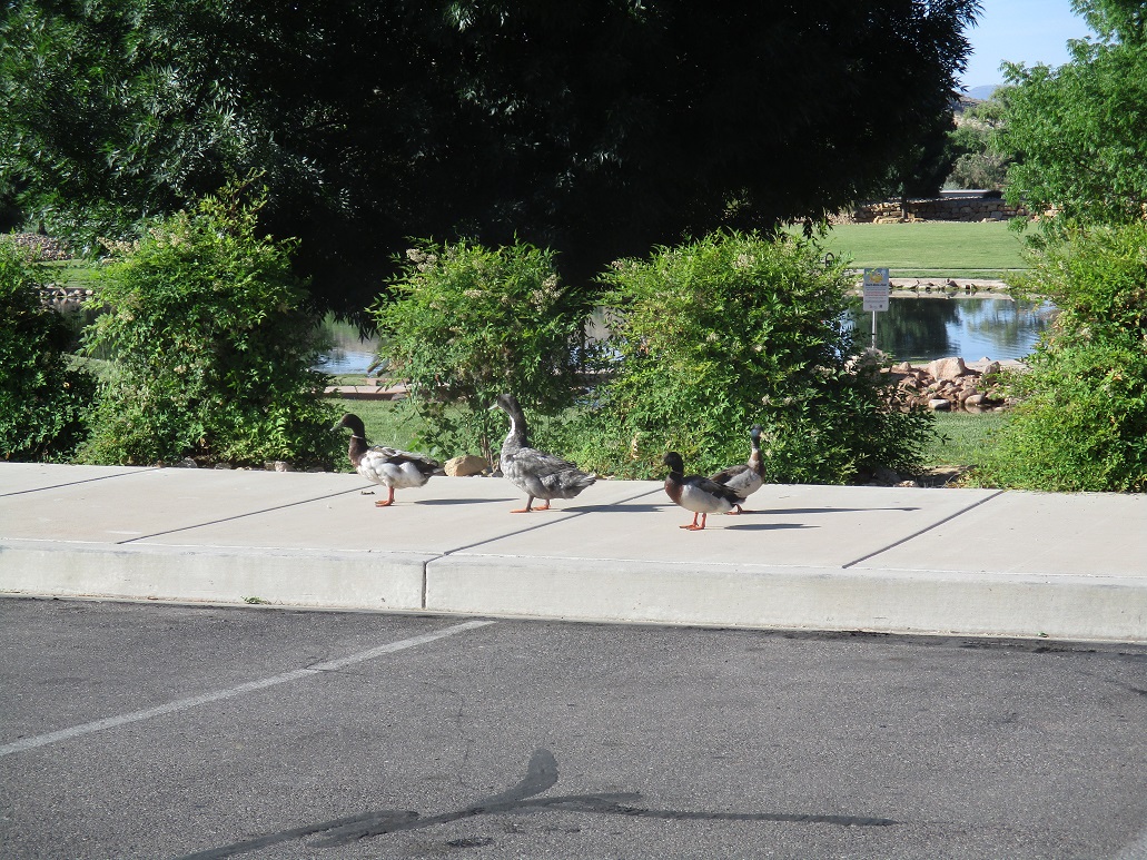
The downhill hike took about the same time since I did not want to rush my steps. I was back to my car a little before 8 a.m.. I drove back out to the main roads, then pulled into a city park where I had some good views of the mesa. Unfortunately, the sun was still behind it and not allowing for photos. Instead, I took a couple photos of ducks. They were all walking and quacking, with their wings kind of extended outward when they walk. These must be the Shinob Kibe ducks I've heard about.
I enjoyed this hike a lot and understand why it is a popular hike and climb for locals. I also want to express my appreciation for the neighborhood for allowing car access to the dirt past the last of its roads. Had this been in Arizona, it would have been gated and fenced with multiple signs about trespassing.
The day was still young. What to do. It was warming fast and I only had two other short hikes planned, neither that would take more than an hour apiece. I had a hotel reserved but it would not open for a few more hours. I was concerned about being idle and thus susceptible to influences of the ne'er-do-wells. I chose to drive back south and go explore the Price City Hills. They did not look like they'd take long and something I could do in the heat. It would eat up an hour. So that's what I did.
|
|