
The Mountains of Arizona
• www.surgent.net
|
| Apache Peak |
• Highpoint: Whetstone Mountains • Coronado National Forest • Cochise County |
|
Date: November 19, 2011
• Elevation: 7,711 feet
• Prominence: 2,886 feet
• Distance: 12.6 miles
• Time: 10 hours
• Gain: 4,160 feet
• Conditions: Overcast and cool
• Teammates: Scott Casterlin & Scott Peavy
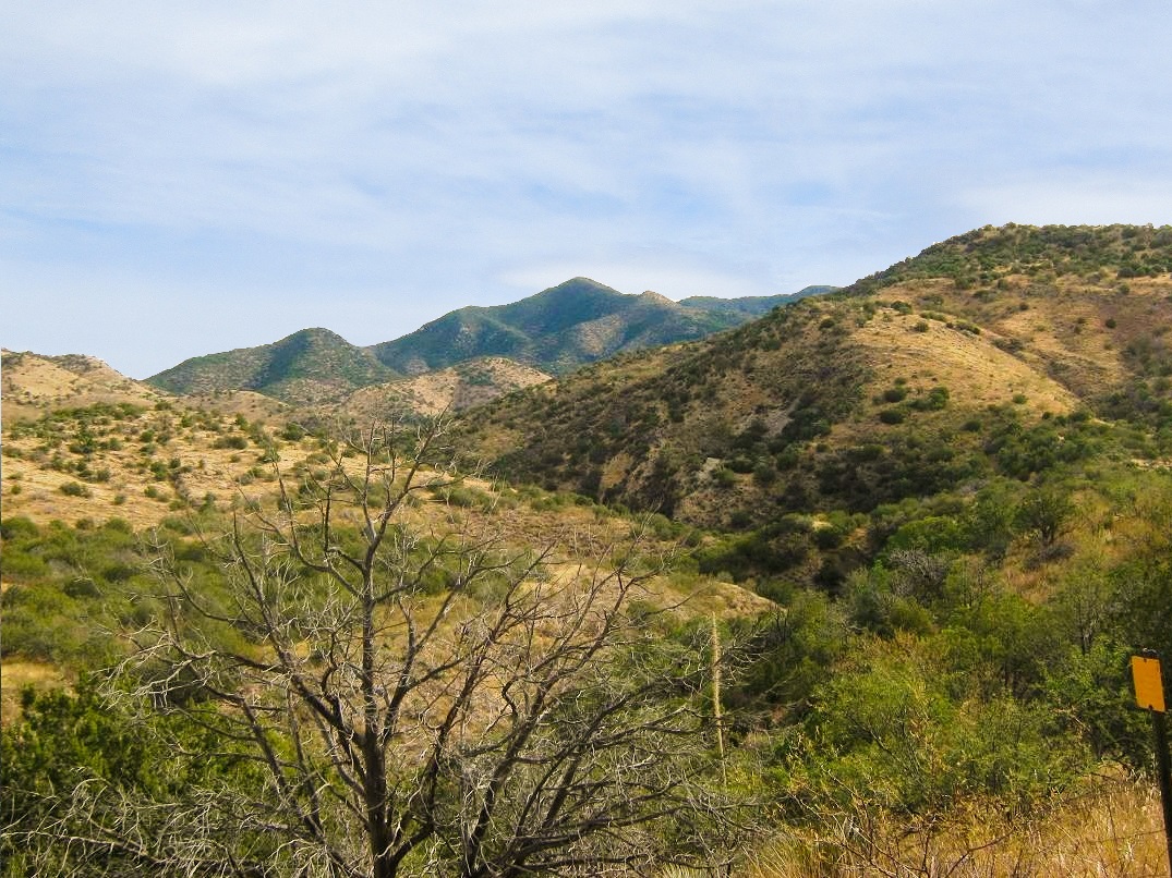
Apache Peak is the highest point of the Whetstone Mountains, near the city of Benson. The range is typical for southeast Arizona: a highly prominent summit with long ridges, grass and brush covered foothills and slopes, and heavily forested crests. The summit and most of the range are enclosed within one unit of the Coronado National Forest. However, there has been little development of the range for hiking and other backcountry pursuits over the years. The main attraction is the Kartchner Caverns State Park, featuring a spectacular cave system only discovered within the last 30 years.
For years, the default route to the top came in from the east side, following French Joe Canyon then up the ridges to the top. The main challenge is the forest itself. The trees grow so close together so as to form a nearly impenetrable tangle. Add to that the underlying cactus, agave, lechuguilla, and loose rock, it's not hard to explain why relatively few people have summitted this peak over the years.
In recent years, a west-side approach has become viable. This whole western approach used to be privately-owned, part of the Empire Ranch. However, much of the property was sold and preserved as the Las Cienegas National Conservation Area, administered by the BLM. A road coming in from the west from state route AZ-83 runs across this expanse of foothills and canyons to within a few miles of the peak. Depending on how close one can get to the end of this road, a hike to Apache Peak can be relatively short, and possibly less brushy. It was worth a look.
My partners for this trip were Scott Peavy and Scott Casterlin. A fourth Scott, Scott Kelley, was supposed to join us but he backed out due to a busted hand. The prior weekend, Casterlin offered to scout the roads across the Empire Ranch, to see how far he could get to the peak. His report was mildly encouraging: he got as far as four miles from the road's end, about a mile southwest of Apache Spring. Any extra road hiking still sounded better than dealing with the drutal brush on the east side. I rode with Peavy to Tucson, where we met Casterlin at 6:15 a.m. at the Wilmot Road Chevron station. We then rode with Casterlin from there to the peak. It was about 30 miles from the Chevron to the start of the Empire Ranch Road.
The ranch road is in excellent shape for the first few miles, then slowly decreases in quality the farther in it goes. It runs northeast through beautiful grasslands and creeks lined with mature cottonwood trees. The road passes a couple gates, where some clever turns at a few junctions are necessary to stay on course. The road then climbs onto the spine of a set of hills, then drops steeply into a canyon system, where it crosses into and out of the streambed numerous times. By now, the road is rockier, with ruts and erosion in spots. Casterlin drove us to where he turned back last week. According to Peavy's GPS, we covered just under 14 miles to our parking spot.
This drive in took almost 90 minutes, and it was 8:20 when we finally started the hike. The weather was cool and overcast. The first leg was the four-mile walk to the road's end. We came to the junction to Apache Spring after one mile, heard some gunshots, and continued walking. Later, two guys on ATVs rambled past us, probably the gunshot guys. We covered the four-mile road walk in 90 minutes, gaining 900 feet to get to the road's end, where the two guys on ATVs were hanging out, scouting the terrain. We had a chat, then continued on our way. The road's quality past where we parked was rough, so we had no regrets about not trying to bash the vehicle in farther. It is best suited for ATVs after a certain point.
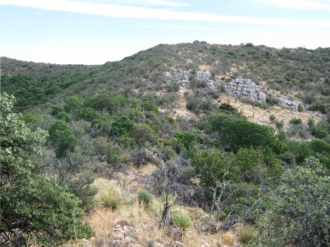
Apache Peak is visible for most of the walk, and from the road's end, it looked close, with nice ridges leading up to the top. The initial problem would be getting to the right ridges. The road ends at a side canyon, which leads into a more deeply-cut canyon below us. We found a faint path dropping straight into this canyon. We followed it, dropping about 40 feet through moderate brush into the canyon bottom, then we ascended up a narrow slot up the other side, regaining our loss and placing us on a brushy slope opposite the road. After a short rest, we started walking upward.
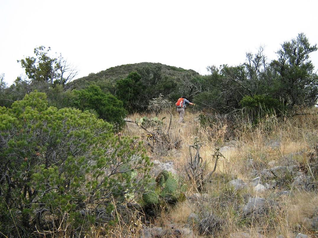
As we walked, we were aiming toward a small hill on the ridge contained in a 6,200-foot contour ("Hill 6200"), but we realized we were not on the right slope. We had to descend off this slope, cross into another canyon and scamper up the opposite slopes. We then climbed steeply through trees to get onto the "right" slope. This slope was open, covered in knee-high grass, thorny brush and low cactus. We trudged up 500 vertical feet to surmount Hill 6200, where we rested. Apache Peak was standing above us, and we could make out the rest of the route from here.
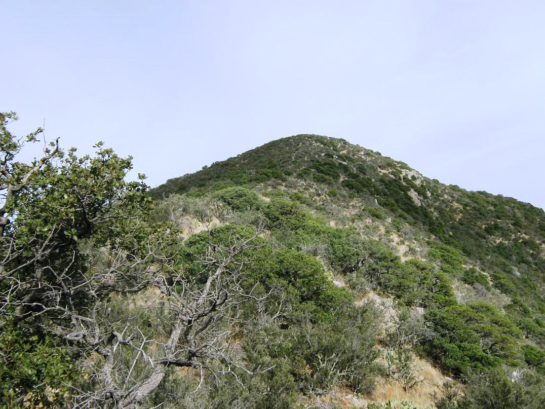
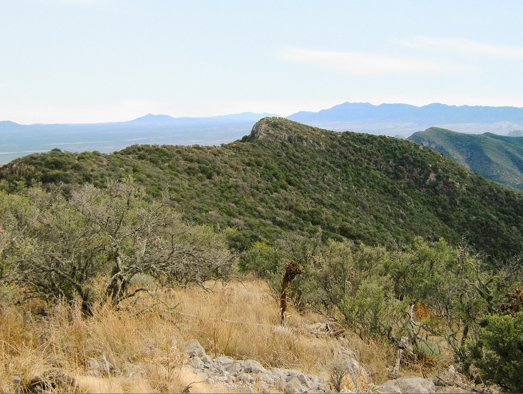
From Hill 6200, we dropped 60 feet to a saddle, then up a smaller hilltop, then through a section of dense trees and brush, aiming for a small band of cliffs 150 feet above. The going was slow and thorny. There was usually a path to squeeze through, but the rocks tended to roll out from under our feet. The other two Scotts bypassed the cliffs to the left, while I climbed up a small opening within the cliffs (less brush). Above the cliffs, it was more of the same steep, loose slopes and lots of cactus. We made slow progress, and finally achieved the main southwest crest coming off of Apache Peak. We were at 6,800 feet.
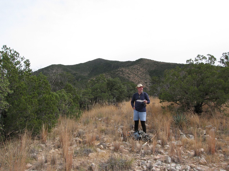
The brush and trees were less thick on the crest than what we'd just come up. The slope was consistent but not too steep, and there was a barb-wire fence running up the whole way. The top was hidden for the moment behind a ridgepoint 300 feet above us. With less-severe slopes and more open terrain, we could work our way around the obstacles. Past the ridgepoint, Apache Peak came into view again, its rounded hump looking less "impressive" from here than from below. French Joe Peak, which is just a few dozen feet lower in elevation, was across the way and served as a way to judge our elevation gain. We walked slowly and methodically, and soon we arrived onto the summit of Apache Peak.
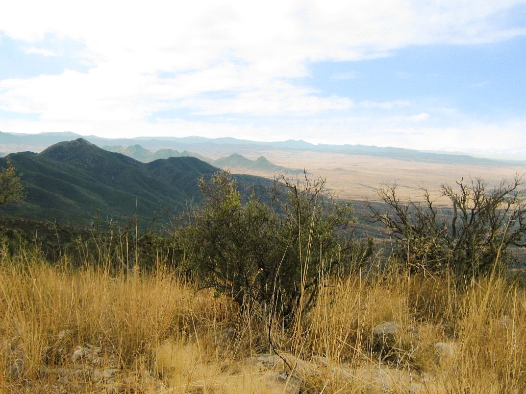
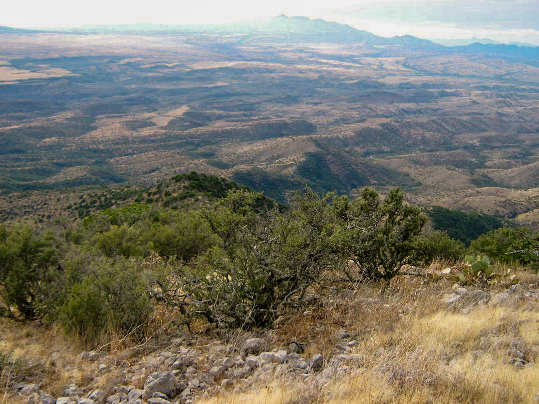
The views are fantastic, as expected from such a prominent mountaintop. East, we could see the horribly thick tree cover carpeting the ridge between us and French Joe, as well as the slopes lower down. Way off to the east we could see the rocky Cochise Stronghold in the Dragoon Range. The Chiricahua Range was visible way to the east. Sweeping from East to South to West, we could see the Mule and Huachuca ranges, Cerro San Jose in Mexico, the Patagonia Mountains, and the Santa Ritas with Mount Wrightson. Baboquivari Peak's pillar was far on the western horizon. North, we could see the Tucson-area ranges such as the Catalinas and Rincons. The sun came out for a few minutes to lighten things up.
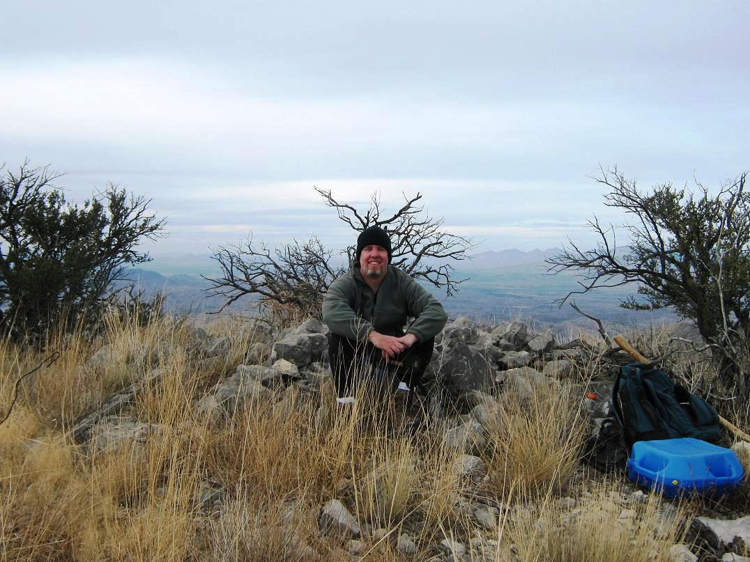
The summit itself is covered in a mound of rocks. We could not find the benchmark, but we found the log and signed in. We had arrived onto the summit at 1:50 p.m., a 5-hour, 20-minute ascent. We were slightly alarmed at the late hour, so we didn't spend much time up here before starting down. We retraced our route, getting slowed up again on that steep downhill section below the main crest. We bypassed the cliff band but got into thick trees and brush. Slowly, we emerged from that crud onto the open slopes, gaining back onto Hill 6200, then down that. We dropped into the canyon in a different spot than before, hoping it would "go". It did, but we had to scamper down a couple 10-foot pouroffs on the way down. Soon, we were out of the canyon and on the road. It was close to 5 p.m., and the sun was dropping quickly.
We now needed to walk out those four road miles. We moved efficiently, no chit-chat, trying to beat the sun, which we didn't quite do. We walked the last mile in darkness, but we had all brought along flashlights just in case. Back to Casterlin's Toyota at 6:30, we piled in and started the slow drive out, which took another hour. Casterlin managed these roads well in the darkness. Another half-hour and we were back to the Chevron. We got our stuff sorted out, said our goodbyes, then Peavy and I drove back to his place in Gilbert, where I got my truck and drove home, finally stumbling in at 11 p.m., utterly exhausted. A shower, some food, some time with my wife, and I crashed.
The hike covered 6.3 miles each way, according to Peavy's GPS. Our gain was over 3,500 feet. While the road-walk was easy, it added three hours to our day. Still, we felt we made the right decision to come this way. The off-trail hike past the road was just 2.3 miles each way but with 2,400 feet of gain. Although not as densely choked with brush and trees as the east side, we still had to battle a lot of it. There is just no way to travel quickly through this kind of terrain. Casterlin's beefy Toyota did well on these roads, and I would be hesitant to drive anything less robust than a high-clearance, 4-wheel drive vehicle on it. My truck might have made it, but a sedan, no way.
We were all pleased to get this one in the books. For Peavy and I, it was our first, and probably last, ascent of this peak. Casterlin had climbed it years ago via the east side, and he admitted there'd be no more visits from him. This is a worthy peak and a climb of it is very satisfying, but the effort needed to attain it, as well as the willingness to put up with the brush, will test one's patience. Some of my clothing was covered in a velcro-like plant leaf that is very difficult to remove, and despite my best efforts, I must have had about 30 cactus spines poking out of my skin when I showered that night. I was still pulling out spines a couple days afterwards.
My deepest thanks to the other Scotts for their companionship and competence on this climb.
|


|