The Mountains of Arizona
• www.surgent.net
|
| Rincon Peak |
• Rincon Mountains • Saguaro National Park • Pima County |
|
Date: November 11, 2007
• Elevation: 8,482 feet
• Prominence: 2,302 feet
• Distance: 16.2 miles
• Time: 11 hours
• Gain: 4,580 feet
• Conditions: Bluebird day
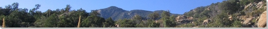
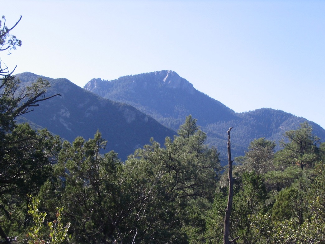
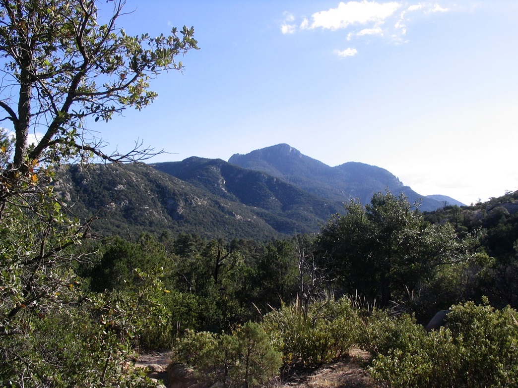
The Rincon Mountains rise east of Tucson, towering nearly 5,000 feet above the city. The range is an uplift, with long gentle slopes to the west, and steep cliffs to the east. From Tucson, the Rincon Mountains appear as a uniform "wall" of mountains, with Rincon Peak being the pointier mountain to the right. The range highpoint is Mica Mountain, north of Rincon Peak. Both peaks and most of the range are enclosed within the Saguaro National Park's East Unit.
The Rincon Mountains are the only significant range in the state that has no road access. All visitors to the range must plan for at least a very long single-day hike, or more preferable, a multi-day backpack. Backpacking is allowed with the usual restrictions and fees, and there are a few camps and perennial springs available up high. The standard route to Rincon Peak starts at the Miller Creek Trailhead from the east, and involves 8.1 miles of one-way hiking and over 4,500 feet of elevation gain.
As of late 2007, I had not hiked either peak. Rincon Peak is hikable in a day, so I chose to tackle it first. I waited for the right combination of weather and timing to set out on the long day hike. Summer and early fall are too warm, while winter snow can make the route difficult and dangerous in spots. Because much of the higher trail is on east and north-facing slopes, snow may linger into late spring. Hence, late Fall is the best time to hike. The weather had been hot, with temperatures into the mid and high 90s into early November. However, I kept track of the weather forecasts and saw a break coming around Veteran's Day.
I planned to drive to the trailhead one day, car-camp overnight, then get moving at sunrise for the all-day attempt. Knowing my usual rate on peaks of this size and length, I figured 10 hours minimum round trip. I left home and arrived after dark, driving north on Mescal Road (Interstate-10, exit 297) onto a gravel road entering into the Coronado National Forest toward Happy Valley. I drove about 16 miles to a sign pointing left for Miller Canyon, then followed a side road to the right to an unused camping area beneath a copse of large trees. Temperatures were still pleasant. I explored the area and ate dinner, but was asleep by 8:30 in the bed of my truck. That evening, the wind kicked up, but I slept well, waking at 5 a.m. the next morning (today) in pitch black.
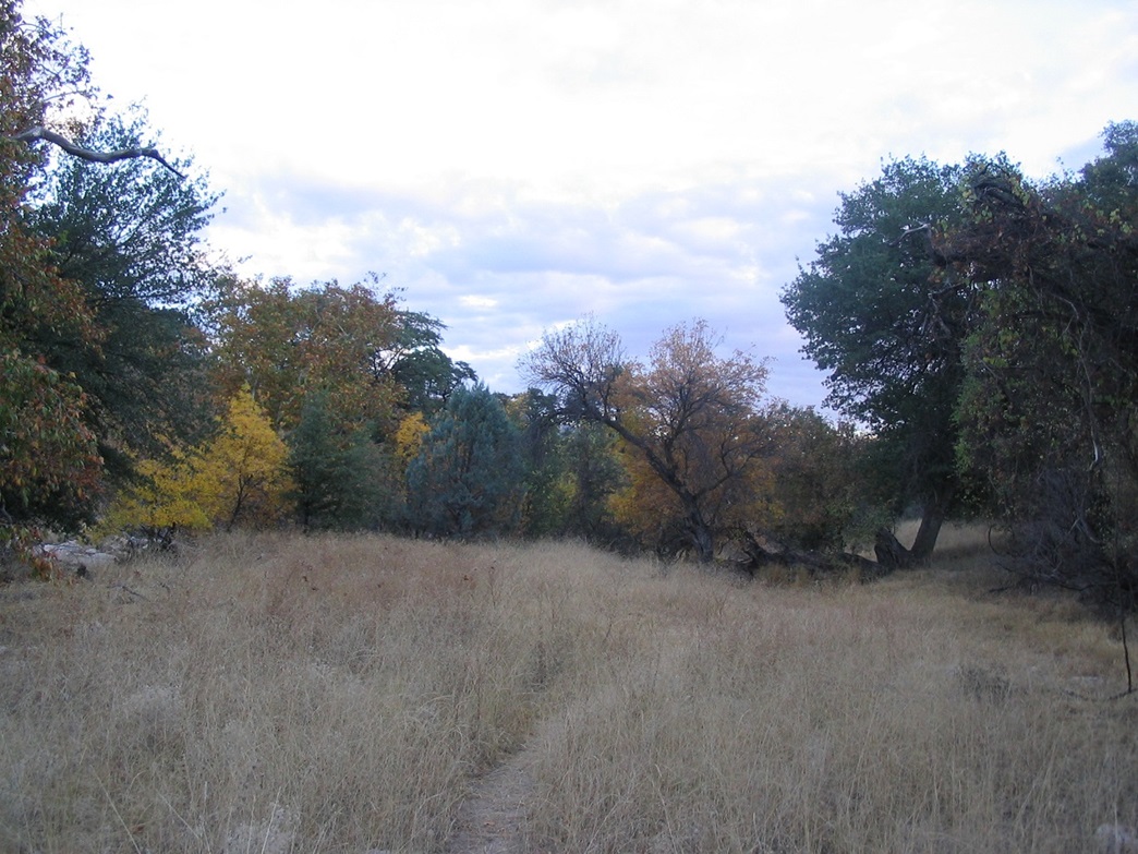
I ate breakfast and got my gear in order, and waited for the sun to rise just enough to make things visible. From my campsite I drove a short distance to the trailhead and parked, starting the hike at 6:20 a.m. The first portion of the hike follows the Miller Creek drainage. The trail is cut into the grass and low scrub lining the sandy wash, occasionally crossing the wash and starting again on the other bank. Cairns helped keep me on track when I lost the tread in the sand. I got off route once for a few minutes following a bad path, but otherwise had no trouble keeping on the trail.
Shortly the land opens up again, hemmed in on the north and south by low ridges and on the west by the east-facing slopes of the Rincons. The path led to an entrance to Saguaro National Park after 1.5 miles. I covered this in about an hour, gaining 300 feet. The sun was breaching the hills to the east. The weather was cool and nice, with not a single cloud in the sky. At the Saguaro National Park entrance, there's a sign-in log, and I added my name. After the entrance, the real climbing begins in earnest.
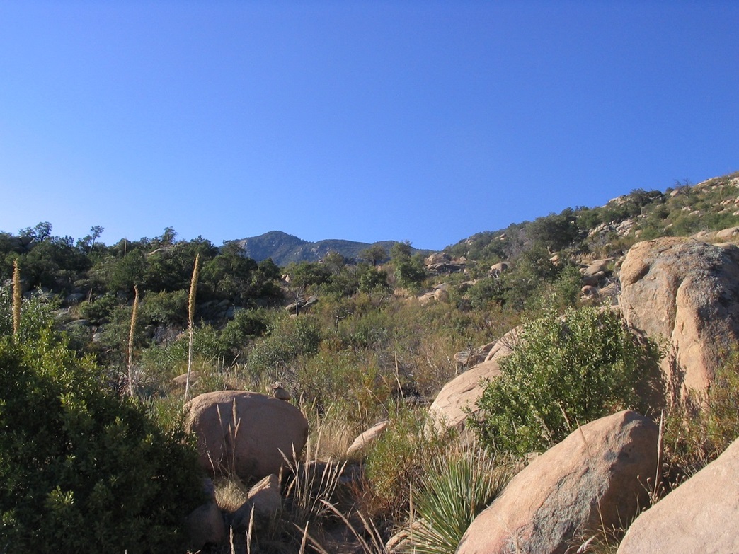
From here it is another 2.9 miles to the range crest and the junction with the Heartbreak Ridge trail. I was now on the steep eastern slopes of the Rincons, a jumble of weathered rock, stone pillars, deep-cut drainages and thick scrub. Still below 5,000 feet elevation, the flora here was mostly that found in the desert, more Chihuahuan than Sonoran: no saguaro or ocotillo, but lots of yucca, lechuguilla and madrone. The trees were limited to scrubby manzanita and juniper. The trail is etched into the rocks, working through the natural fissures and requiring high-stepping and minor clambering to get up the sections. It is well-cairned and easy to follow. I put my head down and marched upward, taking breaks every 20 minutes.
In time, I hiked up over a knobby outcrop and down into the high Miller Creek drainage and headwall. Here, the trail gains at a steady grade for a half-mile, the big mass of Happy Valley Lookout Peak to my right. I surmounted a rise and was pleasantly surprised to have arrived to the range crest so quickly. It was nearing 9 a.m., and I had covered 4.4 miles (said the sign) and gained about 2,000 feet.
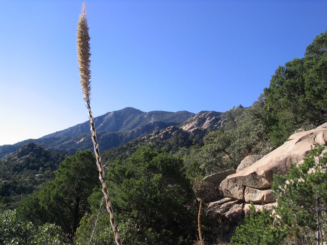
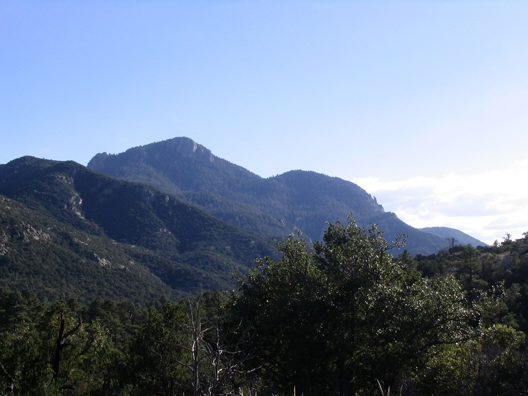
Rincon Peak was now visible to the south, a beautiful fin of rock guarded by cliffs. The morning sun was still low enough to give it a nice light, but not quite right for photographs. Between me and the summit was another 2,400 feet of elevation gain, most of it passing through heavy forest. It looked straightforward. I took a long break here and had breakfast again. I was on schedule.
The next half mile was a real treat: a gentle decline south along the Heartbreak Ridge trail. This section went through mature Ponderosa forest, the trail a nice soft dirt bedding. I covered this segment in 20 minutes, coming to another junction with the Rincon Peak trail. A sign said the summit was still 3.2 miles away. I heard voices and spotted two women hiking up the other way. They had camped at the nearby backpackers campground and were headed up to the top. We had a chat and they went on their way. I took another short break. The trail had lost about 100 feet in elevation, which felt great now, but I knew I wouldn't be feeling so happy about the gain in a few hours when hiking out.
I started up the Rincon Peak trail toward the top. It stays level for a short while longer, then starts up and down small ridges and bumps, crossing a couple of drainages. It then goes up a couple switchbacks at a moderate upward gradient. The large ponderosa pine forest gives way here for a thicker low covering mainly of mountain oak, madrone and some of the heftiest juniper in the state. The trees aren't high, but thick enough to block most views. Only on a few occasions could I view Rincon Peak, which was just as well because each time I did, I was slightly bummed at the amount of gain ahead of me.
My immediate goal was a spot elevation of 7,330 feet near a turn in the trail. In about another hour I had covered this stretch, 1.5 miles from the lower junction. I took a lot of breaks and decided to cache some of my extra weight from my pack, hiding it beside a big log. I was at 7,400 feet elevation, with another 1.5 miles to go and 1,100 feet up. I felt good, and all was going as planned.
With a lighter load, I walked quickly up the trail, which soon segues from the drier madrone-and-juniper forest to more big ponderosa pine. Here, the trail is well-defined but it is very steep. That was both good and bad news. The good news was that there was no delaying the inevitable. Every little push forward resulted in gain upward. The bad news was it kicked my ass every step. I met another couple coming down and we had a short talk, really more an excuse for me to stop for a break.
Shortly, the trail approaches more daylight, nearing the final portion to the top. The trail lets off at rocky outcrops, works west and south amid big jumbled rocks covered in manzanita, oak and juniper. It zigs and zags, up and down, before arriving to the top. Some parts required hands but none of it was technical, but after over 6 hours of hiking I didn't want to slip up here and injure myself.
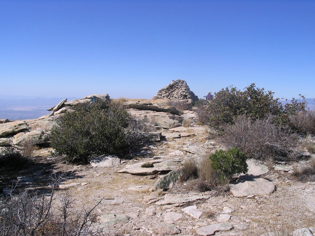
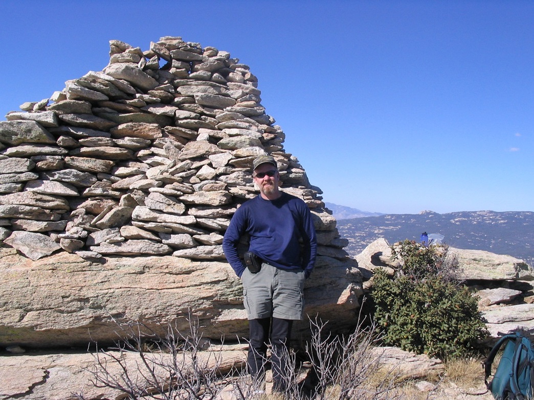
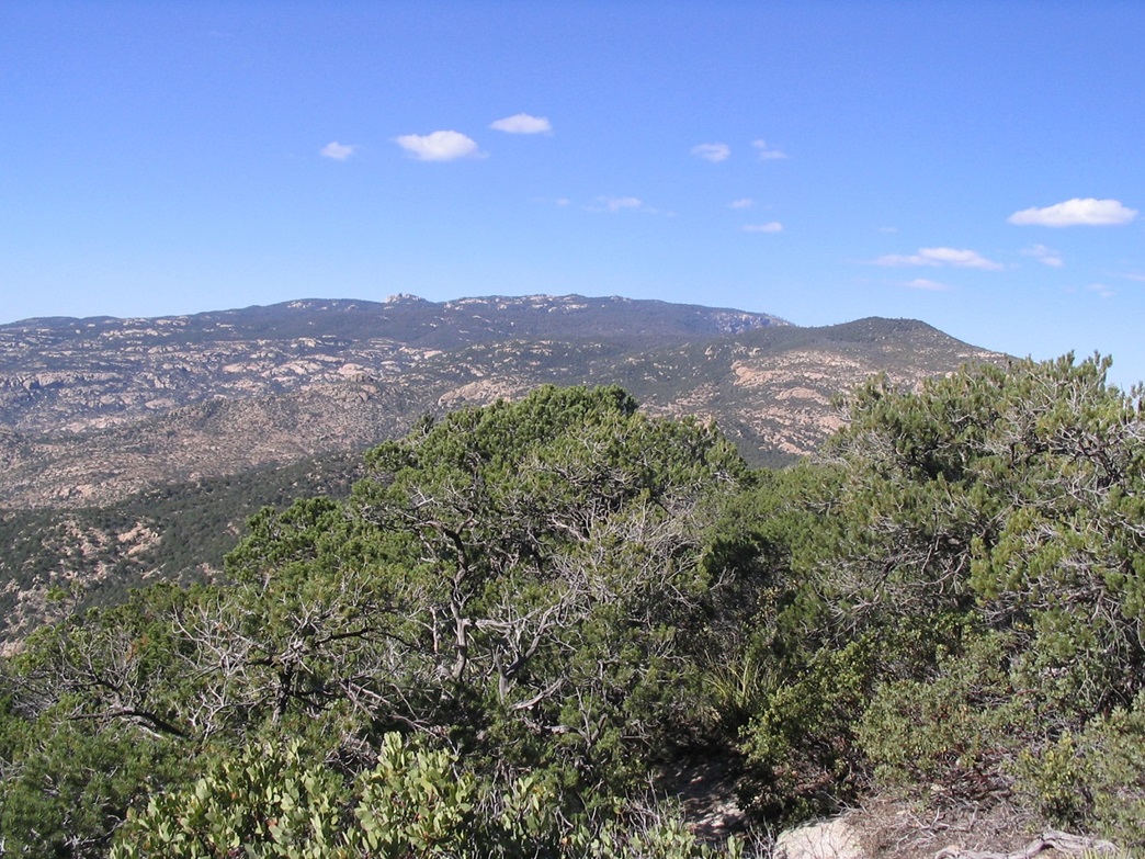
At last, I arrived onto the summit, a flat area about 100 feet square and marked by a gigantic triangular cairn that stood over 6 feet tall. The two women were there, eating lunch. I walked up, said hi and sat nearby. It was 12:45 p.m., taking me 6 hours and 25 minutes to cover the one-way distance. The views were unbelievable, with giant Mica Mountain to the north and hundreds of other peaks in every other direction. With no clouds and a dry day, even peaks on distant horizons were visible with definition. I signed in the log, took photos and relaxed, but not too much. After ten minutes, I started down. My hike was only half done. I was still on schedule, but I knew it was probable I would be exiting at sunset, so I didn't want to waste any time.
So far I had called my times accurately, and based on past experience, I figured 2 hours to get back to the saddle and the junction with the Miller Creek Trail, and another 2 hours back to my truck. Including breaks, I conservatively estimated I'd be out at 5:30 p.m., which would be cutting the daylight close since it got dark by 6 p.m. I had a flashlight but given the rockiness of the terrain, I didn't want to be hiking any of it in the dark if possible. Getting off-route would be very easy.
The hike down from the very top back down to the 7,330-foot spot elevation, near where I stowed my extra gear, went fast. The downhill grade was steep but the (mostly) solid trail made the walking easy. After repacking my pack, I got moving down toward the Heartbreak Ridge Trail junction, and again, this part went reasonably well, with no real trouble other than my general tiredness. I took breaks and enjoyed the scenery and great weather.
I pushed on to the Miller Creek Trail, and took a long food and drink break here, and checked my time. It was 3:10 p.m., ten minutes behind schedule. I took advantage of better lighting for photographs. I spent 10 minutes here, enough time to let the legs get stiff. It was about this time I thought about bringing up a tent and pack for the hike. I could have just fallen asleep right there.
The next half mile is contained within the upper Miller Canyon and drops at a consistent grade. I walked for another 15 minutes and sat down for a short break. The drainage itself was below me, and on the other side was more mountain and jumbles of rocks. Amid the rocks I spied a black shape that seemed out of place. A bear? It had the right size and color and was the only plausible explanation for what it was. Daylight was still good enough so that it wasn't a trick of the light, and it was too dark to be a true shadow. It was about 150 feet line of sight across from me, but across a drainage so I wasn't terribly afraid it would bolt for me. Even so, I clapped to see if I could rouse it ... then figured I better not press my luck. If it was a bear I didn't stick around to confirm it. I think it probably was. I got up and started the descent again.
By this time, the eastern slopes were all in shade, although the hills across the valley were still in the sun. I made good time walking down the switchbacks. I took plenty of breaks, usually for 5 minutes at a time, and made steady downward progress gauging against a small ridge across the valley that I could eyeball across. All I could think about was getting back to my truck, a warm dinner somewhere, getting home, a shower and my wife and kitties waiting for me. Otherwise I had a tune from Earth, Wind & Fire playing in a continuous loop in my head, driving me insane. In case you care, it was "In The Stone" from their I Am album from 1979. Now it's in your head!
Finally, I came upon the Saguaro National Park gate, exited, and dropped into the drainage itself. I still had a mile and a half of easy downhill on mostly soft ground and sand to go, but this went fast. It was definitely getting into the sunset by this time. I heard noises and saw vehicle outlines, and there they were, the cars at the trailhead. I staggered back to my truck at 5:20 on the nose, just like I forecasted. I changed into dry clothes but didn't stay long as I wanted to drive out the road to the highway in whatever daylight remained.
Eleven hours on the trail, sun-up to sun-down, 16.2 miles, 4,500 feet of gain, now that was a full day's work. By the time I rolled into the TTT truck stop in Mescal on Interstate-10, it was dark, and when I got out to get some snacks I could barely walk! I drove through Tucson and had dinner at the Cracker Barrel in Casa Grande, where everyone else there was dressed in their favorite NASCAR driver/team's colors. Oh yeah, it was race week at PIR, and these were the people going home this way. Dinner was good, and I was home by 10 p.m.
|

|