The Mountains of Arizona
• www.surgent.net
|
| Fissure Peak & Mount Ballard |
• Highpoint: Mule Mountains • Escabrosa Ridge • Cochise County |
|
Dates: (1) August 31, 2003 (Mount Ballard); (2) March 23, 2012 (Mounts Ballard & Fissure); (3) March 12, 2024
• Elevation: 7,370 & 7,375 feet
• Prominence: 2,650 feet (Fissure Peak)
• Distance: 4 to 5 miles
• Time: 3 hours
• Gain: 1,350 to 1,900 feet
• Conditions: Hotter than heck in 2003, cool and clear in 2012, nice in 2024
• Teammates: βð in 2003
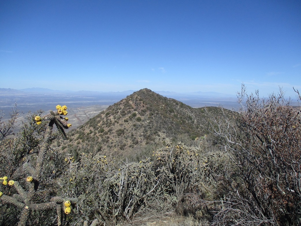
The Mule Mountains encompass the fascinating city of Bisbee in Southern Arizona. The range highpoint is a toss-up between Mount Ballard and Fissure Peak, adjacent peaks a half-mile apart from one another along a common ridge. The topographical maps would suggest that Ballard is higher, but when standing on Mount Ballard, it's pretty clear that Fissure Peak is probably as high, if not higher. The consensus is that Fissure Peak is higher by about five feet.
Bisbee was once Arizona's premier copper mining city, founded in the 1880s not long after nearby Tombstone was founded. The cities grew quickly and at one time, were the largest "metro" area in the United States west of the Mississippi River and east of California. But the population was almost all men, miners from all points of the globe, and often not friendly with one another. While Tombstone became known for its shootouts and high murder rate, Bisbee was just as dangerous a place to be. If falling rocks, explosions or bad air inside a mine didn't kill you, another miner might.
The miners were a mix of American (white and black), Mexican, Chinese and Serbian, the latter imported because of their experience in hard rock mining. Naturally, there were racial and ethnic clashes. In 1917, there was also an infamous anti-union "deportation" of striking miners who were rounded up and sent on a train to the deserts near Columbus, New Mexico. There, they were simply dropped off without food and water and told never to return.
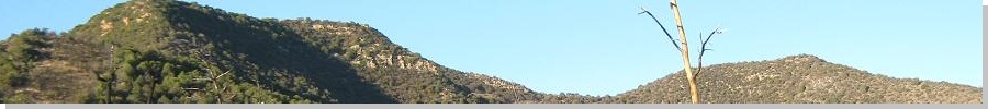
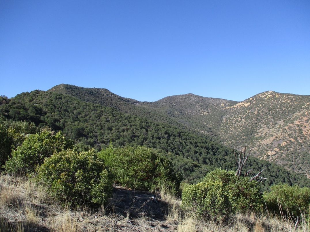
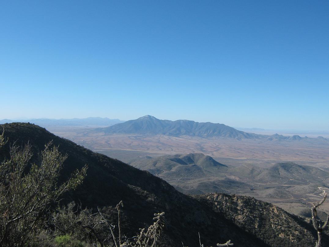
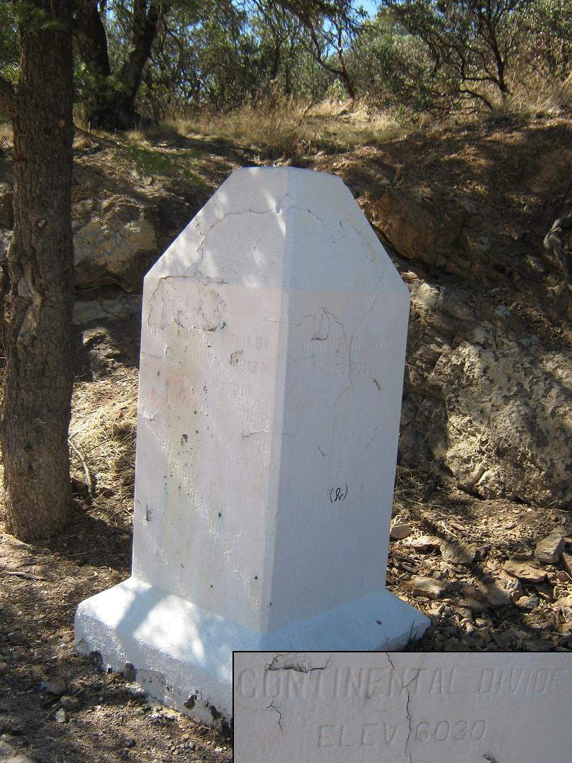
The Mule Mountains have essentially two parts: a prominent southern ridge called the Escabrosa Ridge that contains Ballard and Fissure Peaks, along with the other 7,000-foot named summit in the range, Mount Martin. The north half of the range is a series of sloping ridges and raised highlands, of which the unofficially-named Juniper Flats Peak is its highest point. The two parts of the range connect at Mule Pass, elevation 6,030 feet. From Interstate-10 in Benson, State Route AZ-80 (old US-80) crosses high-desert rangeland and approaches the city from the north via Tombstone. The drive is scenic, and the highway gets steep as it approaches Mule Pass. A tunnel built in the 1950s cuts through the pass, while an older road (the original highway), goes over the top. Once through the tunnel, Bisbee appears immediately, its homes and buildings built on top of one another against the hillsides of Tombstone Canyon.
The mines became unprofitable and by the 1970s, Phelps-Dodge, the modern-day super-conglomerate, pulled out. Soon thereafter, the artists moved in, attracted by the low prices of homes and no doubt, the beautiful vistas, moderate weather and fascinating history of the region. These days, Bisbee is shaped like a spider, with tendrils encompassing the smaller communities of Lowell, Saginaw, Ipper and Lower Galena, Briggs, Tintown, Don Luis and San Jose. It's a mix of all sorts of people, and thankfully, the place has not gentrified. The buildings are shabby and old, but full of character.
It's not that hard to work up the interest to drive 215 miles to Bisbee. Having the week open for Spring Break, we wanted to spend a few days here, our second time in Bisbee together but the first in over 8 years. With the weather warming throughout the state, we could expect beautiful mild weather in Bisbee (elevations around 5,800 feet on average), blue skies and dry conditions.
We stayed at the Bisbee Inn, also known as the Hotel LaMore, on the hillsides above Brewery Gulch, the "center" of Old Bisbee and home today to a handful of bars, breweries, restaurants and shops. The Bisbee Inn is supposedly haunted, among other things by a ghost cat. In fact, a group of ghost-hunters was here one of the nights. The proprietors, a mother and son, are two very kind and interesting people with stories to tell. We arrived late on Thursday (almost 10 pm) but got our stuff unloaded and into our room with no mishaps.
(Visitors to Bisbee should be aware of what to expect. Most hotels in Old Bisbee date from around 1900. The rooms are small but functional, but they are not laid out like today's outfits. There's no gym, business lounge or on-site dry cleaners. The walls are thin. You will be close to the action and will hear lots of noise from the Gulch. I overheard the proprietress talking on the phone to a prospective customer, trying to explain why the hotel does not follow the star system but confirming that yes, each room does have its own bathroom. After hanging up, she mentioned aloud that she hoped they wouldn't call back. I liked her immediately.
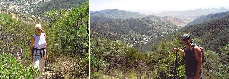
My agenda for Friday (today) was to hike up Ballard and Fissure Peaks. βð and I had hiked Mount Ballard in August 2003, but I later learned that Fissure Peak may actually be higher than Ballard Peak by a couple of feet. At the time in 2003, the goal was to have a fun day-hike, and we did, although it was hot and humid that day (note to self: avoid this hike in summer). In recent years, as I have inched closer to completing the set of 73 Arizona summits with 2,000 feet of prominence, I wanted to come back and re-hike Ballard Peak and then Fissure Peak so that I could properly claim the highpoint of the Mule Mountains. βð was feeling rotten and ended up catching a lot of much-needed sleep while I was galavanting in the hills.
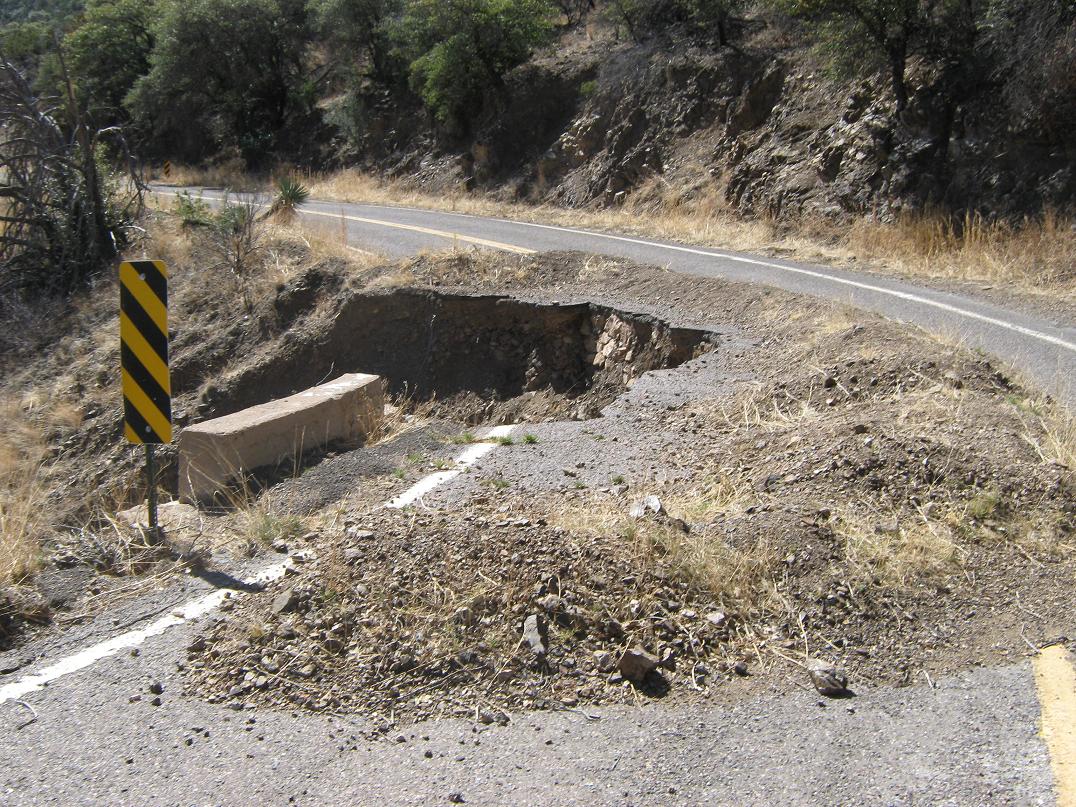
From our hotel, I drove the "main" boulevard west up Tombstone Canyon, past the homes and buildings, coming to the highway at an underpass. I stayed along the road where it ended at a barrier, about a half-mile short of the road's crest at Mule Pass. Back in 2003, we had driven to Mule Pass, but two sections of this road were washed out in 2009 (Note: the road has since been repaired and can be driven all the way to Mule Pass). I parked at a pullout and started the hike at 7:20 a.m. in cool, still weather. I covered a half-mile along the road (and 200 feet of gain) to Mule Pass in about 15 minutes, then found an easy, out-of-the-way spot to scale a fence to get past one ribbon of private property. In 2003, we met the landowner who did not mind hikers and she freely gave us permission. This time, being early, I went in unannounced and quickly hiked up the few dozen yards to another fence, putting me back onto public land.
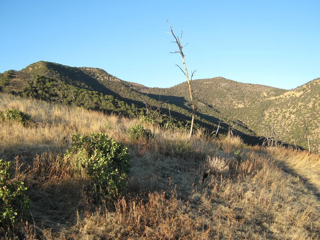
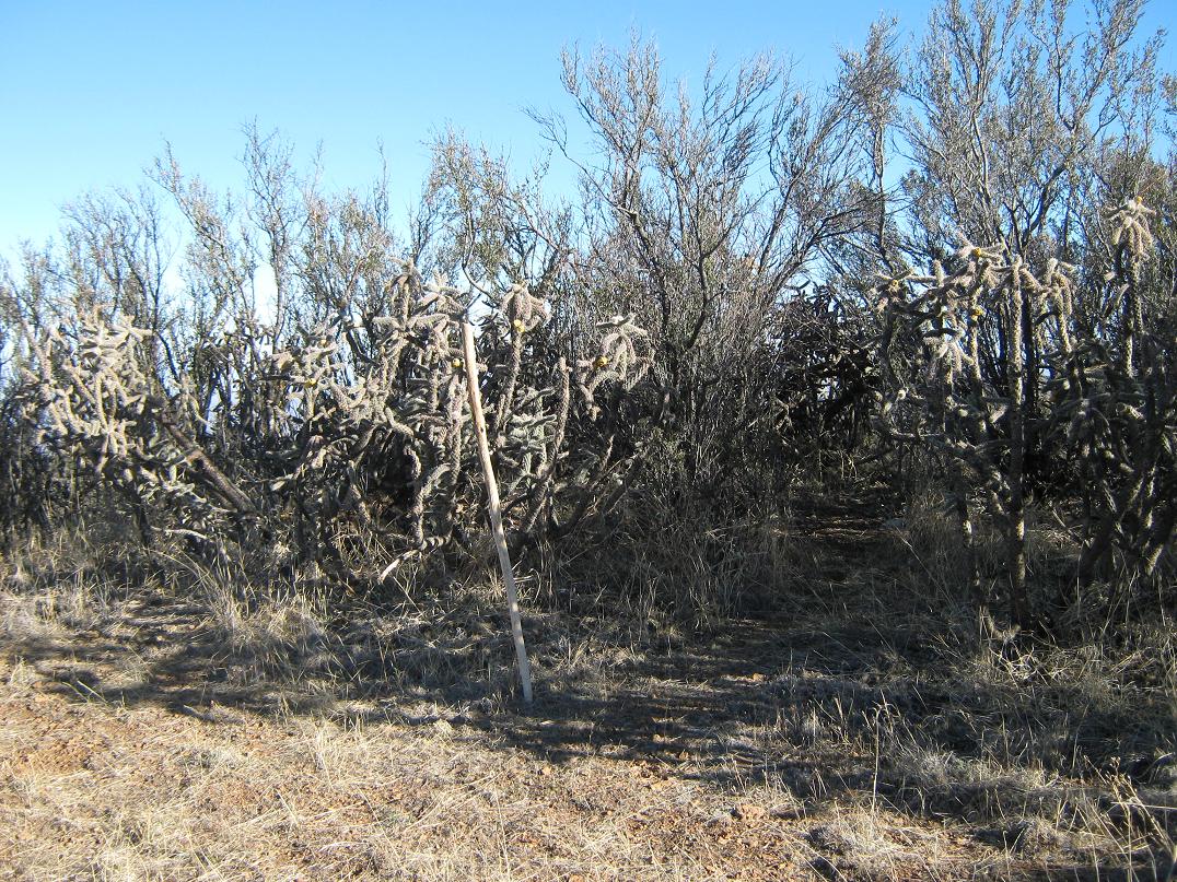
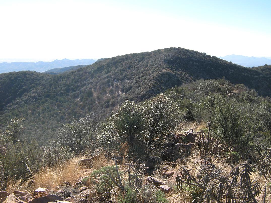
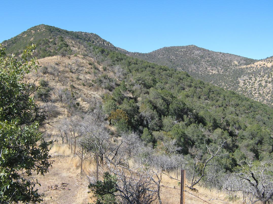
Mount Ballard rises above along a long, sloping ridge, while Fissure is a more pointed summit to its right. The lower third of the ridge that I would be hiking was bare of brush, a fire having come through here in 2008. When we were here in 2003, it was very brushy, although we could generally keep to a scant hiker's path. Now, the path was much more evident with the thickest of the brush simply gone. I put my head down and hiked steadily up the moderate slopes. The trail goes up and down a series of little ridge points, losing about 40 feet at a time. After a half-hour, I came to the fire margin and the start of the thicker, woodier brush. The trail was still easy to follow, but I had to duck and squirm through branchy sections. The trees here were juniper and mountain oak.
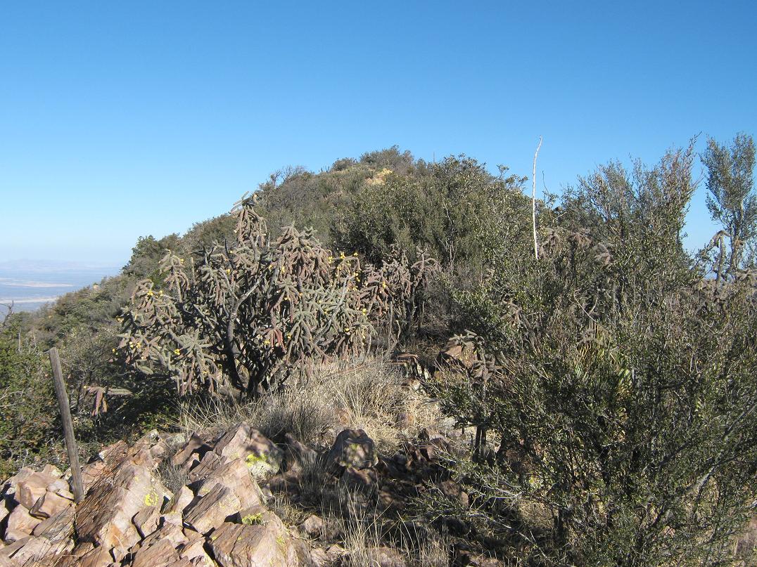
At about 7,000 feet, the trail leaves the ridge and contours across below a band of cliffs. Here, I found remnant patches of snow from a storm that blew through here earlier in the week. Sections here were steep, but these were short and after some more effort, I emerged onto gentler slopes and essentially back onto the highest ridges. Ballard's hump-like summit was about a quarter-mile away, while pointier Fissure was another half-mile farther. I stayed on the trail, dropped 40 feet, then regained it and worked my way to the broad, brush-covered summit of Mount Ballard. I rested here and tried to find our names from 2003 in the log book. I was disappointed to see that the earliest entry in the current register was from September 2003 (we were here in August 2003). I added in our names for the 2003 hike, then some details for this hike. As usually, I recognized about half the names in the log. It was still early and I had covered the distance to here in just over an hour from Mule Pass.
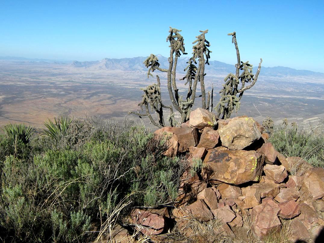
For Fissure Peak, the going gets a little rougher. A thicket of cactus carpets the slopes below Mount Ballard's summit, and I had to try a few routes before finding one that avoided the pointy bits. There is a drop of 230 feet to the saddle connecting Ballard and Fissure, with parts requiring hands to scale easy rock barriers. The hike up to Fissure Peak followed scant paths through the brush, and fairly quickly, there I was, atop Fissure. A cool cairn and cactus mark the top, and I took another break to rest and take pictures. The registry was buried deep in the cairn and it took me awhile to find it. I had great views in all directions, the best being west looking at the big Huachuca Mountains (and Miller Peak, with snow), and south into Mexico, looking at gorgeous (and off-limits) Cerro San Jose, also with considerable snow. Other visible summits were Mount Wrightson to the west, Apache Peak in the Whetstone Range, and farther off, the Rincon Mountains with Rincon and Mica peaks. The views east were mainly into glare, and there were lots of nameless summits looking south into Mexico.
For the return hike, I retraced my steps, and once back on the good path below Mount Ballard, jog-hiked down the slopes, making the egress in an hour. I met some locals at Mule Pass and we chatted, then I went on my way, back to my truck, the overall round trip taking me three hours and covering 5 miles round trip with about 2,100 accumulated gross gain. This had been a very pleasurable hike, much less humid and buggy than in 2003, and I felt good about getting both peaks in the books. I drove back down to the hotel, showered, walked the local streets a little bit, then came back for a nap of my own.
There is no lack of things to see or do in Bisbee, so I spent most of the rest of the day poking around the shops, having a beer or two, snapping pictures, petting dogs, talking with the hotel owners and hanging with βð. We still had another full day, so I hiked Juniper Flats Peak the next morning, along with the usual Bisbee-stuff of artsy shops, ghosts, random cats and dogs, and hippies.
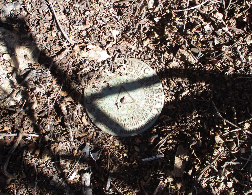
March 2024: I hiked to Ballard Peak with a pal, my first time to the peak since I moved here. The trail is much more well defined these days. We moved fast and I was pushing myself to maintain a quick pace. My hiking partner knew where to locate the Mule benchmark. It's in the dog-hair brush about 25 feet northeast of the cairn. It was under a couple inches of dirt, but he found it. It was cool to see it, as it dates from 1910.
|

|