The Mountains of Arizona
• www.surgent.net
|
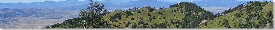
| Miller Peak |
• Highpoint: Huachuca Mountains • Coronado National Forest • Cochise County |
|
Date: July 4, 2005
• Elevation: 9,466 feet
• Prominence: 5,006 feet
• Distance: 10 miles
• Time: 8 hours
• Gain: 2,900 feet
• Conditions: Hot and buggy
• Teammates: Ms. C, two Mexican coyotes, two BoPo agents
Miller Peak is the highest peak of the Huachuca Mountains in southern Arizona, not far from the Mexican border. The closest town is Sierra Vista, and there are a number of trails leading into the range, connecting with the main Crest Trail. Not surprisingly, Mexican border crossers use these trails to sneak into the country. Encountering them, or Border Patrol agents, is a distinct possibility. We did meet two coyotes, and later, two agents. It was an exciting hike.
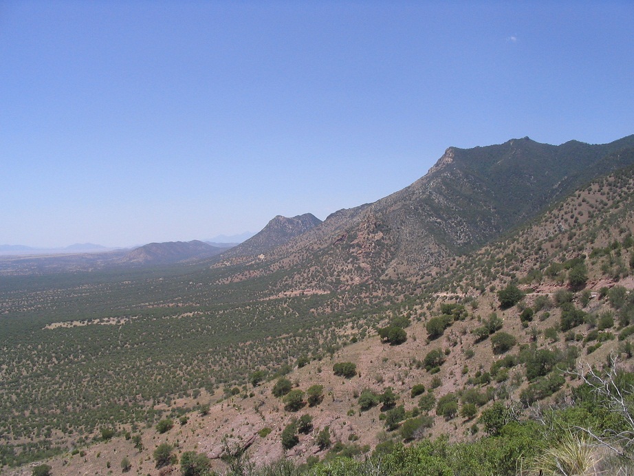
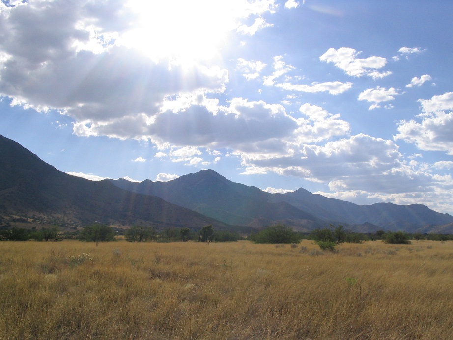
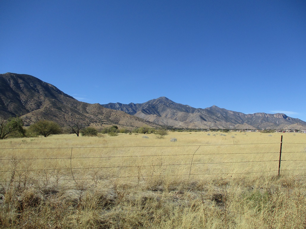
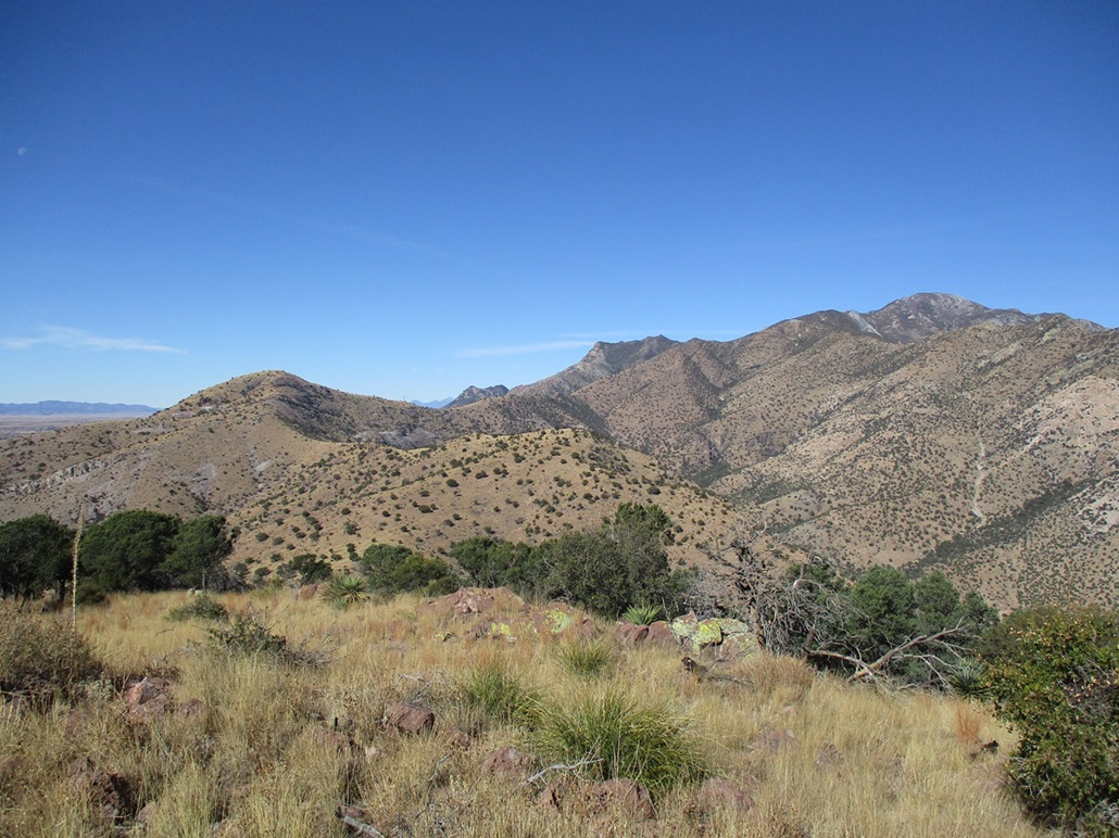
Border-crossing issues aside, the Huachuca Mountains are one of the "Sky Island" ranges in southeast Arizona. These are compact but towering mountains that rise suddenly above the high-desert plains, like islands above the sea. Miller Peak has nearly a vertical mile of relief above the surounding valleys. It is one of 57 mountains in the mainland United States with over 5,000 feet of prominence. The hiking here is notoriously lovely, and we were not unduly concerned about encountering crossers.
There are three main routes to the top of Miller Peak, all involving the Crest Trail in some manner. The southernmost trailhead at Montezuma Pass is just one mile north of the border, and we chose to start our hike here. The trailhead is usually busy with hikers and casual visitors, and the Border Patrol usually have some people parked here monitoring the area. It was safer than leaving our truck stashed in some side canyon.
For us, this would be our second anniversary. Why spend it in a nice restaurant or home listening to romantic music? Instead, we elected to go hike up a desert summit on a day when the temperatures would be pushing 110 degrees in the lower elevations. Throw in possibly meeting Mexican coyotes and heavily-armed Border Patrol agents, and we were sold.
We drove to Sierra Vista on the 2nd, and stayed at one of its many chain hotels, a Quality Inn. The room's air conditioning did not work, the room's temperature about 90 degrees the whole night. It sucked. We tried to get moved to another room, but they were completely full, so we just dealt with the hot, stuffy room. Neither of us slept much. We had planned to hike the peak on the 3rd, but we were not in any mood after a night of no sleep. Instead, we spent the day driving the roads to the Reef Townsite and then back down and on to Montezuma Pass, then down its west side, encircling the Huachuca Mountains. It was a scenic, fun way to kill the day. We were able to get a different room the second night.
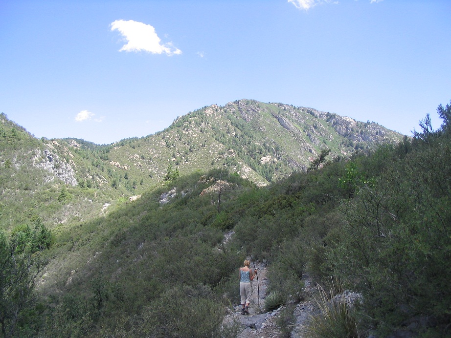
Monday the 4th started well, and we arrived to the small parking area at Montezuma Pass at 7:30 a.m.. We were the only ones there. We started hiking at 8 a.m. in warm conditions. We crossed the road and found the trail, and started in. At first, the trail has easy gradients as it bypasses a small foreground hill. After that, the trail gains steeper up the southeast-facing slopes, passing a few mine shafts along the way. There is no tree cover here and it was warm, but we made good time. We surmounted a pass at a ridgepoint near Peak 7964. To here, we'd gained 1,300 feet in two miles. We took a break. So far, we'd not seen a single person.
Now on the east-facing slopes, we entered into a small copse of trees. We hoped the shade might offer some relief from the sun, but apparently every insect in the range thought so, too, and we had no respite from the bugs. Ironically, it was a relief to be back into the open, where the brush was about knee high and open to the sky and sun. The upper ridges of the Huachucas were now visible.
A few minutes passed, and we were approaching a point where the trail meets the crest again and crosses to the west side. Here, we saw two men appear. Both were wearing flannel, jeans and work boots, and were obviously Mexican crossers or, more likely, coyotes. We decided to meet them head on. I greeted them in my meager Spanish, and they greeted us back. We wanted no part of them, and as I suspected, they wanted no part of us. The whole encounter lasted as long as it took for us to pass, perhaps 15 seconds. We kept walking and after a minute or so, we stopped to assess what had just happened. Looking back, they were long gone. We noticed evidence of other crossers, including food wrappers, water bottles and an occasional piece of clothing. There was a good chance that a batch of them were hiding in the brush as we passed.
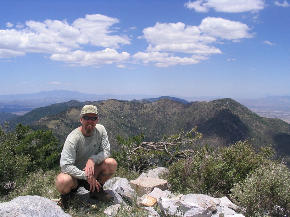
After that, the rest of the hike was rather unexciting. We continued northbound on the Crest Trail, the forest growing slightly thicker as we gained elevation. The day's warmth wasn't too bad, and we made decent time. Finally, the Crest Trail meets the trail coming in from the north (the Carr Peak Trail), and the last mile was up a steep series of switchbacks hewn into the rock to support a fire lookout that once stood atop the peak. We summitted around 11:30 a.m., a five-mile hike with nearly 3,000 feet of gain.
We spent about 20 minutes up top, resting and admiring the views from this lofty perch. The day was clear and we had hundred-mile views in all directions. However, the insects were bombarding us, and it was warm, so we decided to get moving before too long. We hiked down the mile to where the trails met, and we hiked another few minutes south on the Crest Trail, taking a break in a wide area in a glade of trees. Then things got real interesting.
We heard some bashing and voices in the trees, thinking it might be more Mexicans. Suddenly, two men in body armor, fatigues and assault rifles come bursting out, all excited, asking "if we'd seen a whole group of Mexicans pass through here." We told them of the two guys we'd seen earlier, but that was nearly three hours ago, and they were probably in Mexico by now. These two guys were after a group of "20 or 30 Mexicans". Soon, they calmed down and sat with us.
They had been dropped into the range by helicopter a few hours ago, evidently in hot pursuit of a large group of crossers. They asked us what we were doing here. We said we were hiking. They asked us what peak that was, pointing at Miller Peak, so we told them it was Miller Peak. They weren't interrogating us. They were very friendly and probably relieved to see us and be able to take a break from all the running around. We asked them if we should be concerned and they said no, that the crossers will make every effort to remain unseen.
These two guys were young and full of energy, but apparently did not carry a map. We did not see a GPS but then again, maybe they had it hidden. They then asked us which way was out, as in if they follow this trail, will they get out? We said yes, it'll take you down to Montezuma Pass. After 15 minutes, they got up and started walking. We gave them a few minutes head start, then we resumed our hike. Occasionally, we would see the two guys a few hundred yards ahead of us. We had essentially an armed escort off the mountain.
We took our walk out slowly. We did not see a single other person on our hike out. We were back to the parking area at 4 p.m., the warmth of the day much more noticeable now that were lower in elevation. We exited via Sierra Vista, and drove home that evening. The temperatures in the deserts had been around 110 degrees today, and it felt like the 90s at the trailhead. However, it had been a clear, blue afternoon, with no hints of clouds or storms. Just lots of bugs.
We never felt in harm's way where we were, and despite all the histrionic warnings about hordes of border crossers, actual encounters with them while on a hike, and being robbed or hassled, is extremely low. Nevertheless, it pays to pay attention, and if border crossers isn't your thing, the north trailhead from the Reef Townsite may be preferable.
|

|