The Mountains of Arizona
• www.surgent.net
|
| Swisshelm Mountain |
• Highpoint: Swisshelm Mountains • Arizona State Trust Lands (part) • Cochise County |
|
Date: December 15, 2007
• Elevation: 7,185 feet
• Prominence: 2,025 feet
• Distance: 4 miles
• Time: 5 hours
• Gain: 1,425 feet
• Conditions: Clear and cool
• Teammates: Scott Casterlin & John Hamann
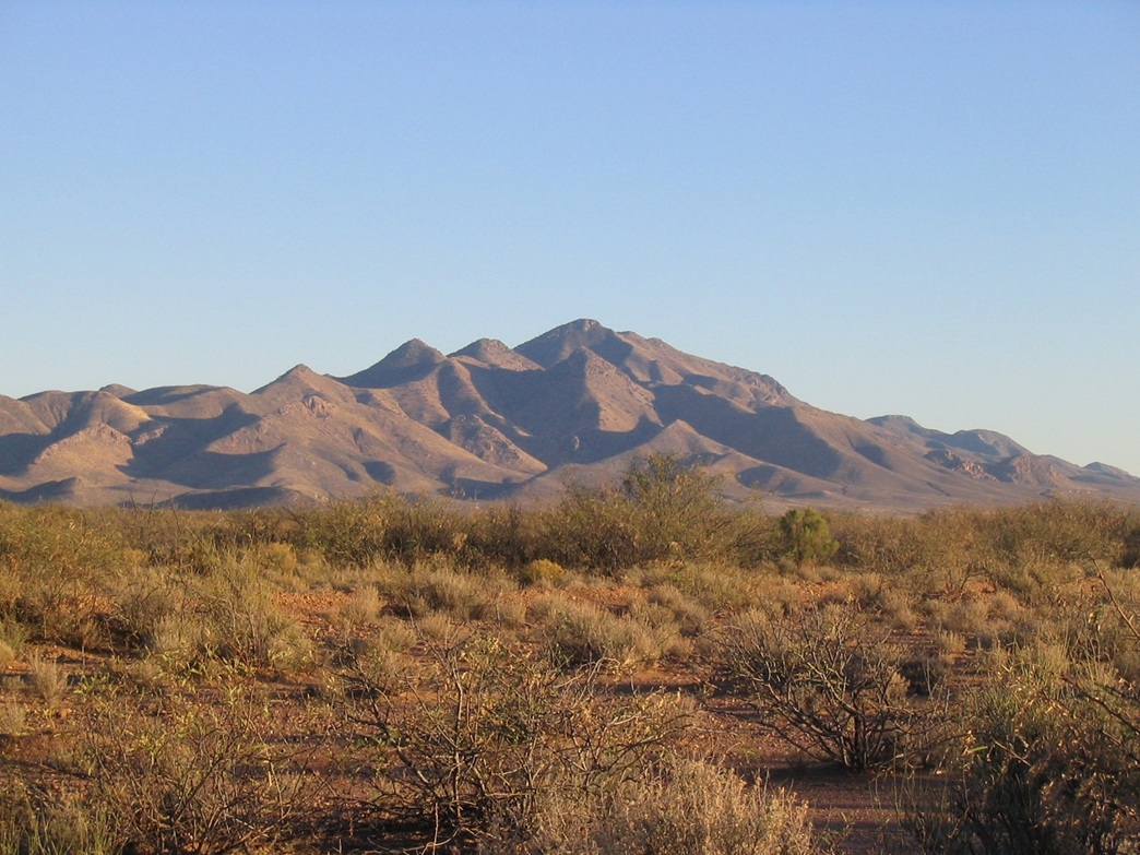
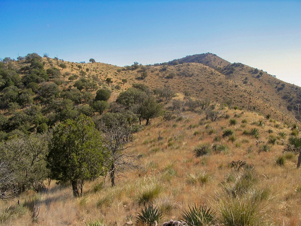
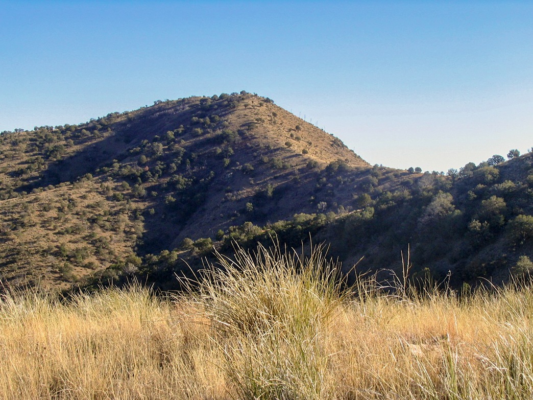
The Swisshelm Mountains are in southeast Arizona, southwest of the Chiricahua Mountains. The range lies on the eastern fringe of a broad valley between Willcox and Douglas, about 40 miles from both cities. It is best viewed, in my opinion, from the south while heading north on highway US-191. From the west side, it is nearly 3,000 vertical feet between the desert floor and the summit.
I had not given Swisshelm Peak much thought until last October when I was in the area hiking Silver Peak. After that hike, I drove into Douglas, then north toward the Swisshelms for a scouting mission, aware the range sits on private land. I drove north through Elfrida, then east on Rucker Canyon Road about a dozen miles to the start of Mountain Queen Road, coming to sign mentioning that access into the range is permitted "verbally", from the landowner. "Gee, who is the landowner?" I wondered.
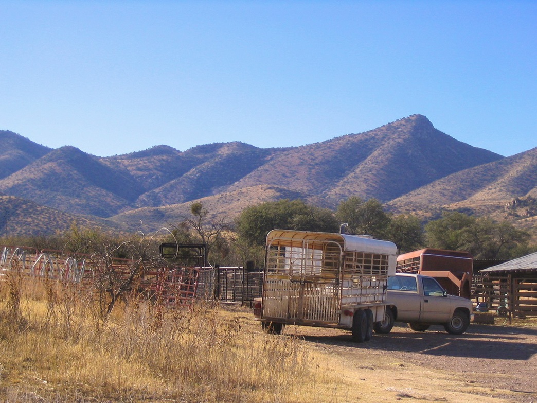
I assumed the landowner in question was located at the Rafter X Ranch that sits along Rucker Canyon Road at the junction with Mountain Queen Road. No one was home, though, but I felt like I had a lead. Once home, I drafted a request letter to the Rafter X Ranch, but could not find an address, and my letter was returned undeliverable. However, quite by luck, a climber from New Mexico, John Hamann, contacted me about hiking a few peaks in Arizona, mentioning Swisshelm Peak. He had a lead, too, and had actually talked to the landowners. This was further than I got, so I asked to tag along for Swisshelm, which we set for mid-December. Scott Casterlin, a long-time climbing buddy from Tucson, was also included.
I left home early in the morning for the 120-mile drive to Tucson, planning to meet Scott and John at a Chevron station off Interstate-10. From there we convoyed the hundred miles toward the Swisshelm Range. We drove Rucker Canyon Road to Mountain Queen Road, then south a couple miles into the canyons of the Swisshelm Mountains toward the Smith Ranch property. We rolled up and Mrs. Smith came to greet us. She was friendly and we had a 15-minute chat about the area and the history. We learned that their property includes almost all of the range, and that it is one of the largest deeded contiguous private land tracts in the state. The land goes back seven generations in their family, too. It was fascinating.
She also filled us in on the sometimes troublesome encounters with border crossers who find their way onto their land. She sounded like a thoroughly fair woman, who understands the challenges some must go through to make a living for their families, yet harbors no patience for the unlawful scoundrels who rob (and worse) the crossers and landowners and anyone else. The border/illegal immigration topic has taken on such a poisonous, extreme bent in the media in recent years, it's actually refreshing to hear someone who lives it everyday talk about it. Like others I have talked to near the border, their views aren't extreme, just practical. I wish them the best of luck. After our talk, we got down to business of unlocking the gate and working out where to go. She bade us farewell, and we were on our way.
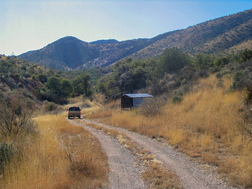
From the ranch house, we went south four miles along a decent ranch road through pretty canyons. We bashed and bumped to the end of the road at a tank on top of a knoll, elevation 5,760 feet. The high peaks of the Swisshelms were above us, but the actual highpoint was invisible on the ridge to the south. We got our stuff in order, beginning our hike at 11 a.m. The weather was perfect, with blue skies, clear, no clouds, dry, cool but not cold, and no wind.
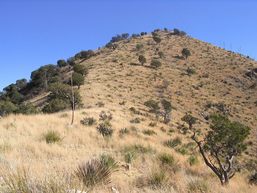
There is no trail to the summit, so we started hiking directly up the slope in front of our cars. We walked a flat section of juniper, cactus and grass before coming to the slope. The terrain steepened, and we trudged upward at our own paces. The slope wasn't too bad, just steep and relentless for about 600 vertical feet before it moderates to meet the upper ridges. There were few large trees or shrubs, mostly grass and agave, plus rocks. The going wasn't bad at all.
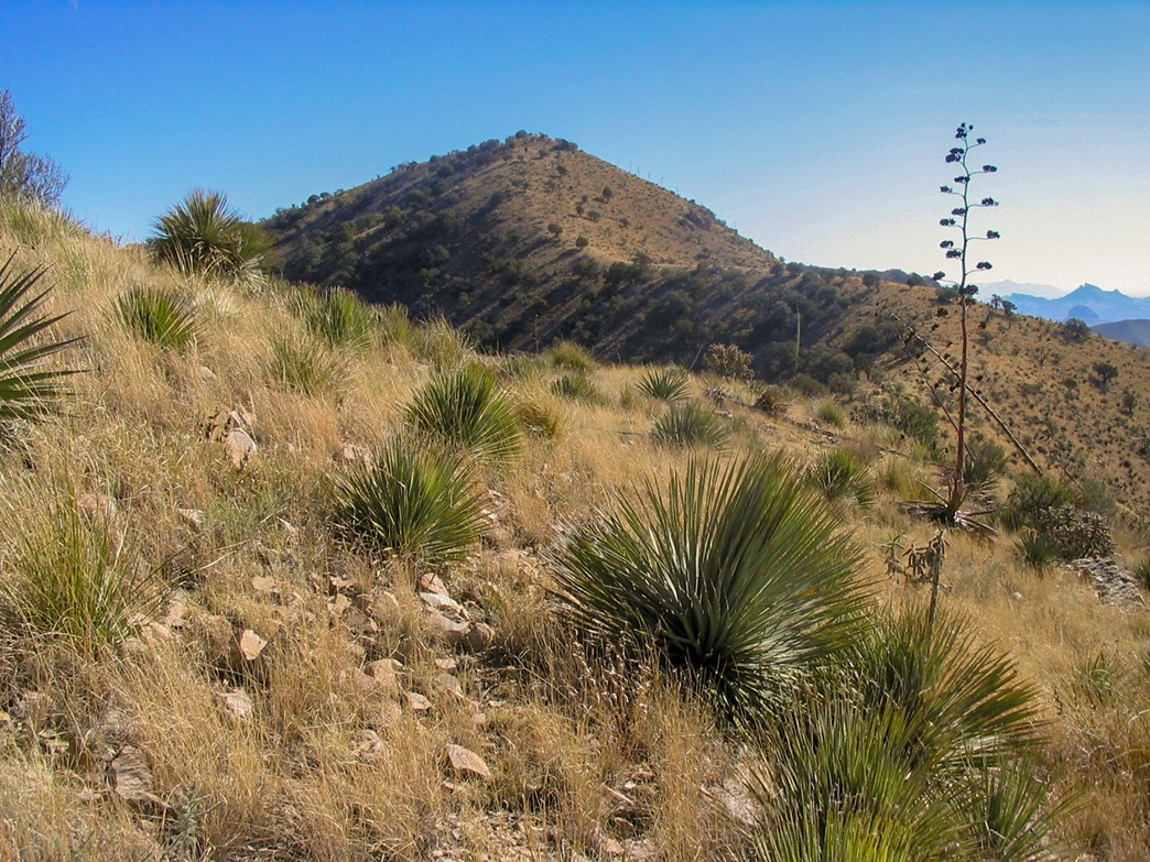
Once we were above the steep parts, we angled left (south) and sidehilled toward a low spot on the ridge. John was a few hundred paces ahead, while Scott and I stayed close together. The summit was now visible, a lovely rounded peak about a mile south. Between us and it were about 3 or 4 small false summits, which we walked up and over or sidehilled as needed.
In time, we were at the base of the final hill, about 250 vertical feet of grass, rock and shrub still to go. John had bounded out way ahead and made the top about 15 minutes ahead of us. I got ahead of Scott a bit, and we achieved the top roughly at the same time, only to discover there was still more walking to do. Fortunately, it was just a few hundred horizontal feet along the summit ridge, the highest point (and the benchmarks and cairn) being at the south end of this ridge. John was already there.
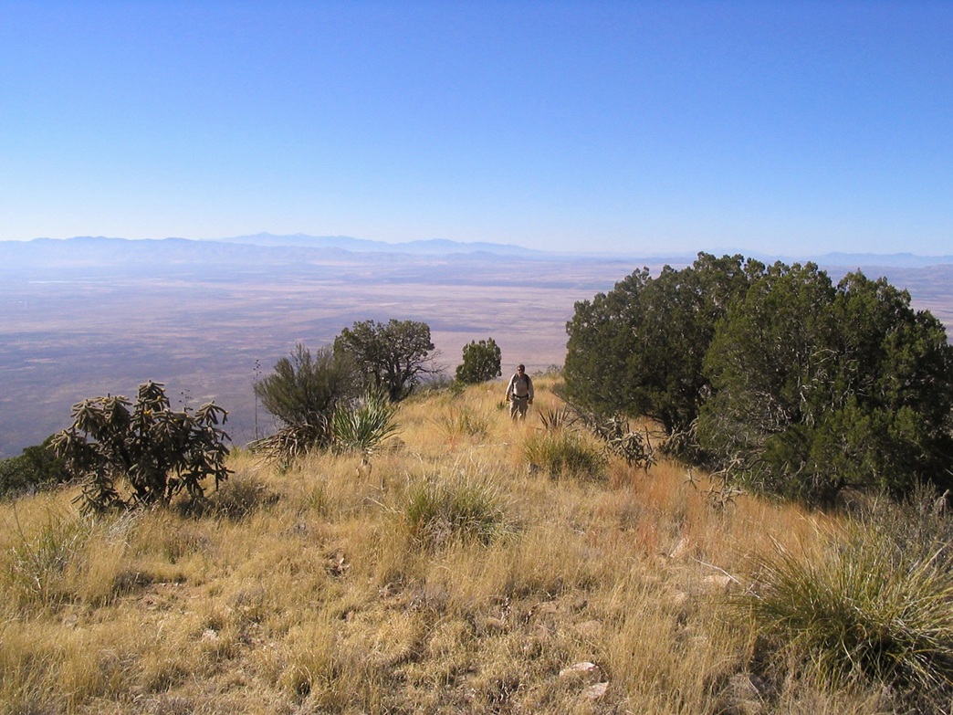
Soon, Scott and I showed, and we all sat down around the cairn, looking over the register which held names going back over 20 years and worked out to about a half-dozen hiking teams per year. The three of us spent about 30 minutes up top, eating lunch and identifying all the surrounding peaks. Given the clear skies, we could make out ranges well over a hundred miles away with no trouble. To the northeast were the snow-bound Chiricahuas, while due east was Animas Peak in New Mexico. Across the valley to the west we could see the Whetstone, Mule, Huachuca and Dragoon Ranges. Mount Wrightson rose far off on the western horizons. North we could see the Dos Cabezas, and farther off, the snowy hulk of Mount Graham. To the south we had unobstructed views of the multitude of peaks in Mexico. I could have stayed up there all day.
We got moving, starting the hike down. Because there were so many rocks on the whole route, we had to go roughly as fast (or slow, however you see it) going down as we did coming up. As usual John was off to the races while Scott and I strung out, me a bit ahead, Scott hobbled by a sore foot. We retraced our steps, walking down the steep initial slope carefully. It took us about 90 minutes to arrive back to the cars. I had time to change into dry clothes while Scott managed the last few feet back to the vehicles.
It was about 3 p.m. when we finished, but the sun was now behind the peaks, so we had shade and colder temperatures. We convoyed out to the ranch house to say thanks and goodbye to the Smiths, and then back out to Rucker Canyon Road. John and Scott were driving back to Tucson while I was heading up to Willcox, where I was going to stay at a hotel since we were all planning to meet again the next day to tackle another peak, the Mae West Peaks in the Little Dragoons.
The day had been a perfect Arizona winter (technically, late fall) day. While the rest of the country was dealing with ice storms and lake-effect snow up the yin-yang, we had picture-perfect conditions. You couldn't ask for anything better. Alas, I did have one very frustrating experience: I am almost certain I dropped and lost my GPS unit somewhere on the mountain. I know I had it driving in. It was only afterwards when I got home that I couldn't find it. I called the hotel and they didn't have it. Damn. The only damper to a great day. My thanks to the Smiths for their kindness and to John and Scott for being good hiking mates for the afternoon.
Update: This information was true and valid in 2007, which is many years ago now. Going this way is not an option any more. Most now come in from the west, but that side also has private property in its way. There are routes that way but you need to do your homework. You may need to take a longer circuitous route to avoid private property or at least mitigate your exposure.
|


|