
The Mountains of Arizona
• www.surgent.net
|
| Silver Peak |
• Chiricahua Mountains • Coronado National Forest • Cochise County |
|
Date: October 6, 2007
• Elevation: 8,008 feet
• Prominence: 2,008 feet
• Distance: 9.2 miles
• Time: 5 hours
• Gain: 3,100 feet
• Conditions: Marvelous
Arizona
•
Main
•
AZ P1K
•
PB
•
LoJ
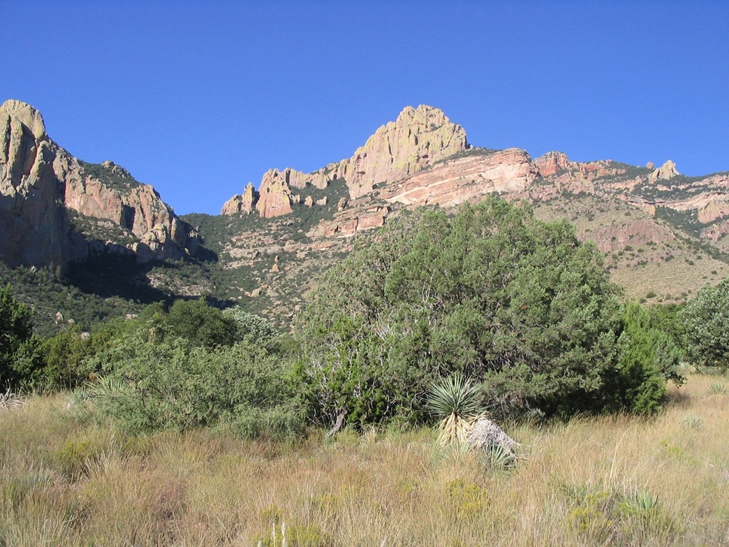
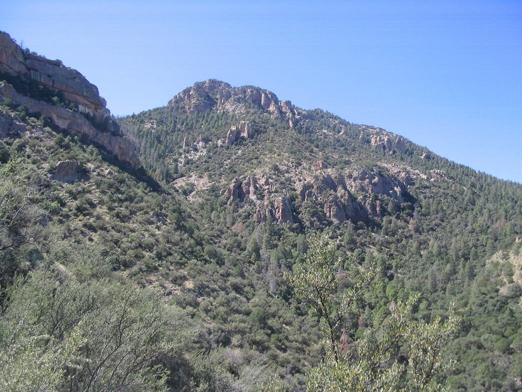
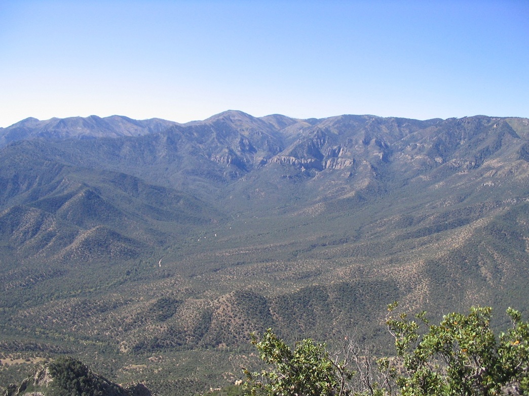
Silver Peak is in the Chiricahua Mountains in southeast Arizona, closer to the New Mexico boundary than most of the range. With Portal Peak, the two mountains rise over Cave Creek Canyon, the "Yosemite of Arizona", named for its abundance of unique cliffs and rock formations. The mountains, canyon and the entire range are formed from volcanic tuff, which weathers easily into spires and formations of all shapes. The region sees little visitation since it is far from most populated areas and receives little attention. That worked to my advantage, just me and a few other random travelers.
With autumn here, the weather was getting nice, with clear days, low humidity, no chance of storms, and cool evenings. I loaded my stuff into my truck after classes and headed out around 1:30 pm, mentally prepared for the long drive (300 miles) and the usual traffic between Phoenix and Tucson. It was breezy and dust was kicking up, in some places blowing across the highway. Fortunately none of these dust storms were sustained, but I drove it carefully.
I hit late-day traffic in Tucson, then smooth sailing east to Willcox, where I topped the gas and picked up some groceries. The sun was low by this time. The all-paved route required staying on Interstate-10 into New Mexico, then down a state highway there to the town of Rodeo, then back into Arizona. However, the atlas showed a road from San Simon (Arizona) leading south to the village of Portal, potentially cutting off 30 miles, so I followed it.
The road was graded dirt, and I drove most of it in the dark. I arrived in Portal at 6 p.m. and on to the Idlewilde campground, getting an open spot near a giant boulder and across from a bubbling creek. I had a dinner, and relaxed in my truck's cab. A skunk was sniffing around my truck, so I tried to avoid him and keep from getting "skunked". He scooted off, and I was asleep by 8 p.m.
Next morning, I awoke with the sun and spent time relaxing at camp, getting a good view of the area. The cliffs start literally feet behind the tent pad and picnic table. The road is just a few feet away, and on the other side, more cliffs. I exited the campground and saw a sign saying "trail" on the other side of the road. This seemed to agree with the map, but this was a false lead. The trail was a nature path that paralleled the road, so I walked back to my truck, and drove off looking for the proper trailhead.
I found the real trailhead in a pullout about a quarter-mile north of the campground, a small "Silver Peak" sign in the brush. The map is misleading since it groups the Portal Ranger Station, trailhead and Idlewilde campground all in one area. In reality they are spaced about a half-mile apart. I started hiking at 8:40 a.m. The weather was cool with a soft and steady breeze. The sun was starting to breach the cliffs across the canyon, so it was warm in the sun and cool in the shade, and whenever I got a little hot, a breeze would come along and cool me.
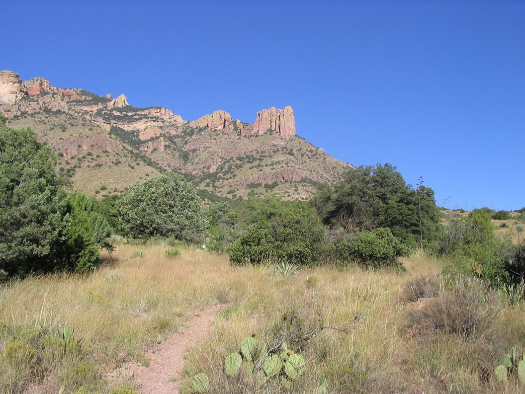
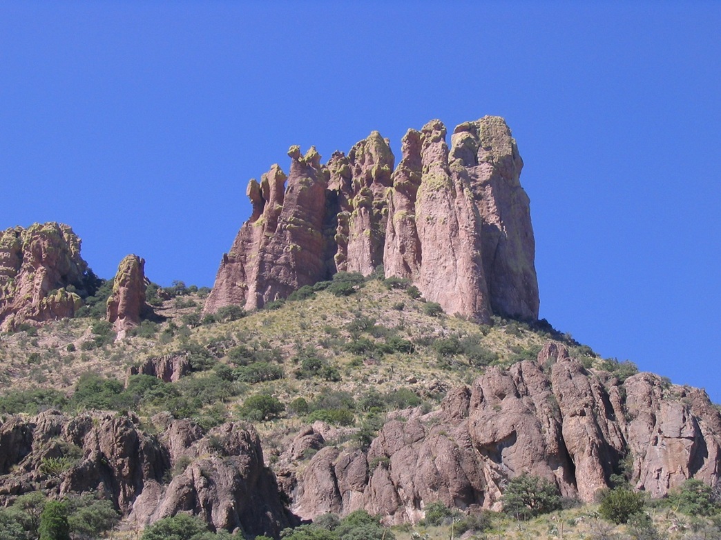
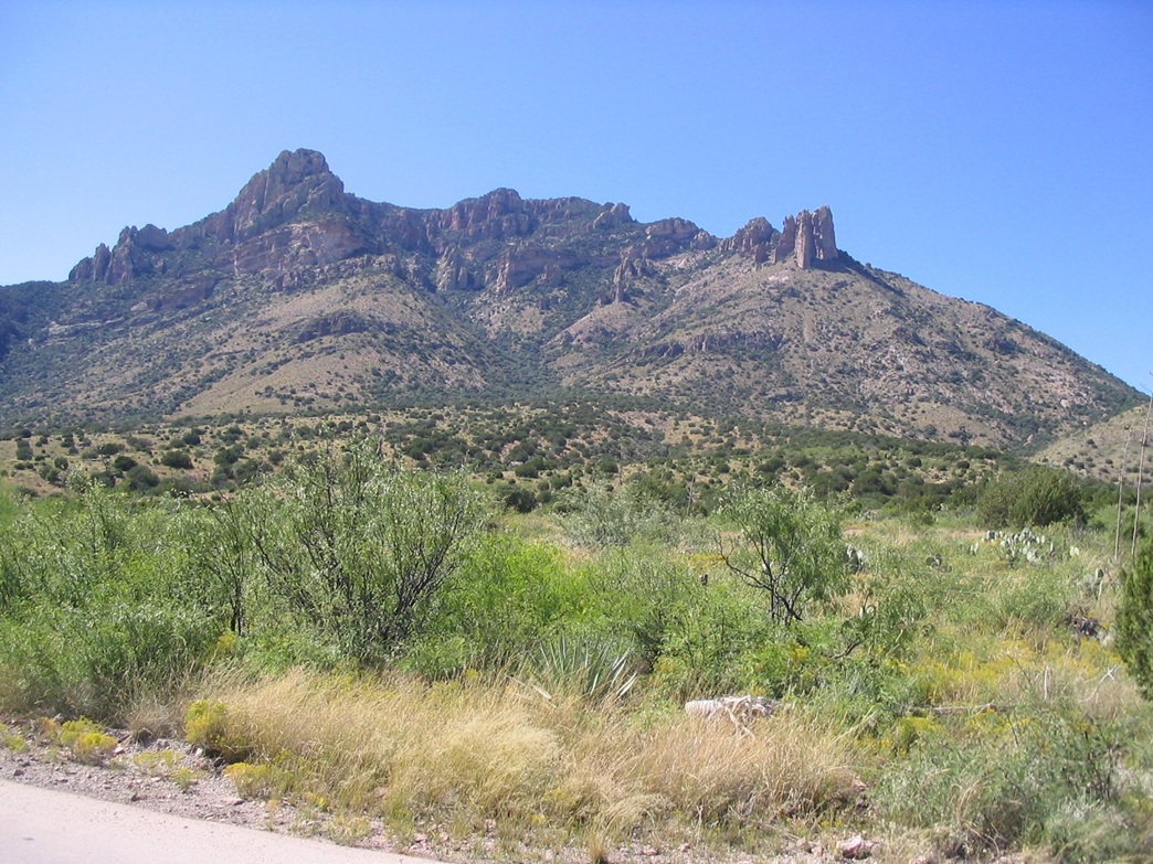
The first mile of the hike is up a moderate slope, a mix of desert scrub and juniper and mountain oak woodland, with a cactus here, a juniper there, and knee-high grass everywhere. I met a couple hunters coming down and we had a chat. They were scoping for bear but had no luck. The trail comes to a barbed-wire fence after three-quarters of a mile, then turns left and parallels the fence for awhile, gaining a ridge toward the main mountain mass. All around me were fascinating rock formations, including "The Fingers", a large prow of pillars on a sloping hillside. The trail meets the base of the mountain, turns right and upslope, generally to the right (and below) of The Fingers.
I passed another fence line, and a few yards later I came to a metal signpost, but lacking the sign. Not paying a whole lot of attention, I went straight, and quickly the trail devolved into nothing. So I returned and saw the correct path going up to the left, working its way up and around the north-facing slopes of the peak. The trail came a bend where the summit was visible for the first time.
I took a break at the first of the many switchbacks ahead of me. Looking up, Silver Peak is big and broad, with a little bare rock section poking up above the trees, this being the highpoint. The map shows a spot elevation of 7,975 feet along the ridge, and an 8,008-foot marker at the highpoint. But for some reason, the 7,975-foot elevation is usually listed as the peak's elevation. Why they ignore the actual highpoint's elevation figure in unknown.
Now on the north-facing slopes and slightly higher in elevation, the flora changed quickly to more substantial pine, mountain oak, and green grasses watered by springs. There was more shade as well, and the air was much cooler. The trail starts up a series of switchbacks, sometimes traversing, then starting up more switchbacks, all the while gaining a lot of elevation. A few sections of trail were eroded and other sections over-grown. Fresh bear scat was everywhere on the trail. I did my best to make noise, especially around blind bends. A few times, I heard noises above me, spooking me. I was convinced there were bears everywhere (and in reality, there probably were). But as I hiked, I saw no bears. In time, the trail had gained high on the north flank of the peak, alternating back into scrubbier ground cover before entering into the forest again for the final push to the top.
The final 400 feet follows many more switchbacks, the forest thick enough to block most views. In one instance the trail-side scrub had grown so thick that the trail itself was like a tunnel. As I inched closer to the top, patches of blue sky now appeared where there were once trees. This was the only hint I was close as I could not actually see the top until I was literally at the last turn.
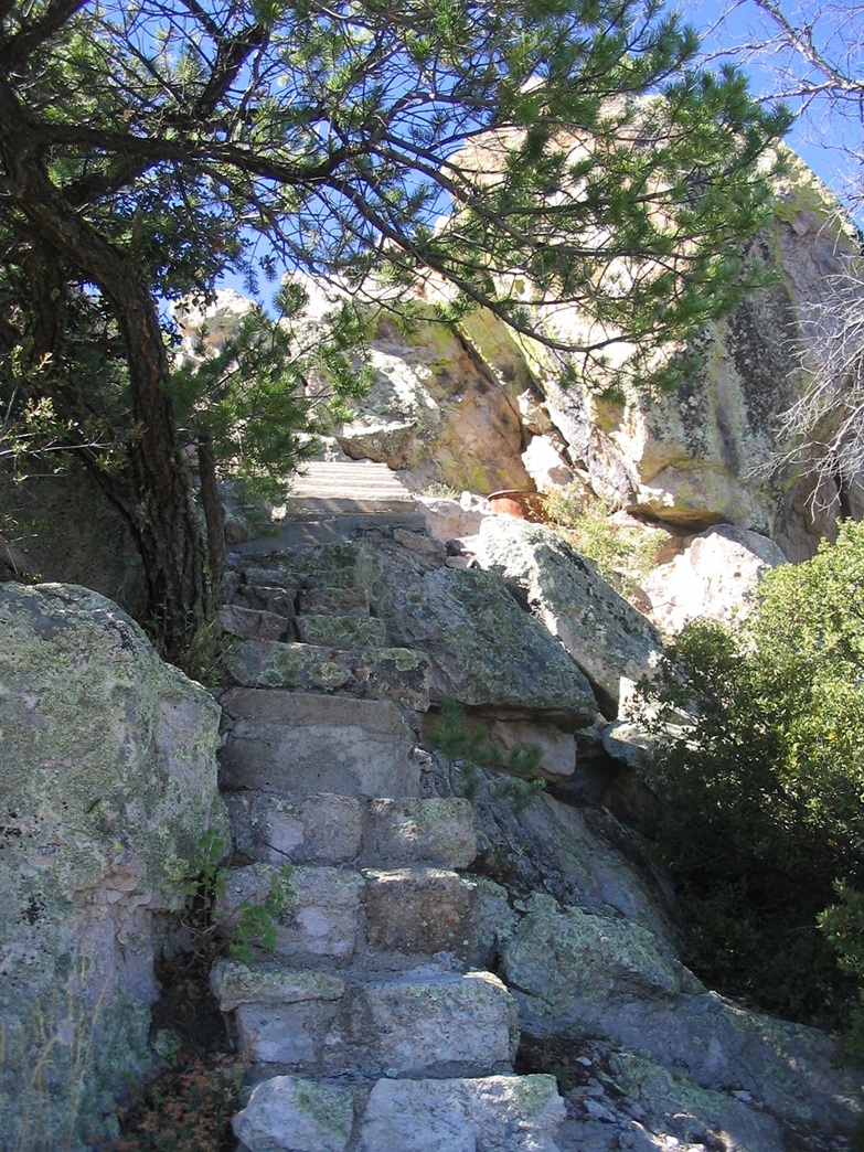
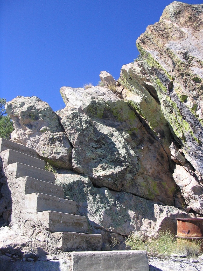
The top ridge is saddle-shaped, connecting the 8,008-foot summit to the 7,975-foot lower summit. A forest-service shed sits in the saddle, door open, its insides strewn about. I took a break here on the concrete stoop. I heard some noise above me --- a bear? I went slowly, clapping, but then the noise was a human "ahem" --- there was a guy on the summit, signing in the log book. I wasn't expecting to see anyone, especially since I never saw him ahead of me on the hike. But it did explain some of the noises I had heard coming up: it was him, also making noises to spook the bears, as he explained to me. He mentioned he heard me clap and holler lower down on the slopes, too.
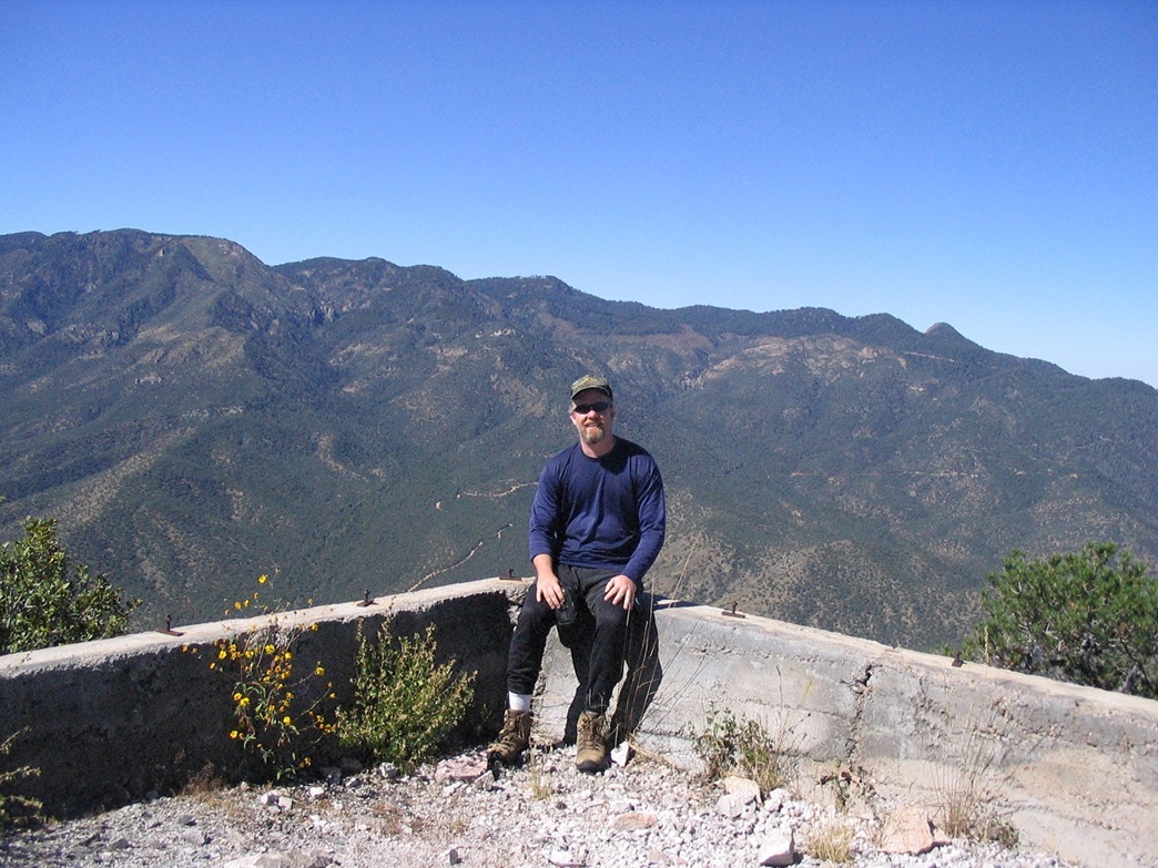
The summit is on top of a pile of boulders, and until 1992 a lookout stood precariously on this perch, but it burned down in a fire and has not been rebuilt. To make the final few feet of ascent easier, concrete steps were built among the boulders. These lead to the top, which consists of a concrete footing for the tower, and a water cistern made of rock. When I showed up, the other guy was signing in and we had a chat. He climbs the peak every couple of years or so. He shot a photo of me, then got moving, while I stayed on top, having it to myself.
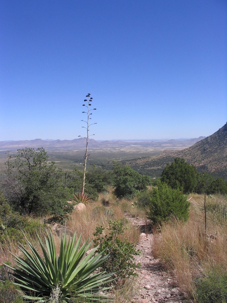
It had taken me 3 hours to the summit from my truck, not including the time wasted on the nature trail. From the summit the views are tremendous: to the south and west is the continuous sweep of the Chiricahua Mountains. Portal Peak's challenging summit rose to the southeast, while looking directly down into the canyon I could see the rock cliffs. Looking east and north, I saw a number of ranges, some far ones way off inside New Mexico. To the northwest the unique double-summit of Dos Cabezas Peak stood high. I spent 20 minutes up here. Soon, the cool breeze started to chill me, and I started my hike down.
Within minutes I came upon the other hiker, and we hiked together for a few minutes, but then I took off on my own again. The hike down went quickly. I only took one break, at roughly the half-way point down, and the trail's gradient was consistent enough so that I didn't have to watch every step so carefully, allowing me to jog-walk. In doing so, I was down in less than two hours. I was back to my truck at 12:45 p.m., where I brought out the camp chair and rested, trying to pick out the hundreds of little burrs I picked up from the grasses and brush on the way down (I had to throw away my socks, though). After changing into dry clothes, I got moving.
Driving out, I took a short tour of Cave Creek Canyon, which is especially impressive just outside the mouth of the canyon where you get a sweep of Silver Peak to the right, Portal Peak on the left, and the cliffy chasm in the center, with Sentinel Peak off in the distance between the foreground peaks. I exited out the paved route east into New Mexico and the small town of Rodeo, then south on NM-80, which turns into AZ-80 a few miles down the road. I had never driven this highway before, and had an enjoyable hour as I drove south through the high-desert rangeland toward the border town of Douglas.
Of interest along the way is a large stone monument comemorating the Surrender of Geronimo in the late 1880s. The actual surrender site is a number of miles off the highway near the New Mexico state line. After a lunch of authentic Mexican food in Douglas, I drove north to scout Swisshelm Peak for a future hike, and spent the night camping at Cochise Stronghold in the Dragoon Mountains. I had a signal and was able to pull in the D-Backs game against the Cubs, as they beat the Cubs to advance in the playoffs. However, I was so beat that I was asleep in my truck's bed by 7:45 p.m. I explored a little more the next morning before driving home.
|

|