
The Mountains of Arizona
• www.surgent.net
|
| Mount Glenn |
• Highpoint: Dragoon Mountains • Coronado National Forest • Cochise County |
|
Date: October 3, 2009
• Elevation: 7,480 feet
• Prominence: 2,840 feet
• Distance: 6 miles
• Time: 8 hours and 45 minutes
• Gain: 2,600 feet
• Conditions: Misty and foggy with white-out conditions up high
• Teammates: Chris Gilsdorf
Arizona
•
Main
•
AZ P1K
•
PB
•
LoJ
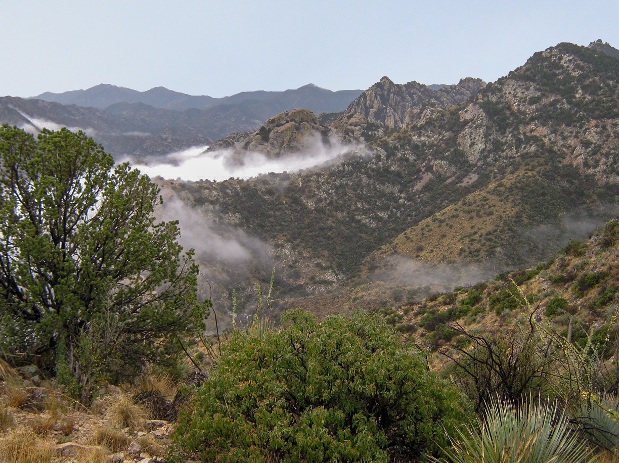
Mount Glenn is the highest point of the Dragoon Mountains in southeast Arizona, about 75 miles east of Tucson. The Dragoons are famous for its remarkable natural rock formations, including pillars, voids, mazes, cliffs and shapes too varied to describe. The bulk of these formations are in a side canyon on the east side of the range and are known as the Cochise Stronghold. Higher up, the range has a smoother profile, with Mount Glenn being a bump along an elongated ridge. It looks simple to get to it, but the brush is (was) something else, and as a result, relatively few people climb this peak.
Most people who come to the Dragoons come for the Stronghold. The Chiricahua Apache Chief Cochise and his men, including his successor Geronimo, would seek refuge in these rocky canyons, eluding the United States Military for the nearly 20 years that the Apache guerrilla wars were fought, roughly 1865 to 1885. Cochise himself, who died in 1874, is said to be buried in the Stronghold. His burial place has never been found and probably never will be.
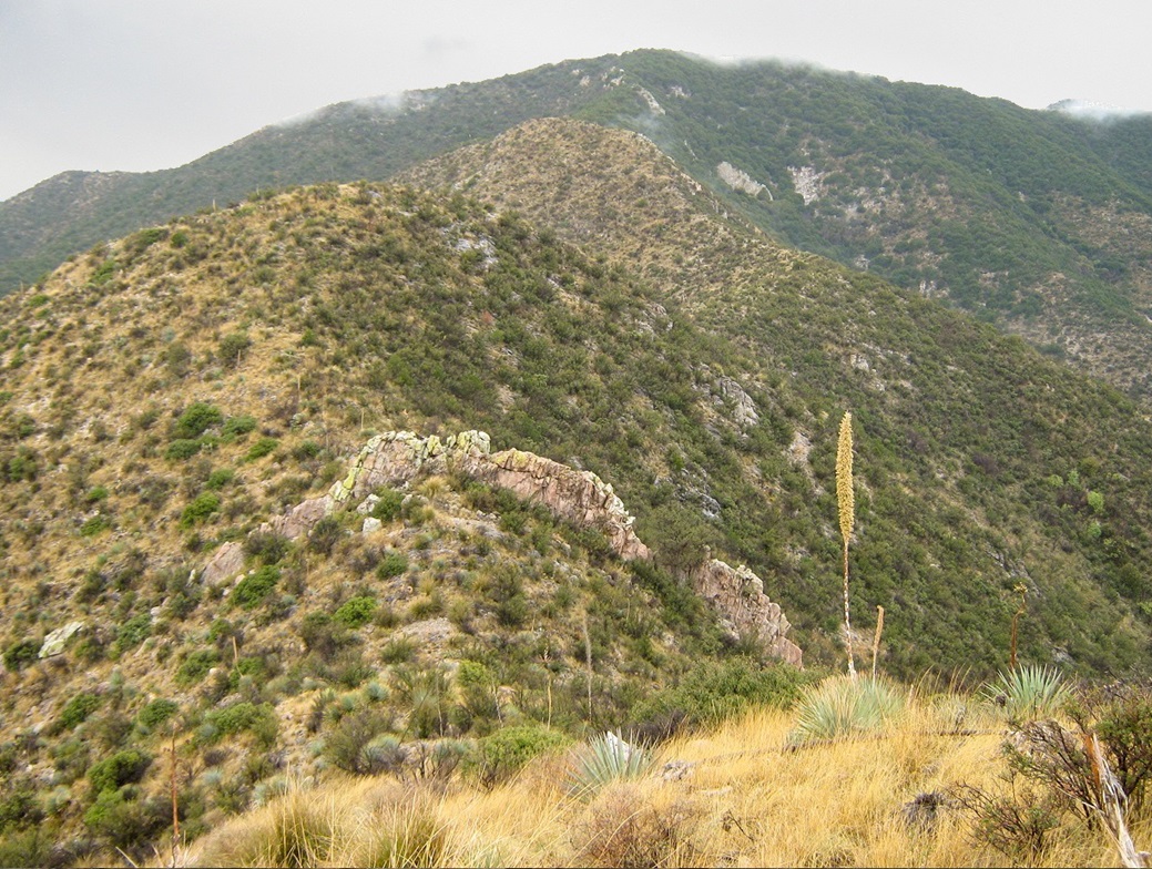
For this trip, my partner was Chris Gilsdorf, whom I "knew" through the County Highpointers group and from Summitpost. With the summer heat finally abating and nicer weather settling in, we chose this weekend to make a one-day assault on the peak. No trails lead to the summit, and although the ridges are mostly gentle and easy to follow, they are rocky, brushy, and full of agave, sotol, small cacti and other pointy plants. There are also a couple of cliff bands and rock outcrops to dodge, and then there is the dense brush up high. We knew we were in for some work, but felt pretty confident we wouldn't have too much trouble.
I picked Chris up in Chandler at 4 a.m., and we drove 190 miles to the Stronghold, arriving shortly after 7 a.m. The weather was cloudy at first, then we hit patches of rain and drizzle after Tucson. We stopped for supplies at "The Thing?" gas station & gift shop, then backtracked, taking exit 318 through the town of Dragoon, following backroads toward the Stronghold. We followed Forest Road 795 north toward Blacktail Hill, then a rougher track toward a stock tank, where we parked.
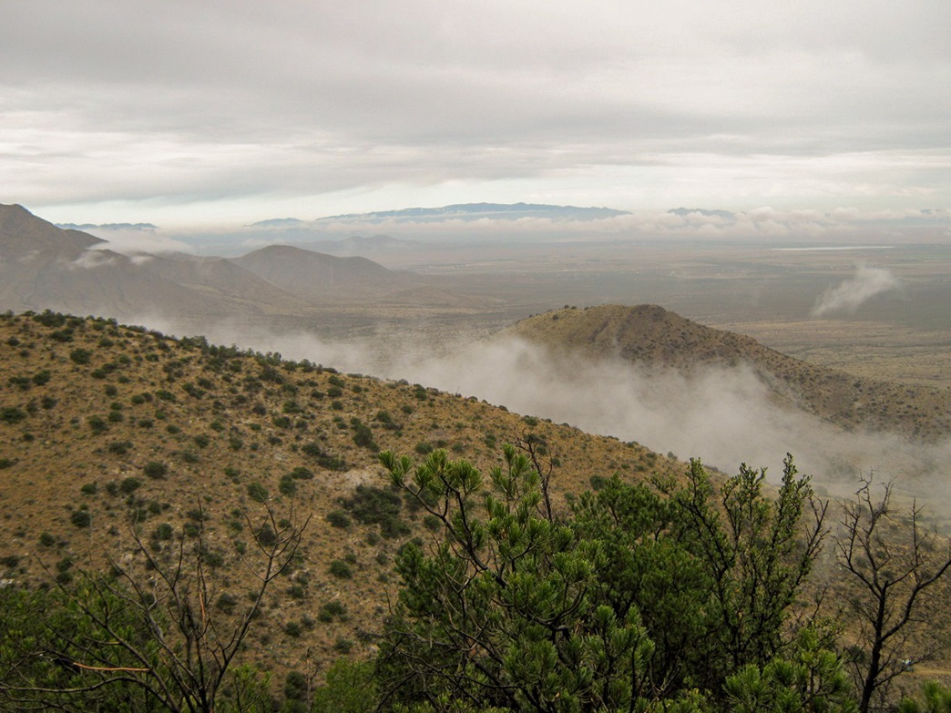
The weather remained drizzly and cool, with clouds obscuring the mountains above us. This would be the theme for the day, and admittedly, I was disappointed given that we expected better weather and usually, this is a dry time of year with optimal conditions. I feared we may be in for storms and have to retreat off the peak altogether. Nevertheless, we went for it, starting our hike at 7:45 a.m.
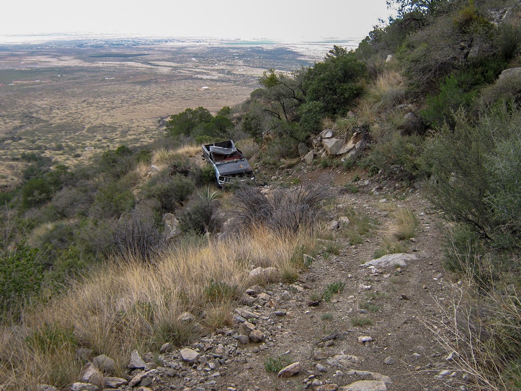
We walked the track for about a third of a mile to where it bent left, noting an abandoned truck on this road a few switchbacks above us, its cab smashed in. We would inspect it on our return. We left the road at the first bend and started up a southwest ridge that connects to the main east-west ridge, near spot elevation 6,241 feet. Partway up this lower ridge we came upon an open mine shaft and peeked in, a drop of 30 feet before the hole bent, and who knows how far down overall. This came with no warning, so we were extra vigilant about paying attention.
We slowly trudged upward through thickening brush and small trees (juniper, fir, mountain oak), arriving onto the main ridge shortly before 9 a.m., where we took a break. The weather was still drizzly and misty, and the fog would occasionally roll into these canyons and up the ridges, intermittently allowing wide-ranging views, or none at all. Looking to the west, we could see our next bump, then not much after that. At times we had nearly complete white-out conditions with as little as 50 feet of visibility.
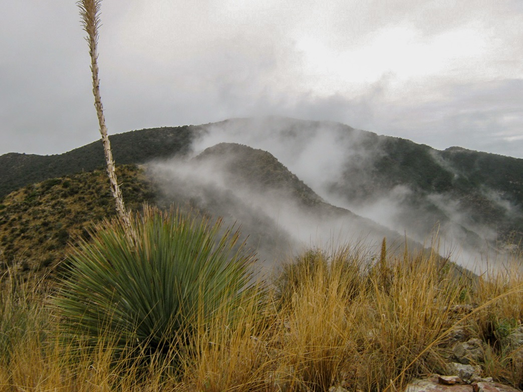
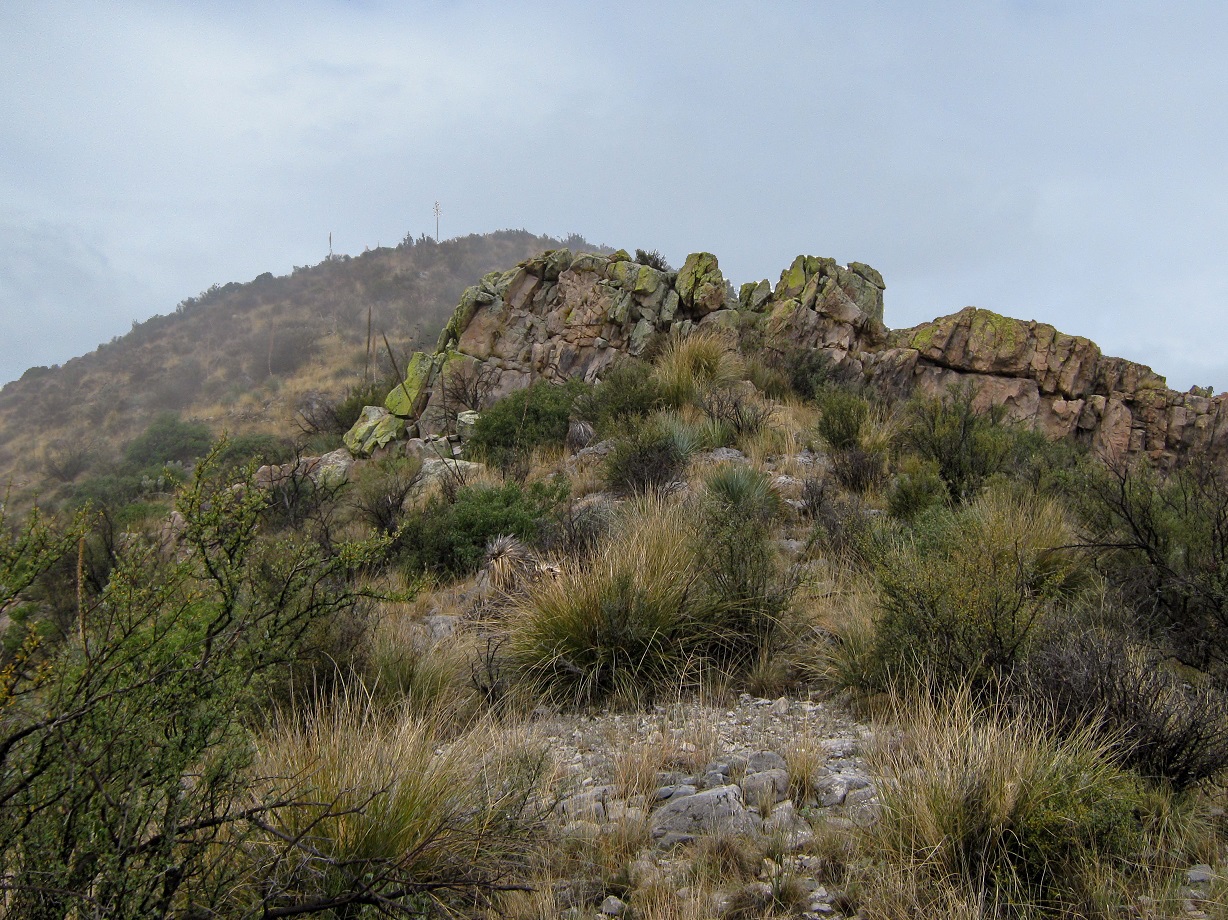
On the main ridge now, we started up the slopes heading west-northwest, aiming for a hill with an elevation of 6,720 feet, at which point we'd make a left turn and start up the southwest-trending ridges to the top. This part went well and there seemed to be a path for most of the way, although we still had to work our way around brush and obstacles. We took a break at this hill and peered south toward the summit. The clouds lifted just enough to reveal the top, and the up-and-down nature of the ridge we needed to get there.
Below us, in the immediate saddle connecting to ridgepoint 6,841, there was a band of rock forming a wall. We descended to this obstacle and climbed on top of it, but were dismayed to see a larger drop on the other side. These drops were only 8-10 feet, but the holds were marginal and in this wet weather, we chose to not test them at all. We descended about 20 feet down the east slope and worked our way around the rock obstacle. From here, it was an easy ascent to gain point 6,841. The summit was invisible as the clouds had descended again.
From point 6,841, we dropped 80 feet to a saddle, then continued up the slopes, gentle at first, then steepening a point, where the terrain leveled one last time. Up until now, the going had been pretty good, terrain and weather considered. We were at 7,100 feet and about three-tenths of a mile from the top. Now the real work began. The trees closed in quickly, and from here to the top was some of the roughest bushwhacking I've ever encountered in the state. There is no good way through the trees other than to plow directly through the branches, ducking and often getting on all fours.
Chris had entered the summit's position as a waypoint in his GPS, and every few minutes he'd read off our remaining horizontal and vertical distance. Even when we were just 100 feet from the top we could see nothing and had no sense of where we were. We then encountered a cliff band at about 7,350 feet. Chris went up the rocks directly, about 15 feet, while I found a brushy alternative to the right that only required one 4-foot scramble, but with lots of branches.
At last, the top seemed to materialize through the fog, the treetops appearing as slightly-darker shades of gray. We found the summit rocks and benchmark, set in a tiny clearing. With the fog, we had no views. It was noon when we arrived, the last 400 feet through the trees taking an hour alone. While happy to be at the top, we both decided to get moving quickly. After a few photos, we did just that. We were both soaked and uncomfortable. By inspection, a small hump of rocks to the northwest seemed about as high as our position.
We immediately encountered trouble on the descent. The final ridge approach had come to the summit on a southwest bearing, while the summit ridge itself is set at a southeast-northwest alignment. We tried to retrace our steps to stay on our correct bearing but soon realized we were off-route. We had covered about 200 horizontal feet and a drop of 20 feet, and had actually traveled northwest along the summit ridge itself.
Chris' GPS had our ascent track but he had no other waypoints entered, so I got out my compass and noted our incorrect bearing. We backtracked back to the summit itself before (a) Chris reported our descent track now overlapping our ascent track and (b) me finding boot prints of ours. Quickly we came upon the cliff band and we knew we were back on track (for now). Even in those 10 minutes of being off track, the sick feeling of being truly lost, especially in these conditions, was rather upsetting. I've already had one bad "lost" experience, I don't want another one.
The descent through the trees went faster since we had gravity on our side, but it was still a great relief to be out of those trees and back onto the open ridges. We descended down slope then back up to point 6,841, then started down its opposite side, and again, got this sense of something not being quite right. We were expecting to come upon the rock wall, but when we did not, out came the compass again and sure enough, we were off by about 90 degrees, traveling east when we should be going north.
In clear conditions, we could have easily used the ridges as a visual guide but we couldn't see 50 feet in front of us, much less 300 feet across a canyon. We hiked north and slowly the rock wall materialized out of the fog and we felt happy (and relieved) again. We took a longer break at the saddle below the rock wall. I was amazed how easily we got off track on this part, and was grateful I had my compass along today.
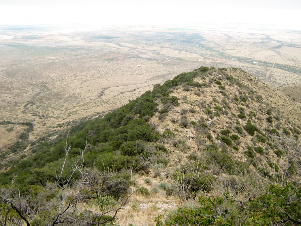
We re-ascended to the top of the 6,720-foot hill, then went right, continuing down the ridge. This went well, and as we descended we dropped below the cloud line, where we could see for long distances. We dropped to the 6,000-foot level, then cut directly down the north slopes, trying to catch the old mine road on the way down. This part went okay. It was brushy and rocky, but more open.
After dropping about 500 feet, we found the road and followed it down to the abandoned, smashed-in truck we'd seen earlier this morning. Maybe there was a body in with the wreckage. Well, there was no body, which was good, but the truck was really beat up and stripped. It looked to have been abandoned there within the last year or two and begs the question how often people come up this high. Surmising this may have been a stolen truck and abandoned up here and left to rot, I sent in a tip to the sheriff afterward.
The final segment back to my truck went well, arriving back at 4:30 p.m., a total time of 8 hours, 45 minutes. I was happy to be able to strip out of my wet, soaked clothing and into dry clothes. That was the best part of the hike, that and the mini-burgers I had at the Jack in the Box in Benson. We drove back into Chandler, arriving at 8 p.m..
I enjoyed the hike and was pleased to be successful despite the conditions. In drier, clearer conditions I imagine our time may have been cut down by an hour or two. In any case, I would strongly advise the use of a map and compass, and a GPS with waypoints, especially for the final bushwhack to the top. Chris was a great partner for the hike and was able to knock out one of the tougher bushwhacks in the state on his first try.
(Update) There was a fire here in the recent past, which burned through the highest ridges and clearing out much of the trees and brush. The going is easier now, so I hear, but I have no intention of going back to verify.
|


|