
The Mountains of Arizona
• www.surgent.net
|
| Mae West Peak |
• Highpoint: Little Dragoon Mountains • Arizona State Trust Lands • Cochise County |
|
Date: November 6, 2010
• Elevation: 6,726 feet
• Prominence: 2,026 feet
• Distance: 5 miles
• Time: 7 hours
• Gain: 2,000 feet
• Conditions: Clear and warm
• Teammates: Scott Kelley, Ken Jones & Evan Jones
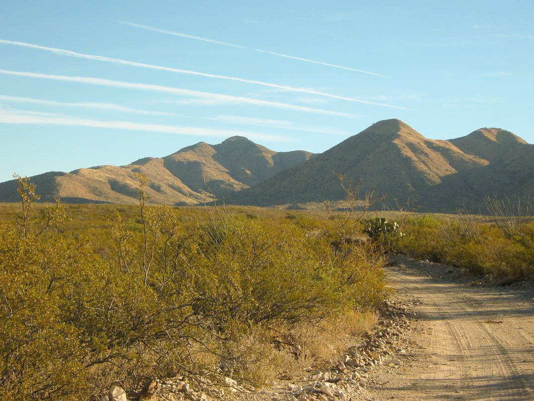
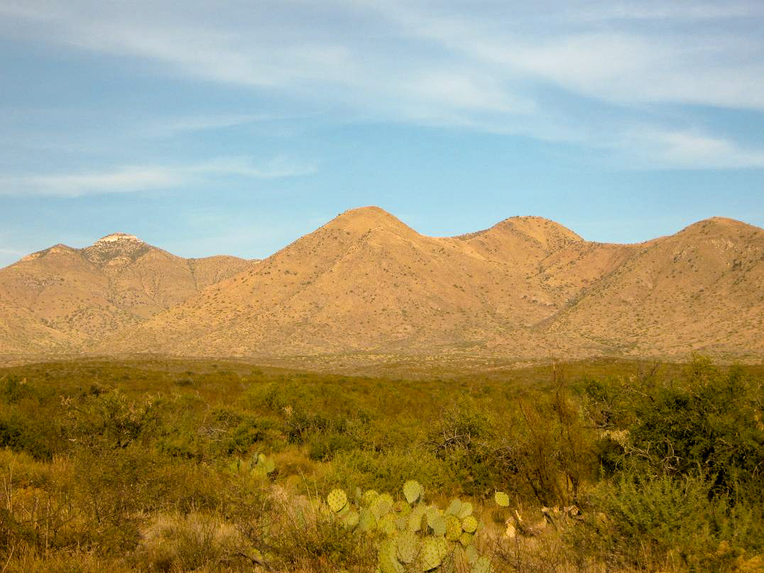
Mae West Peak is the highest point of the Little Dragoon Mountains in southeast Arizona, about an hour east of Tucson. The peak is surrounded by State Trust land, about six miles north of where Interstate-10 crosses the range. Not many people climb this peak, due to its distance, somewhat tricky access, and as we would discover, legendary cat-claw and brush everywhere. The peak is most noticeable viewed from the east, when driving from Willcox.
The name of the peak presumably comes from Mae West, the actress. The benchmark on the highpoint is (was?) stamped "Lime" (according to the map, but we saw no benchmark at the summit). To add to the confusion, another peak in the range about two miles northeast is called Lime Peak. The summit ridge features two distinct rounded humps, the western one being the highest point. The two humps are composed mainly of limestone and much whiter in color than the surrounding ridges and subpeaks. The highpoint is surrounded by small, broken cliffs. As viewed from the west in Hughes Canyon (which is the way we came), it looks possibly technical. In reality, as we discovered, there are broken passageways up these cliffs. Still, it does require a little easy scrambling to gain the top.
For me, this was my third attempt. In December 2007, a day after climbing Swisshelm Mountain with Scott Casterlin and John Hamann, the three of us arrived to hike Mae West Peak. Scott backed out immediately due to a very sore foot and ankle, so John and I went in, while Scott stayed back with the trucks. John and I walked to the end of the road to a windmill, then cut north across a drainage and up the easy slopes to gain the prominent west-trending ridge. However, we encountered steep and loose slopes. I bailed when I started skidding a little too much for comfort. John gutted it out and made the top, reporting there to be some tricky moves to clamber over the cliffs.
A few months later, Scott Casterlin wanted a second try so I went again. Instead of the west ridge, we went farther into Hughes Canyon and hiked up the headwall, aiming for the peak's south ridge. This looked more promising, but I had been sick the previous week and apparently had not fully recovered. I felt weak, with no energy, and felt like I was going to fall over and die at any moment. About halfway up the headwall slope, I bailed again, and returned to Scott's vehicle. I also made a gross error in judgment: I wore shorts. I was completely shredded by the horribly thick cat-claw in the canyon bottoms. So now I was 0 for 2. I decided to not bother with Mae West Peak for awhile.
This opportunity came when Scott Kelley and I were looking for a peak both of us "needed" from the 2,000-foot prominence list. I've known Scott for over a year but this was our first hike together. At the same time, Ken Jones from Washington mentioned he was going to be in Arizona bagging peaks, so it was natural for all of us to give Mae West Peak a try. Ken's son Evan joined us too. I picked up Scott in Tempe at 4 a.m., and we made the long drive through Tucson and Benson, meeting Ken and Evan in a pull-out along the frontage road off the Sybil Road Exit. We convoyed in our vehicles through the ZR Ranch property, where a public easement allows such a passage.
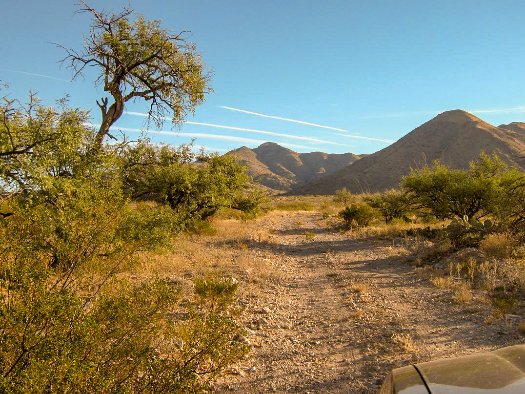
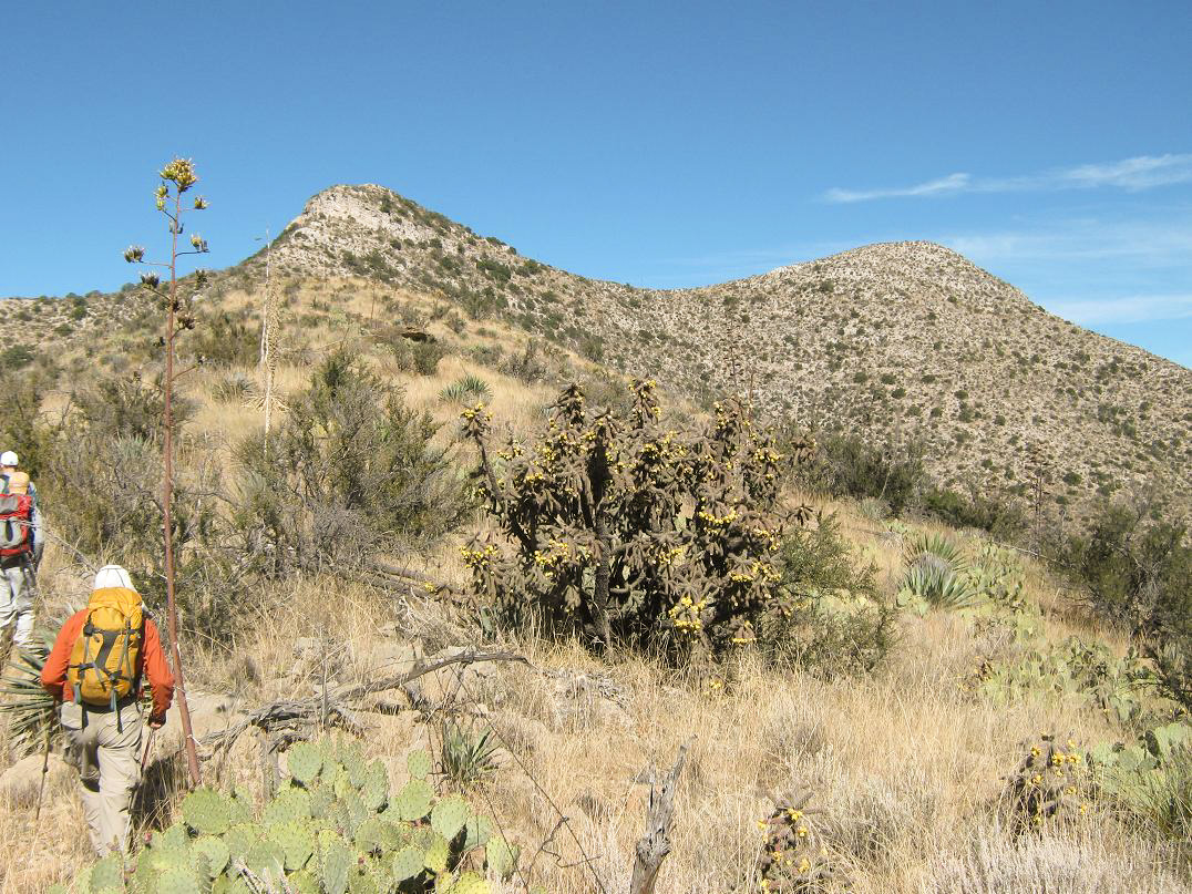
The drive to Hughes Canyon is long and tedious, about a dozen gravelly miles through remote high-desert countryside, making long zig-zags until finally the road rumbles into Hughes Canyon. We parked outside a corral and windmill. Mae West Peak is visible for much of the latter drive, its white cliffs obvious from a distance. We arrived at the corral a little after 8 a.m. and spoke with two guys in camouflage, scouting for a future hunt. They were very friendly and were not bothered by our presence. We started the hike about 8:30 a.m. in cool, clear conditions.
The Casterlin route still seemed the best way to go, so we walked the remainder of the road into Hughes Canyon, coming to its end at a second windmill, then following a footpath another few hundred yards until it petered out in the knee-high grass. We continued east through sparse juniper, going down and up small drainages, aiming for a slope with an obvious rocky knob about half-way up. At some point we had to cross over from one side of the drainage to the other.
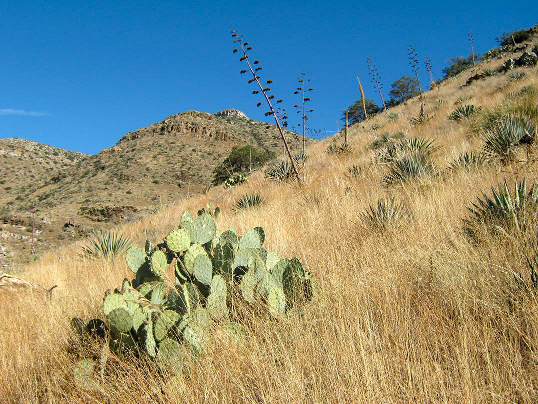
This meant dropping into the steep-walled drainage system and trying to figure out where we were, and when to exit up the other side. Some of it was guesswork, but in time we were up on the "right" slope. The brush and cat-claw in these drainages and along the slopes is thick and annoying. It's so thick there aren't any passages other than to plow directly through it. The slope starts to steepen, now covered in prickly-pear cactus, pencil cholla, sawgrass and lots of agave. The knee-high grass sometimes conceals the pointier plants down below. The rock is also loose, so the going is very slow. We trudged to this rock knob, scrambling up short cliff sections and gaining onto a small flat section where we took a break. This is where I turned around back in 2008.
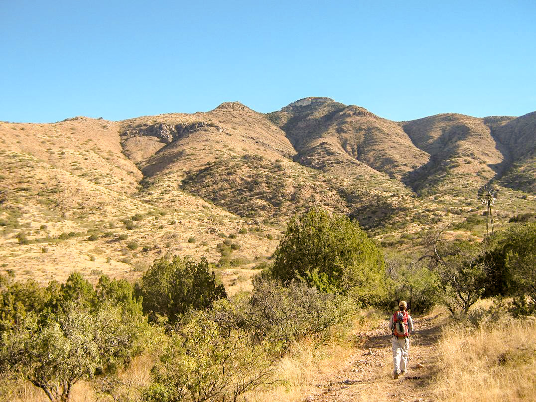
Looking above us was another smaller knob of rocks, then above that, the main ridge. It was probably no more than 300 vertical feet, but the going was slow, featuring the same blend of pointy plants and loose rock. In time we had climbed all this and had gained the main ridge, now with remarkable views of the Mae West summits, in all their white limestone glory. We could also see some possible ways to bypass the cliffs.
The ridge walk was very simple and fun. We came to a low point then started up the whiter slopes, gaining at an easy grade toward the base of the lowest cliff bands. This part went well, and it was easier than it looked from below. Once at the rocky bands, we found all sorts of stair-step weaknesses to climb up and over, generally aiming for the base of the main set of cliffs, the big ones visible from below. Once at the base, we traversed east along the cliff margin, walking a very sloppy slope about a hundred yards to a point where the cliffs eased up a bit. Scott Kelley went up one 20-foot section, then the rest of us followed. Now atop the cliffs, we had about another 70 vertical feet to the top.
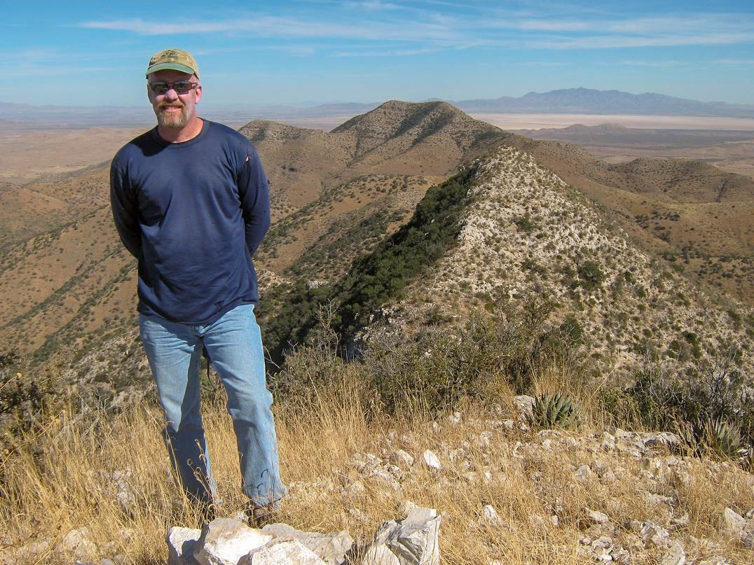
This final segment was loose and maddening. The fist-sized rocks would slip and slide under the slightest weight. We took four different ways up, me getting caught up in a small juniper where it took me a few minutes to completely extract myself. That tired me out, but the good news was the summit was just a few yards away. After a few moments, I arrived onto the rounded summit, marked by a small cairn and low grass, surprisingly free of brush. It was 12:30 p.m. and we spent a half-hour relaxing up top, taking in the views and looking over the log. We were the third group to sign in for all of 2010. After what we just came up, it's not that big of a surprise.
The views, of course, are stunning. Looking west we had the big broad Rincon range with pointed Rincon Peak and gentle Mica Mountain. Way off to the west we could see the lower-set Sierrita Range with Keystone Peak, and the pillar of Baboquivari Peak farther back. South were the Dragoons with Mount Glenn, the Whetstones with Apache Peak, and the Huachucas with Miller Peak way in the back. Southeast were the Dos Cabezas Peaks and the Chiricahua Range, and northeast were the Winchesters with Reiley Peak, the huge Pinaleno Range with Mount Graham, and the Santa Teresa Range with Pinnacle Ridge. Below us was miles of high desert. It still amazes me how remote most of Arizona is, and how difficult it is to get to much of the state, and how little of it is ever actually visited by people.
The hike down went well, forced to take it slow and watch each step carefully. The downclimb off the summit to the cliffs was slow going but uneventful, and I was happy to be down below the cliffs. The walk back along the ridge was easy, but the hike down into Hughes Canyon was tedious. Every step had to be taken carefully, every rock was loose and there was something to poke us at every turn. Plus, it was warm, into the 80s, but with little breeze, bright sun and the reflective nature of the soil, so it seemed warmer.
All of us went through our liquids faster than planned. The cat-claw was aggravating, and it seemed to take a long time to descend. We finally dropped into one of the many drainages into some welcome shade, then followed this drainage out to the more substantial drainage where the going was more open. When the drainage got nasty again, we ascended onto the slopes and found the foot-path, making the rest of our hike out very easy. We arrived back to our cars around 4 p.m.. I was beat, tired and dehydrated. We changed and drove out, saying our goodbyes at the main ranch gate. Scott and I drove into Benson for gas and drinks. All I could think of was a cold Gatorade, and I rewarded myself with a blue-colored one.
It had been much brushier and looser than we had planned, and by the end of the hike we were all glad it was over. Given the challenge of getting to the trailhead and the brush and loose rock nearly all the way to the top, it's not worth the trouble unless you are working on the 2,000-foot prominence list, as we all are. I'm glad we did it, and never regret climbing anything, but you really have to be motivated to climb this particular peak.
We arrived back in Tempe around 7:30 p.m., said our goodbyes, then I drove home to Scottsdale and bought a great beef salad from our favorite Thai food place to celebrate.
|


|