The Mountains of Arizona
• www.surgent.net
|
| Reiley Peak |
• Highpoint: Winchester Mountains • Coronado National Forest • Cochise County |
|
Date: March 3, 2009
• Elevation: 7,650 feet
• Prominence: 2,320 feet
• Distance: 8 miles
• Time: 7 hours
• Gain: 2,440 feet
• Conditions: Warm with high clouds
• Teammates: Bob Eschrich, Elena, Tom (all from SAHC)
Reiley Peak is the highpoint of the Winchester Mountains, about 15 miles northwest of Willcox, within one section of the Coronado National Forest. However, road access into the range is scant. The climb is not that difficult, mostly following open ridges with moderate brush. But getting there is 75% of the battle, and as a result, few people climb Reiley Peak.
I was able to join a group from the Southern Arizona Hiking Club, which greatly mitigated the logistics for me. First of all, the "main" road is very rough, and I didn't want to take my truck on it. Second, the directions are tricky, as the maps are out of date and new roads had to be followed after some older access points were closed off by local landowners. Thus, it made a lot of sense if I could go with some people who knew what they were doing.
I got lucky: the SAHC had scheduled this climb for a Tuesday, but this semester, I had Tuesdays open. The previous day, I drove to Tucson and crashed the night at Scott Casterlin's place, then met the SAHC group before dawn at the Chevron station south of Tucson. Bob Eschrich was the leader and driver, and two others, Elena and Tom, filled out the team. We started toward Willcox at 5:45 a.m.
The drive to Willcox took over an hour, then we exited and followed Fort Grant Road north and west out of Willcox through some farms. Eventually, Fort Grant Road meets with Ash Creek Road, which we followed more north and west through open state-land desert and rangeland into the north foothills of the Winchesters. Ash Creek Road "ends" at a turn with Sunset Road and from here we continued west onto Coronado Forest lands. To this point we'd driven about 110 miles from Tucson and it was now 7:45 a.m.
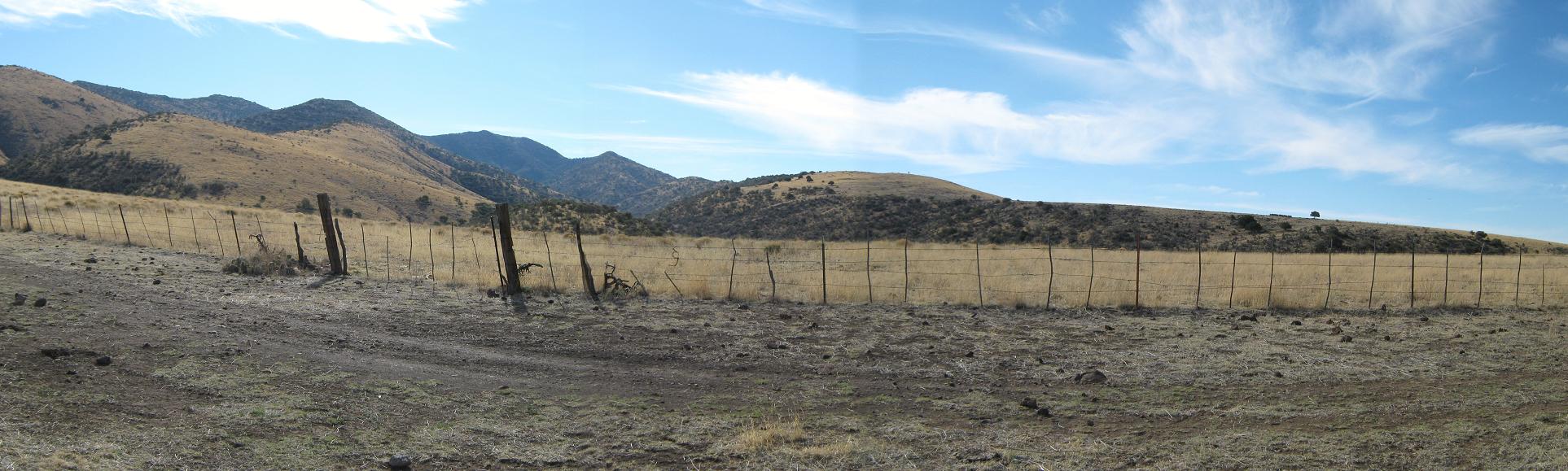
The last dozen miles of road to the "trailhead" was brutal. The old easement through private land was closed so an alternative route had to be bladed. These newer roads aren't on the maps, and the roads are rough and very rocky, plus we needed to watch our junctions carefully. Generally we stayed on FR-659. Bob had a series of waypoints on his GPS to help guide us. A couple sections of the road were rocky and I got out a few times to spot Bob through the driving so he wouldn't scrape his vehicle's undercarriage.
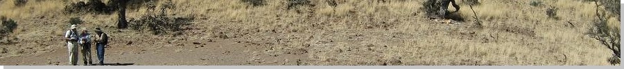
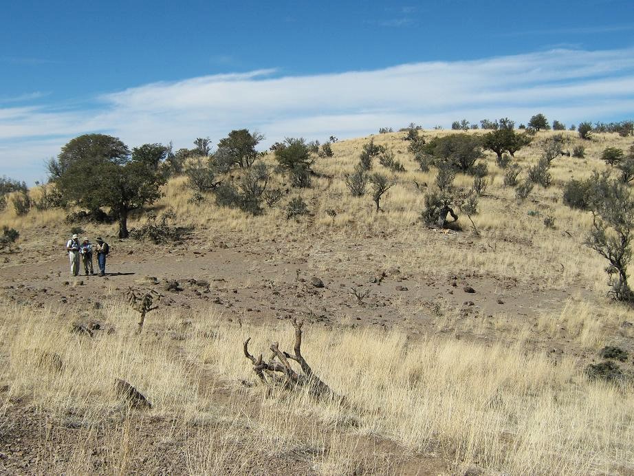
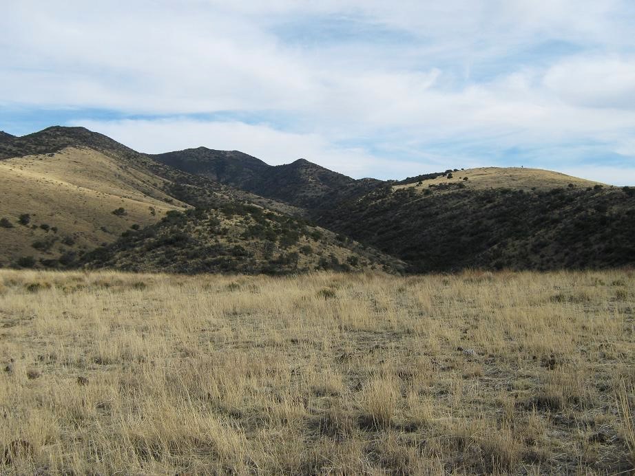
The last three or four miles of the road were atop "The Mesas", raised little plateaus of open rangeland. We passed through a few gates, the last with a sign reading "only entrance and exit for the Broken Dipper Ranch" (This would be crucial on our exit, as things would turn out). Reiley Peak could be seen at times, and finally, finally, we came upon the road's end at a cattle tank, slightly after 9 a.m. The drive had been tiring, and we had the hike still to do. The day was a mix of high clouds and sun, and a bit on the warm side, even at 5,700 feet elevation. I think we started hiking around 9:30 a.m.
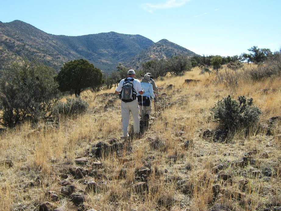
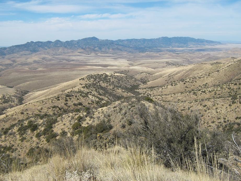
From our starting point, we could easily see Reiley Peak, which is a small saddle-shaped summit with the left (northeastern) summit seemingly higher, although the right (southwestern) point is actually the highest. One possible way to the top was to walk east along the fence line up an open slope, then turn south and walk along a prominent north ridge to the top, but this way looked very brushy for the last half of the hike, so we decided against it.
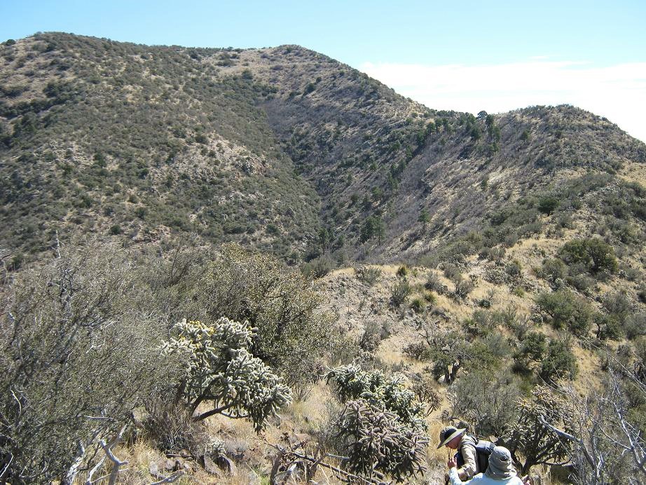
Instead, we followed another ridge, slightly west-northwest of the main north ridge. We had a good view of this route and it looked promising, both visually and on the map. The downside was that we had to descend 200 feet into Brush Canyon below, then up again to get onto this ridge, aiming for the time being for the cattle tanks low on this ridge near a big juniper. Cattle had bashed in some paths both down and up Brush Canyon. We separated here at first but found one another again once on top the ridge.
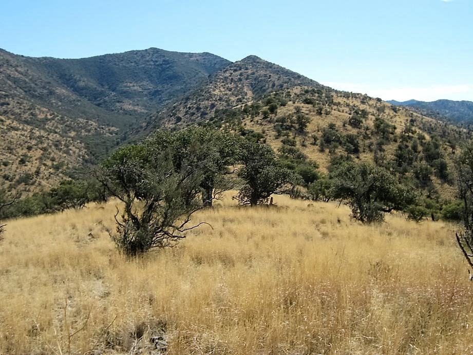
From here it was just a matter of walking southeast along the ridge, up and down the little bumps along the way, until we eventually topped out on Reiley itself. The first half appeared to be mostly open grass, juniper and mountain oak, with very gentle slopes. We fell into a line and made steady progress through the open sections, sometimes going up and over the hills and sometimes side-hilling around these bumps via cow paths.
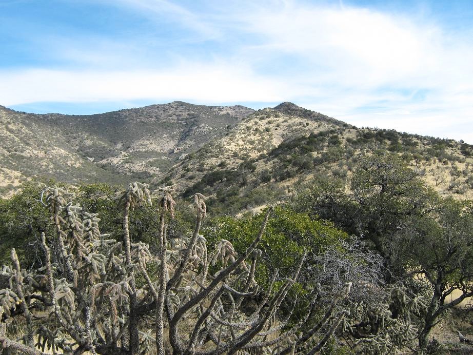
By the way, the cow trails helped considerably, forging paths through the grass, although the paths were often covered with cow poop. In low points along the ridge were dirt clearings where the cattle congregated. These clearings were devoid of grass, just bare dirt with poop everywhere. We made good time and found ourselves in another saddle just south of point 6,521 on the ridge. From here to the top would be much steeper with more substantial brush. We took plenty of breaks and were doing well as a team.
The next way-point along the ridge was point 7,105, and we found another cow path that assisted us greatly. We surmounted point 7,105 then down its south side, dropping about 40 feet to a saddle below the next waypoint, point 7,245. This time we traversed below 7,245 to gain the small saddle to its west and below the summit of Reiley Peak. The going here was again aided by a cow path. We were amazed they get this high. There were small patches of snow up here, too.
The final 400 vertical feet was directly up grass and rock slope, no cow paths to help us this time. We all arrived on top around 12:30, coming directly to the southern summit which is marked by a big cairn. We enjoyed a well-deserved break here. We had a lunch, signed into the log, picked out nearby peaks and rested. The views were outstanding in all directions: we could see the Pinaleno, Galiuro, Santa Theresa, Rincon, Santa Catalina, Santa Rita, Whetstone and Little Dragoon mountain ranges in a sweepng 360-degree panorama. Reiley was centrally located to all these peaks. It was pleasant and we stayed here for about 45 minutes.
The hike down went well, following the same paths we took on the way up. The loose rock was troublesome. One slipped right from under my foot and I fell into a batch of cactus, getting a whole bunch of spines in my hand through my glove. Elena had a set of tweezers and helped me get the little spines out. Then just a few steps later Tom suffered a similar fate. We had to descend into Brush Canyon again then re-climb the 200 feet to get back to the car. We were back to Bob's car by 4 p.m. After a brief rest, we got moving quickly, eager to get down through the rough forest road before dark.
On the way out we took a wrong turn. It all looks the same but Bob's GPS waypoints helped confirm we were on the wrong path. We backed out and found the right path, the Broken Dipper sign being our "proof" we were back on the right path. The rocky sections went well and it took 90 minutes of slow, tedious 4-wheel driving to get back out onto smoother roads. At times the cattle would stand in the road, or run away from us, but in the road, not realizing they should move to the left or right. Finally, back onto Ash Creek Road, we zipped into Willcox for a celebratory dinner of Subway and Popeye Chicken sandwiches. It was dark by now, but we were happy the hike had gone well and so had the roads. Bob did a fine job of taking the challenging sections slowly and carefully.
One hour later, we arrived back in Tucson where we all bid goodbye to one another. They were three really good partners and I enjoyed their camaraderie greatly. For me, though, I still had 110 miles more driving ahead of me, arriving home about 10 p.m., dead tired. After a shower and some dinner and hugging and kissing my wife, I crashed, the end of a very long day, but ultimately, a successful one. The nicest part of all this? I never have to go back on those particular forest roads ever again. But I am happy I did once.
The forest service recently updated their pages pertaining to Reiley Peak to include a couple of my photographs:
Winchester Mountains (USFS-USDA)
|


|