
The Mountains of Arizona
• www.surgent.net
|
| Coyote Mountain |
• Highpoint: Coyote Mountains • Coyote Mountains Wilderness • Pima County |
|
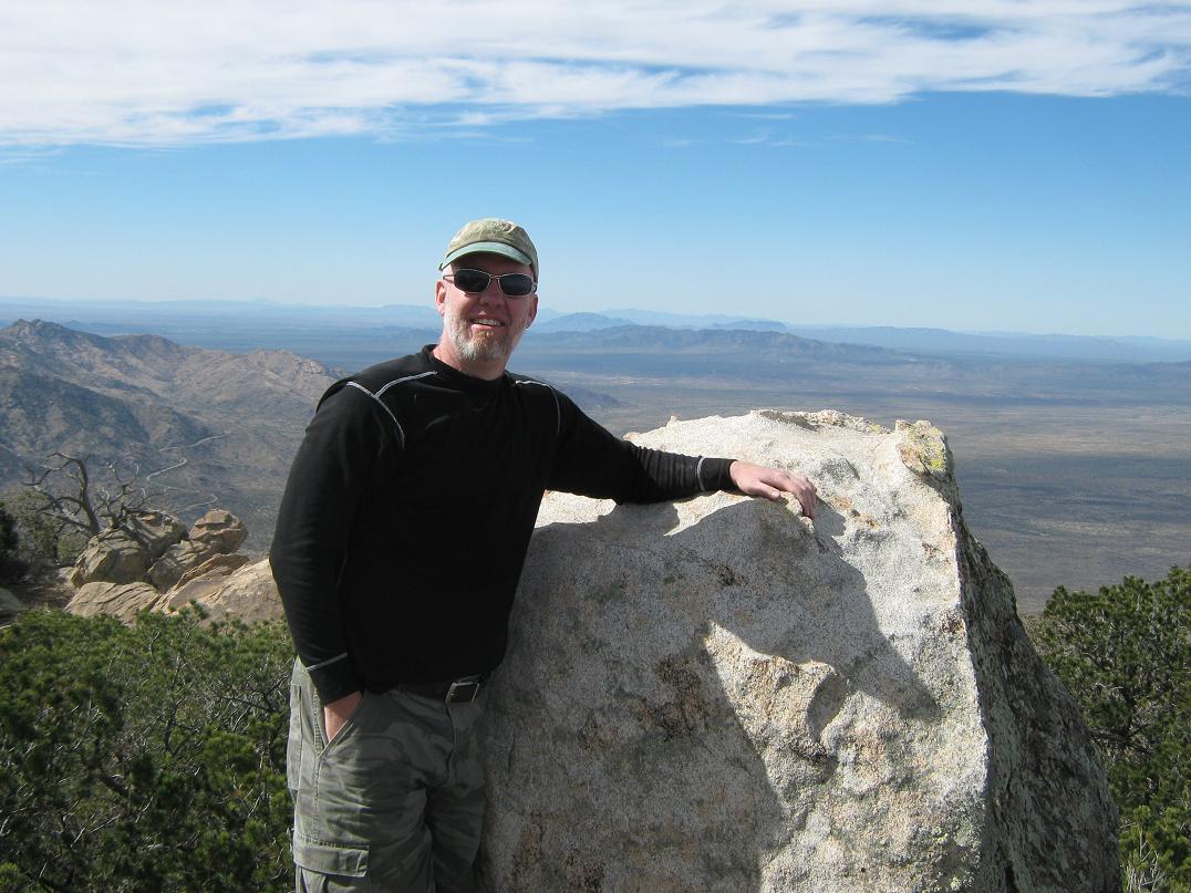
Date: February 11, 2012
• Elevation: 6,529 feet
• Prominence: 2,329 feet
• Distance: 9.8 miles
• Time: 8 hours and 45 minutes
• Gain: 4,475 feet
• Conditions: Sunny and breezy
• Teammates: Scott Peavy, Scott Kelley & Ben Stanley
Arizona
•
Main
•
AZ P1K
•
PB
•
LoJ
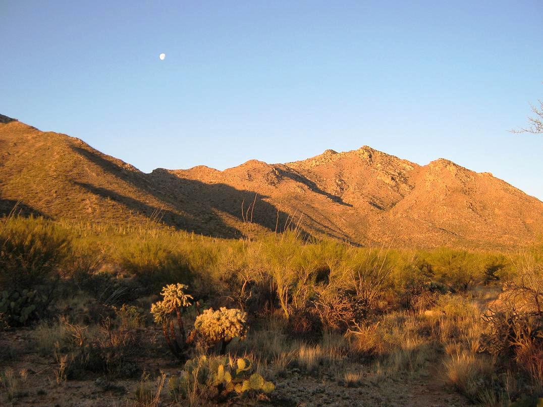
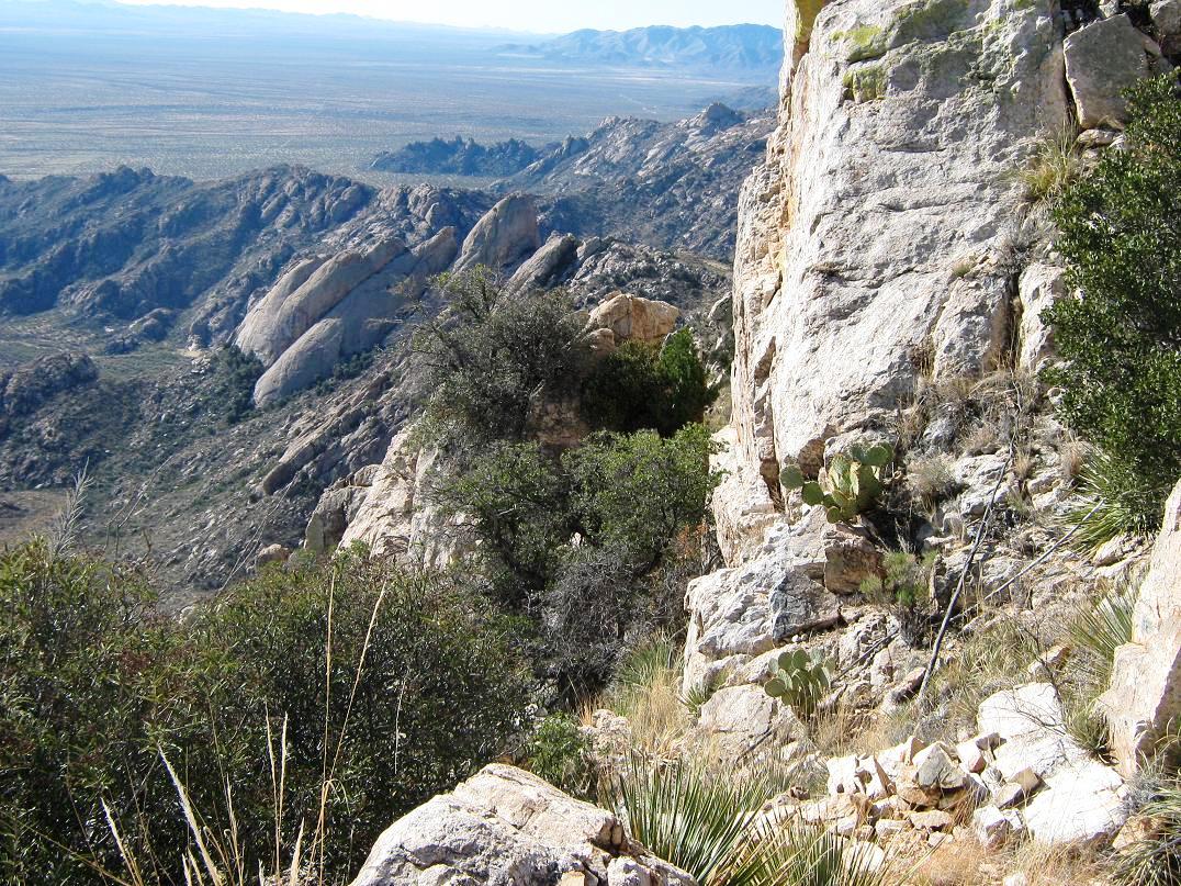
The Coyote Mountains rise about 30 miles west of Tucson, adjacent to Kitt Peak and its observatories. From Tucson, the Coyote Mountains and Kitt Peak seem to blend in together. The two ranges (Kitt Peak is in the Quinlan Range) are actually completely separate and both have significant prominence of over 2,000 feet, rare for peaks in such close proximity to one another. When viewed from the north, e.g. along Interstate-10 in Casa Grande, it is easy to identify Kitt Peak because of the big Mayall Telescope atop it. Coyote Mountain is the massive hump directly east (to the left) of Kitt Peak.
The Coyote Mountains lie within the Coyote Mountains Wilderness, a patch of land surrounded on two sides by the Tohono O'odham Indian Reservation, and on two sides by private and state-trust lands. The range is small in extant but massive in its size, featuring rock pinnacles, cliffs and heavily forested crests. From below, it looks kind of intimidating. There is a trail all the way to its top, but it is arguably the roughest, hardest-to-follow trail in the state. Most of the trail along the high crest is steep, narrow, scant and overgrown. Mature brush grows right in the foot-tread. It is obviously not maintained, and not enough traffic uses it to keep the plants beaten down.
It took me two tries to successfully climb this peak, the first try being scuttled when we lost the trail and spent valuable time messing around with brush, boulders, cliffs and so forth. It seems to be a common theme because apparently other people have experienced the same issue. Even if you are able to spot the trail the whole way up, it's a long day hike, very strenuous, and it's almost a given that you will lose the trail at least once, probably a few times. A GPS track will help a lot.
The trailhead is at a fence and gate at the northeast corner of the Wilderness, at a spot elevation of 2,999 feet on the map. Getting there is a small challenge. In 2008, I drove down to Tucson, picked up John Hamann, and aimed for Coyote Mountain. The roads south of AZ-86 that supposedly get to this corner weren't agreeing with the map, and we spent time trying other roads until getting lucky and finding a way to the trailhead. This cost us some time, and we didn't get started hiking until about 9 a.m..
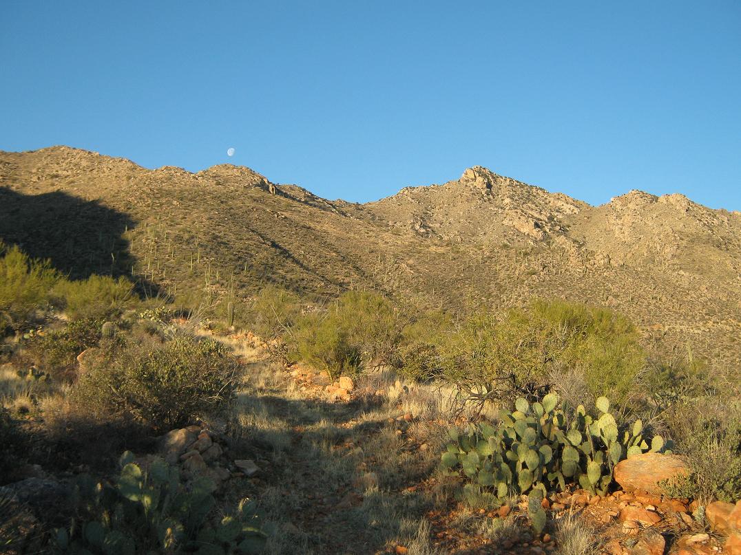
The trail breaks into four natural segments. The first starts at the trailhead, and is an old road that trends west across the desert flats, gains up and across the north-facing slopes of the range, then drops a little bit to an earthen tank, roughly 1.5 miles from the start. The second segment is a proper foot-path that now heads uphill, gaining a little over a thousand feet in another mile to achieve the main range crest at 4,650 feet. To here, the hiking is easy and the path easy to follow, although the trail by now is a little faint. Highlights along the way are some of the biggest saguaro I have ever seen. If the peak itself is not a goal and you don't want to mess around with the nasty bushwhacking that follows, then this is a good place to stop, relax and enjoy the views before heading down.
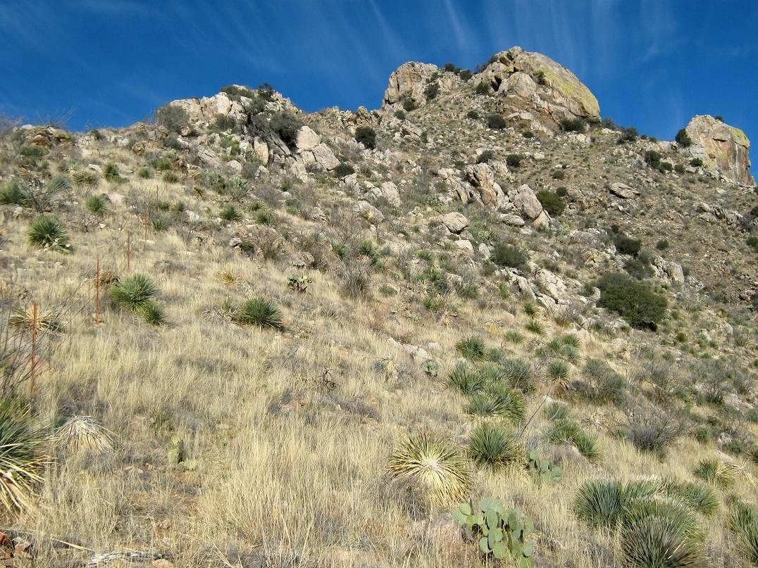
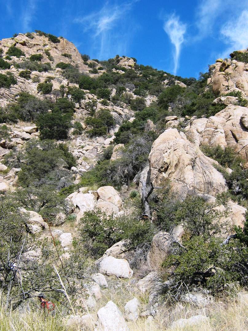
From this point, the trail worsens considerably. In 2008, John and I simply lost it and barged up the steep slope, then we found the trail again somehow. What we found was some stonework that upon inspection suggested a switchback turn. The switchback turns were shored with small and large stones fitted together, obviously something done carefully and by hand. This stonework was unexpected and baffling. Who would go through the trouble to do this?
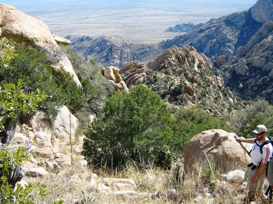
The next mile, the trail gains another thousand feet but now is much harder to follow. Big bushes grow right in the middle. It's easy to track it for a few dozen feet, then just as fast, you can't see it any more. We spent time here just trying to stay on route. The route, such as it was, traverses across steep slopes and imposing rock outcrops high on the skyline. Occasionally the route will come to an outcrop, then worm through the rocks and cracks. Heavy grass, brush, cactus and a few trees, including mountain oak, grow up here. Finally, this third segment ends in a big patch of agave and lechuguilla. As if being slowed by the scant path is not fun enough, you get stabbed repeatedly in the shins too.
In 2008, we got this far, a big saddle due east of the summit. We simply lost the trail and could not locate it. So, we did what felt right, and aimed up the slope in front of us. This put us in some extraordinary brush and large rocks. We were going very slowly here. It was pushing 1 p.m. by now, and combined with the slow hiking and the delays at the start, I sensed I was going to have to call it a day. I told John he could do what he wanted while I would head back down to the high saddle. About an hour later, John came back. He had summitted but mentioned the route he took was very rough. We hiked out, barely beating sunset. I was glad to be off that mountain and not particularly eager to return.
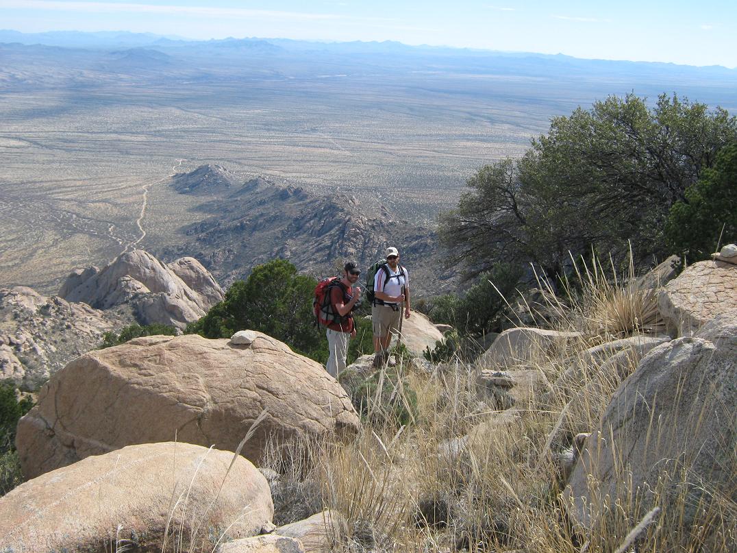
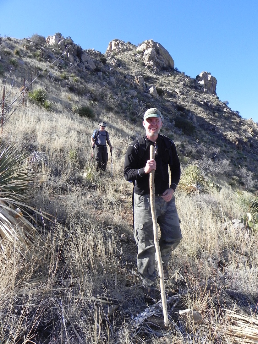
It would be another four years before I tried again, this time with Scott Peavy, Scott Kelley and Ben Stanley. Now, we had GPS tracks and better, more detailed reports about what to do in the trickiest of sections. So Peavy and I met at 4 a.m. at his place, I drove us into Tucson and then to Robles Junction, where we stopped for gas and food, and meeting up with Scott K. and Ben. Wiser to the roads, we were able to get to the trailhead a little before 7:30 a.m.. We locked up the cars, and started walking immediately. The day was sunny and clear, a little warm for February (high would be in the 80s).
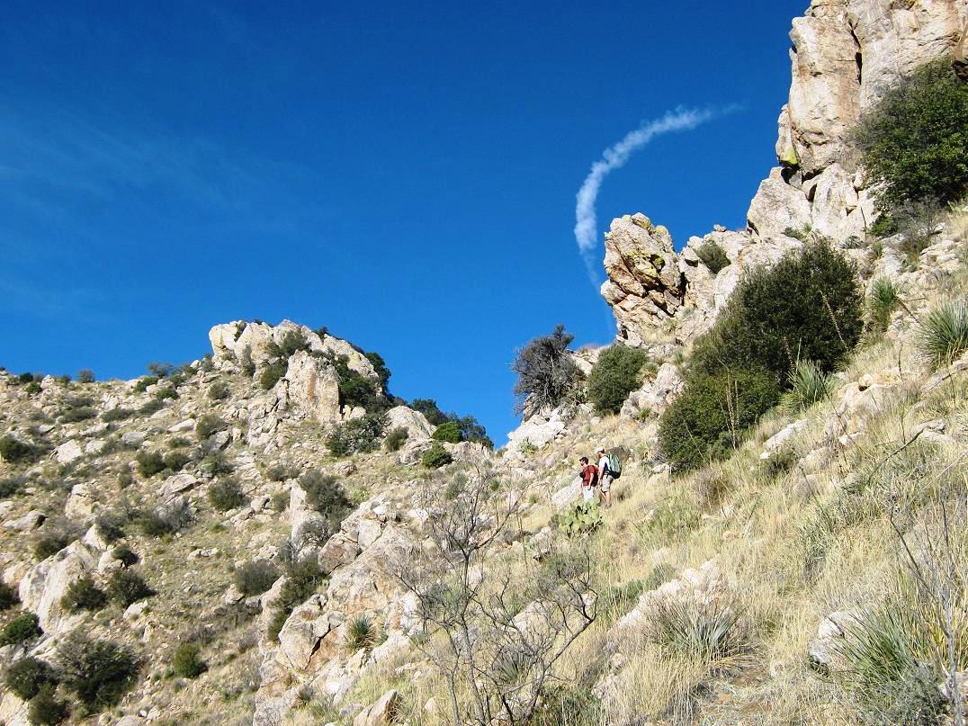
We were able to get to the range crest at 4,650 feet with no problems. Then the fun began. I remembered what not to do. Instead, we dropped slightly from the crest on the north side, aiming west, and soon, found the faintest of tracks that slowly became more defined. Now we were on the steep slopes and those switchbacks with the stonework shoring. Above that, we continued west along the high ridges, rock outcrops and fields of ankle-daggers to get to that high saddle, the one where John and I got to in 2008. To here had taken us about three hours. Now the fun began again.
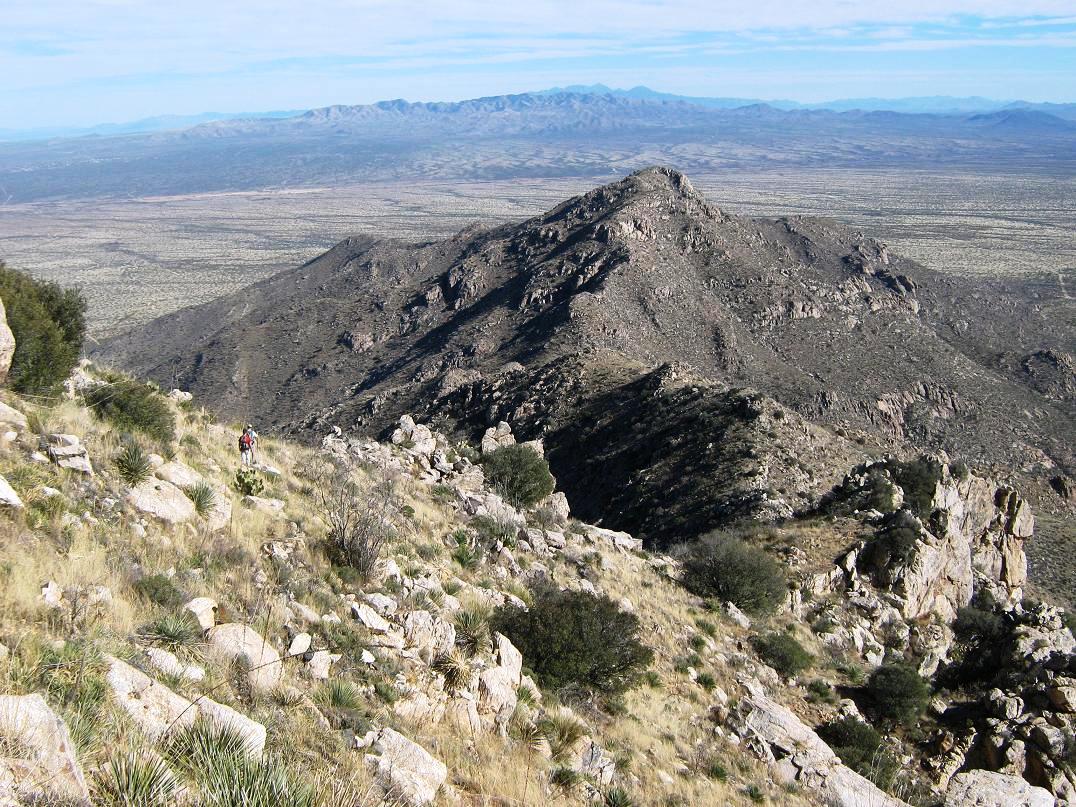
Naturally, I wanted to see just what the heck I couldn't see four years earlier. The better details we now had said to drop south (left) off the saddle, losing about fifty feet, angling to the southwest a bit. So we did, and by gum, we found a path. Then we would lose it again just as fast. At times, there were cairns to help guide us, but we saw what we needed to do: aim for a low point ahead near a conical subpeak. How we got there was up to us. I'd say this segment was 30% trail or path, 70% cross country. We got to the low point, then dropped about 60 feet into a small basin at the base of a long rock gully.
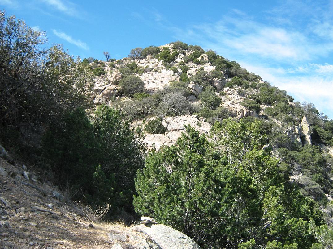
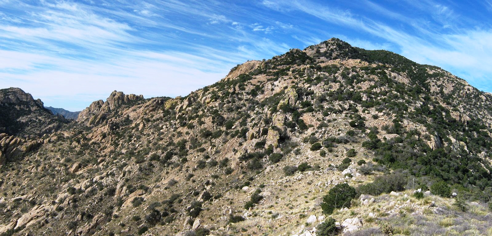
We then climbed up this gully. Here, the path was more defined, most of the time. It was narrow enough that if we lost it, we just went up and found it again. This gained us 400 feet and placed us on a small patch of flat grass. The trail then bends west again, switchbacking up another small rocky hill. Up here, the forest was thicker, featuring pinon, juniper and oak. It was a tangle and we had to push through lots of it. Soon, we were on a saddle, elevation 6,190 feet. Looking up, the summit looked to be right there ... but it wasn't. But were were close. Ben was ahead of us, us three Scotts hiking as a unit for now.
At the base of yet one more rocky hill, the path seemed to veer far to the south (left). We were growing weary of the meandering path, so we played a hunch: we would climb up the rock directly. The uphill was easy, the rock sloped back enough so that it was just scrambling at worst. We gained about 50 feet and sure enough, found the trail. Our hunch paid off. Up ahead we could see Ben standing atop a rock outcrop. Scott Peavy's GPS said the top was still 1,500 feet away, and 150 feet higher. Soon, we caught up to Ben, where for the first time we could see the top, now much closer.
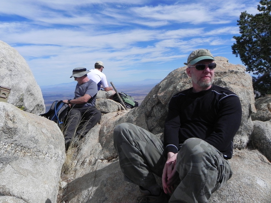
I found a small crevice to scoot down, losing about 30 feet. This placed me on a lovely ramp, perhaps the best segment of the trail all day, that led right to the top. Scott Peavy caught up to me, and the other two guys were right behind us. The four of us summitted at 12:30 p.m., a very hard-earned peak and one I was very happy to attain after my 2008 failure.
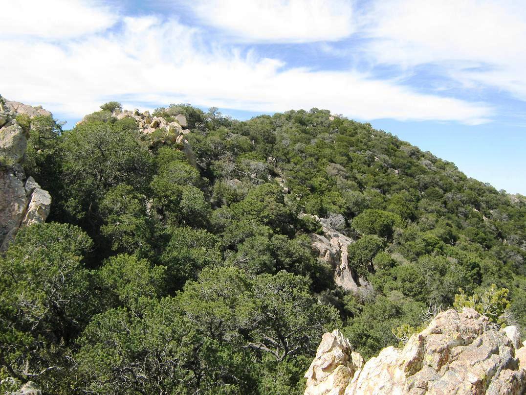
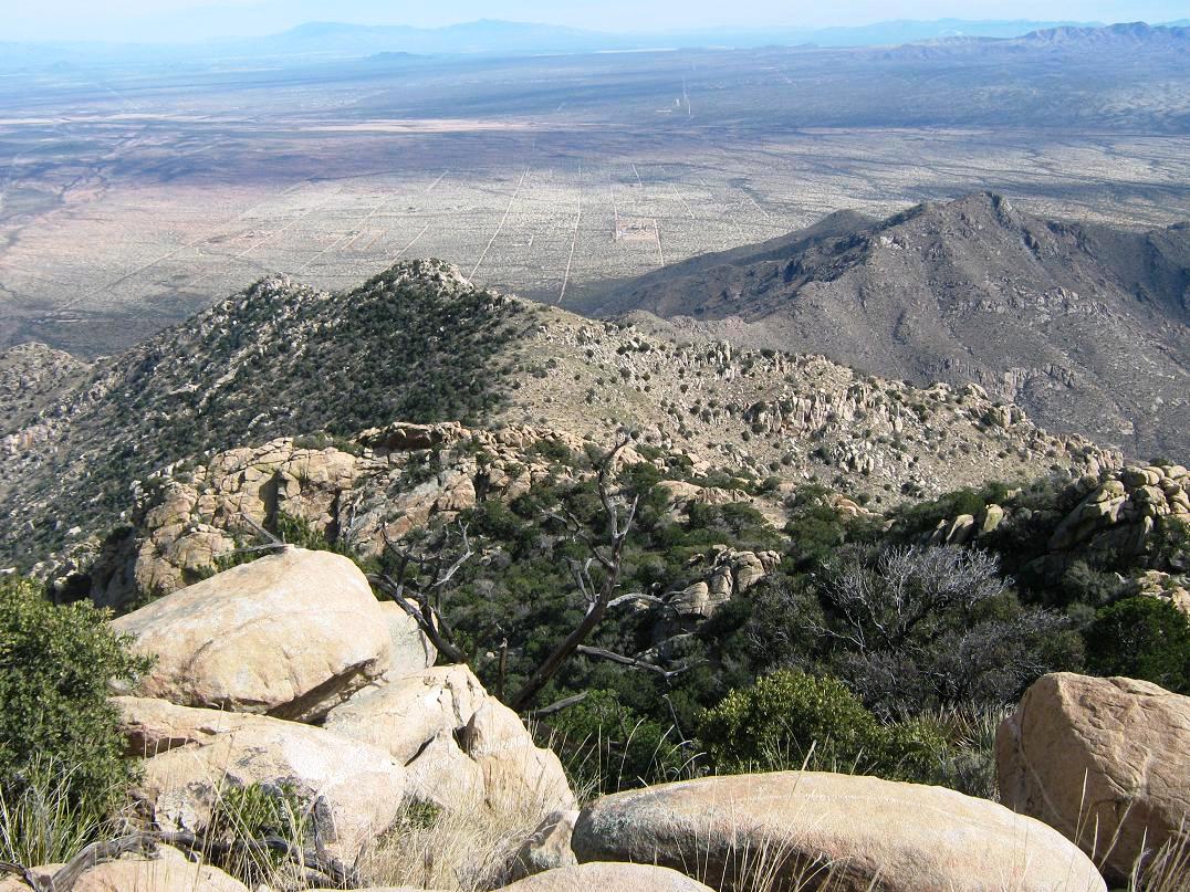
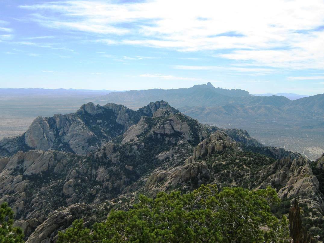
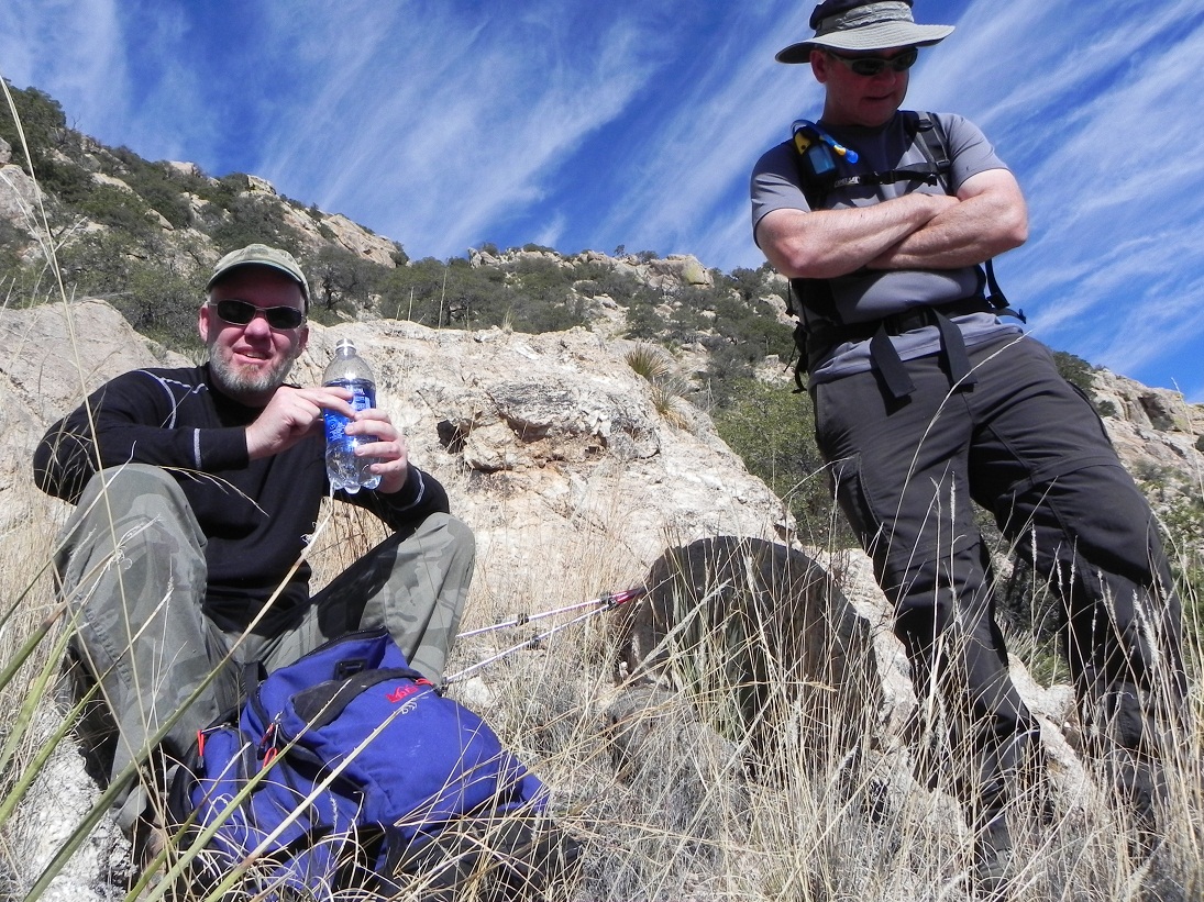
The summit is rocky with stunning views in all directions. Two refrigerator-sized rocks seem to be nearly equal in height, but the western one is higher by about six inches. The other two Scotts took turns scampering up to the top while I was content to lean against it and give it a slap. We took a break up here for lunch. Immediately west are the observatories atop Kitt Peak, while Baboquivari Peak rose to the south. The day was clear and bone-dry, so we could view ranges as far off as Ajo and even Cubabi in Mexico. East we could see the Sierritas, the Santa Ritas (Wrightson), the Rincons (Mica and Rincon) and big Mount Lemmon, plus all sorts of lower ranges such as the Tucson Mountains, the Roskruges, the Silver Bells, the Santa Rosas (Gu Achi Peak) and innumerable other peaks and desert valleys. It was so clear we could discern distant Apache Peak and Glenn Peak, which are both 100 miles east of us. We spent about a half-hour up top. The one-way distance was just under 5 miles but with a net gain of over 3,500 feet from the cars. However, including ups and downs, Scott Peavy's GPS track read 3,977 feet of gain for the ascent, and nearly 450 feet more gain on the descent, for a nearly 4,500-foot day.
The hike down went without mishap. We had some issues staying on trail at times and I whammed my head into a low-hanging tree limb at one point. When things started to open up again we followed the cairns downward, finding it easier to stay on the trail since we could see things a little easier from up high. We had great views the entire way down, and better lighting conditions for photographs. We kept a consistent pace and arrived back to the last saddle where the trail improved slightly. We then continued down to the point where the trail leaves the range crest and starts its journey down to the desert flats below. I was bushed and took it slow, dealing with an upset stomach for the last mile (not uncommon for me). The outbound hike took three and a half hours, and we arrived back to the cars just before 5 p.m., an 8-hour, 50-minute day. After a celebratory beer each, we said our goodbyes and got moving. Peavy and I took the "scenic route" to Phoenix, via the Tohono O'odham nation through Sells, Quijotoa, and Indian Route 15 into Casa Grande. I was home by 9:15 p.m.
Given I had failed my first attempt, I was very pleased to finally summit this big peak. It was a long, steep hike but straightforward, assuming we stayed on the trail. Without the trail to follow this would be a brutal bushwhack and a route-finding nightmare. It was a good team and everyone helped one another. My thanks to Ben and the Scotts.
The trail itself still fascinates me. At the time, I assumed it was just a miner's trail, but John Klein alerted me to the story of Randolph "Pat" Jenks, a long-time rancher and conservationist in southern Arizona, mentioning that Mr. Jenks owned the Coyote Mountains as part of a ranch and had the trail put in for the benefit of his wife, so she could ride her horse into the range and presumably to the summit. Now that would have been something to see and experience. Mr. Jenks was known to put in trails (he put in many in the Santa Catalinas (Mount Lemmon) near Tucson). Mr. Jenks died in 2011, age 98, and his obituary can be read at legacy.com.
I will admit that having a trail put in only for the benefit of his wife seems a little far-fetched. If he did in fact put in the trail, I am sure he had other motivations for doing so, such as to scout from up high, keep a lookout for trouble, maybe do a little hunting, who knows. My wife is happy when I get a couple six packs of Diet Coke for her from the store. If I were to build in a 4.5-mile trail up 4,000 feet of nasty rock and forest for her, I am sure she would be thrilled beyond words ... or concerned for my sanity. Plus, she doesn't own a horse.
I am inclined to believe the main theme of the Jenks story because it does seem plausible to put in a trail for many reasons that a rancher might have. I don't think it's a miner's trail because there are no hints of mines up at the highest reaches. Or any I know of. Plus, the higher up, the trail does meander a lot, probably to keep to lesser gradients should someone need to bring a horse up there. Anyway, it's a good story. And one I can think about after-the-fact, because I never need to go back to that peak again!
|

|