The Mountains of Arizona
• www.surgent.net
|
| Kitt Peak |
• Highpoint: Quinlan Mountains • Tohono O'odham Indian Reservation • Pima County |
|
Date: March 3, 2007
• Elevation: 6,880 feet
• Prominence: 2,092 feet
• Distance: 10 miles
• Time: 4 hours, 30 minutes
• Gain: 2,980 feet
• Conditions: Clear and windy, near freezing at the top
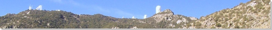
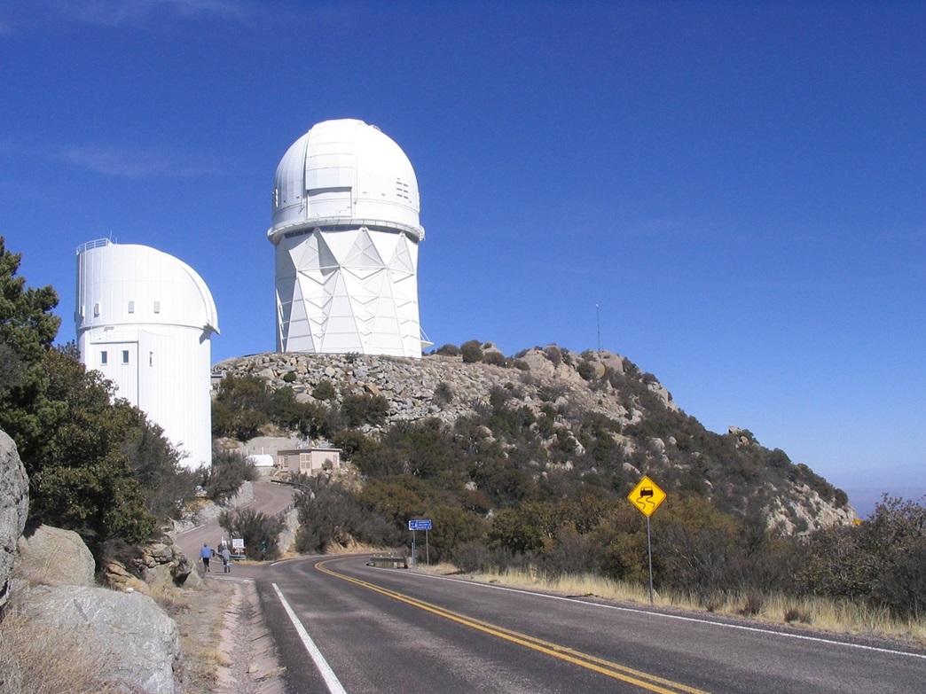
Kitt Peak is famous for its two dozen telescopes and astronomical observatories atop its summit and nearby ridges. Rising about 50 miles west of Tucson, Kitt Peak lies on the east edge of the Tohono O'odham Indian Reservation. The giant Mayall 4-meter telescope building is its most notable feature, visible from miles away. The peak usually has clear, dark nights, and the dry air helps avoid unnecessary light refraction. The peak is named for Philippa Kitt, the sister of Charles Roskruge, surveyor of Pima County in 1930. The Tohono O'odham name for the mountain is Iolkam.
A state highway, AZ-386, winds for 12 miles from the main highway (AZ-86) to the summit, and is open daily from 9 a.m. to 4 p.m. to coincide with the visiting hours for the telescopes. A gate spans the highway at the bottom, but may not necessarily be shut during closed hours. Kitt Peak is popular as a tourist destination, for people with astronomy interests or just who want the views, enjoy the drive, and take in the evening programs that are sometimes offered. To visit the actual highest point requires a short scramble through rock and juniper trees so that only a few who come here will likely bother.
My first visit to Kitt Peak was back on Christmas Day of 1996. With a day open and everyone off the streets and in their homes, I decided to do a driving tour of southern Arizona, making a loop south through Tucson, across the Tohono O'odham Nation to Ajo, then up through Gila Bend and back home. There was no agenda, just curiosity. Traffic was extremely light and I had a good time, but I was disappointed to find the road up Kitt Peak gated at the bottom, closed for the day, even though the big sign says the road is open daily.
My second visit was earlier this year over the New Years holiday. I had hiked Mount Ajo on New Years Eve, with the plan to hike up Kitt Peak for New Years Day. When I drove by late the afternoon of December 31st, the road (and the gates) were open. I camped that night at the Tucson Mountains Park campground. But the next morning, I drove back to find the road "closed" for New Years Day. The gate was just shut for the incoming traffic. The left side of the road was open, and I was tempted to drive in anyway, but I feared I may be locked in afterwards. The weather had also deteriorated, with overcast skies, so I decided to spend the remainder of the day driving through the remote parts of the Tohono O'odham Nation on my way home.
I came back a couple months later, intending to hike the peak from the bottom by following a dirt road from the north that angles up the east-facing slopes, connecting to the telescope complex higher up. I had seen this road etched into the side of the range on my January visit, and it looked straightforward. I wasn't interested in any bushwhacking or long ordeals of navigation, but instead wanted a good hike with a lot of gain and distance, enough to tire me out. In other words, a workout.
I woke before dawn and drove 150 miles through Tucson out to the base of Kitt Peak, arriving about 8 a.m. in clear, windy weather. The route from Tucson follows Ajo Way, which is state highway AZ-86, whose main purpose in life is to connect Tucson to Ajo, 120 miles away, and cross the Tohono O'odham Nation in the process. It's a pretty drive and very, very remote. The gate was open. I wonder if they ever actually shut the gate during the "closed" hours announced on the big sign, of if they just close it during the holidays and bad-weather days, or when they know I am coming here.
I drove south along AZ-386 to a point just before the second mile marker, where a dirt side road stays left while the paved road bends right. I stayed south on the dirt road for another mile. It bent left and passed through an old gate and fence near some interesting rocky formations and an old borrow pit. The area is open, and I was hoping to find a shielded place to stash my truck, but no such luck. I parked it to the side, backing in to a grassy area near an old fire pit. There were recent ATV and dirt-bike tracks on the road, plus a few boot prints, so the area sees visitors. I don't imagine this area has any trouble with border crossers and smugglers, but you never know. I just hoped my truck would still be there when I got back. I left a note in the dash for the benefit of the Border Patrol if they should happen to come across it. The map said my elevation was 3,900 feet.
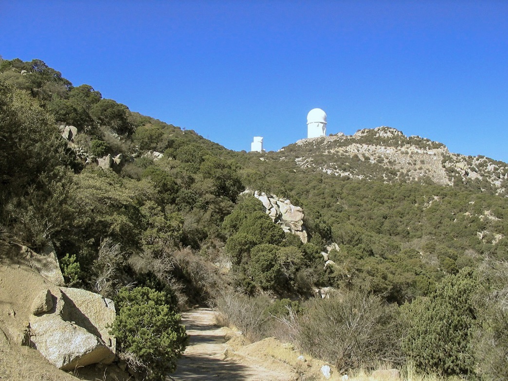
The jeep road is intended to be an emergency secondary route up and down the mountain if the main road should be closed or damaged for whatever reason. An old hand-painted sign said the road should be used for emergencies only, but did not prohibit access. From where I parked I could see the jeep road running up the side of the ridge in a straight diagonal, until it achieved the ridge to the southwest near a large rocky pinnacle. I started hiking up the road, following it east shortly before it swung south, made some random turns then started its long sweep up and across the north-facing ridges. It was still cool and I had mostly shade. I was fine as long as I moved. Once I stopped I got cold quick.
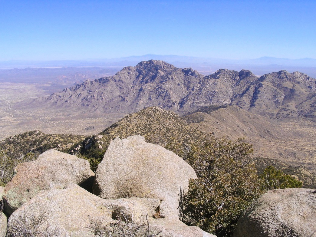
The views opened up as I gained elevation. I could see the roads below, and my lonesome truck. To the east is the giant hulk of Coyote Mountain. Tucked into the canyon between Kitt and Coyote are the buildings composing the community of Pan Tak. The wind was kicking up dust and the views farther off were hazy. In about an hour, I had covered about two miles and had come to the point where the road achieves the main ridge crest, elevation 5,260 feet, a gain of about 1,300 feet. Here, the road crosses an open gate and cattle grate, and now moves onto the steeper, more barren south-facing slopes of the peak.
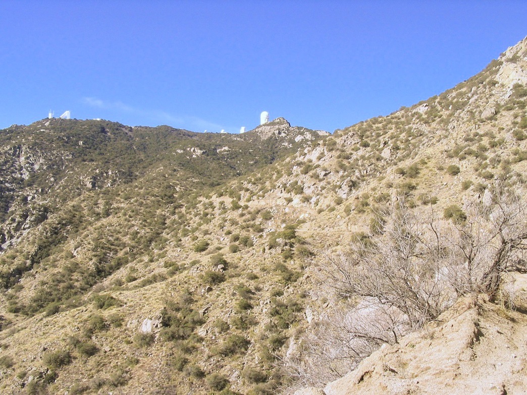
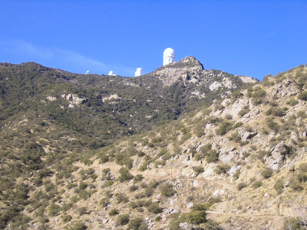
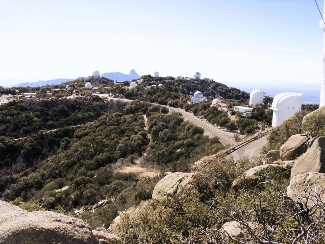
I had my first views of the summit telescopes from this vantage point. The giant building housing the Mayall telescope is probably the summit's most visible feature. It is a gigantic building, so big in fact that it played tricks with my perception. It made it seem the top was closer than it really was, although I knew I still had about 1,600 feet of elevation to gain. As the road works its way across the south slopes, the summit complex becomes more evident, as more buildings come into view. It's like a city up there.
In time, the road passed a few odd piles of junk, suggesting I was getting closer. There were more boot prints here, too. Finally, the jeep road meets up with the main paved road, where a gate spans the dirt road and a small sign that says "no trespassing". Now they tell me. I walked onto the asphalt and down a little bit to an open area where I could rest and put on my jacket. The wind was blowing heavy up here and it was quite cold. I walked up the little side road to the Mayall Telescope Building, and as the road curled to the top, I left it near a railing and went left, entering into the boulders and junipers to seek out the summit. A scant path leads in about 40 feet to the base of the rocks.
I went left into a small cleft, then found wiring conduit and exposed guy-wiring for the antenna. I worked my way into the rocks, using the junipers to either grab onto for holds, or push aside if they were in the way. The final few feet is up sloping boulders with good traction, and quickly I was at the top. The summit is three rock slabs of about equal height, with the USGS BM "Kitts" placed into a small depression, with two witness markers pointing to it.
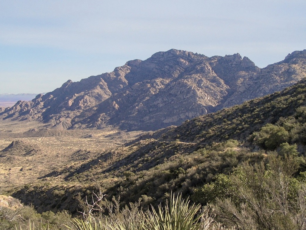
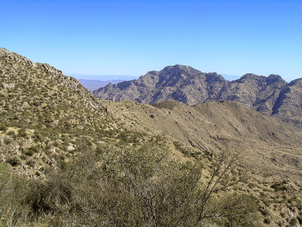
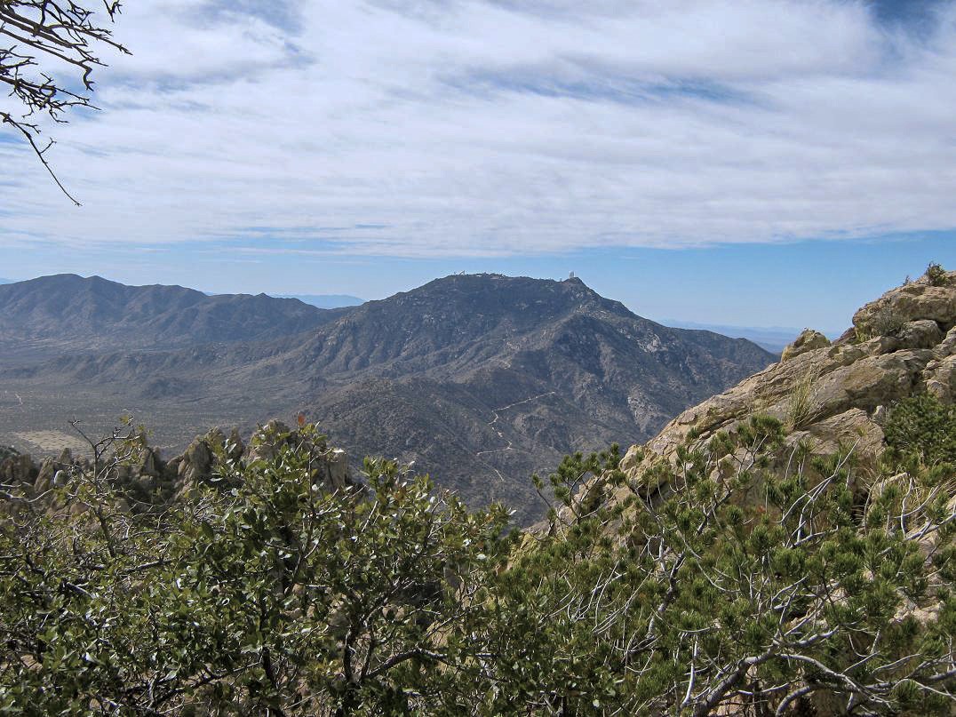
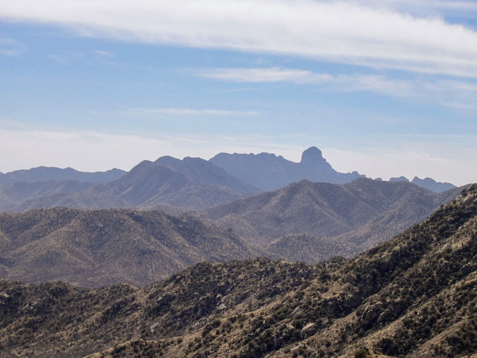
The views are nice, of course. The McMath-Pierce Solar Telescope stands out for its unique appearance, an inverted-V of sorts. It is the largest optical solar telescope in the world. Views east include vast desert plains and a multitude of ranges, including Keystone Peak in the Sierritas, and Mount Wrightson farther back, plus numerous smaller ranges in all directions extending off to Mexico. To the south was the grand silhouette of Baboquivari Peak.
I found a sign-in register in the rocks, and added my name to the list, which wasn't very extensive at all, and mostly consisted of names of people I know, further proof that most people who come to the top probably don't bother with the actual summit. It was now 11:30 a.m. It had taken me three hours to get here, in what I figured to be 5 miles with 2,900 feet of gain. I snapped photos, mainly looking east at Coyote Mountain again, and south at the rest of the buildings and of mighty Baboquivari Peak in the distance. The views were lovely, but the brisk cold wind was uncomfortable, so I decided to get moving again. I spent less than 10 minutes at the top.
I descended back to the pavement and on down to the main road. I thought about walking over to the other buildings, but I was getting a chill and decided it was wise to stay moving. I walked back to the dirt road and the "no trespassing" sign. Having no choice since I wanted to get back to my truck, I broke the law and entered back onto the jeep road. I kept up a good pace, and dropped about 800 vertical feet before stopping for a break. It was warmer the lower I got.
The remaining hike down went quickly, faster than I had figured. The road's gradient was consistent, steep but never too steep so that I could jog segments of it. I walked out the rest of the way without any further rest stops, and I was back to my truck slightly after 1 p.m., for a 90-minute egress and a 4.5-hour day on the mountain. I took a few minutes to relax and change into drier clothes. Somehow I stepped on a cactus barb in my Teva sandals and it poked my foot, but I couldn't see the damn thing. I had to later dig it out with a knife and pliers.
The drive home went quickly and without event. I stopped a few times to snap photographs, plus a meal stop in Casa Grande. I was home by 5 p.m., a great day of hiking.
The jeep road may not be for everyone's tastes. Most people will be content to drive to the top, and seek out the highpoint as an easy 20-minute side hike while touring the telescope buildings. I had that little concern inside of me that someone would find my truck and do something to it while I was gone. The area is generally safe, but sometimes the locals can be worse trouble than the crossers.
|

|