
The Mountains of Arizona
• www.surgent.net
|
| Wasson Peak |
• Highpoint: Saguaro National Park (West Unit) • Highpoint: Tucson Mountains • Pima County |
|
Date: March 4, 2006
• Elevation: 4,687 feet
• Prominence: 2,117 feet
• Distance: 7 miles
• Time: 6 hours
• Gain: 1,600 feet
• Conditions: Overcast at first, then clearing later and warm
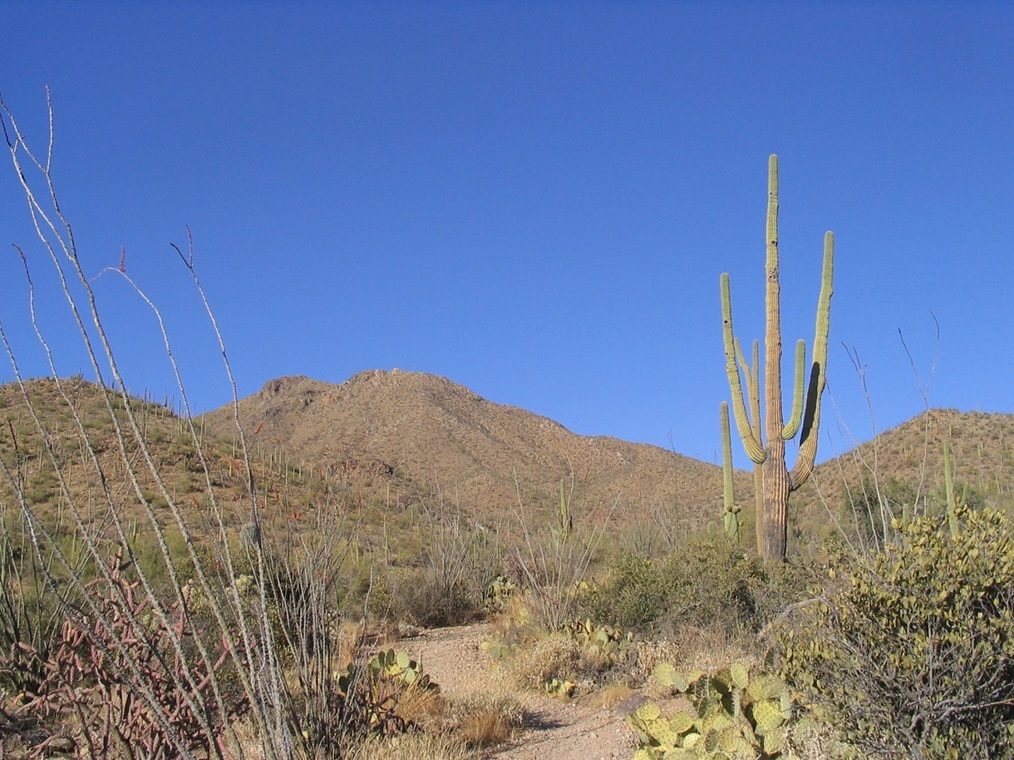
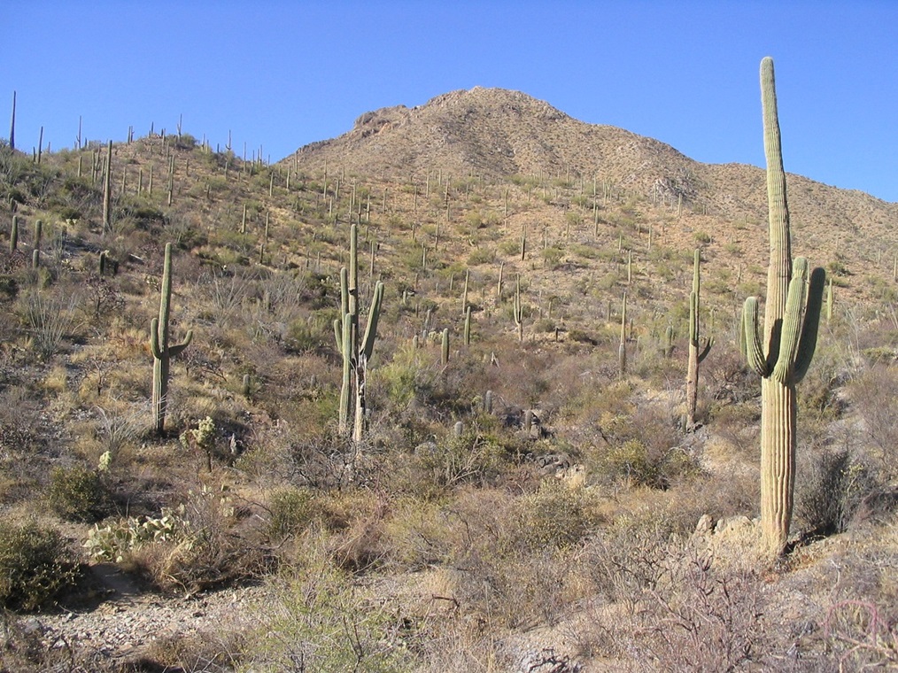
Wasson Peak is the eminent peak of the west unit of Saguaro National Park, west of Tucson, and one of the best desert-mountain hikes in the state. The peak is notable for its forest of saguaro cactus, which cover the mountain from base to peak. The peak also features a network of trails, all with great views. For someone visiting the state and wanting "one good desert peak" to hike, this is it.
Planning this for a weekend getaway, we left Phoenix via Florence and Oracle Junction, with the intent of camping at the Catalina State Park north of Tucson. When we arrived, however, the grounds were full, so we drove to the Gilbert Ray campground located in the Tucson Mountains Park, a county-run park adjoining the National Park. We arrived well after dark and found a good spot and set up camp, sleeping out of the back of our trusty Subaru Outback. The coyotes howled all night, including one feller who let forth a howl right in front of our vehicle. They are loud up close!
The next morning, the lure of coffee at a nearby Circle-K was too strong to resist, so we drove a few miles along Kinney Road to get one, plus some snacks for the trail, and drove back to the trailhead. There are a handful of options to get to the peak, the most well-known being the Hugh Norris Trail which starts from the west and runs along the entire spine of the range. Other options include the Sendero Esperanza Trail and the King Canyon Trail. We chose King Canyon since it was close and allowed for a possible loop hike.
The King Canyon trailhead is a dirt parking lot directly across from the Sonoran Desert Museum. There's room for about 20 cars, and most spots were filled when we rolled in, attesting to the trail's popularity. It is a well-known day hike for local Tucsonians, but we saw plenty of other cars with out-of-state (and out-of-country too) license plates. We took our time to get ready. The sky was sort of dingy overcast, but the weather was stable and we weren't concerned about being out after dark like our last hike (Bassett Peak). We started about 10:30 a.m.
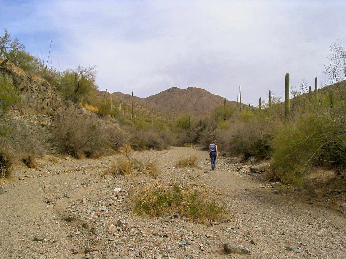
Immediately there's a choice: follow a creekbed in the canyon bottom up for a mile to a ramada and picnic area called Mam-a-Gah (named for a famous old-time Tohono O'odham Chief), or follow an old road paralleling the canyon to the same ramada. We tried the creekbed first and it was nice, wide, easy and open, but it was sandy too. After five minutes in the sand, we gave up and scampered up a faint path up the slope to the road, meeting it near the National Park entry gate.
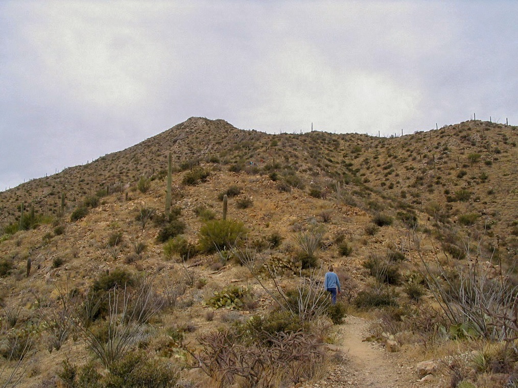
The hike to Mam-a-Gah went quickly and without event and we arrived to the ramada after 30 minutes. We saw a lot of people hiking just to this point, and apparently going no farther. The ramada sits atop a little hill, has wonderful views and a picnic area, so it's not surprising this is a popular, if short, hiking destination for a lot of people. Signs here point to the trail for Wasson Peak, which (according to the sign) is still 2.6 miles distant. We couldn't actually see Wasson Peak yet, it being hidden for the time being behind its principal sub-summit, Amole Peak. The temperatures were cool but when the sun did peek out, it warmed quickly.
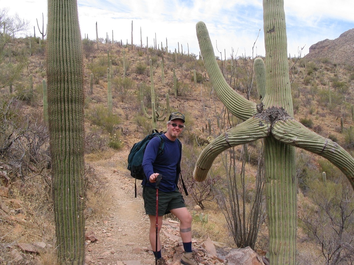
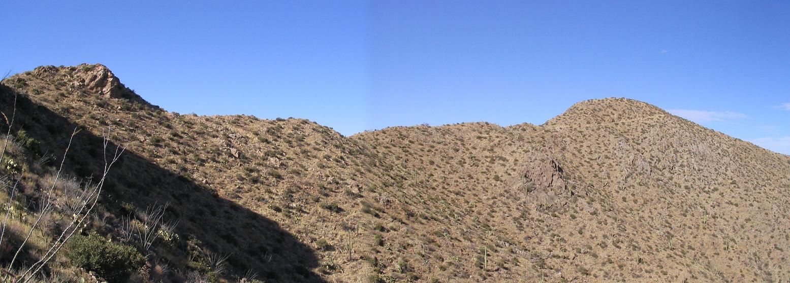
The trail after Mam-a-Gah is well maintained and passed through many stands of saguaro and littler cholla, ocotillo, teddy-bear, prickly-pear, chainfruit and the colorful staghorn. The route went generally up but occasionally dipped in and out of some washes. After 1.4 miles, the trail came to a junction with the Sweetwater Trail high on a ridge directly southeast of Amole Peak (we still couldn't see Wasson Peak yet). From here, the trail steepens and switchbacks up the ridge. After one such turn we could finally see Wasson Peak off of a high ridge from nearby Amole Peak. The trail climbed high on the slopes south and east of Amole, where it connected with the Hugh Norris Trail just below Amole Peak, and another 0.3 mile later and we were on top of Wasson.
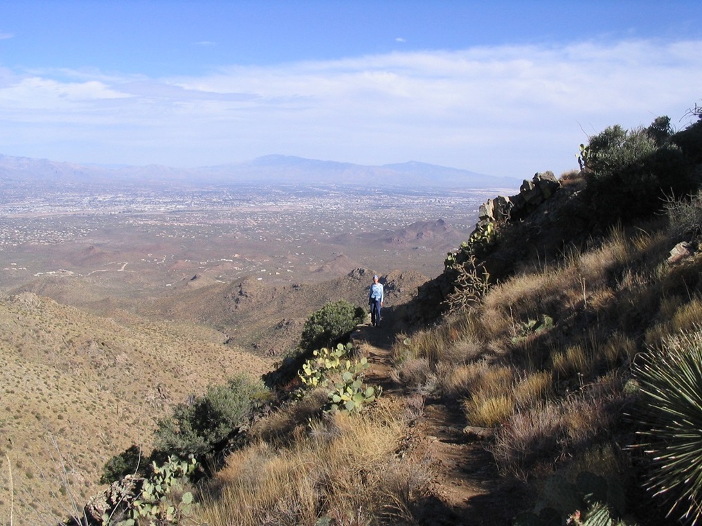
There were six other people on top the peak when we arrived, lazing on the broad summit area. We found a spot a few feet down on its west side and sat, having a lunch and relaxing. The views were outstanding, and, to our luck, the cloud cover began to diminish and the sun came out, allowing for much better lighting for our photos. We took plenty going up, but the ones you see on this page are (mostly) all on the descent.
From the top, the panorama is unbelievable: looking east are the gigantic bulwark Santa Catalina (Mount Lemmon) and Rincon (Mica Mountain and Rincon Mountain) ranges, with Tucson spread out below. To the south was Mount Wrightson and its neighbor, Mount Hopkins, then over a little bit, Keystone Peak, which B. and I hiked a few months later. Then there is mighty Kitt Peak with its observatories, and nearby, Coyote Peak. Big Baboquivari Peak pointed high beyond them. Farther west was the wide-open deserts of the Tohono O'odham Nation, with Gu Achi Peak and Table Top visible. Looking north, we could see the Silver Bells and the Picacho Range (Picacho Peak and Newman Peak).We stayed on top for about a half-hour, and chatted with a family from Washington state who were kind enough to take our photo (we did the same for them). Then, it was time to descend.
We had thought about following other trails down and making a loop hike back to our car, but we both opted to go with what we knew and go back the way we came up. The hike down took 2 hours, and we arrived back to our car about 5 p.m. We drove to the Circle-K for well-deserved cold drinks, then on to our hotel in Tucson where we had ourselves a good night's sleep.
The next day we toured the Pima Air Museum, located on the city's south end near Davis-Monthan Air Force Base. There was an air show going on, with vintage planes flying around as well as some of the state-of-the-art planes. The museum is spread over 80 acres and has many hangars with fully-intact planes and lots of displays, while outside there are more planes, including the actual Air Force 1 plane used by Presidents Kennedy and Johnson, which you can actually walk through. There were also examples of all planes from all eras. I don't know my plane names by heart but I can authoritatively say that there were a lot of them. It was well worth the money and a place we highly recommend.
|

|