The Mountains of Arizona
• www.surgent.net
|
| Bassett Peak |
• Highpoint: Galiuro Mountains • Coronado National Forest • Graham County |
|
Date: February 11, 2006
• Elevation: 7,663 feet
• Prominence: 3,123 feet
• Distance: 11 miles
• Time: 8 hours
• Gain: 2,700 feet
• Conditions: Warm and clear
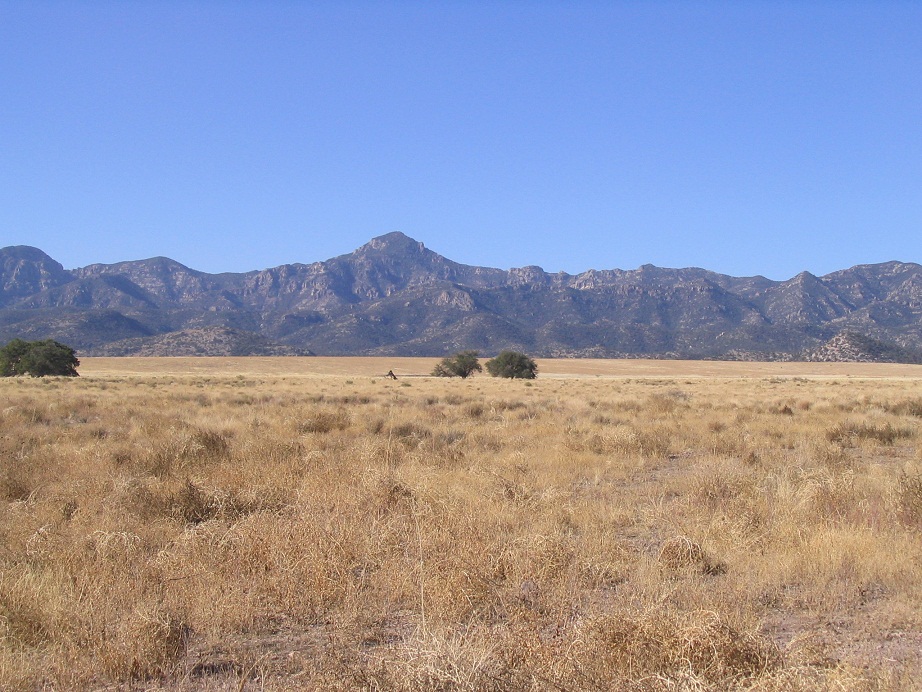
Bassett Peak is the highest peak of the Galiuro Mountains in southeastern Arizona. They lie northeast of the Rincon Mountains, in southwest Graham County in the middle of nowhere, usually not visible from the main highways.
We stayed at the Essence of Tranquility hot springs in Safford, a privately-owned outfit with hot spring pools, with limited camping on the grounds. The place is tiny and kind of ragged, but fun with a good vibe. We've stayed there many times. We arrived here late yesterday, splurging a little extra to stay in a faux-teepee, which was drafty but functional.
We had the hike planned for Saturday (today), but slept in, took a dip in the waters, not getting on the road until 9:30. From the grounds, we drove south on US-191 to highway AZ-266, following that southwest through the foothills of the Pinaleño Mountains. Twenty miles later, we passed through the small locale of Bonita, which had a schoolhouse and a burned-out general store. There is no real "town" here.
The pavement ends in Bonita. We stayed on the dirt continuation, called High Creek Road, for 16 more miles. This ends at a T-junction with Coronado Forest Road 660. We went right (west) and followed this bumpy track a couple more miles to a small parking area. These last couple miles were rough and required 4-wheel drive. It was 11 a.m. when we rolled in.
From our truck, we hiked along the remaining road, passing through a creekbed (the Ash Creek drainage), then up onto dirt again before coming to a gate, about 300 feet from where we started. At the gate, a trail sign mentioned Ash Creek Spring 2.8 miles ahead, and Bassett Peak Trail #277 4 miles farther.
About three-quarters of a mile into the hike, we came upon a water tank noted on the topographical map. We took a break here so I could calibrate my altimeter better. Surprisingly, two friendly dogs ran up to us, soon followed by their masters, two women who live in the ranch complex at the base of the mountains. They said hike up here a lot, and they gave us useful information what to expect ahead. They were only going in for a short walk. They continued on, and a few minutes later, we did too.
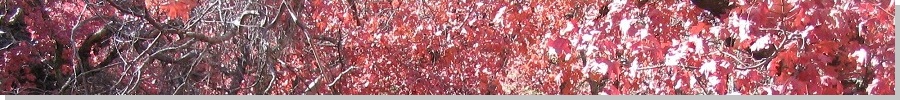
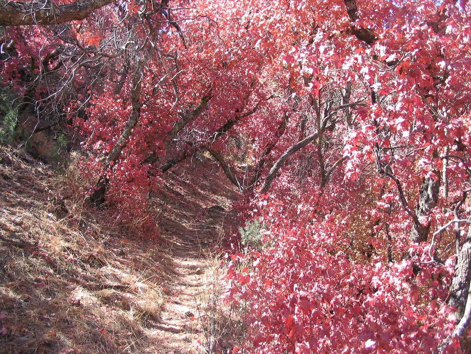
Another three-fourths of a mile later, we came to another set of water tanks, both full and fed by the Ash Creek Spring, which was still higher up the canyon. There maple trees in this canyon, and today they were colorful, featuring bright red leaves, and some more orange, pink and peach. It was lovely Fall colors, never-minding that it was the middle of Winter. At Ash Creek Spring, the two dogs ran toward us again, and shortly the two women, who were now hiking out. Once again, we all said hello.
At Ash Creek Spring, the trail makes a sharp right at a concrete tub. To this point we'd covered 2.8 miles and gained a thousand feet of elevation. We took a snack break and assessed our time and situation. It was nearing 2 p.m. and we had concerns about being out after dark, but the weather was holding up and we both felt energized to keep going. βð was doing great, but hurting.
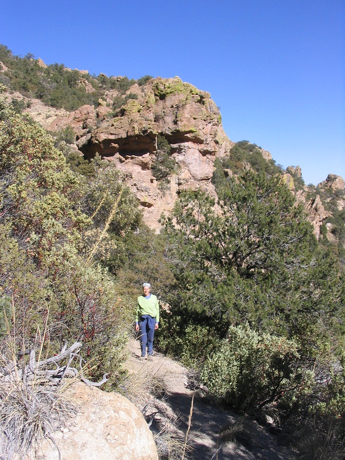
After Ash Creek Spring, the trail switchbacks up a subsidiary ridge north of Bassett Peak, near Peak 6,996. Quickly, we ascended out of the thick trees and into shorter, sparser growth, a few pines and juniper, plenty of scrub oak and manzanita, and a number of agave-like succulents. In a few spots, the trail was gravelly and slippery. We gained elevation quickly, turning west toward Peak 6,996. Views east over the desert, foothills and the Pinaleño Mountains were outstanding, as was the impressive conical summit of Bassett Peak, now visible above us. We took another break at a flat section on the subridge east of Peak 6996. βð's knees were giving her trouble so we took the time to tape them and relax. Shortly, we hiked the remaining segment to put us onto the range crest south of Peak 6996 and north of Bassett Peak.
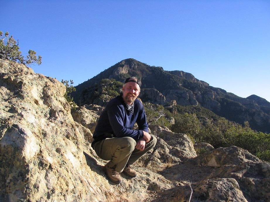
It was 3 p.m., and conditions were gorgeous. After discussion, βð opted to stop here and rest, to give her knees time to recuperate for the hike down. We had packed in blankets and reading material for this contingency, so I found a flat section of ground ringed by rock outcrops, and set her up. The weather was actually quite warm, into the 60s, and a breeze that was gentle at its strongest. I ditched my pack and took just the essentials for the remaining hike to the summit, and bid goodbye for about 90 minutes. A sign at this point said the peak was 1.4 miles away, while my map told me it was about 700 feet higher. Off I went.
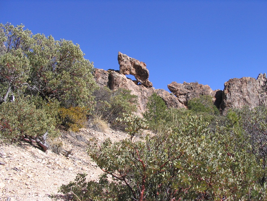
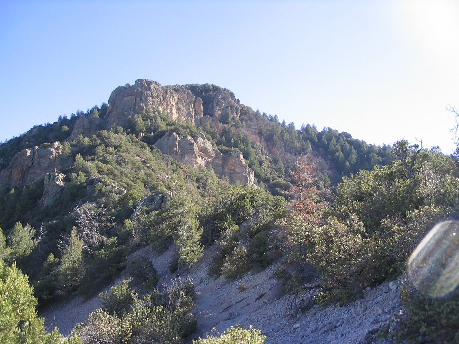
I moved quickly, following the trail south along the ridge, passing about three or four interesting rock formations along the ridge. After a half-mile, I was at the base of the final segment to the top. From below, the top looks steep and cliffy, but the trailbuilders managed to etch in a route on Bassett Peak's north and west-facing slopes. In many parts, it was a foot wide, crossing long sections of scree. Tree and shrub cover was moderate, and I moved as fast as I could, trying to return to her within my promised 90 minutes. Soon, the trail topped out at a saddle at 7,550 feet, west of the summit. A small cairn here suggested a possible off-trail route to the top.
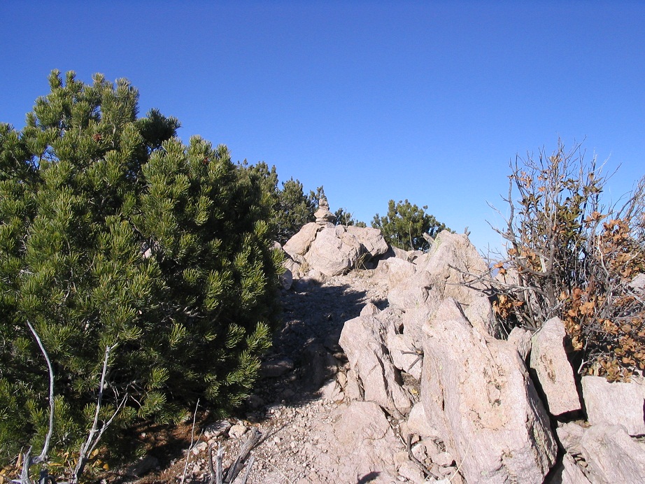
Trusting the cairn, I entered into the brushy slopes for the final 110 vertical feet to the summit. At first I was able to follow a mostly open path, but quickly I found myself surrounded by dense thickets of mountain oak, sawgrass and fir. Sacrificing style for economy, I barged through the brush and arrived to the summit at 4 p.m. A small cairn was built upon the summit blocks. I signed in and rested briefly. The views were outstanding, and absolutely worth the effort. But given it was already 4 p.m. and βð was waiting for me, I started down quickly and jog-walked back to her location, arriving at 4:40, 10 minutes longer than I had predicted. She had laid out her clothes to dry and was enjoying the sun, sights and solitude. But she, too, was aware of the time, so we packed up and started down without time to waste.
Normally we wouldn't have been out on the trails this late in the day. But we had some things working in our favor. We had stable and warm weather, and no threat of storms whatsoever. The moon was nearing its full stage tonight, and we had a flashlight and were even a little eager to hike in the moonlight. Third, the route was fool-proof. We knew we could be back to the lower canyons by nightfall, from which we'd just follow the old road back.
The hike from Peak 6996 down to the Ash Creek Spring took us an hour, with waning light by now. When darkness fell, we were still about a mile and a half from the truck, using the water tanks to gauge our progress. The bright moon was occasionally obscured by the lower ridges, but it was bright enough to allow us to see our way very well. The flashlight was handy. βð was doing well, moving slowly due to her ailments, but pushing forward.
I had the flashlight out and we used it to keep an eye out for the rocks in the trail. Then we heard rustling and a large shape appeared ahead of us. A bear? No, a stupid cow. We had seen a small herd on the way up, and here they were. We clapped our hands, made noise, and told them to stand aside, and they obliged by crashing off into the brush. Except for one, who would run away from us by scooting farther down the road. He (she? It?) proved to be a bother, as we had to clap and shout to get the damn animal to finally enter into the woods. Finally, we came upon the gate. The walk to the truck went fast, and I kept clicking the buttons on my key fob until I was in range to unlock my truck’s doors and momentarily flash its lights. A neat effect in the dark.
The drive back to Safford took awhile, almost two hours. We had an amusing encounter at the Golden Corral in town. We showed up about 20 minutes before they closed. They were already mopping up and were not too thrilled to see us straggle in. We were the only ones there. So we ate and ignored them, and they continued to clean around us, giving us the stink-eye.
So literally within minutes before they were to close, a school bus rolls up and out comes a whole bunch of high-school kids. By the looks of it, they’d come back from an athletics meet somewhere. So now, the Golden Corral people were stuck for at least another hour. You could see the staff there just slump in frustration. I'm sure the manager was happy, though.
Late that night, tummies full, bodies sore, we drove back to the hot springs and allowed ourselves a midnight dip into the pools. The hot water soothed our soreness and aches and pains. We slept well that night, and drove on home the next day.
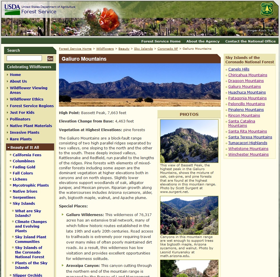 This is a screen-capture of the United States Forest Service page for the Galiuro Mountains. The banner image is mine, as is one of the photos in their right sidebar. |

|