The Mountains of Arizona
• www.surgent.net
|
| Newman Peak |
• Highpoint: Picacho Mountains • Pinal County |
|
Date: November 11, 2008
• Elevation: 4,506 feet
• Prominence: 2,526 feet
• Distance: 7 miles
• Time: 7 hours, 10 minutes
• Gain: 2,700 feet
• Conditions: Blue skies, cool and very dry
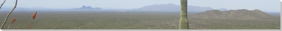
Newman Peak is astride Interstate-10 in central Arizona, about midway between Casa Grande and Tucson. It sits across the freeway from Picacho Peak, and the two peaks are considered part of the same range, with Newman Peak being the range highpoint. Despite is proximity to a major highway, few people know the peak by name, and fewer still attempt to climb it. I would soon discover why.
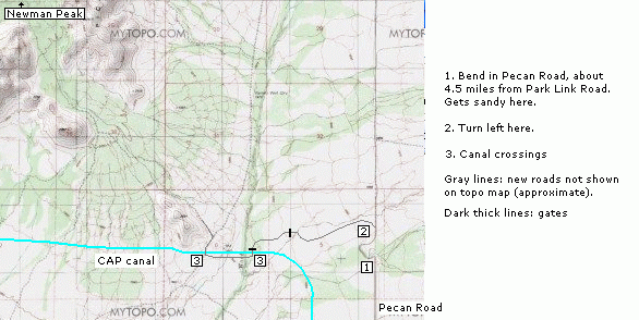
The main challenge of climbing Newman Peak is getting close to its base. It is surrounded by state trust and private lands, with some BLM sections intermixed. This creates a confusing mish-mash of roads, gates, and uncertain access. Also, the Central Arizona Project (CAP) Canal runs along the west and south base of the peak, creating an effective barrier, there being few ways to cross the canal.
My first attempt was with Eric Noel, a climber from Washington visiting for the holidays. We "knew" one another through SummitPost, but had never met until today. This was in January 2008. Long story short, I could not figure out the roads, coming up against dead ends, gates and fences. Plus, it was hunting season here. After a couple hours of futzing with the roads, we bailed and headed across the freeway to climb Picacho Peak, which was quite fun, and a good way to salvage the afternoon.
In early November, Adam Helman met at the Red Rock Exit of Interstate-10 to attempt Newman Peak, and this time I had more maps, and still, I could not solve the riddle of the roads. Clearly, the maps alone aren't sufficient (so I learned). The CAP Canal blocked many roads and created new ones, not shown on the maps. This may have been a blessing as the day was quite warm for early November, in the mid-90s. We split, and I spent the day exploring other roads from the west side such as Brandy Pump Road.
Frankly, I was miffed about the whole situation and resolved to conquer it, so I got onto Google-Earth and was able to scan the terrain, noting numerous minor roads not shown on the maps, but enough to suggest a very winding, not-at-all obvious route to the south base of the peak. Without these maps, it would be nearly impossible to solve this in the field. When Veteran's Day rolled about, I set out before dawn to climb Newman Peak, the weather by now glorious, dry and highs in the low 70s.
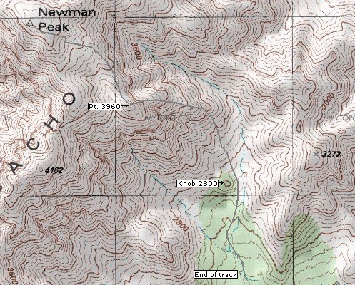
Below are two thumbnail maps showing the general way.
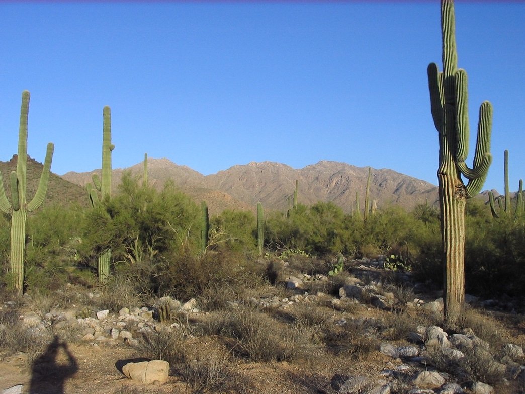
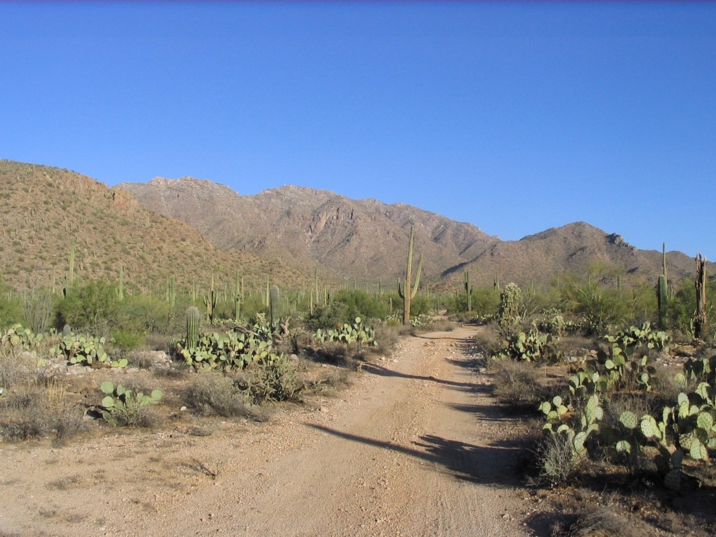
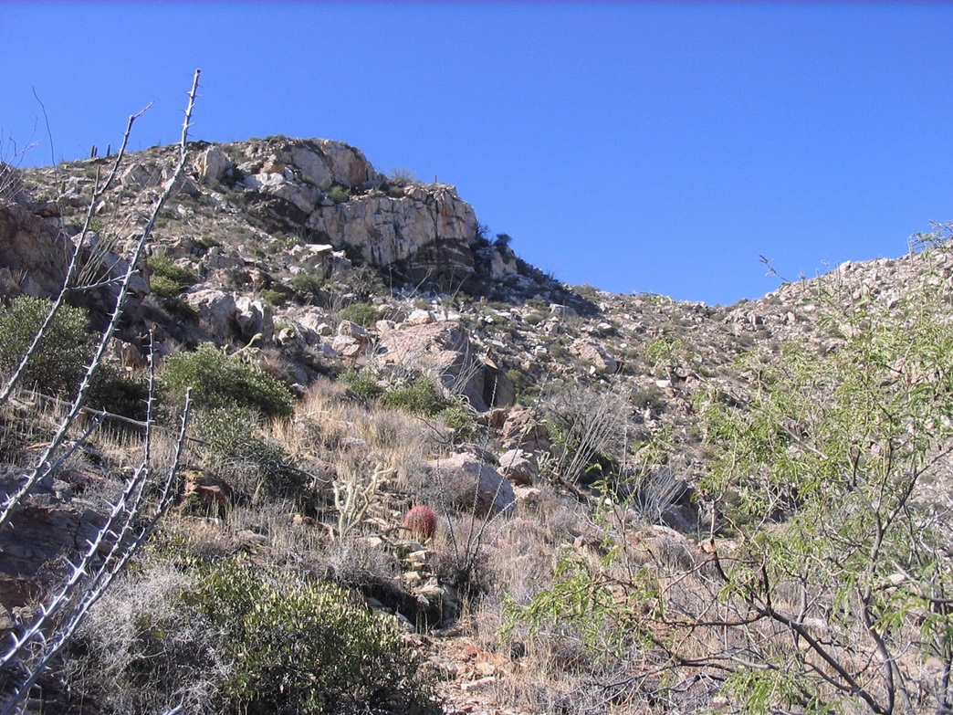
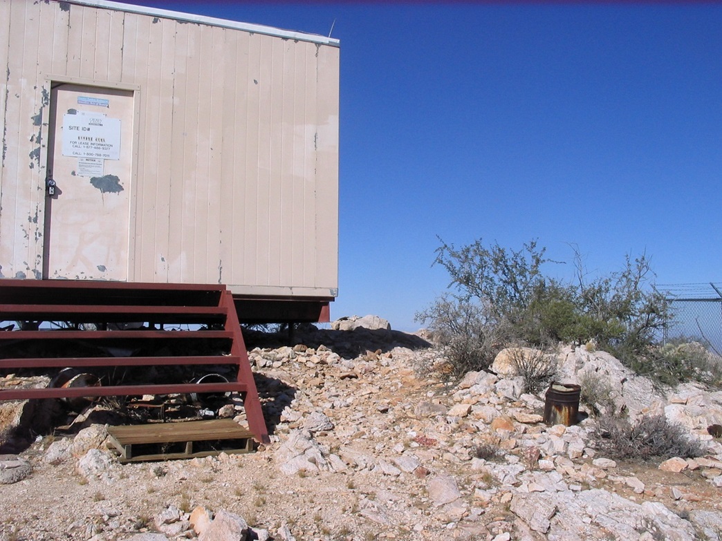
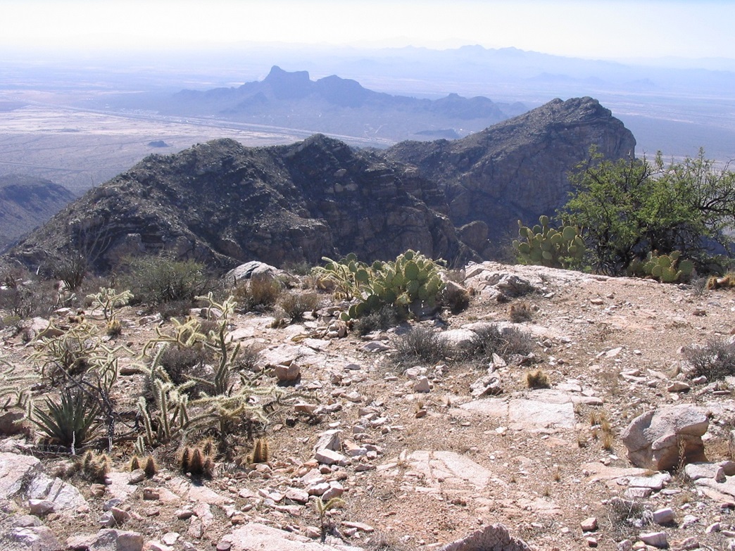
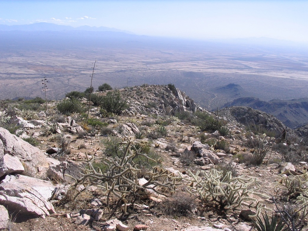
The roads ranged from hardpack to soft powder sand, smooth to rutted with high centers, driving through braided arroyos involving descending and ascending their banks, two canal crossings, gates, and so on. In other words, it was one thing after another, and it took me an hour to cover about 8 miles. I parked in a convenient clearing and started hiking at 7:45 a.m. The road seemed to improve and I thought about going back to my truck and driving some more, but I was in a good walking mode and decided against it (although at the end of the day I really would have appreciated having my truck closer). I took 45 minutes to walk the road into the heart of the range, directly below Newman Peak's summit, flanked on three sides by ridges and subsidiary summits. I figured I walked two miles to get here. Now to decide on a route. The best information on climbing this peak that I could find came from the geocaching website. Most seem to follow the steep gully directly below Newman Peak's summit on its south face. However, I decided to gamble and try another route, bearing more northeast into a side canyon and trying my luck with the canyons and ridges that way. From a distance it looked doable, and it looked friendlier than the direct gully route. The desert flats leading up to the slopes were thick with beautiful saguaro and pricky-pear cactus. I hiked down and up the main washes and many side washes, hiking by sight toward a rock outcrop I denote "knob 2,800" (see the map). I worked my way up on the southeast-facing slopes of the canyon past knob 2,800 and a few hundred more yards northeast toward an obvious ridge. The terrain here was heavy with cactus and brush, and lots of rock, but there was always some path or open space to walk through, if not necessarily in a straight line. In time, the slope steepened and I was now hiking up to the first main rock clump on my destination ridge. The plan was to hike as far as I could, and hope. It was not unreasonable to assume I might meet some impassable section higher up, so I knew I was gambling. I went from one rock outcrop to the next, usually gains of 50-100 feet at a time, checking out what came next. Almost always, what looked like cliffs from below was more stair-steppy up close, or there was some steep slope or brushy alternative to use as a bypass. I made good time overall, despite the need to stop constantly and assess the route (and run up and back a few dead ends). Every type of Arizona cactus was represented on the slopes: saguaro, prickly-pear, barrel and cholla, as well as ocotillo and thick, woody manzanita-type brush. I had one run-in with a barrel cactus at some point. It felt like a light scratch, didn't hurt at all, but a few moments later I see two thick trickles of blood on my leg. I only had one run-in with a cholla ball, and as usual it hurt like hell. My destination was a small peaklet, called Point 3960 on my thumbnail map, which lies about 3/8-mile south-southeast of Newman Peak. As I inched higher, I gained confidence I just may be successful on this hike. About 250 vertical feet below this point, I came upon the only "crux" of the hike: a band of sloping rocks that were bent and clefted into many shapes, some sections with small steps and others open slope. It took me a few minutes to inspect a way up. While it wasn't that steep, a slip on this rock would have been bad news since I would not have a means to arrest myself. I got up them fine, they were not a problem at all. After these rocks, I worked up around another rock outcrop and came upon a small saddle directly below Point 3,960. I chose to climb Point 3,960 via its south slopes (my left) then come down its other side. The climb up went well and I was on top of Point 3,960, where I had excellent views of the remainder of my route. I downclimbed off Point 3,960, losing 60 feet, then started up the ridge toward the summit, which was still 550 feet higher and 3/8 of a mile distant. The climb here was easier than the ridge I came up, but closer to the top I had to negotiate a jumbled section of rocks, loose scree and lots of organic crap. I surmounted a small cliff edge and there it was, the summit. It's rare I am happy to see towers, but this was a case where I definitely was glad to see them. I left my pole and gloves leaning against a bush, and walked the last easy slope, gaining 50 feet to reach the top. The summit is a jumble of rocks beside a building. I tagged the top rocks, signed in the register (noting I may have been the first to be up here since March, but I can't be sure of that), and also noting the bigger geocache box in the summit cairn. I took a few photos and inspected the immediate area, but didn't stay up top long. The best views are southeast toward Picacho Peak, which from this angle looks like a resting cat. I had leaned my trekking pole up against a bush near where I surmounted the cliff so that I'd know where to start the descent, so I picked it up and started my way down. It was about 11:30, a 3.5-hour ascent time. The initial hundred-foot drop down the rock and brush jumble went slow, but soon I was on firmer ground. A DPS helicopter was buzzing the summit, coming within a few feet of it for whatever reason. Surprisingly, I met up with a group of three hikers coming up just a couple hundred feet later. We had a short chat. Soon we parted ways and I continued my descent. Getting back down to the saddle just north of Point 3,960 took 10 minutes and I decided to traverse left below its east-facing cliff instead of climbing up and down, like I had done coming up. This went well and quickly I was back onto the long steep ridge I had come up. Going down this went slow as I took each step carefully. The sloping rock section went slow too, as I had to carefully manage my movements so as not to slip. Once below that, the rest of the descent into the canyon went without any problems, other than the need to watch my step. The slopes started to level out and I was now within the canyon, hiking back out toward knob 2,800, then through the maze of rocks and washes to get back onto the road. Once back on the road, I still had that two-mile trek to my truck. Road walking is easy, but I was beat by this time and kept lamenting my decision to park as far out as I did. The walk took me an hour, taking a few rest stops on the way. I changed into my driving-out clothes, talked to a couple guys guys out scouting for deer for next week's hunt season, then exited back the way I came in. The round trip hike had taken me 7 hours and 10 minutes with about 7 miles of actual hiking but nearly 2,800 feet of elevation gain. The day had stayed cool, but I could feel the warmth of the reflecting sun off all the rocks and sand. I was happiest though to have finally summitted Newman Peak, and putting to rest my previous frustrating experiences with the peak. I rewarded myself with a Dr. Pepper at the Picacho Peak Gas Stop near the Interstate, then drove home, arriving about 5 p.m. I would be curious how the route "goes" from the Houser/Brandy Pump Roads approach, underneath the CAP canal. Judging by the quantity of entries in the log book, maybe 3-4 parties a month come up to the summit in the winter, and no one in the summer (discounting the workers who helo in). Many of the names in the log book were people I know and have met previously on other hikes. It can be a very small world sometimes. I have no idea if the geocachers sign in on the summit logs or vice-versa. They probably account for the other half of the visitation. |


|