The Mountains of Arizona
www.surgent.net |
| Wilson Mountain |
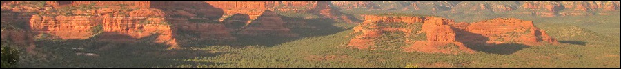
• Oak Creek Canyon - Red Rocks of Sedona • Coconino National Forest • Coconino County |
|
Date: June 10, 2006
• Elevation: 7,122 feet
• Prominence: 1,402 feet
• Distance: 10 miles
• Time: 8 hours
• Gain: 2,400 feet
• Conditions: Clear blue skies
(Ambiguity alert: There are two relatively significant peaks in Arizona named "Wilson". The other one, Mount Wilson, is located north near Lake Mead.)
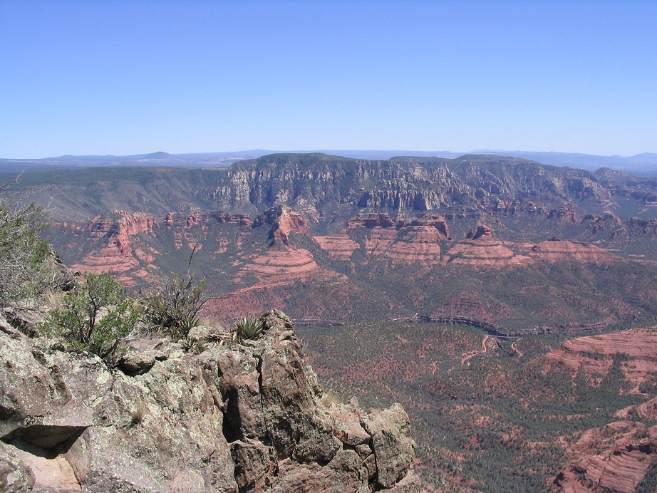
Wilson Mountain is a peak formed by erosion. It is a part of the Coconino Plateau, but separated from the main plateau by smaller canyons and ridges formed by erosion. Thus, the mountain has a flat plateau top, its highest point not the easiest point to locate without a map. The southern cliffs overlook Sedona and its surrounding red rock wonderland.
We don't visit Sedona that often. It's way over-crowded and expensive, and camping requires advance planning due to the limited spaces and the hordes of people. The area is unbelievably gorgeous, so it is not surprising that so many people want to come here. If I were visiting Arizona on vacation, I'd want to come here too.
In any case, we had to plan this beforehand to be sure we had a camping spot waiting for us. We drove north from Phoenix on Friday (yesterday) and arrived to the Manzanita Campground at dusk. Our spot abutted Oak Creek itself, and we enjoyed a quiet night eating dinner, listening to the Diamondbacks on our radio. We had a full moon during the night.
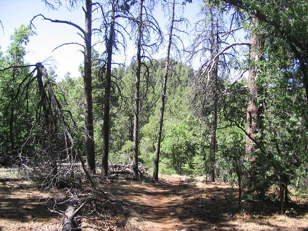
The next day, we drove to the Encinas parking area, intending to follow the North Wilson Mountain trail, #123. From the parking lot, we followed the trail up onto a ridge, which then led into a forested canyon. In the trees, we had shade, but it was warm. The trail was in great shape and pitched at a consistent, moderate grade, and we made good time.
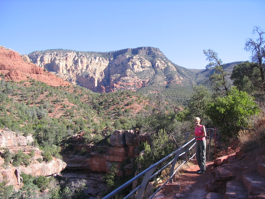
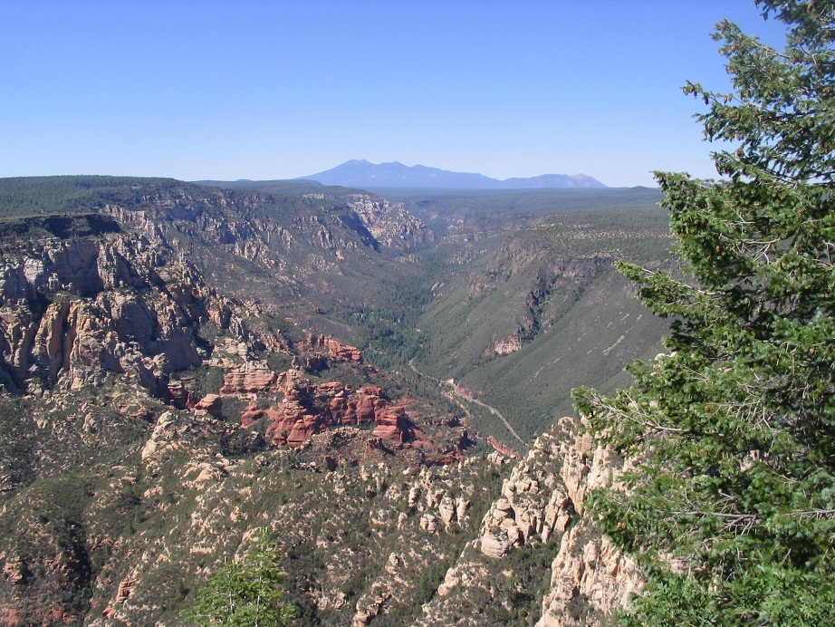
Higher up, the trail turned south and became steeper, hemmed in by cliff walls and huge stands of ponderosa pine. Finally, the trail left the canyon bottom and started a series of switchbacks up the canyon's east side. The flora transitioned from beefy forest to scrubbier juniper, mountain oak, sycamore and chapparal. We had fantastic views, mostly of the cliff walls, but also of Oak Creek Canyon to the north.
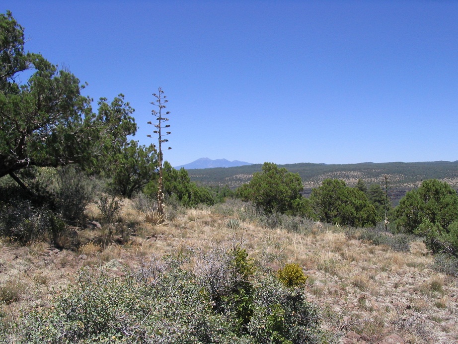
The switchbacks lead to the north end of the First Bench of Wilson Mountain, as named on the map. The grade eased and we found ourselves atop this "First Bench", a smaller plateau about a mile long and a few hundred feet wide, covered in scrub, pinon and juniper, and isolated stands of fir. We walked until we met with the south trail, where we then ducked into the shade of a juniper for a long rest. We were approximately 6,320 feet elevation, having gained nearly 1,600 feet in 2.5 miles of hiking, all in about two hours. Surprisingly, we came upon very few hikers: just one girl descending as we ascended, and a couple up on the Bench. Other than that, nobody. We followed the trail through a dense glade of trees and brush, up a drainage and then up some more to a saddle with an odd wooden "closet" lashed to a tree.
We took a rest here and pondered our plan. A spur heads south from here to an overlook at the south end of Wilson Mountain, while the main trail continues west, then north for about 1.25 miles to the northern rim, with views of Humphreys Peak and the Coconino Plateau. Wilson Mountain's actual summit was a short cross-country hike to the north of this saddle. We decided to save the highpoint for last.
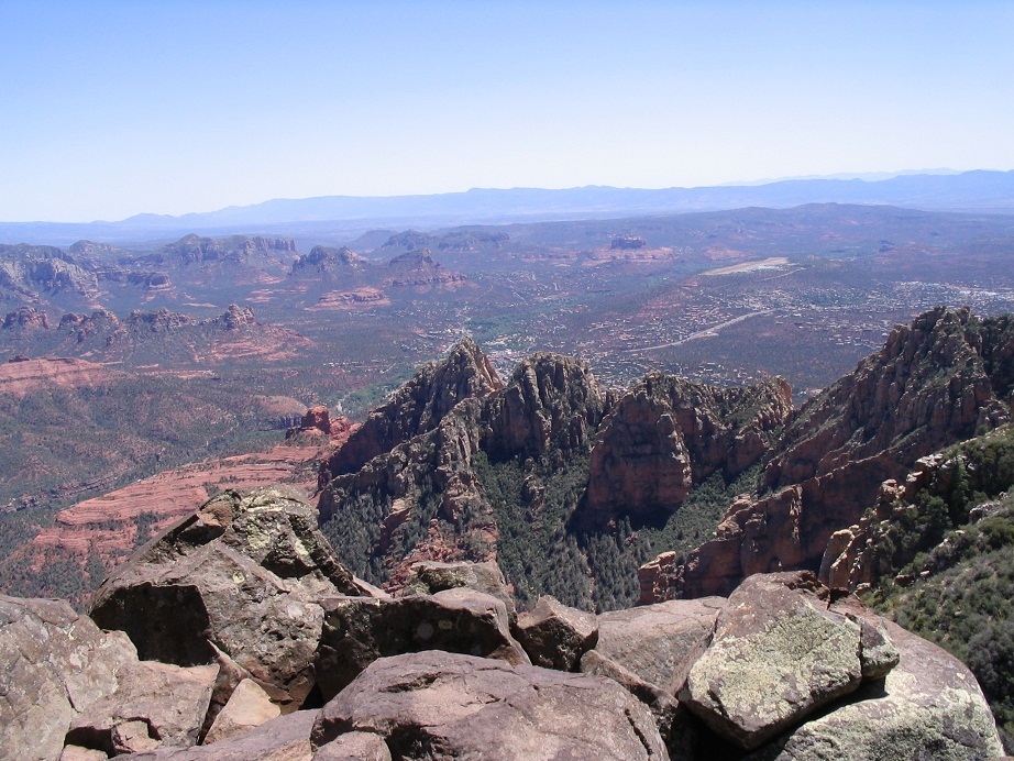
We went south first and hiked to the overlook. The trail gains shortly, then slowly drops, coming out to the cliff edge and absolutely beautiful views of the entire Sedona region. Every unique craggly red rock and spire was visible, plus the mazework of Sedona's roads. The Black Hills were in the distance, including Woodchute Mountain, and, interestingly, the town of Jerome, which we could barely make out high up on the hills below Woodchute and Mingus Mountain. On the distant southeast horizon, we could see the hulk of Mazatzal Peak, believe it or not.
After a few minutes and many photos, we hiked back to the saddle. From there, we continued on the main trail to the north rim. It dropped slightly, then ascended gently, gaining 120 feet in a half mile. The forest was moderate, and we passed through meadows along the way. There was one last small slope to gain and suddenly, we were on the north-facing rim's edge, with stupendous views to the north.
We had unobstructed views of the northern part of Oak Creek Canyon, the convoluted cliffs and plateaus that form the high country. Humphreys Peak stood tall, front and center. Bill Williams Peak, which we hiked a week ago, was off to the northwest. We had a sweeping view of the entire rim and endless expanse of ponderosa forest. It was magnificent.
After admiring the views, we walked back to the first saddle, where & rested while I hiked up to the summit of Wilson Mountain. I followed cairns and scant paths to the top, a jumble of rocks on the edge of the cliffs. The highest point was a spire leaning out over the cliffs. I shimmied up beside it, leaned out and tagged it. I then headed back down, a total detour time of 20 minutes. It was now close to 5 p.m. and we started our descent off of Wilson Mountain.
I taped βð's knees and we hiked slowly, especially on the steep switchbacks coming down from the First Bench. In time, and taking care, we were down into the lower canyon and back out to our truck, coming out about 7:30 in the evening. Both of us were hungry so we went into town, found our favorite sandwich shop (Wildflower Bread Company), got supplies at the market, and rode back to our camp, arriving after dark. We were both dead tired and asleep before long. This was a great hike with and some of the most incredible views you will ever see from the top.
June 18, 2006 (a week later): A large wildfire called the Brins Fire erupted Sunday, June 18th, and within a day has grown to over 3,000 acres. Brins Canyon runs generally west of Wilson Mountain. The fire did reach the top of Wilson Mountain. We feel fortunate to have hiked this when we did, but feel awful knowing that the beautiful woodland atop the mesa went up in flames. We understand this is part of the natural process, of course, but the immediate effect is a sad one.
|


|