
The Mountains of Arizona
www.surgent.net |
|
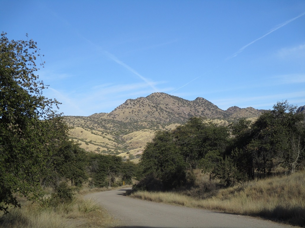
Peak 6311 "Weigles Ridge Highpoint" • Granite Mountain My primary goal today was a thousand-foot prom peak in the northern Santa Rita Mountains, and then whatever else I could find depending on how I felt after the main hike. The primary peak is a point along a ridge south of Weigles Butte. There are two bumps along this ridge, the southernmost one having a map elevation of 6,290 feet, and the next one north (this peak) having no printed elevation but just a 6,280-foot contour. Weigles Butte itself has a map elevation of 6,284 feet. From below, it's not obvious which peak is highest. Past visitors have all reported that this particular peak is highest, just on visual observation alone. I checked on the Lidar sites and this area has been mapped to the 1-meter refinement, which meant that some actual figures one could place faith in could be derived. Here's what I got: The southernmost bump comes in at 6,283 feet, and Weigles Butte also comes in at 6,283 feet. This peak, which I dub "Weigles Ridge Highpoint", comes in at 6,311 feet. I checked its key-col elevation and it is 5,176 feet, which matches a spot elevation on the map too. The prominence is thus 1,135 feet. I was on the road about 7:30 a.m., heading west from Bisbee via Sierra Vista, catching AZ-82 in Whetstone, then following AZ-82 to Sonoita, then north on AZ-83 to the Madera Canyon turnoff (Coronado Forest Road 62, paved). I followed FR-62 to a Y-split and went right, the road now all-weather hardpack. A couple miles later, I turned north onto FR-231. The main track goes left but it was heavily rutted, too much to trust my vehicle on it. Instead, I parked in a clearing to the right. It was 9:10 a.m. when I pulled in, the day sunny and clear, with a steady breeze and temperatures in the mid-50s.
Date: December 16, 2023
• Elevation: 6,311 feet (per Lidar)
• Prominence: 1,135 feet
• Distance: 5.2 miles
• Time: 3 hours, 20 minutes
• Gain: 1,370 feet (gross)
• Conditions: Sunny and cold at first, clouds moving in, breezy but mild
Arizona
•
Main
•
AZ P1K
•
PB
•
LoJ
I started walking at 9:15, northbound on FR-231. This road wiggles northward then bends left and comes to an apex at a private-property sign that's been shot up. There is a cleared flat parking area here. The main road goes north, and a lesser track, FR-4053, branches left. Were it not for those ruts earlier, I think I could have got the Forester to here. The road itself was generally smooth. As it was, I had only walked a mile.
I followed FR-4053, which drops about 50 feet and is much narrower and more haggard than FR-231. This road hugs the slopes above a small canyon. At one pont, I looked down and saw the bed of a pick-up truck amid the trees about twenty feet down. The main cab wasn't there. In my opinion, nothing less than a Jeep would be adviseable on this road, or a side-by-side type contraption.
The road eventually makes a big leftward hairpin bend, then immediately, a side track branches north with a small canyon. I followed this track to its end about a quarter-mile later. There were a couple mine adits alongside this track, and at the road's end, a five-foot tall circular rock structure that may have been a shed at one time (my guess). There were some timbers lying about that suggested a roof. It was much too big and fancy to be just a windbreak.
My plan had been to continue north about another quarter-mile to gain a saddle, then angle left and bust up the slopes to gain the main ridge south of the summit. I walked up this drainage and came upon a stick with surveyor's ribbon, probably a mine claim boundary. I had only walked in about fifty feet. I found a path here that went up slope so I followed it. After gaining about twenty feet, I had an unfettered view of the slopes above me, and they looked friendly. There was no need now to hike to the saddle. Instead, I would just hike up these slopes and gain the high ridge directly. I had about 400 feet to gain to get to the high ridge.
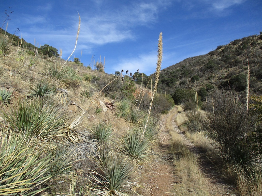
The path I was on petered out, so I just hiked upward, following lanes and openings. There were scattered trees here, nothing substantial, so I had good line-of-sight views. The main problem down low was persistent thornbrush. I was dressed in jeans and long sleeves so I didn't get stabbed too many times but it was often waist high and took a lot of energy to push through it. There were also some patches of lechuguilla ("shin daggers") and pencil cholla. I tied surveyor ribbon in a couple spots so I could follow the same line down on my descent.
This slope worked well. It was steep but it was consistent and it laid back well. There was substantial grass that held it all together and the rocks were usually solid. A few rolled. Higher up, I encountered more low trees and agave with their tall stalks. After about twenty minutes, I was on the main crest. I had emerged almost exactly at the lowpoint in the saddle between the main summit and the southern bump.
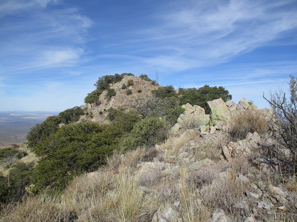
I angled right (north) and started up the remaining ridge to the top, which for now was not visible. The grade was much more lenient. About a third of the way up, I encounteted rock outcrops, and after about the halfway point, it was pretty much all rocks, with trees and brush growing in the cracks and spaces between them.
The climbing wasn't difficult but I went slow because I needed to figure ways around the rocky barriers. Most of the time I found a way off to one side but at times, I was obliged to stay high. As usual, something tangly or pointy grew in the most logical way through the rocks and I would spend time breaking branches and moving aside crud to get through. At no time did I "scramble", but it was slow going. I was finally on the summit ridge.
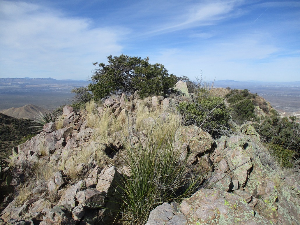
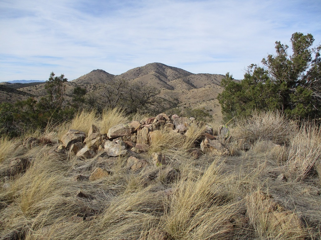
Any one of three or four rocks could have been the highest. I felt that an angular slab kind of by itself at the north end of the short ridge was highest. Another rock within the branches of a tree was close. I tagged everything, but could not locate a register at any of the possible highpoints. Looking over at the south peak, it was very clear that it was lower, affirming what others have reported.
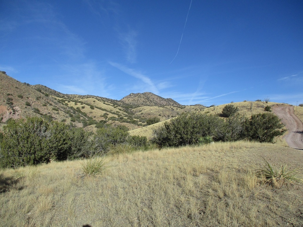
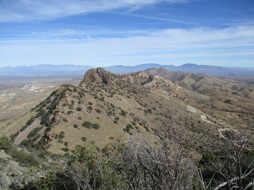
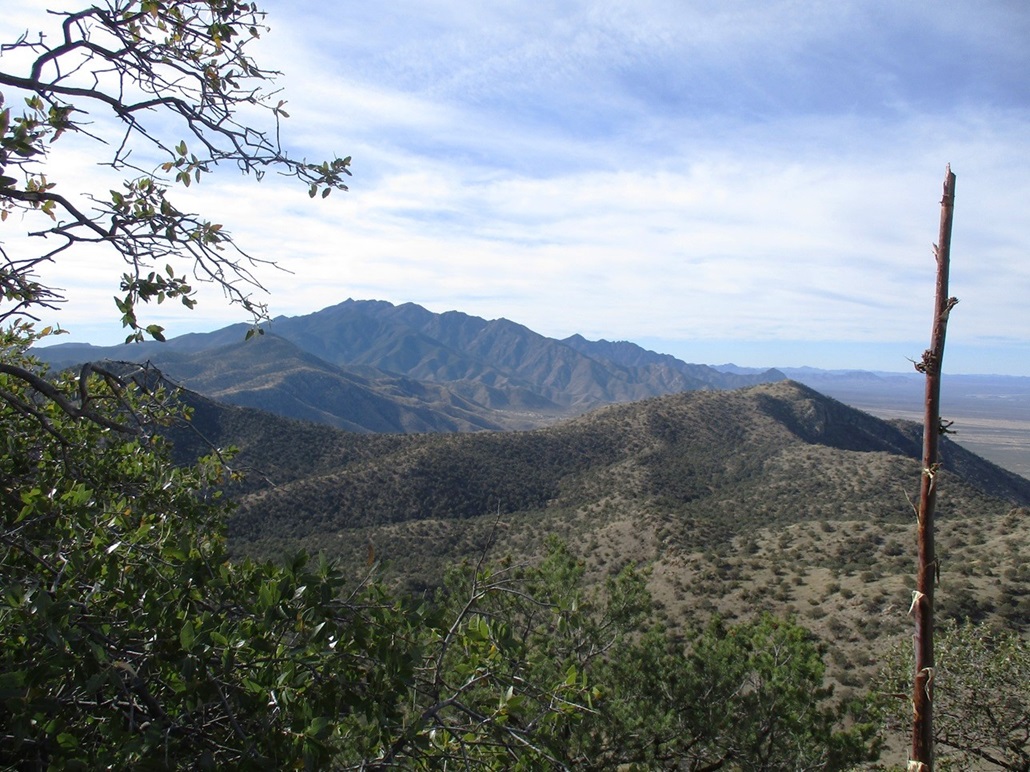
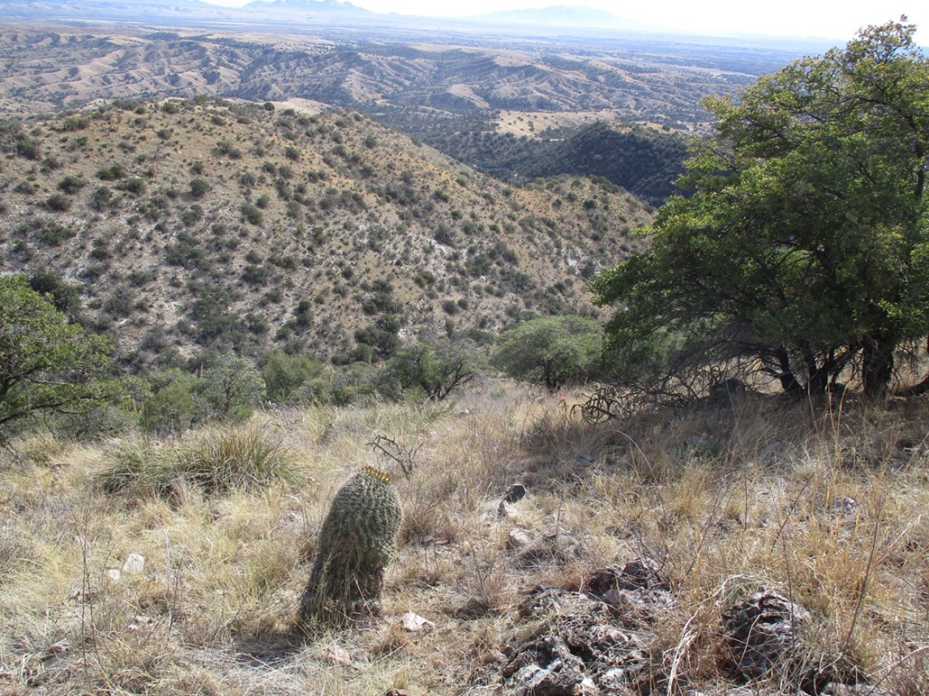
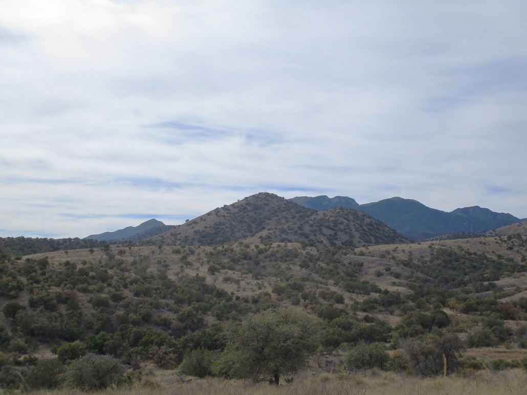
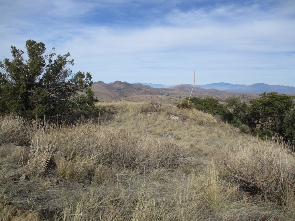
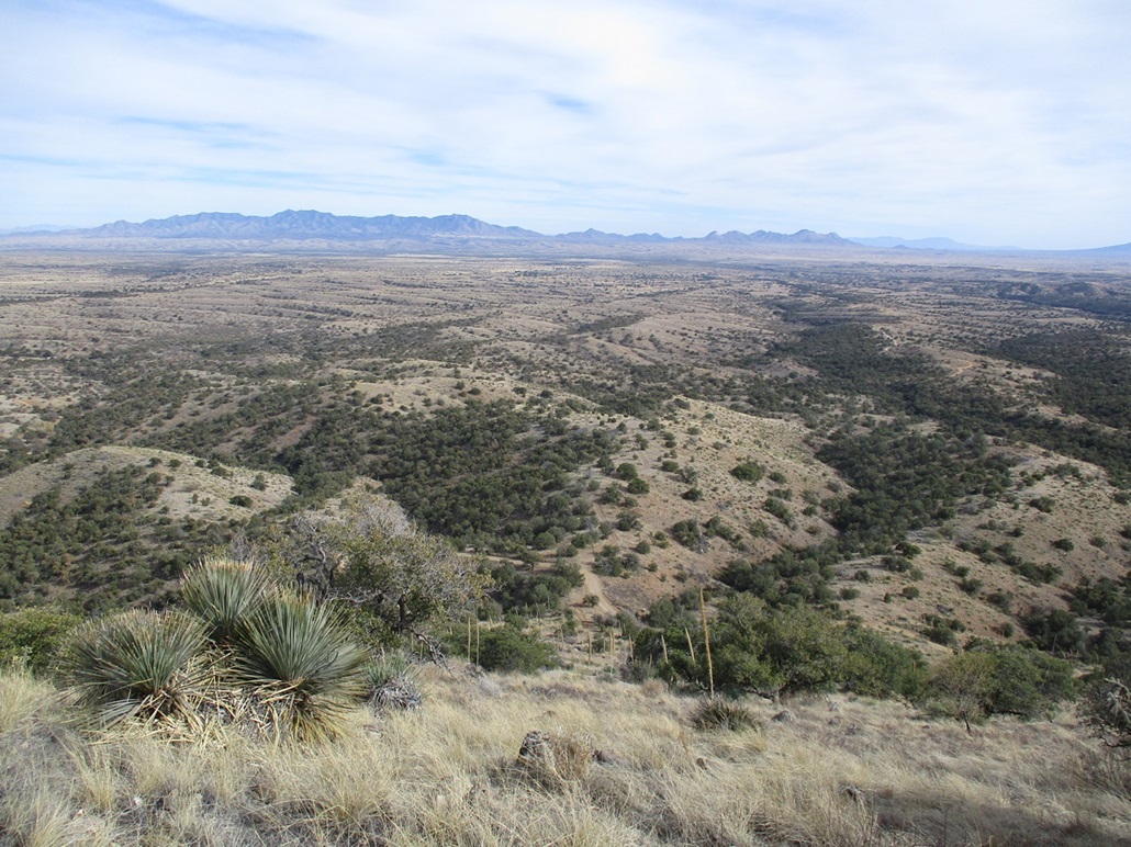
Up high, I had to contend with the steady breeze. It was cool, in the 50s, but with the breeze, easy to chill fast. I kept moving, never really stopping for a break. I took a few photos. Looking north was Weigles Butte itself, with an impressive cliff on it west. In the distance was Mount Fagan. Below were a number of roads and mine diggings. Looking south I could see Mount Wrightson. Off to the east I could make out the Whetstone, Mustang and Huachuca Mountains, then way way in back, the Mule Mountains, where I now call home.
I descended the ridge, then at the saddle lowpoint, started downslope, going from one ribbon to the next. The descent went well, and I was back to the road in not too long. As I walked out, I could see fresh bear scat in the road, and fresh prints of what I think may have been a mountain lion. I never saw any animals. However, I had my bear spray with me just in case.
I walked back to where FR-4053 meets FR-231 at that flat parking platform I mentioned earlier, and took a longer break, having something to eat and drink and actually relaxing. Just then, two guys in a side-by-side come up. They'd been back on those roads "shooting and exploring". We had a friendly chat. They were cool.
The walk back to my car took about thirty minutes. I had another chat with a driver and his three young children as he bashed his car up the road. He said he was taking his kids hunting, this being archery season. The kids were young, about 5-7 years old. He was cool too. I suspect the "hunt" would be more just a chance to hang out with dad for an afternoon in the wilderness, which I think is awesome. Good for him and his kids. Back at the car, I met an older couple and their two dogs, and chatted with them too. I think I set a record today for most "chats" on a hike.
I was feeling pretty good still. It was 12:30 now, and some clouds had moved in, but it was still mild, and down low, the breezes not much of a problem. I felt up for another peak, preferably something easy and short. There is a nifty peak nearby, Peak 6224, but it would entail over a thousand feet of gain, so I put that one off for a later date.
I drove back to where that Y-split on the road was earlier, and took the other split, going southwest and south...
Elevation: 5,983 feet
• Prominence: 321 feet
• Distance: 3.2 miles
• Time: 90 minutes
• Gain: 740 feet (gross)
• Conditions: High clouds but mild
PB
•
LoJ
I zeroed in on Granite Mountain, located a couple miles south of the Y-split, near the ghost town site of Greaterville. I was now on Forest Road 229, which passes through a small private inholding, then comes to an apex at a four-way junction. I went right (west) onto FR-165, which was a little more rocky and beat-up than FR-229. I drove in a half mile, parking in a lovely clearing with a fire ring. I was only a mile from the peak and couldn't pass up the opportunity to park in this fine spot.
I was still dressed for hiking, so I got my pack on and started walking at 12:50 p.m.. The clouds had really moved in now, the high kind that form a white sheen in the sky and mute all the colors. I walked the road and in about twenty minutes had covered a mile, locating myself near the Morning Star Mine, where FR-163 splits to the left (south). This is also signed as part of the Arizona Trail. The road to here was a good road and I could have driven it, but I did not feel like I made a bad choice in parking where I did.
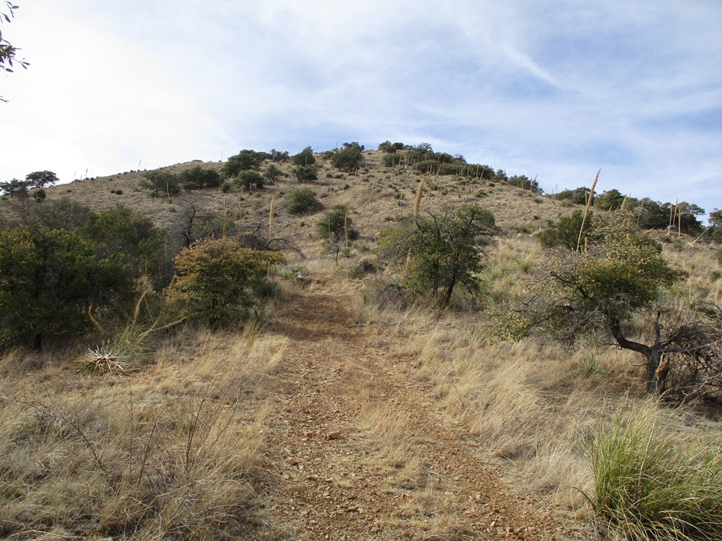
I turned south onto FR-163, just moments after about five ATVs full of people came down from the other direction and onto FR-163, so I let the dust settle first. This road is rockier and steep, but easy to walk. I stayed on it until it reached a highpoint, now at the eastern foot of Granite Mountain.
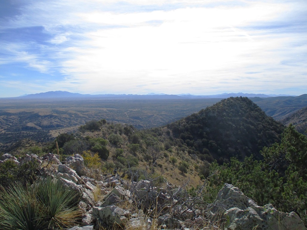
Looking up, it looked like a very no-nonsense peak. Just a slope of grass, agave and thornbrush, some trees higher up, and then the top. It's not a big mountain so it can't be too complicated. I found a lesser track that went up a few yards to a concrete pad that may have been the foundation of a water tank (the topographic map says there is a water tank here).
I started up through the grass and just made baby steps upward, weaving through the occasional cactus or woody patch, and dealing with the thornbrush which wasn't as heavy as it was over on my first peak. It took about fifteen minutes, and I was on top. The summit features two bumps, the southern one higher by a couple feet, topped by a pile of rocks.
I took a few minutes to look around, snap photos, and locate the register, but I couldn't find one here either. I didn't stay long, and descended the slope the same way, coming right back to that concrete pad then back to the road.
The walk-out didn't take too long and I was back at my car at 2:20 p.m., a ninety-minute walk, covering just over 3.2 miles round trip. The elevation gain includes a couple drops and regains that I had to do on the road hike.
This peak went fast and without drama, and I was happy to tag it. I wouldn't come here just for this one peak but as an add-on, it was perfect. It also allowed me to explore some of these roads for later visits.
I got myself back onto state route AZ-83 and into Sonoita, where I stopped for snacks at the gas station. Then I just drove back to Bisbee, arriving there around 4 p.m..
|


|