
The Mountains of Arizona
• www.surgent.net
|
| Mount Fagan |
• Santa Rita Mountains • Coronado National Forest • Pima County |
|
Date: March 25, 2018
• Elevation: 6,190 feet
• Prominence: 1,032 feet (confirmed via LIDAR)
• Distance: 5.4 miles
• Time: 5 hours
• Gain: 2,400 feet
• Conditions: Warm and still to cool and breezy
• Teammates: Scott Casterlin and Scott Peavy
Arizona
•
Main
•
AZ P1K
•
PB
•
LoJ
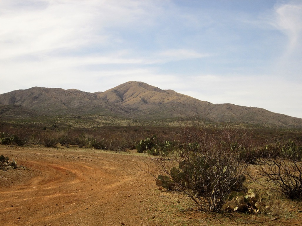
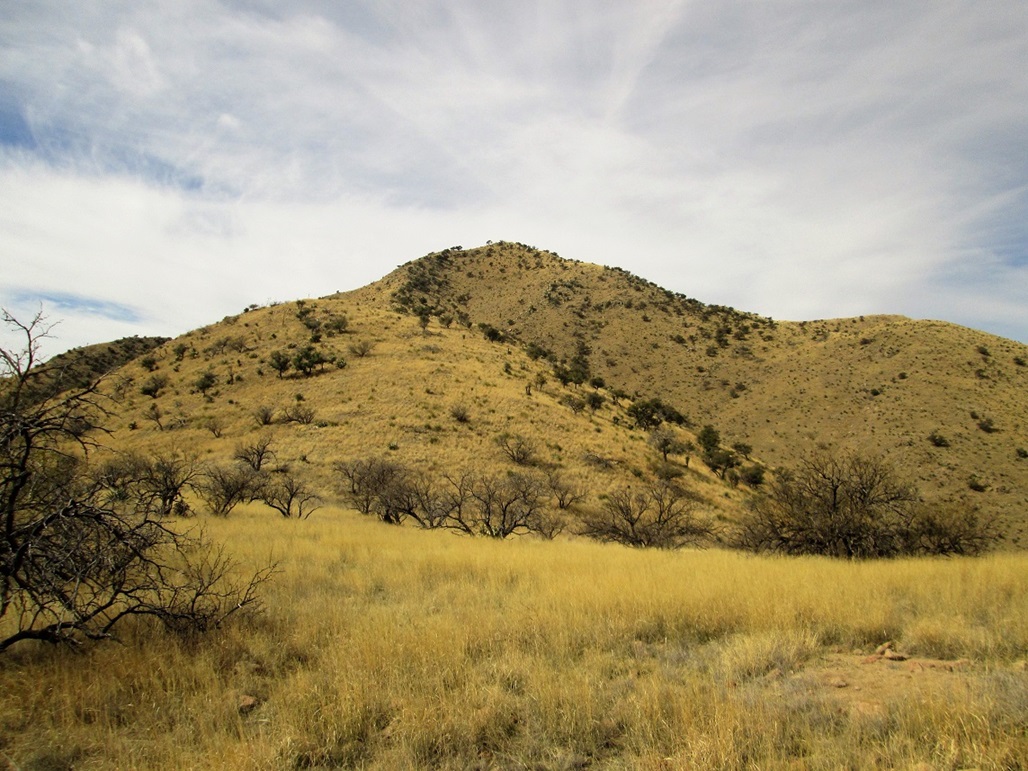
Mount Fagan is the main peak at the north end of the Santa Rita Mountains, the range that includes Mount Wrightson. It lies inside Pima County about 20 miles southeast of Tucson, in the sprawling community of Vail. In December, Scott Casterlin and I were in the area scouting some of the roads, but we did not hike it that day. This peak has been on Casterlin's want list for a long time and he was eager to climb it.
We didn't get around to Mount Fagan for nearly three months. We figured our window of opportunity was closing, as the weather starts warming about this time. Scott Peavy and I met at his place in Gilbert and I drove us to Casterlin's home in Tucson, arriving there about 7 a.m.. It would be just us three Scotts today.
We piled into Casterlin's Toyota FJ and drove about a half-hour to get onto state route AZ-83 and some desert tracks northeast of the peak, near a stock tank called Twin Tank on the map. This is Arizona State Trust land, but it is apparently leased to local ranchers who run cattle on it. We saw a few but there weren't that many of them.
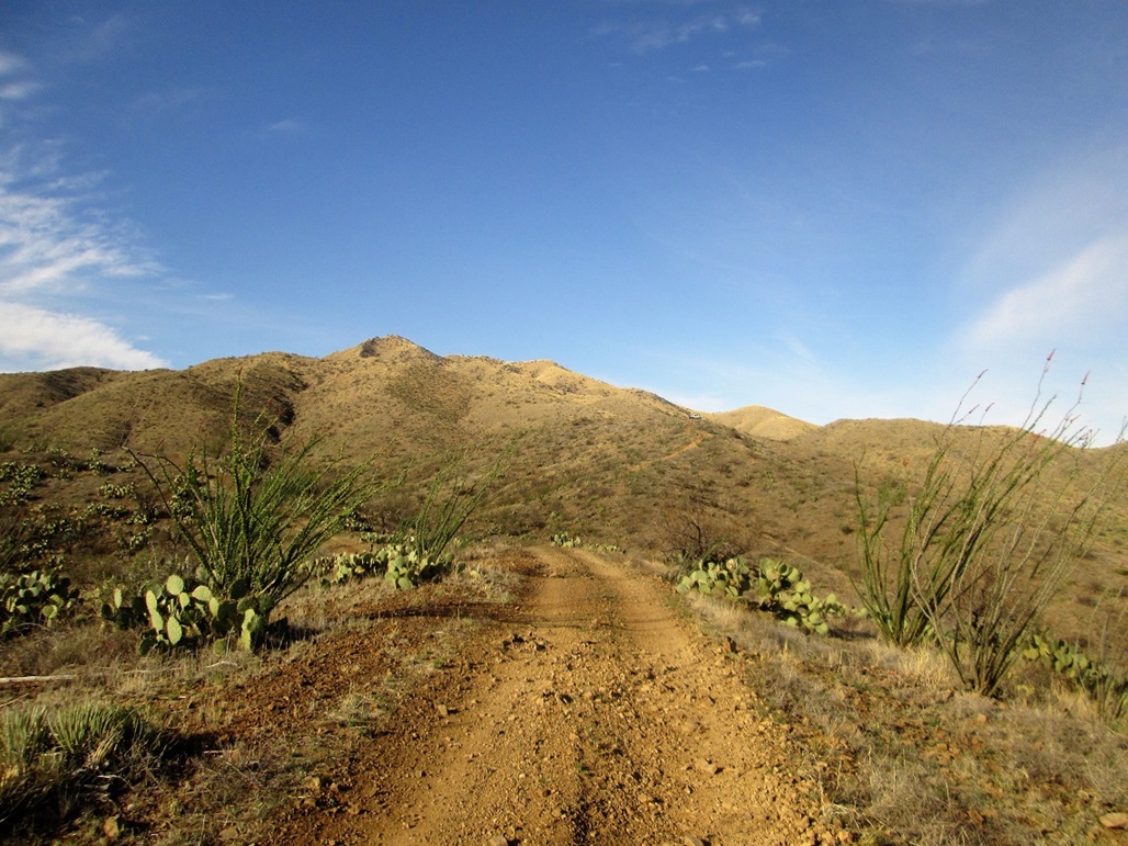
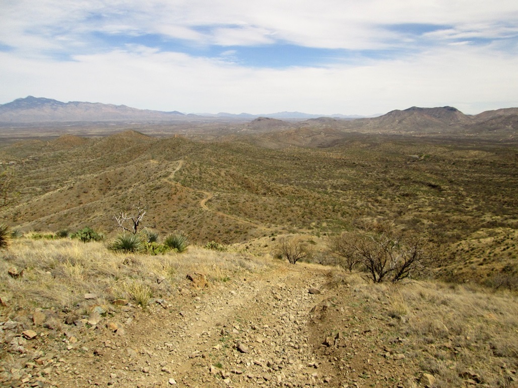
The roads get bad fast. For the first mile, they're tolerable, where most stock 4-wheel drive would be sufficient. Near Twin Tank, the roads drop a notch in quality. Then, about a mile later to the west, near "The Lake" (another stock tank), the roads get truly nasty. They're steep, deeply rutted, full of large rocks, and have challenging leans. Casterlin's FJ was critical, and he was able to drive in nearly 3 miles from the highway. We parked about a half-mile west of The Lake, elevation 4,320 feet, just below a steep uphill near a ridge. We were about 2 air-miles from the summit. There's no way my vehicle would have got this far.
It was close to 8 a.m. when we got situated, Scott parking his FJ off the road in a clearing. The peak was not far, covered in grass and spotty trees, with nice lines. It was cool for now, but sunny. When there was a breeze, it was pleasant. When it was still, we could feel the ambient warmth.
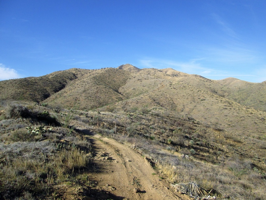
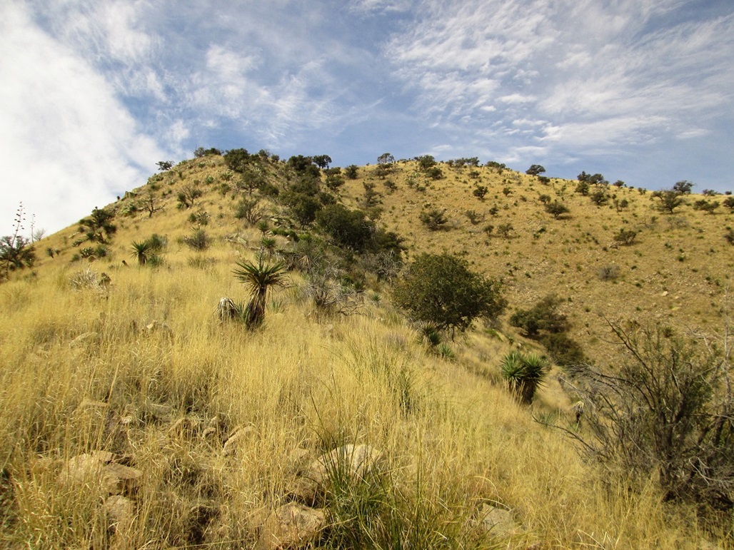
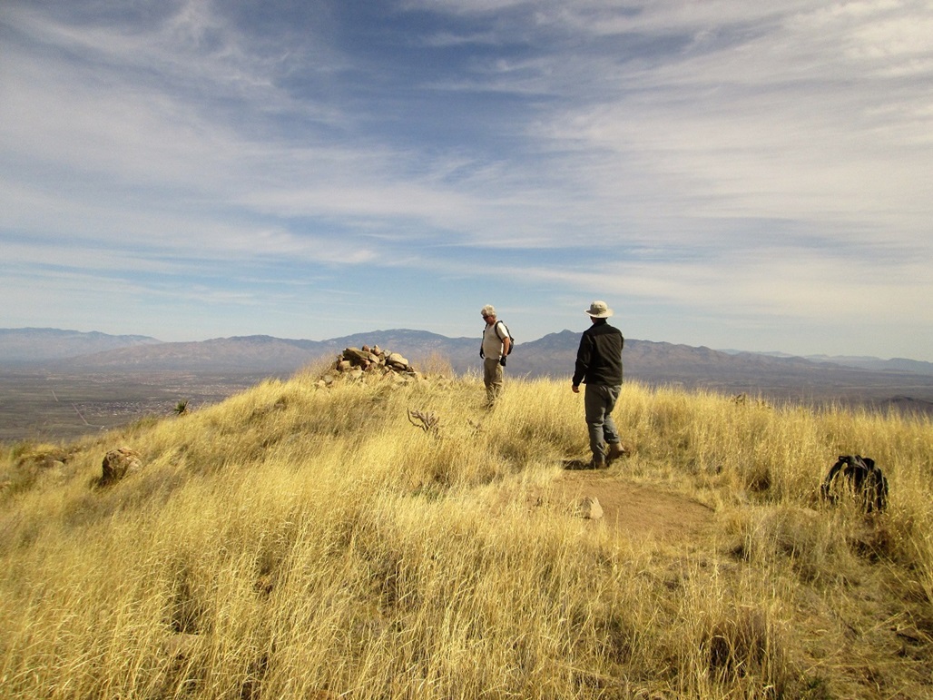
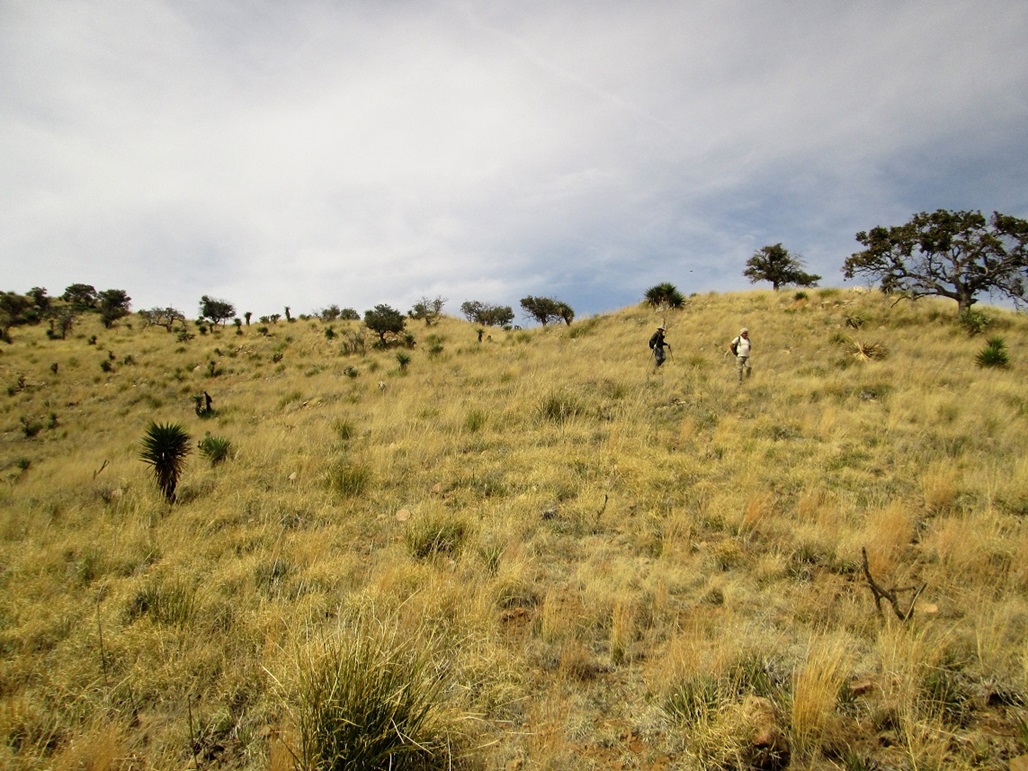
We walked the road up the ridge, then down and up to another bump, where we met a guy who had driven his truck up here. He was glassing deer, and had come up another road. We chatted a bit. He lives nearby and comes back here often. We then dropped down another slope, then started upwards again, following the track steeply uphill. From here, the track aims for a bump at elevation 5,102 feet, then ends. We got nearly to its end, breaking from the main track by following a lesser track down to a saddle below Point 5,420.
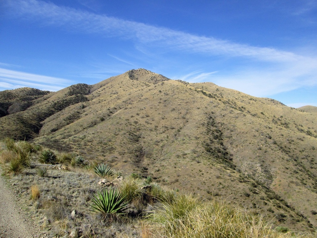
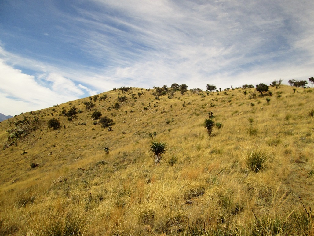
At this saddle, the tracks ended. We then marched uphill to Point 5,420, a gain of about 480 feet. The terrain was steep and grassy with rocks. It was warm, so we kept an eye out for snakes. Once at or near Point 5,420, we stopped for a break, now on the main northeast ridge of Mount Fagan, less than a mile away. Up here, we had deep grass and few trees. There was a faint path for most of this segment.
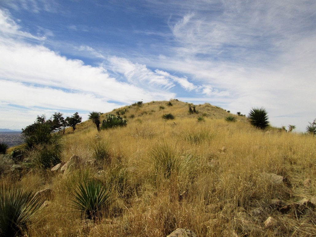
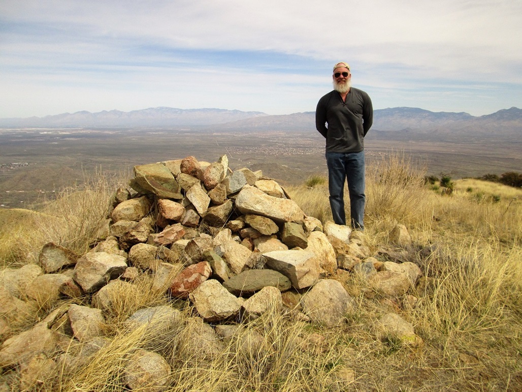
We then walked uphill, gaining about 700 feet, all the while aiming for what appeared to be the summit. Near the top, we could see the real summit up ahead, not far away. We followed paths and cross-country to the summit, arriving a little before 11 a.m.. There is a large pile of rocks up here, a local family comemmorating deceased family members with stone placques. The map says benchmark "Faggan" is up here but we could not locate it. It may be buried under the cairn and we had no desire to take it apart. The log book went back just to December, when the SAHC was up here with about 10 people. There were a couple more people who had climbed the peak since then.
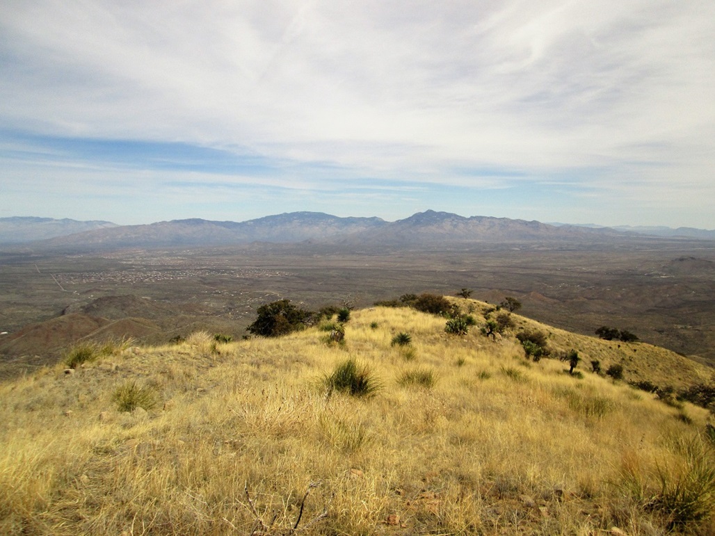
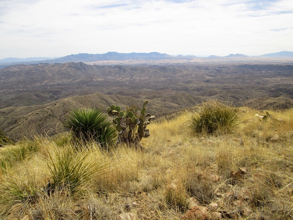
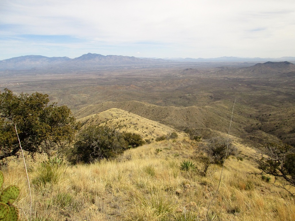
The views were excellent. Mount Wrightson was easily seen to the south, the Whetstone, Mustand and Huachuca Ranges to the east, Rincon and Mica to the north, the Sierrita, Baboquivari and Tucson mountains looking west. We could even make out Newman Peak and Picacho Peak, plus peaks south into Mexico. We stayed up top about 20 minutes. The breezes had picked up and the clouds moved in, although it was still warm and no threat of rain.
For the hike down, we followed the same route out, the exit taking about 90 minutes. We were back to Casterlin's vehicle a little before 1 p.m., the round trip hike taking just under 5 hours. Scott Peavy's GPS said we put on about 2,400 feet of total elevation gain, about 600 of that being drops and regains we had to do along the way. The hiking was not difficult but it was steep and often very rubbly. Scott Peavy's GPS put our distance at 5.4 miles round trip. It was a tiring hike, but enjoyable and easy to manage. Of course, having Scott Casterlin drive us in saved us many miles of tedious road-hiking otherwise.
The Prominence: The clean prominence of Mount Fagan is 989 feet, with 40-foot intervals. The peak's key saddle is just a few miles to the south, and on the map, it lies between the 5960-foot contours on the low end, and 6000-foot contours on the high end. However, the 5960-footers are closer together, suggesting the saddle's elevation is nearer 5,960 feet. Thus, this peak is considered an almost-certain 1,000-foot prominence peak. Update: This has been confirmed via LIDAR data.
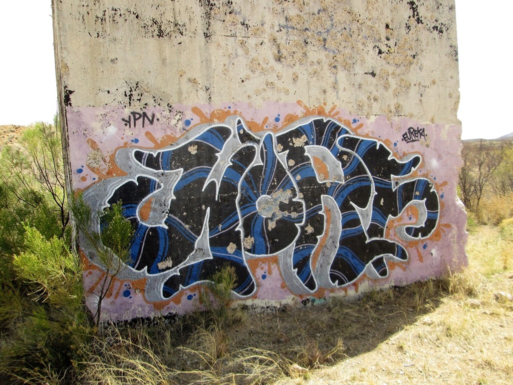
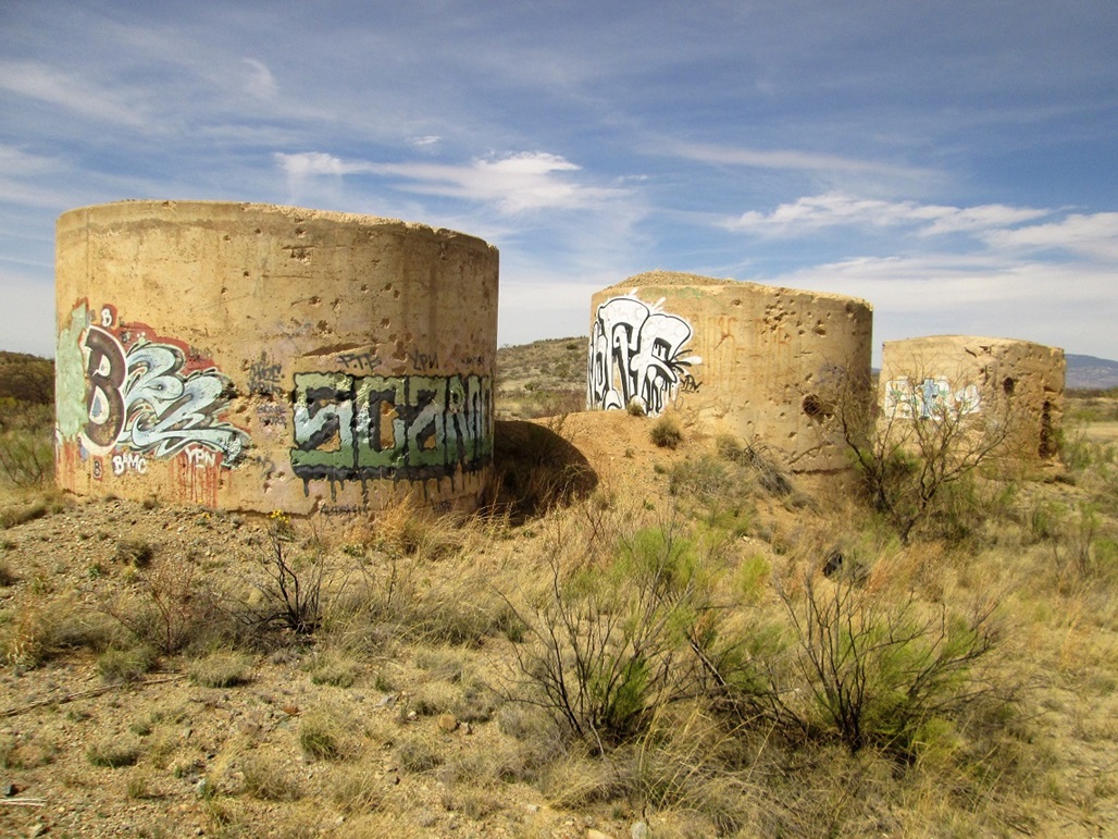
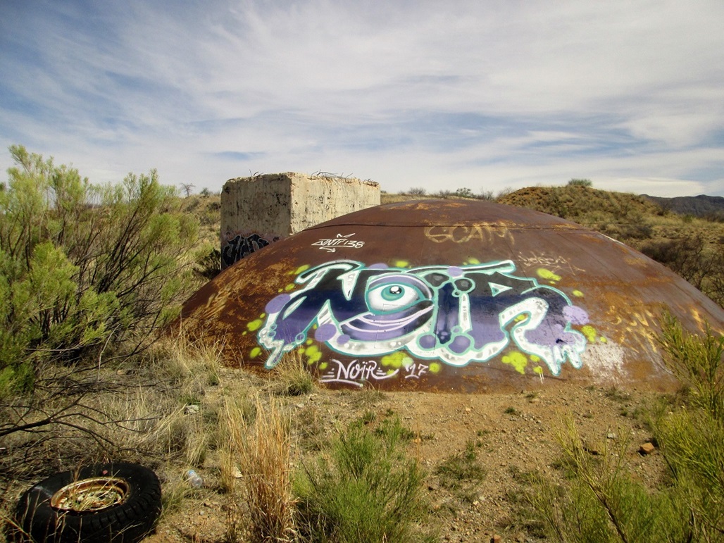
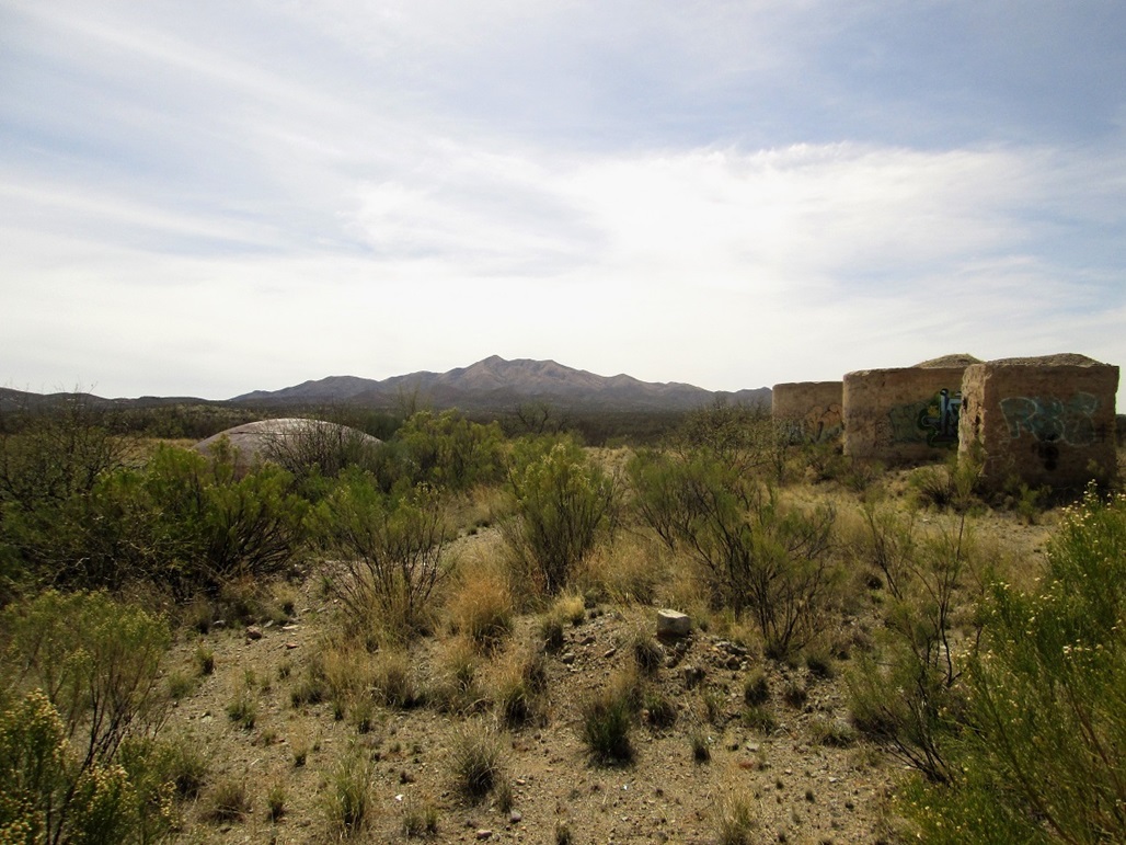
The day was still young, so as we drove out, Casterlin suggested we go visit one of the old Titan-II missile silo sites that were built in the Tucson area in the 1960s. It was close by and we were curious to see what was there... This is the site of one of nine old Titan-II missile silos placed here during the Cold War. One near Sahuarita has been developed into a museum with tours down into the silo, and is a worthy destination. Beth and I visited that one back in 2004. This site is along Old Sonoita Road, slightly east of highway AZ-83. The silo was filled in and a couple of buildings were filled with concrete. There's not much to see here except for modern grafitti, but it is interesting to contemplate that 50 years ago, this was a top-secret missile launch site. The area is owned by Pima County now and is closed to the public, but there is no one to guard access. There's not much to do other than walk amid the remaining "structures".
|


|