The Mountains of Arizona
www.surgent.net |
|
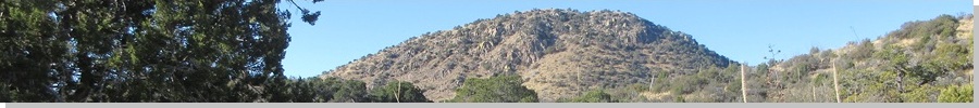
Peak 6163 • Peak 6224 These two peaks rise in the northern Santa Rita Mountains, north of where Madera Canyon Road cuts through the range. The peaks lie on a common ridge north of Castle Dome and south of Peak 6311 (Weigles Ridge Highpoint). I was here in December 2023, when I climbed Peak 6311. The state has been experiencing a February "heat wave", with highs in the 80s in the deserts and in the 70s at the higher elevations. Frankly, it feels wonderful. I just hope it doesn't continue to get warmer from here on out. The conditions would be perfect for a hike here. I left Bisbee about 7 a.m. and was in the area by 8:30, with a stop along the way for snacks. I followed the same route as I did before, parking at the dirt cleared area called the Box Canyon OHV on the forest-service map. I rolled in and parked, the only one here for now. It was sunny and very pleasant, temperatures in the mid-50s for now.
Date: February 2, 2025
• Elevation: 6,163 feet
• Prominence: 343 feet
• Distance: 9 miles (entire hike)
• Time: 4 hours, 15 minutes
• Gain: 1,730 feet (entire hike)
• Conditions: Sunny, no clouds, warm for February
Arizona
•
Main
•
PB
•
LoJ
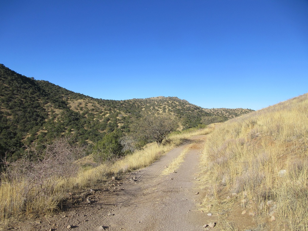
I got everything together and started walking at 8:45 a.m., heading north up FR-231. This road is actually a good road, but it has very nasty erosion ruts down low that would stop my Subaru. Bigger vehicles can handle it.
I hiked about a mile and a quarter, coming to an apex at a tiny private-property parcel. There is a clearing here used for target practice, but no one was here at the moment.
Forest Road 4053 starts here and drops about 80 feet, angling west and crossing a slope. This road would need a strong 4-wheel drive vehicle. It then bends north, where a side road branches north toward Peak 6311. I stayed left, on FR-4053.
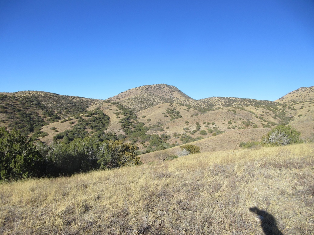
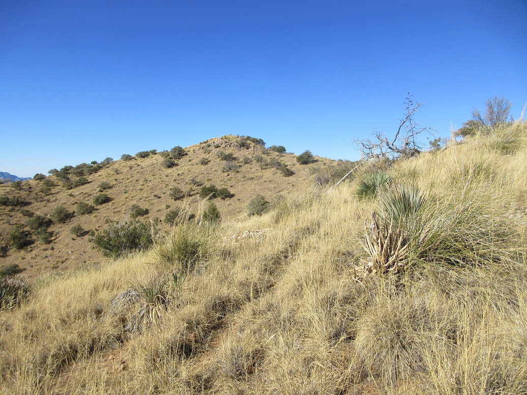
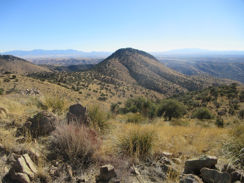
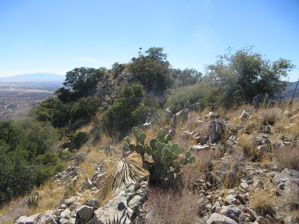
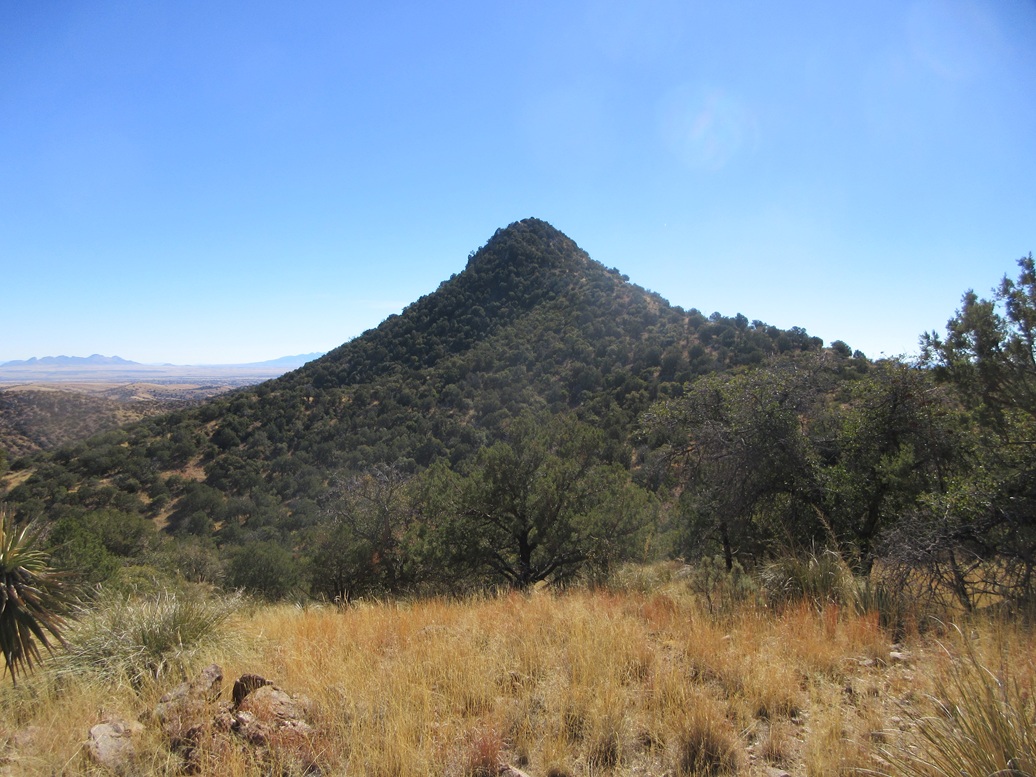
The road gained elevation, aiming west, parallelling Sycamore Canyon, which up this high, wasn't too deep. Peak 6224 rises to the south from where I stood, with a pointed profile from this angle, and Peak 6163 rose a mile to the west, more broad than tall. The road drops about 120 feet to a lowpoint, within the canyon.
I stayed on the road heading west, taking a left at a junction and following this spur steeply up to its end, now on the main range crest, north of Peak 6163. To here I had hiked over 3 miles. I scared up a group of white-tail deer hiking up this last road.
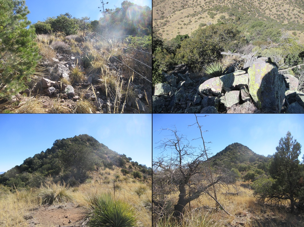
I left the road, now on a path that went south and dropped about fifty feet. This was a weak path, but it parallelled a fence line and was probably used by both people and animals. The path branched often, and I always went right, staying high.
I marched up a steep slope toward a hilltop ahead of me. Once at it, I rounded a bend and saw the peak in the near distance. Paths helped, and what wasn't a path, the grass and brush were low enough to keep things uncomplicated. I had to shimmy down one rock band, the only time I used hands for this peak.
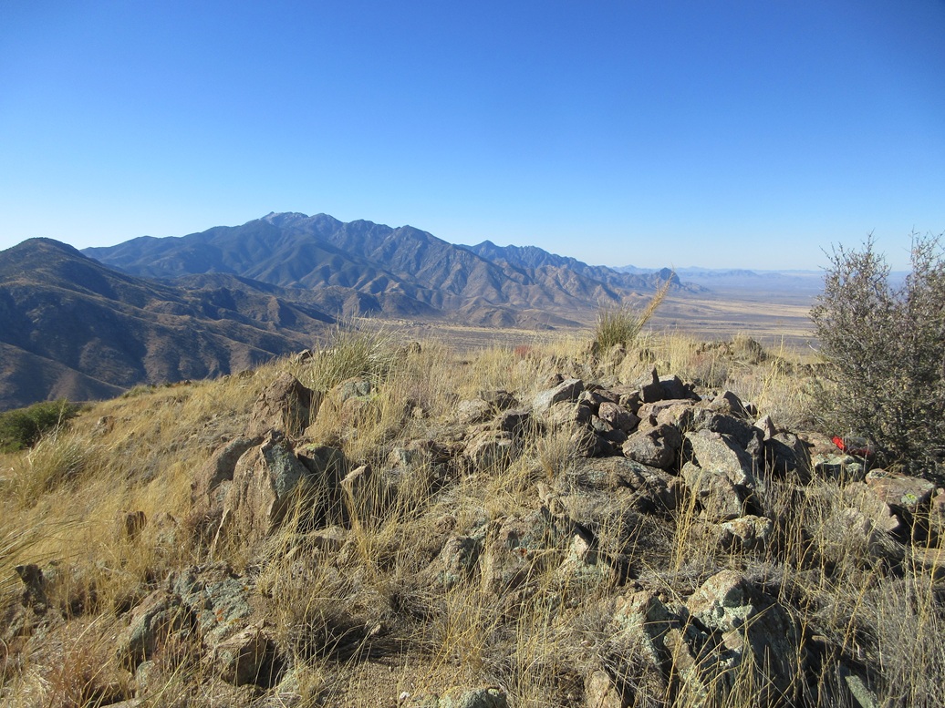
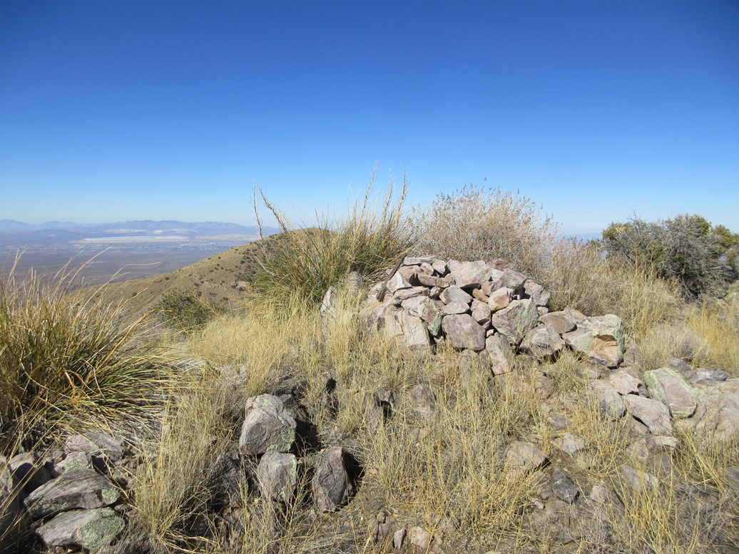
Soon, I was on top of Peak 6163. The summit is bare, with a pile of rocks and some low brush. Views were tremendous, the skies being bright blue. It had warmed into the 60s and felt wonderful.
I found a register jar just lying in the open. It was placed here in December and already had two groups sign in, the same group apparently. This "hiking club" was here in January, and thirteen people had signed in. That means I am likely the 14th visitor of this peak for 2025. I built a small cairn to enclose the jar.
It had taken me just about two hours to get here, covering 3.9 miles and gaining about 1,270 feet including the drops and regains. I spent about ten minutes on the peak, enjoying the views and the pleasant weather.
Elevation: 6,224 feet
• Prominence: 484 feet
PB
•
LoJ
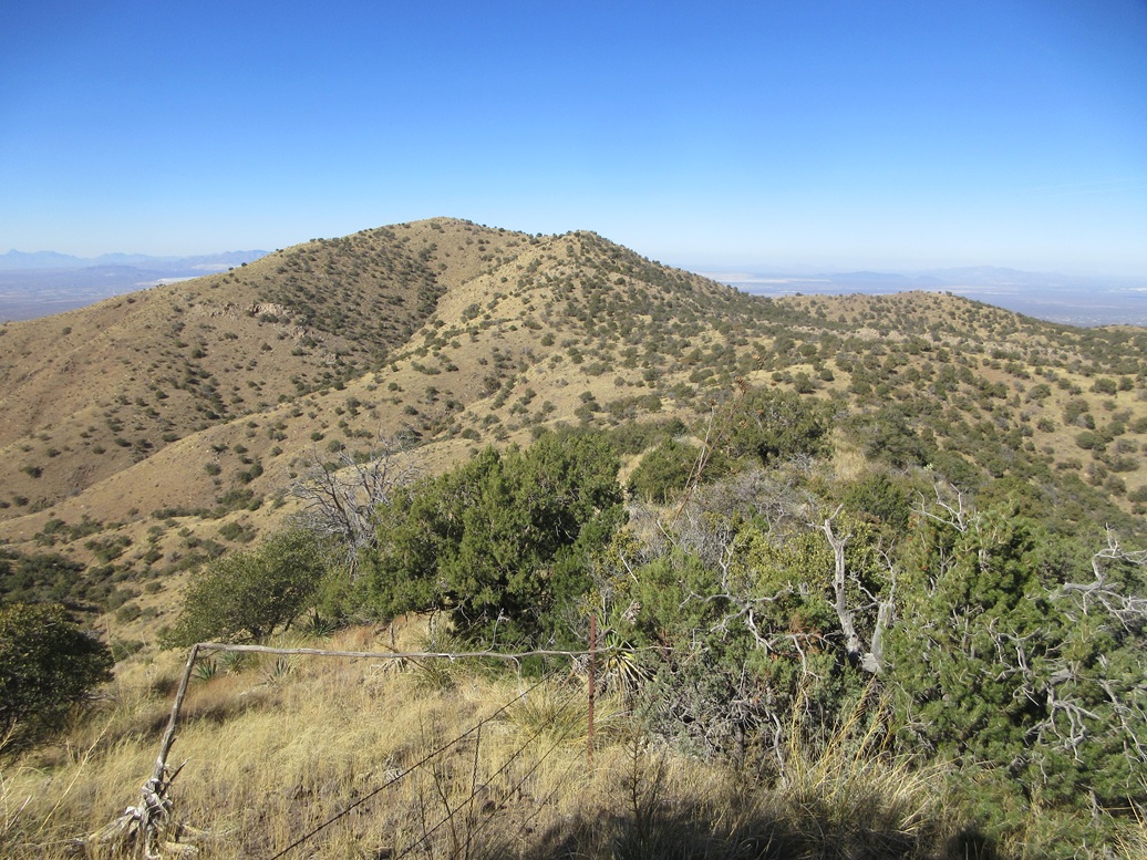
I descended off Peak 6163 aiming east, following the long gentle slopes downward to a lowpoint between the two peaks. Another fence line runs the entire length of this ridge, so it made sense to stick close to it. The trees and brush are spaced out so that navigation is easy, but there seemed to be a rough path about half the time near the fence.
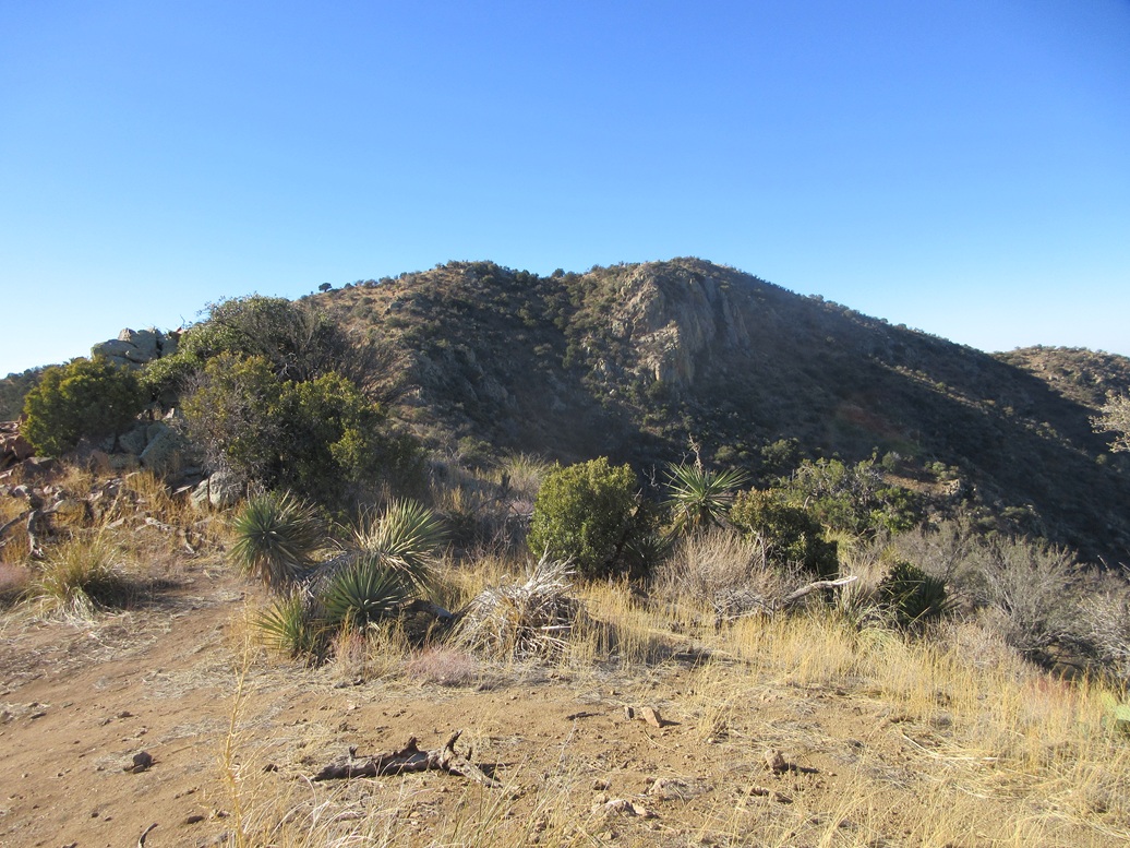
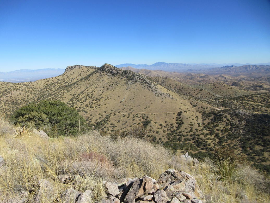
Peak 6224, from this angle, looked like a tough customer. It has a very sharp pointed profile, was covered in trees and brush at the top, and what wasn't covered, looked like possible cliffs. I was confident I could figure it out, but I was concerned I may be stopped short of the goal.
From the lowpoint, the slope starts upward gently, then moderately steep, mostly through open grass and light brush. I stayed near the fence, figuring if some fence guys could put this in on this terrain, I should be able to manage it too.
The slope got steep but was never treacherous. I was often forced away from the fence to find ways through the brush and branches. I was soon at the end of the fence, where it ends abutting the lowest of the rock bands.
Getting up the first band went well. The rocks here form into jumbled heaps, some solidly in place, some loose. I stepped carefully and used my hands to hoist up the first band, a gain of about eight feet. I walked up more rocky slope to the second rock band, this one also a gain of about eight feet.
I had more rocky slope to trudge up, then the third rock band, this one about my height. This took a little thinking to get up, mainly to ensure my feet were on rocks that would not kick loose. Once above this band, I was relieved to see that there were no more rock bands. This rock band segment was brief and encompassed about forty vertical feet in total.
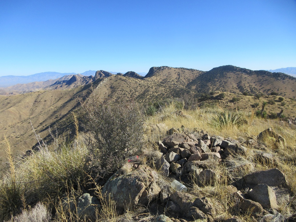
The natural route angled left and sidehilled briefly, then busted up to the summit ridge, the top about two hundred feet away, maybe twenty feet higher. I walked the ridge, then dropped to the side again to bypass some large rocks. I gained up a slope of talus, which fed me directly onto the summit rocks.
I was pleased to be successful, after being concerned I may not make it. This summit was also open, a register hidden in a crevise in the summit rock pile. The people who had signed in over at Peak 6163 did not come here. This register went back over twenty years and featured the more familiar peakbagger names. The register itself is in poor shape and needs a replacement.
The views from here were great, too. I spent about ten minutes relaxing, having a snack and drink and messing with the register. I could hear some engines on the roads below, and someone was shooting nearby. But up top, it was still and mostly very peaceful.
For the descent, I followed my exact route down (I had flagged a couple spots to be sure I stayed on route). Back at the lowpoint between the two peaks, I decided to bail early. The road was below me, just a quarter-mile away and about 250 feet down. I could cut off a mile and a half hour if I could get back to the road this way.
I followed an open ridge most of the way, then it dropped steeply into the canyon. It was messy and branchy for this short segment, but it went fast. I scampered up the opposite embankment to get myself back on the road. This bail route worked very well.
I now had 2.5 miles to hike back to my car. I immediately had to regain the 120 feet where the road had dropped originally. Once past that, I made good time, enjoying the day and not in any hurry. I was amused to see some snow still on the road where the road was shaded. Give how warm it's been, I did not expect to see any snow. The last big storm was about two weeks ago. There was some smaller activity the middle of last week.
I did not see anyone until I was almost back to my car. I talked to a couple in a truck inching their way uphill. Back at my car, I changed. In the other half of the big lot were about a half-dozen Polaris-type vehicles and their drivers all milling around, plus their dogs. It's odd that I never saw anyone up in the hills. It was a little past 1 p.m. when I arrived back, a four-hour and about 15-minute hike.
The drive out went fine. I stopped in Sierra Vista for groceries, then on home to Bisbee, arriving about 3 p.m.
I enjoyed these two peaks and combining them into one hike made sense, using the higher roads to gain easier access to both. The terrain was always easy to manage, even the rocks and brush high up on Peak 6224 wasn't that bad. With a strong vehicle, some of these roads can be driven to shorten the hiking distance.
|


|