The Mountains of Arizona
www.surgent.net |
|
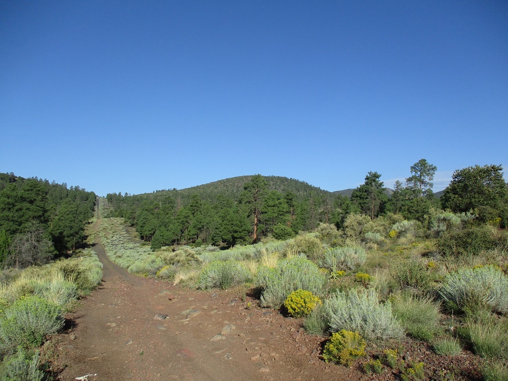
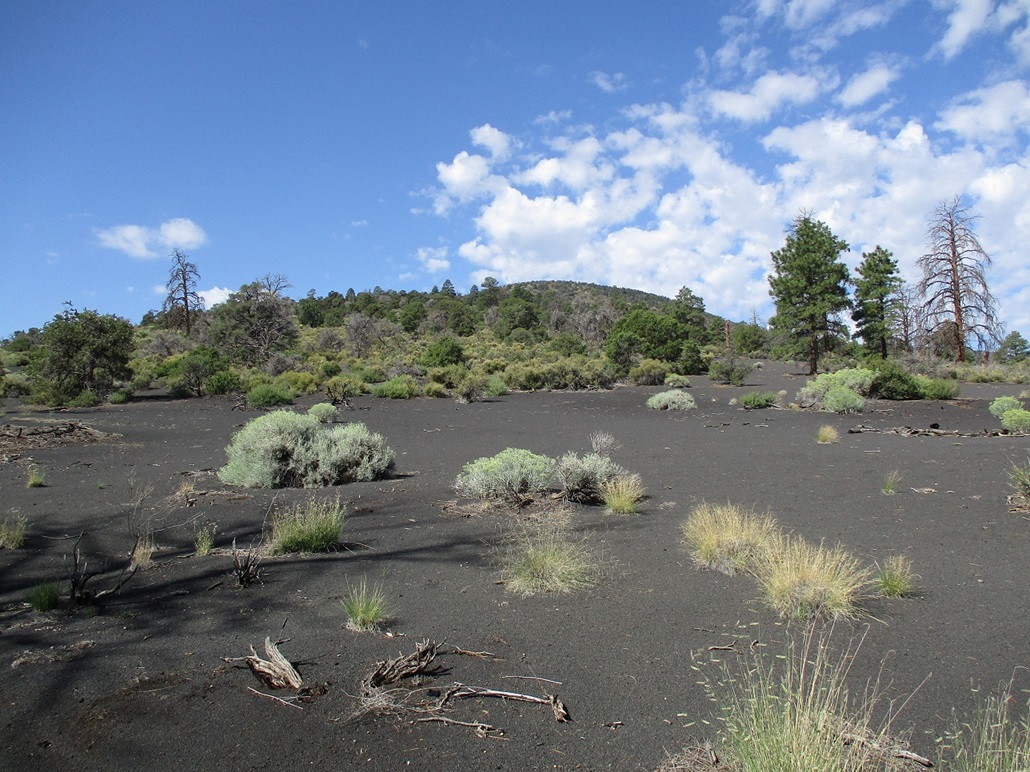
Saddle Crater • Peak 7093 • Peak 7338 I returned to Flagstaff for a day and a half of hiking up peaks then back down. I would be concentrating on the volcanic mounds on the east side of the city, in the Doney Park area and along Leupp Road. This was my first time back here since August 2021. I was on the road out of Tempe at 3:30 a.m. and in Flagstaff about 5:30. The sun was just starting to rise, and it was cool outside, in the high 50s. I stopped for drinks and snacks at a Circle K and then followed the Townsend-Winona Road eastbound to Leupp Road, following that about a dozen miles more east, placing me on the eastern fringe of the San Francisco Volcanic Field. In the past few years I had hiked and climbed virtually all the mounds out this way, but there remained a few I had yet to visit. First up was Saddle Crater, which rises east of Francis Crater and west of Merriam Crater and the Sheba Craters.
Date: September 9, 2023
• Elevation: 6,232 feet
• Prominence: 552 feet
• Distance: 2 miles
• Time: 50 minutes
• Gain: 600 feet
• Conditions: Sunny, clear, cool but warming
Arizona
•
Main
•
PB
•
LoJ
•
Interactive map
The sun was now rising, low on the eastern horizon. The glare was intense and I had to drive carefully. I drove until I was northwest of Saddle Crater's mound, then entered onto a main dirt track (with mailboxes along its side) heading mostly south. I stayed right at any intersections, then turned left (east) onto a track underneath power lines. I parked in a clearing surrounded by piñon. The land here is a checkerboard of State Trust and private sections. I was on a State Trust section, and the peak's summit is also in this same section.
I started walking, the time about 6:30 a.m., sunny and cool but not cold. I was still in shadow for now. I walked up a gentle grade to the lowpoint of a rise ahead of me, then turned left, starting up the steep west-facing slopes of the peak. This went well. The rocks were loose but not too bad, about usual for these peaks. I was soon on the crater rim.
I was high enough to see around me. There is a residence below the slope, hidden from me until I was up the slope. It was full of scattered junk. A dog barked non-stop, possibly at me. I could see a few other residences scattered about in the region.
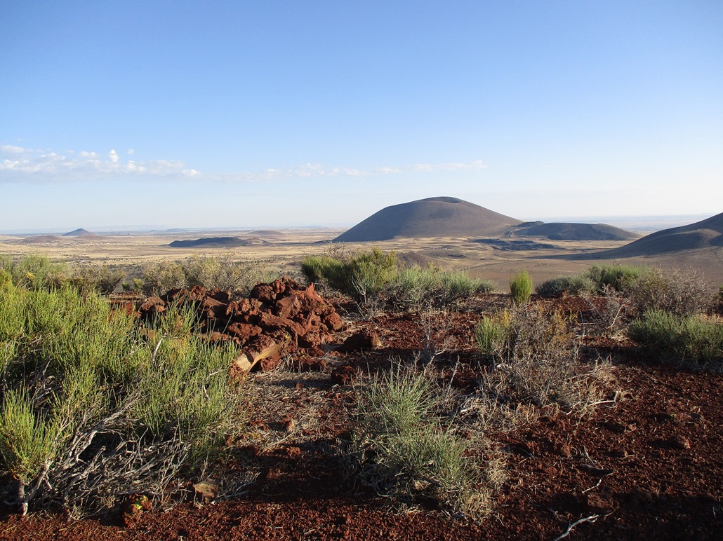
On the crater rim, I walked up the steep but easy slope to the top, the summit being mostly bare, with a spread-out rockpile and cairn. I could not find a register. I took a few images but the low sun in the east glared any images out that way. Even shots to the north or south got a lot of "side glare".
I didn't spend much time up here. I hiked down the same way, the only difference being I took a slightly different line down the slope below the rim which put me on a more direct line to my car. The round trip took less than an hour and it felt good to get this first peak done and in the books.
I exited back onto Leupp Road, now aiming for a pair of unnamed peaks.
Elevation: 7,093 feet
• Prominence: 313 feet
• Distance: 2.5 miles
• Time: 75 minutes
• Gain: 820 feet
• Conditions: Sunny, warmer
PB
•
LoJ
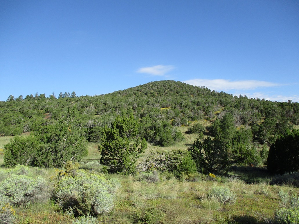
There are two peaks, Peak 7093 and Peak 7338, that lie deep in the wilderness off the main roads, whether from the north or south. Both lie south and southeast of the Cinder Hills, but the roads in here were an unknown quantity to me.
I was pretty sure I could get close enough to hike much of the roads to get to Peak 7039, even if I had to park farther out. But Peak 7338 was farther in and I was not confident I would be able to get to it.
By now, I was back on Coconino National Forest land. From Leupp Road, just south of a bend it makes going underneath a set of power lines, I found FR-244 and started following it. Within a half mile, I came to a section that was heavily eroded, forming a v-channel within the road that I did not want to chance traversing. So I stopped and got out and walked the road a little bit. Above me on an embankment I saw another road that appeared to be a bypass. I got back in my car, reversed out about 200 feet and found where this bypass started. It worked well, and once past the eroded section, the road was in much better shape.
The road goes north then bends a little east going under the power lines. A lesser track then branches off directly underneath the power lines. However, I stayed on FR-244 to a junction about a quarter mile ahead, then left, still on FR-244. This road parallels the power lines and is a very good road. About a mile later, this road came back to the power lines. This time, I stayed on the main road (still FR-244) under the powerlines another mile or so to a junction with a gas-line road (FR-9145). Peak 7093 rises about a mile and a half to the northwest.
I was able to get about a quarter mile in on this gas line road, parking in soft cinder gravel beside the road. A steep decline with bad ruts stopped me. A beefier vehicle would probably be fine but 4-wheel drive might be necessary.
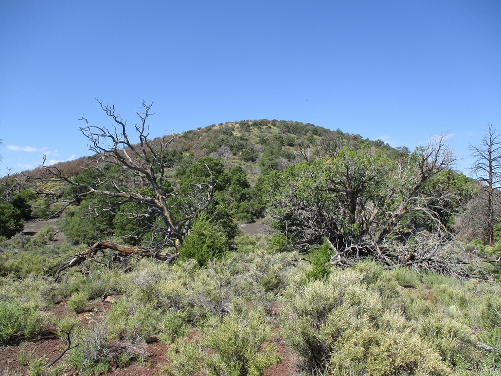
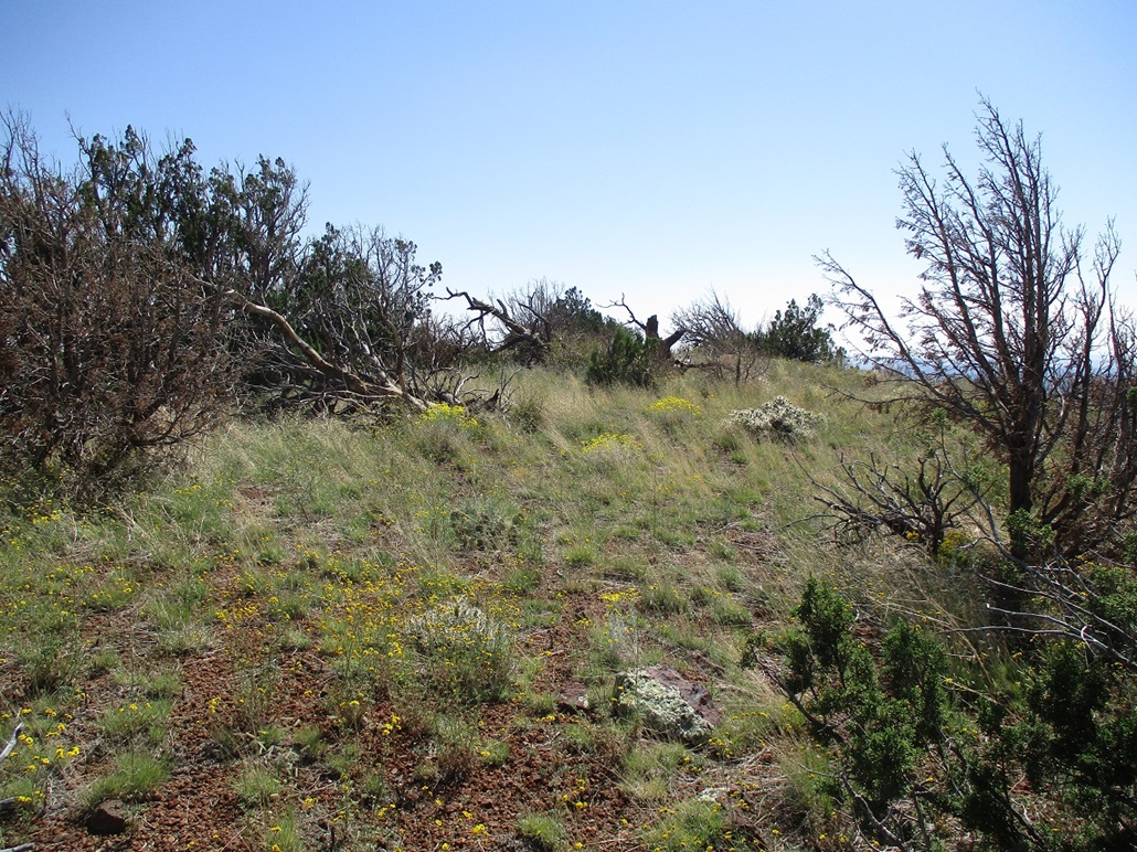
I walked this road down to a lowpoint, then a long uphill to where it tops out along a ridge up ahead. The map said there was another track that went north toward the top (not all the way). I found a couple tracks but they were scant. I picked one and followed it up as far as it seemed smart to do, then angled off it and up through mostly-open terrain, following the grade uphill. There were no big ponderosa here, mostly junipers, piñon, grasses and wildflowers. Toward the top, it got thicker and I had to search for ways through the tangles.
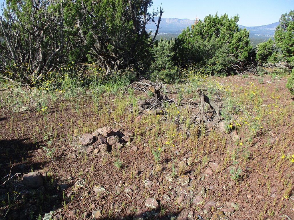
The top is flat and it took time to locate it. I found a meager cairn and a small regsiter buried in it, placed by the MacLeod-Lilley duo back in 2011. Not many people had signed in, just the usual addicts. The MacLeod-Lilley registers usually mention whether a "carin" was here or not, misspelling it. I don't know who does the actual writing. For whatever reason, I decided to correct the spelling.
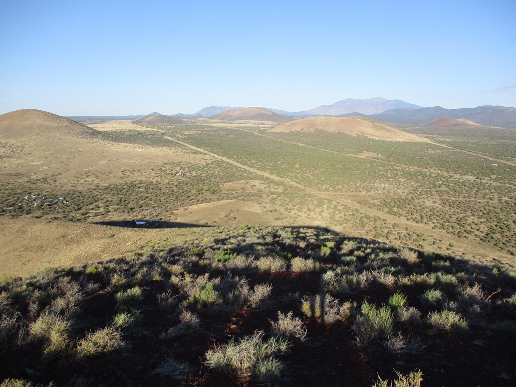
The top is wooded with limited views, although they can be found by walking around and looking for openings. To the north were the southern peaks of the Cinder Hills and to the northeast was Peak 7338. I stopped briefly in a shady spot for a drink and to rest, then started down, following the same general path back to the tracks and the main road. I was back to my car by roughly 8:45 a.m., a round trip hike of about an hour and fifteen minutes.
I was happy to be successful and happy that I was able to drive in as far as I did. Now I set my sights on Peak 7338.
Elevation: 7,338 feet
• Prominence: 418 feet
• Distance: 2.4 miles
• Time: 90 minutes
• Gain: 980 feet
• Conditions: Sunny and very warm
PB
•
LoJ
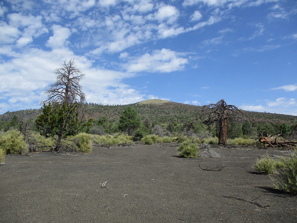
I drove back to FR-244 and then followed a road bending northeast, this being FR-244B. Peak 7338 was up ahead, and I planned to drive to where the road comes to a saddle at the east base of the peak, where FR-244A bends left and heads north toward the Sunset Crater-Wupatki Road. The road was in great shape and I was able to get to this point without difficulty. I parked off the road underneath a big tree.
I started hiking immediately, already dressed and ready from my pevious hike. It was warm now, into the low 80s, with a bright sun and no clouds above. The route is just the long east ridge all the way up. The lower two-thirds is mostly black volcanic cinder-sand with low scrub and scattered piñon and juniper. There was always a lane but I had to zig and zag to find them. The sand preserved my bootprints well and I was essentially marking my path as I ascended.
The slope then levels briefly and the last third of the hike was up a slightly-steeper grade, now with more grasses and golf-ball sized pumice rocks that did not hold together very well. Otherwise, it was easy uphill trudging.
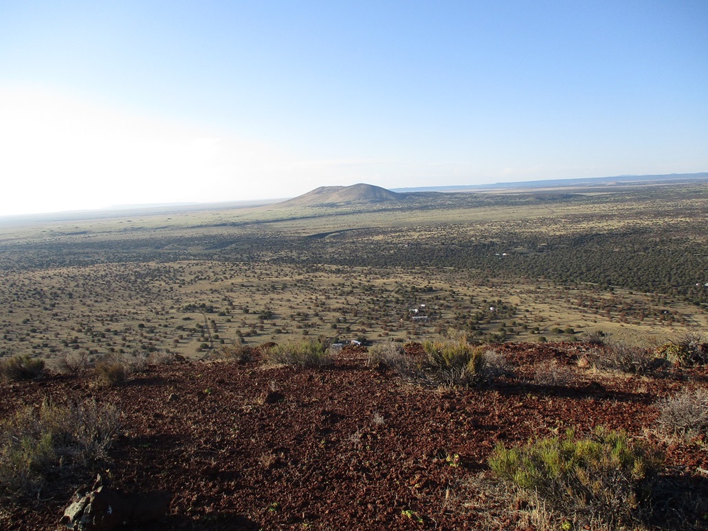
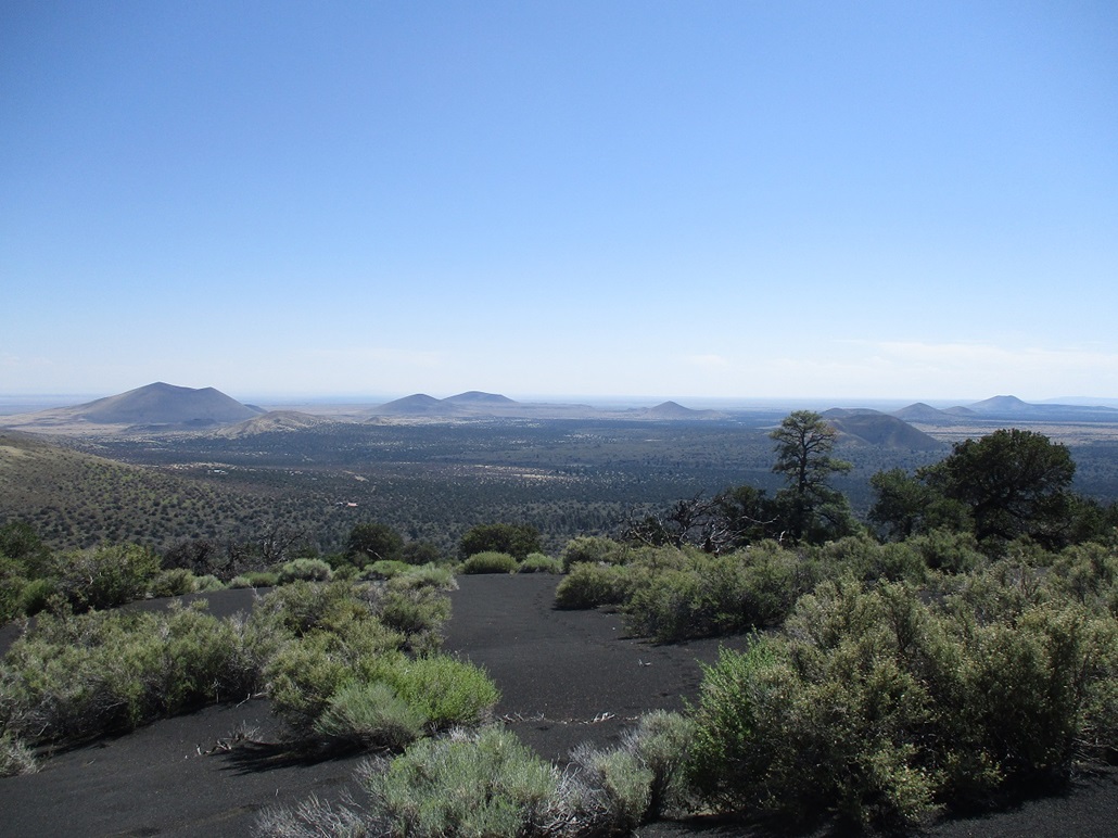
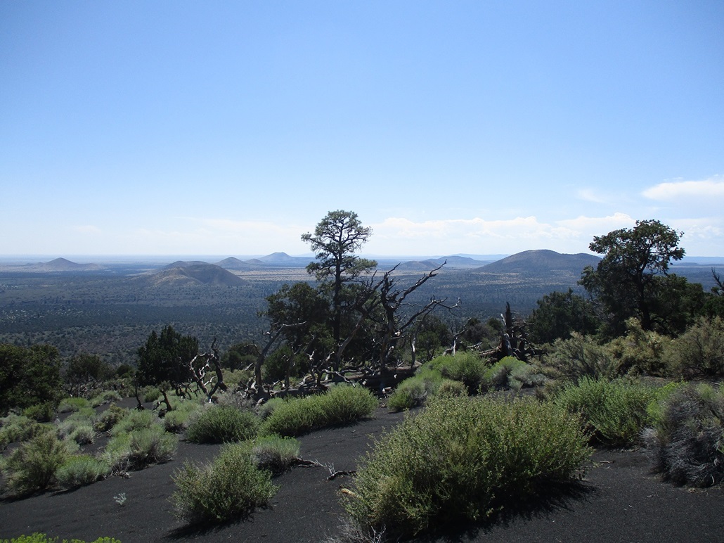
I got to the top and walked the long ridge about another 200 feet until I was certain there was no higher land. I walked back and topped out on the highpoint, which agrees well with where the map shows the spot elevation. There was nothing here to signify past visitors, no register nor cairn, and no convenient sitting logs or rocks. The views were quite good, the sun high enough now not to glare everything out.
I looked around for a few minutes and snapped some photos. Then I started down, following my route generally at first, then when I got back to that cinder sand, I followed my own bootprints almost the entire way down. This had been a hefty hike with almost exactly a thousand feet of elevation gain in a little over a mile. I was very happy to hike this peak as I had no confidence earlier that I would even get close to it.
Storms were starting to build above the San Francisco Peaks while above me it was still clear and warm. It was pushing 11 a.m. and I had plans for one more peak in the area, Peak 6973 in Doney Park. However, when I got there, the storms were picking up power and a lightning bolt nearby stopped me on the spot.
I had a successful morning with three more cinder mounds to my credit. I still had more peaks to tag, but given the warmth and the storms, I chose to take a two-hour break at a Starbucks in town. The story then resumes here.
|


|