The Mountains of Arizona
• www.surgent.net
|
| Merriam Crater |
• San Francisco Volcanic Field • Coconino County |
|
Date: September 11, 2010
• Elevation: 6,813 feet
• Prominence: 1,163 feet
• Distance: 4 miles
• Time: 1 hour and 50 minutes
• Gain: 1,450 feet
• Conditions: Clear with breezes
Arizona
•
Main
•
AZ P1K
•
PB
•
LoJ
•
Interactive map
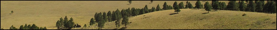
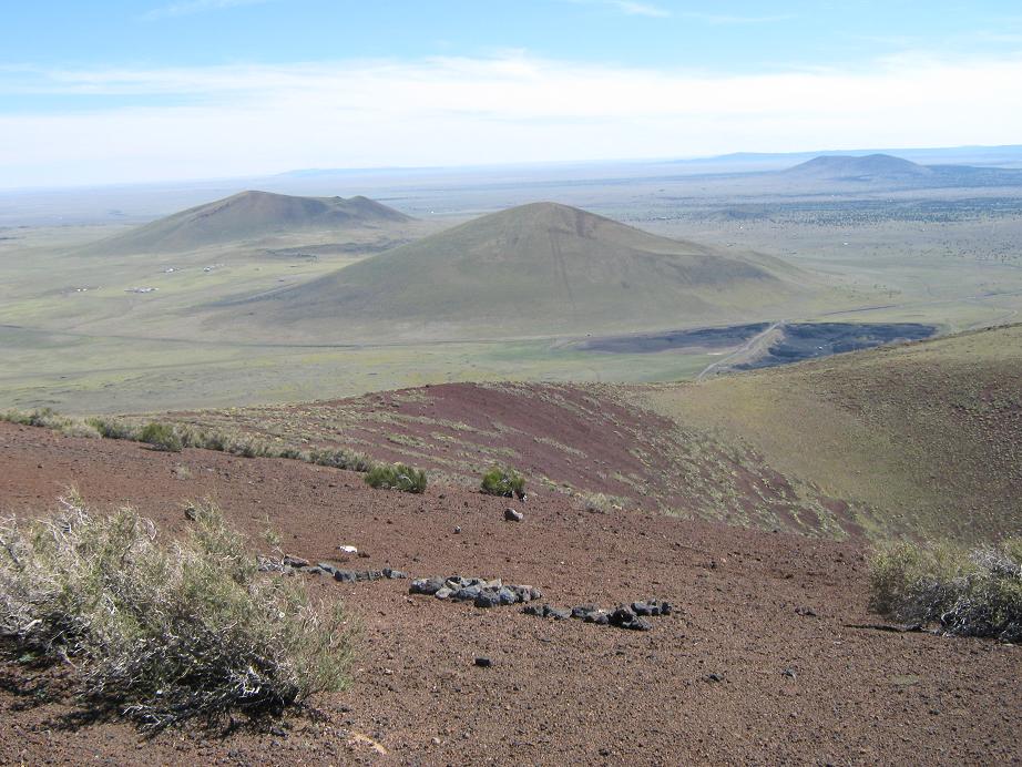
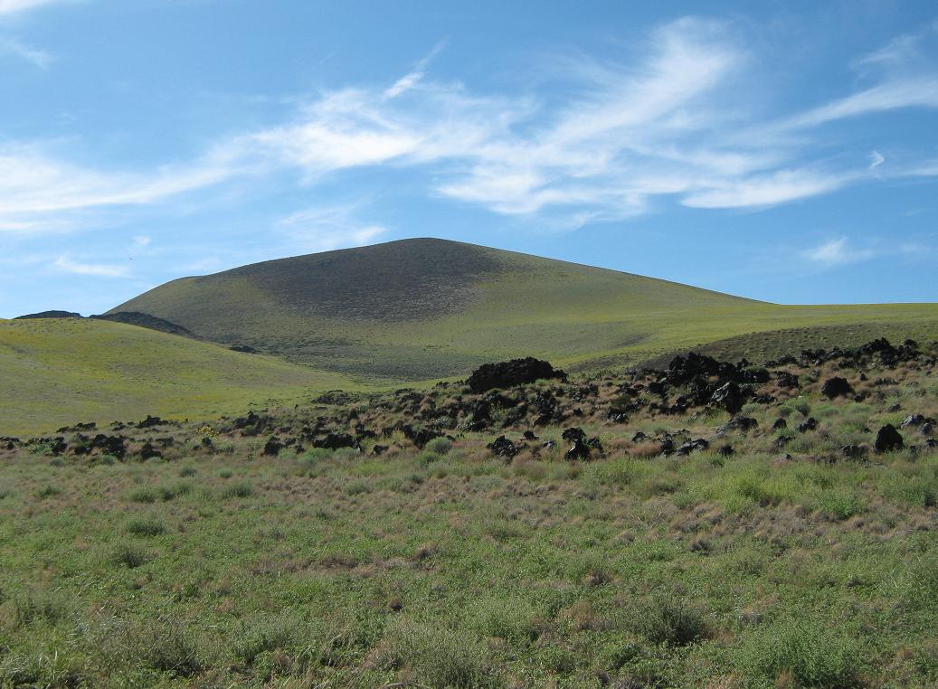
The eastern San Francisco Volcanic Field features a number of cinder cones, with Merriam Crater being the most prominent of the immediate batch. These hills were formed by ancient lava plumes that erupted from vents in the ground, the lava cooling into tiny pumice pellets, and collecting in a symmetric pile surrounding the vent. The slopes all lie at their angle of repose, the hills having smooth, uniform appearance and little vegetation, even after all the centuries since these hills were formed.
The San Francisco Volcanic Field stretches about 60 miles west to east, the peaks and hills on the east side being the youngest. Sunset Crater is the youngest of them all, about 900 years old. From afar, they look like regular hills. Each one has a depression within it, some well over a hundred feet deep.
Merriam Crater lies at the east edge of the Volcanic Field. The land gives way to high desert from here heading east, the Navajo Nation boundary about a mile away. In fact, the driving route partly crosses into and out of the Navajo Nation. There is a steep road to the summit of Merriam Crater, which is maintained and used by the hang-gliding clubs in the state. The hill itself lies within one square mile section of BLM land. The surrounding lands are State Trust and some private sections. Access does not appear to be restricted.
I "discovered" Merriam Crater while researching places to camp and hike in this part of Arizona. The Grand Falls are the main attraction out here, roughly 40 miles east-northeast of Flagstaff near the Navajo community of Leupp (pronounced "loop"). The Grand Falls is a thousand-foot wide series of ledges within the Little Colorado River. If it has been raining in the high country, the flow of the Grand Falls is tremendous, a muddy Niagara Falls. The problem is, no one knows for sure when flows will be like this. You have to get lucky and time it just right.
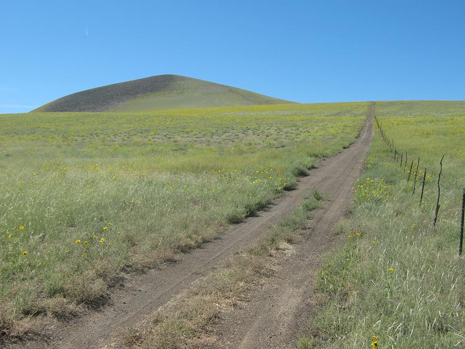
We left home on Friday evening, arriving in Flagstaff where we stayed at a hotel. Unfortunately, we were kept up by a barking dog until 3 a.m. The next morning, we got an early start. We followed Interstate-40 for twelve miles to the Cosnino exit (#207), then north on Cosnino Road through the town of Cosnino, catching Thompson-Winona Road after two miles. We went east three miles on T-W road, then left onto Leupp Road. We followed this road a dozen miles through cinder hills and low pinon-juniper woodlands, losing elevation (and the trees) until coming upon a pass with Merriam Crater on our left, and North Sheba Mountain on our right.
There is a not-so-obvious turn-off from this road that leads to Merriam Crater, and I drove past it, and within moments had passed into the Navajo Nation. I drove about a mile, then went north on Indian Route 70 north another mile to a small church, then hard-left onto a smaller road back onto state land for yet another mile to that first road I had missed. This road went north for one mile also, skirting Merriam Crater's slopes on its east. The road is rough in spots as it surmounts a couple of lava ridges. I parked at a junction, where a side road goes west up to the summit of Merriam Crater. We arrived at 12:30 p.m. in pleasant conditions, bone-dry with not a cloud from horizon to horizon. I set her up with her camp chair and sodas and she was good to go. I got my shoes and hiking clothes on, and within minutes started up the road.
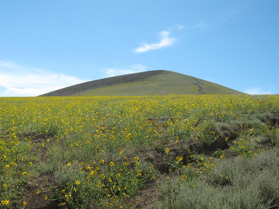
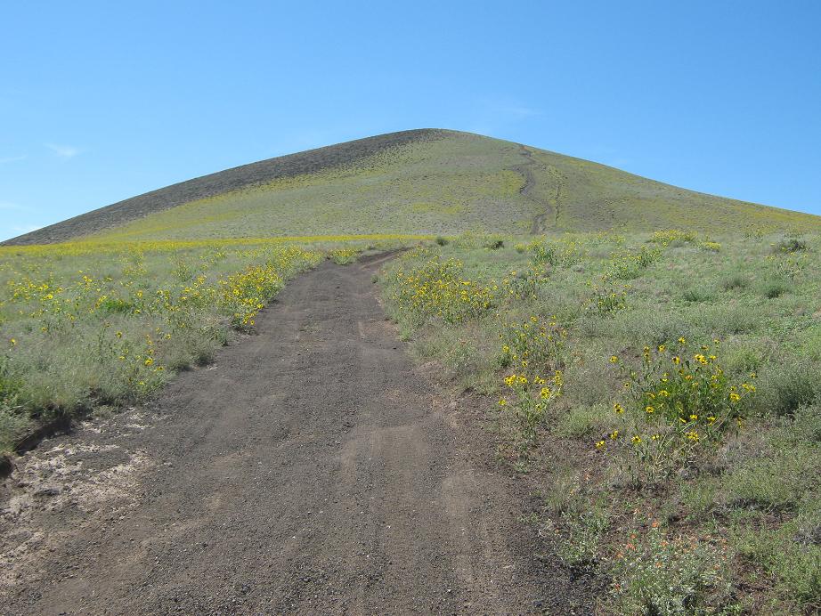
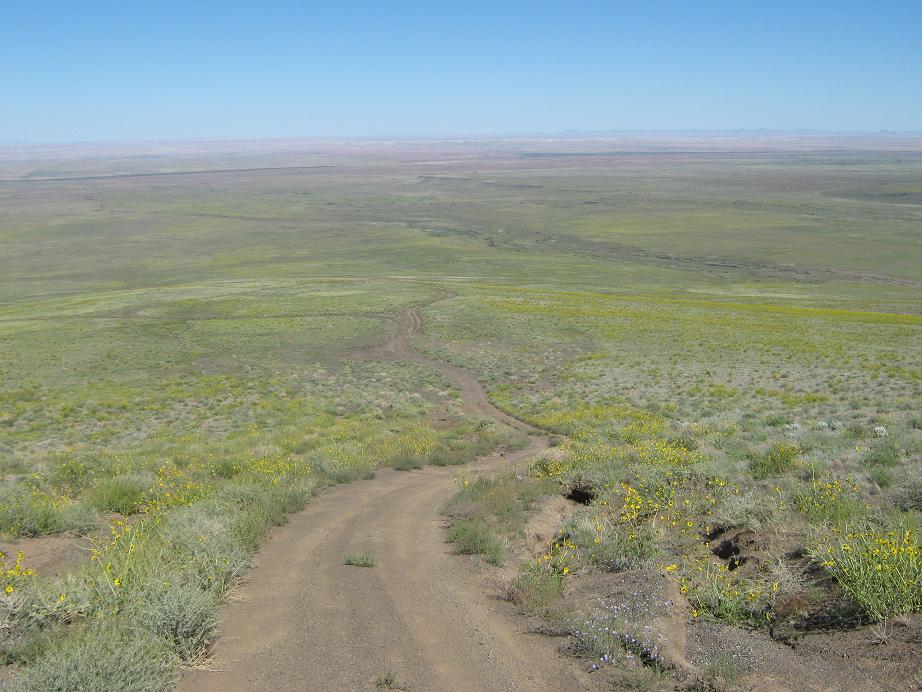
There's not much to describe the route. I just hiked the road two miles to the top, a gain of 1,450 feet. The initial segment is steep, paralleling a fence, then it gains onto a flat buttress, the fields covered in beautiful yellow tickseed flowers. For about a half mile, the road is mostly level, or gains with very lenient grades. About half-way up the road splits (the split is not shown on the map). The hang glider people call this the First Bench and use it as one jump-off point. I noted that to here the road was fairly solid and never too steep, a 10% gradient at worst and only for short stretches, so that most stock 4-wheel drive vehicles could come to this point without much trouble. I rested here for a few minutes. The weather was spectacular, a fall-like day after a long summer of brutal heat. There was a soft breeze, and I had million-mile views to the north, east and south.
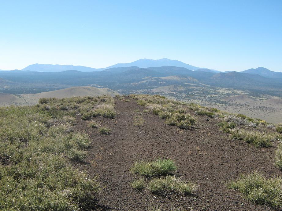
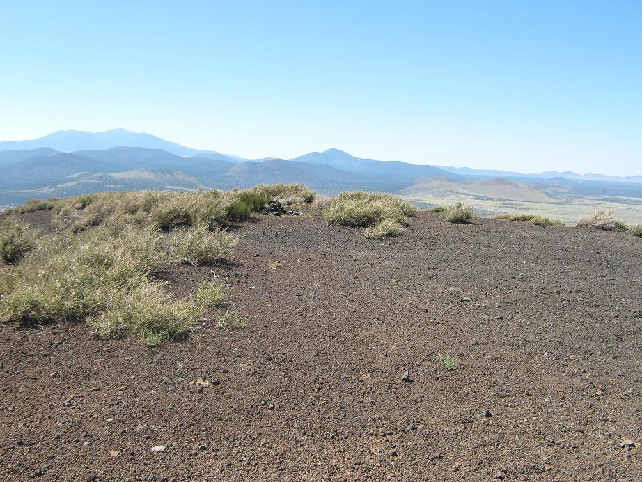
The remainder of the hike is up much steeper slope, about a 20-25% gradient. The rubbly cinder made the tread slippery, so I walked on the exposed "bedrock" (agglutinate) whenever possible. This section gained about 800 feet in less than a mile. I arrived on the summit an hour after starting. The top is bare, and the summit cairn is set toward the west end of the hump. I walked past it down the other side for photos of the San Francisco Peaks. I also inspected the actual crater, but did not hike its perimeter. I wondered if someone were to descend into the actual crater (about 75 feet deep), if they could get out, due to the loose rubbly slopes that surround the crater. I chose not to find out.
To the south were the two Sheba Peaks. West were the many hills and peaks of the San Francisco Peaks. Looking east, there were a few scattered homesteads on the greener state lands, then the starker, more pinkish high-deserts of the Navajo Nation, with interesting volcanic plugs and mesas way off to the east. The hike had been quick and simple, and the views were astounding. I stayed up top for 10 minutes before starting down.
The hike down went well. The steep upper portion was slippery, but I am happy to report I didn't land on my arse at all. I felt like I was skiing on ball-bearings. Once I got to the lower slopes near the First Bench, the going was much friendlier. The hike out took about 30 minutes, and I was back to the truck in less than two hours. βð had conked out in the cab, so I woke her and got myself dressed for the drive out. The area was lovely, but it was getting buggy, and we wanted to get moving. We exited south along the road, coming out to the paved Leupp Road directly without following all the turns we took coming in through the Navajo lands.
It was 3 p.m. when we were back on pavement, and we decided to skip Grand Falls. Instead, we drove east into Leupp, just to see what it looked like. Leupp appears to be a town of recent creation, most buildings being pre-fab and laid out on a grid. There are governmental administrative buildings here, plus a boarding school that serves the surrounding region. About a thousand people live here. It's not a place most people would visit, and it does not lie on any major highways to and from other big cities.
From Leupp, we followed highway AZ-99 toward Interstate-40 and stayed the night in Winslow. We celebrated with Subway sandwiches and an early night. We stayed in Winslow on New Years Eve 2005/New Years 2006, so this was our second time back. The city plays up its "fame" being featured in the Eagles' song Take It Easy. The city even has such a corner, with commemorative signs, none of which point out the obvious, that "corner" and "Arizona" barely rhyme. It's something to do when in town, but it takes all of five minutes. But people do come here just for this one attraction, even from overseas.
The next day, we drove home, taking the scenic route through Payson.
|


|