The Mountains of Arizona
www.surgent.net |
|
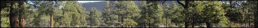
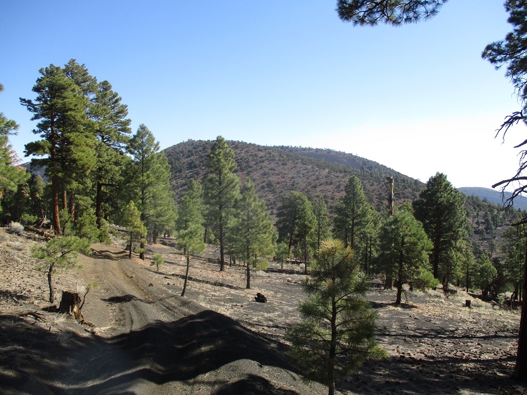
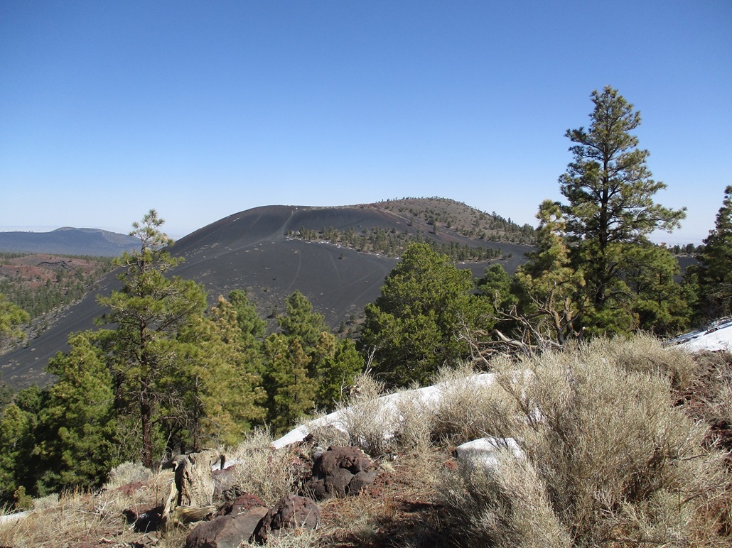
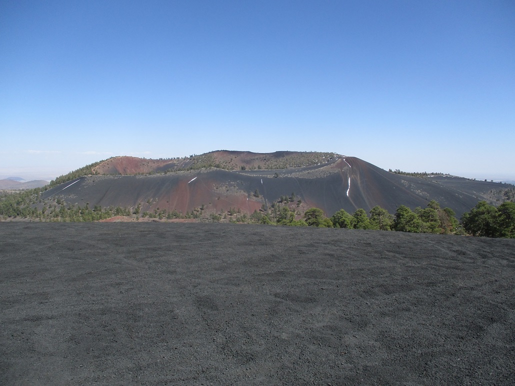
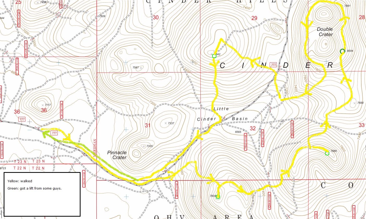
Peak 7804 • Peak 7866 The Cinder Hills are a collection of hilly mounds covered over in trillions (quintillions?) of black volcanic cinder pebbles, ranging in size from a beebee to a golf ball, all lying generally east of Sunset Crater, northeast of Flagstaff. I was here in October with Matthias, and again in February when I hiked two peaks north of Sunset Crater. I came back today to hopefully tag four summits all lying close to one another, all in one long loop hike. In October, Matthias and I planned to hike Double Crater's summit, the highest and most prominent of the hills not named Sunset Crater, which has been closed to hikers since 1973. But we were shut out when we discovered the road in toward the peak was closed and gated off the main road. Not knowing an alternative way in, we bailed and hiked something else. I came back by myself today, almost exactly 6 months later, to visit Double Crater and three of its subsidiaries, Peaks 7804, 7866 and 7842. The four peaks lie roughly in a square, surrounding the Little Cinder Basin, which is a popular off-road vehicle recreational site, as are the hills themselves. With all the dirtbikes, off-roaders and big beefy pickups, this would arguably be the loudest hike I'd ever done. However, for the most part we were able to avoid one another almost the whole day. I heard them all afternoon, but only saw them occasionally.
Date: April 3, 2021
• Elevation: 7,804 feet
• Prominence: 524 feet
• Distance: 9.5 miles total hike
• Time: 7 hours & 30 minutes total hike
• Gain: 1,114 feet gain, 564 feet loss
• Conditions: Sunny and warm, some clouds
Arizona
•
Main
•
PB
•
LoJ
•
Interactive map
I left Payson at 5:20 a.m., arriving into Flagstaff a little after 7, the drive not too exciting except when I had to brake hard to avoid a small group of elk racing across the highway back on Lake Mary Road. I got snacks at a Circle-K, then drove northbound on AZ-89, looking for Coconino Forest Road 414 (according to the map) or 776 (according to the signs). This road leads a couple miles east in toward the Cinder Hills OHV Recreational Area. I followed FR-776 about two miles, then turned onto FR-777 for another mile and a half.
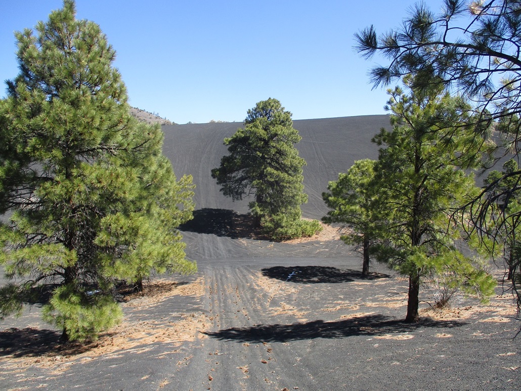
The roads are gravelled but bumpy and pitted due to the traffic they see from the massive RVs pulling toy-haulers. I drove to where the "good" portion of FR-777 ends, and parked in a cleared area. Already, there were dozens of campers, RVs, trucks, ATVs, you name it, scattered everywhere. The place was jam-packed, but quiet for the time being. I got situated and locked up the car, starting my hike at 7:38 a.m..
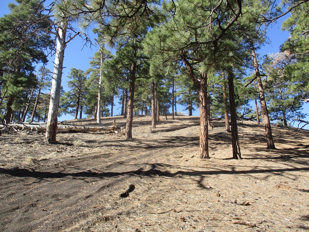
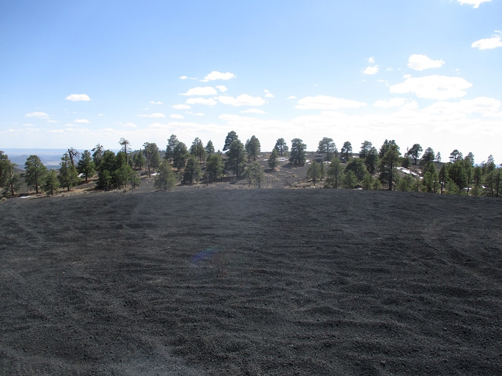
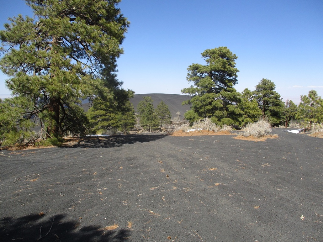
The day was already pleasantly mild, temperatures in the high 40s but clear and calm. I intended to follow FR-777 eastward in toward the hills about two miles away, but by now, the roads were just tracks in the cinder-gravel plains, with about three equally-good looking options, so I picked one and started walking. I could already see Peak 7804, my first objective, up ahead, so I could always hike to it by sight. I eventually merged with the main FR-777. The tread was loose cinder gravel the whole way. That stuff does not hold together at all. When it's piled up, it's like walking on a pile of dry dog food. I'd look for places where tires had smooshed the gravel down, where footing should be more solid. And this was on flat terrain. It was already tiring. So far, though, it was just me.
The road bends northeast and starts uphill, a 200-foot gain to achieve a saddle north of Peak 7804. I was almost at its apex when I heard a loud engine whine coming up from behind me. I bailed off the road to let this guy pass, and he did, going about 50 miles per hour up this road. Since I was up on the hillside, I just kept trudging uphill through low grass until I found a track, which I followed steeply uphill. I was in the trees again, but they were spaced out and I could see my way easily. There were a few scattered snow patches too, nothing too big, but fun to step in whenever I had the chance.
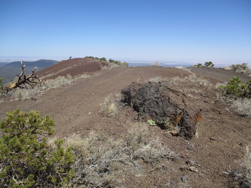
I was about two-thirds the way up when I heard a shrill whine and loud norteño music above me. Then it appeared, the same off-roader who had roared past me fifteen minutes ago. He came barrelling down the track I was on, but I had already got myself well off the road. He gave me a quick wave as he drove downhill. The off-roaders were starting to get active. As I ascended, I could hear more of them down below. I kept going upward, trending a little right toward the west of the two small hills that line Peak 7804's crater. The western one is the presumed highest point.
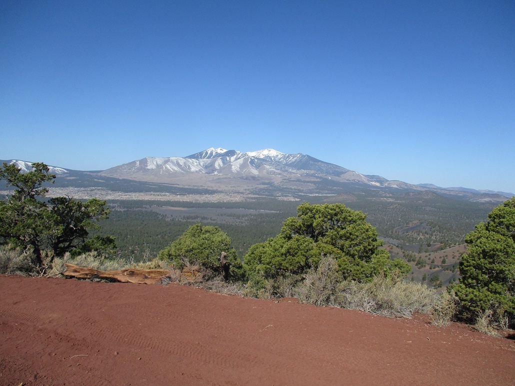
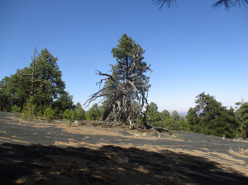
I arrived on top about an hour after leaving my car. To here I had hiked roughly 3 miles with slightly under 1,100 feet of gain. The top was open and unexciting, a track forming a loop around a patch of "natural" ground, the highpoint itself. I had a wonderful view of Humphreys Peak, but I did not stick around too long. I walked down about 60 feet, then up the eastern of the two hills. This hill was more brushy and rocky, with the blobby agglutinate boulders everywhere. I tagged anything that looked like a highpoint because I sensed this hill may be as high as the western one. I continued by descending off this hill to the south, scrambling down a couple rock slopes until I was on another track.
Now on a track, I followed it down hill, losing about 500 feet, to place me just south of the saddle that connects Peak 7804 and 7866, my next objective. I took a short break in the shade of a tree before ascending Peak 7866.
Elevation: 7,866 feet
• Prominence: 406 feet
• Gain: 626 feet gain, 416 feet loss
• Conditions: No change
PB
•
LoJ
I ascended Peak 7866 by following a track that runs up its west slopes on a northeast tack. This road appears on the forest-service topographic map but is not numbered. It was steep and loose and I ended up hiking alongside the road in the low brush and trees to get past the rubbliest parts of the road, that combined with the steepness, made uphill walking almost impossible in some segments.
I pushed upward a few hundred feet until the road bent east and flattened, now circling the summit crater clockwise, the highpoint on the east ridge of the crater. The road ended at a loop, but hiking beyond it was easy, as the brush was low and there was nothing to impede me.
I found myself on another track, this one coming up from the north, and I followed it to a big downed tree. Past the tree, I followed a narrower path accessible to dirtbikes only, and was soon at the top, which was broad and indistinct. I found a cairn and register. I was the first person to sign in in over a year, the register showing about one or two groups or individuals per year. I surmise that the off-roaders simply don't come here since the downed trees (there were a few) blocked any semblance of a road.
I took a break, then started down. I hiked around to the north tip of the peak and looked for a way down its north slopes. There were a few tracks, but there was also abundant snow here still. I found a track that was partially open, and carefully inched down it (and the snow patches) until the steepest gradient lessened. I then just walked directly down the cinder slopes towrd the saddle connecting this peak to the Double Crater peak up ahead.
This peak was the quietest peak I would hike today. No one was up here while I was here. However, once I started up Double Crater, the off-roaders and the noise would resume. Being later-morning by now, they were all awake and probably all on sugar highs by now.
I took a longer rest in the shade of a beautiful ponderosa, enjoying a snack and drink and a chance to empty my boots of all the little cinder pellets that had got in. The cinder is very dusty, too, and I was getting absolutely filthy with black dust too. Life could be worse.
Elevation: 8,004 feet
• Prominence: 924 feet
• Gain: 884 feet gain (gross), 1,134 feet loss
• Conditions: Warmer, some clouds
PB
•
LoJ
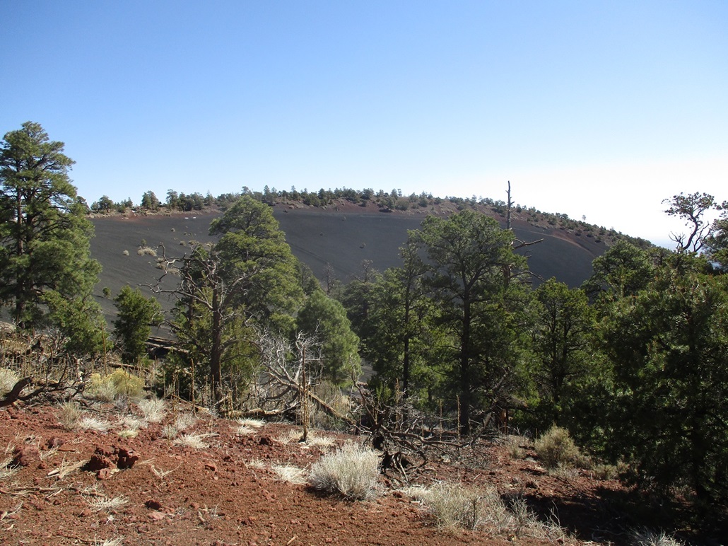
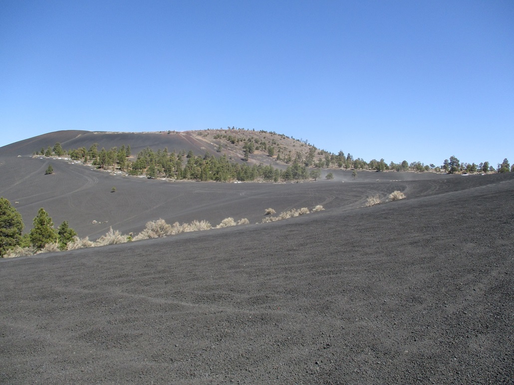
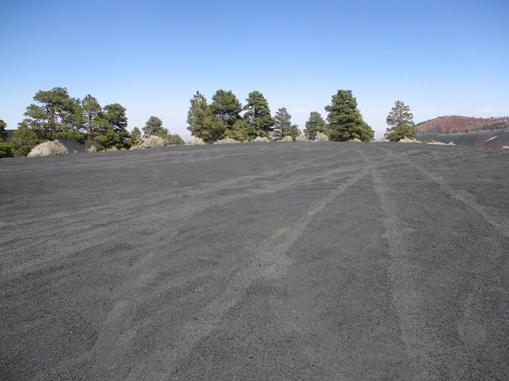
I started walking up the bare open cinder slopes of Double Crater. Above me was a ridge about a hundred feet higher. Behind it were a group of off-roaders kicking up dust clouds and making all sorts of noise. As I approached the ridge, they had moved on and were preparing to go to the top. As I surmounted this lower ridge, I watched them roar up a very steep "road" that placed them (four vehicles) on the top-most ridge. I admired that they could get to the top so quickly while I was doing it the caveman way.
Temporarily quiet again, I angled toward Hill 7688 and into a band of vegetation (scattered low trees, woody scrub and grass, all a nice light brown and tan color). I figured the cinder would be holding together better in the vegetation, and that I'd be clear of any off-roaders who might suddenly appear.
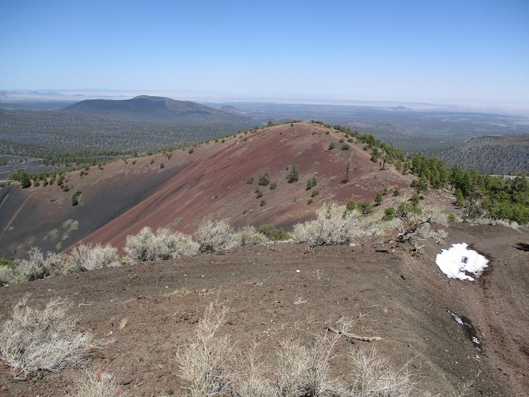
The hiking here was easy because the gradient was very gentle. It was warming now, and I was still feeling energetic. The grade steepens as it approaches the top-most ridge. By now, the off-roaders had moved on ahead. The hike up this steep segment was tiring but it went fast, and I was soon on top. The highpoint was just up ahead, a bare bump of cinder topped by a large rock split into three portions. A rise about 300 feet to the north seemed about as high, although the map said I was highest where I was. But I walked over to this other rise and looked back, and yes, it was higher to the south.
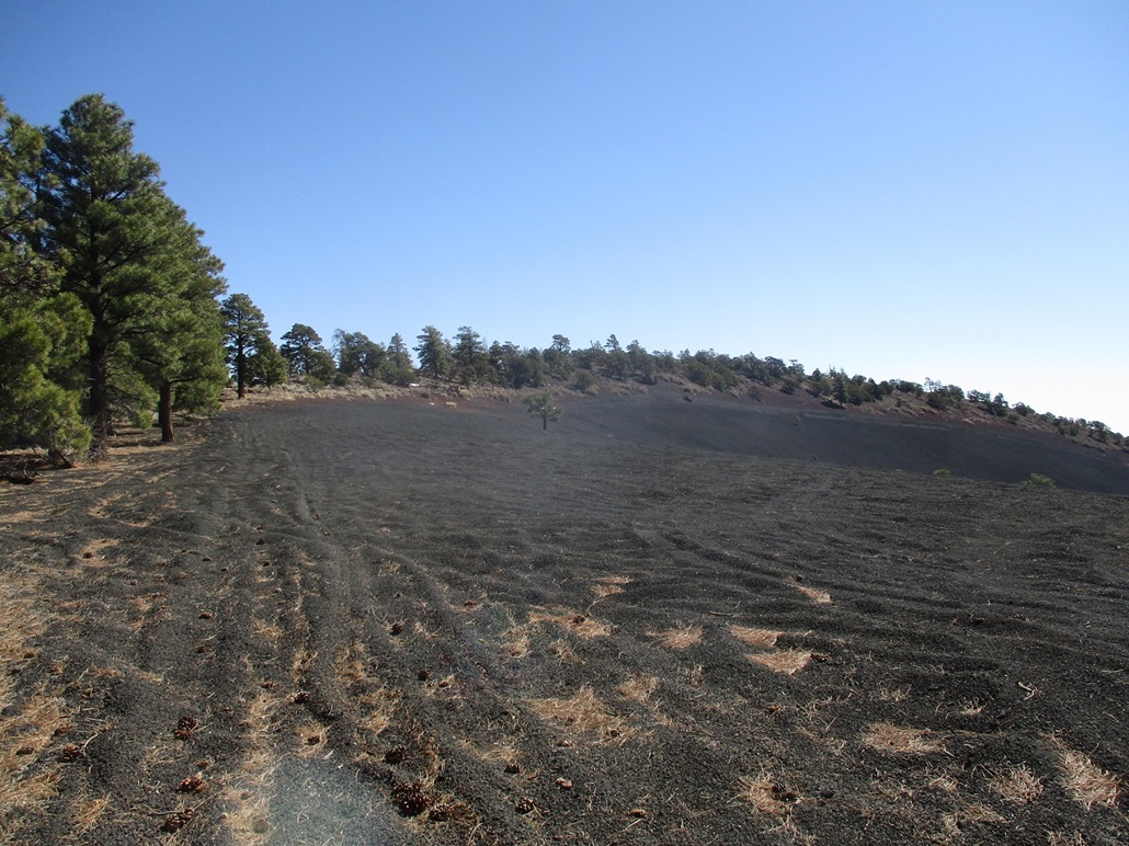
I made a tactical error, although at the time it seemed like a good idea. I continued north along the top rim, looking down into the first crater, then the second crater, toward a bump with spot elevation 7,891 feet. Looking down, a whole bunch of off-roaders had convened at the lower lip of one of the craters (probably the group I'd seen earlier). I continued around and down the road, now on the north rim of the hill. My thinking was that I would find a road or track that would lead me down off the peak altogether. I found plenty of tracks, but anything north-facing still had snow in it, and it all looked too steep for hiking. So I continued around the crater rims, now on the west edge of the rims.
There were more tracks here, but man, they were steep. I could not tell if the cinder rubble would be stable for my footing. It's one thing to slide down three extra feet with each step, a totally different matter to potentially slide 20 feet at a time. So I kept hiking along the rim, now southbound back toward where I had first surmounted the rim. It became clear I would have to re-ascend the rim edge before I could locate myself above some gentler slopes to where I could descend safely. So I did. All this added about an extra mile, and about 300 extra feet of elevation gain, to my day.
Once back up high, another group of off-roaders, three of them, each with about 3 or 4 occupants, were now up top and having a merry old time. They saw me and just smiled, more like a "what the hell is this guy doing up here?" smile. As soon as I could, I bailed downslope, the grade about 45 degrees but safe, the rubble catching each step solidly. I did not take chances. I took the slope at an angle and kind of "slalomed" down, angling left then right and so forth. The grades lessened slightly, but I still had a long way down, almost 800 feet total, until I was down off Double Crater Peak and back into the trees, where I stopped again for a rest and a chance to empty my boots of the cinder pellets.
What I should have done once I tagged the highpoint is turn right around and descend the way I came. This would have saved me a lot of extra energy and time. I was beat by now, happy to have three of the four peaks done. I even thought about calling it a day and heading out, but the final peak, Peak 7842, was close by and it appeared to have easy slopes the whole way up.
Elevation: 7,842 feet
• Prominence: 442 feet
• Gain: 702 feet gain, 1,042 feet loss
• Conditions: Spotty clouds
PB
•
LoJ
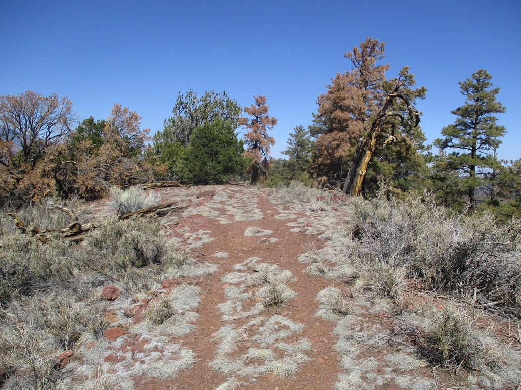
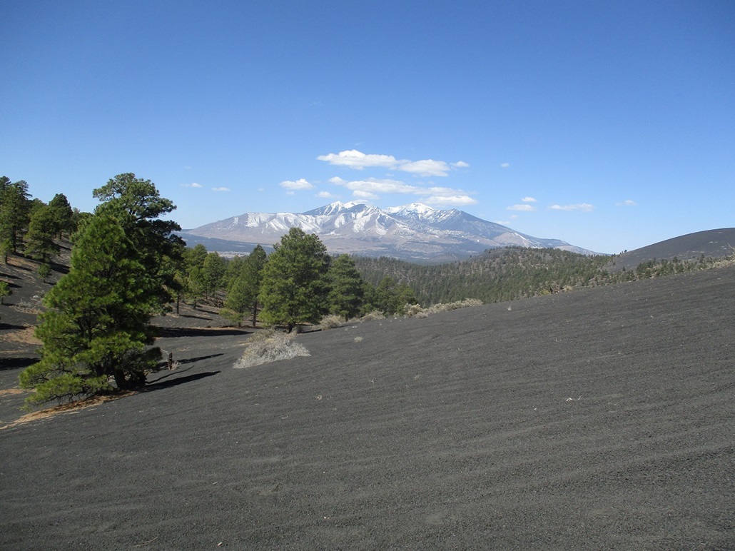
After a few minutes of rest under a shade tree, I started walking up Peak 7842, following roads and tracks as I found them. I made no effort to be on the "right" track. As long as it went up, it was right for me. The gradient was gentle, slowly steepening, but never got as aggressively steep as I had on the other three peaks. However, I was tired by now and moving slowly.
Some clouds had started to collect around Humphreys Peak and a few drifted our way, blocking the sun and providing welcome shade. It was warm now, into the mid 70s, with the ambient warmth magnified by the reflection off the cinder. It was never uncomfortable, but just warm enough to be noticeable. Thus, any shade, even for a few minutes, was appreciated.
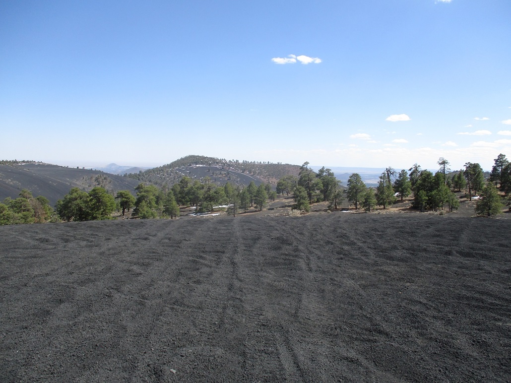
I generally followed roads, grass patches, and open areas, taking rests every few minutes. At one point a couple off-roaders came busting downhill on a track a couple over from mine. I could see their tops and hear their engine whines and loud music. Soon, I was at the end of the light forest margin and now on bare cinder once again. I aimed for a hill up ahead, arriving on its bare top after a few minutes. This was the north hill of the summit, about as high as the presumed summit, which lies on the south hill.
There was absolutely nothing on this north hill except for cinder pellets and tire tracks. The south hill looked higher. I walked downhill about 30 feet, then uphill to this south hill's top. It has more vegetation, but its very top is also bare cinder. Looking back at the north hill, it appeared higher, or just as high, so visiting both ensured I'd reached its highest point.
I did not stop at either summit. Instead, I continued walking south, catching a well-beaten track that dropped off the summit straight down the slopes. I walked quickly down this track, stopping every few minutes to remove my boots and the rocks therein. By now, I had probably taken off my boots a dozen times today to rid them of the cinder. I dropped close to a thousand feet, eventually back into the trees, catching FR-777. I was done with my hike, I had been four-for-four on my intended peaks and I felt very pleased about that. I was out of gas and just wanted back to my car, still a couple miles away.
Once off the mountain and back on FR-777, I walked about a half-mile, by now back on the flatter parts of the cinder fields, when a pickup truck pulled up beside me. The driver and his passengers were big burly hispanic guys, real friendly. They first were wondering what I was doing, and if I was okay. Then they asked me if this was the right road for getting back to the staging area, and I said "I hope so". He then pulled up a couple more feet and then asked if I wanted a lift. That was music to my ears. I jumped in the back and he then drove me back to the staging area and my car. I hopped out and thanked him. I did not get his name but he was totally cool and I appreciated his kindness. That knocked off a couple miles of walking on cinder kibble, and about 45 minutes too. As it was, I was back to my car at 3:08 p.m., exactly a 7-hour, 30-minute journey.
I was totally beat and completely filthy, covered in black cinder dust. I changed into dry clothes and tried to wash off what dust I could. The whole area was a din of engines, dirtbikes, small ATVs, mostly kids driving these close by their camping trailers and presumably their folks keeping an eye on them. I slowly exited, careful not to hit (or get hit by) any of them, then back in Flagstaff, stopped for snacks and a chance to wash myself a little. I drove directly home, arriving to Payson a little after 6 p.m.
I used an on-line distance calculator to gauge my total distance, which came out to about 9.5 miles, which is likely a low figure because I did not necessarily account for all the wiggles of my path. I also calculated that I had cumulatively gained over 3,300 feet throughout the day, which was the most I've done in a day in a few years. And most of it on that loose cinder which probably added an extra thousand feet of gain given how often I slid backwards.
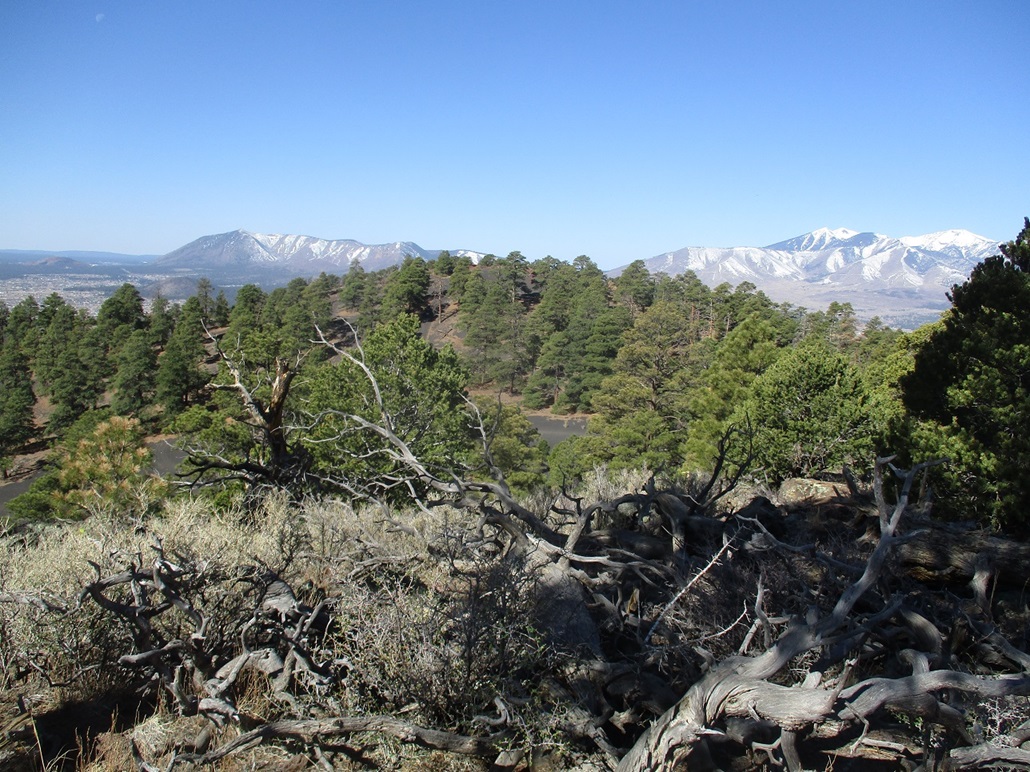
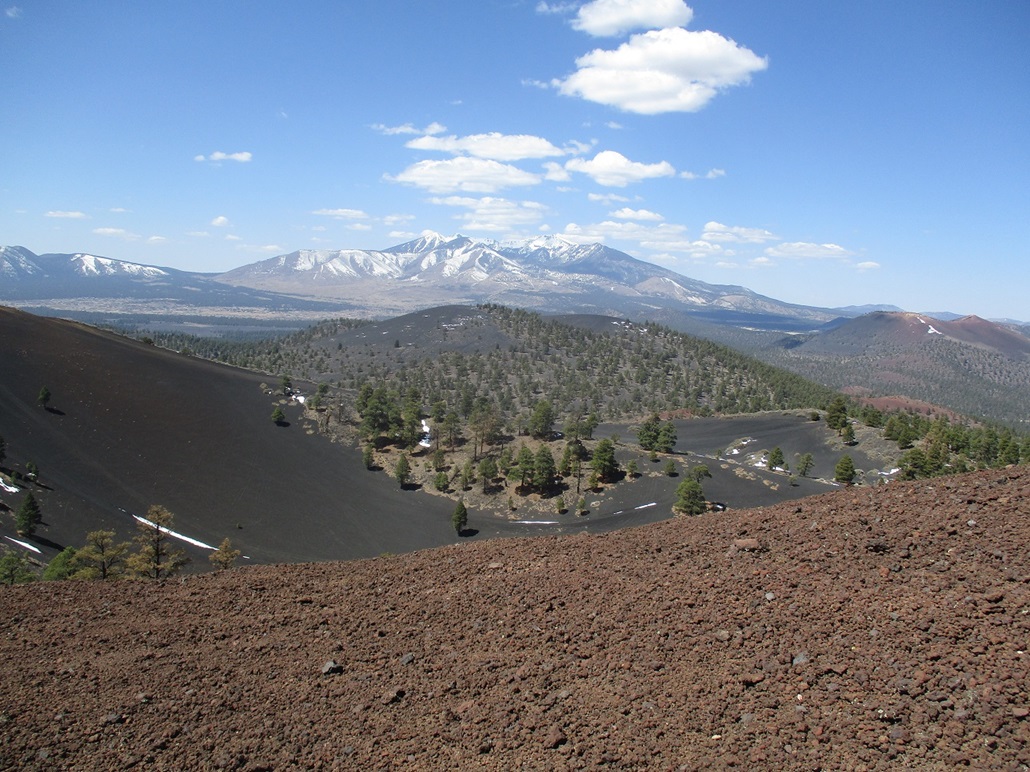
Today had gone well, and I enjoyed the outing and the area. The off-roaders were not much of a problem. Relatively few venture up onto the peaks, and it was easy to avoid them. Yes, they were loud, but it wasn't bothersome. I went in knowing it would be a loud day, so I was not expecting a wilderness experience. The views from up high are excellent, and Humphreys Peak was in view all day, still covered over in snow.
So I got to thinking about Sunset Crater, the main peak in the area and the centerpiece of the Sunset Crater National Monument. There used to be a trail to its top, but it was closed in 1973. The reason given on the forest service website is that the thousands of hikers over the years had beaten in a deep path so they closed it to protect the peak. However, after seeing what years and years of driving off-roaders over cinder slopes will do, I have to wonder if human feet, even thousands of them over time, will have an appreciable effect on the slopes. Clearly, these Cinder Hills I hiked today have been sacrificed to the off-roaders, and years of off-road vehicles have put in many visible tracks on these hills, but the nature of the cinder kibble is such that it does not wear down to the underlying rock (if there is any). Instead, the cinder literally just seems to move to the side as the vehicles roll over it. I know Sunset Crater isn't opening anytime soon, if ever. I hope they would for a few dates every year. I suspect the closure has more to do with cultural and archaeological concerns than lotsa human feet. One last thing. The HikeArizona pages for these hills is scant and essentially just a couple short references to two of the peaks for ham-radio enthusiasts. I enjoy HikeArizona a lot, mention them a lot on my pages, and find all sorts of great ideas for hikes and areas to explore through its site. But the pages for these peaks mention "car okay" for getting to them, or up them, I am not sure. It's rather vague. For getting up any of these peaks in a vehcile, a car is not okay. You'll need an off-road contraption specifically designed for this sort of thing. For getting into the central inner basin, you'll need at a minimum a strong 4-wheel drive vehicle. It's not rocky, but the cinder pebbles are soft and 4-wheel drive would be necessary to ensure you don't get stuck up to your axles in the pebbles. |


|