
The Mountains of Arizona
• www.surgent.net
|
| Pinta Benchmark |
• Highpoint: Sierra Pinta • Cabeza Prieta National Wildlife Refuge • Yuma County |
|
Date: February 10, 2013
• Elevation: 2,950 feet
• Prominence: 2,010 feet
• Distance: 18 miles
• Time: 12 hours
• Gain: 2,030 feet
• Conditions: Blustery and cool with spotty clouds
• Teammates: Ken Jones
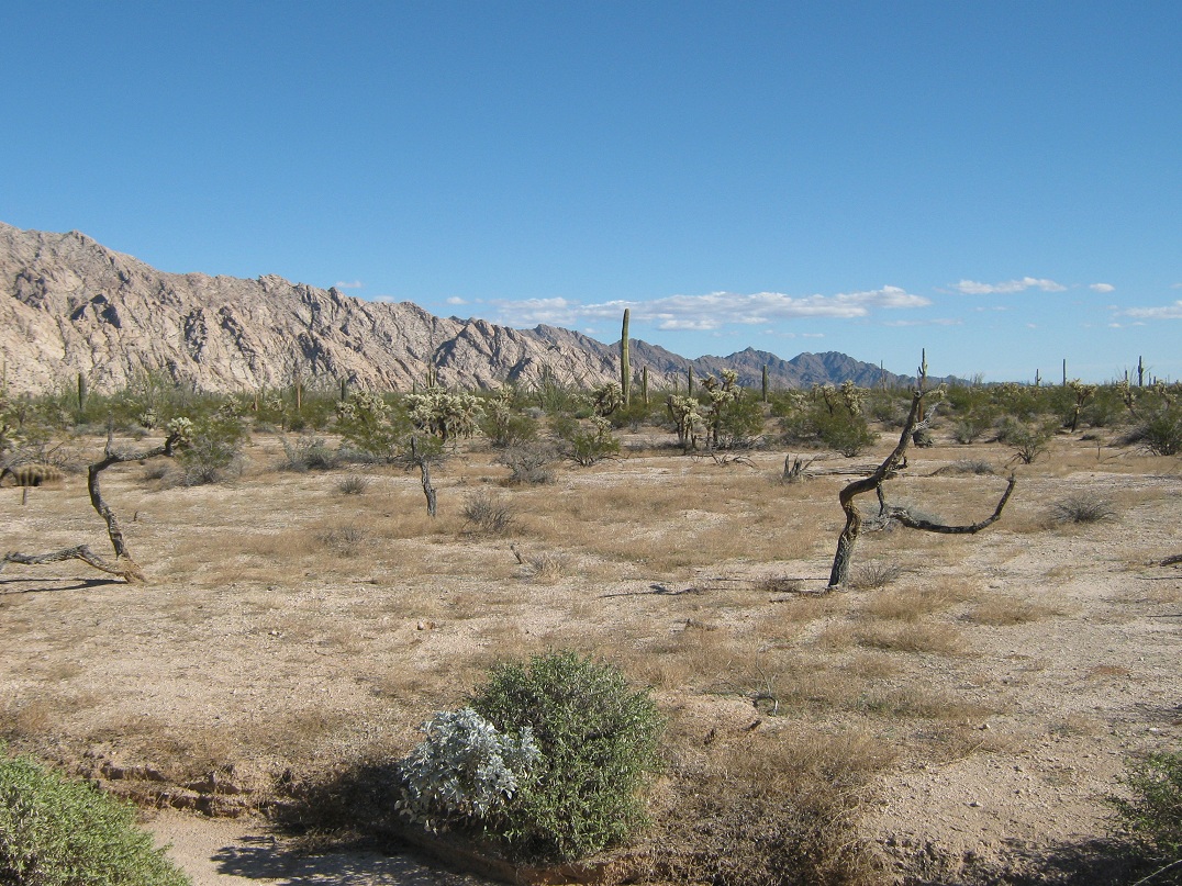
Pinta Benchmark is the highest point of the Sierra Pinta, a remote mountain range in the Cabeza Prieta National Wildlife Refuge in southern Arizona. The range is like many in this part of the desert, treeless and rocky, with rugged and steep slopes that rise dramatically from the flat desert plain. The range highpoint has no official name and is usually called Sierra Pinta, or Pinta Benchmark. The actual benchmark at the summit is stamped "Pinto". (Update 2019: someone has chiselled out the benchmark, I have been told)
It took me many years to work up the interest to climb this peak. There are good reasons not to. For example, it is remote, requiring a long drive along washboarded sandy roads in the middle of one the least hospitable ecosystems in North America. The area is also popular with Mexican border crossers and drug-runners. The actual climb is short, but because the peak is located within a Wilderness, the road leading into the range is restricted, meaning an eight-mile road walk each way just to get to the approach canyon. Thus, you leave your car parked in the open during the whole time.
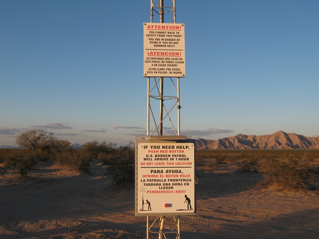
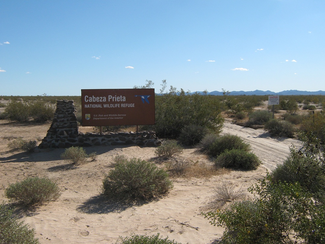
However, there are mitigating factors. The actual climb is straightforward and a little simpler (in my opinion) compared to Mohawk Mountain and Sheep Mountain. The main road is regularly patrolled by the Border Patrol, and as a last-resort failsafe, there is a rescue beacon at this road junction. Thus, if our vehicles were damaged in some manner, or no longer there, we could press the button and get assistance from the Border Patrol. Other people have hiked the peak with no problems, so I began to consider a trip to the Pintas. The remoteness and challenge just to get there was also appealing. Among other things, this would be my first trip ever onto the Cabeza Prieta.
This opportunity came when Ken Jones mentioned he would be in the state during January and February, hiking a series of peaks. We had agreed to schedule a hike to the Pintas for late January, but we were rained out that weekend. We then re-scheduled it for two weekends later, or this weekend. We agreed to meet in Tacna along Interstate-8. I left my home Saturday afternoon and topped the gas in Tacna, where we met as planned. From Tacna, we drove east on the interstate to an open gate on the south fence, then passed through it and proceeded south to our intended camp at the trailhead.
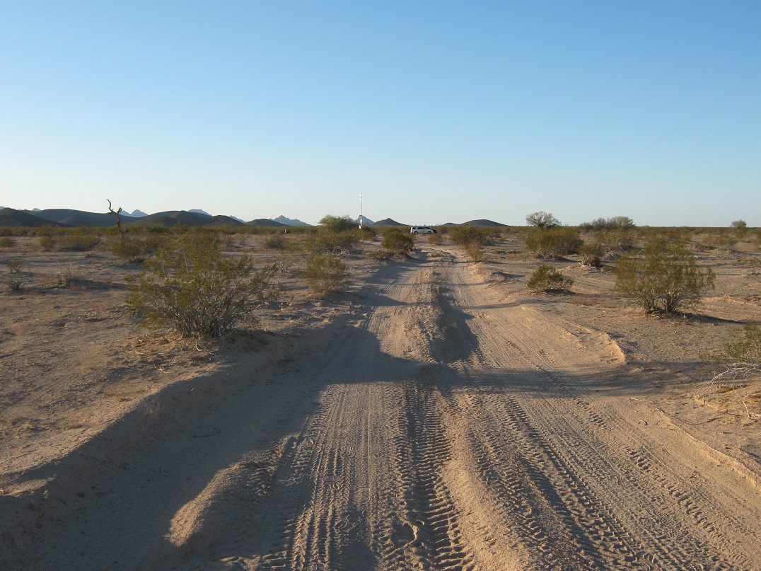
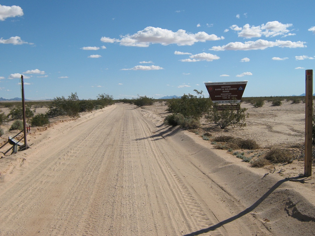
At the gate, I zeroed the odometer. The road is sandy but solid, and we drove south for 2.1 miles to the entry gate onto the Barry Goldwater Air Force Range. The road runs southeast, paralleling the Mohawk Sand Dunes. At 18.2 miles (all miles cumulative from the Interstate), the road comes to a four-way junction where one of the scattered rescue beacons stands. To this junction, the road was in good shape, and we were able to average about 35 miles per hour. South of this junction, the road narrows and becomes sandier and bumpier. At 23.5 miles, we crossed the Cabeza Prieta boundary, then found our trailhead/camp after 32.1 miles. The last 14 miles were a chore, and took an hour. In places, the road is sunk about four feet below the surrounding desert. If you go too fast, the washboarding will cause your vehicle to yaw, and a couple times I nearly ran into one of earthen banks. The entire drive from the interstate took 90 minutes.
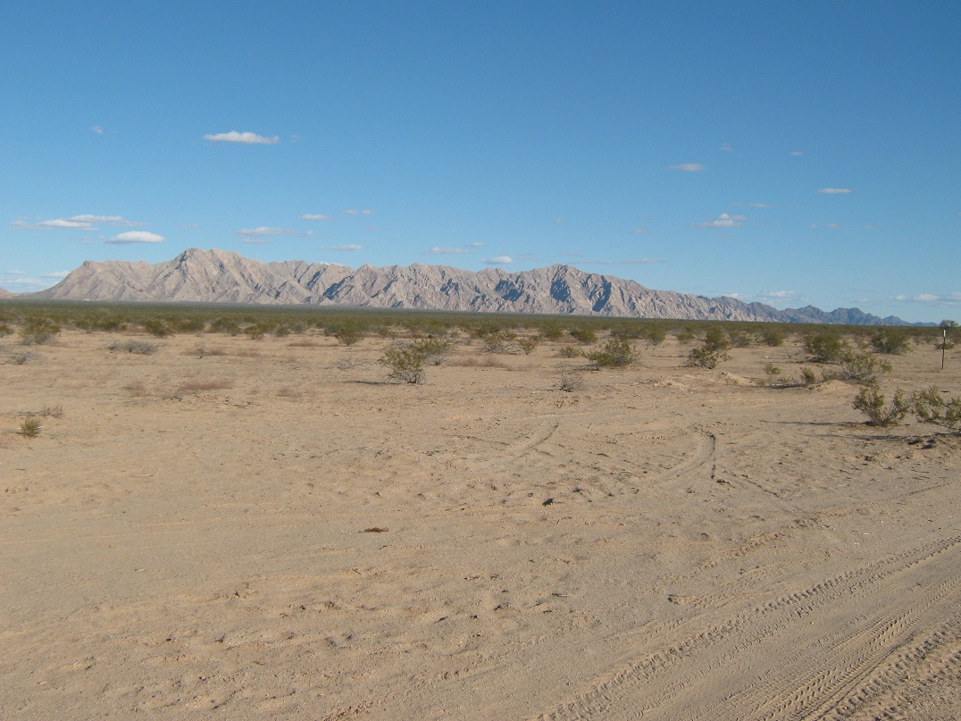
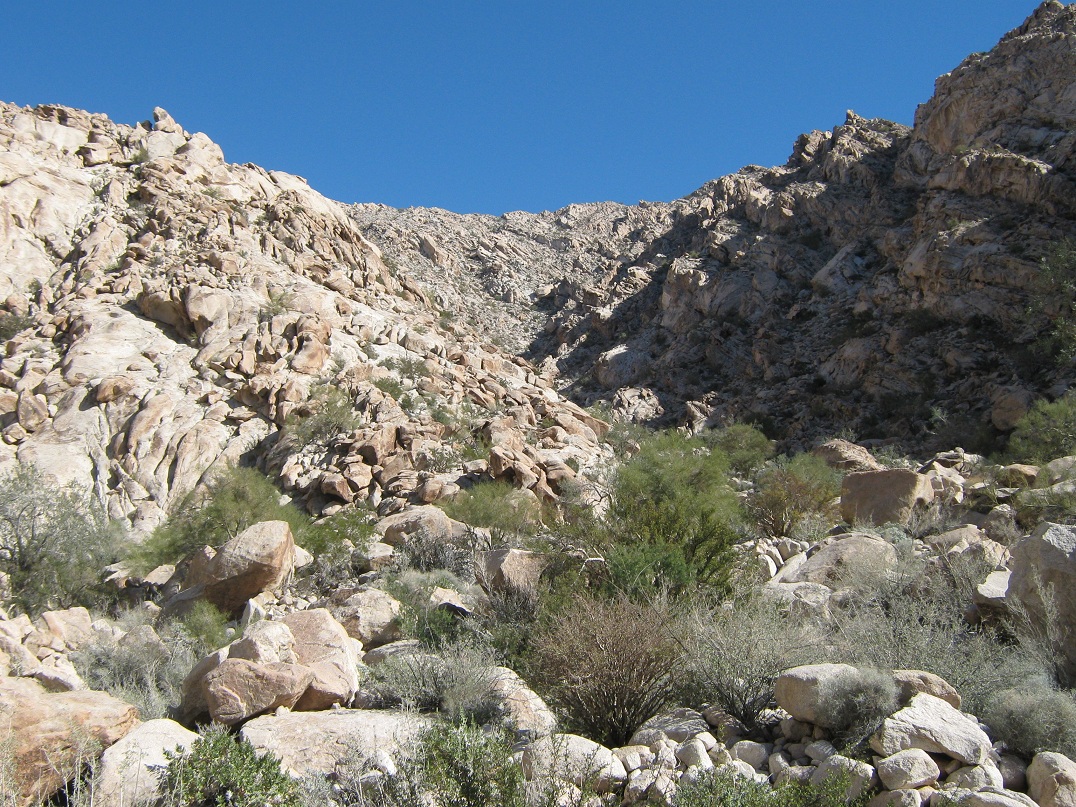
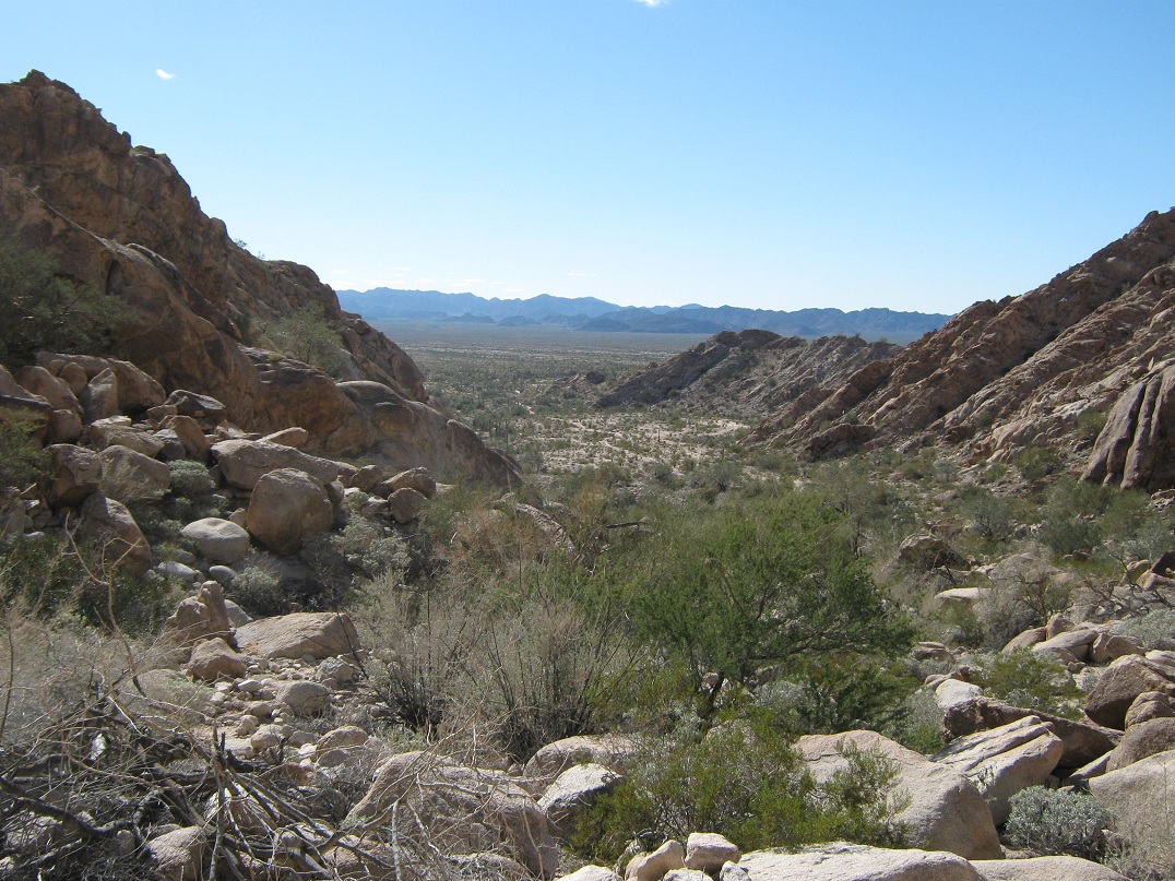
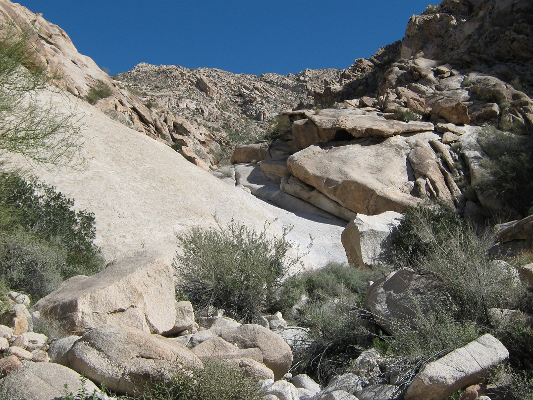
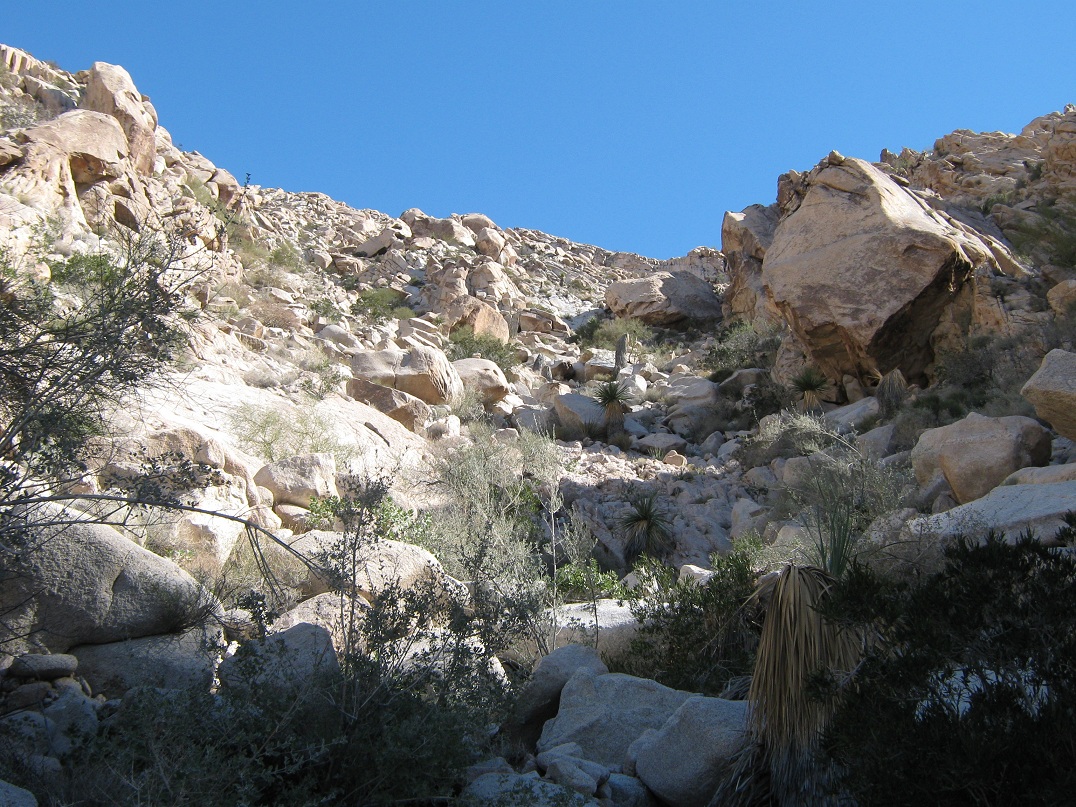
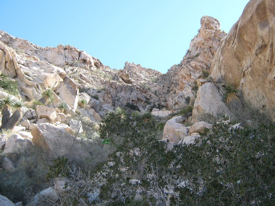
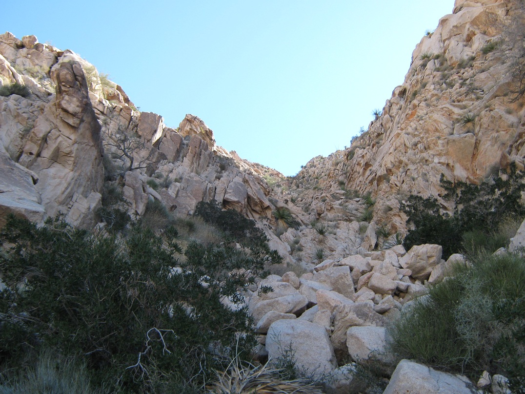
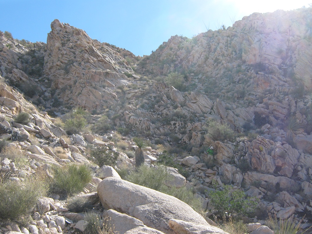
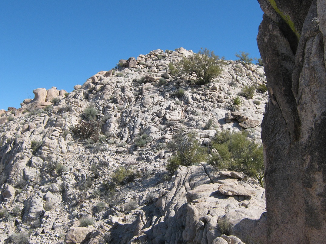
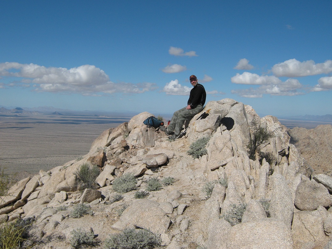
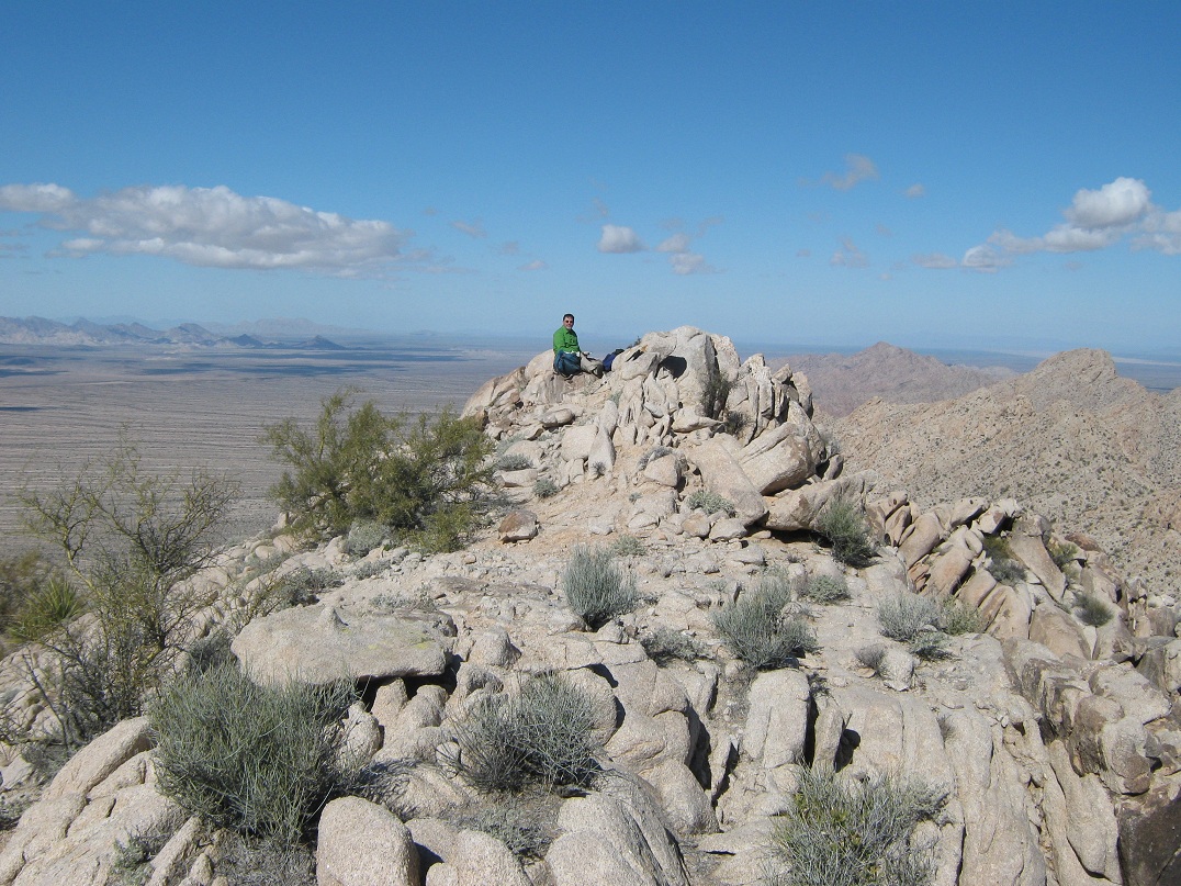
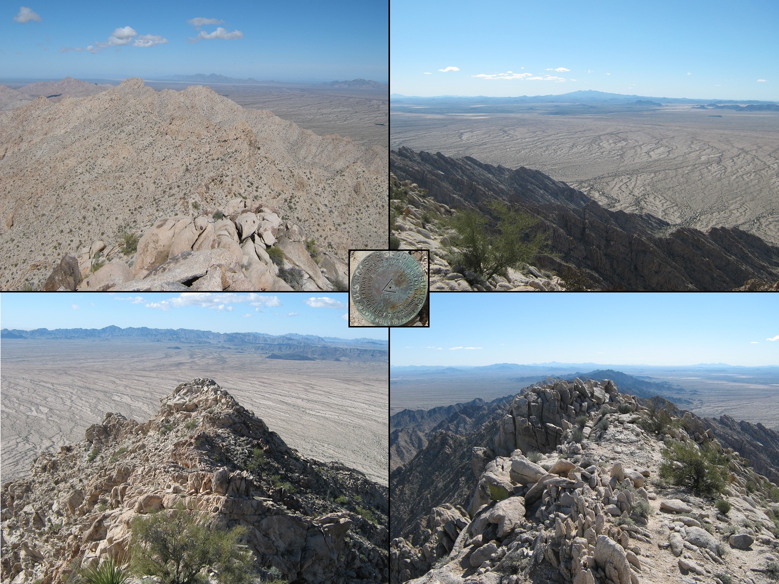
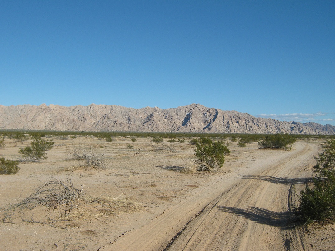
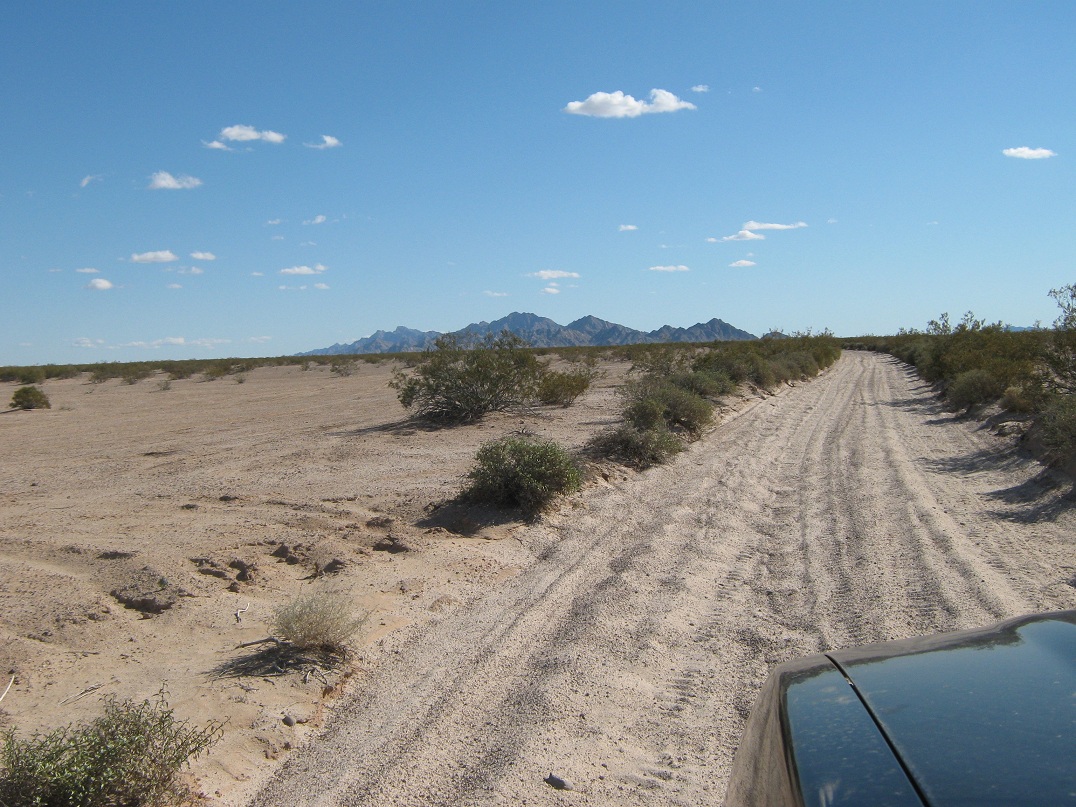
We rolled in around 4 p.m. A small storm had passed through the state two days ago, but today was sunny, with low puffy clouds and temperatures in the 50s. We parked apart from the beacon and inspected the area: flat sandy desert (called the Tule Desert, a sub-ecosystem of the Sonoran Desert), featuring creosote bushes, but with little grass or other significant ground cover. Our objective, the Sierra Pinta, was off to the east. The side road that we would be following, called Heart Tank Road, starts from here. Ironically, it was in better condition than the road we had driven in. All that blocked us were two little signs on each side barring unauthorized vehicles. We intended to stay legal anyway. When the sun set and the temperatures fell, we turned in for the night in our respective vehicles. The night was cold, with temperatures in the 30s. Around 2 a.m., a truck rumbled into camp. I sat up and watched it as it came up behind our vehicles and shone its light on us. It was a Border Patrol truck. It then turned and inspected the beacon. At this point, I poked my head out to greet the patrolman. He asked us what we were up to and our intentions. I told him our plans, and he was friendly and pleasant. This was good, because we wanted to make the Border Patrol aware of our presence, so they'd know why two vehicles are parked way out here, plus to keep an eye on them as they did their normal rounds. At 4 a.m., Ken and I awoke and got our stuff in order, taking our time. The plan was to leave before dawn, to walk as much of that road in darkness so as to be at the base of the mountain by daylight. We locked up the vehicles and started the long eight-mile trek at 5:30 a.m. There was no moon, but the millions of stars in the sky shone enough to give us just enough ambient light to make out the road against the contrasting darker-colored brush lining it. Thus, we hiked without a flashlight for most of this trek. The road itself was hard-pack sand, with no rocks whatsoever. In fact, one would be challenged to find a rock larger than a baseball in this whole desert plain, apart from the actual mountains. With nothing visual to distract us, we walked and walked and walked, and walked some more, so that when the sun rose, we were well over half way to the range. We covered the 8 miles in 2 hours and 40 minutes, taking a break at the road's end near a small weather station and a "guzzler" printed on the map. In the shade of the range, the temperatures were chilly. Now began the actual climb. From the road's end, the canyon starts in earnest, and the summit is only a mile away, but over 1,800 feet higher. We followed a scant path for a few yards before it petered out in the jumble of large rocks and thick brush of the canyon bottom. We poked our way up these rocks for a few hundred more yards to a point where the canyon splits. The left split leads up to a water-stained overhang, presumably Heart Tank itself. We went right, and continued on our task of hopping from rock to rock, avoiding brush, and figuring out each little section a few feet at a time. In 20 minutes, we had gained about 300 feet from the road's end, and had come upon a smooth-rock waterfall. There was no flow, but there were a couple of natural pools (tinajas) holding water from the previous storms. I was able to friction-step my way up the approximately 20 vertical feet of the dryfall, but I had to lean way in to keep my center of gravity nearly on the rock itself. Ken had no luck, and opted for a bypass up a brushy chute, then a traverse across a rock barrier. We met again at the top of the waterfall, and continued upward. The going was a consistent blend of rocks and brush. The navigation was easy and the climbing and scampering easy, too. We seemed to encounter a "major" obstacle every 400 vertical feet. Usually, these occurred at points where the canyon pinched in, or split. We always angled right, and the various obstacles had enough hand-holds or bypass options so that we could get up and past them. However, at times, we had to try a few routes first before solving the riddle. Another significant obstacle comes about two-thirds of the way up (see image on the left sidebar). A large rock sits in the gully, and at first, going left up a series of fractured stone ledges seemed promising, but I pulled off two large stone flakes and quickly determined that I wanted no part of this loose rock. Ken was able to clamber up a brushy chute up the rock's right (looking up), and I followed him. Above this rock, the terrain steepened. We were on the home stretch toward the main ridge, which now was only a few hundred feet higher. There was one more obstacle about another 200 feet higher at another choke point. There's a six-foot "step" that neither of us were comfortable with. Ken again went right and worked his way up a nasty chute of loose rock. Me, I angled left and up a slope to another chute, and found it to be manageable, gaining about 20 vertical feet. This was the only segment of the whole climb that I felt would warrant a Class 3 rating. Looking up, the gully splits once more, and according to our information, were were to go right, crossing below a rocky prow (see picture at left). By now, the slope was very steep, but the rocks were "mostly" solid. We moved carefully and had no problems, and momentarily, we had arrived onto a ridiculously tiny saddle, five feet wide before it dropped precipitously off to the south, and five feet between the rock outcrops lining the summit ridge. At this saddle, we turned left and bypassed the rocks by scampering up an easy slope facing the canyon we had just ascended. Gaining the top, we saw the actual summit still a few dozen yards farther away, but a steep cliff barring our progress. I was able to find a ledge on the south-facing rocks that offered an easy, if minorly exposed, way down onto the small notch separating our current rock outcrop and the next one over, with the true summit. Once past that obstacle, the final few dozen feet to the top was easy, up a gentle slope with a palo verde growing in the middle. We arrived on top just before noon, a three-hour climb from when we left the road. We stayed 30 minutes on top, inspecting the wonderful views and anjoying the tremendous solitude. We tagged both rock piles along the small summit ridge, and signed into the log, noting that someone had been up here three days earlier, but only one visitor for all of 2012. We saw the usual batch of familiar names, and the log held names and dates from 1965. The benchmark "Pinto" is cemented into the rocks below the highest of the rocks. Looking north, the rest of the Pintas gave way to desert plains and then, farther on, the Mohawk Mountains. Looking west, we saw the Copper Mountains, the Tinajas Altas and the Cabeza Prieta Mountains, plus the distant Gila Mountains. The most remarkable view was south at the magnificent Volcan Santa Clara in Mexico. To the southwest slightly were the pink sands of the Altar Desert, and beyond that, a faint blue sheen: the Gulf of California (Sea of Cortez). I was surprised we could see that far. The views alone were worth all the effort. The climb down went slow, as we retraced our route and took extra care to not hurt ourselves. We had no navigation problems and were able to handle the couple of tricky segments without issue. However, we were both lagging now, given we'd hiked and climbed close to 10 miles to this point. It took us a little under three hours to inch our way back onto the road at the mouth of the canyon. We took a break here, trying somehow to get "excited" about walking another 8 miles of road back to our vehicles. The walk out was tedious. The upside was that the day was cool and slightly breezy. The views were nice, and every so often I'd turn around to see the Pintas slowly getting farther away. We agreed to walk our own pace, and I was about 10 minutes ahead of Ken. We took one break about half way out, but the act of sitting down, then getting back up, was laborious. Ironically, it was easier to just keep walking. Also, there are few landmarks to judge the distance. It was just the endless road. Still about three miles out, I saw the beacon near our cars, and this was mildly exciting, but it never seemed to get any closer. Finally, the walk ended and I was back to my truck. I changed clothes and relaxed, and Ken arrived 10 minutes later. It was 5:30 when I arrived, a 12-hour day. We wanted to be driving as soon as possible. In retrospect, the road walk had its own allure. It was very pretty, in its own unique way. The tediousness allowed me to clear my mind, and it was a good way to meditate while walking. I literally thought of nothing. However, it's the type of thing I want to do once, but not twice. It definitely takes some will to "want" to hike an extra 8 miles after an already-strenuous climb. We started the drive out. I wanted to be back at that road junction fourteen miles north (the one 18.2 miles south of the interstate) before darkness. Other than the washboard, this segment went well, and it took an hour. The final 18 miles back to the interstate were driven in the dark, but by now, we were on the better road and were able to average 35 miles per hour, except those times when the Border Patrol pulled us over. Ken got pulled over once, then we were both pulled over at the Goldwater gate, two miles from the interstate. The Border Patrolman knew we were coming, having been radioed by his colleague down the road. Still, he questioned us, shone his flashlight at us, and looked inside my truck. He was friendly and bored. He asked us where we'd been hiking, and when I mentioned the Cabeza Prieta, he replied that we couldn't have possibly hiked there, since "the granola types get pissy when people go there." I needed to be back to the interstate soon where I would have a cell signal and could call my wife that we were safe. It was getting close to our agreed "call the sheriff" time, and this border patrol guy was wasting our time. After fifteen minutes of this, he was convinced we weren't hauling drugs or illegals, and he let us go. I think he just wanted some company. We drove back to the gate abutting the interstate, where we said our goodbyes. Ken went west toward Yuma. I stayed a few more minutes to call my wife and tell her I was alive and well. I headed eastbound and rewarded myself with a late dinner at the Space Age Cafe in Gila Bend. I was home about 11 p.m. The whole journey had gone well, and we had zero problems. We did not see any border crossers, nor footprints along the road we walked. I had left a few bottles of water beside my truck while we were hiking for a couple reasons: in case they needed it, they could have it, and also, as a gesture that in my kindness, please don't break into my vehicle. Well, those four bottles were still there, untouched, when we returned. The whole experience was fantastic, and the climb was far simpler than Mohawk or Sheep. I am happy to have hiked it. I won't be going back for a second time, but I would like to revisit the Cabeza Prieta sometime. My thanks to Ken for proposing this hike and being a great partner. |

|