
The Mountains of Arizona
• www.surgent.net
|
| Sheep Mountain |
• Highpoint: Gila Mountains • Barry M. Goldwater Air Force Range • Yuma County |
|
Date: December 11, 2011
• Elevation: 3,156 feet
• Prominence: 2,326 feet
• Distance: 6 miles
• Time: 8 hours
• Gain: 2,300 feet
• Conditions: Calm, high clouds
• Teammates: Adam Helman, Scott Peavy, John Klein, Scott Kelley & Tanya Kelley
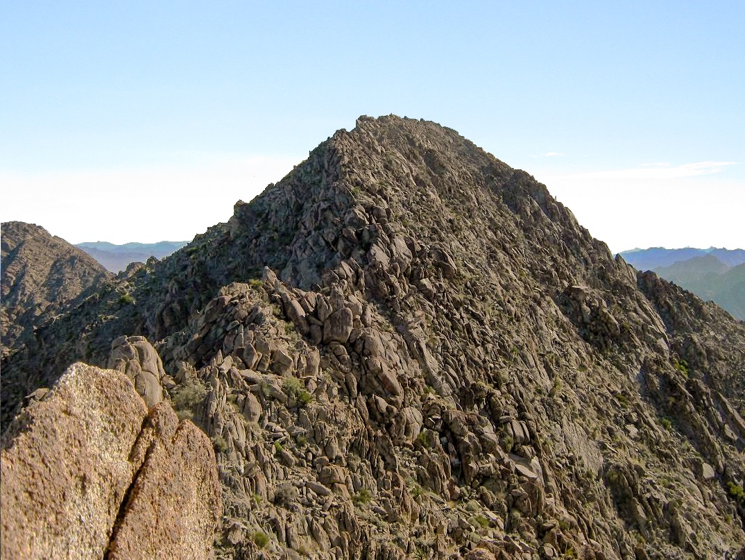
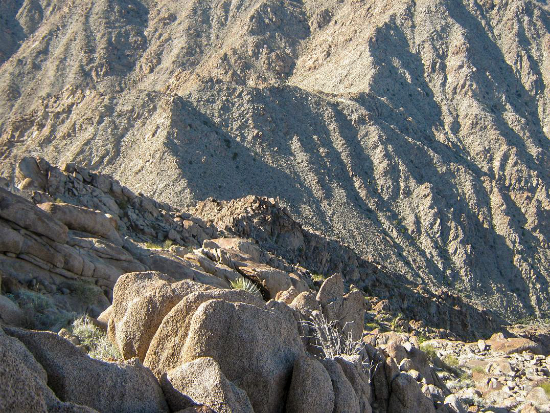
Sheep Mountain is the highpoint of the rugged Gila Mountains that rise east of Yuma. Most of the range (and the summit) lie within the Barry M. Goldwater Air Force Range (BMGAFR), requiring a free permit to access. The peak can be seen looking south from Interstate, where the highway drops down from the mountains into the desert below. It is the obvious high summit, surrounded by rocky and aggressive-looking ridges.
For this climb, I was part of a team of six: Scott and Tanya Kelley, Scott Peavy and me from the Phoenix area, Adam Helman from San Diego, John Klein from Tucson. We all had our individual agendas and somehow managed to coordinate everything so that we could all meet to climb this peak together. Scott Kelley had been here before and his knowledge of the peak would be most helpful. From below, it looks like a tough customer.
The day prior, Scott Peavy and I had driven west to meet with Adam and John on a lonely sandy road south of Interstate-8 near the Mohawk Mountains. The four of us climbed Mohawk Mountain, then drove back to the interstate and to Wellton for supplies before leaving the interstate again in Wellton, aiming southwest toward the Gila Mountains. We met Scott K. and Tanya, who were already there. We rolled in about 6 p.m., as the sun was setting and a full moon rising. The six of us stood around and caught up on all the mountains we had climbed. Me, I was tired, so by 8 p.m., I curled up under my blankets in the bed of my truck.
We were up early the next morning, intending to be moving by 7 a.m. I'd heard good things about Sheep Mountain, and Scott K. assured us that the rock here was much more solid than the other BMGAFR peaks. After the loose slopes and scree on Mohawk Mountain yesterday, that was good news. I was psyched and looking forward to the climb, albeit still sore and fatigued from yesterday.
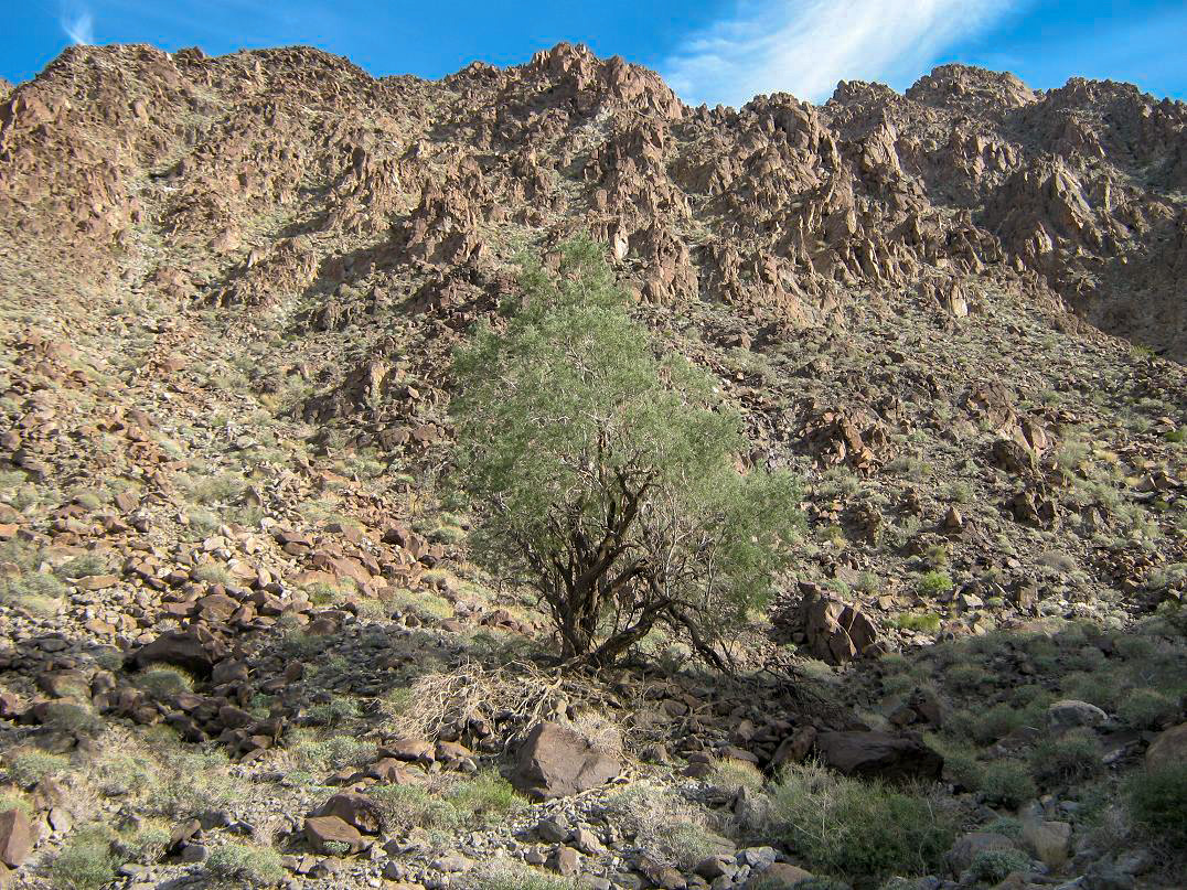
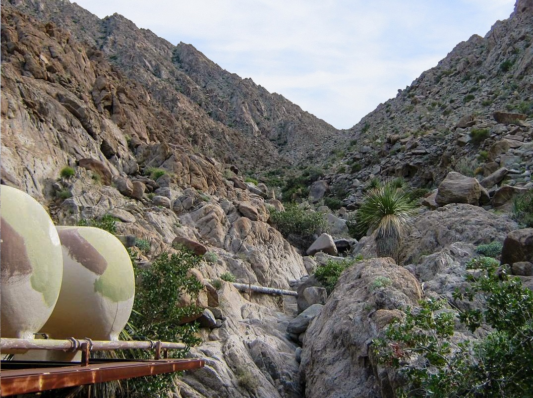
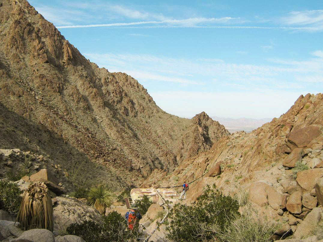
The initial hike follows a scant track that leads to an open vertical mine shaft, which we wisely avoided. Shortly, we entered into a wide drainage emanating from a north-facing canyon, and followed the rocks into the canyon as the walls became higher and more closed in. The hiking was easy, with solid rocks and relatively light brush. The canyon bends a couple times, and in an hour we had ascended 900 vertical feet, stopping at a set of large water tanks on a metal support apparatus—a "guzzler" set up for the bighorn sheep. We took a break here, and more importantly, could now see the saddle high up on the ridge, our next destination.
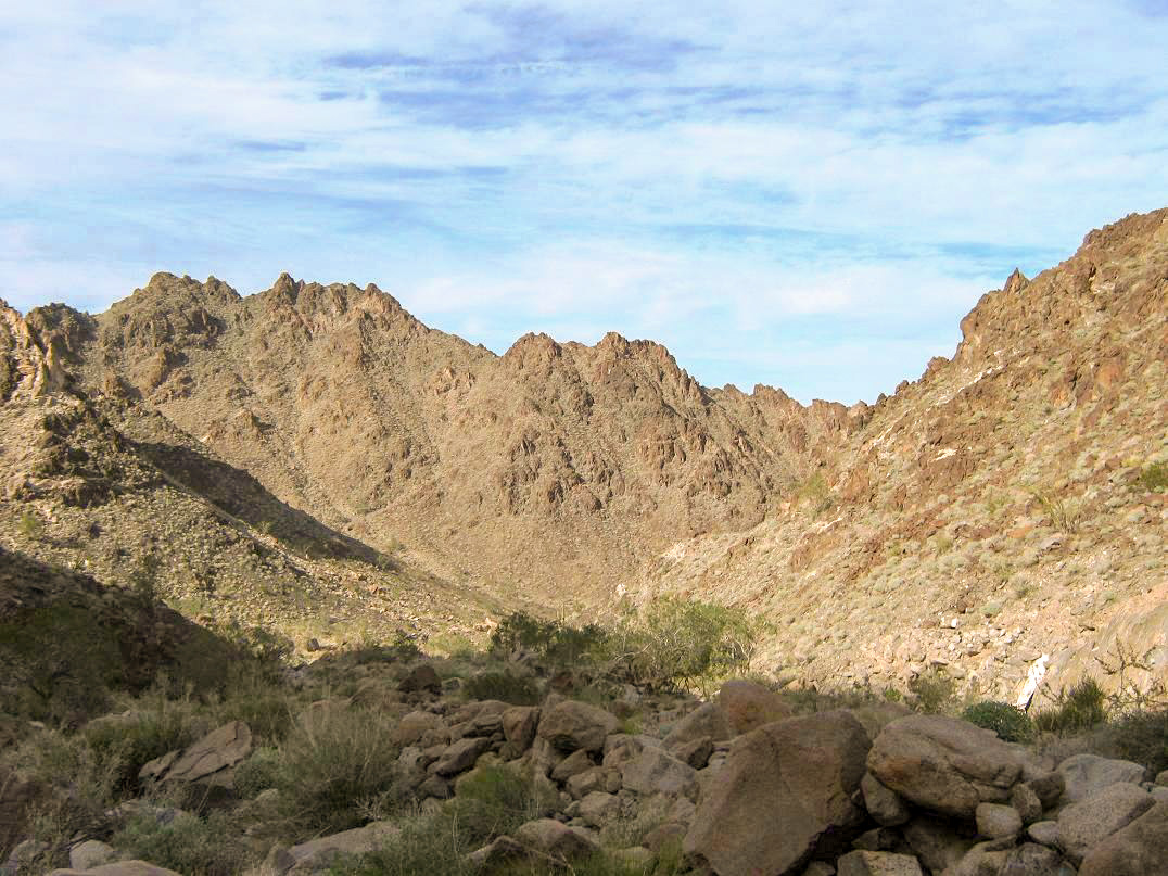
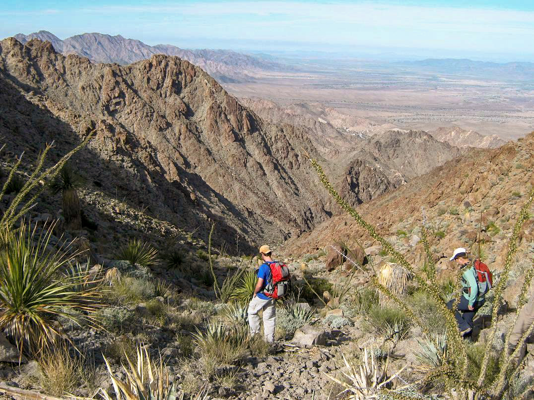
The hike to the saddle covered another 600 feet of elevation gain in a half-mile, with the last hundred feet being open and gently sloped, the most pleasant part of the hike. We had gained about 1,500 in two miles from the cars to the saddle, and from this saddle we had a view of Sheep Mountain's summit, still 750 feet higher. We also had a view of the multitude of rocks between us and the top. As easy and straightforward as the hike to the saddle had been, we'd be earning every step of the way from here to the top the hard way.
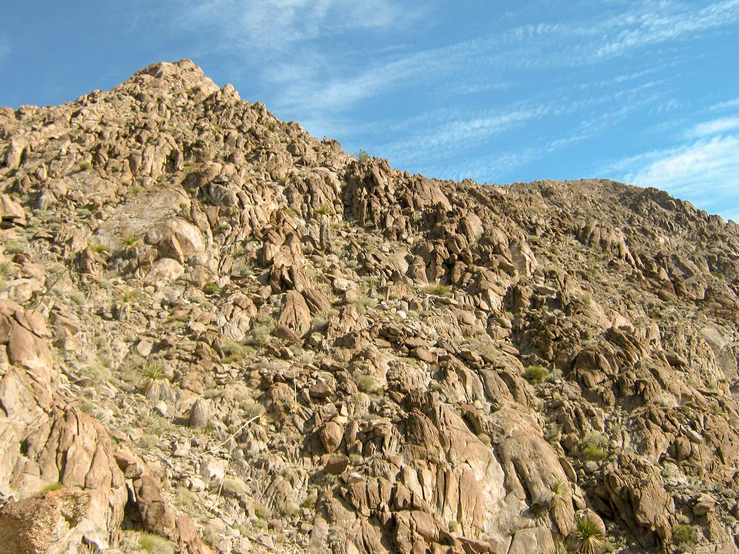
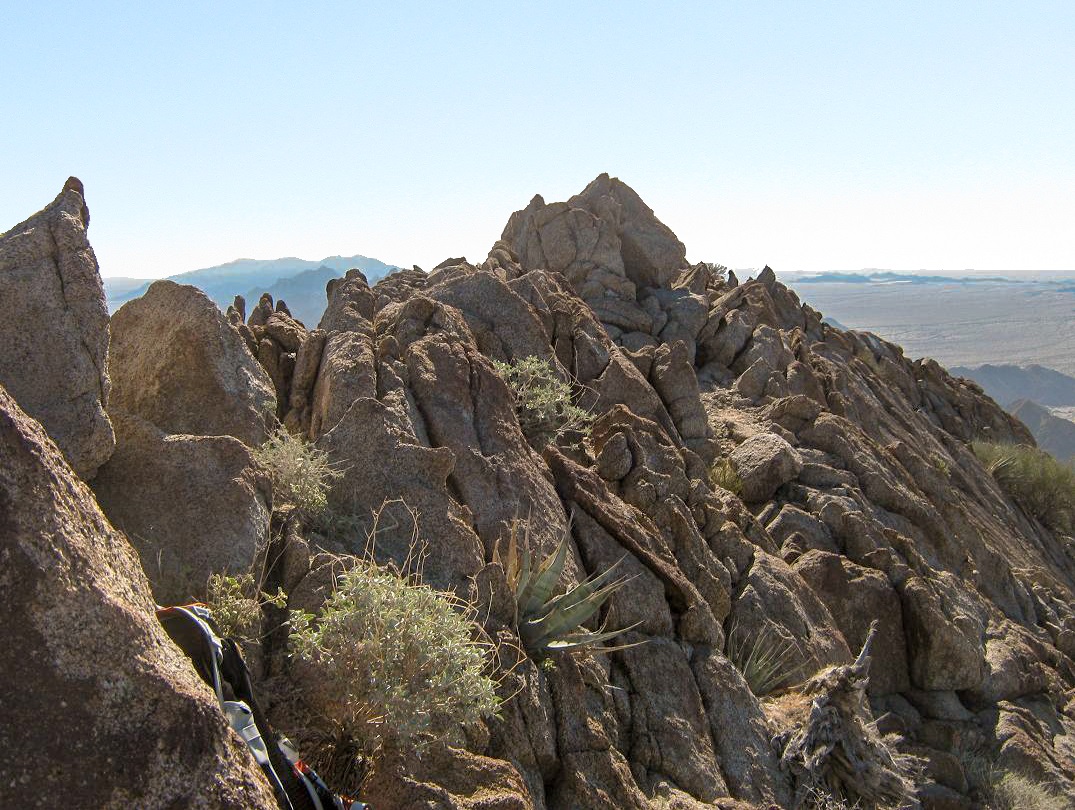
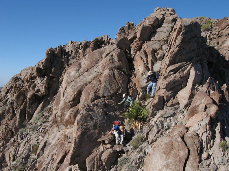
The initial hundred vertical feet from the saddle is simple, up a gentle slope with natural breaks in the rocks. That went fast, and soon we were at the first of the rock obstacles. The climb essentially breaks into two segments: a steep uphill grind to a false summit, then a drop and a traverse along a ridge to the true summit. To the false summit we had a maze of rocks, pillars, scree slopes and chutes to follow. We generally stayed right as we ascended, scrambling up chutes and open, angled slopes, then gaining back onto the rock to work our way through breaks and voids whenever we found them. John went on ahead, with Adam also taking a lead, while Scott K. stayed back to guide the rest of us through the sections.
The climbing was easy. We could always bypass any technical section by looking for a slope or a chute to scramble up. But I had to talk myself up each eight-foot segment, then repeat the process, over and over. After battling through one rock outcrop only to see more heinous formations ahead, it was easy to lose the spirit to continue. In parts, the exposure was fairly pronounced, where a fall might have been fatal (if you really tried). Also, the rock would sometimes fracture easily. We all learned to test each hold carefully. Most of the time, the rock was solid.
As we approached the false summit, we angled to the left side of the ridge and worked up a relatively tame slope, surmounting this false summit, with one of climb's two crux moves now required: a fifteen-foot descent down an exposed chute that might earn a 3/4 rating. We were able to get down this, then looking ahead, the summit was so close—yet between us and the top was more large rocks everywhere, and between them, more rocks. So we continued on.
By now, John had reached the top, and Adam had followed him a few minutes later. The remaining four of us worked our way through the intervening rock outcrops. We came to a large one, and now came to the second of the two crux sections: a traverse across a ledge with about 30 feet to the deck below. The alternative was an ugly down-scoot to the loose slopes below, so we opted for the traverse. The ledge was about a foot wide, so as long as I didn't think too much about the drop below, the actual traverse was very easy. There were ample hand-holds.
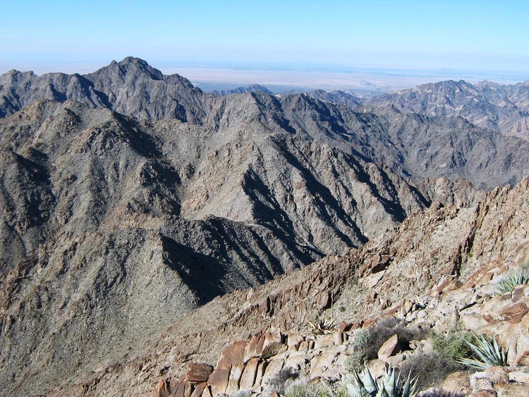
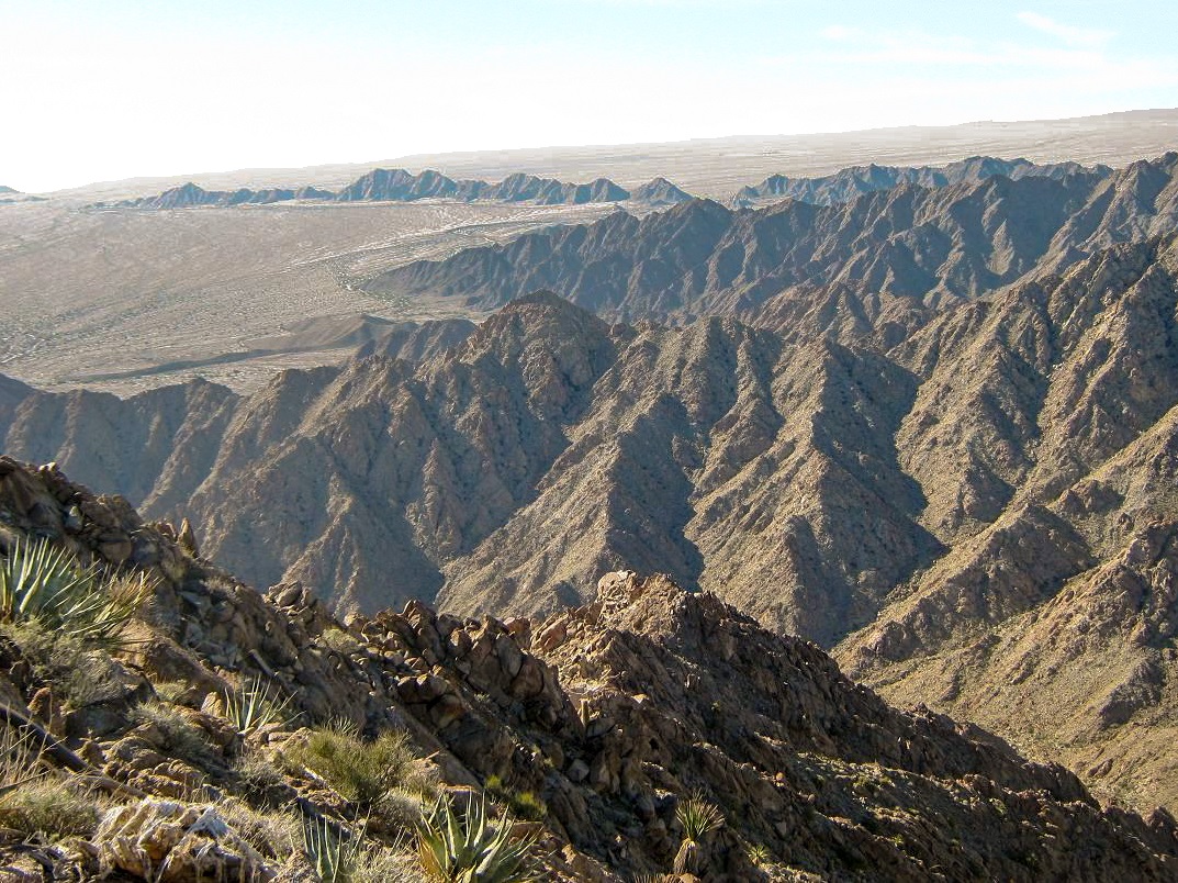
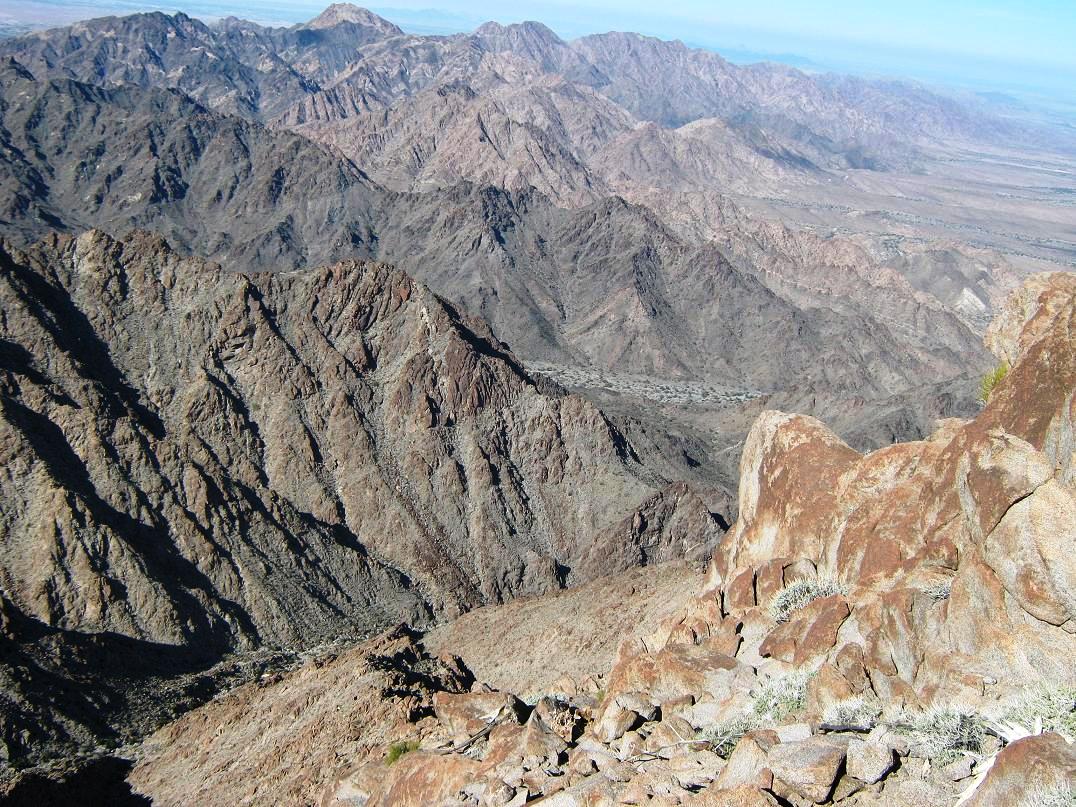
Past that section, we had another set of easy chutes that led onto a gentle slope and to the summit. John had already left by now, as he had to get back home to catch up on work (he passed us just as we were readying for the traverse section). Adam waited up for us, and we five rested our weary bones on the airy summit of Sheep Mountain, a reward well-earned. Scott Kelley celebrated with a beer. Me, I was just happy to be here. We ate lunch and looked out over creation. The Gila Mountains are a rugged range and we wondered just how often anyone gets out this way. Even the Mexican crossers probably know better than to deal with this terrain. We had million-dollar views of desert in all directions, some slightly occluded by a dim haze and high clouds that were moving in. We spent about 30 minutes up top before beginning the downclimb. For me, the sooner the better.
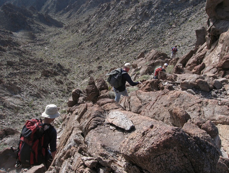
We retraced our steps. Knowing what to expect helped a lot, and our progress was slow but methodical. We up-climbed that steep chute with no problems, then started the long descent back to the saddle. We had the advantage of being able to spy routes from up high, spotting ways that would have been invisible to us on the ascent. As such, we didn't follow our exact route in some places. There was no let-up to the rocks, but none of it was worse than low class-3, either.
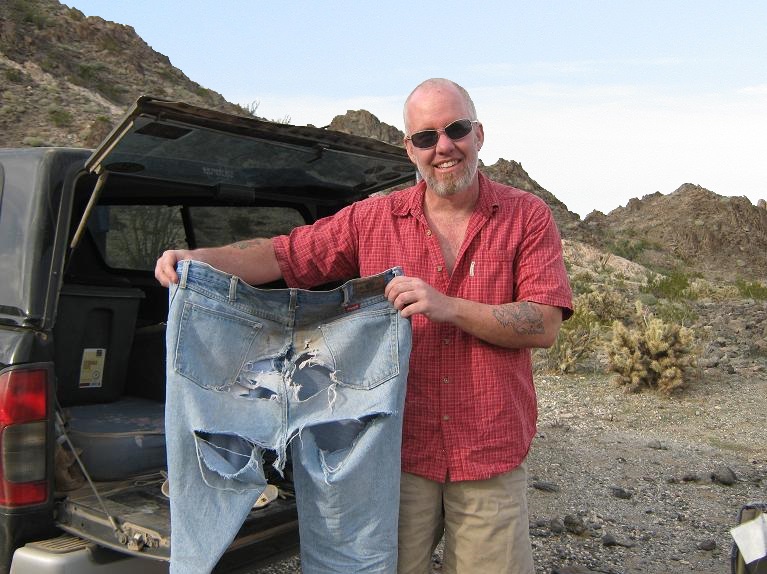
Along the way, I tended to use the five points of contact technique. My pants, a cheap pair of denim Wranglers, already had worn thin back there from past scooting. The hole had grown in size after yesterday's scooting down sections of Mohawk Mountain. And now on Sheep Mountain, with the amount of sitting and scooting I was doing, my pants were simply tearing apart, and my undies, not doing so much better. I didn't give a damn. What could I do? I just let them rip apart. I felt the breezes better. I tried to be last in line.
Soon, we were back to the saddle where we took a break. In another thirty minutes, we were back at that guzzler where we took time to explore it. From there, we rock-hopped down the easy slopes back to the desert flats and our cars. I changed, got my stuff packed and spent a few minutes hanging around with everyone before we started the drive back to Wellton. Adam, Scott and I stopped at a Circle-K for treats and last goodbyes before Adam headed west to San Diego. Scott and I then drove to Gila Bend and the Space Age Cafe, where we met up with Scott and Tanya for a meal. There were too many Scotts to keep track of.
Sheep Mountain was a toughie, but everyone I had talked to always spoke highly of it, and in retrospect, I agree. The upper ridges appear aggressive, but a well-chosen route means never dealing with anything beyond class 3 and maybe some low class 4 moves here and there. Patience is a must, and good, cool weather, too. The log books had few signatures. The summit may see just two or three ascent teams in a given year. I am extremely grateful for the help, patience and guidance of everyone on the team in making this a successful and safe climb. I'll readily admit that on my own, I wouldn't have carried through with the climb. I am very pleased to have this one done, and now, I can admire it from a distance.
Addendum: This was the last climb I did with Adam. He passed away three years later, in early 2015. You don't ever think something like this will have such significance. At the time, it was just a couple of dirty guys saying goodbye after a successful climb and going on our separate ways. The last time I ever saw him was at the Circle K in Wellton, after descending down from Sheep, me heading east and Adam west back to California. Never in a million years did I think that would be it. We climbed together for eleven years. I am grateful for that. |


|