Peaks in Mexico
• www.surgent.net
|
| Cerro Pinacate |
• Highpoint: Volcán Santa Clara • Highpoint: Pinacate Biosphere Reserve • Sonora, Mexico |
 Border crossing at Lukeville & Sonoyta
|
Date: January 6, 2009
• Elevation: 3,950 feet
• Prominence: 3,150 feet
• Distance: 11 miles
• Time: 7 hours
• Gain: 2,800 feet
• Conditions: Sunny and cool
• Teammates: Scott Casterlin
Main
•
PB
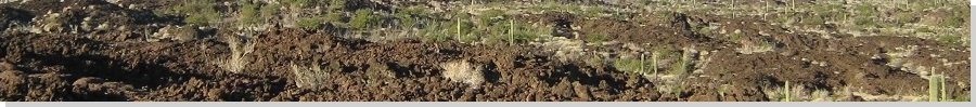
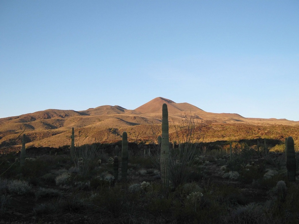
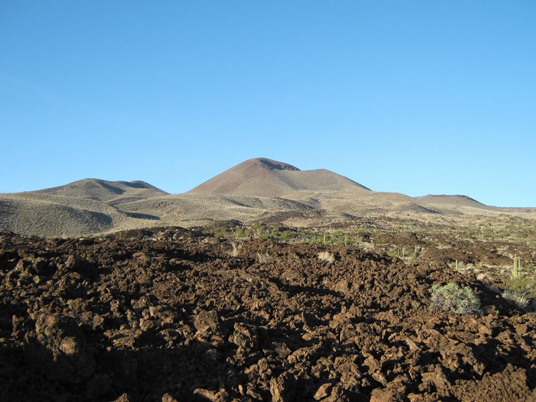
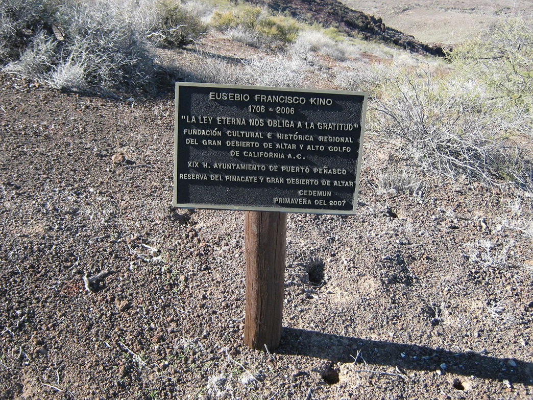
Cerro Pinacate ("Pinacate Peak") is the highest point atop Volcán Santa Clara, a sprawling shield volcano in northern Mexico that rises over the Pinacate Biosphere Reserve (formally: Reserva de la Biosfera de El Pinacate y Gran Desierto Altar). This is a remarkable place—hundreds of maar volcanoes lie below the peak on the desert plains, while to the west is the Altar Desert, one of the biggest sand dune fields in North America.
Volcán Santa Clara is visible along the highway between the border city of Sonoyta and the beach town of Puerto Penasco (Rocky Point) on the Sea of Cortez. The entrance into the Pinacate Reserve is about 30 miles south of the border, roughly halfway to Rocky Point. Looking at Volcán Santa Clara from the highway, it looks like a typical mountain range. It's easy to forget this is one single mountain mass, more spread out than tall.
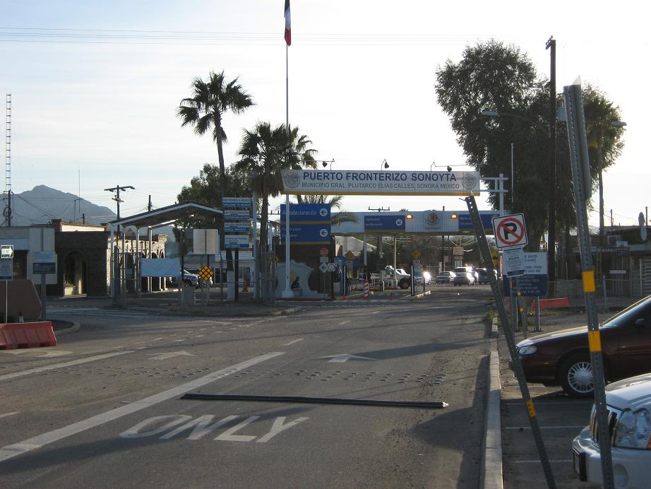
From Arizona, the Pinacate Preserve is reached by following state route AZ-85 south from Gila Bend through Ajo to the Organ Pipe Cactus National Monument, and entering into Mexico at the Lukeville-Sonoyta border checkpoint. From here, one follows Mexican Route-8 southwest toward Rocky Point. The best time to visit the Reserve is in winter. In summer, temperatures here are obscenely high, exceeding 120 degrees Fahrenheit. Even spring and fall can be warm and into the 90s. The lack of shade and the reflective lava rock adds to the heating effect.
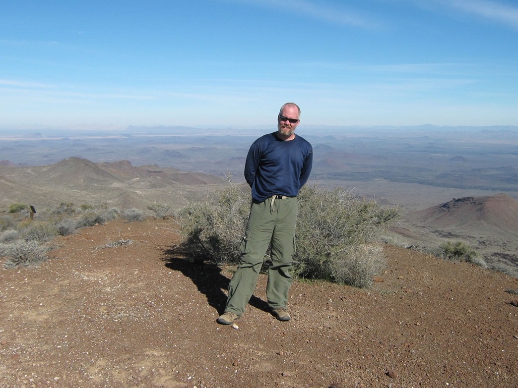
I wanted a partner along for the adventure, and talked Scott Casterlin into coming along. He had hiked the peak twice in previous years, and was willing to visit it again. We met at my home, transferred gear into my truck, and set out around 11 a.m. on Monday, January 5th. The drive went well: 65 miles to Gila Bend via Maricopa, then 80 more miles to the border crossing, with a stop in Ajo to get Mexican auto insurance and groceries. At Lukeville on the American side of the border, I topped the gas, then did something I'd never done before: drive myself into Mexico. Within moments, there we were, south of the border, in Sonoyta, Mexico. It was that easy.
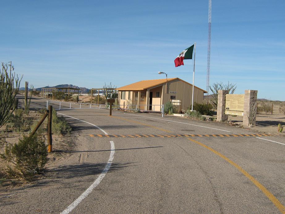
I drove through town, following the signs, looking for Highway 8. In Sonoyta, I enjoyed looking at the buildings, dogs, horses grazing beside the road, guys pulling ice cream carts, everything, but also tried my best to keep at the speed limit. I was being extra cautious not to do anything to get me pulled over. Within minutes we were on Highway 8, Volcán Santa Clara coming into view after about 10 miles, once we got past the local hills. Thirty minutes later, we rounded a bend and exited the highway at the entrance station to the Reserve, paying our fees (about USD $8 per person) for entrance and camping. Scott and I know a little Spanish, the girl who helped us knew probably about the same in English, but we got it all figured out.
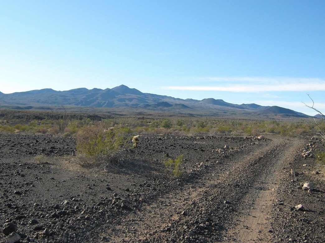
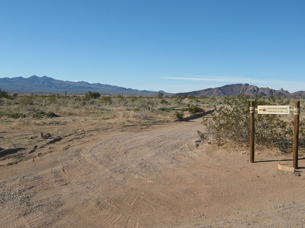
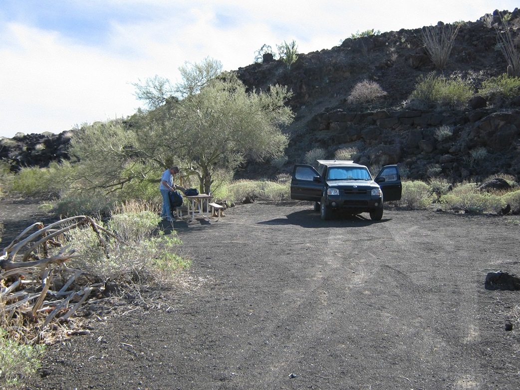
From the entrance station, we drove north 2.5 miles along a good dirt road (sandy, wash-boarded) to a junction, then left another 11.2 miles west and northwest across desert plains, washes and lava beds to reach our destination, the campground at Cono Rojo (Red Cone). Cono Rojo is located at the base of a lava flow, so named for a red-colored cone nearby. The campground is basic, with two main camping spots, tables, cleared areas, and a trailhead sign. We arrived at 3:45 in the afternoon and enjoyed the solitude and views. About 6 p.m., three other vehicles rolled up, all with kayaks (!) on their roofs, and set up camp in the other main section. Later, their leaders, three men, came to greet us. They were from Mexico City, and we surmised that this looked to be a professional tour outfit based on the abundance and quality of their gear.
(Comment on the drive: Highway 8 is well maintained and about half the vehicles had Arizona plates. It's a "Hassle Free" zone meaning that one may drive this far into Mexico without having to go through a huge maze of bureaucracy of registering one's car with Mexican authorities. The road in from the entrance to the campground was better than I expected: the junctions are signed, notable land features are signed, and the road is graded so that minor junctions are obvious. It took us an hour to drive this stretch. Based on past reports, this development and improvement is new. The road is still rough and high clearance is an absolute minimum requirement. I had 4-wheel drive and used it for the handling and also for a couple short patches of sand. Good tires are a must since much of the road is carved into the lava, and the little lava rocks are notoriously sharp. I brought along a shovel and wood planks for potential traction devices but didn't need them. The Reserve people probably don't patrol these roads more than once every few days. Self-sufficiency is much more a requirement here than it might be up in the U.S.)
Darkness came around 6:30 p.m., but the skies were clear and we had a waxing half-moon that lit up the countryside. We sat around for a little while longer, but the temperatures fell drastically (near freezing by early morning) so we both decided to call it a day and get busy sleeping, me in the bed of my truck and Scott in the open on an open spot of lava gravel. Aside from waking up a few times during the night for imagined noises, I slept well and awoke at 6 a.m., still dark and very cold. Scott heard me rustling and he got up too. There was no hurry, so we waited for the sun to breach the eastern horizon and warm things up a little more. At 7:30 we set out for the summit of Pinacate Peak.
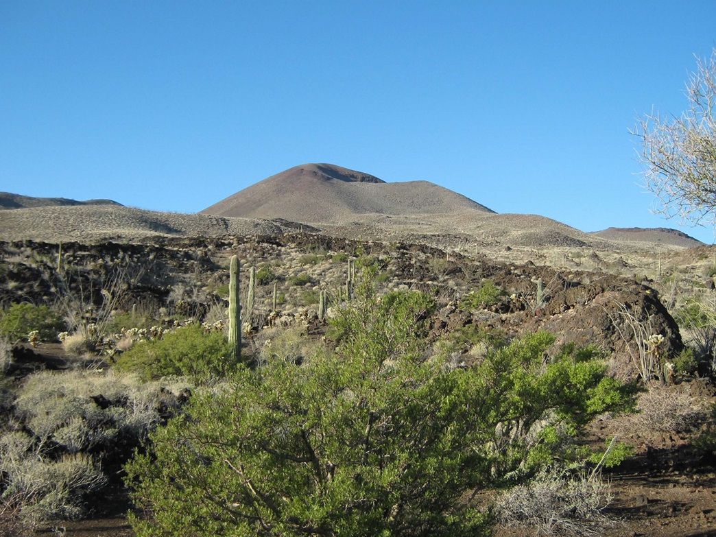
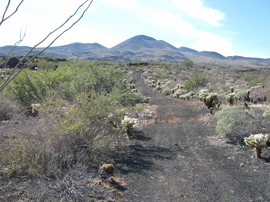
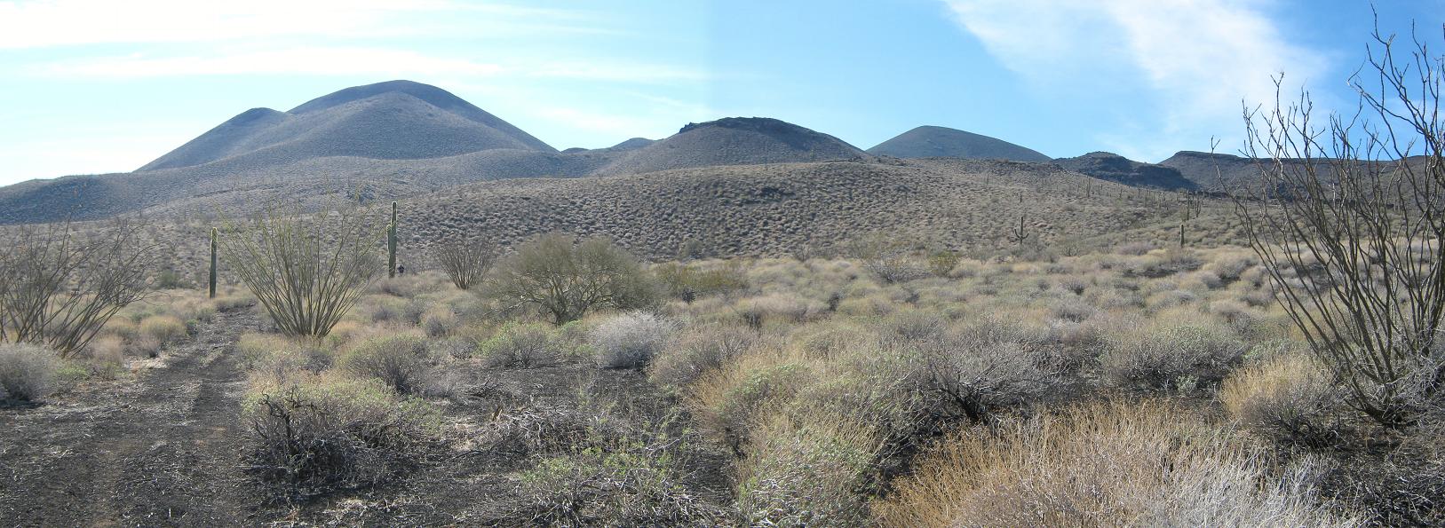
We crossed through the camping area of the other group and said hola to them. The trailhead is a sign blocking the road, which worms its way up about 25 feet to gain a higher bench of lava. The road, as we would learn, runs nearly to the summit, but is only open for walking. The road, as we would also learn (and is described here later on) is not the ideal route to the top if you stick just to the road, but is useful in conjunction with well-planned cross-country shortcuts. Pinacate Peak itself is hidden from view from this vantage, with its slightly lower eastern sub-summit, Carnegie Peak, dominating the view. We walked the road for a half-mile as it angled more north than west, then at some point when it felt right, we started walking cross-country west, aiming for the ridges north of Carnegie Peak, with a conical fumarole to the north of the peaks serving as our main point of reference.
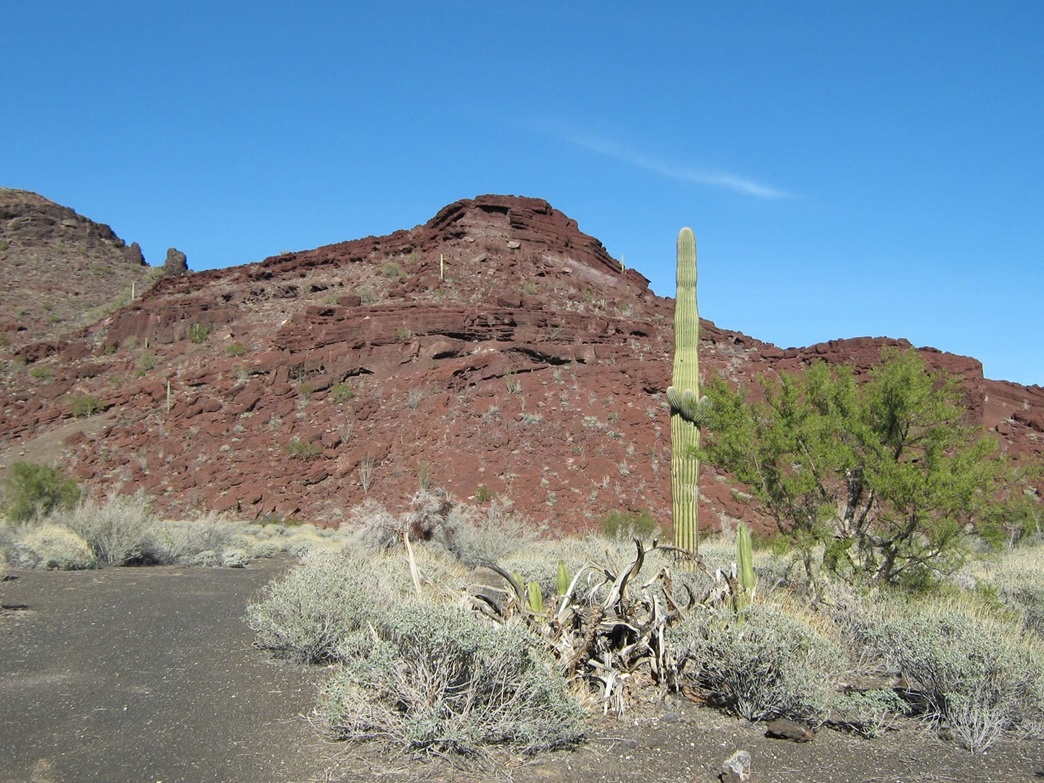
Any cross-country route to the summit involves crossing lava fields, which is technically easy but a chore due to the sharp and broken nature of the cooled lava. Some sections have mature vegetation growing through cracks, intermingled with islands of native terrain, while other sections look like it cooled last week, with nothing on it, barren as the moon. We had good luck with our route. Brush was moderate, and we admired and avoided cholla, ocotillo, barrel, saguaro and organ-pipe cactus along the walk. A small storm from a few days ago caused the creosote bushes to give off its pungent, yet pleasant, rubbery odor.
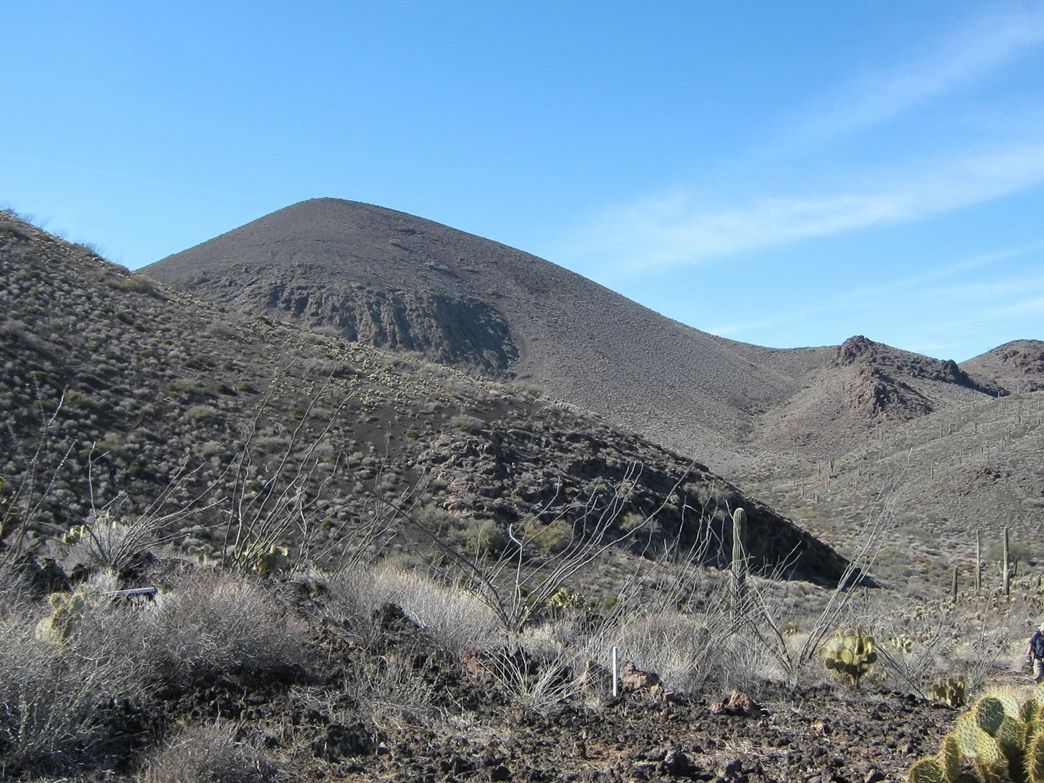
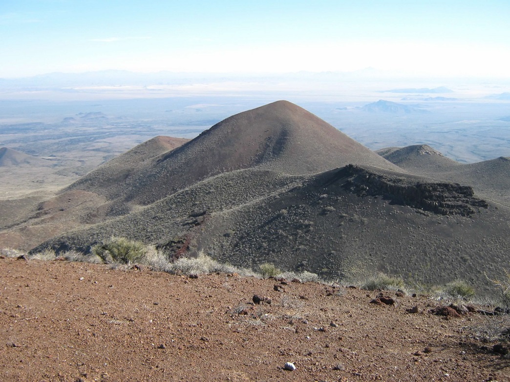
In about an hour we had gained high on the north slopes of Carnegie Peak, and now we were through with the lava fields, which was a relief. We traversed through a section of low brush and grass then came upon the road again. The road barged steeply up a ridge to a saddle immediately northwest of Carnegie Peak, with the slightly asymmetric profile of Pinacate Peak coming into view for the first time today. We took a break here.
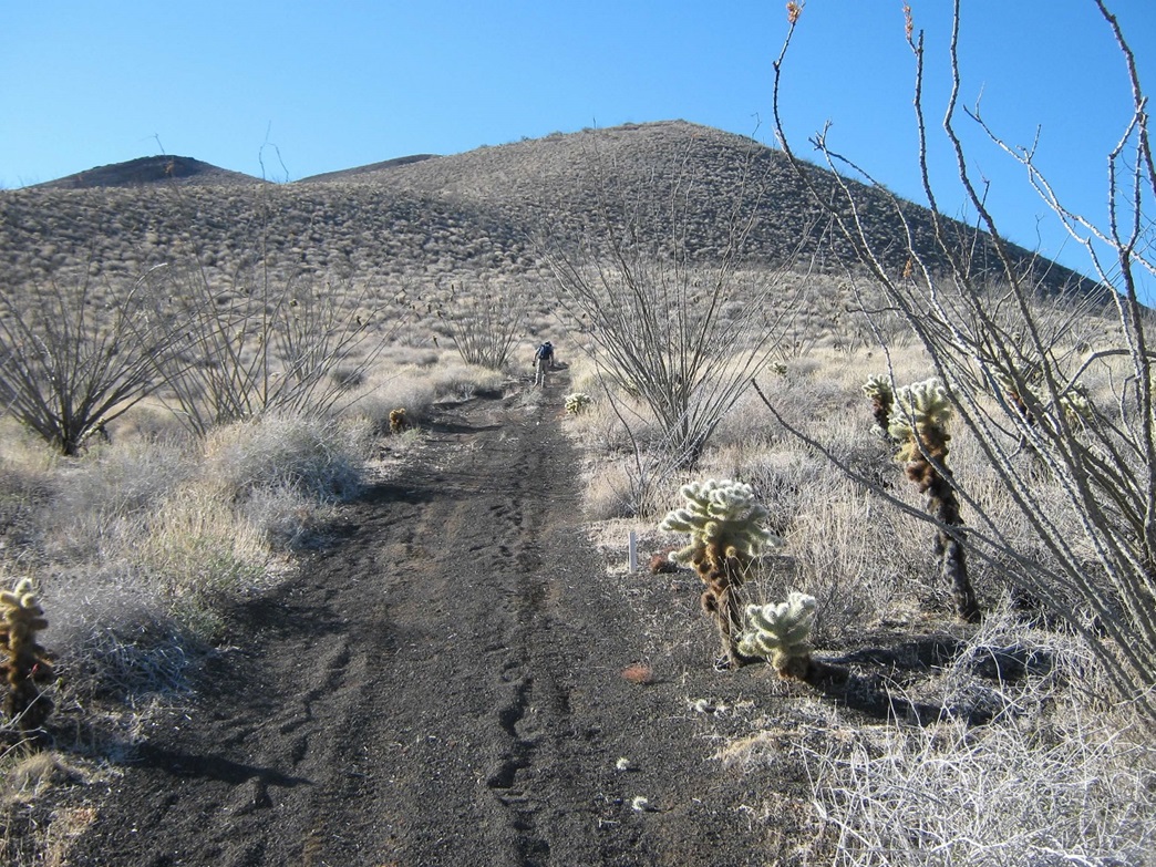
From the saddle the road continues a little more, descending a few feet into a small basin ringed by Carnegie and Pinacate Peaks. The road ends about three-quarters of a mile and 600 vertical feet below Pinacate Peak's summit. Why was there a road up to here in the first place? I guessed an old mine but there was no sign of any mines up here. I honestly have no idea. But it helped, saving us the hassle of ascending the steep grades of loose lava rubble, rocks and small kibble, where every two steps up is negated by back-sliding one step down.
The final portion to the summit follows a footpath that continues from the end of the road. The footpath enters into a drainage, staying on the slopes to the south, with an impressive lava formation on the other side. We made good time up the path, but where it steepened, we were battling the dreaded walk up/slide back effect of the lava rubble. So we left the path for more solid rock (and brush) for the hundred feet where this was a problem. When the slope moderated slightly, we got back onto the path and took it all the way to the top. We arrived at 11:15 a.m., slightly less than three and a half hours for the ascent.
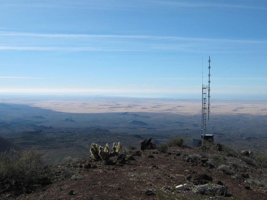
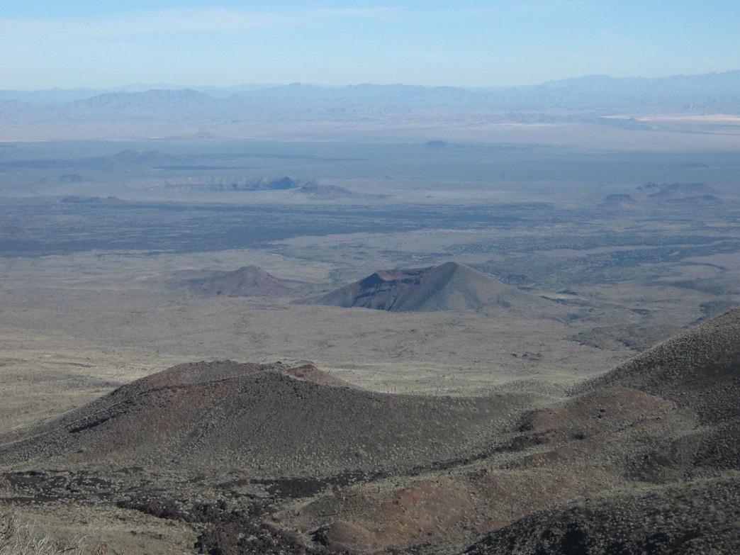
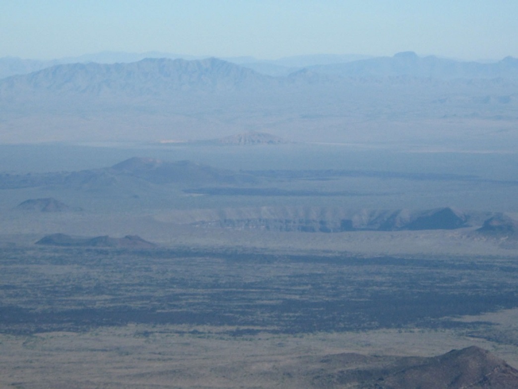
The top itself is just a little hump of rubble and bare rock. A clump of rocks to the side holds a register inside a strong box which is bolted to the rock. To the south sits a small antenna structure. I was very excited to gain the top and the views were absolutely stunning. In all directions the slopes of Volcán Santa Clara gave away gently for miles, merging into the deserts below, dotted by dozens of cones and craters. The amazing Crater Elegante, the largest of the maar volcanoes, was visible to the north. It's about six-tenths of a mile across, 800 feet deep and is nearly perfectly circular. It is a beautiful landform and a testament to the incredible geology of the region.
West and south were the sand dunes of the Altar Desert. The Gulf of California was visible to the southwest, with the buildings of Rocky Point also visible. The farthest views west were dimmed by haze, but sticking above it all was the top of Pico del Diablo, the 10,000-foot summit and highpoint of the Baja peninsula. Looking north were more cones and lava fields, and way north we could see peaks in the Cabeza Prieta and Organ Pipe Monuments in Arizona, including Mount Ajo. The eastern views were of Carnegie Peak up close, the Sierra Cucapas farther off, and miles and miles of desert as far as the eye could see. We stayed up here for about 40 minutes, having lunch. The weather was nice, in the 60s, and not too cool as there was essentially no breeze for the moment. We started off the summit about noon.
The hike down went fast since walking down the loose lava rubble, so laborious and tedious going up, is wonderfully fast going down, since it holds solid but also slides along with you on each step. We were back to the end of the road in less than a half-hour, and we continued on the road down the slopes to roughly where we met it on the way up. So far, we were making excellent time, and it was here we met the group from Mexico City on their way up to the top.
We decided to follow the road out instead of cut across the lava fields. The road eventually leads back to the trailhead, but it takes so long to do so that we grew weary of it and concluded, before we were done hiking it, that we had made a bad decision. The road goes far to the north to avoid the heftiest of the lava flows, hence the extra distance. According to various sources, the road runs about 7 miles each way. We finally arrived back to my truck around 2:30 p.m., an overall hike of about 7 hours. We figured our up-hill route covered about 4 miles one way with about 2,600 feet of gain, downhill about 7 miles and adding about another 200 feet of gain due to the ups and downs it takes. Our conclusion: cut across cross-country and deal with the lava fields, and re-meet the road higher up, where it is actually useful.
Back at the truck, we changed into drier clothing and started the drive back to the highway and to the border. The drive out took an hour to the Biosphere buildings, then another 40 minutes to Sonoyta. I was concerned about the possible long lines at the border, but we got lucky—there was no wait. I drove right up, we showed them our passports, answered a few questions, surrendered an apple and an orange, let them paw through the junk in my truck's bed, and once they were satisfied, let us go on. Now barely inside the United States, I pulled into a parking lot near the Lukeville General Store to send a text to my wife, and in that time the line of cars coming up into the USA had grown to about five, so I timed it well.
We stopped for dinner in Gila Bend and were back to my home by 8 p.m.. The hike and climb had gone well, much to our satisfaction, but also, we had no trouble at all with any other aspect of the trip, considering the logistics of driving into a different nation. Getting through Sonoyta was straightforward, and the dirt roads in the Biosphere were not as bad as I had feared. My thanks again to Scott for being a willing and enthusiastic companion for the hike.
Some discussion and links:
• How often is the peak climbed? More than I would have expected at first, but then again, it seems to be gaining in popularity. The summit register already had about a dozen groups (and 20+ actual people total) signed in for 2009. Most groups were from Mexico, the rest being from the USA. It's clear that while Pinacate Peak may never be over-run with people, it is known to hikers in Mexico, who take the effort to come all this way to hike it. It's not a peak known to most Americans, but slowly it seems to be gaining notice. Most Americans who hike it probably know about it due to its inclusion on the Sierra Club's Desert Peak Section list, or geography nerds like me.
• The season for climbing this peak would be winter, naturally, but even more strictly so given this region is among the hottest in the world in summer, and the volcanic rock radiates the heat very well, making even a moderately warm day uncomfortably warm. The air tends to be dry and still, and the terrain is unforgiving. The log book showed no signatures after late March from 2008, before resuming for the winter.
• Despite improvements made on the access roads, this is a remote and demanding place, and I would strongly suggest to go in prepared with a strong vehicle with beefy tires, lots of supplies, shovel, traction items in case you get stuck in sand, and the wherewithal to stay put for a couple days if something unfortunate should happen. Although the road seemed passable to a high clearance 2-wheel drive vehicle, I would still err on the side of caution here. I recommend having four-wheel drive.
• Keep in mind this is Mexico, so leave the gun at home, have all your paperwork and passport in order and keep it with you on the hike as well. You should have no problem at all.
• One of the USA border guys looked at my shovel and saw it had dirt on it. Mexican dirt? he asked. No, good old American dirt, I replied. I never needed to use it on this trip. If it had been Mexican dirt, I would have been required to wash it off before re-entering the USA. So, make sure your shovel is clean. Just one less hassle to deal with.
This guy has a number of excellent websites with photos detailing his trips to the sand dunes of the Altar Desert. You will also learn what a "Mog" is.
• Altar Desert |
|