The Mountains of Arizona
• www.surgent.net
|
| Perilla Mountain • Benchmark & Highpoint |
• Perilla Mountains • Arizona State Trust Land • Cochise County |
|
Date: February 17, 2024
• Elevation: 5,939 feet (HP), 5,922 feet (BM)
• Prominence: 1,285 feet (HP), 127 feet (BM)
• Distance: 6.5 miles
• Time: 4 hours, 30 minutes
• Gain: 1,700 feet (gross)
• Conditions: Sunny, clear, cool at first then warmer
Arizona
•
Main
•
AZ P1K
•
PB
•
LoJ
•
USGS BM Datasheet
The Perilla Mountains rise east of Douglas, north of the Mexican border and south of state route AZ-80, in southeast Arizona. The word "Perilla", when translated into English, means "knob", which is an apt desciption of the peaks in this range: many of the mountains have distinct knob-like summits that rise suddenly above their underlying ridges.
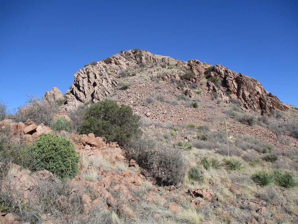
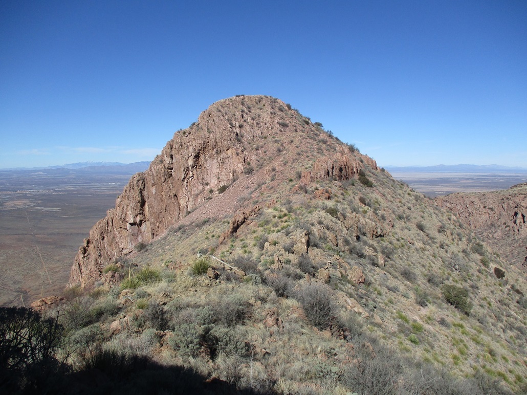
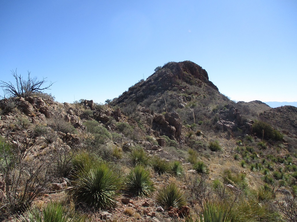
The peak I was interested in today has a distinguishing profile, easily seen from many miles away. It is a long ridge topped by two nearly-equal "knobs". This peak is the second-most prominent peak in the range so it stands out. The northern knob is higher than the southern one, but the southern one holds the "Perilla" benchmark. The approach makes it sensible to visit both, rather than skipping around one.
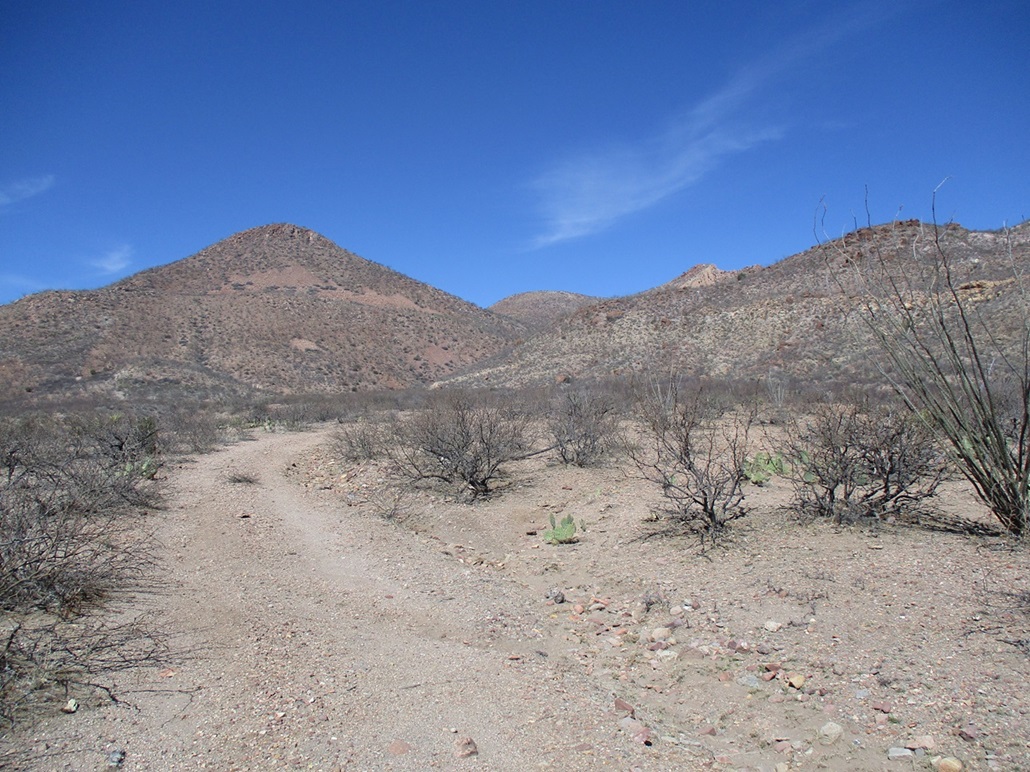
I was out the door about 7 a.m. and in Douglas a few minutes later, getting gas and snacks. I passed through town, taking 15th Avenue east until it becomes the Geronimo Trail, a long back-country byway that eventually crosses into New Mexico. The first four miles are paved, and passes by D Hill, a little hill which I climbed about two years ago. The road then becomes wide well-tended gravel. I drove to just beyond milepost 6, then turned left onto a rocky track, then right onto a lesser track that encircles an old gravel pit, now used these days as an informal shooting range. I parked off the track, backing into some desert scrub. The trees and brush here aren't big enough to hide a car. It would be sitting there in the open. This is just a mile or so north of the border, but I wasn't overly concerned about migrant shenanigans.
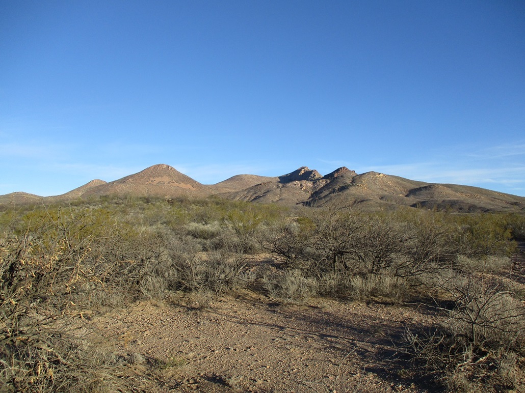
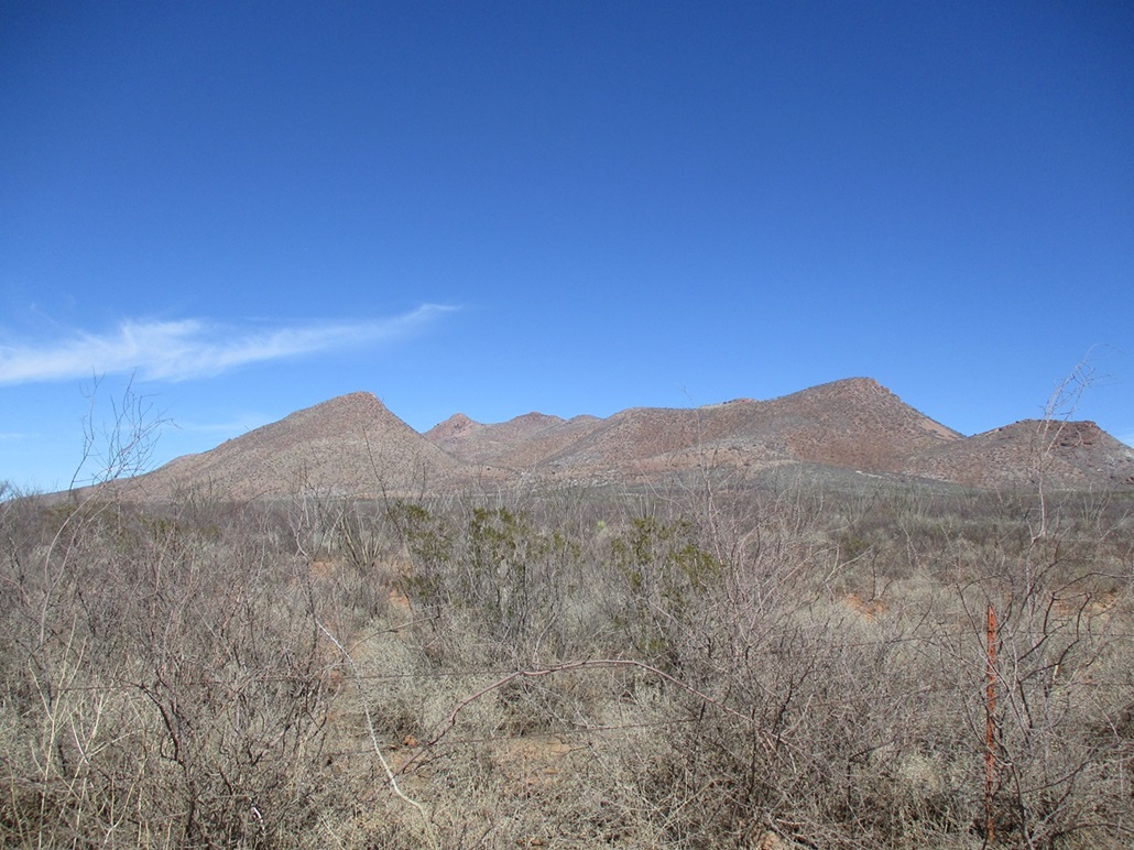
I locked the car and started walking at 7:45 a.m., the day sunny but the sun still low in the east. It was cool, about 45°. Highs in Douglas were forecasted to be in the 60s, and the sky was cloudless except for a random wisp here and there. From my parking spot, I had about a mile walk up this desert track into a canyon. The peaks could not be seen from here, though. They were hidden for the time being by a rounded bluffy ridge and a rocky highpoint marked by spot elevation 5829 on the map. This peak lies at the south end of the ridge that contains the two Perillas, which are about a mile more to the north.
The road walk went fast and wasn't difficult. It comes to the mouth of the canyon, where one branch drops about 20 feet into the drainage. There are a couple water tanks here and a trough. I angled around these, following a lesser road (an ATV path at this point) that headed into the canyon. I stayed on it until it dipped into the drainage bottom, at which pont I followed the drainage. The going was still easy, mostly open and few obstacles. About 300 feet later, I came to a windmill, a masonry stock dam and above it, a water guzzler with a solar panel atop it.
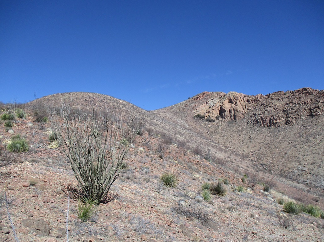
The next half mile was mainly spent in the drainages, which branched as I headed "upstream". The brush often closed in — the usual thorny crap that is everywhere in this desert. Getting through all this wasn't difficult, but I often had to find ways past the densest scrub or the occasional rocky barrier. Whenever I could, I would follow a cattle track. A hill with elevation 5343T (as printed on the map) lies at the south tip of a ridge and I used that to gauge my position. Once I was "past" it, I knew to begin thinking about a way up out of the drainage and onto this ridge.
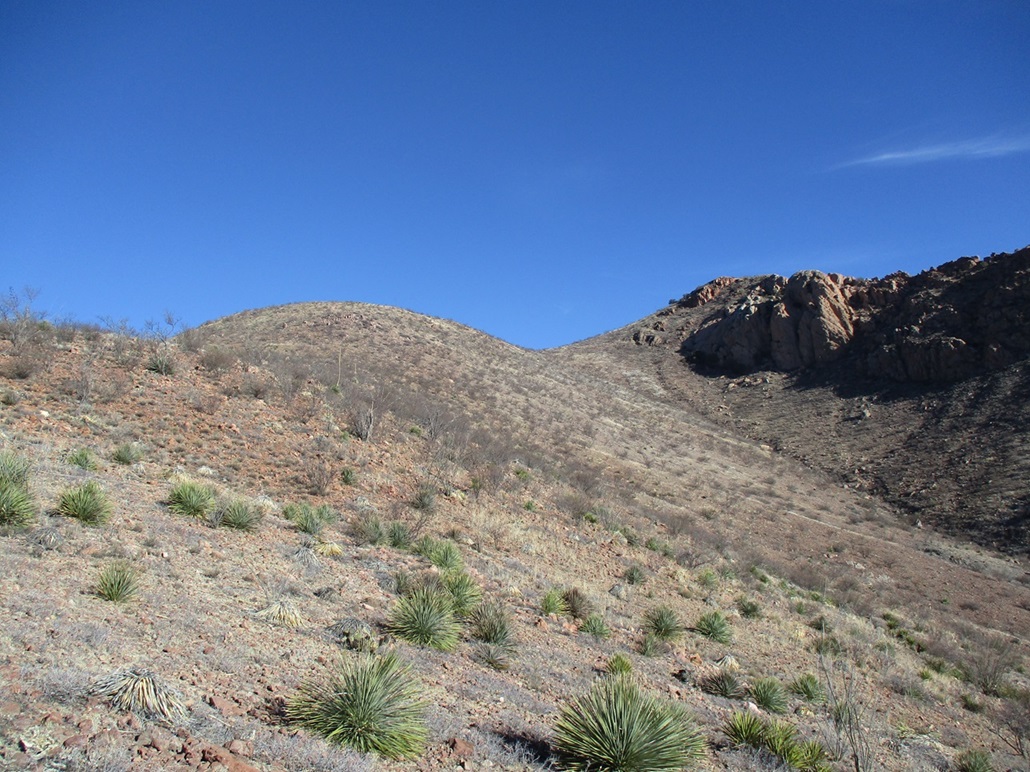
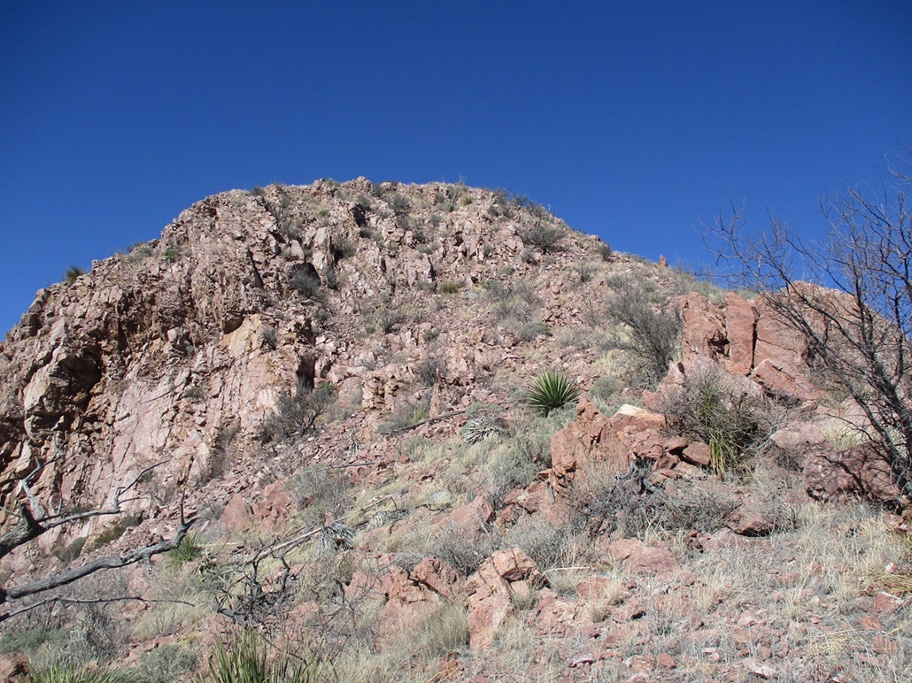
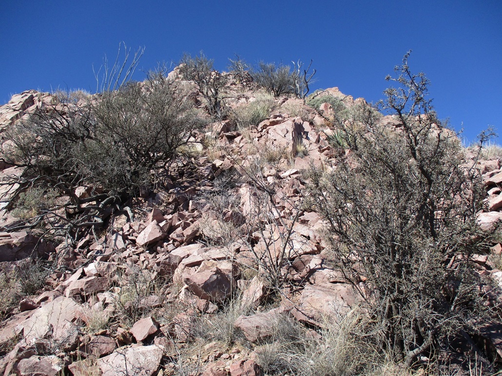
I picked a spot pretty much at random and started up, again following cow paths whenever I found them. I found myself needing to drop into and out of smaller side drainages to get on to the preferred slope. I then busted straight up slope, scampering through a low cliff band, until I was on this ridge. From the drainage to the ridge was about a 450-foot gain. It was messy and brushy, and every rock wanted to roll, but otherwise not difficult.
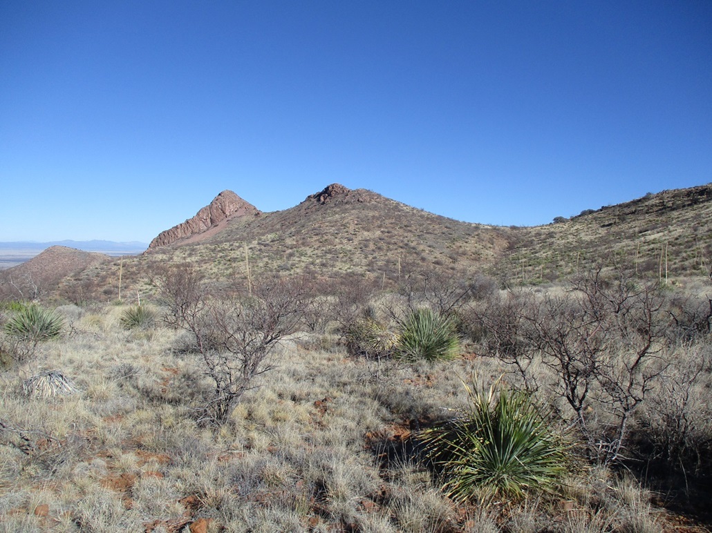
Now on the ridge, the thorny scrub lessened. It was more agave and ocotillo up here, and abundant grass, some low cactus, and rocks rocks rocks. Up ahead was that big rounded bluff I mentioned earlier. It was steep but easy, a gain of about 300 feet to get above it. Finally, I could now see the two Perilla peaks, a little less than a mile north of me. They looked very knobby, for sure. They stuck up over the ridgeline with cliffs and steep slopes, making me wonder just what I was in for. But I was confident I would figure it out. I was not expecting any show-stopper cliffs.
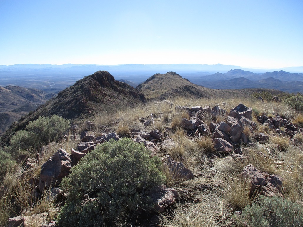
I continued north on the gentle grassy slopes, aiming for a saddle up ahead. Cow paths went all the way to this saddle, where there is a clearing here and evident they bed down here sometimes (poo cairns). I never did see any cattle today, but appreciated their paths which helped me a lot. I then contoured around back of a smaller hill, aiming now for the nearest of the two Perilla peaks. This first one (the southern one) is the benchmark peak, while the higher northern one, the highpoint peak, was visible poking above the skyline ahead of me.
Even from just a few hundred feet away, it looked too messy and vertical to be safe. The lower half is just a talus slope, the upper half a mix of grassy slopes and rock outcrops. But once at the saddle and immediately below it all, I could see it angle back and even sensed a "path" in the talus.
The talus portion actually went pretty well. It held together most of the time. I took careful steps and ensured that the rocks wouldn't move under me. This fed me onto the grassy slopes. I made a turn around one with a distinct horn which I would use to remind myself of the route coming down later. Now I was on the steep slopes below the top. I got to a rock knob, thinking it was the top, but the actual top was a few more yards ahead, about 40 feet higher. In some of the nooks up here, I found old food tins and sweatshirts, evidence of past crossers. But these looked old, like they've been out here for years.
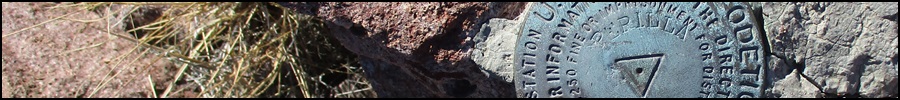
I was on top of the benchmark peak soon, where I stopped briefly for a photo of the benchmark. According to the datasheet for this benchmark, it was placed here and not on the higher hill because nearby Pedregosa Mountain couldn't be seen from the higher peak, which I found amusing. Even in the datasheet, they acknowledged this was not the highpoint.
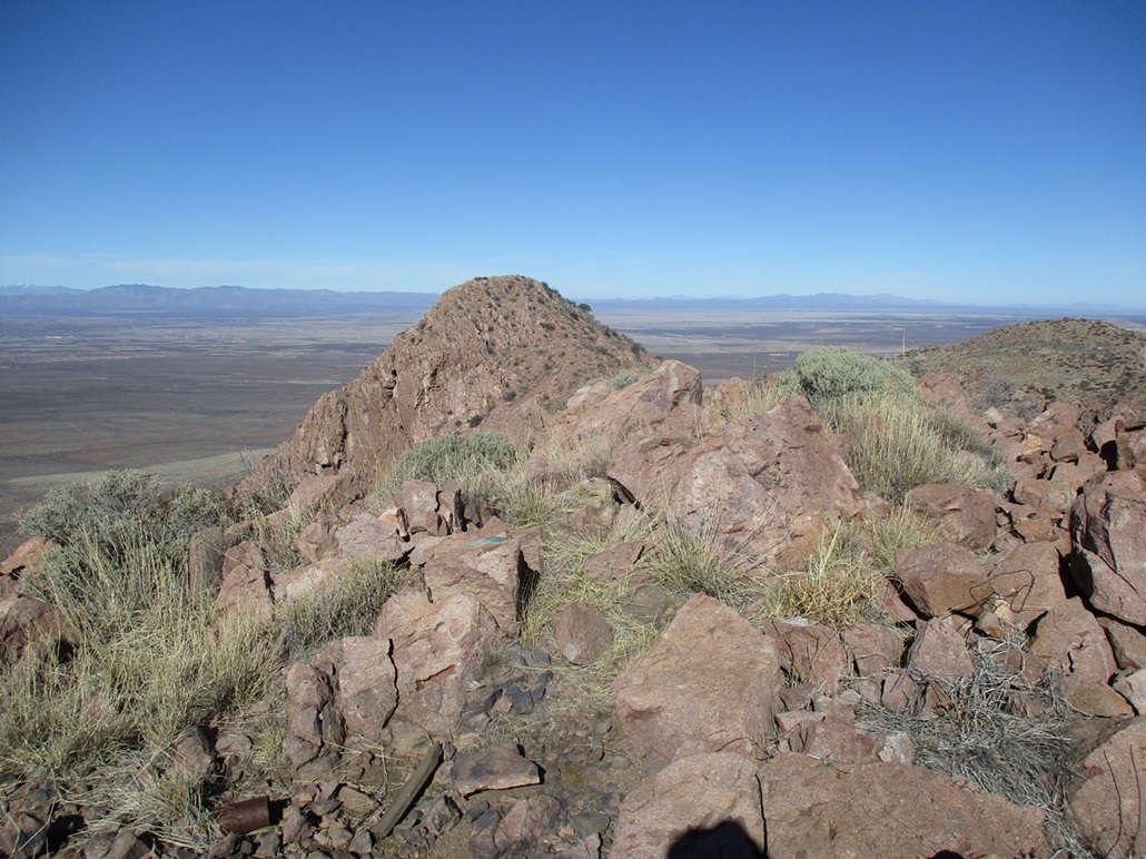
Normally, I'd feel relieved to be done with the uphill and happy with a peak well-earned, but I knew I still had more hiking, scampering and climbing to do. I needed to descend off the benchmark hill, a drop of about 125 feet. This segment was rocky but not cliffy. I spent a lot of time easing past the rocks, which was very slow-going. Brush and loose rock slowed me down too. But soon, I was down to the saddle, now getting a good look at the highpoint peak.
This peak was essentially a slope of talus all the way up. I got onto the lower slopes, which angled gently, then steeper. I aimed for a lone boulder on the slope ahead of me, then angled slightly left and upward. The last 50 feet was steepest and loose, but I was able to stick to the most stable of rocks. I was glad it fed me right to the top. Finally, I was done! I stood atop the highpoint peak and looked around, snapping photos. I took a very brief break here to check the time — it was 10:15 a.m., a 2 hour, 30 minute ascent. I found a cairn but no register. I spent just a few minutes up here, wanting to get back down while I still remembered what to do.
The downclimb went well, some of it on my butt by design. I was back to the saddle in just a few minutes. Do I go around the benchmark peak? Neither side looked attractive, so I chose to reascend it, which was a chore but easy. The register is found in a cairn near the benchmark, so I took a longer break here to sign in, eat something and relax. There were better sitting rocks on this peak anyway.
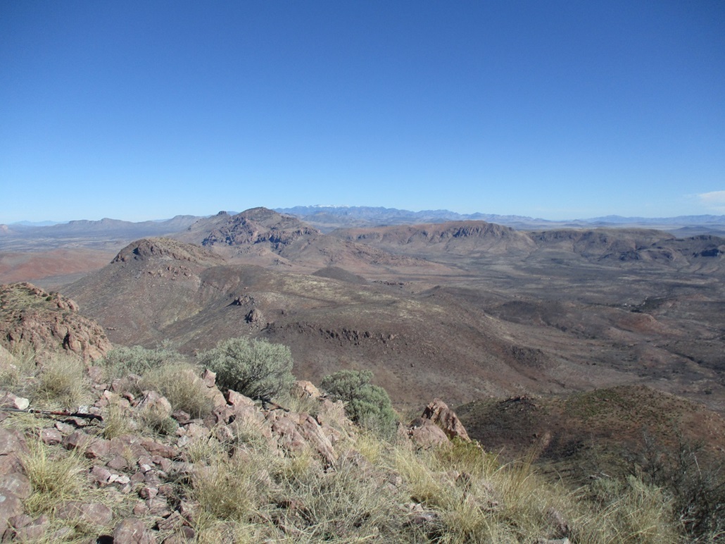
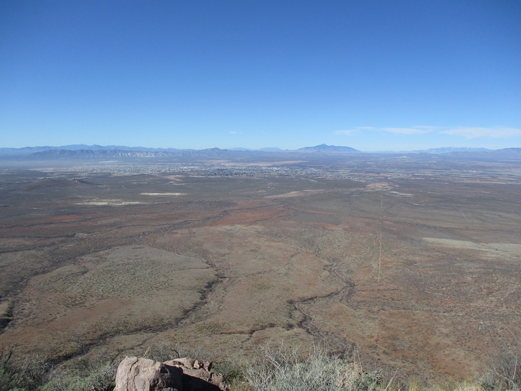
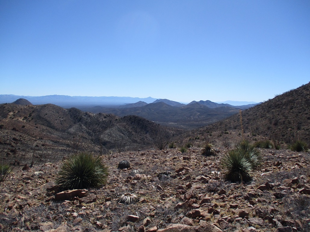
The day had warmed nicely, although it was breezy up this high. I spent about ten minutes up here, looking at the surrounding deserts and mountain ranges, and at the cities of Douglas and Agua Prieta. The register held a bunch of names going back to the 1990s, mostly familiar ones, a lot from the Southern Arizona Hiking Club, and a few names I did not recognize. It sees a handful of summit teams (groups or individuals) a year, maybe two or three.
Now, I could officially be relieved that all the uphill was finished, and could start down for real. Going down this hill went well, I was able to keep to the same route I had followed coming up, and was soon down below the rocks, slopes and talus. The long segment through the grasses, down below the bluff onto the lower ridge and into the drainage went well. I was fatigued now and I stumbled a little more when rocks would suddenly roll out from under me. All the while I could hear someone shooting, and it was consistent, one shot after another, and from the sound of it, I was heading their way. I hoped they weren't firing into the canyon.
The drainage portion was a chore. Like before, it was never difficult, but I needed to bypass rock and brush barriers, or squeeze through them, which went slowly. I was soon back to the dam and windmill, then onto the ATV track, then to those water tanks, then uphill to the track that I would follow back to my car. Those gunshots were getting louder.
I was back to my car at 12:15 p.m., a 4 hour and 30 minute round trip hike, covering about 6.5 miles. I could hear the shots plus some music blaring, but I did not see them, nor my car, until I rounded a bend. There were a couple of them shooting things in the gravel pit. I got into my car and started out, making sure they saw me as I drove around the pit, to get back onto the Geronimo Trail.
I was feeling very happy about how the hike went. It was a little scraggly down below and brushy/cliffy up high, but otherwise went very well with easy navigation and nothing to scare me. The day was so nice, I didn't want to just head back home yet. I had a map printed for a smaller close-by peak, so I went east some more on the Geronimo Trail, but decided I felt good with what I had done, and saved this dinkier peak for later. I scouted a couple other peaks and could combine those into one outing.
I returned to Douglas and straight into Bisbee, arriving home about 2 p.m.. The Perilla Peaks were a lot of fun and even a tad challenging, but not difficult as long as I used my head. I never once "scrambled" in the usual sense of the word. Segments required me to use my hands to ease up, down or around rocks, but as long as I went slow, it went well. There's no way to move fast once on the peaks themselves. Even on the lower ridges, the rocks want to roll.
|


|