The Mountains of Arizona
• www.surgent.net
|
| Loco Knoll |
• White Mountains • Apache-Sitgreaves National Forest • Apache County |
|
Date: May 27, 2023
• Elevation: 9,069 feet
• Prominence: 369 feet
• Distance: 2.8 miles
• Time: 90 minutes
• Gain: 470 feet
• Conditions: Clear, cool & gorgeous
Arizona
•
Main
•
PB
•
LoJ
•
USGS BM Datasheet
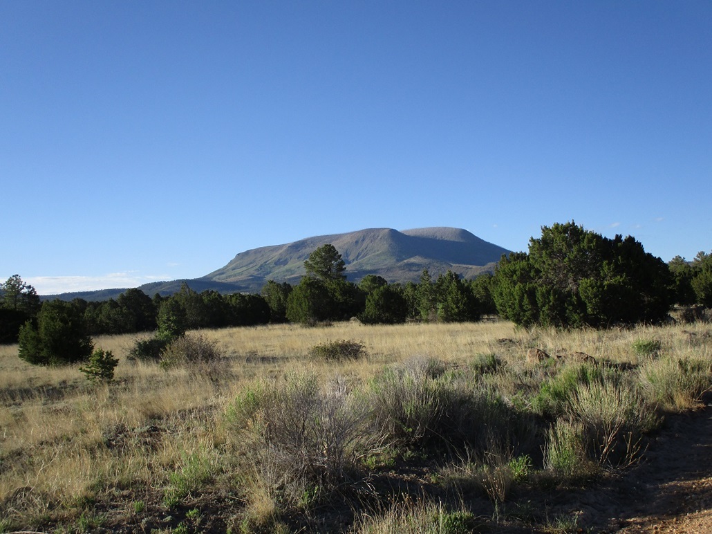
I awoke today in Springerville, eastern Arizona, ready for a day of peakbagging. I had driven up yesterday and hiked three peaks west of town, the last being Peak 7268. Today, I would concentrate on the peaks in and around Alpine and Escudilla Mountain to the southeast. Although I did not need to be up at dawn, I was still on the road pretty early. First up was this peak, Loco Knoll.
Loco Knoll is a forested mound located north of Escudilla Mountain, with gentle slopes on its west and south faces, and steeper slopes on its north and east faces with small cliffs, but nothing technical. From town, I followed US-191 south, gaining elevation onto a higher plateau, then turned left (east) onto Apache County Road 2116, which then gains onto a slightly-higher plateau. This road swings south and bypasses a spread-out residential "suburb" of Springerville. The road is hardpack but well maintained, with a few ruts and bumps. I could see Loco Knoll for the first time rising a few miles to the east.
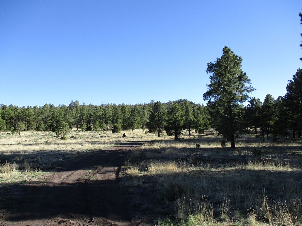
The road swings south of the subdivision, then east, then turns into Forest Road 275, called Stone Creek Road on the map. This is an excellent road that leads east and slightly southeast toward the hills, gaining a few hundred feet to top out on a ridge slightly south of a lower knoll, itself south of Loco Knoll. Here, I turned east onto FR-8889, which was in good condition for the quarter mile I was on it. It drops into a small valley, with Skunk Flat Tank in the middle. An unmarked side road then branches north toward Loco Knoll. I parked in a clearing near the junction. It was 7:15 a.m., sunny and cool, but not cold.
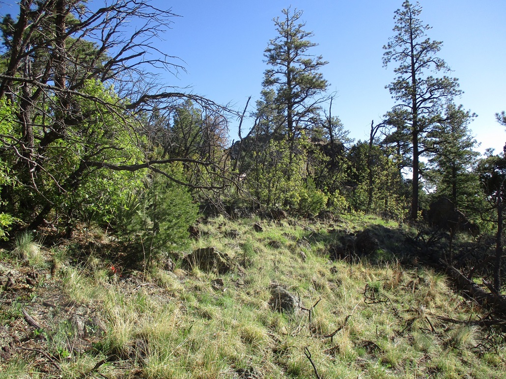
I walked north up this track, which was haggard but drivable. Had I been motivated and careful, I could have eased the Forester up this track. It's rutted with high centers, but no big rocks. The track bends west and circles around that lower southern knoll, coming out into a meadow south of Loco Knoll and north of the lower knoll. Yet another track branches off and continues north, aiming for Loco Knoll, which could be seen but just as a mound of trees.
This track is very rough and 4-wheel drive would be necessary to drive it. Some very large rocks lay in the middle of the road. But I did not need to go far on this road. In about a quarter mile, I had reached its apex near a merge of roads, another coming up on my left. Not knowing any better, I chose to leave the road at this apex and start up the forested slopes. The forest is thick but easy to maneuver through and generally good line-of-sight views to where I could see a hundred feet ahead most of the time. Downed branches and rocks were the main challenges down low.
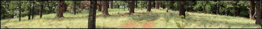
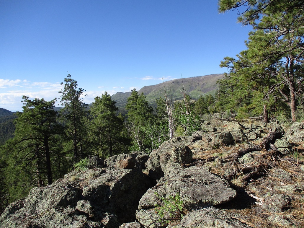
I simply walked uphill, the grade steepening, even requiring some easy scrambling through rock bands. I knew I was gaining the knoll itself, and soon, I was on flatter terrain, but very rocky. I was "on top", but not sure where the highest point was. I was actually at the south tip of the peak's tiny summit ridge. The forest limited views such that I could see a little bit ahead, but not the whole ridge.
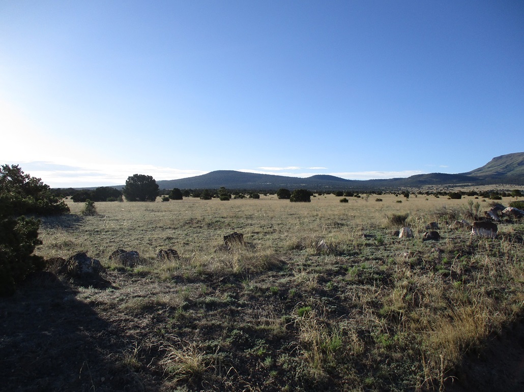
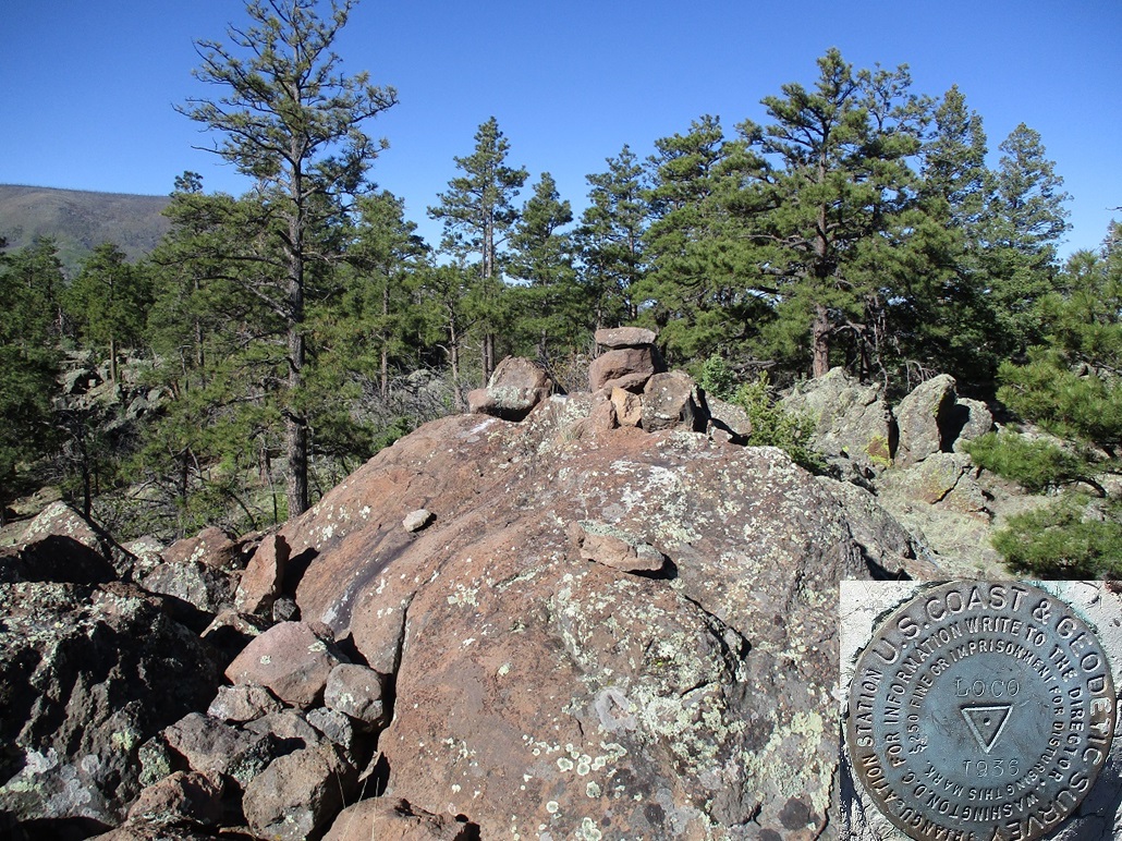
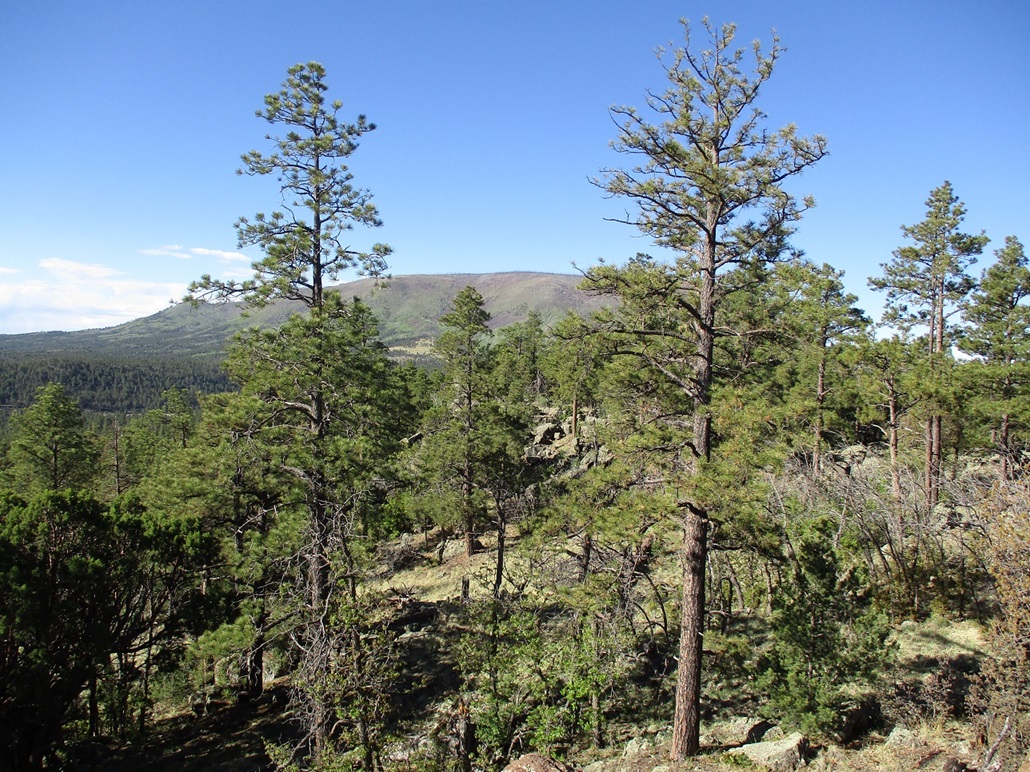
I simply walked north on this ridge, going up and down and around rock outcrops, using the hands a few times, until I was at the highest knoll, the summit now being obvious. It's a rocky knoll with a small cairn atop its highest rock. I set down the poles and pawed my way through the rocks to the top. Benchmark "Loco" lies on the top rock, and a register nearby. I signed in and relaxed. It had taken about 45 minutes to get here. Trees blocked any views to the north and west, but I had open views of the eastern flanks of big Escudilla Mountain, and then of peaks and ranges east into New Mexico. From here, the state line is just a couple miles away. I spent about ten minutes up top. It was a pleasant summit, with convenient sitting rocks and the weather was calm and very comfortable. Even though I had an "agenda to keep!", I felt in no hurry.
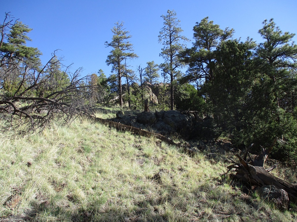
For the descent, I dropped straight off the summit knoll onto the slopes to the east. This worked out very well. The trees are not as dense up high and I could see my way easily. I hiked south, making a long and angled descent to place me back on the track a little south of where I had left it earlier. I recommend to ascend the peak this way: just ascend until near the summit ridge, then hug it but don't commit to it until at the highest point, which will be obvious.
I was back to my car a little before 9 a.m., a 90-minute round trip hike. It went extremely efficiently and I enjoyed it a lot. Navigation was easy, the forest was not too dense, the scrambling was fun but not tedious and the views were very good. Back at the car, I got my things in order and then egressed back onto US-191, now aiming south a few more miles to Alpine for the bulk of the day's hiking. First up was South Mountain, then a couple of brutal brush-and-thorn peaks to follow.
|

|