The Mountains of Arizona
• www.surgent.net
|
| Peak 7268 |
• Springerville Volcanic Field • Arizona State Trust Land • Apache County |
|
Date: May 26, 2023
• Elevation: 7,268 feet
• Prominence: 528 feet
• Distance: 0.8 mile
• Time: 1 hour
• Gain: 618 feet
• Conditions: Sunny and warm
Arizona
•
Main
•
PB
•
LoJ
•
Interactive map
Today was the first day of a three-day hiking and peak-top-touching getaway to the high country in and around Springerville in eastern Arizona. I had left Tempe at 2:20 a.m. this morning and had already hiked two peaks, Peak 10932 up in the Sunrise Ski Valley on White Mountain being the most recent. I was down off that peak about 2 p.m., and my hotel in Springerville would not be ready for another hour.
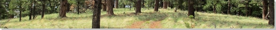
Faced with the prospect of an hour of boredom, I decided to go hike another peak, there being no shortage of them on the Springerville Volcanic Field. Peak 7268 is a noticeable bump in the rangeland north of US-60 and west of US-191, where the two highways diverge northwest of town. In this immediate area, the land is grassy rangeland pocked with numerous rock outcrops and rounded humps of peaks, all the result of individual eruptions over many millions of years. Peak 7268 is particularly tall compared to the surrounding mounds, with steeper sides, not as spread out as the others.
One mile west along US-60, west of the US-60/191 split, I eased right off the highway onto Apache County Road 4365, which is chunky gravel and heads northwest aiming directly toward the peak. This is State Trust land, but I had my permit, not that I expected anyone to check. The land is used here for cattle, and a lower hill next to Peak 7268 was (is?) used for cinder mining, probably the easiest mining ever, where they just scrape off the side of a hill, and load it into trucks to use as road fill and other general landscaping needs.
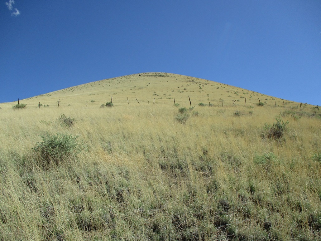
I drove on this road about 4 miles until I was on its north flank, where the road achieves its highest point. It was also clear that approaching the peak from the north would be the best choice. The slope from the north is steep but not as steep as other directions, and the highpoint is on the north tip of the the small summit ridge, meaning as soon as I topped out onto the "top", I'd be at the highest point.
I pulled in about 3 p.m. and parked off the road. It was warm, in the low 80s, with a steady but gentle breeze. The slope in front of me was all yellow-colored grass, and speckles of cactus and low scrub, but nary a tree. Navigation would be trivial. Knowing it's warm and the snakes are probably out, I got on my beater Wranglers and hoped that would stave off any bites. I stepped over a barb-wire fence and started up slope.
I followed any openings that I could. There are a few weak drainages down low that had bare berms that I could walk on for a few yards at a time. But eventually, I was forced onto the grass and just had to walk slowly and keep an eye open for snakes. Fortunately, the grass was barely ankle high and spread out, so I could see most of the ground. Unfortunately, snakes are masters of blending in. Every single rattlesnake I have ever seen has always been at the last possible moment before my boot comes down beside it. I never see one a couple seconds beforehand.
The slope is gentle at first then steepens. I crossed another fenceline midway up, then trudged up the steepest parts methodically until I was on top. Higher up, there were more open slopes of rubble and more cactus patches. I had no trouble at all, no snakes, no cactus barbs, no sudden falls. I was on top in about 20 minutes.
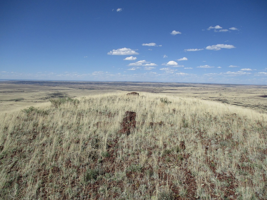
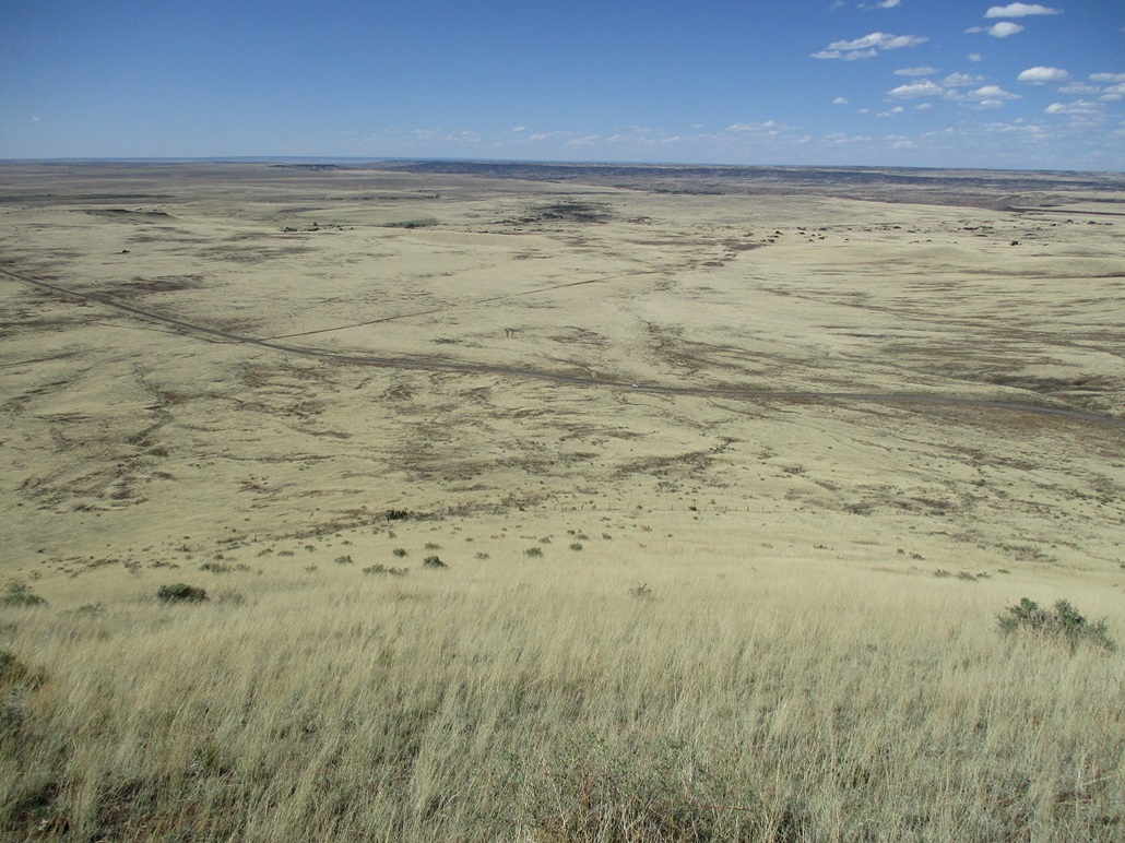
The views were really good up here. Looking south I could see White Mountain and its snowy summit. Looking north, the land flattened away, the next hills of any size about a hundred miles away on the Navajo Nation. West were all the summits on the volcanic field, and east was the spread out Coyote Hills, a shield volcano. Springerville can be seen to its south.
The top itself was vacant except for a rock cairn, a rock cross, and a pile of rocks that looked kind of like a packrat midden. There was no register. I spent my customary three minutes on top, then started down. Other than keeping an eye open for snakes, the downhill hike went quickly and the round trip took a little under an hour. Back at the car I changed into shorts and a t-shirt, and decided I had done enough today and that I deserved a hotel room and cable TV.
The next day, I would head south toward Alpine and climb six peaks, starting with Loco Knoll.
|


|