The Mountains of Arizona
• www.surgent.net
|
| Hackberry Mountain |
• Mormon Mountain-Hackberry Volcanic Field • Coconino National Forest • Yavapai County |
|
Date: October 23, 2011
• Elevation: 5,831 feet
• Prominence: 1,391 feet
• Distance: 5 miles
• Time: 4 hours and 15 minutes
• Gain: 1,700 feet
• Conditions: Sunny and warm
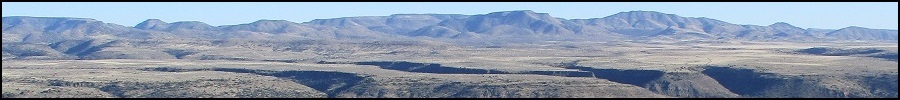
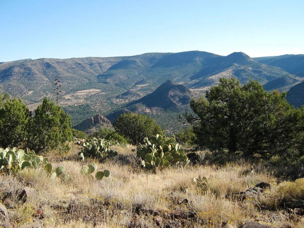
Hackberry Mountain lies within the Verde River Valley of north-central Arizona, hemmed in on its south by the Verde Rim and on the north by the southern cliffs of the Coconino Plateau, Mormon Plateau and the Mazatzal Range. The Verde River Valley is noted for the many cliff-dwellings built into the the cliffs by the ancient Indians. The most famous is known today as Montezuma's Castle, but there are hundreds of smaller structures still to be found in and around the area. Hills within Towel Creek, a feeder creek into the Verde, hold many of these old structures.
Hackberry Mountain hems in Towel Creek to its north, and coming in from Camp Verde, the peak is visible as a light-colored mound-shaped mountain, rising above the lower hills, set apart from the Verde Rim. I was on a short run, hiking two peaks in two days, the first being Black Mountain north of Cottonwood. After coming down from that peak, I got food and supplies and tried to get somewhere close to Hackberry before it got completely dark.
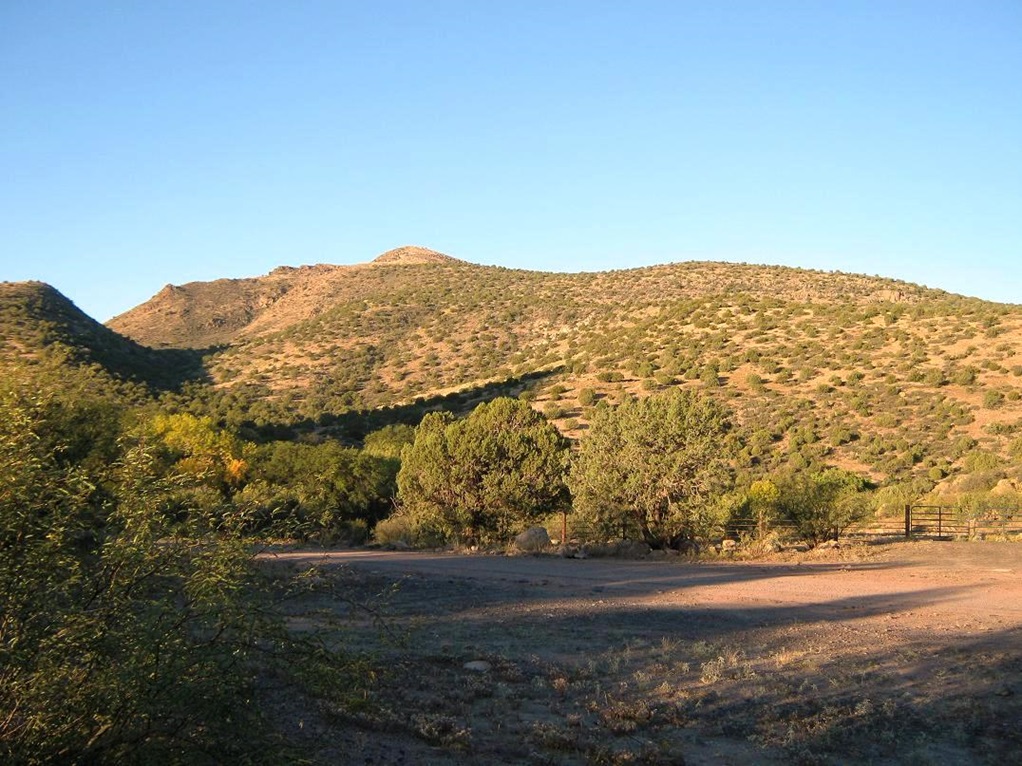
From Cottonwood, I took AZ-260 southeast about 20 miles, crossing over Interstate-17. At first I looked into camping at the Clear Creek campground off of AZ-260, but they wanted $18, and it was crowded with RVs, kids, dogs, and everyone was crammed onto one another. I drove a little more, easing onto Forest Road 708 and driving in another four miles before snagging a spot at a pullout that had a fire-ring. The road in was washboarded but solid, with steep drops and not one I wanted to be driving on in the dark. Finding this spot was good, as I had 10 minutes of daylight left before it got totally black. I had a peaceful night of camping here.
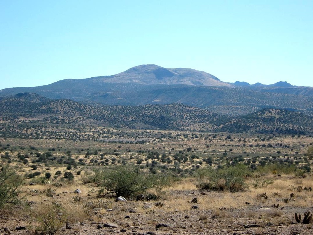
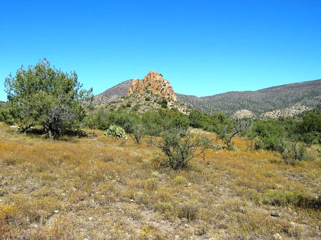
The next morning, I awoke with the sun and got moving around 6:45 a.m., driving another four miles farther into the wilderness. Hackberry s mass dominated the immediate view, and I pulled into a parking area opposite a prominent rock outcrop called Needle Rock. The weather was clear and calm, chilly but warming as the sun rose. Hackberry Mountain was directly across from where I parked, and I could now eyeball ways to get to its summit. I was mildly relieved to see it wasn t covered in a thick mat of woody brush and trees.
The map shows a trail (#66) that supposedly runs across its north slopes, bypassing the summit by 200 vertical feet. This was my default plan, of course. I hopped a metal fence and followed a tiny spur road a short ways, coming to what looked like an abandoned residence. Here, I found an ATV track that went south and followed the route laid out for Trail #67, the Towel Creek Trail. So far, everything was going well, but quickly I noted that any evidence of Trail #66 was gone. I could find no trace of this mysterious trail. Quickly I concluded this would be an all cross-country ramble. While a trail would have been nice, the cross-country option looked like fun too.
At some point, I simply left the Towel Creek Trail and started up-slope, heading due west. I quickly came to a fence-line and crossed it. I walked up the slope, aiming toward a saddle to the right of Peak 4879, connecting it to Hackberry s lower flanks. The going was good but closer to the saddle, the brush thickened and closed in, slowing me. I plowed through some woody thickets in places, and when it felt right, descended into the rocky gully, coming up the other side, now on Hackberry Mountain s eastern slopes.
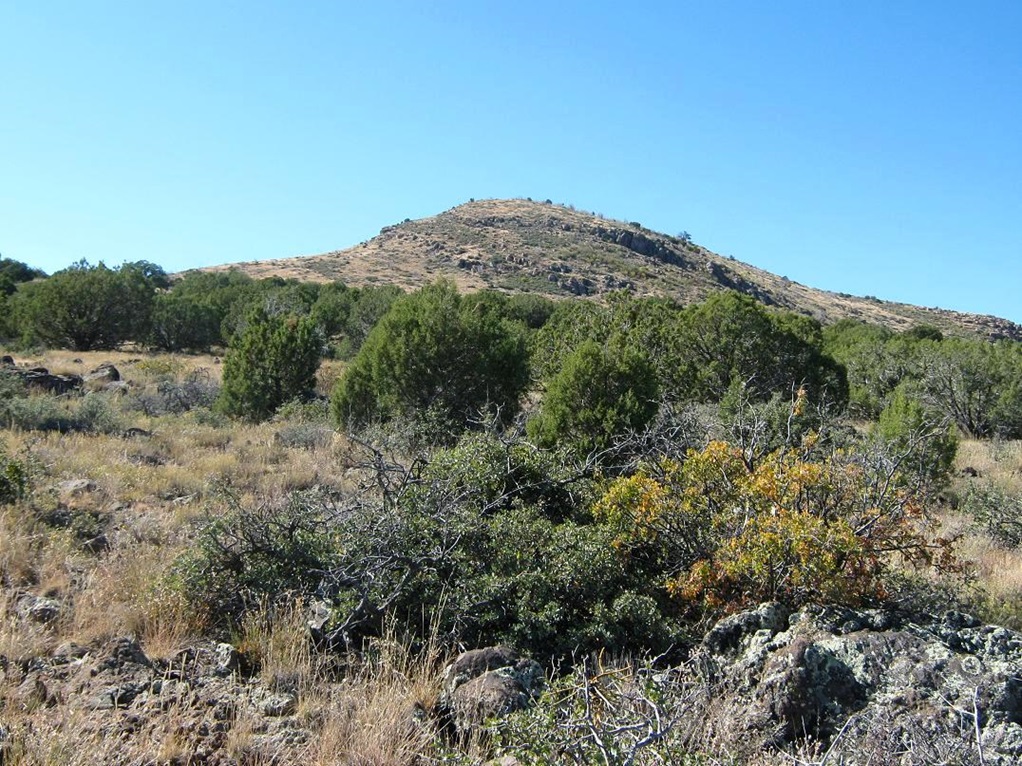
The brush was much lighter on these slopes (although the cactus, mainly prickly pear, was much thicker). I followed a gradient directly up slope, gaining about 300 vertical feet quickly to come upon a broad ridge. I was well above the 4879-foot peak across the way. I took a breather here and plotted my next segment.
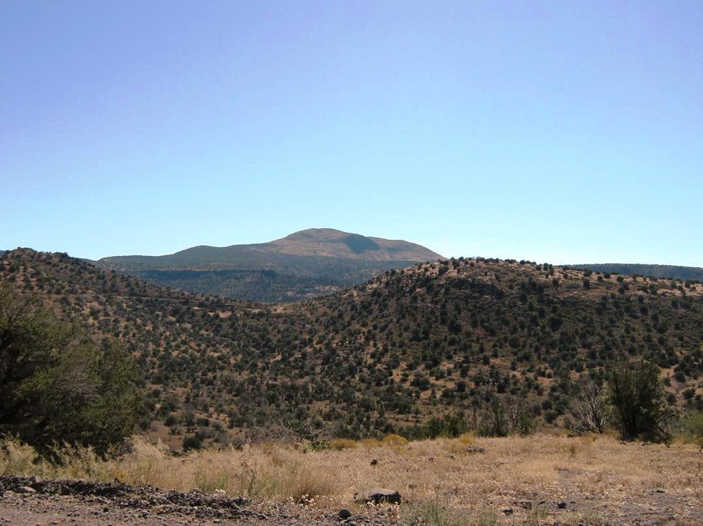
On this ridge, I went up slope, now on a more westerly bearing, generally following the path of least resistance through the brush, rocks, cactus and grasses. The forest here was moderate pinon and juniper, and there were more rocky sections and outcrops the more I climbed. The grade here was pleasant, and in time I had gained onto a flat bench, elevation 5,300 feet, a little bit south of spot elevation 5,212 shown on the map. Here, I had views again of Hackberry Mountain s summit mass, although the actual highpoint was still hidden from view. I took another break.
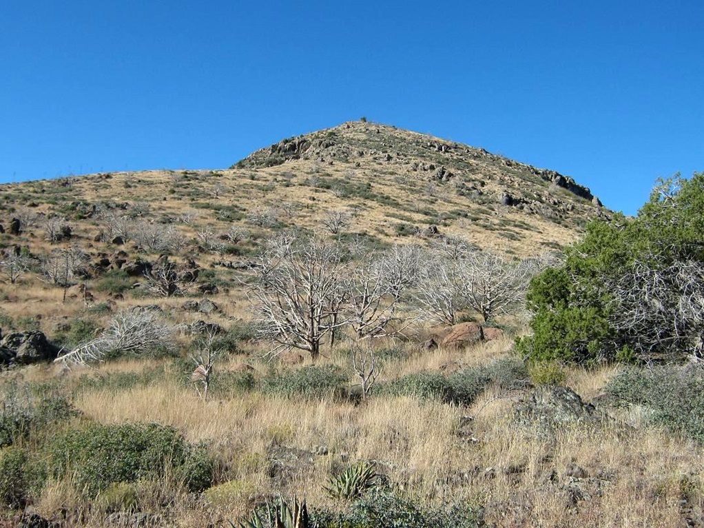
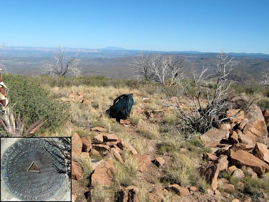
The final segment was a straight-forward grunt up the slopes. I aimed to the left and came upon a well-defined east-west ridge coming off the summit. Here, the rocks got thick and in spots I needed to clamber up easy obstacles, never needing to do anything more technical than keep myself balanced. I slowly walked up to what I thought was the top only to see slightly higher land a few hundred yards more west. So I walked up that slope and yes, there was even a little more to go! Fortunately, it was simple hiking and I came to the summit rocks at about 9:45 a.m., a 2-hour, 30-minute ascent.
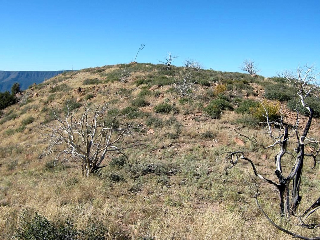
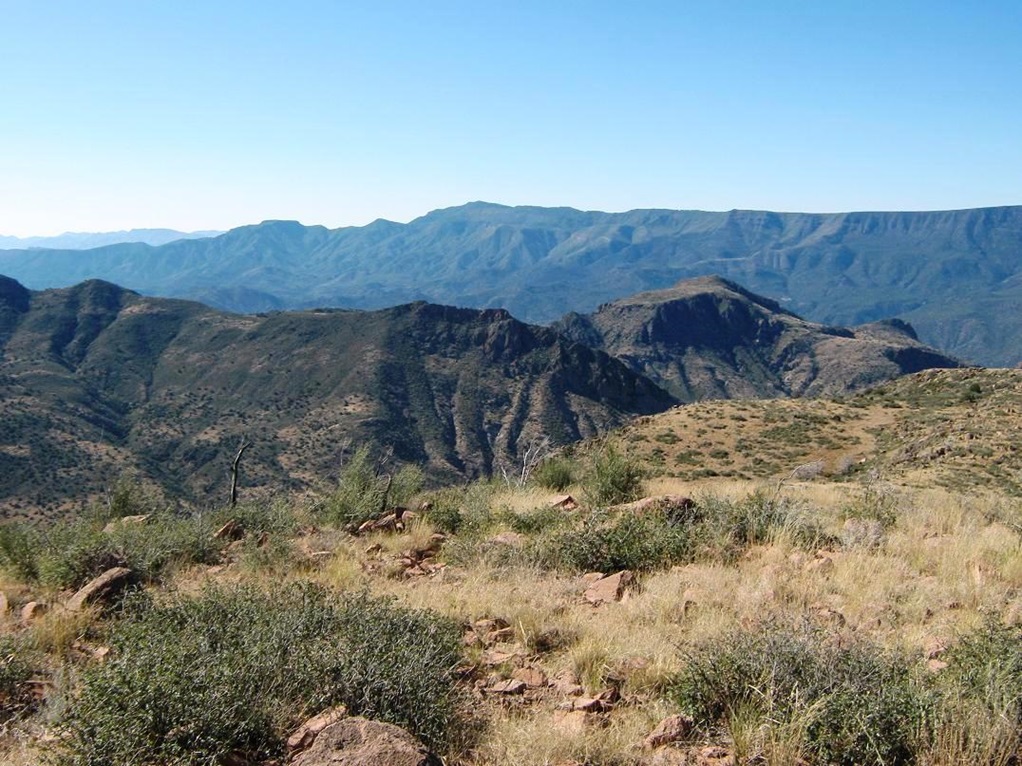
The summit is open, a witness marker embedded in the highest rock, while the USGS benchmark sits on a flat rock slightly lower. I sat on a nearby rock and took a food and water break and enjoyed the incredible views. The whole Verde Rim, a forested band of cliffs, took up most of the southern view. Squaw Peak, which I hiked back in March, held up one end, all the way to Pine Mountain, which I hiked back in 2006. Off beyond were the Mazatzals. Looking north I had more cliffs, and way off to the northwest was big Humphreys Peak, just sitting up there on the Coconino Plateau. The weather was warming up, but it was very pleasant, a beautiful fall day. The sky was deep blue, the humidity about 5%, or so it felt.
After a few minutes I started the trek down. I took a route more northeasterly, aiming more toward the 5,212-foot spot elevation. I felt no need to exactly retrace my ascent route, and I followed what looked like open paths. I zigged and zagged, keeping Needle Rock to my left so that I would stay on track. I started to hear some rifle shots, but they were distant so I didn t worry much. It was hunting season, so I knew to keep an eye out for the hunters. I came out close to where I had left the Towel Creek Trail, and from here I cut across to the road and walked that back to my truck instead of going back to that old residence. I was back to my truck at 11:30, a four-hour-and-change round trip for me, with about 1,700 feet of gain. I felt tired but good.
The hunters I had heard shooting came out at this point, and we had a friendly talk. They d seen me ("glassing me") from across the valley. But we stayed out of one another s way, and there was no trouble at all. I got changed, packed everything up and was on the slow roll out by noon.
The drive home took a couple hours. It was pushing 100 degrees in Phoenix, for late October. Give it up, already! Five months of 100-degrees, we re done with that!
|

|