The Mountains of Arizona
• www.surgent.net
|
| Pine Mountain • Verde Rim |
• Pine Mountain Wilderness, Verde Rim • Prescott & Tonto National Forests • Yavapai County |
|
Date: October 21, 2006
• Elevation: 6,814 feet
• Prominence: 2,054 feet
• Distance: 10 miles
• Time: 5.5 hours
• Gain: 1,730 feet
• Conditions: Gorgeous blue skies and nice temperatures
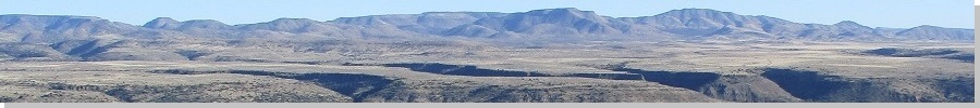
Pine Mountain is an obscure peak, the most prominent point along the Verde Rim overlooking the Verde River in eastern Yavapai County. The two nearest highways, Interstate-17 and AZ-260, offer limited views of the peak, but it does not stand out and you have to know what to look for.
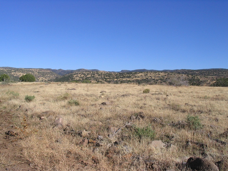
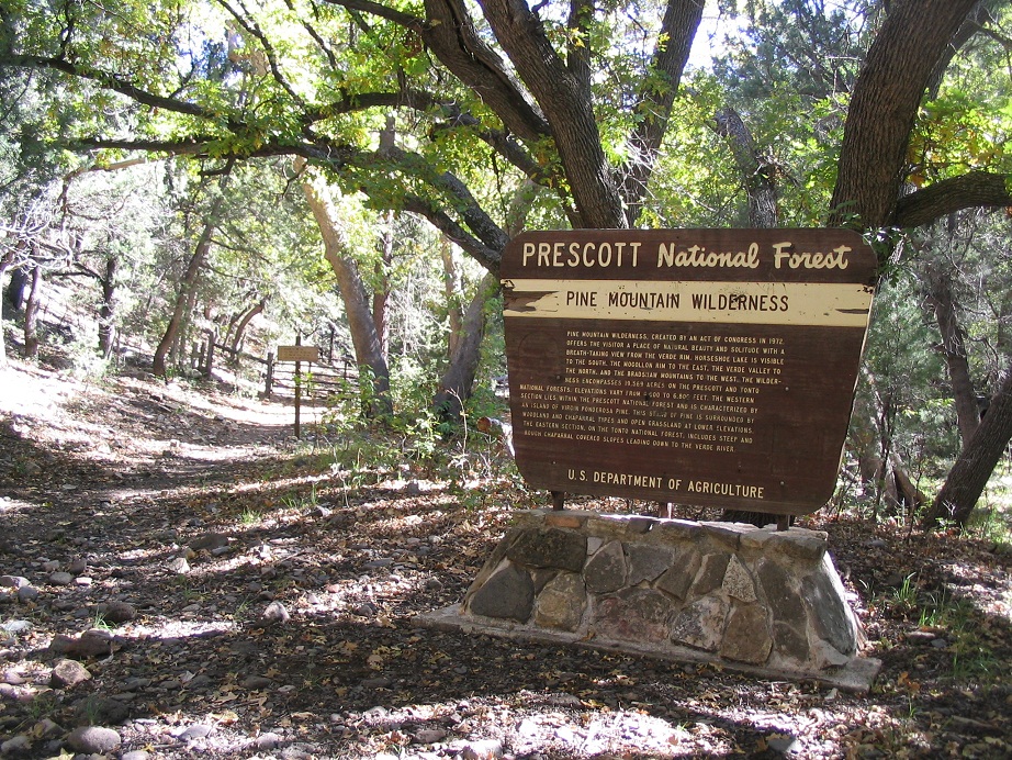
Pine Mountain is part of the Pine Mountain Wilderness Area, an enclave of the Prescott National Forest. It is roughly located in the center of the state, about 60 miles north of Phoenix, sitting on the eastern highlands of the raised Yavapai Plateau. There are no towns nearby. The surrounding land is a mix of private, state and BLM land, mostly protected as wilderness, or used for ranching.
The Verde River starts in the highlands around Cottonwood and Sedona, then runs southeast and south, before emerging into the lower deserts near Cave Creek. It is dammed at the Horseshoe and Bartlett Lakes. The canyon it cuts is as grand as any in the country, but given we already have a "Grand" Canyon, the Verde River Canyon gets overshadowed. In a way, this is good. It's one of the last roadless areas in the state. People come here to hike, backpack and play in the river, but it is remote and hard to get to.
I planned to hike Pine Mountain and another nearby peak, Mount Ord in the Mazatzal Mountains, this weekend. After studying what little information I could find, I determined that I could probably get to the Pine Mountain Trailheads without any difficulties. The map shows trails that criss-cross the Pine Mountain area. I left home after work and drove up the grade into Yavapai County, exiting at the Dugas-Orme Road Exit. It was dark by now, but I was able to find a flat place to park a few miles off the interstate. The night was cold enough to leave a frost on my truck.
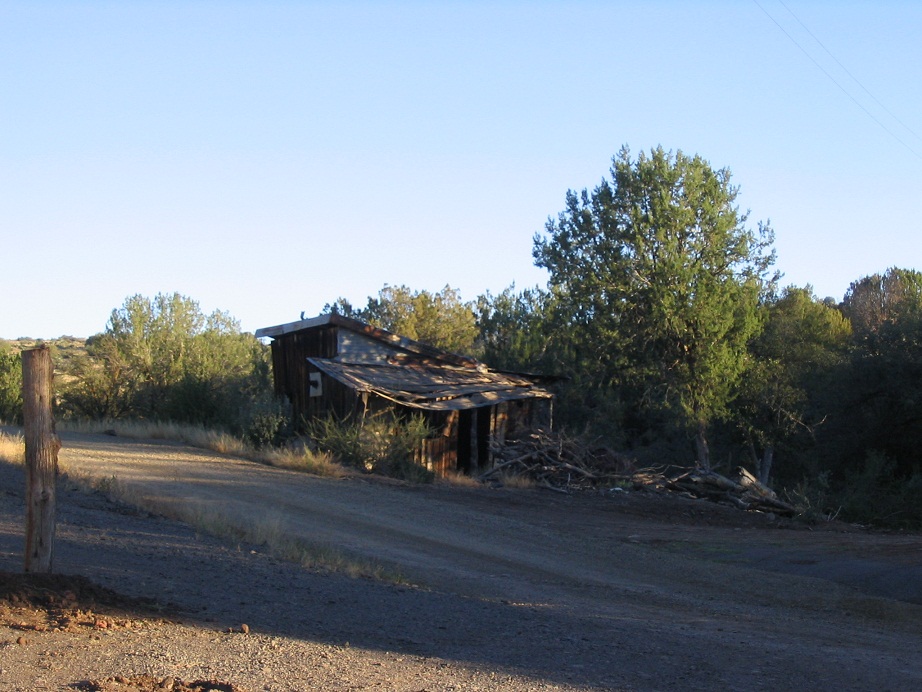
I started driving agin the next morning at 7 a.m., driving directly into the rising sun. In a couple more miles, I had entered the "town" of Dugas, which is seven miles east of Interstate-17. Dugas is mainly one big ranch, two or three other homes, and a couple of derelict buildings. The total current population looks to be about 20. I can't imagine it was ever a big place, maybe topping out at a hundred back in the day. In any case, the roads into Dugas from the Interstate were wide and very solid.
In Dugas, I angled left and forded a small stream, then started up a scanter road. Three miles past Dugas, the road comes to a junction, and I went right, following the signs to Pine Mountain. A sign mentions the end of Yavapai County road maintenance. The road got rougher but not too bad. It continued to snake its way up onto higher ground, then, two miles later, I went right again at another junction, again following the signs to Pine Mountain.
The rest of the drive covered about seven miles and was generally bumpy, but never too bad. I did not need 4-wheel drive, but it took almost an hour to make the drive in. Toward the end, the road steeply descends into Sycamore Canyon, passing the Double T Ranch, and a mile later, ends at the Salt Flat primitive camping area. This is still Prescott National Forest, but outside the wilderness boundary. A couple of cars were there already, some having camped out the night before. I gathered my gear and started my hike at 8:30 a.m.
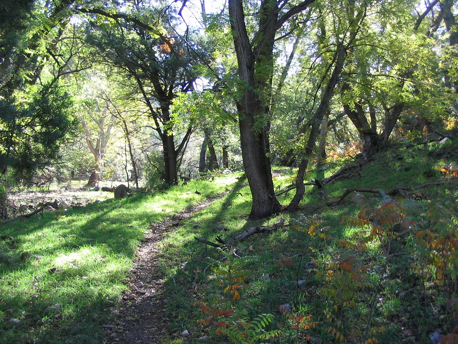
I followed the Willow Trail (#156) past a gate and up Sycamore Creek for 2.5 miles, all of it a very gentle gradient. About a half-mile from the start, I came upon the old Nelson Place homestead. The only hints of past habitation were stone walls, a wooden platform, and apple trees apparently planted as an attempt to start an orchard. The area is lovely and features a flowing spring. I covered the first 2.5-mile leg (2.7 miles says one of the maps) in an hour, coming to the junction with Trail #12, leading directly to the Verde Rim. I had gained 600 feet.
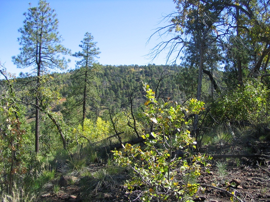
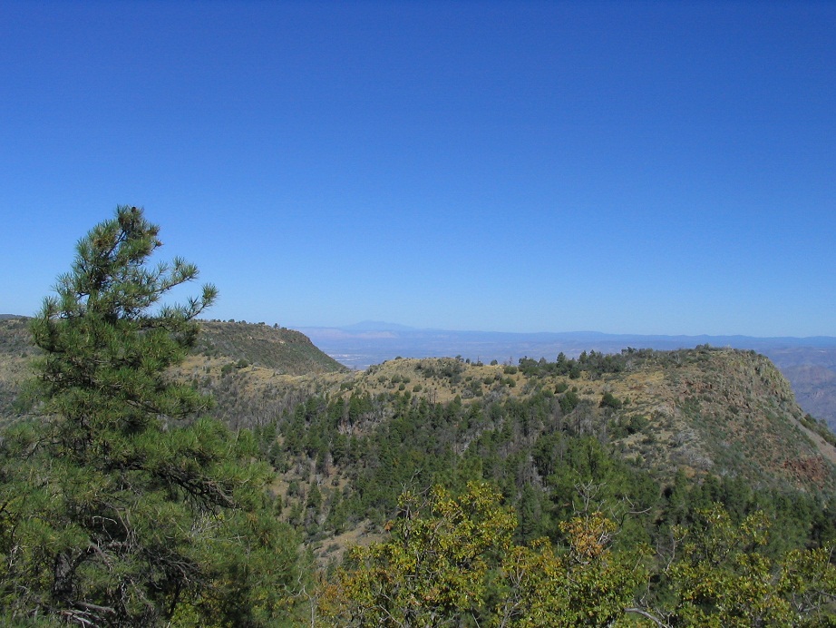
At the junction with Trail #12, I decided to turn right and stay on Trail 156. It gained 400 feet in a half mile to top out on a broad saddle called Cloverleaf. I met a man on a horse coming down, plus his half-dozen hounds. At the saddle, I went left on Trail #14, heading east, working my way up a subridge and onto the Verde Rim. I had my first views of Pine Mountain and its subsidiary summits, strung out along the rim's ridge. I was making good time, except for places where the trail was hard to follow. It's not a well-traveled trail, and is overgrown in places. Nevertheless, I arrived to the Verde Rim at the junction with the Rim Trail (#161), where I had my first views down into the Verde River Valley.
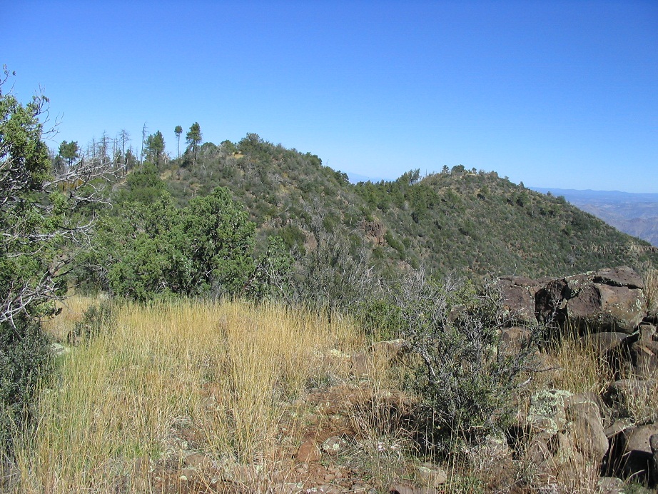
Pine Mountain itself (according to the map) is about three-quarters of a mile north along the Rim Trail from where I was, but the map also shows three other bumps with the same contour elevation, all south of the main peak. Two of the three have enough rise to be genuine contenders for the highest point, so I chose to visit all potential spots. I deliberately chose this route as it put me just feet north of the southernmost summit. I took a break here.
Refreshed, I started hiking again. It took me just moments to walk up 30 vertical feet to the southernmost bump's broad top and tag its boulders, and back down to the trail junction. I sighted toward the northern peaks but everything looked equal. The second-from-southernmost area was a short stroll north along the Rim Trail. On the map, it is marked at 6,810 feet, and is probably not a contender for top honors. Even so, it had open views and a neat rocky prow directly on the cliff's edge.
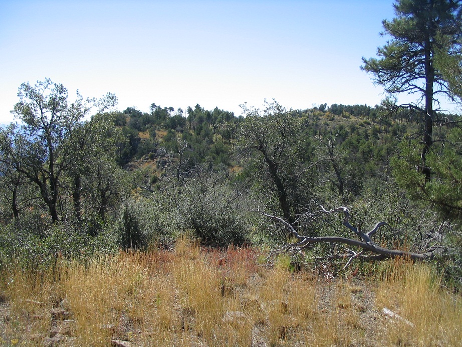
The two northern areas were now better visible, and in minutes I was beneath them. The second-from-north area was brushy and I had to wend my way up through grass and bushes to get to the top. Views were hard to come by in the foliage. I descended back to the trail and descended into a saddle between the two peaks, then walked up to the northernmost area. A spur trail leads steeply to the top, which features a small patch of open grass, some rocky outcrops, and a big pine tree.
I took an extended break here, had lunch and took in the views from all directions. The Mazatzals were to the east, and the Mogollon Rim farther back, north and east. Humphreys Peak stood up on the Coconino Plateau to the north, framed by the flat tops of nearby Tule Mesa. The views west were blocked by trees, but as I descended, I had better views out that way. I covered five miles and 1,700 vertical feet of gain to get here, including the littler summits to the south.
For the exit, I continued north along the Verde Rim Trail as it descended very steeply, 400 feet down to a saddle and the junction with Trail #12, the one I had ignored on my way up. I went west on this trail, and a mile and a half later it came to the junction with Trail #156, signifying the end of a loop. I was in thick forest with minimal views. Once back on #156 I started encountering a few more hikers, and had a friendly chat with an older couple who were renting out one of the Forest Service cabins in the area, which I thought was a pretty cool idea.
I was back to my truck by 2 p.m., where I changed into dry clothes and crashed for a short bit in the bed of the truck. The weather was beautiful and the nap felt really good. By 3 p.m. I was ready to roll. It took an hour to drive out to the interstate. I stopped for food in Camp Verde and drove into Payson where I camped for the night, in preparation for tomorrow's hike up Mount Ord.
I enjoyed my day hiking in this wilderness. It's a fairly easy peak to gain, the trails are easy to follow (when you can see them) and all junctions are well signed, and the views over the Verde Rim are outstanding. Not many people come out this way. You need dry conditions as the roads in past Dugas would get muddy when wet. Fall (October and November) would be the most dependably dry and pleasant time of the year to be here.
The camping spots near the trailhead were in the open. The toilets were awful, and in other reports, others apparently felt the same. Either hold it all in, or go somewhere discreet when no one is looking.
Update: Richard Hensley has performed some high-level survey work and has posted his findings at Peakbagger. His fieldwork suggests with strong likelihood that the second-from-north area is highest. I tagged all the contending spots anyway, but I thought I should mention this.
|


|