The Mountains of Arizona
• www.surgent.net
|
| Peak 6884 • Gate 7 Peak |
• Coronado National Forest, Huachuca Mountains • Fort Huachuca Military Reservation (summit) • City of Sierra Vista, Cochise County |
|
Date: July 6, 2024
• Elevation: 6,884 feet ✳
• Prominence: 329 feet
• Distance: 5 miles
• Time: 2 hours
• Gain: 1,104 feet (gross)
• Conditions: Sunny, clear, pleasant
Arizona
•
Main
•
PB
•
LoJ
•
Lidar
This is a non-descript peak on the west ridge of the Huachuca Mountains. It lies north of the bigger peaks such as Miller and Carr Peaks, and south of Huachuca Peak. ListofJohn cites it by an inferred elevation, "6862", but the 1-meter Lidar shows a summit elevation of 6,884 feet, and 329 feet of prominence.
The summit of this peak is a waypoint of the western boundary of the Fort Huachuca Military Base. However, I would be approaching it from the west, on Coronado National Forest lands. A road inches up toward a low pass north of the peak, where "Gate 7" is located. On the Fort Huachuca side, the roads continue in about three different directions. It was possible I could stay off the military base the entire way until I got to the top, but I'd figure that out once I got there. (Fort Huachuca is entirely within Sierra Vista city limits. So technically, I'd be "in" Sierra Vista when on the peak.)
I chose this peak not because of its amazing profile or historical significance. This time of year, it's hot, often stormy, and the snakes, bees and other insects are out in force. I wanted something that was mostly on road, with as little off-trail as possible. I wanted something that I could knock out in a couple hours, and close to home. This little bump met all the criteria. I've been on this western side of the Huachuca Range just once before, in 2005. This would be my first time back and a chance to explore the area for future visits.
The whole western United States has been under an intense heatwave, with temperatures in the deserts surpassing 120°. In Bisbee, it's been stormy for two weeks solid, but this "heat dome" has suppressed the monsoon for now. It would be hot and sunny and cloudless everywhere. Even and 5,000-6,000 feet of elevation, temperatures could easily be above 100°. I wanted as early a start as possible, so I was out the door at 4:15 a.m., which is nice because there's no one else on the roads at this early hour.
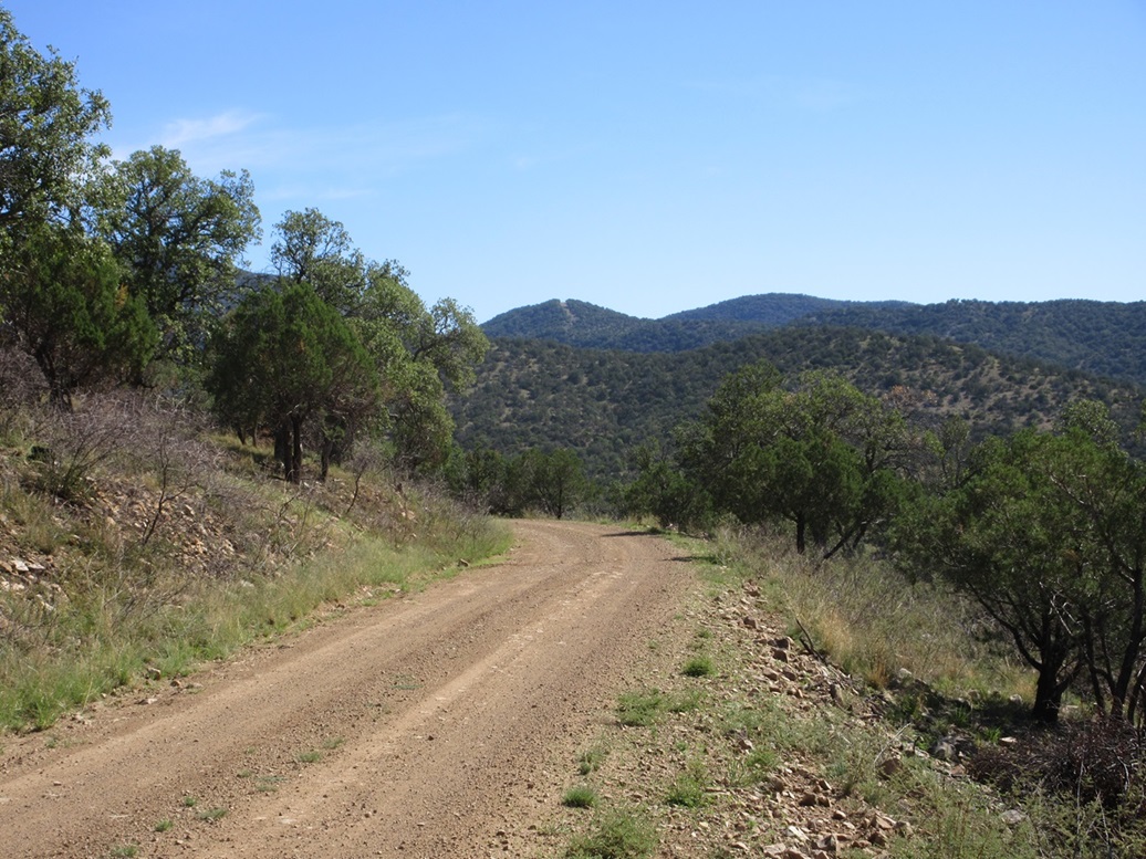
I drove into Sierra Vista for gas and drinks, then followed AZ-90 to Whetstone and AZ-82 west to Upper Elgin Road, which I followed south toward the Canelo Hills, eventually getting on to AZ-83, which heads for Parker Lake. This highway follows the valley between the Canelo Hills and the Huachuca Mountains. It's paved but narrow and twisty. Near Parker Lake, I got onto Coronado Forest Road 48. I followed it south a couple miles, then took a left onto FR-228, which goes northeast.
This road was a good road, but the sun was just now poking above the mountains exactly in front of me. The glare was so intense I could not see in front of me. I'd have to stick my head out the window to see anything. I followed this road about 2.5 miles. It makes a right bend, then a sharp left bend, now on FR-4759, which heads for the old Peterson Ranch and then Gate 7.
FR-4759 was a little rougher but not bad. I did not go in far, parking in an open area where the Arizona Trail crosses it. This would be a good place to stash my car. It was in the shade kind of hidden by trees. I got properly attired and my pack arranged, and started walking at 6:20 a.m.. It was cool but not cold, about 70°. It was pleasant, and I had shade for now.
I started hiking the road. It drops about 50 feet into a shaded creek drainage with a little bit of flow. Beyond it was a couple trucks and tents, and one guy already up taking down his tent. Two dogs then come running up to me and barking. He'd call them back but one kept making starts toward me. It'd run back to him, then two or three lunges toward me, barking the whole time. Just what I want on my hike: being the center of attention. I just kept walking until that second dog finally cooled it.
They were the last people I'd see on this road. The road itself was pretty good overall. It was rocky but just the small kind, no show stoppers or bad erosion. The Subaru could have handled it if I went slow. The only tricky parts were where the road would drop into the creek and back up. Here, the Subaru would have struggled. Less than a mile up the road splits. I went right, but this road was in bad shape. I should have gone left, toward the Peterson Ranch site. I had just a little over two miles to the pass at Gate 7, about 750 feet higher in elevation.
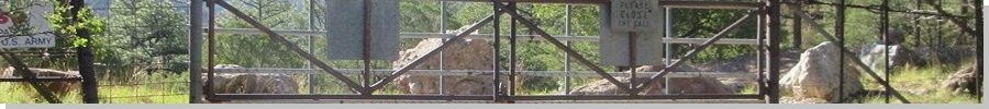
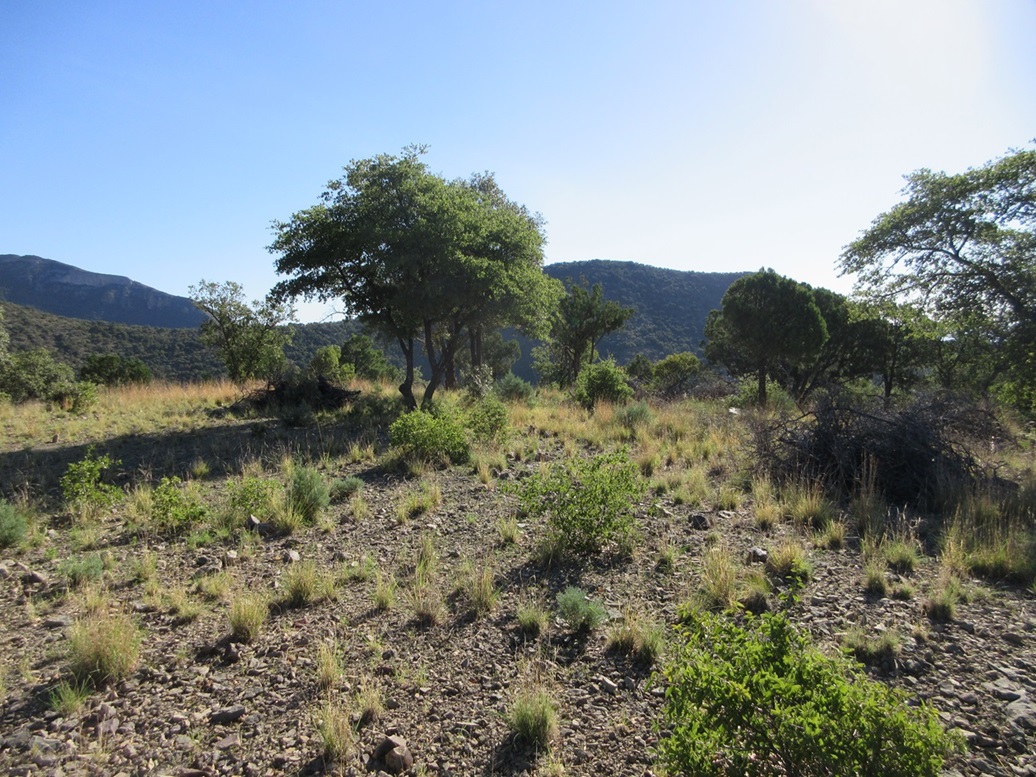
The sun was up higher now and warming things up, but it was still reasonably comfortable. I covered the distance to the pass and Gate 7 in about 45 minutes. Sure enough, there was a gate. At one time it was a functional gate with a cattle grate in front of it. These days, the gate is welded closed. The cattle grate had been removed so a big hole lies where it used to be. Not unexpectedly, there was a sign saying this was military land, no trespassing. Peak 6884 rose up to the south, a steep forested bump right there in front of me.
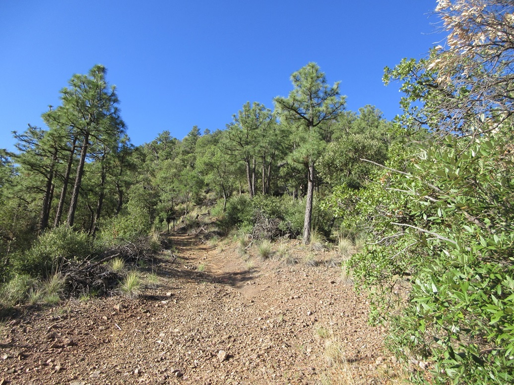
I did not cross the gate. Instead, I would keep this as legal as possible, so I entered into the trees and followed the boundary fence upward. The trees here were thick and branchy, but I was able to weave through and find lanes. I gained about a hundred feet, to where the slope started to steepen dramatically. On the other side of the fence was an open track. I let temptation get the better of me, and I crossed through the fence and onto this track.
The track went uphill another fifty feet, to an old Forest Service sign. Evidently, this was once part of the Crest Trail. The road ended, and the trail stayed level. I went uphill, aiming for some big rounded knolls about another hundred feet higher. I stayed near the fence, usually within fifteen feet of it, but these rocky knolls forced me to find breaches a little farther in. I found a steep ramp that led up through the biggest of the knolls, placing me above them and on the home stretch to the top.
Then I hear some voices! I stop and get a sense where they're coming from. They're down at Gate 7, where I just was. I'm high above them in thick forest, so I am invisible. I watch them, but cannot make out much detail. I got paranoid, thinking these were MPs and I had tripped a sensor somewhere. But they sounded more like they were having fun, lots of woo-hoos and things like that. I'd hear what sounded like bicycle tires on dirt. I then saw someone coming down the road north of Gate 7 on a big mountain bike.
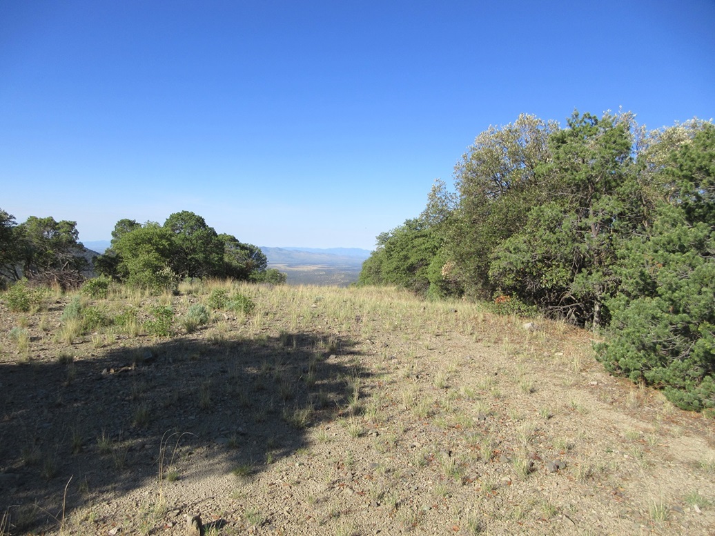
I still wanted to lay low, so I stuck close to the fence. By now, I was right beside it the whole time. The top wasn't much farther. I found a track that led to the top, which was open, this actually being part of a road network. No one was here. I walked the top for a minute and snapped a couple images, kicking a couple possible highpoint rocks. I did not linger, and started right back down, following the fence exactly.
I got to the knolls and was able to scoot down that ramp so that I was below the big rocks. The people were still down there, still talking and riding their bikes. There was still the possibility they were from the base, maybe having some fun on their down time, so I did not want to just appear suddenly and worry them. I got onto the other side of the fence and hiked downhill in the thick trees, going slow. Eventually, they rode off and I never heard from them again.
Back on the road, I walked it out to my car, arriving back about 8:20 a.m., a two hour hike covering about five miles and a little over a thousand feet of gain. It was sunnier now and warming, but not hot, temperatures in the mid 70s or so. I was pleased to be successful and to be back at my car. It would be too hot to do any more hikes anyway. This wasn't a memorable peak, but it worked for me today.
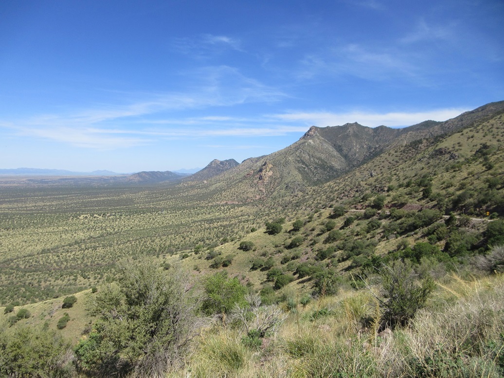
I decided to take the southern loop road through the Huachucas back to Bisbee, rather than go out the way I came in. Back on FR-48, I aimed south and followed the road as it curled around south, then east, hugging the lower slopes of the mountains. The road was in good condition the entire way.
I moved along at about 20-25 miles per hour, which felt right given the conditions, and a few miles later, got in behind someone going much slower. Rather than rush this person, I slowed down too and held back, but even going at 10-15 m.p.h., I would catch up to this person. Sometimes I would stop for a couple minutes and listen to a tune, then resume and sure enough, get on this person's butt once again, even going at half speed.
The road gets steeper as it gains up toward Coronado Pass, in the Coronado National Memorial and near Coronado Peak. It's still a good graded road, but it becomes more exposed for the last couple of miles. I think the person ahead of me got spooked because twice I came up behind only to see them stopped in the road, and at one point, actually reversing very slowly downward back toward me. I was far back, at least a hundred feet, but even then wondered what they were doing. I even backed down a bit into a pullout just in case. Then he or she would stop then start upward, going very slowly, like at an idle crawl forward. I was trying to be patient the whole time. I gave this person a couple minutes head start before I resumed my driving.
This last shelf road does demand one go slow, so I moved along at about 10-15 m.p.h., and saw this person, an older woman, now parked in a pullout. She was less than a mile from the Coronado Memorial parking area. I passed her and then parked in this small lot to take a break, there being about six other cars here. I felt bad for this older lady. I suspect she likely did not know what she was doing, possibly following her car's GPS without questioning it.
I spent about twenty minutes at the parking area, walking around and taking some images. The last time I was here was in 2015 and I recall it being a very cloudy, gloomy day. Today it was sunny with great views. It was warm now, into the high 80s, but it was still comfortable. That lady never did appear. She possibly just turned around. Me, I continued down the east side, catching highway AZ-92 and following that home. It wasn't even noon yet, but I had a full day already, happy to get out when conditions this time of year just aren't amenable.
|


|