The Mountains of Arizona
• www.surgent.net
|
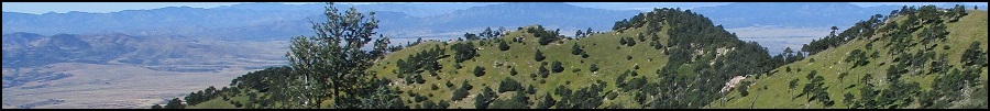
| Huachuca Peak |
• Huachuca Mountains • Highpoint: Fort Huachuca Military Reservation • Highpoint: City of Sierra Vista • Cochise County |
|
Date: October 24, 2015
• Elevation: 8,410 feet
• Prominence: 1,910 feet
• Distance: 10.5 miles
• Time: 7 hours and 20 minutes
• Gain: 3,400 feet
• Conditions: Cloudless blue skies
• Teammates: Scott Peavy & Matthias Stender
Arizona
•
Main
•
AZ P1K
•
PB
•
City HPs List
Huachuca Peak is a major summit of the Huachuca Mountains in southern Arizona, within the Fort Huachuca Military Reservation. Access is not restricted, but civilians must get a day pass to enter onto the base. Other possible approaches to the peak come from the south, where only the last mile is on the military property.
Beth and I hiked to the range highpoint, Miller Peak, back in 2005. Until today, I had not returned to the Huachuca Range. I was a little unsure just how open the base is in allowing civilians on, and I did not want to drive 200 miles only to be turned away.
In February of this year, I had to attend a conference at Cochise College in Sierra Vista. I took advantage of this opportunity to make it into a weekend getaway for Beth and me. We stayed at a hotel in town. My conference took up about half of that Friday. My plan was to possibly hike the peak Saturday. But first, I needed to see if I could get onto the base first.
Still that Friday, I decided to go find out. I drove to the southern entrance gate. The guy at the station scanned my driver’s license and let me on. I was surprised how fast that went. I had maps of the streets on the base, and was able to get to the entrance of Huachuca Canyon, where the pavement ends. I drove in about a mile, but sensed that this was not as quick a hike as I first thought. Furthermore, the weather had become cold and gray, with a stiff breeze. Conditions high on the ridges were probably very uncomfortable.
I returned the way I came and exited the base, then returned to the hotel. I was not disappointed. In fact, I was pleased because it apparently was not that difficult to get onto the base. I should mention that the websites for Fort Huachuca are not that helpful and the phone numbers always go to voice mail. The next day, Beth and I drove to Montezuma Pass at the south end of the Huachuca Range, where we were in 2005 when we hiked Miller Peak. This time, I had a much shorter hike to Coronado Peak.
This hike was a last-minute plan after another hike I had been considering fell through. Our team was me, Scott Peavy and Mattias Stender. We met at Mattias' place at 3:30 a.m., Mattias driving us to Fort Huachuca. We arrived at the base about 6:30 a.m.. The policy for getting on had changed. They made us park in a side lot and we had to go into a small building and get a day pass after first passing background checks. The whole process took just 10 minutes and shortly, we all had our day passes, which were more like identification cards with our photos on them.
We drove the roads to the mouth of Huachuca Canyon, following Lawton Road to Winrow, then right to a roundabout and now on Smith, then a left onto Christy, which turns into Hines at a soft bend. This last segment along Christy and Hines features all the old, original buildings of the Fort, which was established in 1877. It’s a large property, covering a couple hundred square miles, and is historically significant as being the base for the Buffalo Soldiers in the early 1900s. Today, it is home to the Army’s Intelligence Center, among other things.
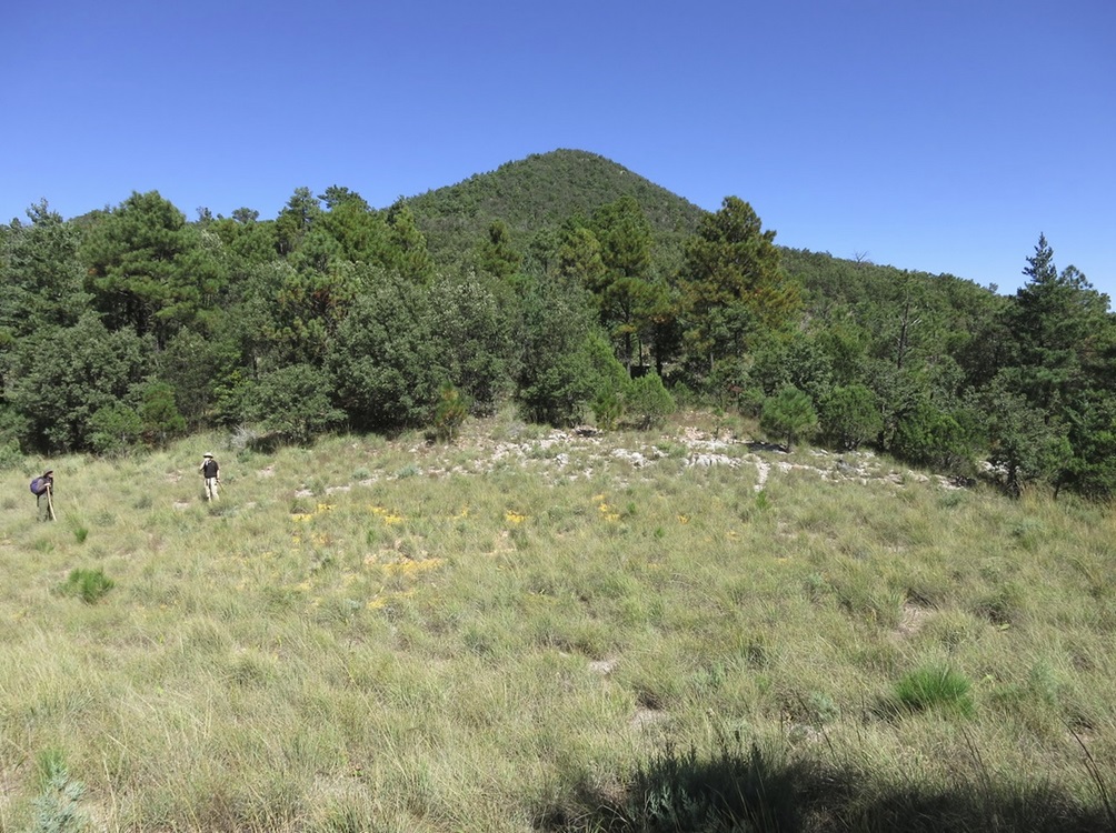
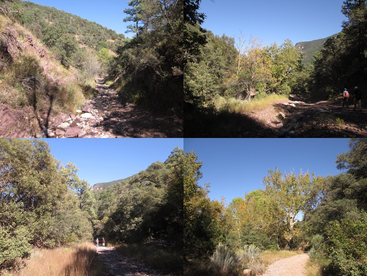
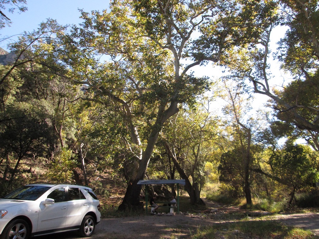
Now on the dirt road, we slowed down. The road is pretty good but has a lot of fist-sized rocks, so going fast would probably result in a flat tire. In about 10 minutes, Mattias had eased his vehicle to the "Campground" as shown on the map, a mile and a half from the pavement. This location is basically one big roundabout, a couple picnic tables and flat areas for tents. It's hemmed in tightly within the canyon walls. Huge sycamores grow here, and a creek runs through it. The leaves were turning yellow, our version of fall colors. We parked a little after 7 a.m., at elevation 5,627 feet (said Scott’s GPS). The day was clear and calm, and not very chilly.
Our planned route was to follow the road farther up the canyon to where it tops out on the ridge, then walk the ridge along the Crest Trail, catching a spur to the summit. It looked long, possibly as much as 6 miles one way, but we had no better information. The internet, believe it or not, has very little useful information on routes from this canyon to the top. We were aware that there are other trails, but none appeared on our map and we didn't want to waste time getting lost on unmaintained trails. So we went with the failsafe route. We started walking at 7:15 a.m.
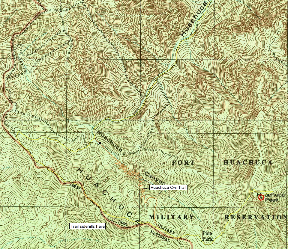
The road after the campground is narrower and rockier, with the stream running within it for stretches at a time. We made good time walking the road, which was pitched at a lenient grade. We walked past one Y-junction after a mile, then came to another junction after 2.3 miles. Here, we went right, then straight at another junction, now gaining steeply. Soon, the road achieved the range crest. Scott's GPS said we hiked 3.08 miles to get here, which we did in a little under two hours. We were at 6,810 feet elevation.
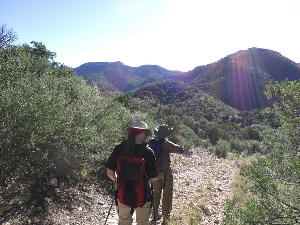
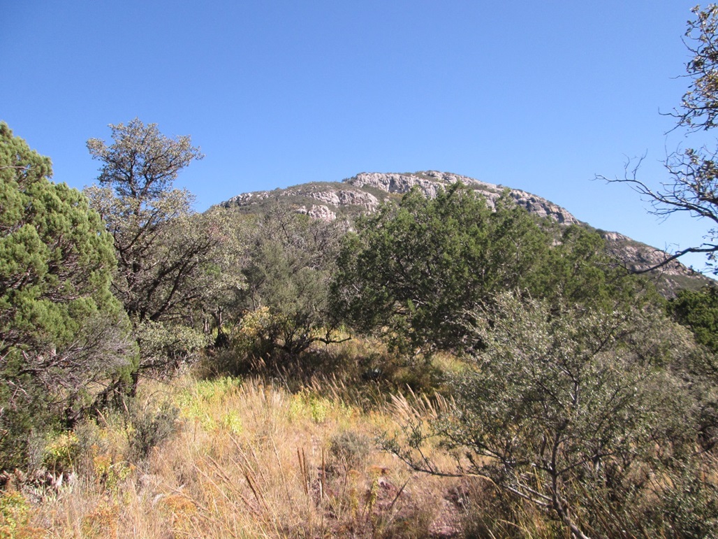
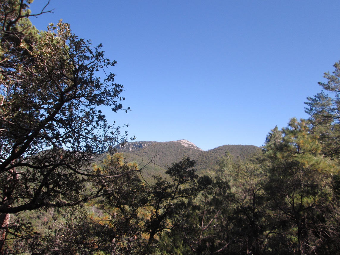
Along the crest is another road. In fact, looking around us, there were roads everywhere, no surprise given the military presence. We went left and started up more slope, gaining about 200 feet before dropping a hundred feet toward another saddle. The road ended here, and we picked up the Crest Trail. The sign said the top was two and a half miles ahead. We could see it, with its wooded ridges and south-facing cliffs.
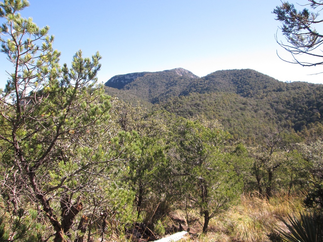
The Crest Trail gains steeply up Pine Peak (not named on the map, but marked by spot elevation 7,709 feet). The map shows the trail going over the top, but in truth, it sidehills on the north, getting as high as about 7,500 feet. We came to a trail junction here, with the Huachuca Canyon Trail. The sign was busted and someone’s old jacket hung on the metal post. We noted this as a possible alternative for the hike down.
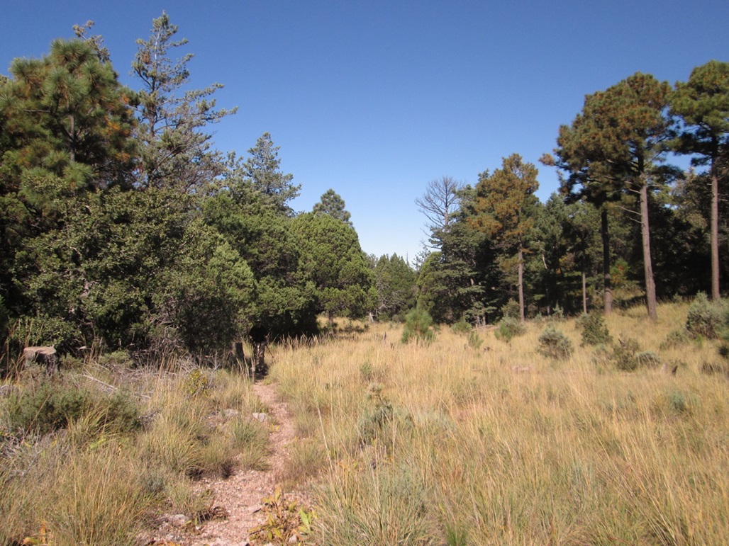
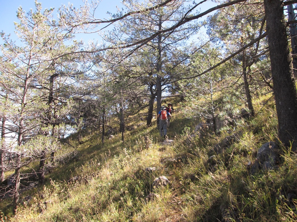
Next up was Pine Park, an open meadow about 0.3 mile east of the trail junction. Along the way, we had to make a left onto the spur trail to the summit, staying north of the boundary fence. Once past Pine Park, we followed the trail steeply uphill, the summit still about 800 feet above us. The trail gets somewhat vague in places, as we marched through tall pines in some places, and scragglier mountain oak in others. We stopped at one point, and suddenly, some guy just appears! He had come up from adjacent Garden Canyon. We talked for about 30 seconds, then he continued on his way, presumably to the top. We were not expecting to see a soul on this hike today, so seeing this guy was a surprise.
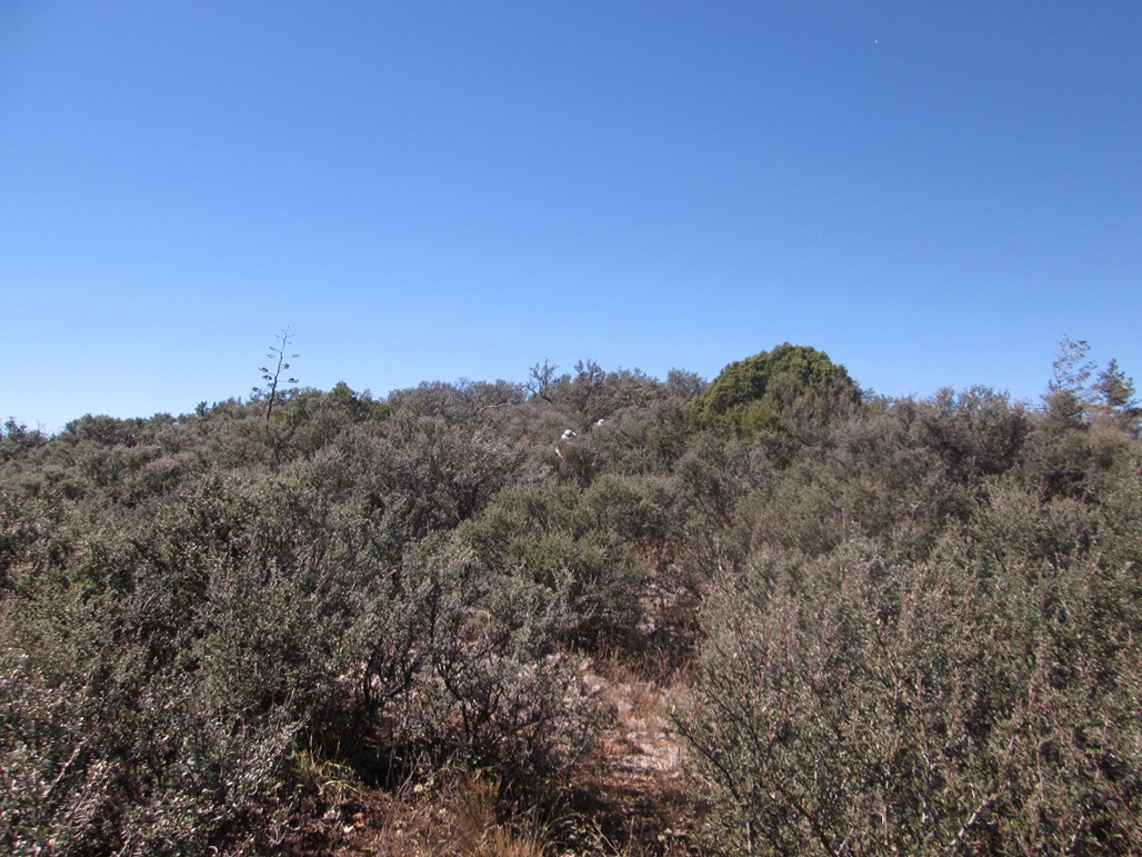
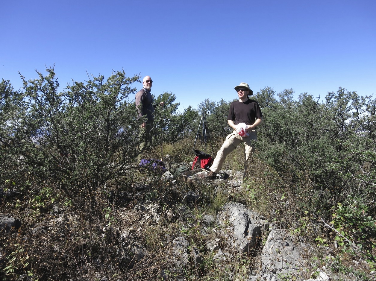
The trail gains a ridge at about 8,000 feet elevation, the summit again visible above a series of cliffs. We kept to the trail, which was steep and tiring, but quickly, we had gained onto the summit ridge, now a little to the north of the peak. We had to make a hard right at a poorly-signed junction. We hiked through tall pines, then made one last turn and hiked through man-high scrubby oak to the summit, arriving a little after 11 a.m.
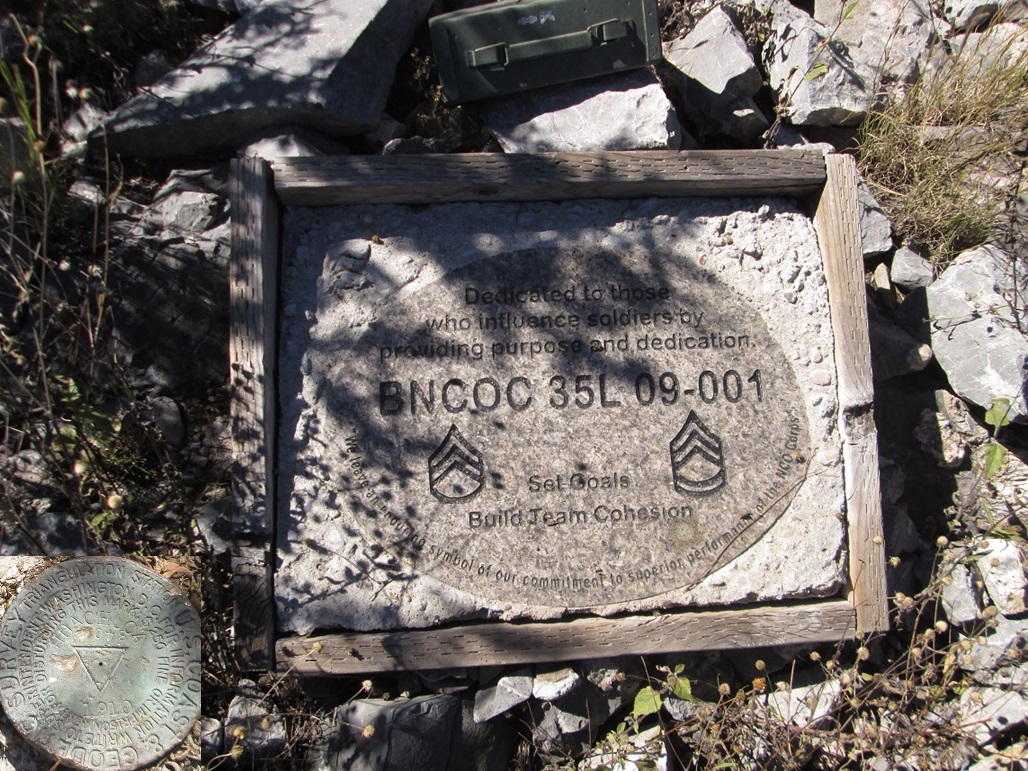
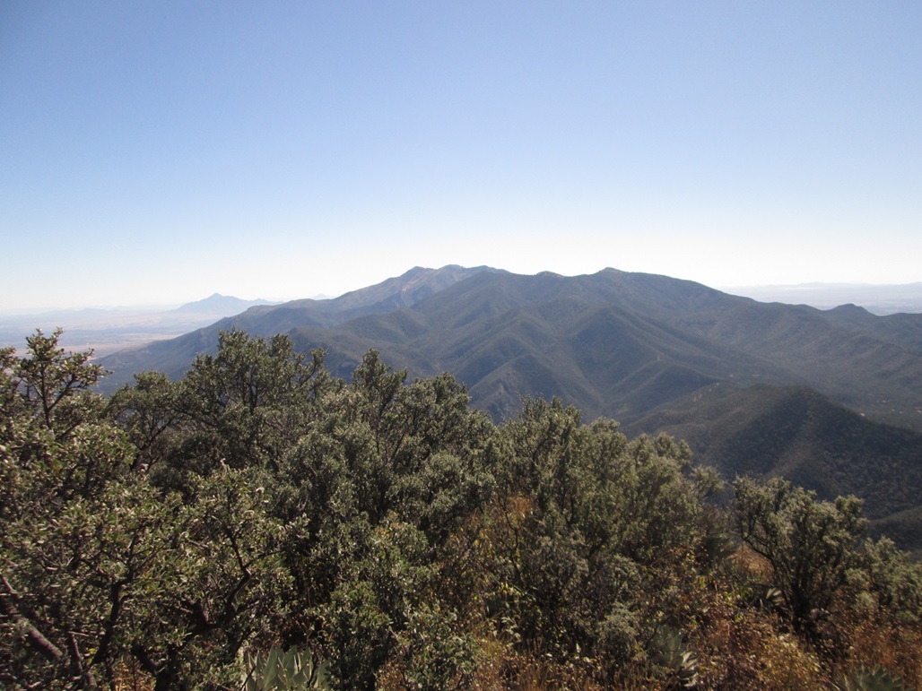
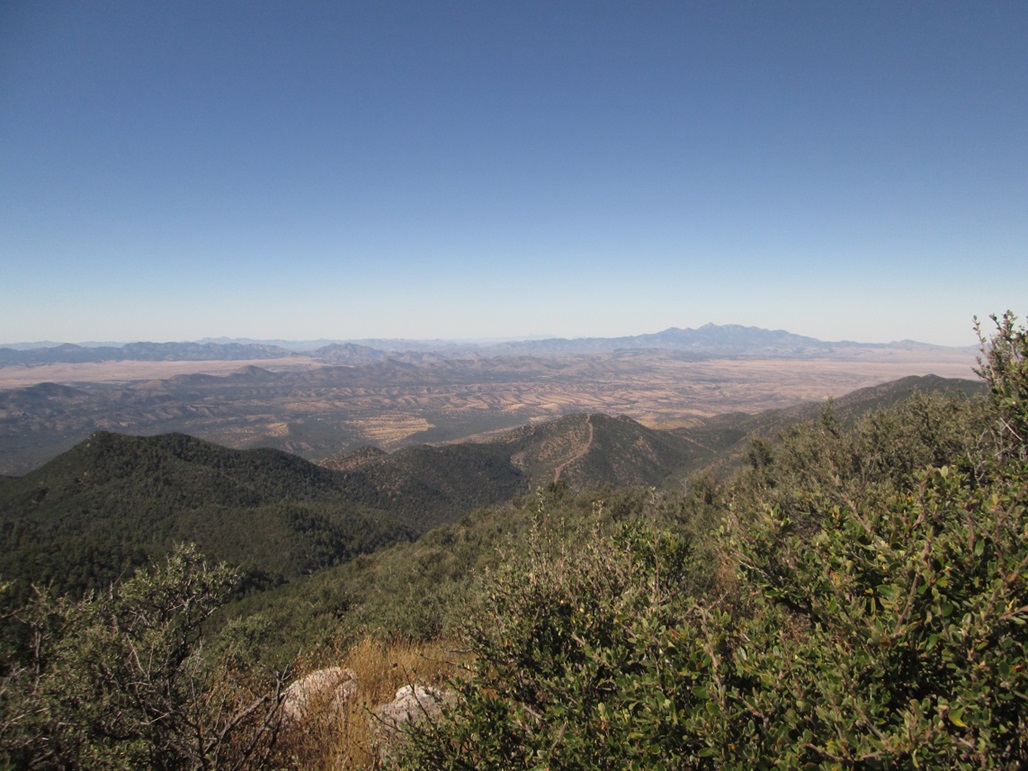
We took a long rest up top. The day was gorgeous and clear, and we could see mountains a hundred miles away, almost all of which Scott or I have climbed, and which Mattias will surely get to in time. The benchmark has “1910” stamped on it, the year it was placed there, but coincidentally, also the mountain's clean prominence figure. The log book was in bad shape and only had names from last year onward, most being military. I didn’t recognize anyone in the log book.
We never saw the other hiker. We assumed he'd be on top, or coming down, but we never saw him. There are other trails and it’s possible he took one back to his starting point. The only other plausible conclusion was that he was eaten by bears. It is true that we saw a lot of fresh bear scat on the trails.
We started down after about a half hour, making good time with gravity now in our favor. We returned to the Huachuca Canyon trail junction and decided to take it down instead of the way we had come. It seemed to lead to the roads below faster, and would bypass some uphills we would have to take otherwise.
The trail is in good shape but is very steep, dropping about 1,260 feet in 1.2 miles (all from Scott''s trusty GPS). At one point, the trail skirted above some tall cliffs, with about two feet of wiggle room. A slip here could be fatal. Needless to say, we took this segment carefully. The trail let out on the road below, about 200 feet from one of the junctions we had passed going up. I show this on my annotated map with a small black square. There’s a sign here, but it’s in the trees and otherwise, we’d have never known about this trail. I would recommend taking it uphill in retrospect.
We took a break at the base of this trail, and watched a couple dirtbikers rumble past. Once they were gone, we walked down the road back to Mattias’ vehicle, arriving back at 2:30 p.m. We took a long break here, enjoying the stream and the big trees.
The drive out went well. We stopped for refreshments at a Circle K in Huachuca City, then drove home, arriving as the sun was setting. We shook hands and congratulated everyone for another successful hike.
• The road into Huachuca Canyon is decent in normal conditions. It has rocks in it and a few ruts, but we agreed that most passenger vehicles could get to the campground as long as the driver went very slowly in some areas. Only the smallest cars would have trouble. After the campground, the road get much rougher and narrower. With 4-wheel drive and high clearance, most stock vehicles should be able to get to that first Y-junction, where there is room to park (the left fork is blocked with big rocks). After this, the road is very rough, with some show-stopper rock piles blocking the way.
• Getting on the base is apparently fairly easy, and the main gate (Van Deman Gate, along Hatfield Road, west of where state routes 90 and 92 intersect) is open at all times. You'll need state-issued identification, and it's probably a great idea to have your car's registration and insurance forms handy, in case they ask. I am not sure if one must be a citizen to get on. I would assume if you have warrants out for you, they'll find out fast.
• The southern approach could be an alternative, but getting there would add an hour to the drive. I know people who have done it, probably not wanting to deal with the military checkpoints. I have no idea what conditions the roads are from the south. Only the last mile of the hike is on the military reservation, but you may have to cross private property along the way.
• There are bears in these mountains. We saw a sign on the gate leading into Huachuca Canyon that suggests they close the gate when there is a bear sighting.
• There's always a chance that border crossers will be in the area. We saw some discarded clothes in places, but not nearly the amount of junk as on the southern Crest Trail.
• The city of Sierra Vista incorporated the entire Fort Huachuca into its city limits back in 1971. This makes Sierra Vista one of the largest cities in Arizona going by area, and means that Huachuca Peak is within the city and is its highest point.
|


|