The Mountains of Arizona
• www.surgent.net
|
| Carr Peak |
• Huachuca Mountains • Miller Peak Wilderness • Coronado National Forest • Cochise County |
|
Date: September 16, 2022
• Elevation: 9,225 feet
• Prominence: 675 feet
• Distance: 6 miles
• Time: 3 hours, 45 minutes
• Gain: 2,205 feet
• Conditions: Gorgeous
Arizona
•
Main
•
PB
•
LoJ
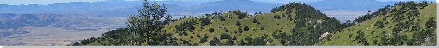
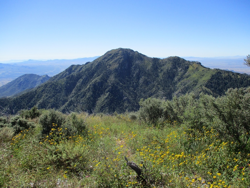
Carr Peak is the Huachuca Range's second-highest peak (behind Miller Peak) and a "twin" of Miller when viewed down below from Sierra Vista. Miller Peak is the left of the two obvious highest peaks, and Carr Peak lies to the right, slightly more rounded than Miller.
Carr Peak has been on my agenda for awhile. My wife and I hiked Miller Peak in 2005, including encounters with Mexican coyotes and two fully-armed Border Patrol agents. For this hike, I would have no such excitement, other then seeing three hikers and a dog. Many people hike Carr and Miller in one long out-and-back hike, or a traverse with cars at the starting and ending trailheads. When my wife and I hiked Miller Peak, we parked at the southernmost trailhead at Coronado Pass. For this hike, I would park at the Sawmill Trailhead near the old Reef Townsite. This is a closer trailhead to Carr Peak.
I was on the road at 4:30 a.m. and in Sierra Vista about 7 a.m.. The monsoon seems to have disappeared suddenly for the season, and today was pleasantly cool, and as the sun rose, cloudless with bright blue skies. I drove along State Route 92 to the Carr Canyon Road (Coronado Forest Road 368), which leads steeply uphill into the mountains toward Reef Campground and the Reef Townsite.
My wife and I drove this road on our 2005 visit, more just to experience the road but not to do any hiking in this particular area. I recall it being steep and exposed, but not difficult, with a decent road tread. But back then, I had a beefier Nissan Frontier truck which no doubt made the drive easier. I was curious how the Subaru Forester would do on it.
The road is paved at first, passing a few homes, then becomes dirt at the National Forest boundary. Its condition was fair, with a lot of small ruts, no doubt from the summer rains. It was rocky in parts, but just the smaller baseball-size rocks, nothing big. For short segments it was very steep, probably above a 15% grade. I had the Forester in Low gear most of the way. The biggest challenge was the sun. In some parts, I was driving directly into the sun's glare and couldn't see anything. Given the narrow road and steep drop-offs, I drove slowly and hoped a lot. I covered about 5 miles in about 45 minutes, parking at the Sawmill Trailhead, opposite the Reef Campground. I was the only car here. It was a little before 8 a.m., sunny and cool, temperature about 60° F.
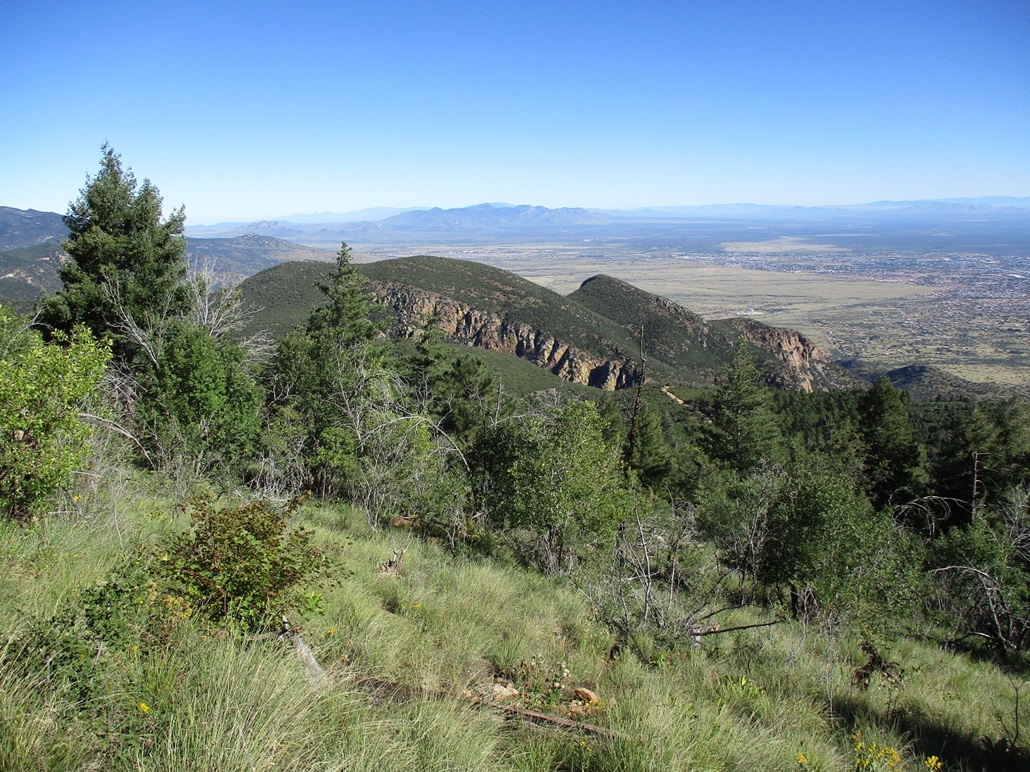
There was an old mine here, the Reef Mine, active in spurts from about the 1910s through the 1950s, with an actual town here, numbering about 200 people at times. Nothing currently exists of the town, but getting to and from it would have been a chore back in its day. The road up I just followed is interesting but not something I'd want to do regularly, and certainly not when the weather is active. The townsite is named for the huge "reef" cliffs that form much of the range's east-facing aspects. They are impressive to view, but I had to keep my eye on the road, of course.
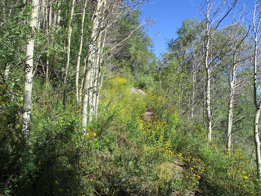
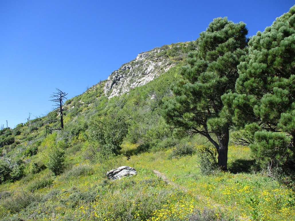
I was ready to go in a matter of minutes. I locked the car and started walking at 7:55 a.m., following the Sawmill Trail for three-quarters of a mile (said the sign) to where it intersects the Crest Trail, now part of the Arizona Trail. Lower down I hiked mainly through chest-high manzanita brush, but once on the Crest Trail, was now in heavier forest. The trail was easy to follow, but overgrown with grass and wildflowers from the summer rains.
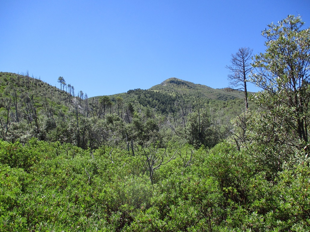
The trail marches upward, one switchback after another to alleviate the gradient, which was never too steep. I made good time. The trail emerges from the trees, onto a bare section of grass, evidence of a fire from 1977. The peak was now visible again, about a thousand feet higher, meaning I was about halfway there.
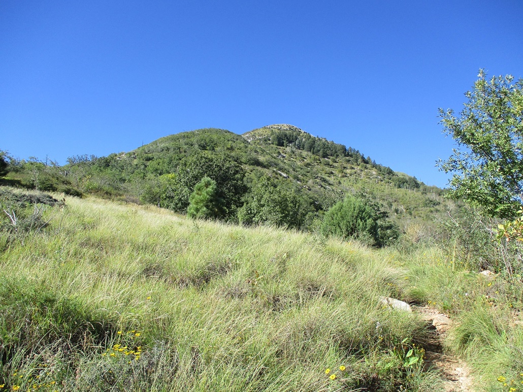
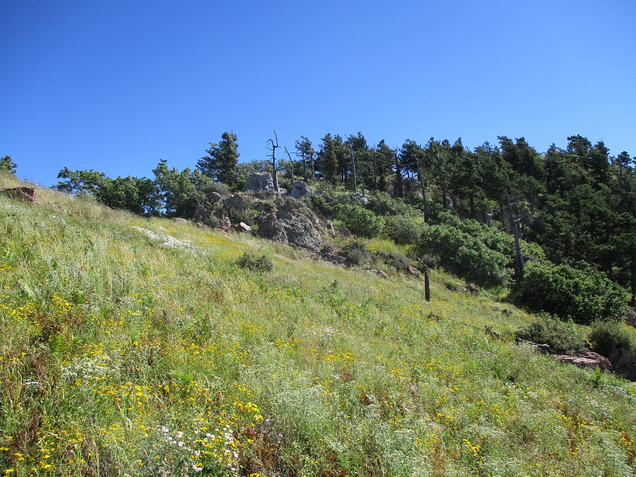
The trail then contours to climber's right, entering the trees again, featuring more aspen. The trail makes one more switchback and then a gentle upward traverse to a small saddle east of the summit, which was now very close, its cliffs much more imposing. Next, the trail angles right, now hugging the south slopes of Carr Peak. It was much grassier here, the trees spaced out more, some dead husks, this all being evidence of that big fire. But it was grassy and very green, almost like a park.
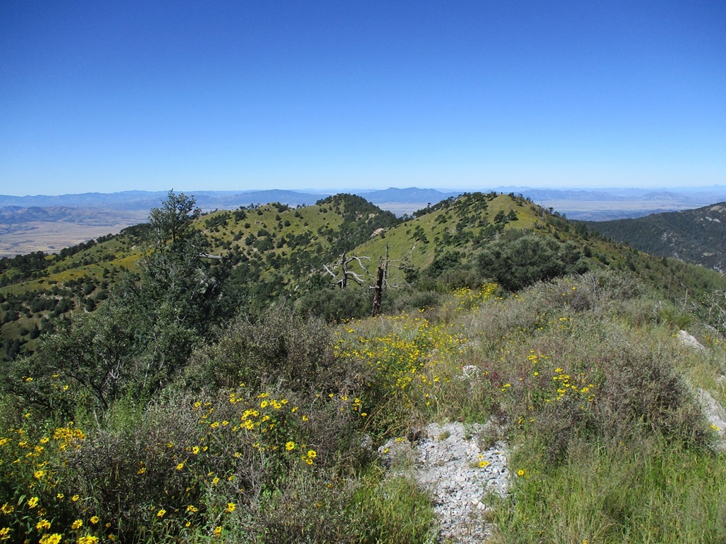
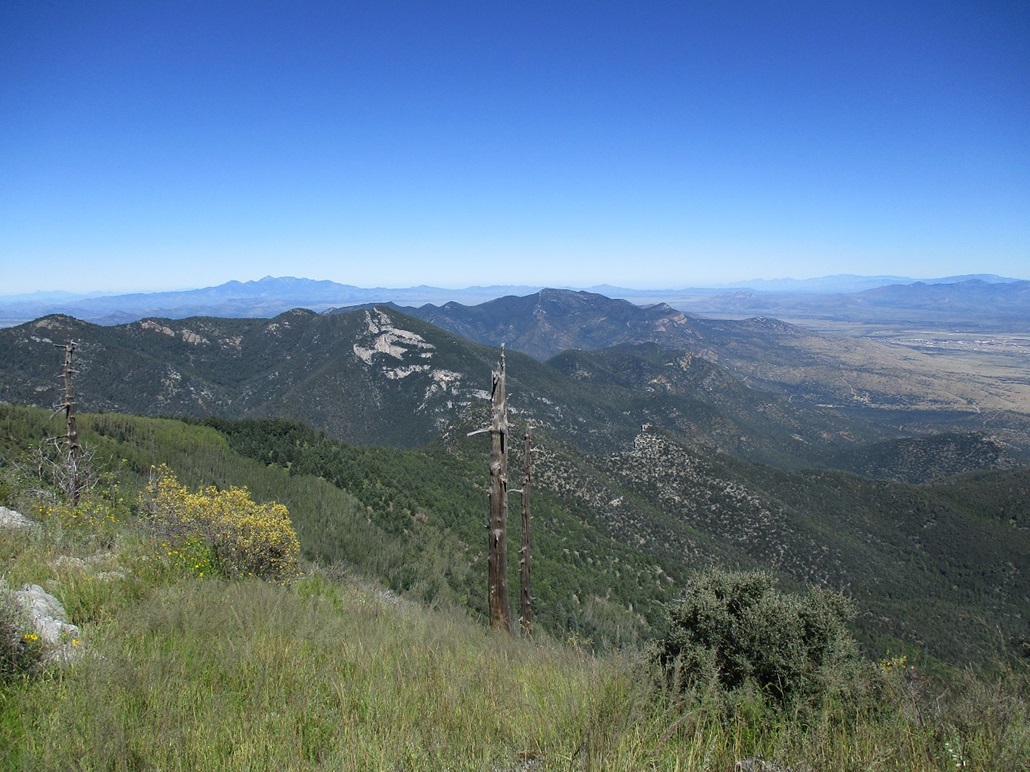
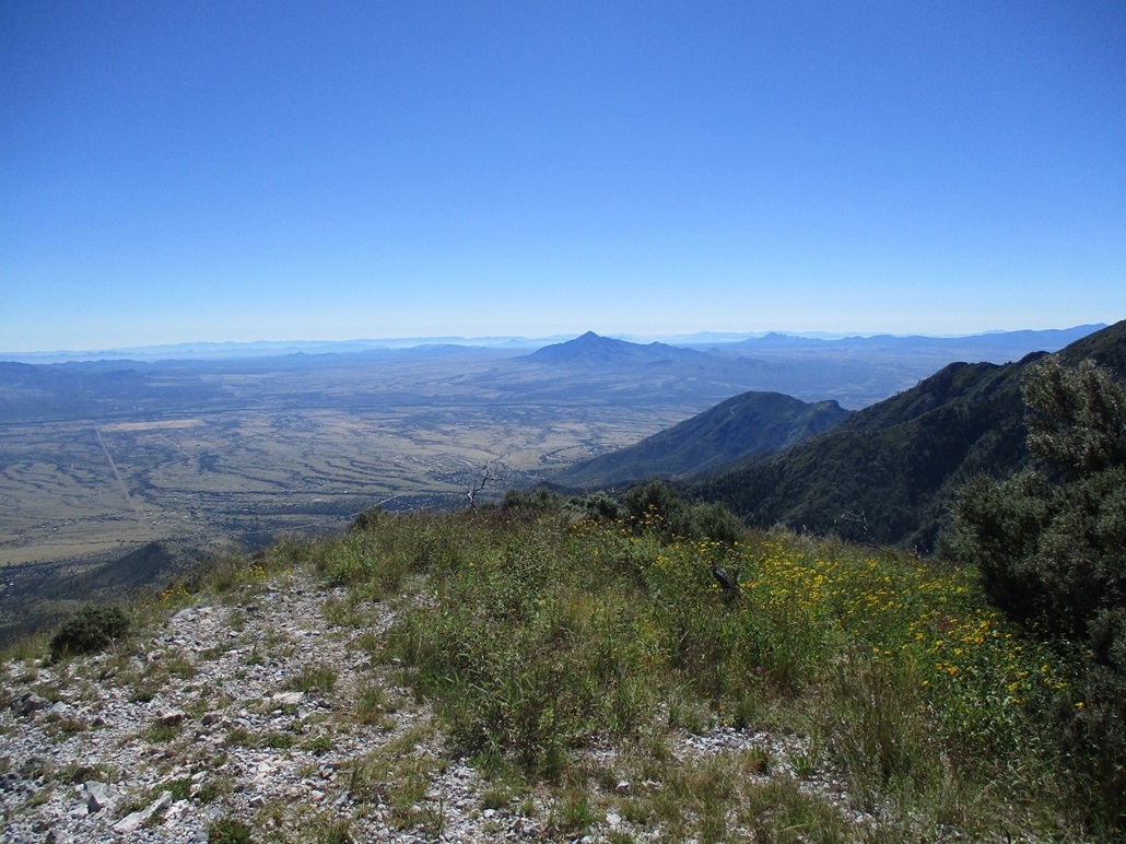
There is a trail junction here, and I went uphill to the right. This spur doesn't take long. I was soon on the high ridge, then entered into a small complex of rocks and trees, then quicky onto the open bare summit. It was 10 a.m., meaning a two-hour hike with a little over 2,000 feet gained in 3 miles (going by the signs). It was breezy up here but pleasant, temperatures still in the 60s. There wasn't a cloud for a hundred miles. I had crisp and clear views of Miller Peak to the south, Huachuca Peak to the north, and the distant Whetstone, Dragoon, Pinaleño, Rincon, Galiuro, Patagonia, Santa Rita, Dos Cabeza and Mule Ranges to the east, north and west. Looking southeast was giant Cerro San Jose, just over the border inside Mexico, and numerous more peaks in that direction whose names I don't know. I stayed on the summit for about 15 minutes. It was a lovely day and there was no reason to be rushing things.
The downhill hike followed exactly the same route, of course. I moved steadily, letting gravity assist, and was back to my car in 90 minutes, the time 11:35 a.m.. It was on the descent I met with the hikers, one a group of two, and the other out with his dog. That was all. Being a Friday, it was mostly empty. I am sure over the weekend more people were here. I think there was one other person camping in the area. I saw a tent but no people.
Now for the drive down. I would have gravity to help, but also needed to be mindful not to ride my brakes. I put the car in Low and inched downhill, careful not to lose traction and yaw. In parts, there is no room for error. When they say "one lane", they mean it. There were a few short stretches where it would be impossible for two cars to pass. I hoped I would not encounter anyone going uphill. The views were outstanding but vertigo-inducing. I just kept my eyes on the road, both hands on the steering wheel, the tunes on Sirius Channel 27 (appropriately, it played Bob Dylan's Desolation Road at one point). In time, I was down off the steep parts and back onto pavement and civilization.
I had time to kill, so I parked at a Circle-K in town and made a few phone calls, then went to my hotel room when they allowed people to check in. The hike had gone well and I was pleased. It was a very pretty hike, very green from the summer rains, and my nose and sinuses did not let me forget it.
So, here's my take on the road: it probably needed a grading when I was here so take that into account. My Subaru Forester has good clearance but not big beefy tires. It does have all-wheel drive and that, combined with Low gear, was sufficient for me. I never yawed, but I took it slowly the entire way, often below 10 miles per hour. I saw a passenger vehicle about two-thirds of the way up, so it clearly can be driven in such a vehicle. Four-wheel drive is not necessary in dry conditions, but good clearance is. The road demands attention and may spook people with a fear of heights and tumbling down hillsides. I was mindful not to overtax the engine going up, and not to ride the brakes going down. Tiny passenger vehicles, those with about two inches of clearance and tires about the size of a dinner plate, will not be sufficient for this road. And absolutely and unequivocally no RVs or trailers. The signs are emphatic about this, but some people ignore such warnings. But the signs mean it. The hairpin bends are too tight for trailers and RVs, and some parts too narrow. It would be absolutely foolish to take such a vehicle up this road.
|

|