
The Mountains of Arizona
www.surgent.net |
|
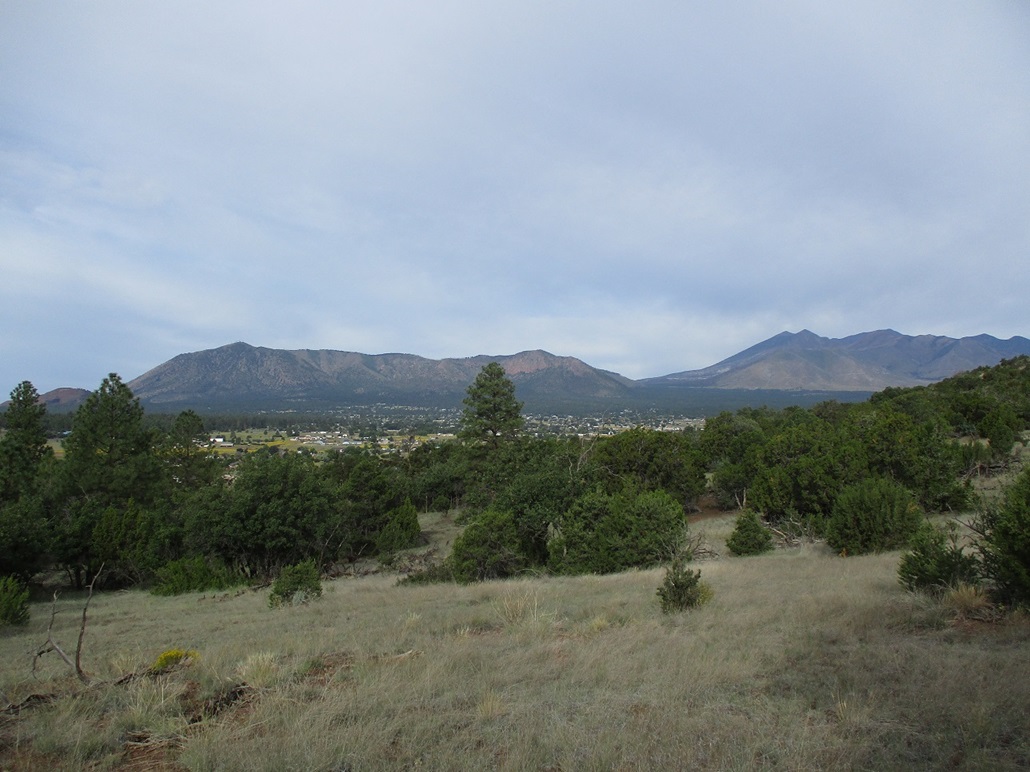
Peak 6973 • Peak 7872 I had spent yesterday hiking volcanic mounds east of Flagstaff, starting with a trio along Leupp Road then a pair more northeast along the Sunset Crater-Wupatki Road. I then scored a room at the local Motel-6 and ate dinner at Denny's, living the high life. Today's plans included three more peaks in and around Flagstaff. I had maps for Sugarloaf Peak, Dutton Hill and Peak 6973 in Doney Park. Sugarloaf was my primary goal, it being a 9,000-footer, a plug at the east end of the ancient crater of San Francisco Mountain. The other two were "fill ins", peaks I would pass on by otherwise, but figured would serve as nice bonus peaks for the day. I was out of my hotel about 7 a.m., the day mild, temperatures in the 60s. A cloud bank had moved in, the sky was a sheen of white. Not so much a lot of little puffy clouds, but one big featureless sheen. It muted the light and was not conducive for photos. I drove through Flagstaff and north up US-89 to the "Forest Access" road opposite the Sunset-Wupatki Road. I followed this road in, making turns and following the signs to Lockett Meadow. However, at the last turn before the road starts uphill into Lockett Meadow, the road was closed. There was a grader parked nearby (Reviewing this online later, the road closure is due to the damage wrought by the 2022 Pipeline Fire). I had no desire to hike the road, so I canceled this attempt and returned south to Flagstaff. While disappointed, I can always return. I then set my sights on Peak 6973 in Doney Park.
Date: September 10, 2023
• Elevation: 6,973 feet
• Prominence: 413 feet
• Distance: 2.4 miles
• Time: 1 hour
• Gain: 570 feet
• Conditions: Warm amd cloudy
Arizona
•
Main
•
PB
•
LoJ
•
Interactive map
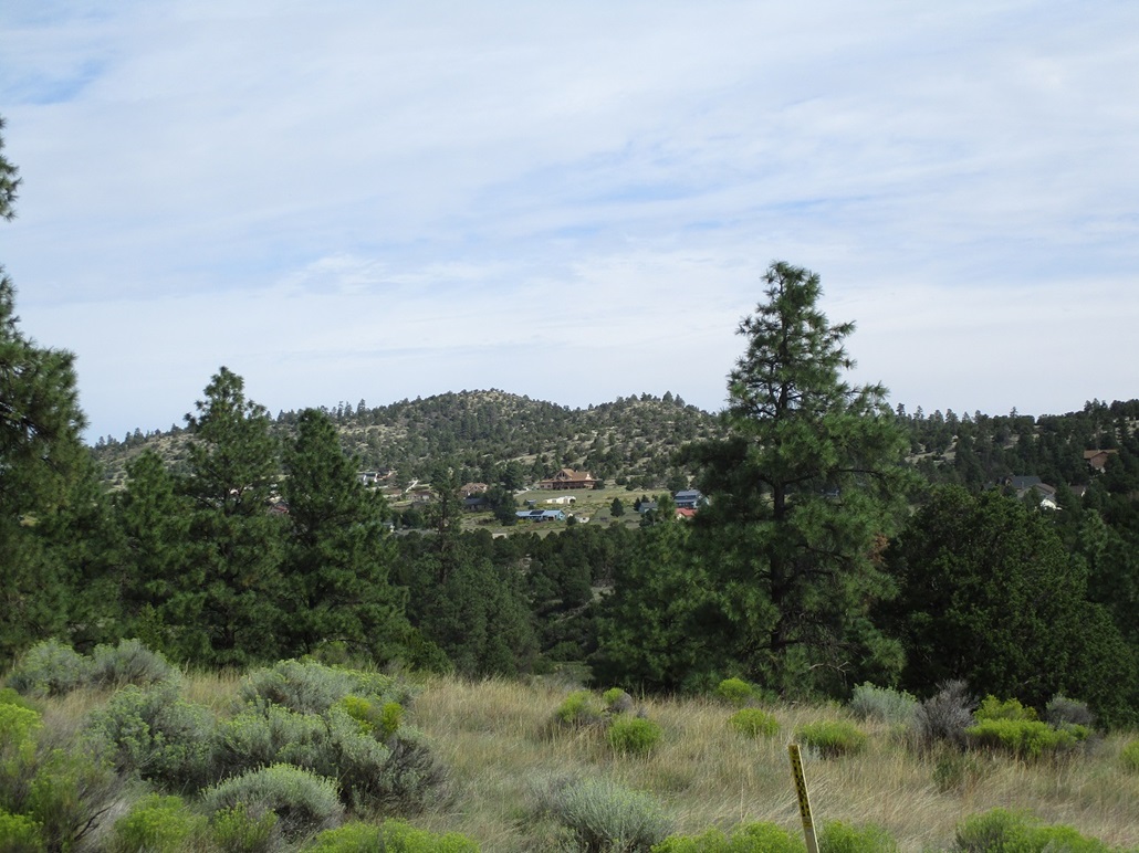
This peak rises in Doney Park, the eastern suburb of Flagstaff. It is surrounded on three sides by homes and private property. There is an all-forest-property access to the peak from the south, which would avoid the need to cross someone's land.
I was here yesterday. From the Thompson-Winona Road, I followed Slayton Ranch Road north through one private-property section, then briefly back onto Coconino National Foest property. I had a detailed map that showed property boundaries accurately to ensure I did not stray onto private property accidentally. I eased onto a meager track, went in about a hundred feet, then went "soft right" at a three-way intersection (the first right just goes back to the main road). I drove in about another 300 feet and parked where a sign said vehicle traffic was barred.
I was already dressed and ready to go, so I locked the car, got my butt pack on, and boom, a lightning strike and ensuing thunder. I didn't get more than ten feet from my car. A storm was building over Humphreys Peak while above me it was mixed. But the lightning strike and thunderclap was all I needed to see and hear. I got back in my car and said "tomorrow". As I drove out, I passed a younger woman walking along the road with her two dogs.
At this point, the day was very warm and starting to become stormy, so I encamped at a Starbucks near the mall for two hours, before heading north and east to tackle a pair of peaks that way.
So today, I roll in and up ahead of me is that same lady and her two dogs. She must live nearby. I thought it would look bad if I tried to pass her again. She would surely recognize me. So I parked early, in a nice open spot of low grass. This would add about 300 feet each way to my hike.
I suited up and started walking. The road continues past the sign, bends left then steeply gains to the ridge above, taking care of half the elevation gain all in this short push. At the ridge, a trail branches right, so I followed it. A few dozen yards later, I went right again at a split. The trail was wide and distinct and obviously regularly used. It gained a slope, crossing through patches of that black volcanic sand. I stayed on the trail as long as it kept going north. Numerous lesser trails branched off of it.
The trail started to trend more west, so I left it and started up through the low grass and scattered piñon, gaining another slope and passing one easy rock band to top out ... on a ridge point. The true summit was still ahead, but not far. I dropped off this hill, and was able to follow weak paths almost all the way to the top. The one-way hike took about a half hour and covered a shade over a mile.
The top was scraggly, there being no register or cairn. I suspect it gets climbed somewhat regularly by the locals. The gray sky didn't motivate me to take many images. I didn't really stop, just slowed a little bit. There was a trail up here! Was it the same one I was on earlier?
I followed it down but it started to trend more west, so I left it, and like before, followed scanter paths and open terrain, the navigation here being very easy. I was back to the trail I had been on earlier and back to my car soon thereafter, the round trip taking about an hour. I have no idea if that trail connected to the one I was on. They probably do, butI didn't want to waste time following it hither and yon.
I was quite pleased how well this hike had gone and appreciated that there were trails and paths most of the way. I was not expecting much, but came away happy with the experience. This was better than I was expecting. It was now about 9 a.m. and warming.
Next up was Dutton Hill, a forest ridge-hill located a few miles southwest of Woody Mountain. I got onto the west end of Business-40 (Old Route 66) then followed Woody Mountain Road south over the interstate and onto forest land, where pavement ended.
At first the road was decent, but it gets a lot of use and degrades. It was washboarded and full of bowls and divots. Today, there were many joggers ... a lot, suggesting there may have been a race or some event going on. I was past them after awhile, then past Woody Mountain. The road was bumpy the entire way and very annoying, too.
I got to Mill Park, an open meadow near the hill. But the clouds had lowered and there was a soft rain. This would be an all-forest hike and if the plants and grass were wet, I'd be soaked. I decided to bail. I wasn't liking it very much and the crappy road soured me, too.
As I exited, a mile or so later, an older-model (1980s) pickup hauling a small junk trailer was stopped dead center in the road. I stopped too, but it was evident he wasn't moving nor was motioning to me in any way, so I eased past him, driving partially in the shoulder to get past him. I looked in and it was an older couple. Both sat up straight, looking ahead, not at me. He had both hands on the steering wheel. Neither acknowledged me, like someone normally would they let you pass. It was like they were zombies. I passed them then would see them in my rear-view mirror as they drove out too.
By now it was pushing noon and warming, too. I was shut out on two of my three Flag peaks for the day. I needed to be heading home and had no desire to mess with Interstate-17 on a Sunday. So I topped the gas in town and followed Lake Mary Road south. Along the way I would hike another peak, a good way to break up the drive and get a two-fer for the afternoon.
Elevation: 7,872 feet
• Prominence: 372 feet
• Distance: 1.2 mile
• Time: 45 minutes
• Gain: 270 feet
• Conditions: Cloudy and humid
PB
•
LoJ
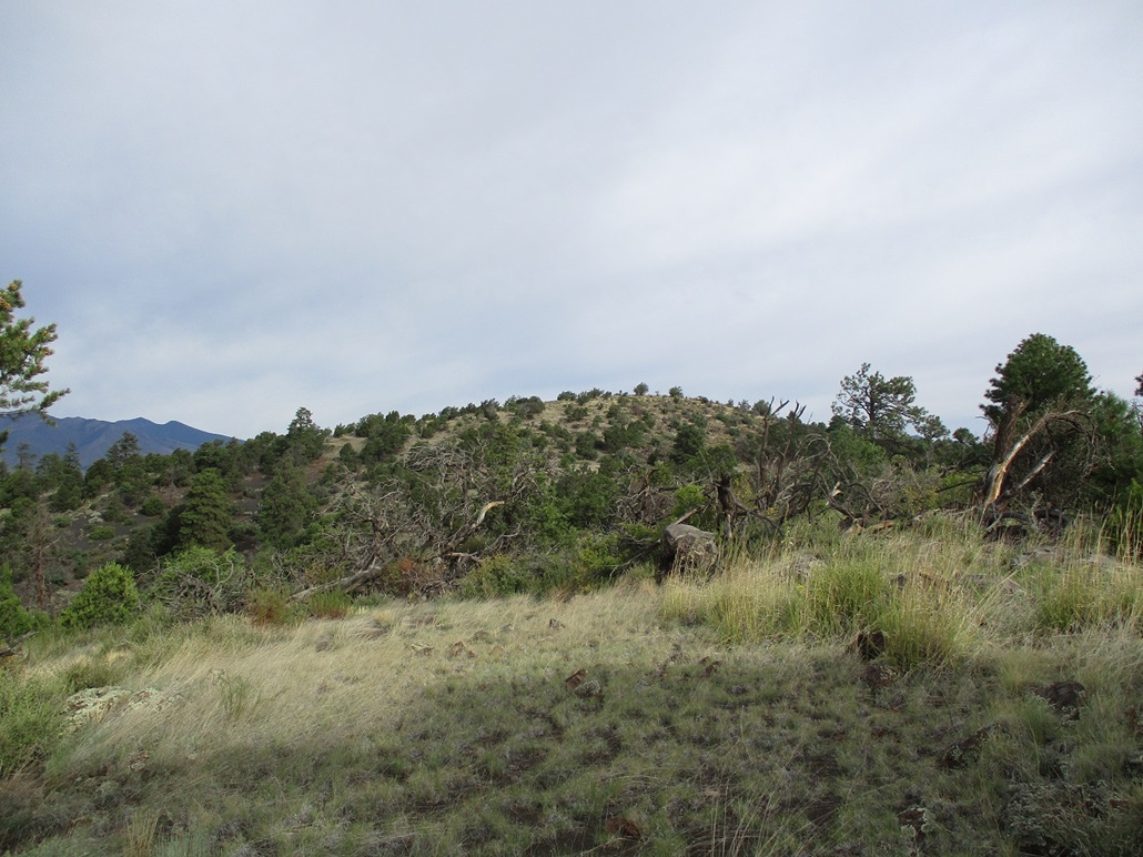
This peak lies south of Mormon Mountain, west of Mormon Lake. It is a low mound of thick forest and not at all obvious that it is a peak to begin with. Only the maps show that a peak exists here.
I had pre-printed maps for all these peaks but as I drove near it, I couldn't find the darn map! I stopped and dug through everything. It had fallen under the passenger seat. Stupid map.
Near the scenic overlook near the St. Joseph's Youth Camp, I followed FR-240, a fine road, up and west into the hills. About a mile and a half later, I eased onto FR-240A, which wasn't signed, but was the only "obvious" road along this segment. I followed it in about a half mile, parking at its end. This was good because I was expecting this road to be in poor shape, but it wasn't.
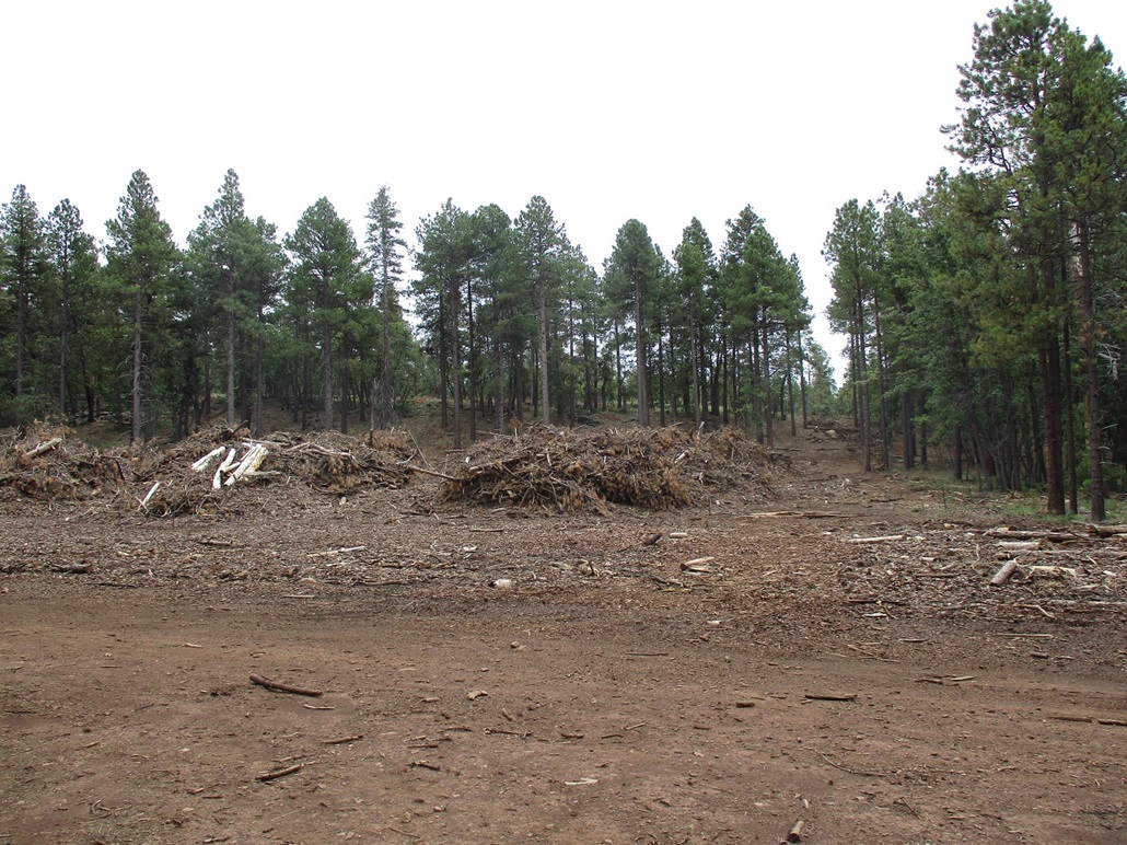
At the end of the road were mounds of logs and tree slash, the whole area being thinned and logged. This might explain why the road was in decent shape. This did not show on the satellite maps, suggesting this to be a recent activity.
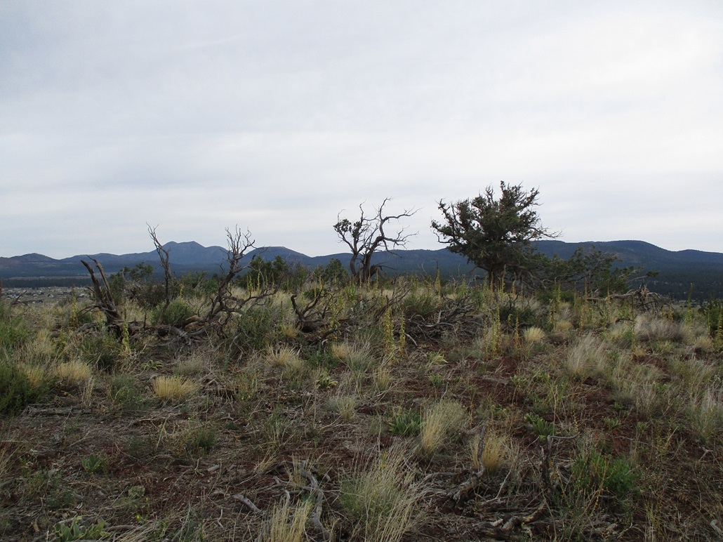
I walked a nasty logging road east, uphill onto a slightly-elevated bench, following the road essentially parallel to the peak, which was hidden in forest for now. The only hint there was a peak back there was that some trees were higher than others. When it felt wise, I left the road and started hiking through the heavy forest, using surveyor ribbon to mark my route.
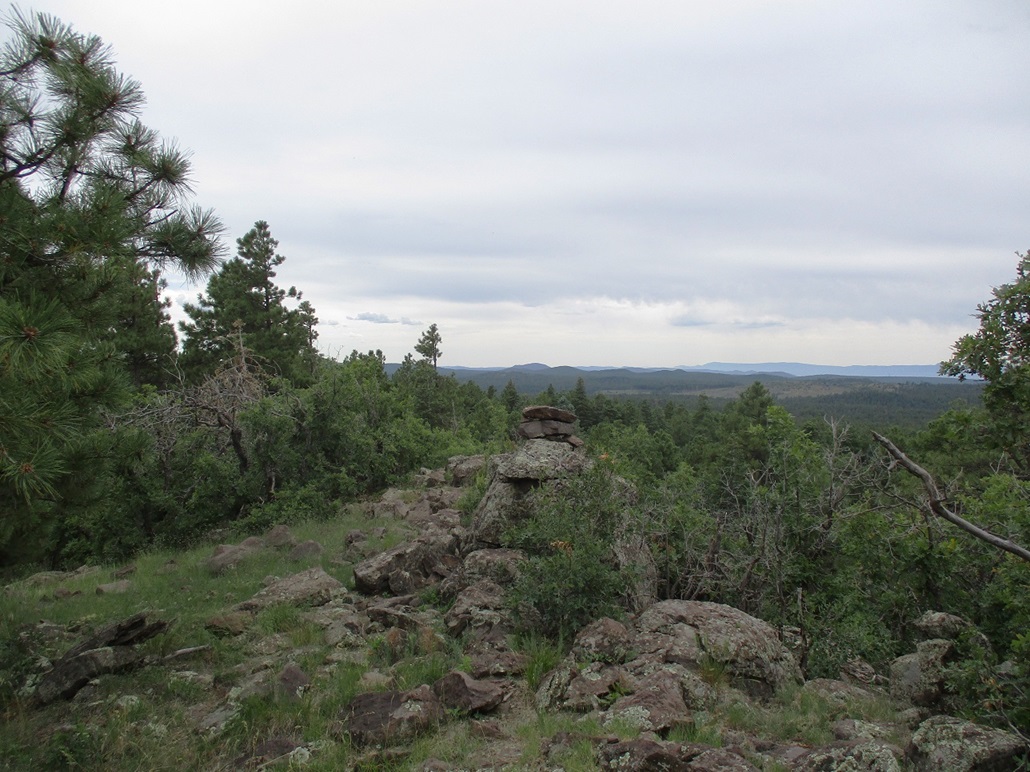
This portion went well, the undergrowth not too heavy. I eased through one rock jumble and surprise, came upon a road. I followed it upward and saw the summit just a few dozen feet farther up. I walked through clumpy grass and rocks to the open peak. There were two cairns, but no register. Views would have been decent had it not been so grayish-white and mucky. I did not stop.
I followed my route down exactly, untying the ribbons as I exited. It's possible the upper road I was on was a continuation or a branch off the one I was on lower, but I did not care to find that out. My way worked fine and the whole hike took just a half hour.
This was not an interesting peak, but it counts and I'm glad to have hiked it. I returned to Mormon Lake then back onto Lake Mary Road.
The drive went well. It got a little crowded as the big campers were now driving south. I knew to go slow and roll with the punches, but others were passing, often on double yellows. I stopped for gas in Payson, then drove home to Tempe. I watched the outside temperature gauge climb from the lows 80s to 113 as I dropped into the lower deserts. I was hot, tired and filthy, but happy with the two-day mini-vacay, seven more peaks now to my credit.
|


|