The Mountains of Arizona
• www.surgent.net
|
|
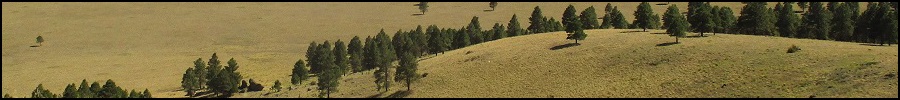
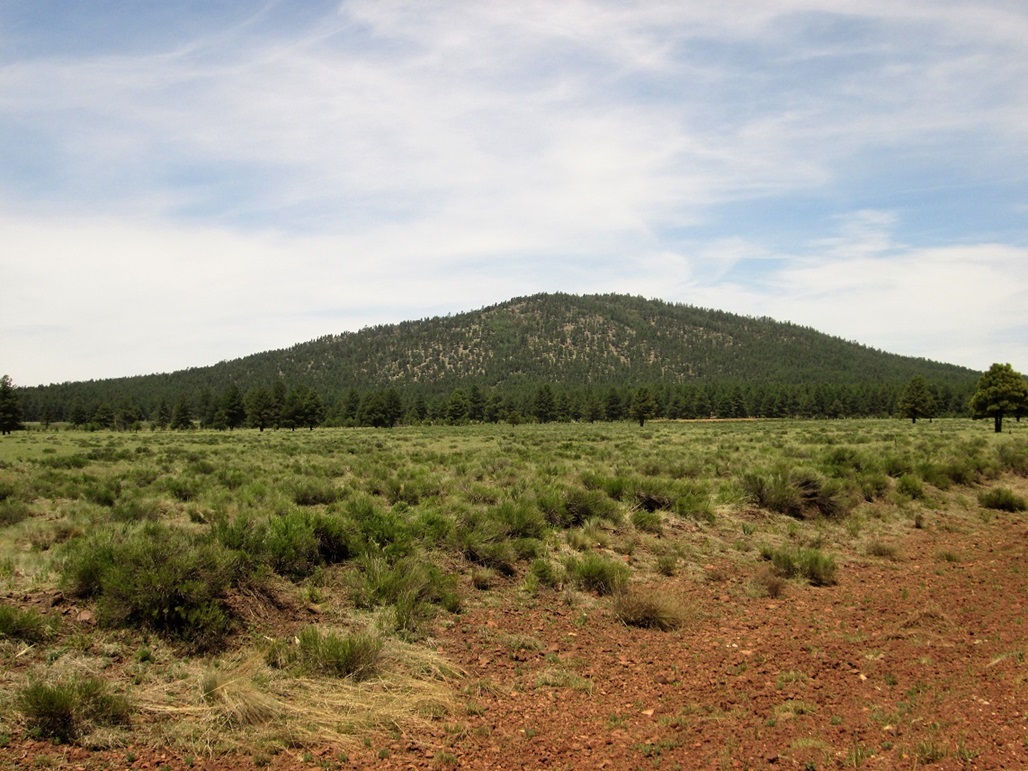
Davenport Hill • KA Hill • Woody Mountain We were in Flagstaff, taking a short vacation out of the heat. It was my birthday weekend, the big "fitty". We camped at the Motel-6 on Woodland Village Road. We arrived very late on Tuesday the 6th, but we had no traffic for the whole drive.
Date: June 7, 2017
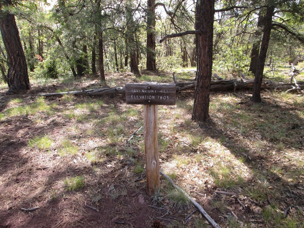
• Elevation: 7,805 feet
• Prominence: 735 feet
• Distance: 5 miles
• Time: 2 hours
• Gain: 750 feet
• Conditions: Clear with high clouds
Arizona
•
Main
•
PB
•
Interactive map
Today, I had a few peaks on the agenda, some mid-sized hills toward Williams. This one, Davenport Hill, was the primary objective, being the longest and ostensibly the most interesting of the batch, although that was just an uninformed opinion of mine. Information on the web is scant, and truthfully, I had never heard of it until scanning maps a few days beforehand. But it has a trail and seemed to be not-too-long nor not-too-short. I wanted to check it out.
I left the hotel at 6 a.m. and drove west to the Garland Prairie Exit, about 20 miles away. I went south, crossed over railroad tracks (the pavement ending here). Now I was on Kaibab Forest Road 140, which angled more east, then southeast. A couple miles later, I came to a "major" fork in the road, but no signage to tell me what the road numbers were. However, it looked correct per my map, so I took the right fork.
This road was slightly lesser in quality, and I drove in about a mile but was not sure it was the correct road, so I retreated back to the junction, drove more on FR-140 east, and found a sign (facing the other way) which did confirm that the other road (the one I was just on) was FR-141, the one I wanted after all. This all wasted about ten minutes.
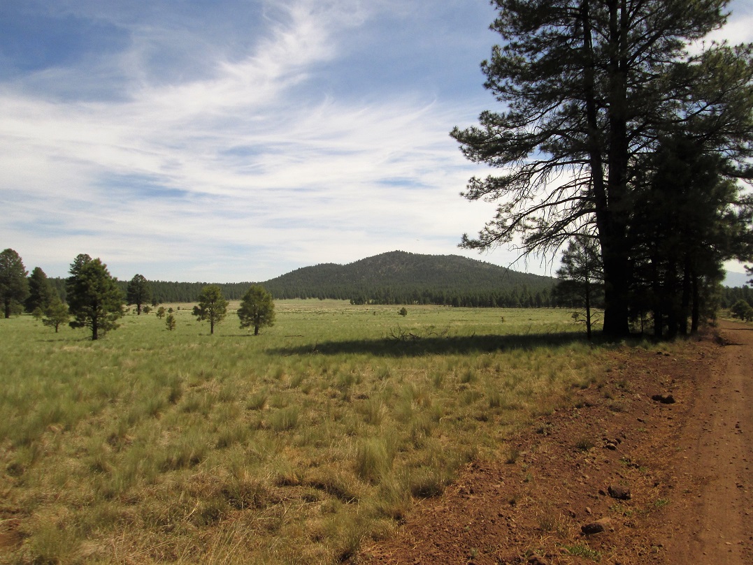
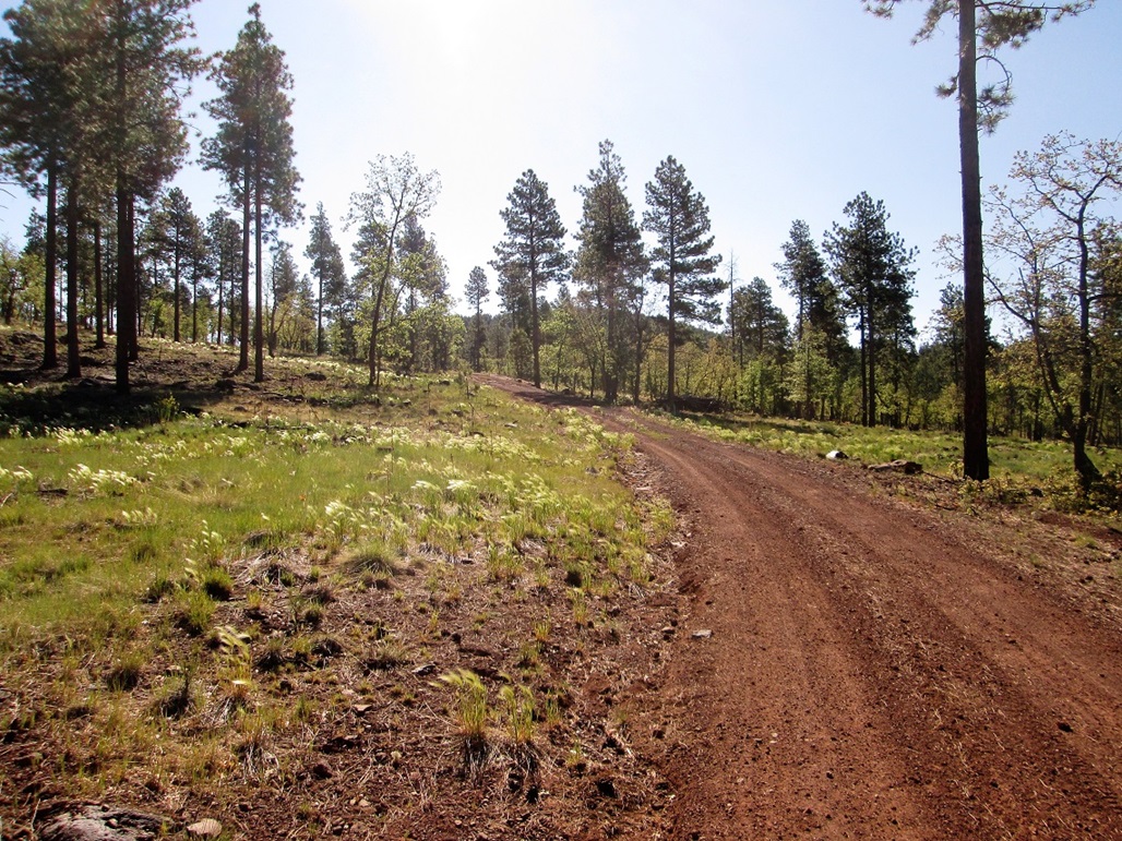
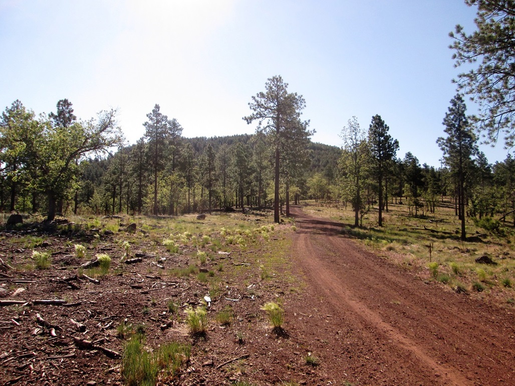
I drove south on FR-141. The road gets rough for a couple miles, where deep ruts and an uneven tread were the worst problems. There were no rocks to deal with, but it appears that when wet, this stretch is boggy and slow to drain. Today was dry, fortunately, no hint of mud anywhere. I got past the bumpy bits and the road improved, crossing a meadow south of the hill. I then followed a side road (and signs) to the Dogtown Reservoir Campground.
I expected to see signs for the trailhead, but saw nothing. I drove both loops of the campground but saw nothing that looked like a trailhead. I then drove to the small day-use parking area near the lake (this being Dogtown Reservoir, a popular fishing locale). I parked and found a trail, I think. My map showed the trail supposedly skirting the campground, so I played a hunch, walked the northern loop, then walked across open ground to yes, a trail. I felt happy. But this trail simply petered out in the low grass. I tried to follow it, but didn't want to spend the whole hike going cross country. I returned to my vehicle, and saw the campground host doing his rounds.
He confirmed there is a trail, but seemed vague on its location. He also mentioned the trailhead sign I was looking for, for the Ponderosa Loop Trail, was "out for repairs" (whatever that meant). He handed me a brochure for the Ponderosa Loop Trail which mentioned a junction with the Davenport Trail. This was most helpful, so I thanked him, and started again. All this cost me another 45 minutes. It was close to 8 a.m. when I started again.
The Ponderosa Trail is just a one-mile loop nature stroll with numbered posts that tie-in with the brochure telling you what you're looking at. I stayed on this trail going north. It dropped about 50 feet into a drainage, which seemed incorrect to me. But I stayed on it and it soon bended right (east) and soon, I found the Davenport Trail and sign, so everything worked out well.
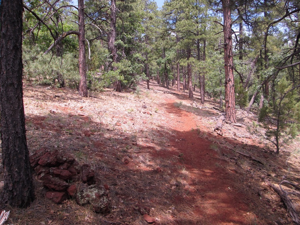
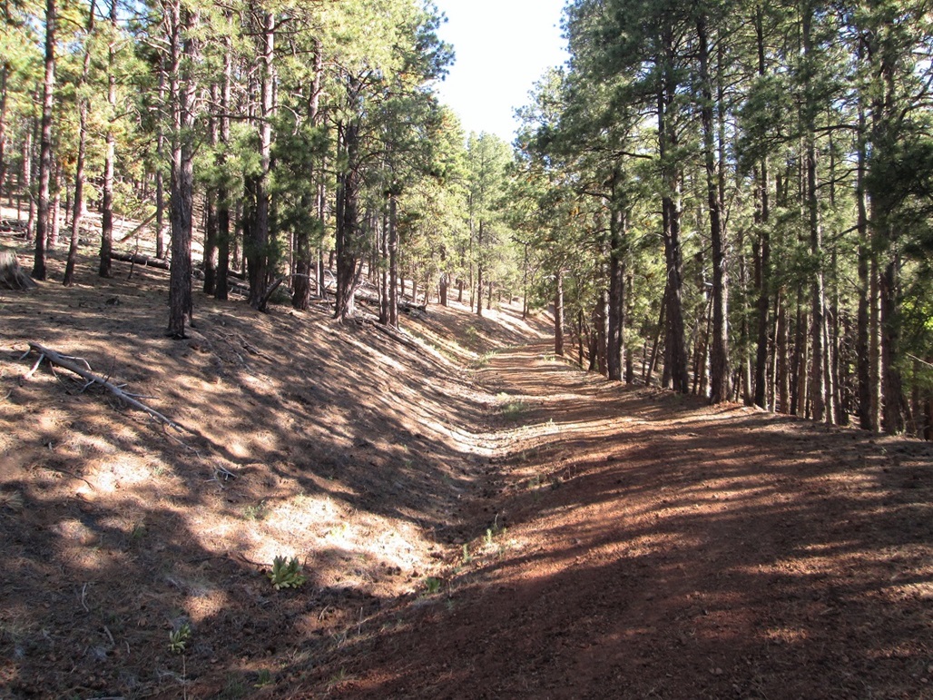
I followed this trail east, up and out of this drainage and across a meadow, past a gate and soon, crossing a road. This stretch covered a mile and was mostly flat. The day was clear with wispy high clouds and a bright sun. In the open, it was warm, but in the shade or if a breeze picked up, it was pleasantly cool.
Beyond the road junction, the trail starts to gain uphill, crossing one more gate, then going in and out of the folds of the mountain, generally north and west of the summit. Up this high it was shaded with thick ponderosa and gambel oak, plus other "oaky" strains whose names I am not entirely sure of. Getting close to the top, I rounded a bend and heard some rustling, looking up just in time to see a big elk's butt as the creature scooted away from me into the trees. I was also looking for bears but saw none, nore did I see any scat.
The trail meanders a little, crossing onto the peak's southwest slope, then angles up to the top, where a 6-foot tall cairn stands, topped by a stick. For such an obscure peak, it surely has one of the more impressive cairns. It had taken me just over an hour to get here, a 2.5-mile one way hike. The views from the top were wooded, so I didn't stay long, just long enough to drink and rest.
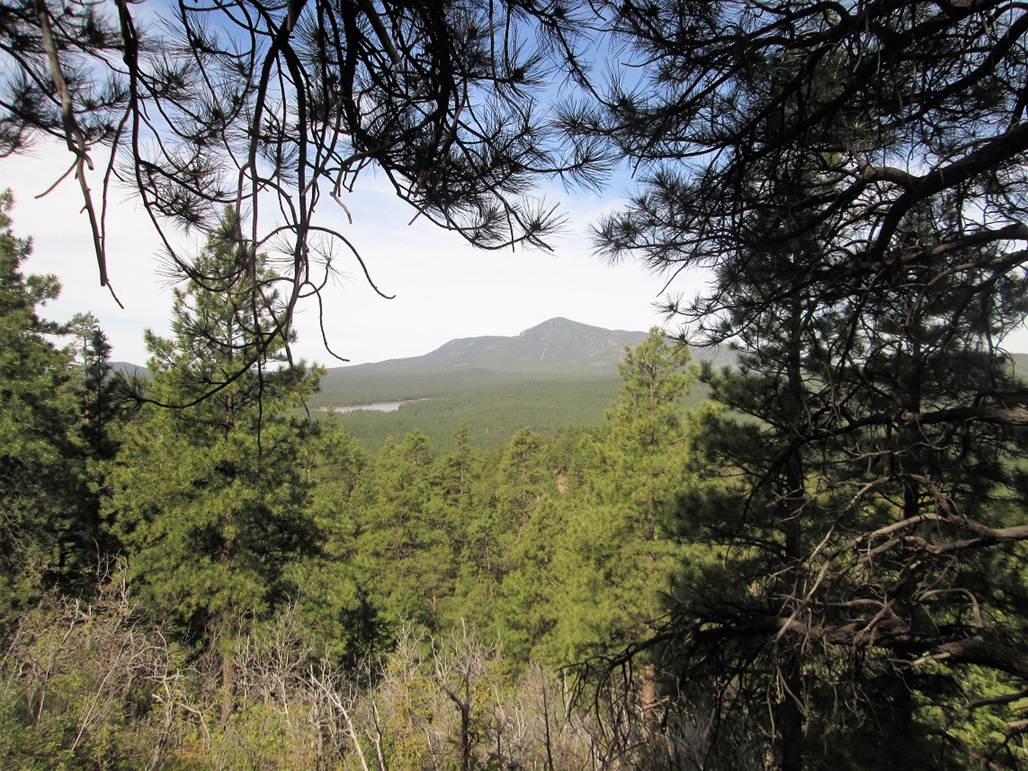
I followed the same route on the way out, but stopped a few times for photos and views. I could see many of the surrounding big peaks at times, but the forest kept good views limited. I did not take that many photos. As nice as it is hiking in ponderosa forest, photos taken from within are usually very bland, looking like every other photo ever taken of a trail in a ponderosa forest. I did get one image of Dogtown Reservoir and Bill Williams Peak in the background.
I was back to my car after another hour, the time about 10 a.m.. I rested briefly, but not too long, as I had my eyes on at least one more peak. I opted to hike KA Hill, an easy bump about five miles to the southeast.
I give Davenport Hill a positive review. It's an easy hike, you get a workout, and the campground looks decent. Most people there were clearly there for the fishing. Everyone had boats or kayaks with them (I think motorized boats are prohibited). I'd stay there in the future. Surprised I'd never heard of it. I don't know how often the peak is hiked, as there was no register at the summit. I suspect not that often.
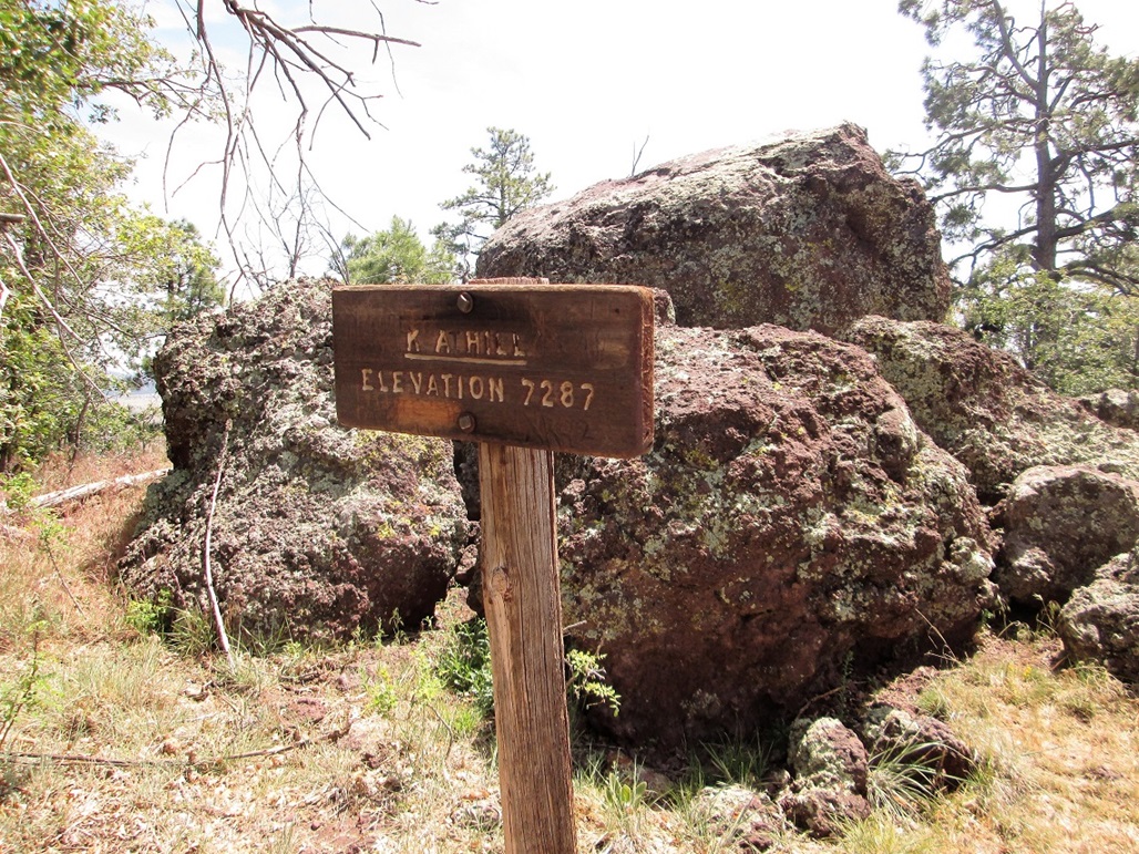
Elevation: 7,287 feet
• Prominence: 487 feet
• Distance: 2.5 miles
• Time: 1 hour
• Gain: 570 feet
• Conditions: High clouds and warm
PB
From Davenport Hill, I retraced my driving route back to Kaibab Forest Road 140, which is Garland Prairie Road. The road runs about ten miles southeast from the Interstate to Garland Prairie, a big flat area about five miles on a side. Now heading southeast, I drove about five miles and then followed another road that cut south, along KA Hill's eastern flank. I forget the road's number and the exact mileage, but finding everything was cake. I parked in a small parking area for the Sycamore Rim Trail, rolling in about 10:30 a.m., the weather calm but warm. Mine was the only car here.
The hike itself went fast. I followed the trail west, coming to a sign saying the top is 1.25 miles farther. The trail gains slowly at first through a section of open ponderosa forest. Soon, it comes to the base of the hill and steepens. The trees and brush were thicker here. The trail made a couple switchbacks, then gained the south ridge of the hill. The trail started to level and quickly, I was at the top, the one-way hike taking 30 minutes. It was warm, but occasionally a breeze would pick up and cool me nicely.
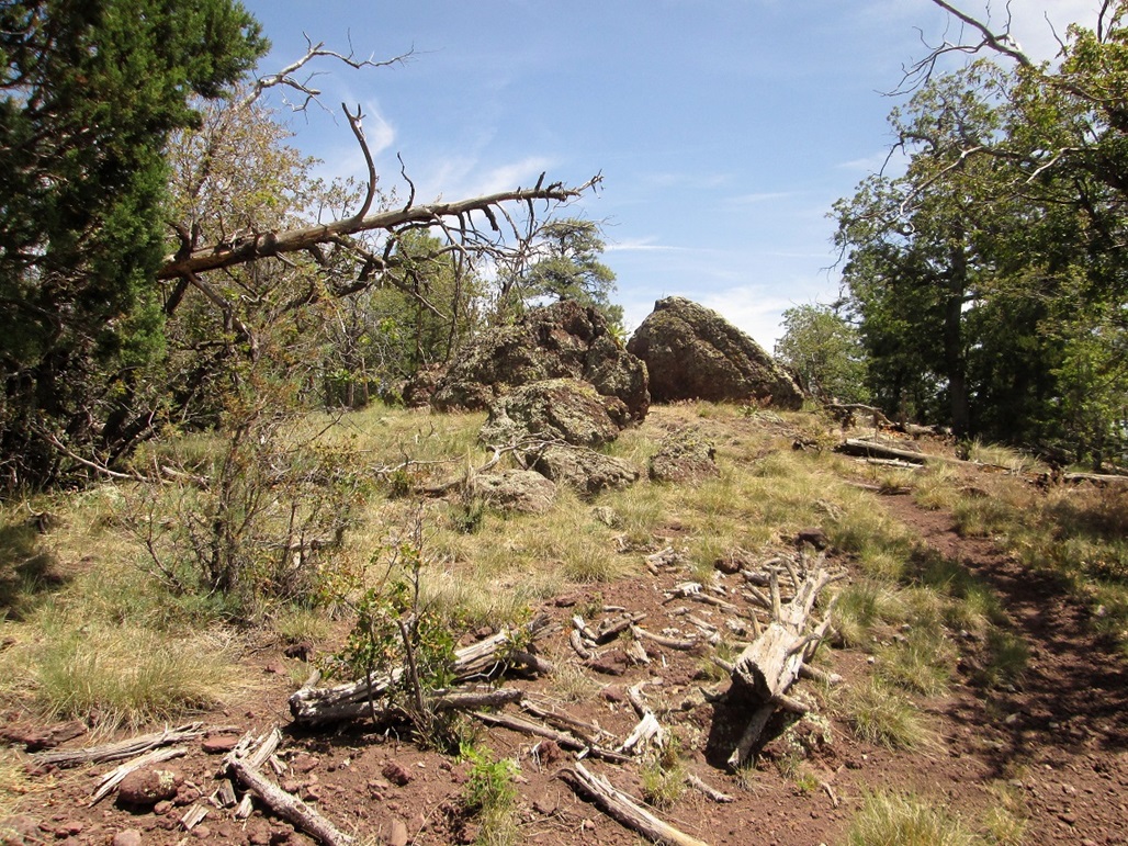
The top features a batch of rocks and a sign. Scampering up the rocks was easy. I tagged the top, then snapped a couple photos. The trees and brush blocked most views, so I didn't stay too long. I rested and drank some water, but it was a little too warm, surprising given how high up I was. In the still air in the sun, it was downright hot. I hiked back down and was back to my car after 25 minutes. Counting rest stops, the hike had taken exactly one hour. Back at the parking area, one other vehicle was there, with a big "Just Married" written on it. The newlyweds, I presume, were nowhere to be seen, possibly having taken the Sycamore Rim Trail the other direction.
The big attraction out this way are the Sycamore Breaks, a canyon system that eventually leads south toward the Sedona area. These are impressive canyons, with rocky walls with lots of trails and camping areas. Back in 1998, I was here with my Mountain Rescue team on a training, the last and biggest one for our training class. We set up highline systems that spanned the canyons and enacted scenarios for two full days. It was a lot of fun. I would have taken Garland Prairie Road to get here ... but have absolutely no recollection of the drives to and from the Breaks. I know I have been on this road and in the area before, but just don't remember it.
I drove back to the highway and back to Flagstaff. Together, the two hikes had encompassed 7.5 miles and 1,320 feet of elevation gain, so I was feeling pleasantly tired afterwards, my first hikes after turning 50 years old. I showered and rested, and lazed around the place, plus taking short walks.
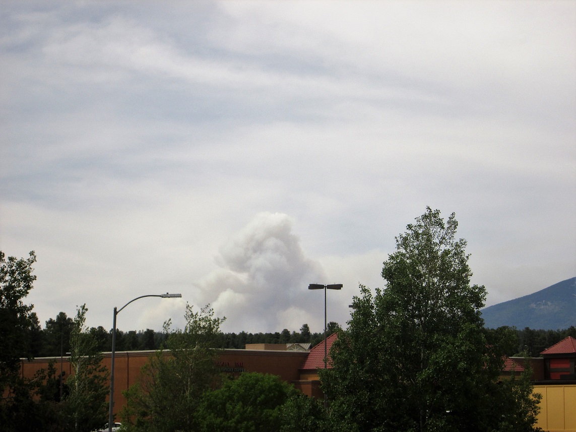
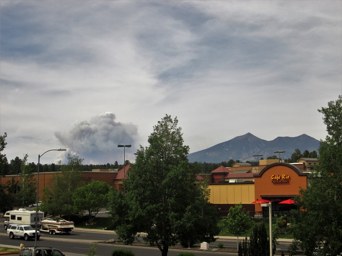
Later, we watched as a big plume of smoke billowed near Kendrick Peak. I got a couple photos taken from our hotel balcony. This was a lightning-caused fire that conveniently had started in an area where they were going to do a controlled burn anyway. The plumes were sometimes white and sometimes black and gray, and at one point, there were two distinct plumes that melded into one, presumably one being a backlit fire. This provided about an hour of entertainment. The other entertainment was provided by our neighbors, a bunch of laborers and workers working on a giant condominium complex behind the shopping center across the street from us. They'd come back to their rooms here about 4, quickly get blitzed on beer, all hanging out on the balconies, laughing and talking. They were totally cool and not a problem. They'd be crashed by 8 p.m. and were quiet after that. Couldn't ask for better hotel neighbors.
The next day, I hiked one more peak, Woody Mountain. I had another peak planned in the Hochderfer Hills, but those are near Kendrick Peak and I figured given the fire and clean-up, I should avoid that area.
Date: June 8, 2017
• Elevation: 8,045 feet
• Prominence: 735 feet
• Distance: 3 miles
• Time: 1 hour, 40 minutes
• Gain: 780 feet
• Conditions: Clear and cool
PB
From the hotel, I drove to Business-40 that leads west out of town, then turned south onto the road that leads to the Flagstaff Arboretum. This road crosses the interstate, then the pavement ends. From here, the road is dirt but well-maintained. I drove about five more miles, to the Rogers Lake area. Here, the road bends south, and I found the gate that spans a side-road that leads to the top.
I parked off the road and started walking, and in about 20 minutes, had covered about a mile to where the road meets with a different road that comes in from the north. That road crosses private property lower down, which is why I skipped that route. From the junction, the road winds counter-clockwise up the slopes to top out on the mountain. The one-way hike covered 1.5 miles and took me about 40 minutes.
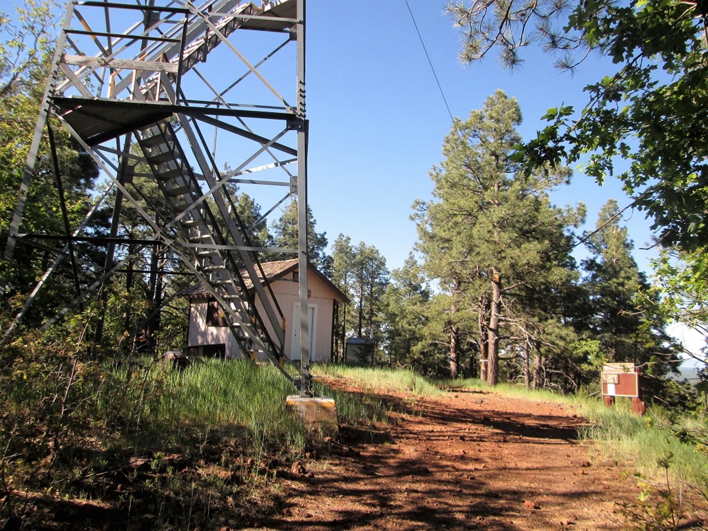
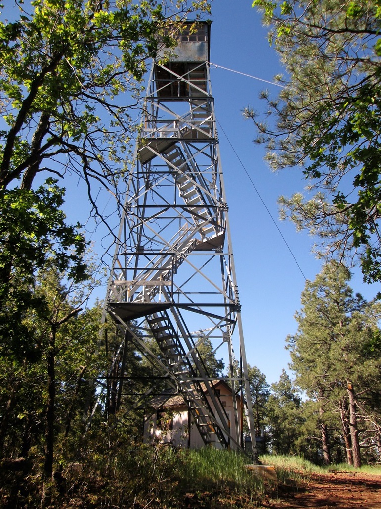
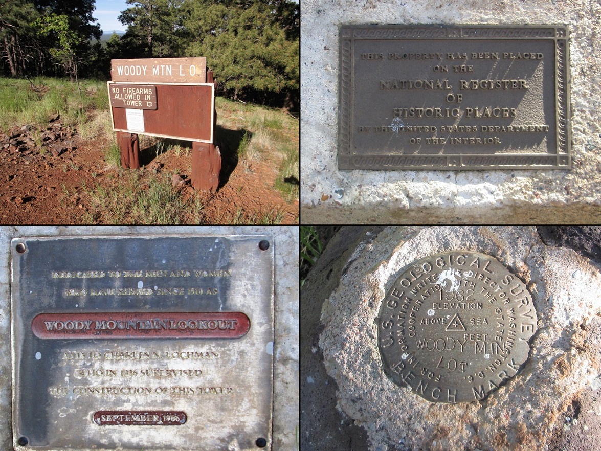
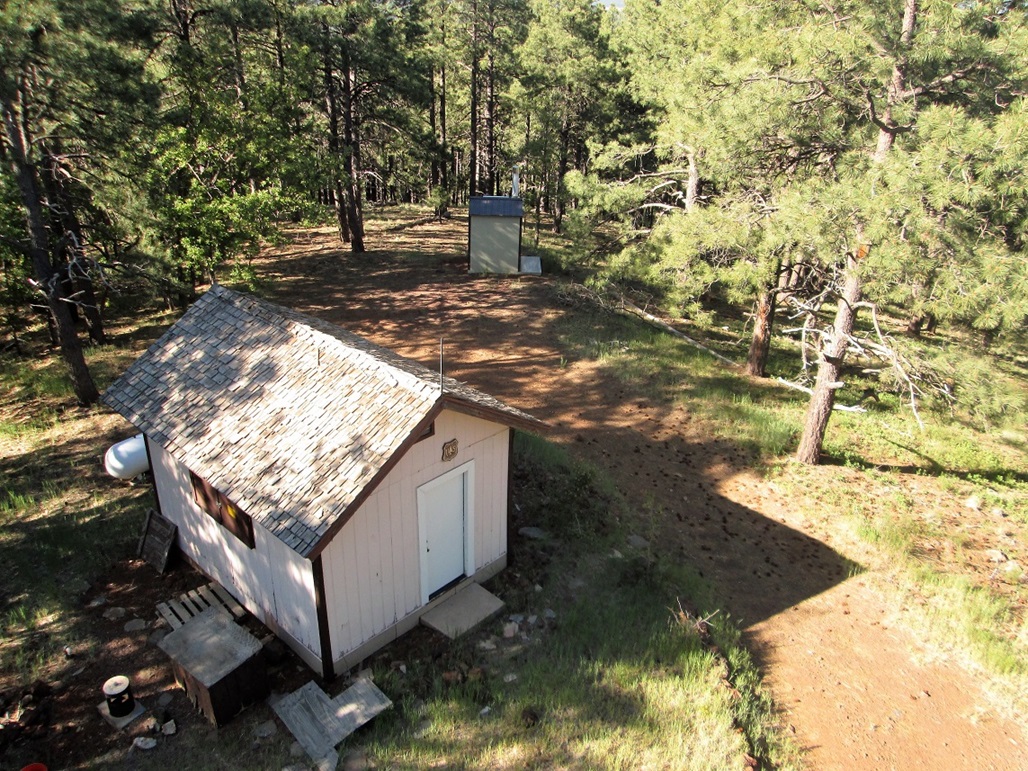
The top has an active lookout tower and small residence, plus signs and plaques. The tower itself is on the registry of historic lookout towers. No one was here this morning. I looked around, then walked up two tiers of steps up the tower to snap a couple photos. I spent about ten minutes at the summit area.
The hike down went well. A bunch of workers were driving up as I drove down. The downhill hike took me a half hour, and was enjoyable. I saw a lot of deer on the hike, including a mama and her baby fawn. I did not see any other hikers.
|


|