The Mountains of California
www.surgent.net |
| Micro Benchmark |
• Chuckwalla Mountains • Chuckwalla National Monument • Chuckwalla Mountains Wilderness (part) • Riverside County |
|
Date: January 2, 2020
• Elevation: 3,770 feet
• Prominence: 1,290 feet
• Distance: 4.4 miles
• Time: 3 hours
• Gain: 1,600 feet
• Conditions: Stunning in every way
California
•
Main
•
PB
•
LoJ
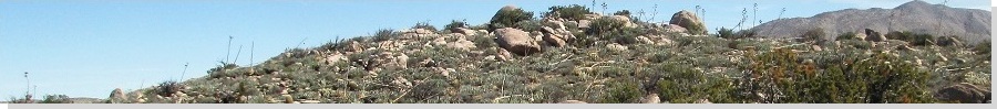
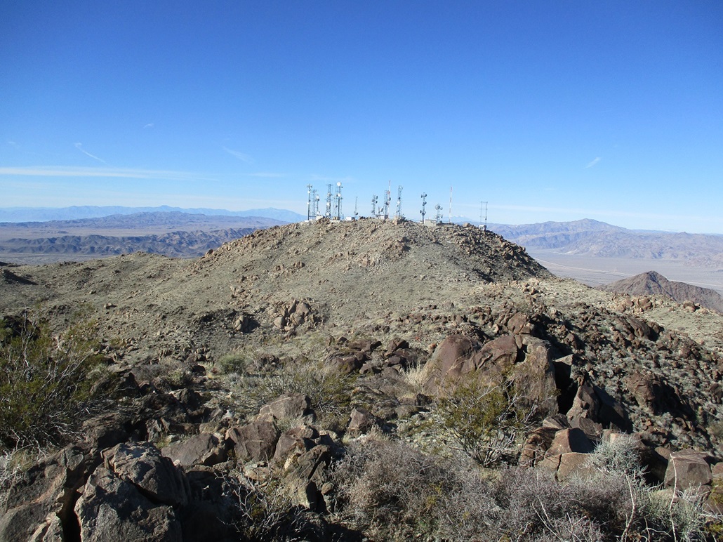
Micro Benchmark is the second-most prominent mountain in the Chuckwalla Mountains in southeast Riverside County. I climbed its highest peak, Black Butte exactly ten years ago to the day, January 2, 2010. Micro is more visible from Interstate-10: it hosts a small city of communication towers atop its summit, and can be seen from points along the interstate west of Desert Center, looking south. Most of the range is enclosed within the Chuckwalla Mountains Wilderness, except for the access road and the towers. However, the eastern summit bump may be inside the wilderness boundary.
I was returning to Arizona after a fun getaway to Southern California, visiting my amigo de escuela alta in La Verne for the new years celebrations, plus climbing a couple peaks on the way in, Zanja Peak and Shandin Hills. I knew his peak would go quickly, there being a road to its top for service-people to work on the towers.
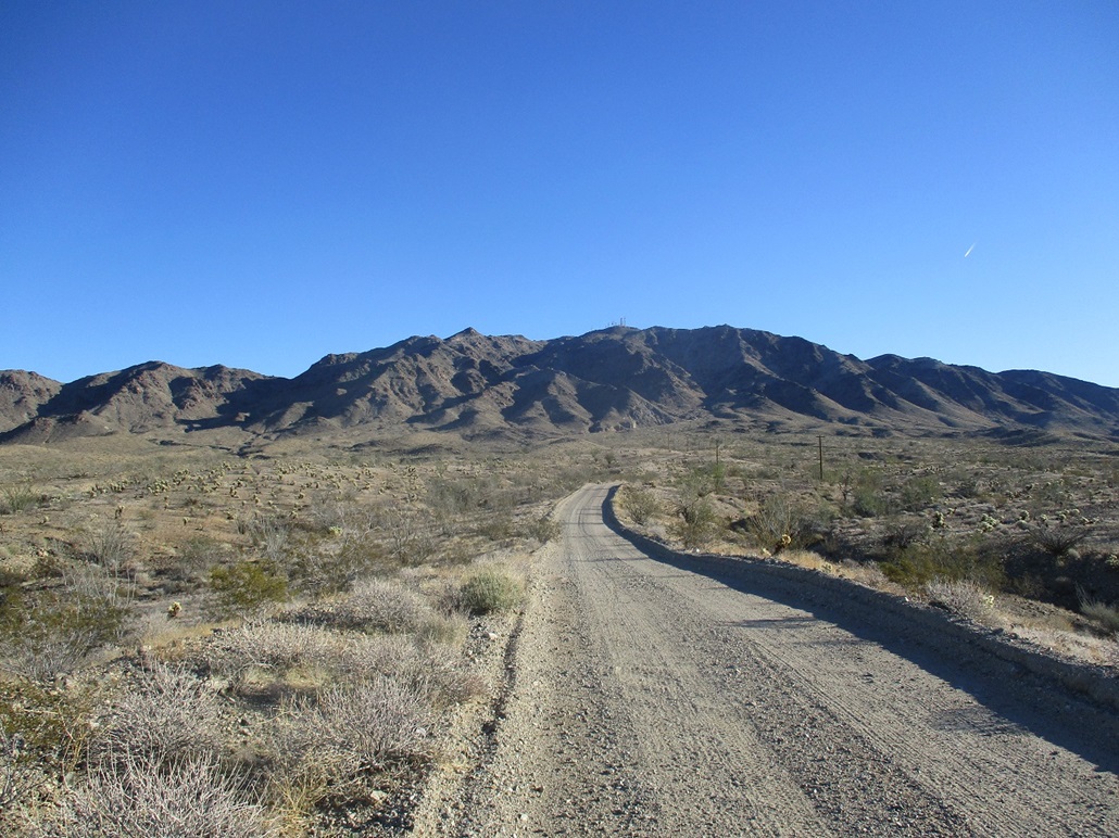
I left SoCal early, before dawn to beat the traffic. I topped the gas in Coachella then drove up the grade over the San Andreas Fault past Chiriaco Summit, then the long descent toward Desert Center. I left the interstate at Red Cloud Road. I had no maps with me but had "memorized" the roads needed to get close to the one going up to the towers.
Once off the interstate, the roads are hardpack but in generally good shape. I drove southeast on Red Cloud Road, coming to a Y-junction after a few miles, staying left, then left at another Y-junction a couple miles later. This was my first error, although later I learned this would have worked had I stayed on the road ... but I did not know that at the time, so I backed out to the first Y-junction. Here, I actually looked at the road markers and saw the one to the right (if looking south) is signed as "Summit Road". This did not seem right, but maybe it was correct, so I followed it for about three miles, but realized quickly this was not correct either. So I backed out again to that first Y-junction. Typical for me, I was making this harder than necessary.
I was going to drive back to near the interstate, just to gather my bearings. As I was driving out, I had to stop behind a truck and trailer blocking the road. Some guy was loading in a big circular saw blade into his truck (I assume he just saw it laying there). The blade was about two feet in diameter and looked like something from heavy machinery. Anyway, I got out and asked if he was familiar wih these roads. Why yes, he said. He was able to describe where I wanted to go and what to look out for. Nice guy. I wonder what he intends to do with that blade.
I drove back to the first Y-junction, stayed left, then at the second Y-junction, stayed right this time. This road (Red Cloud) meandered southeast past a few people camping in the open desert. The road comes to another "major" junction with a north-south track with power lines. I stayed on my road, heading southeast, coming to another Y-junction, the left branch heading directly toward the towers. This was the right road. Finally!
I drove in as far as I felt comfortable on this road, getting in a little under two miles. Toward the base of the mountains, the road steepened and filled with rubble. I pulled into the first wide spot I could find, and found a lovely one, level and wide, a pile of old asphalt just lying there. For me, this worked perfectly. It was about 9 a.m. when I killed the engine. The day was sunny and clear, a little chilly still. I locked the vehicle then started hiking.
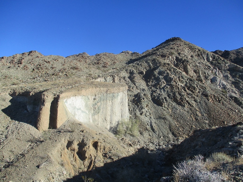
I got about 200 feet when I stopped to take a photo of a neat cliff across the way, where the soil layers were evident. When I did, I heard the scampering of a bighorn sheep! I saw him scamper off, and studying my image later, and blowing it up, I got him in the photo, but a little too blurry to actually see well. But still, seeing a bighorn is always a treat.
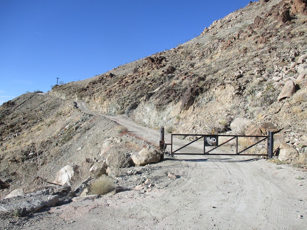
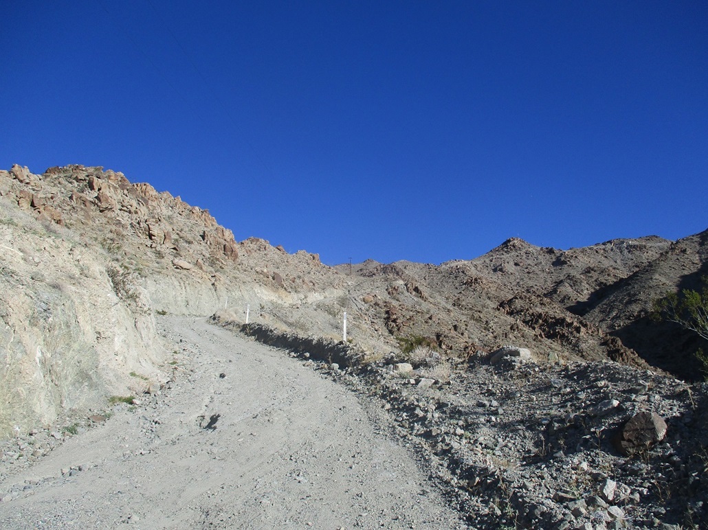
I hiked another quarter-mile up the road as it entered into a canyon, then made a sharp left where a gate spans the road. To get this far would have required a better vehicle than mine. Most stock 4-wheel drive with good clearance could get here easily. The gate is locked with about twenty smaller locks. Assuming the gate will be closed, it is necessary to walk the remainder to the top, about a 950-foot gain in a mile. I eased around the gate and continued walking.
The road was not terribly steep at first. It makes a hard-right bend then begins a long sweep up and to the right. Here, the road is very steep, about a 25-30% grade. Portions of the road were covered in a layer of rough concrete, presumably for traction. Over this concrete was a layer of rocks and gravel that naturally falls onto it over time. Going up, it was just plain steep, nothing special. I hiked and hiked and took a few breaks. I was at the towers in a little under an hour after starting my hike.
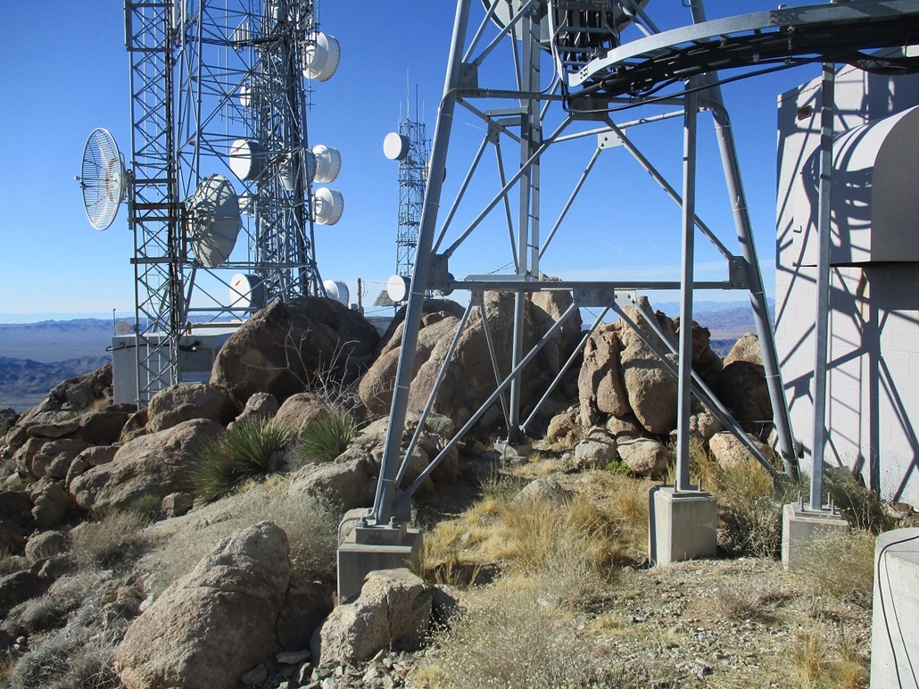
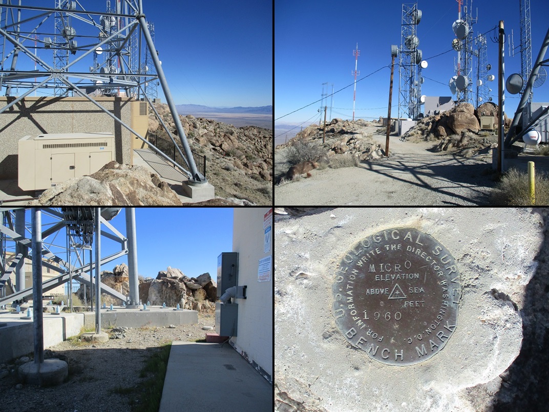
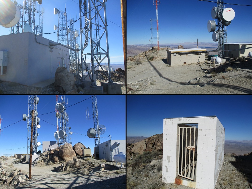
This is quite a tower complex. Numerous big towers and smaller associated buildings line the summit and its many rock outcrops. I started tagging rocks and eventually found the highest set, and a well-hidden register in the cleft of these highest rocks. Not many people had signed in, but I know this peak gets more visitors. I bet that most people never find the register to begin with.
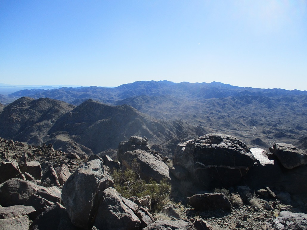
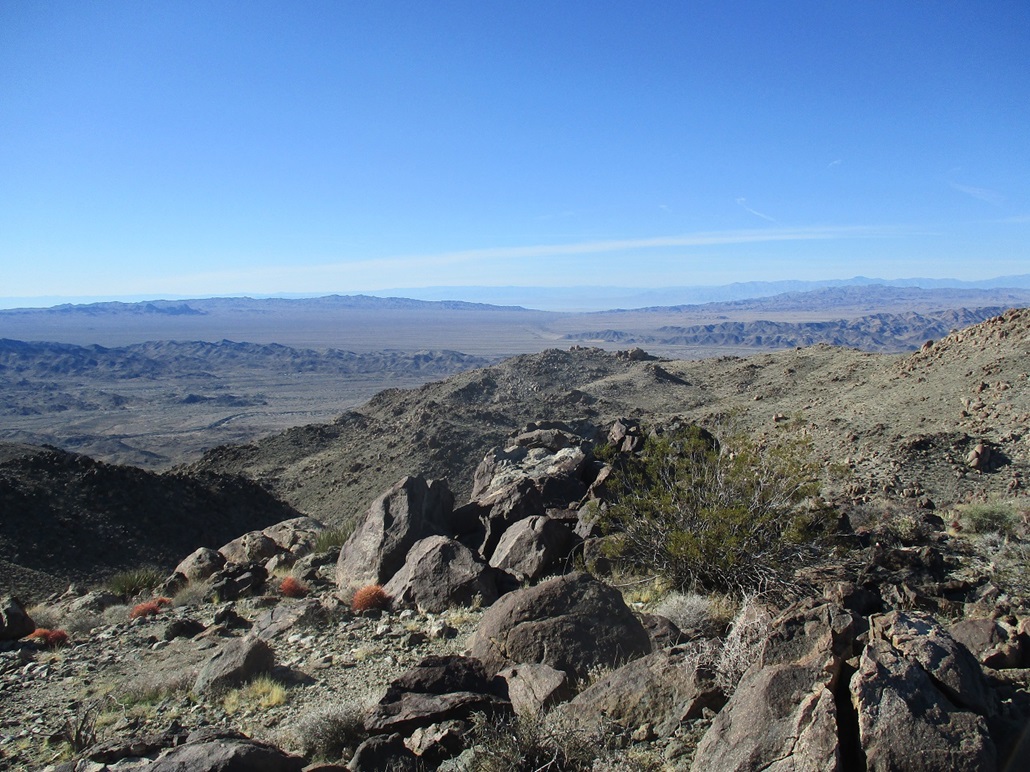
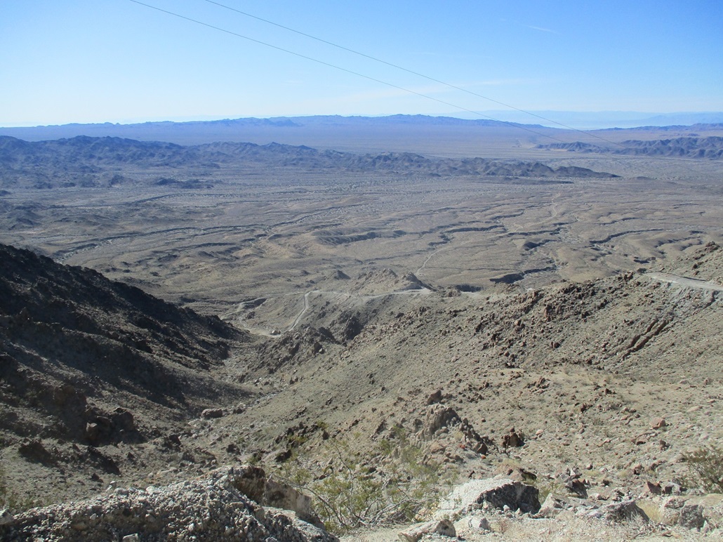
There is another bump on the summit ridge, about 0.4-mile to the east, its summit elevation about the same as the western one I was on now. I descended off the towers and down about 60 feet, then walked cross-country across easy terrain to top out on this eastern bump. I took my long-distance summit photos here, and signed into another register. I had good views of Black Butte to the southeast, the Salton Sea, the towers, and looking down to the northeast, the bustling town of Desert Center. I could even hear the trucks on Interstate-10. I spent about ten minutes here, then walked back to the western summit with all the towers.
My goal now was to find the "Micro" Benchmark, plus explore the buildings. It was fun to walk around the buildings, listen to the automated air-conditioners turn on, and see the electrons beam from the towers to various and sundry hand-held devices so people could know what their friends had for breakfast. I found the benchmark in another rock outcrop, about 8 to 10 feet lower than the highest rocks. I spent nearly a half hour up here, feeling like an extra from a Mad Max movie.
Now, it was time to hike down. You'd think hiking down a road is easy, but this was a pain in the backside. The steepness meant I had to go slow, which was no surprise. But on the concrete parts, the gravel layers moved like ball bearings. More than once (as in a lot), I suddenly slipped. In one case, I had to do a controlled fall into the side walls. There was the real concern that a bad slip on one of these slopes could result in a tumble downhill, with nothing to stop me. So I just went real slow, and carefully baby-stepped down the steepest portions. Once back at the gate, I was able to walk at a good pace back to my car.
The round trip was not long, about 4.4 miles overall. Other than the loose tread, I had a great time on this hike. Normally, towers are kind of anticlimactic, but I had fun poking around this batch. The off-trail segment out to and back from the eastern bump was also pleasant, and the views today were fantastic. This was a fine way to herald the "Roaring Twenties". This peak was the bee's knees. I even wrote that in the register. I took about a half-hour in my car just sitting there, enjoying the sun and the solitude. Then I drove back to the interstate and then another three hours to home, traffic not too bad.
The topographic map shows the west summit as 3,766 feet, presumably the elevation of the benchmark, and the east summit as 3,770 feet (a spot elevation, no benchmark). The consensus seems to lean toward the west summit being higher, given that the highest rocks are about ten feet higher than the benchmark. However, hiking out to the east summit is easy and enjoyable.
|


|