The Mountains of California
www.surgent.net |
| Black Butte • Chuckwalla Range |
• Highpoint: Chuckwalla Mountains • Highpoint: Chuckwalla National Monument • Highpoint: Chuckwalla Mountains Wilderness • Riverside County |
|
Date: January 2, 2010
• Elevation: 4,504 feet
• Prominence: 2,844 feet
• Distance: 7.2 miles
• Time: 5 hours
• Gain: 1,760 feet
• Conditions: Clear but extremely windy
California
•
Main
•
PB
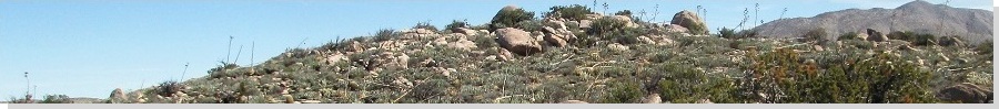
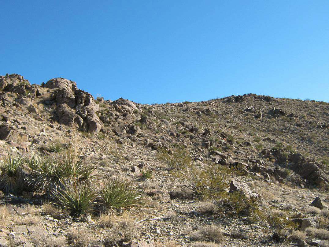
Black Butte is the highpoint of the Chuckwalla Mountains, southwest of Blythe. The Chuckwallas run for about 40 miles, south of Interstate-10 roughly between the Wiley's Well and Red Cloud exits. Black Butte itself is set farther back in the range, so it is not obvious it is the range highpoint, especially when viewing it from the Interstate. Its summit elevation is 4,504 feet, but a few other peaks in the range rise above 4,000 feet so the summit sort of hides among its neighbors. It's best viewed from the south along the Bradshaw Trail, but very few people ever come this way. Needless to say, Black Butte sees very few visitors.
I had been in the region just a week earlier, hiking Eagle Mountain in the Joshua Tree National Park, but now I was heading to Southern California for a couple days to visit friends and family, so I worked in a hike of Black Butte as part of the journey.
I left Arizona on the 1st, covering 180 miles from my home to the Red Cloud exit. Red Cloud Road and Gas Line Road are both washboarded due to the high volume of off-road vehicle traffic they get, while by comparison, the Bradshaw Trail is surprisingly smooth. I had an unintended cat-and-mouse game with a BLM Ranger, who tailed me, presumably to run my plate. When I pulled over to let him pass, he passed, but stopped, then reversed and simply glared at me. Huh? I told him where I was headed and he seemed okay with that. Then he rolls forward and pokes along at about 1 mph. I had no room to pass and 7 more miles to go (this was all on Gas Line Road), so after a few minutes I got close to his rear bumper and at last, he pulled aside. I had no idea what his deal was.
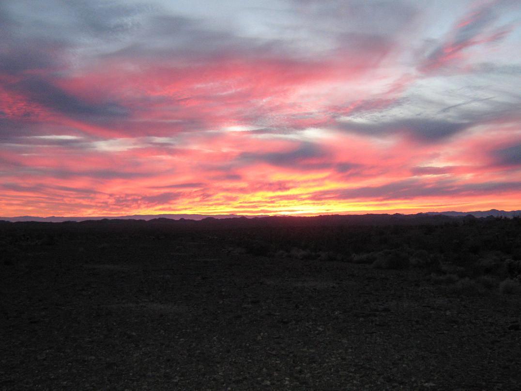
After the BLM Ranger encounter, the overall traffic along this road (ATVs, motorbikes) lessened, and after awhile it was just me. I made good time on the Bradshaw Trail, then drove the rocky and gravelly 4-wheel drive track north about 2.5 miles to a clearing at the base of a canyon below Black Butte. I decided to camp here, and I was treated to a beautiful sunset as I rolled in.
The night was quite windy. I slept in the bed of my truck, but the wind knocked the truck around all night, gusts pushing 50-60 mph, and often sustained 30 mph. I ended up being kept awake a little more than I would have liked. On the plus side, the skies were clear and a mostly-full moon was up, lighting everything up in a beautiful moonglow. The only hints of civilization were two beacon lights, far off south on the Chocolate Mountains Gunnery Range.
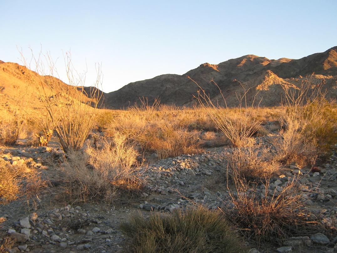
I woke with the sunrise and spent a few minutes warming in the cab of my truck. I was parked north of a junction of two roads (shown on the map). I had gone up the left fork, while the right fork curls south then north, going far up into this canyon. However, I drove this left fork to its end, and I managed another half-mile before it petered out in a wash. I parked and start the hike from here. I was about 2,700 feet elevation, and I started walking at 7 a.m., sharp.
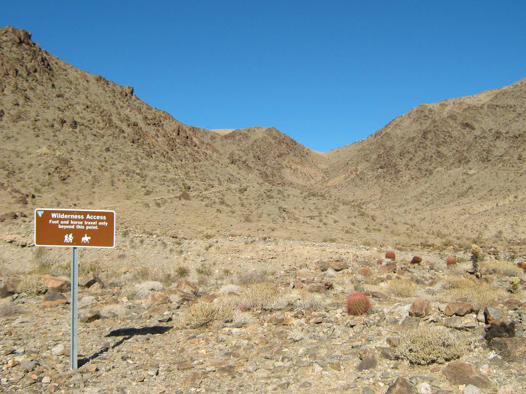
I walked north through this wash, in and out of many sandy braids and avoiding the brush whenever possible. The wind was still blowing but not as fast, but at times I had to lean into it, and it did make me work a little harder. After a few minutes I came upon the road, the right fork I had ignored. I continued north along the road, making good time. After about 1.5 miles of hiking from my truck, the road ends at a wilderness sign, within the main canyon and directly above a huge wash.
The Sierra Club's Desert Peaks Section guide suggests to follow a prominent side canyon on a slightly northeast bearing to gain the highest ridge, from which it's a short stroll to the top. I wasn't exactly enthused for more steep canyon hiking so I chose a lesser poison, to keep on my north bearing and aim for a saddle on the main range crest, about three-quarters of a mile away.
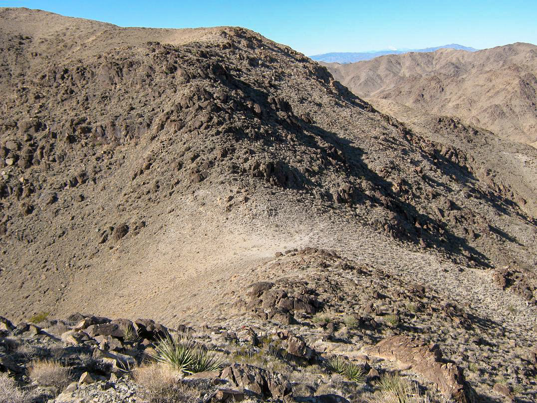
I dropped into the big wash and worked my way up its main channel. The going was pretty straightforward, the usual blend of rocks, sand, and brush. I covered half the distance to the saddle when I ascended out of this channel and started hiking on the slopes. I started to angle slightly to my right, aiming to reach the range crest a few hundred feet above the saddle. This worked, but was loose in places, but I met the main range crest at roughly 3,800 feet elevation.
From here to the summit was another three-quarters of a mile and 700 feet of gain. And to my delight, I noticed a few cairns and a scant path. This allowed me to put my head down and my brain on autopilot, and I trudged up this little path to gain another 150 feet, coming out on a small rock knob where the gradient was much gentler. The next small portion was a series of little gains to rocky outcrops, culminating with a sidehill across Hill 4,132, then a descent of about 60 feet to a saddle below. The summit ridge was now visible and the summit itself sometimes visible when not obscured by foreground rocks. There was no more path but the route-finding was obvious.
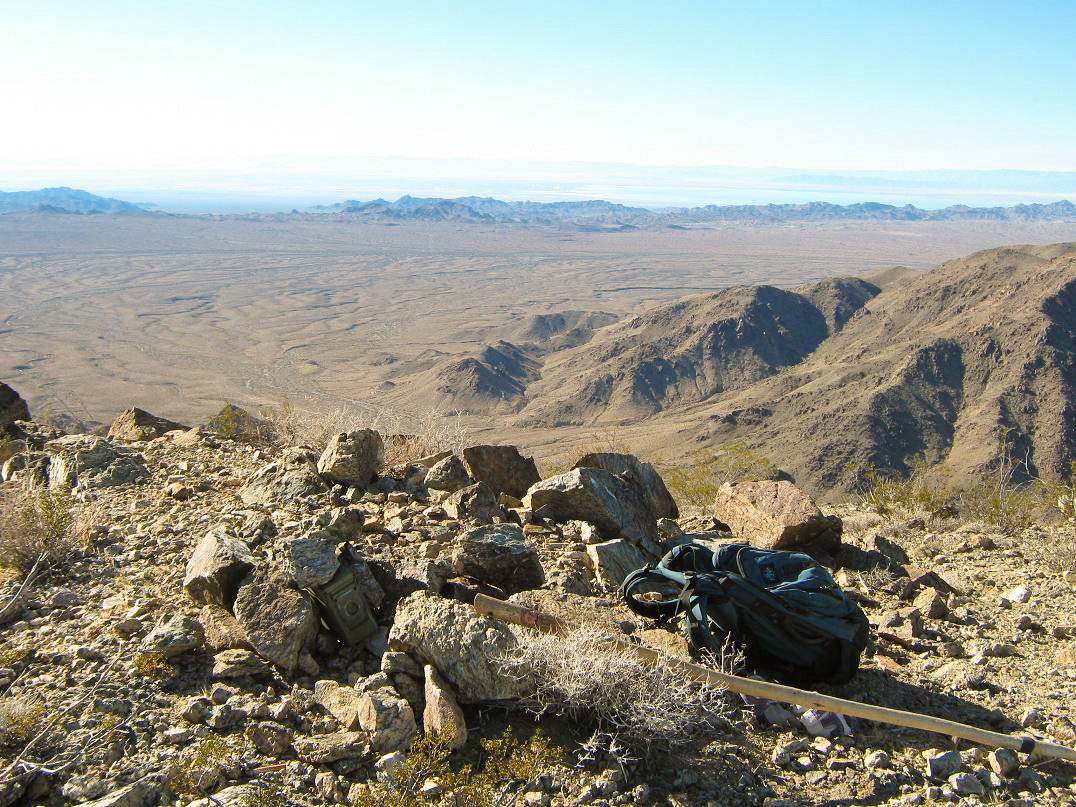
From the small saddle below point 4,132, I walked up a slope to another flat section, where I had a full view of the top. I walked up yet another slope, wormed my way through one last rock band, and then the final few easy steps to the summit. I arrived at 9:45 a.m. and took my time to enjoy the views and a well-earned break. The log held entries back to the early 1990s and probably averaged 10-15 people ascending this peak per year, most of them via the Desert Peaks Section outings. There were a lot of familiar names in the log, a few I knew personally and others I "know" electronically. I was the first to sign in for the 2010s decade.
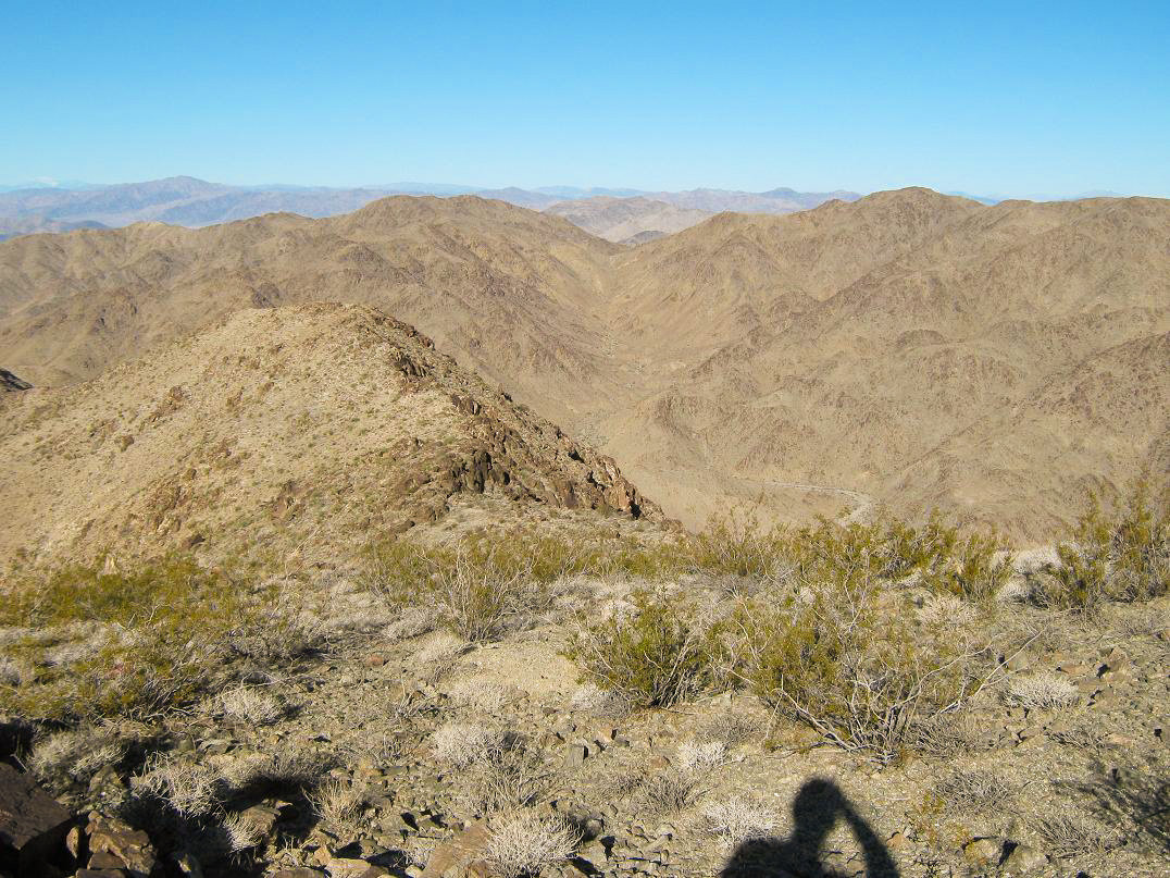
From the summit, the views were tremendous. To the north was more of the Chuckwalla Range, plus Interstate-10 out in the valley beyond. To the west was more of the Chuckwallas as well, plus the Orocopia and Eagle Ranges, and way off, the snow-capped "Sans": Jacinto and Gorgonio. To the south was open desert and the Chocolate Mountains, and off to the southwest I could make out the Salton Sea and some interesting steam plumes (I would find out what they are two days later). The wind was brisk but not bad, but I started to chill after 15 minutes, so I bade the top farewell and started my trek back to the truck.
The hike down went fine, my only variation being that I actually descended to the saddle itself before turning south and going back out the lower canyon. I made fantastic time and every time I stopped, the saddle and summit was so much higher and farther off than before. I got back to the road and was back to my truck at nearly noon, making for a five-hour hike overall, covering 6 miles and a gross of 2,000 feet of gain. It was warming very nicely now and the area was beautiful.
I took the time to snap more photographs than I had going up. After some time to change, I rumbled down the road back to the Bradshaw Trail, then from there back to Interstate-10. Gas Line Road was crap again, enough to put me in a slightly crabby mood, and then I got pulled over by the Border Patrol. He just wanted to know what I was up to and if I'd seen anything suspicious. Back at the highway I stopped for awhile to relax, check my tires, and call my pal Treetops, telling him when I'd be showing up.
The rest of the day was spent driving into my chum's place in Monrovia, watching Droopy cartoons, eating Japanese takeout and talking about football and baseball and hockey and basketball and cars and pistols and Mad magazines and other stuff. The next day I visited my brother and his family and a late Christmas with his kids, then I drove back east for a little hike along the Salton Sea.
Update: The Chuckwalla National Monument came into being on January 7th, 2025. The proposed maps show with almost certainty that Black Butte is the new National Monument's highest point.
|


|