The Mountains of California
www.surgent.net |
| Zanja Peak |
• Highpoint: Crafton Hills • City of Yucaipa • San Bernardino County |
|
Date: December 31, 2019
• Elevation: 3,543 feet
• Prominence: 703 feet
• Distance: 5 miles
• Time: 3 hours
• Gain: 1,090 feet
• Conditions: Probably the best weather and clearest skies I have ever seen in SoCal
California
•
Main
•
PB
•
LoJ
For the New Years celebration, I drove to California to visit my childhood chum, "Treetops", to catch up on old times and see how his international drug and extortion racket was going (answer: not very good). I wanted to end the 2010s in style with a couple peaks to break up the drive. I started looking at maps and found this interesting peak, located here in Yucaipa, about 15 miles east of San Bernardino. I wanted something that would give me a workout but wouldn't take half a day.
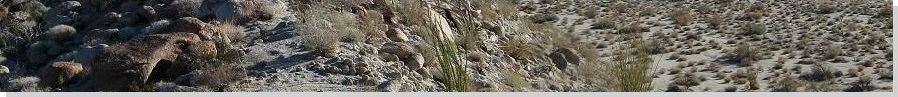
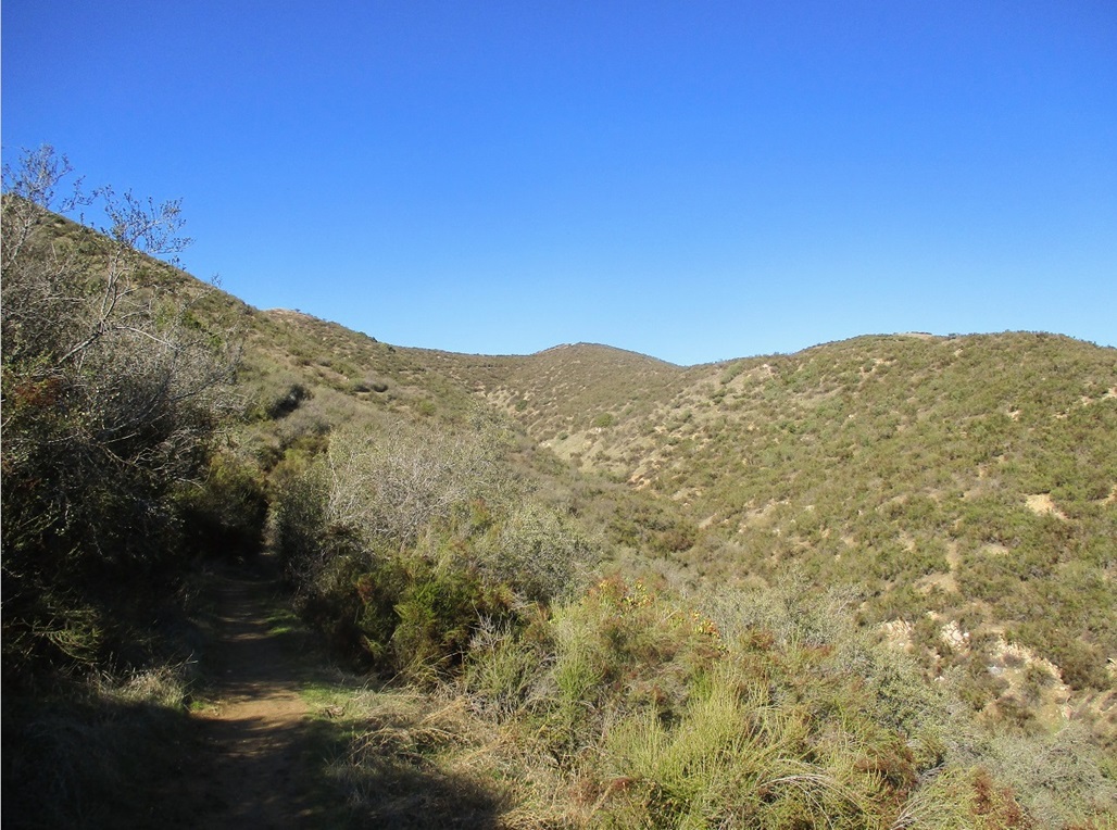
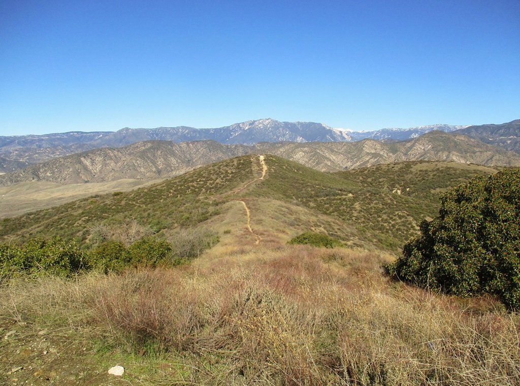
Zanja Peak is the highest point of the Crafton Hills, which abut the cities of Yucaipa and Redlands. The Crafton Hills are themselves an appendage of the San Bernardino Mountains, but lower down, covered in grasses and woody scrub, with the occasional big tree to break up the monotony. The hills are protected as part of the Crafton Hills Open Space Preserve, with numerous hiking trails that are also open to bicyclists and horse-riders.
I left Scottsdale very early, before dawn, and drove 310 miles, arriving into the Yucaipa area about 9 a.m., the day sunny and bright blue with a chill to the air after a few days of storms that had blown through the Southwest over Christmas. I exited the interstate onto Oak Glen Road, stopped for basic supplies at a 7-11, then drove to the small parking lot at the south end of the range. There were already about a dozen cars there. I parked and was moving soon thereafter.
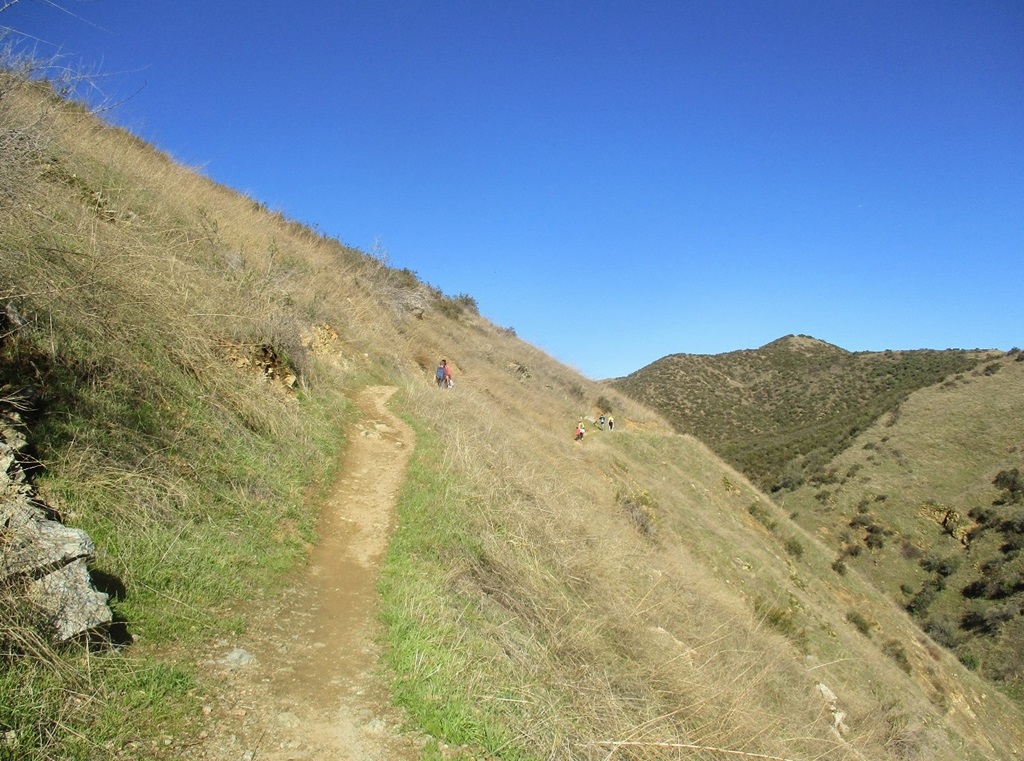
I hiked up the continuation of an old paved road, now closed to traffic, for about 500 feet, turning left onto an obvious trail. Shortly, I took a right at a Y-junction, heading up a small canyon. The trail then makes a hard-left and angles up a slope, then angles hard-right, now atop a ridge.
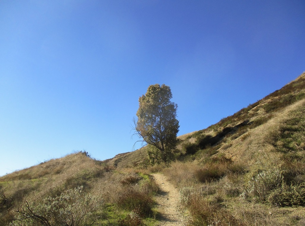
Down this low, the terrain was mostly tall grass with pockets of woody manzanita. The trail itself was steep but with a smooth tread. I continued upward, the trail then making a couple sharp switchbacks, then coming to a T-junction near a single eucalyptus tree (see photo at left). I had covered a little over a half-mile and gained about 300 feet.
Here, I got a little confused, whether to go left or right. My sense was to go right on the better-looking trail, but that went downhill while a left would go uphill. I was pretty sure both trails would get me to the top. In any case, about this time another guy was hiking down from the right, so I asked him and he said both ways work, but the right way (the trail he was on) was in overall better shape. So that's the way I went.
After making the right, the trail loses about 40 feet and is actually covered in a layer of asphalt for about a hundred feet. It comes to a cyclone fence near a couple more eucalyptus. The trail angles left of the fence and starts angling up the nose of a ridge. Below was a cleared area with old roads. I learned later this may have been an old dump, and the trail I was on was named for it, the Dump Trail.
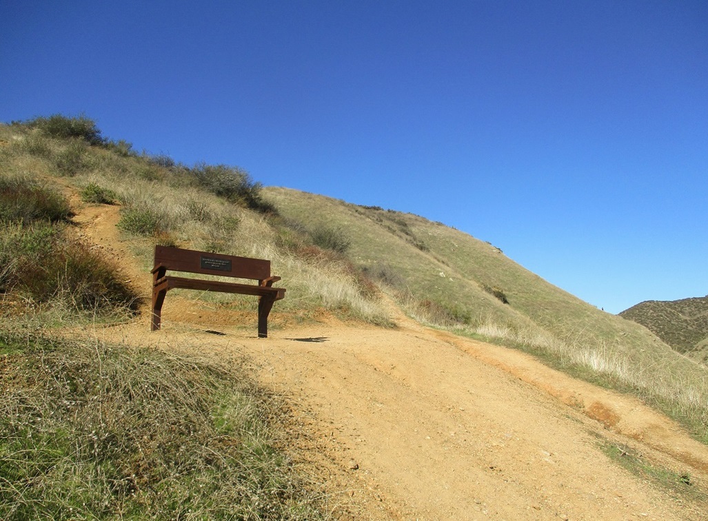
I followed the trail up a couple more switchbacks then to a memorial bench for a Margo B, encouraging people to take a break and have a seat, which is what I did. I was about a mile into the hike, so far everything was going well.
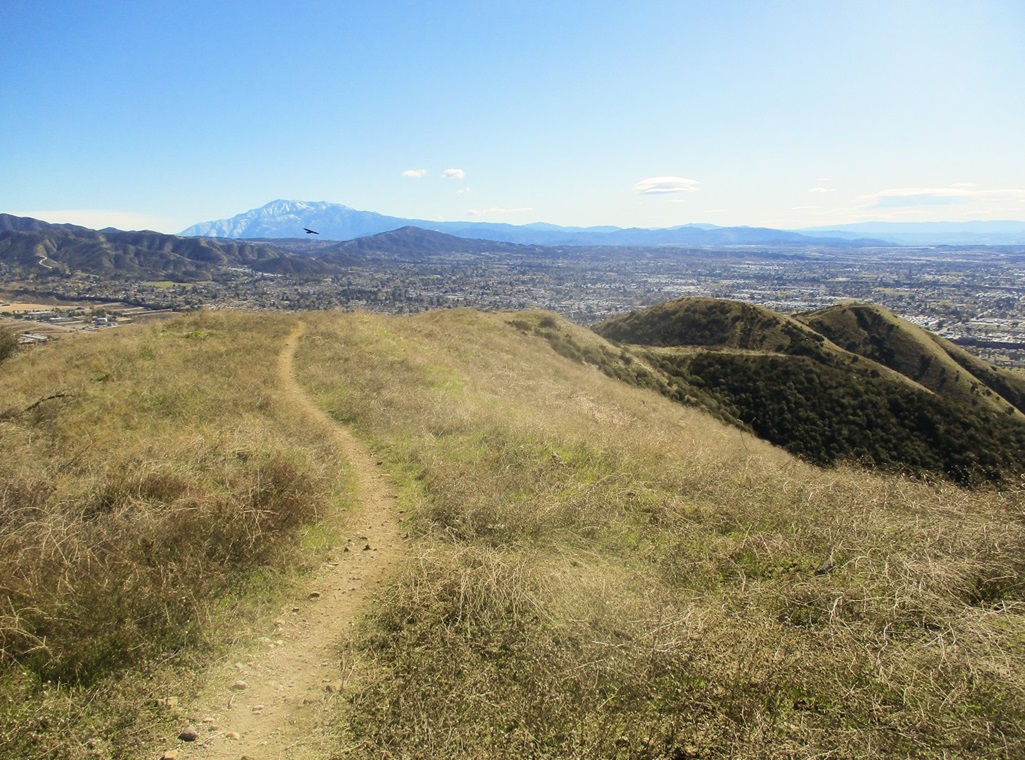
Past the bench, the trail angles away from the nose of the ridge and starts an upward traverse of the ridge on its grassy sides. The slopes are very steep below the trail, a fall could be troublesome as one could roll for quite a ways before stopping. The trail itself was about two feet wide and in excellent shape. I then came upon a small group of younger women and (presumably) their children, ranging from young teens down to about six or seven years of age. They were all hiking upward, even the little ones. No one was getting a carry.
I passed this group and continued upward. Moments later, another woman came hot on my heels, so I let her pass. As it was, we hiked roughly at the same pace, so we hiked the last mile or so to the top together. She's a regular hiker in these hills and knew the various trails very well. We arrived on the top, for me, a little over an hour since starting. The sign at the trailhead said it was 3 miles one way, but it felt more like 2.5 miles.
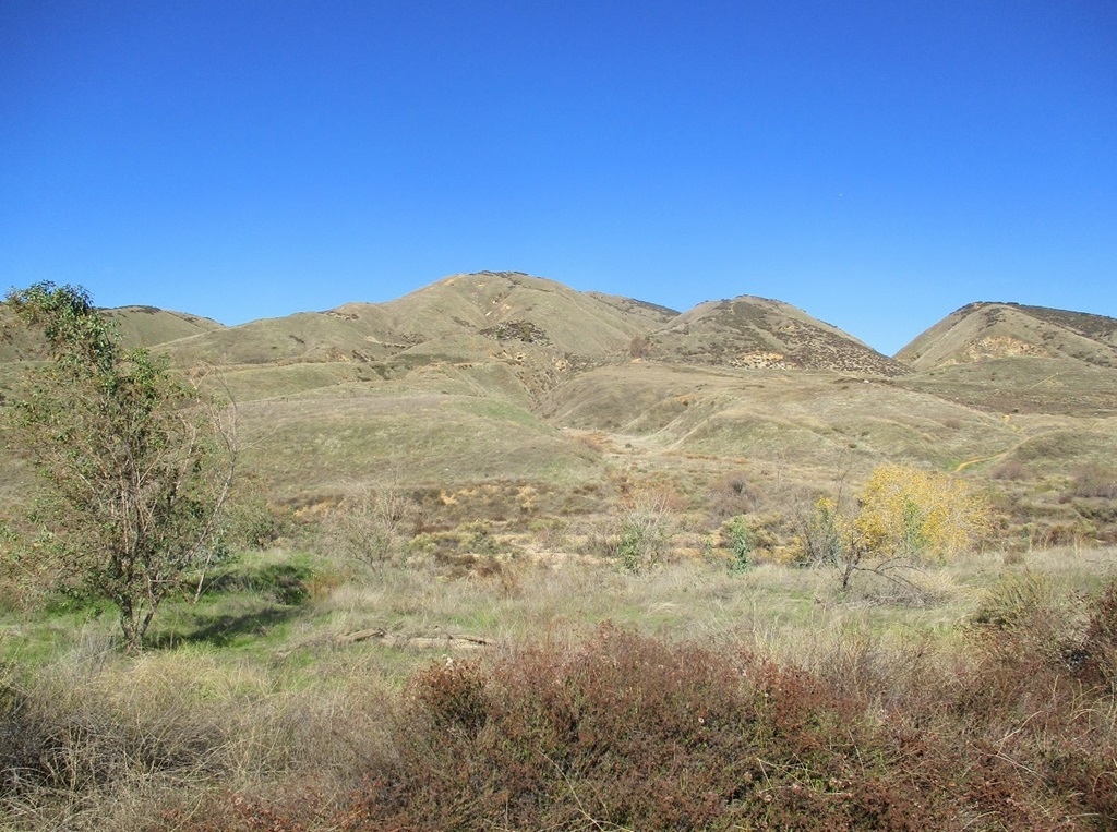
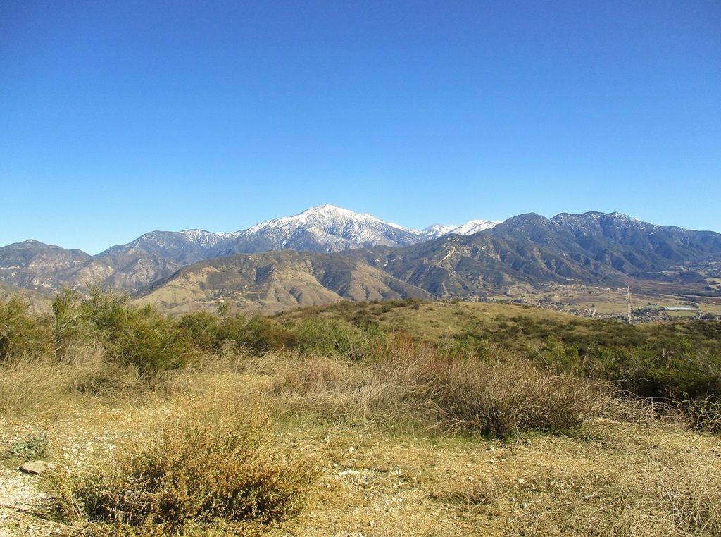
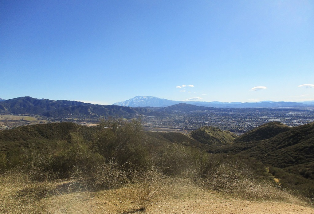
The top is open and gently-rounded, with two benches. I dropped my day pack and relaxed, and talked more with the woman. She pointed out all the hills and where she's been, giving me a quick history lesson. She was smart and friendly. We were up top for about ten minutes. The views of the surrounding mountains was magnificent, the big peaks covered in newly-fallen snow, and not a speck of smog to muck things up.
The group of younger women and children were soon on top with all of us, and each of the kids had made it on their own, very impressive work indeed. I took a photo for them, then the older woman wanted to get moving, as she was following a different route down. I bid her goodbye and thanked her for the brief companionship on the hike.
Me, I wanted to hike on over to the nearby "Zanja Benchmark" hill, about 500 feet to the southwest and nearly as high as the main summit. I scooted down off the main peak, and followed a good footpath to the Benchmark hill. However, I could not locate the benchmark. It may have been under a pile of rocks which I was not about to take apart, or more likely, someone chiseled it out about 50 years ago. I got some more good photos of the peaks, plus of a hawk that swooped me a couple times.
I returned to my car by following the same route down. The consistent gradient and quality of the trail meant I could move fast and not have to worry about turning my ankles on rocks. The down-hill hike took about an hour, and the entire journey, including breaks, a little under three hours. It was a little after noon when I arrived back at my car.
I was expecting a mundane path through rock and scrub, but was very pleased how this hike went. The scenery was outstanding, the hill itself being a mix of grasses, scrubby plants and a few bigger trees, as well as the views of the surrounding mountains on this fine clear day. I got exactly what I wanted, and left feeling very happy about the experience.
I had another hike planned, this one in San Bernardino itself, in the smaller Shandin Hills. I would then meet my compadre at his home in La Verne for a mellow new years celebration.
|
|