The Mountains of California
• www.surgent.net
|
| Mount San Gorgonio |
• Highpoint: San Bernardino County • Highpoint: San Bernardino Mountains • San Bernardino National Forest |
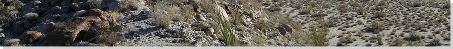
 Looking back at the trail from the summit
|
Date: September 29, 2001
• Elevation: 11,502 feet
• Prominence: 8,294 feet
• Distance: 15.5 miles
• Time: 11 hours
• Gain: 5,440 feet
• Conditions: Perfect
• Teammates: About five different people at different segments of the hike
California
•
Main
•
PB
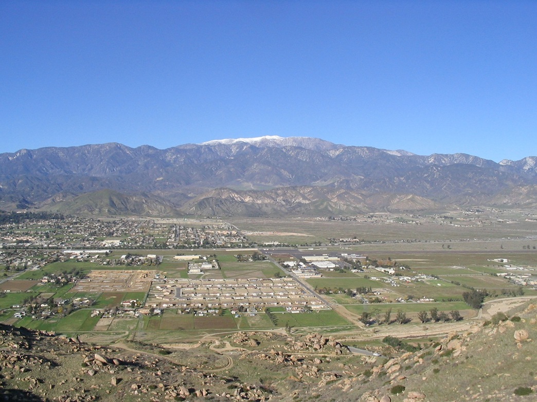
Mount San Gorgonio is the landmark mountain of Southern California. It rises over 11,500 feet in elevation, overlooking the millions of people who live in the Los Angeles and Inland Empire basins to the west, and the Mojave Desert to the north and east. It is the seventh-most prominent mountain in the mainland United States (Mount San Jacinto immediately to the south is in sixth place). This puts the peak in such company as Mount Rainier, Mount Whitney and Mount Shasta.
Mount San Gorgonio is also a popular hiking destination. A network of excellent trails approach the summit, and conditions on the peak are usually calm enough to allow access nearly all year when the trail is dry, as well as when it is shrouded in snow. From a distance, Mount San Gorgonio has a bald, slightly gray-colored top. It's old nickname is "Grayback", but I don't recall that name being used too often. Most Southern Californians just call it San Gorgonio. That is, if they are aware it even exists. The smog-haze layer can be so thick that it can render these giant peaks completely invisible from the basins below.
Although I lived nearby the peak for many years, I did not climb it until nine years after I had moved to Arizona. I decided to tackle Mount San Gorgonio over a weekend, driving to Southern California for the hike and to also visit my brother's family. The weather was still hot this time of year in the deserts, but conditions were dry, and higher in elevation, very nice. I drove to Banning and stayed the night at a hotel, then very early the next morning, drove to the Vivian Creek Trailhead.
The Vivian Creek Trailhead is the most popular of the trailheads to San Gorgonio's summit. Nevertheless, the hike from here would still involve nearly 16 miles round trip with over a vertical mile of elevation gain. I was here at dawn, a few other cars already here. Some people nearby were comparing ascents. One person would be making his 130th ascent today, another her 70th. Me, this would be my first. I started walking at 6:30 a.m.
The initial portion of the trail is an old dirt road paralleling Mill Creek. After a quarter-mile, the trail crosses Mill Creek and starts up the steep slopes on the other side. I hiked up steep switchbacks well hidden in the forest. Soon, I topped out at the San Gorgonio Wilderness Area sign at 7,000 feet elevation, gaining almost 1,000 feet in less than a mile. Fortunately, this would be the steepest part of the entire hike. So far, no problem.
From the sign, the trail drops slightly, then levels before coming around to Vivian Creek. This area has scattered camping sites, and I came upon a few campers just waking up. The trail crosses the stream on an old log. For the next two miles, the trail gains at a pleasant grade, paralleling Vivian Creek, and sometimes hemmed in by steep canyon walls. Periodically the trail wandered through brush away from the creek. Halfway Camp is passed near here, half-way to where I don't know. I caught up to another hiker named Peter and we hiked together a short while. He's an old Gorgonio veteran who knew a lot about the area and filled me in on the details. Soon, he was off on his own pace. I kept my own forward progress and came upon the base of a set of switchbacks at 8,200 feet elevation.
These switchbacks gain at a slightly steeper grade out of Vivian Canyon and allow views above the foothill peaks. I could finally see peaks miles in the distance instead of the canyon walls just a hundred feet away. The trail eventually leads to High Creek Camp at elevation 9,400 feet. I walked into High Creek Camp at 9:30 a.m., having covered 4.8 miles and 3,400 feet of gain from the Vivian Creek Trailhead. I stopped here to take an extended food and water break, and met a couple (and their golden retriever), who were camped here with plans to hike the summit today. They kindly allowed me to stash some of the items from my pack I knew I wouldn't need, thus lightening my load by a pound or two. Every little bit helps. The skies were cloudless and there was a soft breeze, with temperatures in the 60s.
From High Creek Camp, I continued up a long series of switchbacks through thinning forest, steadily gaining elevation to emerge onto the spine of the main ridge at 10,100 feet that eventually leads to the summit. A smaller set of switchbacks led me up over a small ridge-knob, elevation 10,500 feet. I had my first large-scale views of San Gorgonio's summit mass, still looming high to the north, still a thousand feet higher in the sky. Now above the trees, I could see the rest of the route, including periodically spotting Peter ahead of me by about 20 minutes.
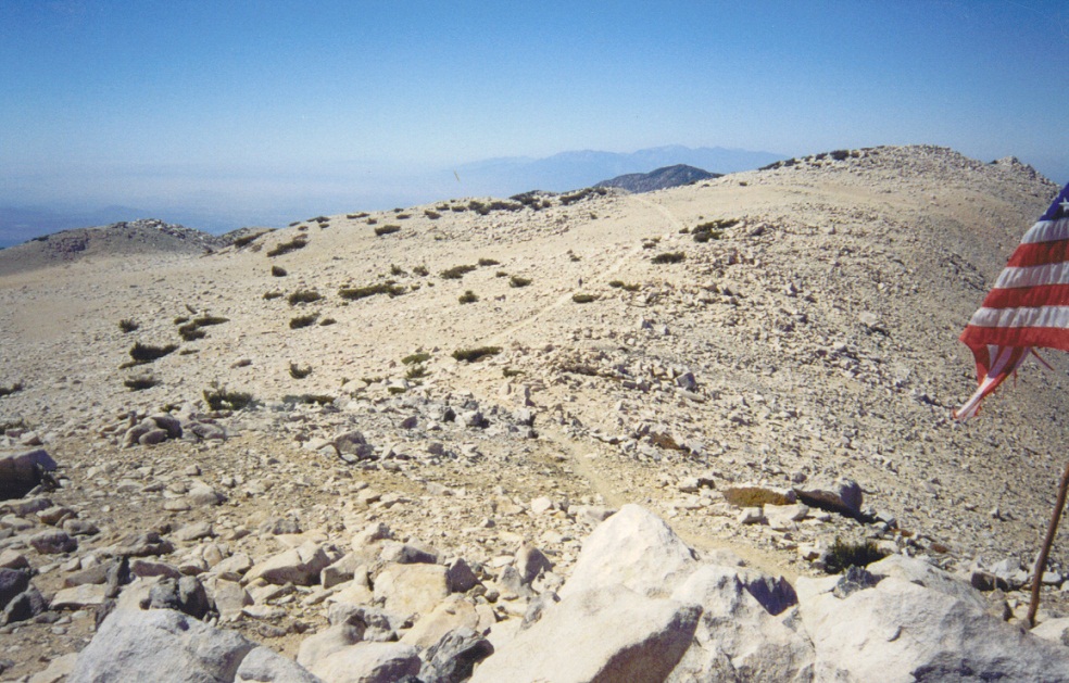
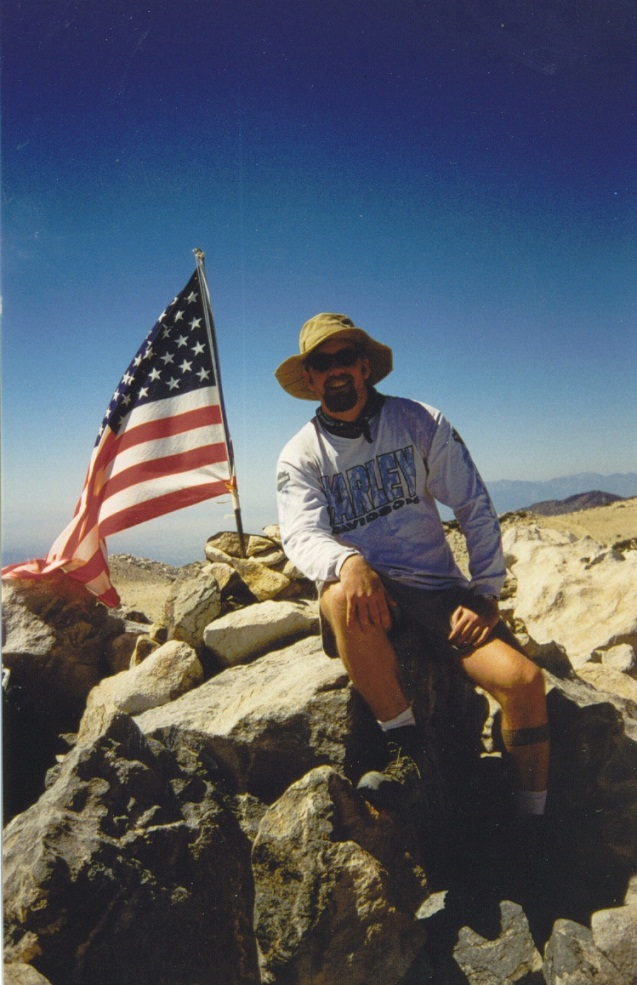
The hiking here was easy but tiring, and finally, the trail traversed a scree slope below Peak 11,171, then merged with another trail at elevation 11,240. From here, it gained up easy, bare slopes to the highest point. Two large American flags fluttered in the breeze. I arrived at 12:30, a six hour ascent, and a new one-day record for elevation gain for me. I had a lunch and a good rest, and enjoyed the views. A couple other hikers were there, plus a ranger doing his rounds. The views were magnificent in all directions, and conditions at the top were calm and comfortable.
Now, to hike down. The descent went quickly, and I was back to High Creek Camp after 90 minutes, where I gathered my cached items, and noted Peter sound asleep on a log. Even back at 9,000 feet or so, the weather had warmed up a lot, and there was not a lot of shade up here. I just walked and walked, and steadily descended, taking breaks every now and then and talking with the numerous day hikers. Lower down, the trees were thicker but the air was much warmer. Overall, I did well but I lagged for the last couple miles, beat after the long hike. I arrived back to my truck at 5:30 p.m., an 11-hour day, but a good day, as everything had gone well. I was exhausted.
I spent the night with my brother and his family in Cucamonga, conversing with my 18-month old niece who is just learning to talk. What a cupcake! The next day: the long drive across Interstate-10 to Phoenix.
|
|