The Mountains of California
www.surgent.net |
| Eagle Mountain |
• Highpoint: Eagle Mountains • Joshua Tree National Park • Riverside County |
|
Date: December 25, 2009
• Elevation: 5,350 feet
• Prominence: 2,230 feet
• Distance: 10 miles
• Time: 8 hours
• Gain: 2,400 feet
• Conditions: Cold and breezy, but clear
• Teammates: Just me, then a chance meeting with Scott Casterlin and John Hamann
California
•
Main
•
PB
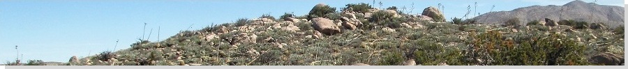
The Eagle Mountains are in Riverside County, partially within Joshua Tree National Park. The actual highpoint of the Eagle Mountains is in the southwest section of the range, visible from Interstate-10 near the Cottonwood Springs Exit. Other hiking plans I had lined up fell apart at the last moment, so I found myself with a few free days and set my sights on Eagle Mountain. I left home Christmas Eve and drove 250 miles to the Cottonwood Springs exit, and camped at the Cottonwood campground within the Park.
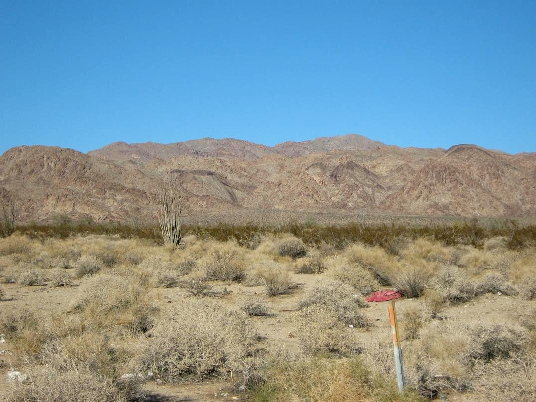
There were few people here on this Christmas eve, just me and maybe three others. I slept well in the bed of my truck, but the wind blew heavily all night. The next morning started cold and clear, the wind still blowing but not as heavy as it did overnight. I started hiking at 6:30 a.m., just as the sun was rising. From the campground, the mountains rise to the northeast, about three miles away across sloping desert plain.
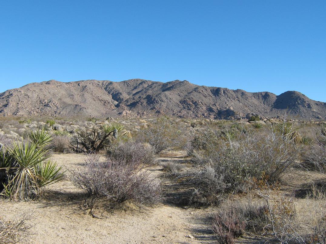
From the campground, I walked a sand path north, the one that starts at campspace B-17. I stayed on this path for a mile, gaining little elevation and trying to line myself up with a prominent west-facing canyon in the range, the one I wanted to follow to the summit. When the sand path started to braid and lose distinction, I started to angle on a bee-line toward this canyon, still two miles away.
The plain was not as flat as I would first have assumed. At first, I made good time, keeping a steady bearing while dodging a few interesting rock outcrops. Then, I started to encounter arroyos, at first shallow and easy to cross, then steadily steeper and more defined, almost like little canyons unto themselves. These were part of the fractalous "fan" of drainages emanating from this main canyon. I would drop into one, follow it for awhile, then when it felt right, pop back out and see where I was. I was still keeping a good pace but managing this arroyo-maze took time.
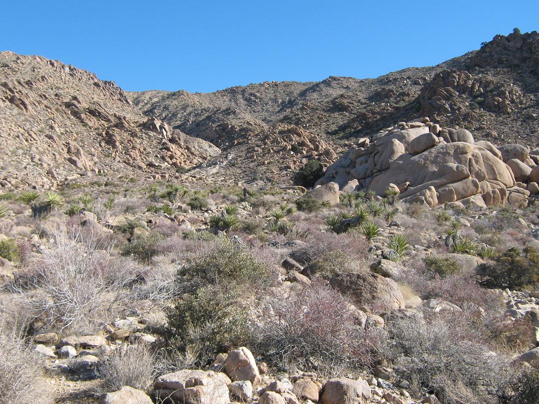
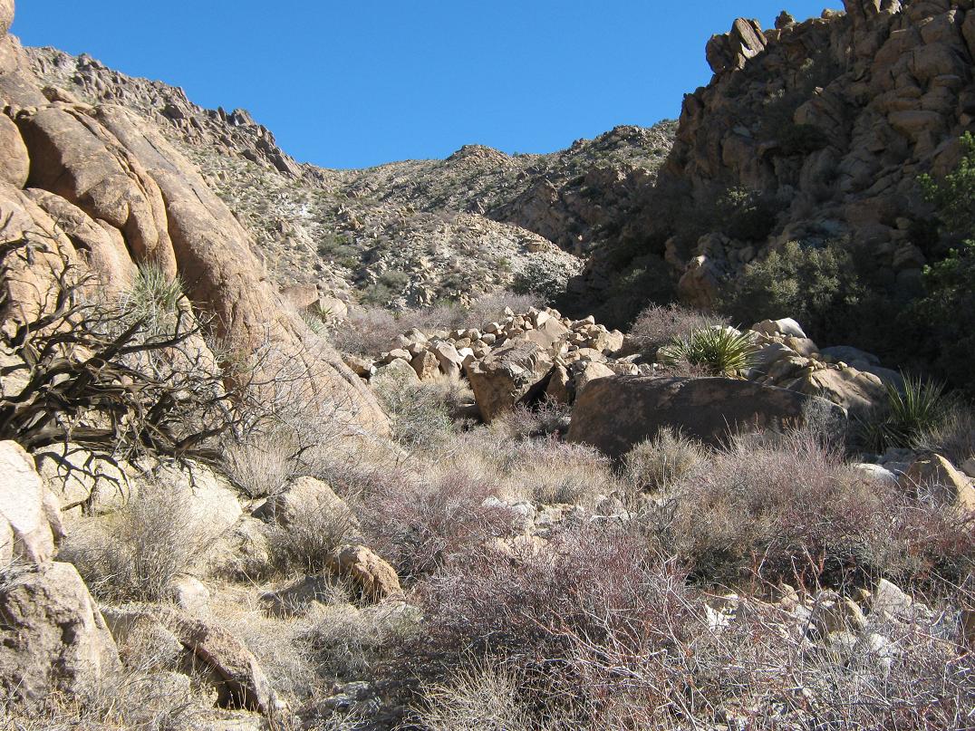
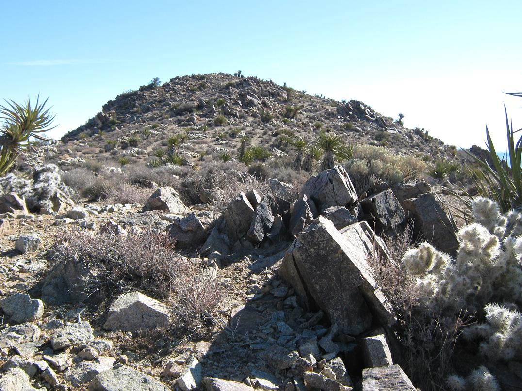
I was soon close to the range and the mouth of the main canyon. I was now on higher ground with heavy brush. Once at the mouth of the canyon, I took a break, having hiked 90 minutes by now. But I did not sit long. I was in the shade and it was still biting cold. I hiked into this canyon, weaving through the mess of boulders and brush. In time, the walls closed in and I was now within the canyon, at times the walls just a few feet apart.
This segment was steep and tedious but presented no challenges. The gradient steepened by degrees. I did not notice so much until I stopped and turned around, surprised to see how much elevation I had gained. The route then levelled and the canyon opened up again. I now had a good sweeping view of the inner canyon and the headwalls in the distance. I took a break and studied the headwalls and ridges, plotting a course from here. I picked the most promising opening and continued upward.
If I hiked too far toward the headwalls, I'd get boxed in or blocked by cliffs, so I exited the canyon by angling right (as I looked up into the canyon) and ascending a sloppy rock and scree slope to gain a small ridge. It looked to be no more than 200 feet of elevation difference, so I went for it. It worked but it was a lot looser than I had anticipated and it was treacherous in spots. Large boulders would groan under my weight and some slid right out from under me.
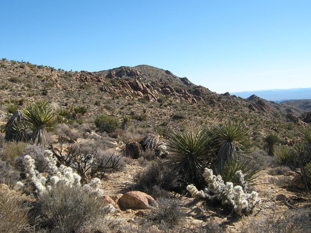
I was soon atop this side ridge. I followed it upward another 250 feet to place myself atop a more principal ridge, essentially now on the main range crest. This part went well as the rocks were more solidly in place. I took a break once on the main ridge, now having hiked for about 3 hours. The sun provided some warmth, but the wind up here was heavy. The summit was visible about a half-mile to the east. More rock outcrops and pillars lined the ridge between the top and me.
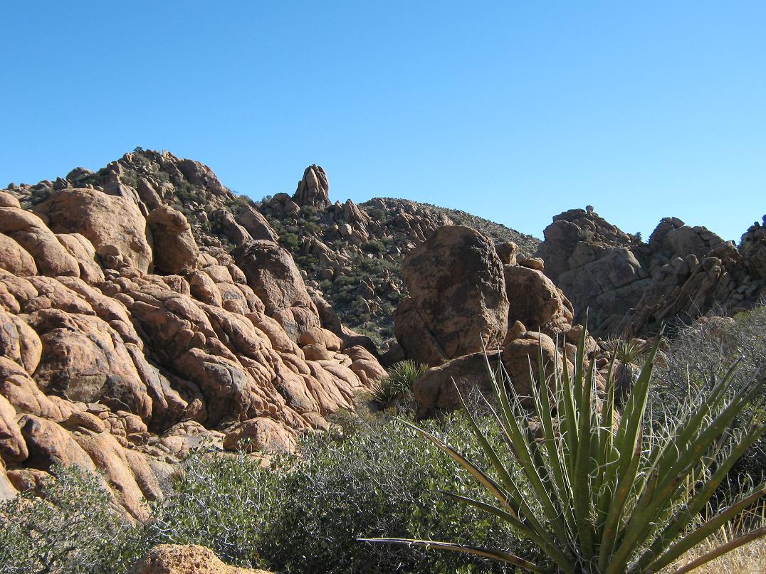
The route sidehills past a couple easy ridge points, then drops about 100 feet toward the first of the big rock outcrops. Despite the quantity of rock outcrops, most of the route-finding in this section is logical. Occasionally I'd see a lone cairn or 10 feet of path, but often I would explore up one way, hit a dead-end, then return and try another way. The route essentially zig-zags through this gauntlet of outcrops, often dropping low to one side before re-ascending again to meet up with the next obstacle.
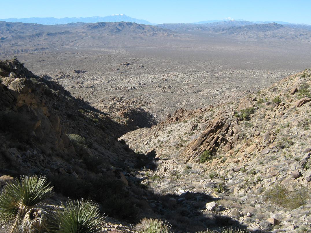
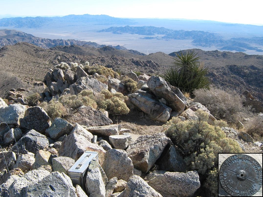
Past the last large outcrop, I came upon a beaten path that went upslope toward the summit ridge. The summit itself was a little farther east along the ridge, a gentle hump with a benchmark. I signed into the log book and stayed a few minutes to take in the views. There were some signatures in the log from about 3 weeks ago, and about 10 for all of 2009. The skies were clear and bright blue. I could see a lot of the Salton Sea behind the foreground ranges. Other ranges fanned out in all directions. Big Mounts San Jacinto and San Gorgonio were covered in snow to the west, and nearby Toro Peak had a dusting that I could see. It was beautiful, but also cold in the wind. It had taken me about 4 hours to get here, but I only stayed five minutes before starting down.
The walk back through the outcrops went well since I knew where to go and I was back to the top of the descent ridge quickly. I descended the ridge quickly to the point above the sloppy rock section I had come up earlier, not looking forward to this part. It looked a lot nastier coming down, and I had to be extremely careful at each step so as not dislodge big rocks. I used the five points of contact technique. At one point I felt a big rock, easily 300 pounds, move under me, and knowing I'd be under it soon and not wanting it above me, I "nudged" it and watched (and listened) as it careened into the canyon below. One less widow-maker to worry about. That's how precarious it was set on the slope. If I had not bumped it loose, a random mouse would have.
I was now back in the canyon when I heard voices. For a peak that gets climbed perhaps a dozen times in a year, who else could be up here, on Christmas Day no less? Why, it was Scott Casterlin and John Hamann, partners of mine on many Arizona peaks. Imagine our surprise to be seeing one another up here. I knew they were doing some California desert summits but did not know their itinerary, so to meet them like this was quite remarkable and amusing. We spent a few minutes chatting, but it got cold and we were all interested to keep moving, them up and me down. We said our goodbyes and I continued down the canyon.
The downward trek out of the canyon went quickly since I could see paths that were not evident coming up, and I exited the canyon not too long afterward. Instead of retracing my exact route from this morning across the desert plain, I tacked more westerly, following paths of least resistance and trying to mitigate the arroyo crossings I would need to make. When I would need to cross an arroyo I would descend into one and walk its thalweg for a while until some obstacle would force me out. There were many neat slot canyons and even hidden pools of water. A fella could lose himself in these arroyos if he wasn't careful.
In this manner, I crossed all the big arroyos and was soon back on the desert flats. I hiked south toward a big water tank on a hill near the campground, which I used as a navigation reference. I came across some of my footprints from the morning hike and soon the sand path that led back to the campground and my truck. I arrived at 2:30, for a total time of 8 hours. I changed into dry clothes and spent a few minutes yanking out cactus spines I had picked up along the way.
I exited back to the visitor's center where I paid my entrance fee since I arrived too late the day before to do so. Next, I simply drove home, arriving back at 7 p.m.. It was nice to be back home for Christmas with my wife and our furry floor monsters. Eagle Mountain turned out to be a pleasant, moderately challenging day hike, with marvelous views and well worth the effort to come all this way for the experience. It was a nice Christmas present (from my wife to me, to let me go on this journey) and a good way to close out the year.
|


|