The Mountains of California
• www.surgent.net
|
| Mount San Jacinto |
• Highpoint: Riverside County • Highpoint: Santa Rosa & San Jacinto Mountains N.M. • Highpoint: San Jacinto Mountains |
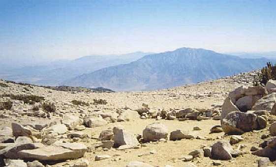 View of the mountain from Mt San Gorgonio, Sept 2001
|
Date: May 28-30, 1993
• Elevation: 10,804 feet
• Prominence: 8,284 feet
• Distance: 7 miles
• Time: 6 hours (summit day)
• Gain: 2,500 feet total
• Conditions: Excellent
• Teammates: UCR chums
California
•
Main
•
PB
Mount San Jacinto is the big mountain everybody sees when visiting Palm Springs or driving by it on Interstate-10. Its summit is 10,804 feet, and looms 8,000 feet above the surrounding valleys, and over 10,000 feet above Palm Springs itself. It is the sixth-most prominent mountain in the coterminous United States. Mount San Gorgonio to the north is the seventh.
I grew up in Southern California, in the suburbs west of Los Angeles. Most days were hazy or smoggy, and the marine layer whites out the sky. These big peaks, along with Mount San Antonio can literally be made invisible by the hazy skies. On clear days such as the windy Santa Ana days or after a big winter snowfall, the big peaks were visible and usually magnificent. Only after I moved to Arizona in 1992 would I actually come back and climb these big peaks. A group of college pals set up a backpack hike over Memorial Day weekend of 1993, and I drove in from Arizona to join them.
The two popular options to reach the summit are via Idyllwild, requiring a moderate day-hike along trail, or from the Palm Springs Aerial Tramway, which lets people off at about 8,500 feet elevation, about three miles from the peak on a direct line. I had taken the tram to the top buildings on previous occasions, but never hiked close to the peak. Then I moved to Arizona.
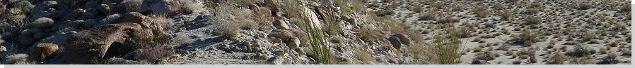
We opted for the tramway route, and allotted the whole weekend, so we carried our camping gear on our backs. We were off the tram by mid-morning, and the hike portion went well, other than the extremely muddy trails we encountered, including areas which were essentially huge shallow lakes. It had been a big snow year in 1993, so we were seeing the effects. We still managed to follow the trails for about three miles to a camping area, where we set up our tents for the evening.
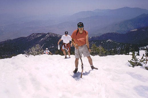
The next morning, we set out for the top. Under normal conditions we would have followed trails to the top, but we encountered substantial snow patches at about 9,000 feet, and by 9,500 feet it was all snow. We followed what trail we could until we gave up and struck out cross-country through the thinning forest. The snow had consolidated over the past many weeks, so it was solid, crusty and easy to trod upon. We hiked by sight toward the summit, generally following saddles and ridges before arriving to the top via its north slope. The one-way hike from camp took a couple miles and a couple hours, and had gone well for us rookies.
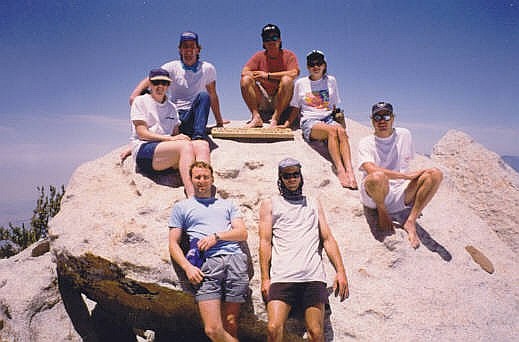
The top was free of snow and we spent awhile on the summit rocks, enjoying the warmth and the views. There were a lot of hikers on top, many having come up from the Idyllwild side, but the summit is large enough to accommodate a lot of people. We stayed up top for an hour. The views were unbelievable. Unfortunately, the usual mucky air sat west of us, hiding might San Jacinto from the 10-million people living out that way.
The hike down was a mini-adventure. The snow was hard enough so that we didn't leave any tracks to follow for the descent, and we got off the summit on a slightly "wrong" bearing. We encountered steep snow slopes, high enough so that a slip could have resulted in a long, bumpy ride down. We didn't have any snow-travel gear, so we took the slopes slowly, butt-scooting some parts, until we were down onto the gentler terrain. From here, we walked downward into the forest until we lost the snow, then back to camp.
We'd been gone six hours, so we still had half the day to kill back at camp. There was no hurry to pack up and depart, and the other people seemed pretty cool. A ranger gave a talk later that evening. Me, I was on my headphones, listening to the seventh game of the NHL Semifinal Series, the Los Angeles Kings against the Toronto Maple Leafs. That was the game the Kings won to advance to their first Stanley Cup Finals. I was the bearer of good news. Some people were genuinely happy. Others had no clue what I was talking about.
We hiked back to the tramway the following morning, and had a hearty meal at the restaurant before the tram ride down. Back at the bottom, I said goodbye to everyone and drove back to Phoenix that afternoon. I was happy to have finally climbed one of the big "San" peaks in southern California. There would be more to follow.
|
|