
The Mountains of Arizona
• www.surgent.net
|
| Ridge Crest Peak • Peak 4373 |
• Tortolita Mountains • Town of Marana • Pima County |
|
Date: January 29, 2023
• Elevation: 4,373 feet
• Prominence: 393 feet
• Distance: 7.2 miles
• Time: 4 hours, 15 minutes
• Gain: 1,573 feet (gross)
• Conditions: Sunny, breezy
Arizona
•
Main
•
PB
•
LoJ
I spent yesterday in the Arivaca area hiking a couple peaks, Fraguita Peak and Cerro Colorado, then a night at a Motel-6 in Nogales. I was to head back to Tempe today, but there was no rush. Naturally, I wanted to take advantage of the opportunity to, as usual, hike something.
Last night, vegging with the Lakers and Celtics on, I was looking for something to do. I had no particular agenda, anything would do. On the HikeArizona site, I found a report from a guy who had just hiked Peak 4373, locally known as Ridge Crest Peak. It's in the Tortolita Mountains in Marana, north of Tucson, the area having been developed in recent years with high-end homes and a Ritz-Carlton resort. This looked real interesting, so I resolved to hike it.
When I awoke, it was in the mid 20s. I didn't need to be on the road at dawn so I let the sun come up to warm things. Well, the sun came up, but it stayed cold. But the day was looking to be a real nice one, no clouds and bright blue skies. I left about 7:30 and followed Interstate-19 north into Tucson, then north on Interstate-10 to the Tangerine Road exit. I followed that east to Dove Mountain Road, which goes north then bends west, now in the lower foothills of the Tortolita Mountains. I saw what I thought was the peak, but wasn't quite sure yet (it was).
I got onto Secret Spring Road, signed for the Ritz-Carlton up ahead. I got to a guard station, and before I could say a word, he said "hiking trailhead, third road on your right." He assumed I was a hiker and not a guest of the Ritz-Carlton. I was not sure whether to be offended or complimented. I drove into the trailhead, which is very large and could accommodate probably 50 vehicles. It was getting close to 9 a.m., and I was about the tenth car in the big lot. I got dressed properly and started walking at about 9 sharp.
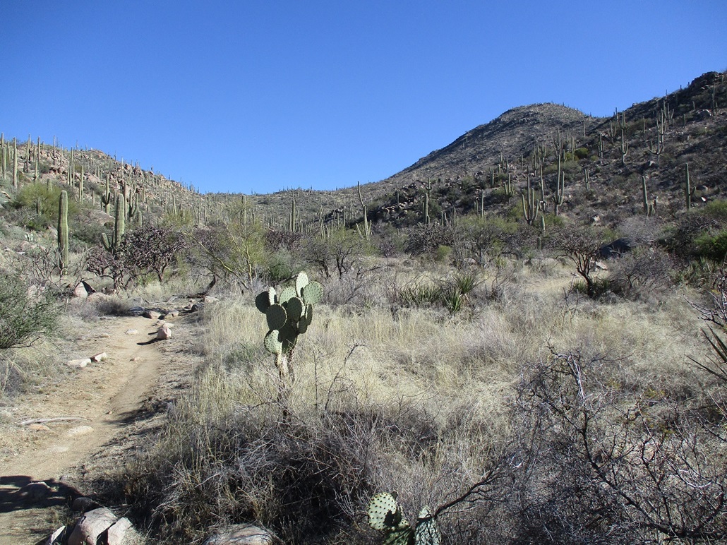
The area here has been developed with many hiking trails. I was at the Wild Burro Trailhead. The Wild Burro Trail goes north into the canyon, named Wild Burro Canyon. I wanted the Alamo Spring Trail. There are useful trail map guides at the trailhead, free for the taking.
I was on the Wild Burro for about a half mile. It goes north but winds back and forth with the sandy wash, which seemed odd because that wash actually was a more direct route and with excellent tread. For now, I just went with the map. It connects to the Lower Javelina Trail, which I followed upward. Shortly, the trail branches again, a right now on the Alamo Spring Trail.
The trail was in fantastic shape. The big rocks were placed so as to form steps or easy tiers, and the little rolling rocks were simply tossed aside so that the tread was rock-free, no need to go slow each step to avoid rolling an ankle. As such, I made real good time. Up ahead was a group of three older ladies, probably in their 60s, and they were booking. They then took a break where the trail gains a lower ridge, and let me pass. Otherwise, they were off to the races, putting guys like me to shame.
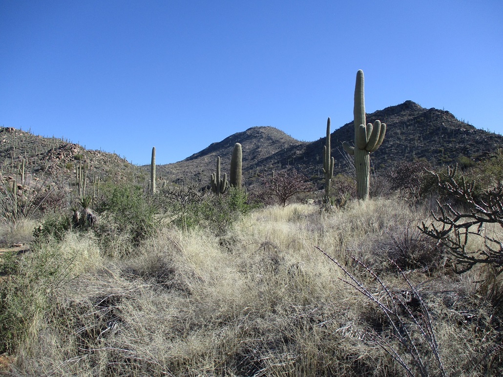
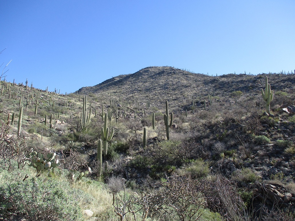
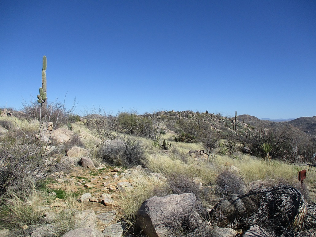
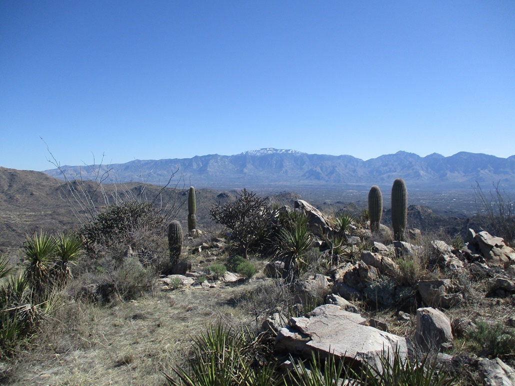
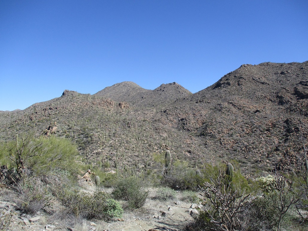
The trail is now on a long rocky ridge, heading north. I had to get around a foreground hill, and once past it, got a big-picture view of the peak, its subsidiaries and the ridges leading up to it. It was still over a mile away. I just kept walking, enjoying the fine trail. As I got closer, I could see things better, getting ideas how to approach the summit. It's beautiful up in here, with a lot of interesting geology, and abundant brush and saguaro.
The trail achieves a highpoint on a ridge west of the summit, then starts a descent back into the lower canyon. At the apex, I went right (east), following a scant path in about a hundred feet before it petered out. After all that lovely trail, I was now going cross country, now dealing with brush, cactus and loose rocks. It wasn't that bad, really.
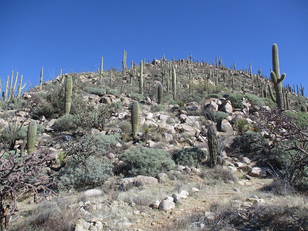
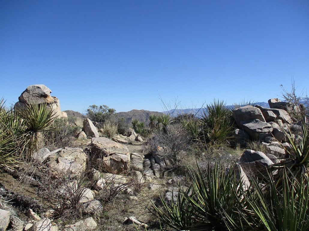
It seemed to me that going up and angling right was the best bet. The slopes get steep so making an upward traverse would (should) mitigate the gradient. So that's what I did, and suddenly, I'm on a path! This was unexpected. Was this a trick of the eye? A game path? I followed it, and sure enough, it went up and up, and was definitely a path, albeit a weak one. But it helped tremendously, cutting down all that time I would be using to eyeball a route otherwise. I even found two cairns and a couple bootprints.
This "trail" inched higher, and at some point, disappeared, but I wasn't far below the high ridge. I started upslope, tying a couple orange surveyor ribbons to branches so I'd know where to go on the descent. Then, I was on top the ridge and on another trail. This one comes up from the other side and is apparently a private trail, in the sense that it comes up from a gated neighborhood. But it's an excellent trail too.
I followed this trail up and up, soon on the summit. A sign at the top cites this as Ridge Crest Peak. There is a viewing platform on one end, and the highpoint is about a 50-yard walk north to a bump about 8 feet higher. I was at this bump, topped by rocks, with one being clearly the highest. I had made it, and it felt great. My time was about two hours.
I found a register inside a food tin below the summit rock and signed in. The Southern Arizona Hiking Club was here a few weeks ago. An older register (a single white envelope) had names going back over a decade, most being the familiar peak-bagging people. I signed in and placed the tin back into its crook, then as I held onto a large boulder to gain better footing, the big rock nearly came off the rock below it! It teetered on the edge. Thing probably weighed 300 pounds, so I was able to ease it to one side using fulcrums and leverage (not actually picking it up) so that it's not a hazard for the next person. It very could have fallen on someone who was reaching for the register. It could have fallen on me. Glad it didn't.
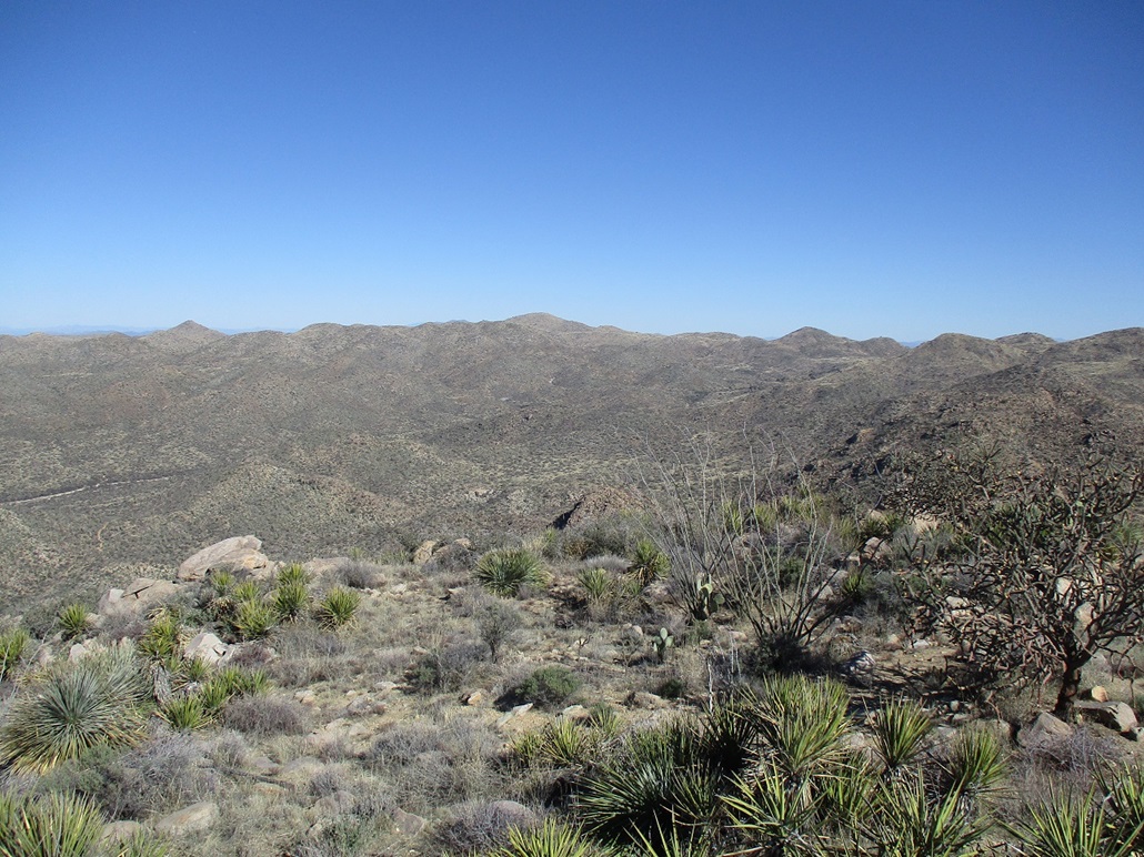
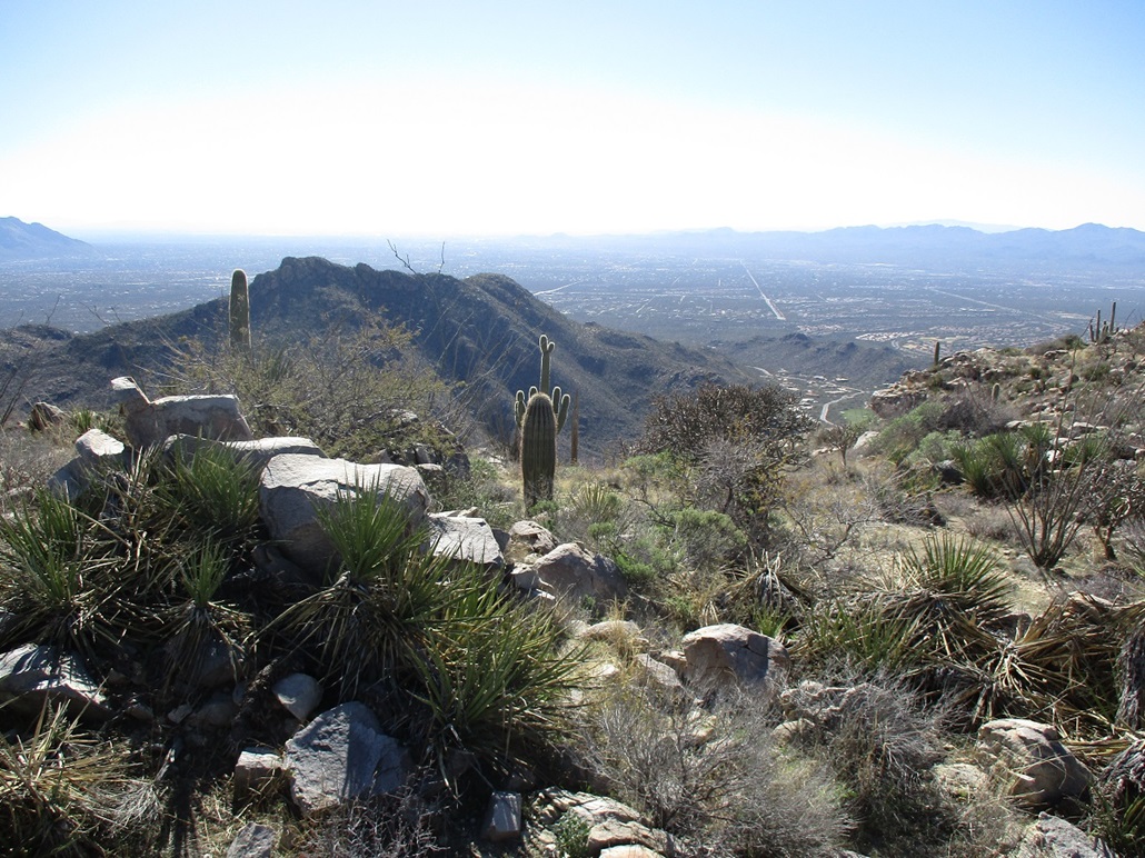
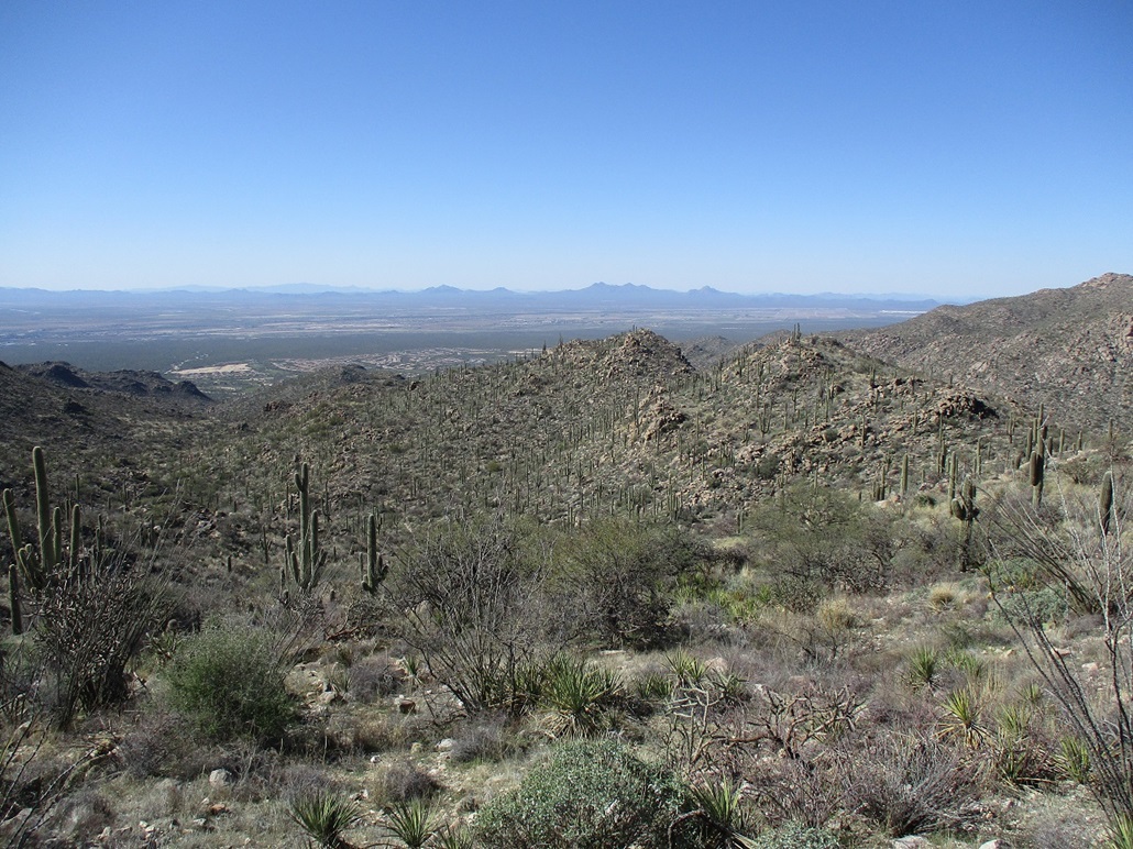
It was cool, but quite comfortable, temperatures about 60 degrees. There was a steady breeze, and the skies were cloud-free, no haze anywhere. I could make out shadows on ridges 50 miles away. The most notable fature was the snow-capped Santa Catalina mountains to the southeast. Farther south and southwest were the Tucson Mountains, then Coyote Mountain and Kitt Peak. Looking west were peaks such as Safford, Waterman and Ragged Top. I stayed up top about 20 minutes.
I hiked down carefully, following my ribbons and back to the main Alamo Spring Trail, which I hiked back to my car. I didn't see many people, maybe a half-dozen at most. Those older ladies were probably in Utah by now. As I descended into the Wild Burro Wash, then there were more people, most out for a stroll, some coming over from the resort. I walked with a lady out hiking for the last furlong (1/8 mile) to the parking lot. She too looked like a hard-core hiker. She was very friendly.
I was back to the car a little after 1 p.m.. The lot was full now, cars still coming in, looking for a place to park. I changed, not in any hurry, then got rolling myself, heading for Tempe. Other than some weenie dust clouds due to the wind, that drive went fine.
I give this hike and peak a lot of praise. I knew nothing about it until I read that HikeArizona thumbnail, but I'm glad I did. The trail was great, the off-trail part not too bad, and the views were tremendous. I would definitely come back ... in fact, I now intend to hike a peak across the canyon, maybe before summer.
|


|