The Mountains of Arizona
• www.surgent.net
|
| Fraguita Peak |
• Coronado National Forest • Cobre Ridge • Santa Cruz County |
|
Date: January 28, 2023
• Elevation: 5,369 feet
• Prominence: 1,089 feet
• Distance: 3.4 miles
• Time: 3 hours, 15 minutes
• Gain: 1,480 feet (gross)
• Conditions: Clouds at first, heavy wind and cold
Arizona
•
Main
•
AZ P1K
•
PB
•
LoJ
•
USGS BM Datasheet
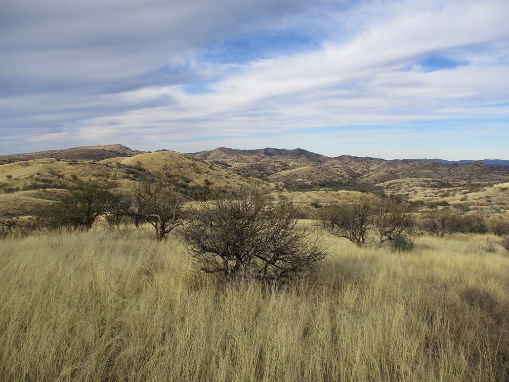
Fraguita Peak lies in southern Arizona, south of the historic town of Arivaca, and about 6 miles on a straight line north of the Mexican border. It lies in a hilly area, a mush of small ranges and hills, some with names and some without. Elevations are generally above 3,000 feet, so it's cooler than the deserts and can be quite cold in winter.
Scott Peavy was here about a month ago, then "Dixie Flyer" from the HikeArizona crowd not long thereafter. Viewing their photos, it looked like a fun peak to climb, and pretty too. Seeing photos always helps "inspire" me to get off my butt and drive the extra distances to these peaks. It was also an excuse to drive Arivaca Road and visit the town, my first time ever on these roads. I very rarely get to Santa Cruz County. I think the last time was in 2017 and we were just passing through.
I was up early, on the road at 5 a.m., timing my drive so I'd be through Tucson as the sun rose, then driving on Arivaca Road in the morning light. The day was supposed to be sunny, and it was, except for this immediate region. There was a bank of clouds that seemed to just sit in place. It was barely above freezing when I rolled in, and shady due to the clouds, which just made things more cold.
My car's thing that tells temperature always "beeps" when it reads 37 degrees, warning me to be aware of icy roads. It's a preset, I never set it. Well, every single time it would rise above or drop below 37, I'd get that beep and reminder. I was probably reminded to be aware of ice about 30 times. How annoying. Anyway...
The drive to Arivaca was enjoyable, a winding paved route through rangeland with mountains along the fringes. It's a 23-mile drive from the interstate to Arivaca, which is a real neat place. Lots of history here, little shops, one truck with a hippie psychedelic paint job, a good vibe.
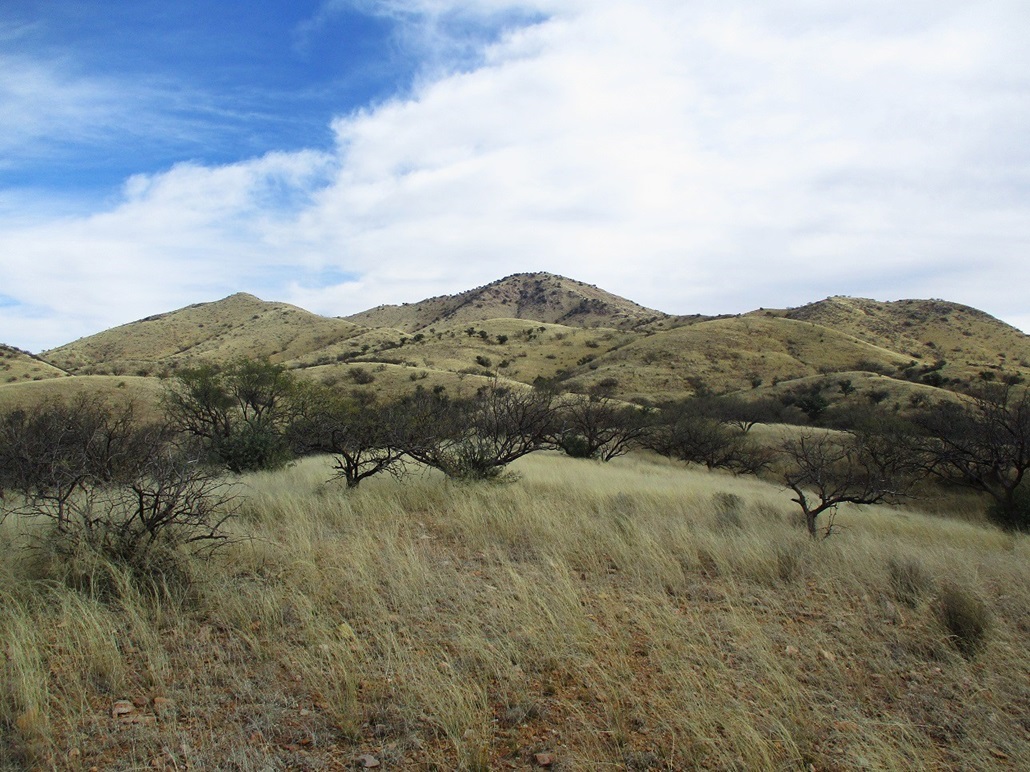
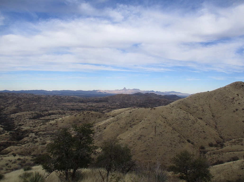
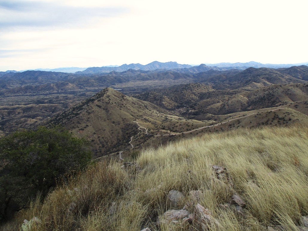
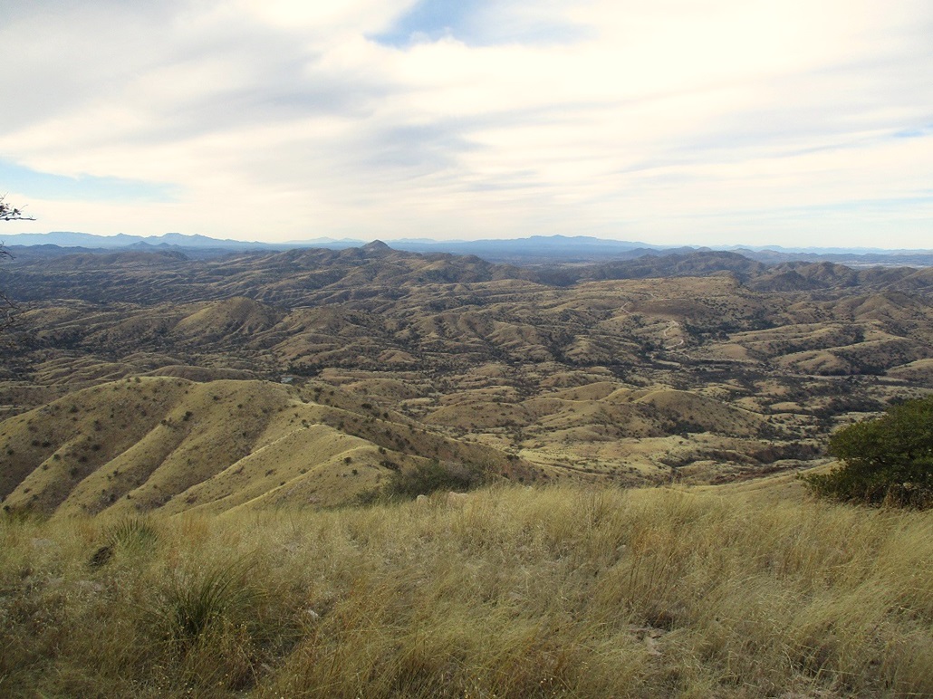
From Arivaca I followed Ruby Road south, then onto Tres Bellotas Road, which is hardpack dirt. Fraguita Peak was visible, a few more miles south, the only high mountain in that direction. At some point, I crossed onto Coronado National Forest land. The road winds a little more, now being hillier. I had a choice of routes: follow a track south and approach the peak from the east, or stay on Tres Bellotas Road going west then south, approaching the peak from the west. This is one of those hikes where most any direction will suffice, just being a very steep uphill slog. I chose west because there appeared to be a ridge I could follow up, to mitigate the steepness of the hike.
On the west side of the peak, the road crossed into and out of Fraguita Wash six times, each time with water flowing. It was never more than a few inches deep. I kept driving until I could see the peak and find a place to park. I found a road that went in toward the hills. I followed it in but not too far. I parked in a clearing, near Jarilla Tank, about a mile-and-a-half southwest of the peak. It was about 8:40 a.m. when I finally shut the engine off. It was cold and cloudy, although sunny and blue to the north and west.
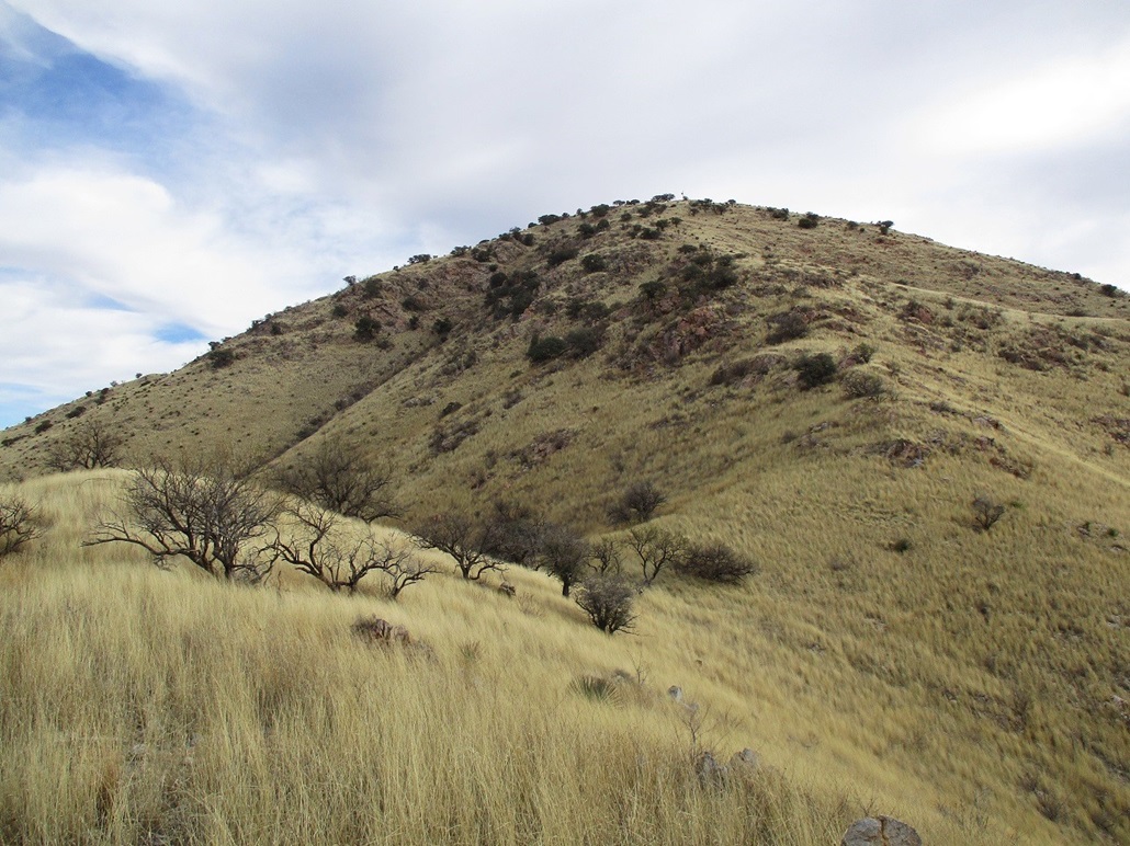
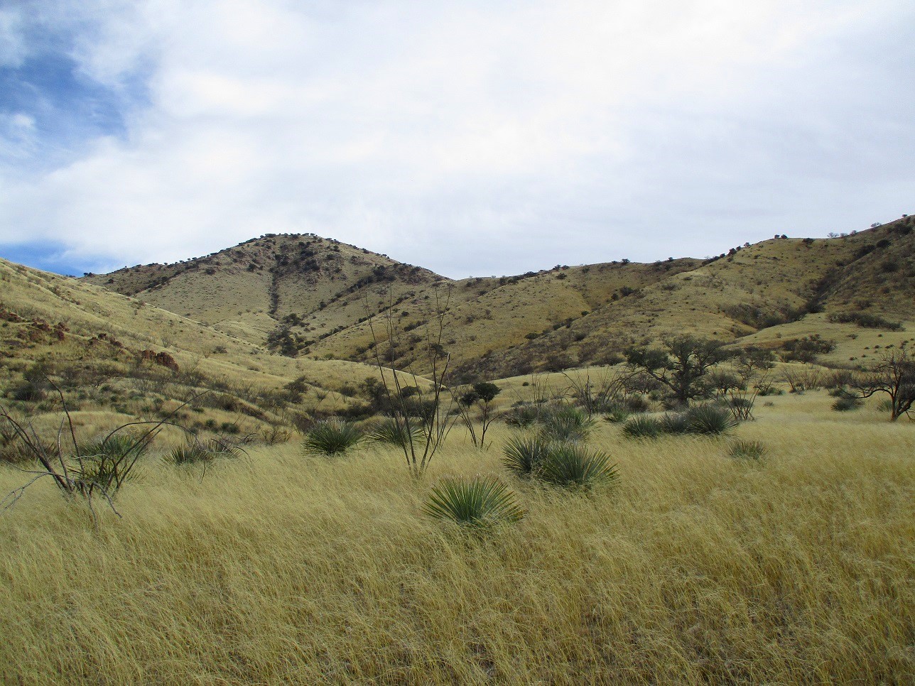
I started walking, with no plan in mind except to get in some distance then figure out things. I gained about 20 feet to get onto a broad slope of grass and low scattered trees, then continued walking. Elevated slightly now, I could see the peak ... not too far away. Heck, this might go easier than I thought. The slope I was on narrowed slightly into a proper ridge, and I just followed it uphill. The grass wasn't too bad either, generally ankle high and not hiding too many rocks.
This route gained up to a hill, which I didn't realize was a hill until I saw it dropped down on all sides. This was minorly annoying but not all bad. I had about a hundred-foot-high perch to survey all before me. I could plot out a route from here, what slopes and ridges looked friendliest, what to avoid. It looked very logical.
I thought about going up a slope of an adjacent ridge (the map shows old mine diggings here, these are visible on the hillside). My thinking was that I'd get most of the elevation done quickly, then take the gentler slopes around to a saddle then to the top. I dropped off my hill directly into a very thick clump of catclaw. Also, the grass was getting taller. This little segment went slow. The grass was waist-high, rocks rolled every chance they could, but falling was never a concern because the catclaw would hold me in place.
I got down to a lower slope, then tried to cut through a drainage to get to that slope, but the drainage had walls about 40 feet high. Yikes, me. In fact, I got up to the lip of one thinking there'd be a sloppy slope to follow down, but no, it was an actual cliff. Once I realized that, I jumped back because these "cliffs" are not solid rock but soil, and unstable on the lip.
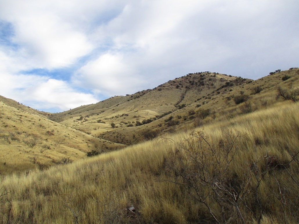
I was committed to the slope I was on, so I went with Plan B which was a slope that would put me on the southwest ridge directly, a straight-shot to the top. I was able to get onto this slope easily, crossing one drainage but this one only about 10 feet deep. Now on the slope, I grunted upward. The grass was thick, about knee high now, hiding some cactus and rocks, but this segment went well. There was no catclaw on this slope. I was soon on top the southwest ridge.
Up on the ridge, the breezes picked up, nothing to stop them. It was chilly, in the 40s. I had to bundle up, that is, put on my flannel shirt. I went up and down a couple gentle bumps along this ridge, with its lovely grass. It's actually quite pretty, just a chore to walk through. I also found a path that ran along the ridge, then I found a few scattered clothing items and food wrappers. These looked old and decayed. The path is almost certainly one put in by the crossers. I kept an eye out for them.
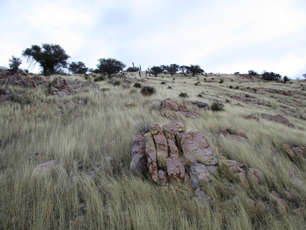
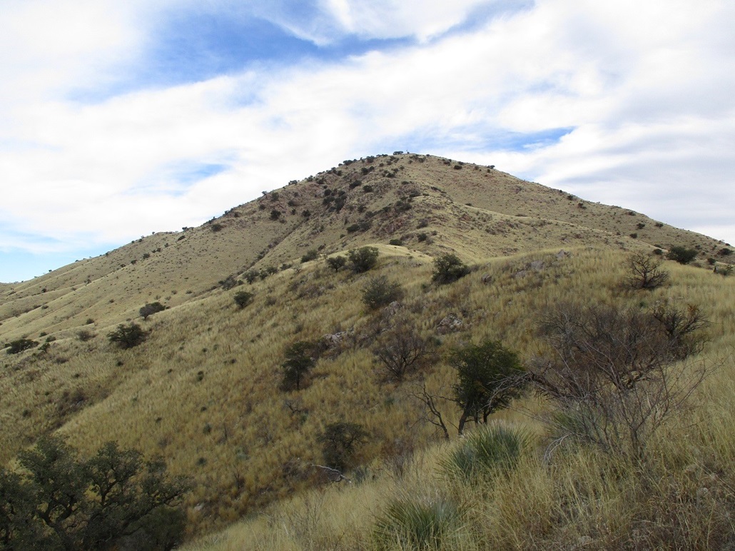
I was now on the final slope to the top, about a 400-foot gain. From below it looked steep and jumbled slightly. I climbed up to a fence line (which I wasn't expecting), then up some more to the first of the handful of rock jumbles. I also found a path. It went where I wanted to go so I followed it. It weaved through the first rocky segment, then up more slope, then through another small rock segment, then up to the main rockpile, to where it was an actual cliff in spots. I went right and up a slope of boulders and grass. I used hands here a couple times just for balance.
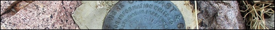
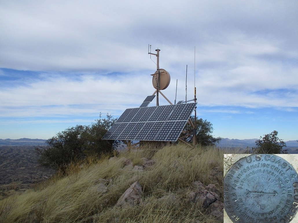
Above this, I had about a hundred feet more to the top, just a long steep slope. I got up this and onto the small summit, the wind blowing hard. The top hosts an antenna apparatus, almost certainly for the Border Patrol. The highest rocks were to the east, a foot higher at most. I tagged these and found a reference mark for the Fraguita benchmark, but I could not locate the benchmark, which is likely underneath that antenna unit. I could not find a register either. I also found a flannel bedroll tucked beneath the structure. I took a few photos and a short break to drink, but the brisk wind was uncomfortable unless I was moving, so my stay up top was for no more than five minutes.
I hiked down the same route. The sun started to come out a little, so I snapped some images. Otherwise, I just kept a steady pace and watched my footing, trying to dodge the patches of catclaw. I was able to keep to my ascent route nearly exactly. The hike in had taken one hour and forty minutes, the hike out about an hour and fifteen minutes. I was able to navigate this hill-ridge-arroyo system very well, egressing back to my car at noon almost exactly.
Other than being chilled, this hike had gone extremely well with no difficulties or wasted effort. Once I could see the lay of the land, plotting a route was easy and it worked perfectly. I never saw any crossers and just a few of their clothing items, not as much as I've seen on other peaks by the border.
I had planned to hike the Las Guijas Mountains Highpoint next. That didn't quite work out, but I was able to tag a second peak, Cerro Colorado, about fifteen miles north of Fraguita Peak.
|

|