|
|
|
Date: January 10, 2008
• Elevation: 5,456 feet
• Prominence: 2,036 feet
• Distance: 3 miles
• Time: 2 hours and 15 minutes
• Gain: 1,050 feet
• Conditions: Clear and cold with snow in the slopes
Arizona
•
Main
•
AZ P1K
•
PB
•
LoJ
The Black Mountains extend south from Lake Mead, fronting the Colorado River as far south as Bullhead City. Mount Wilson is the highpoint of the north part, north of highway US-93, while Mount Perkins is the highest mountain in the whole range (by 11 feet over Mount Wilson). Mount Perkins is about 30 miles north of Kingman, near the community of White Hills.
I was on my annual winter getaway, driving to California to visit family and friends. Earlier in the trip, I hiked Orocopia Mountain in California. I spent a couple days in California, then drove to visit my parents in Henderson, Nevada. I was now driving home, and I planned to scout the roads around Mount Perkins for a later visit. I had no information to go by, and assumed the roads were either gated, in horrible shape, or both. I was not expecting to actually climb the peak today.
I left Henderson before the roosters woke up, and was over the Hoover Dam before dawn, beating the crowds. At the time, the big by-pass was still being built, and the section of US-93 over the Hoover Dam was notorious for long backups. By the time I had arrived in the general area around Mount Perkins, the sun was up. The day was cold and lovely. The peaks, including Mount Perkins, were covered in snow from a big storm a few days ago.
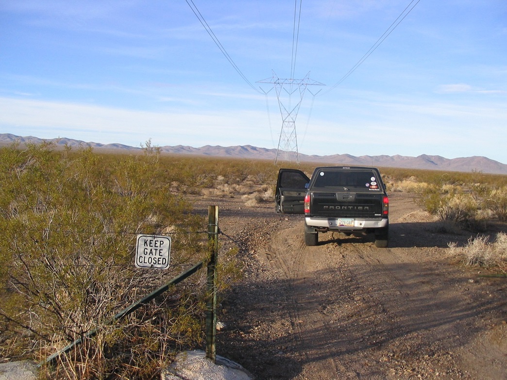
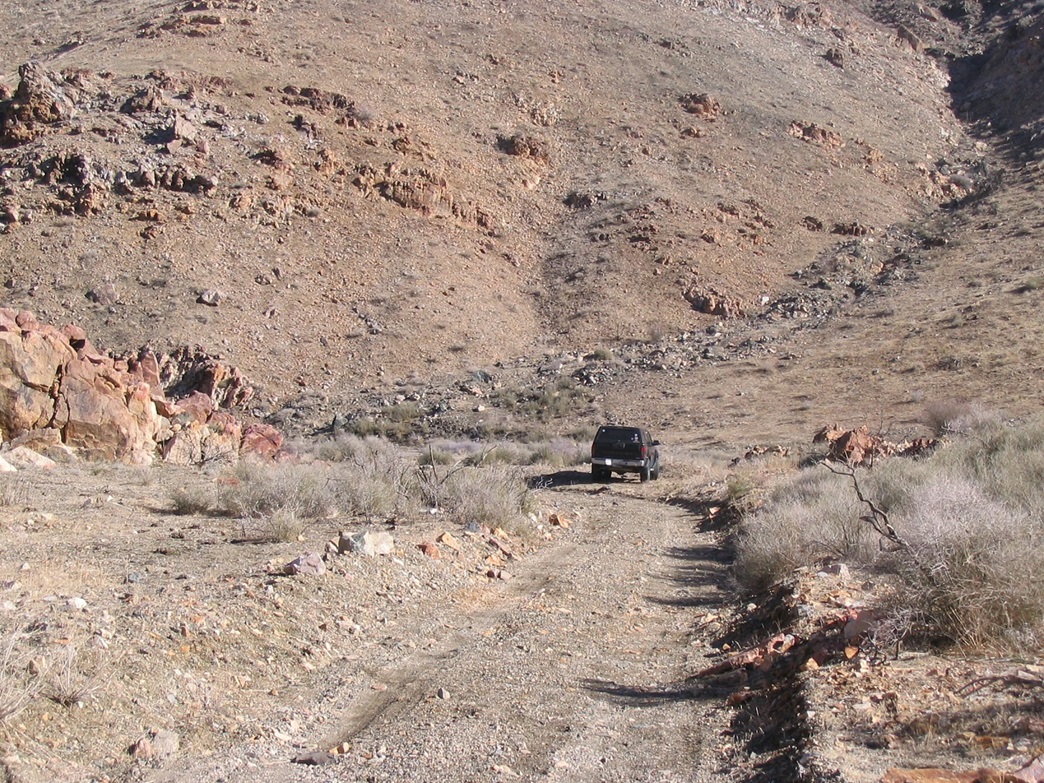
I first tried "residential" roads in and around the community of White Hills. These are roads bladed in willy-nilly, and homes built wherever the mood strikes. Some are nice, some are hovels. I had no luck with these roads and soon, was back to US-93. So I tried Plan B, a scant power-line access road. I drove south to the powerlines and eased to the right (west) shoulder, and found a discreet wire-stick gate in the fence, the sign just asking to close it afterwards. I went in and hoped the road was driveable.
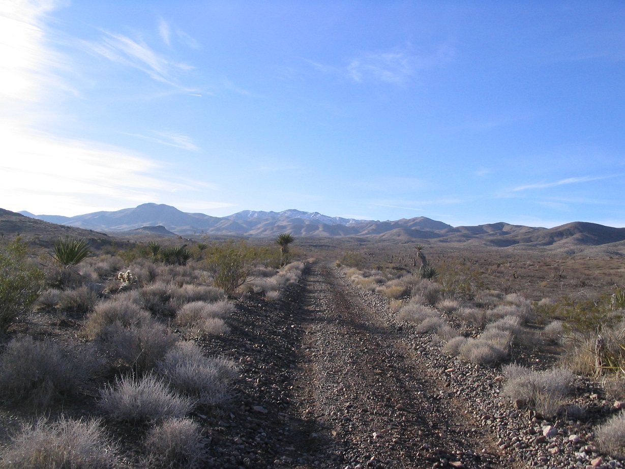
I drove west a couple miles, then south on another road, now aiming for Mount Perkins directly, covered in white. About 6 miles later, I had rumbled to the hills directly below Mount Perkins, gaining about a thousand vertical feet, a pleasant surprise given the road had a gentle grade the whole way. Along the way, I passed through a few mine claims. Ironically, the road's quality improved the farther I drove. I parked in a clearing about a half-mile short of the communications towers, as by now the road had become quite steep and littered with boulders. I was about 1,100 vertical feet below the top.
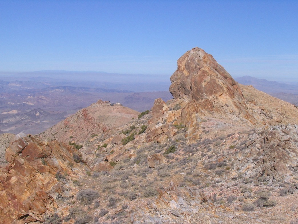
There was patchy snow on the hillsides above my truck. From a distance, the actual summit seemed to be covered over with snow. I packed light, but carried in my snowshoes "just in case". From my truck, I walked the road toward the towers, but left the road when I spied a path that barged steeply up a slope to gain the ridge southeast of the towers (so I never actually hiked to the towers). I followed a set of old jeep/ATV tracks up another slope toward a rocky pinnacle and surmounting this, could see the summit and the rest of the ridge I would follow. It looked friendly. Big rocky outcrops seemed to be spaced evenly along the route, while the snow was not an issue yet.
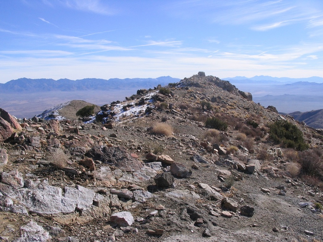
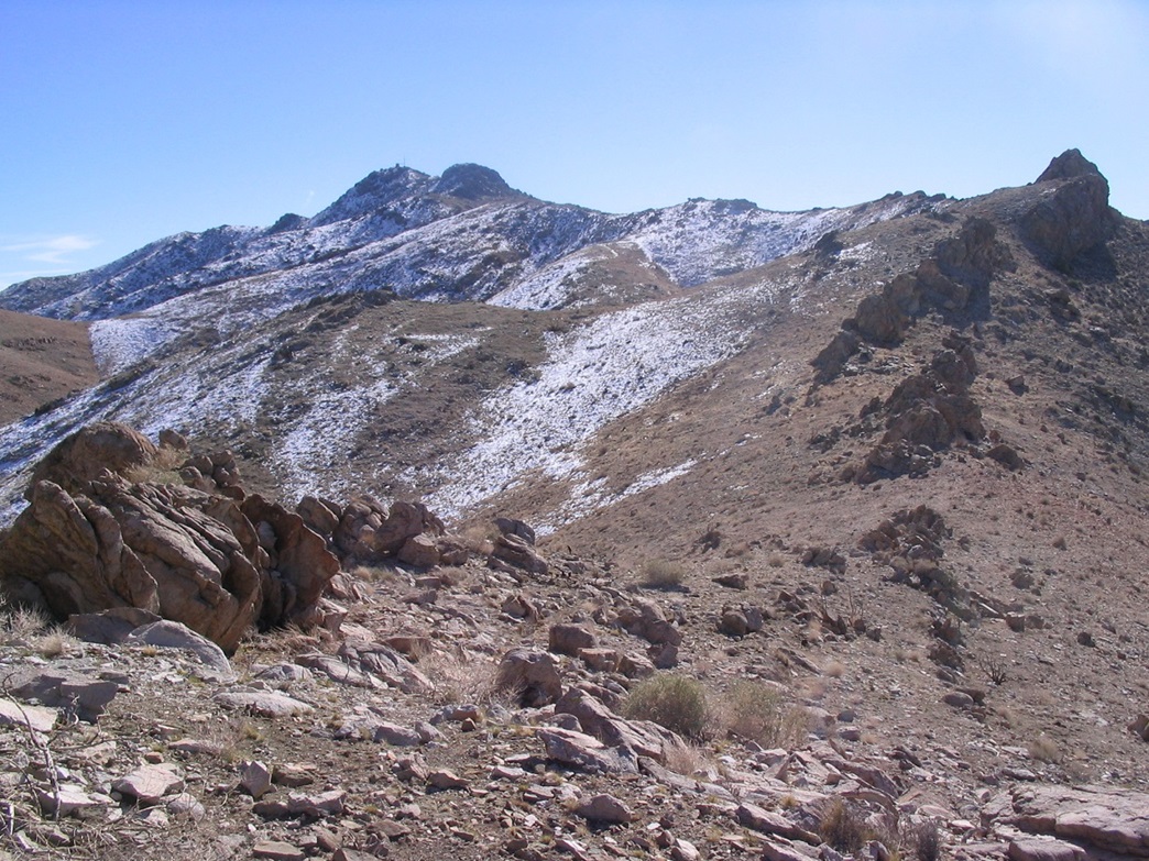
I walked along the ridge toward the rock pinnacles. Paths skirt these pinnacles and the climbing is easy, sometimes using my hands hoist up or down rock steps. So it went for this stretch: ridge, rock pinnacle, ridge, another rock pinnacle, ridge ... you get the idea. The snow started to get more abundant the closer I got to the top. One last pinnacle stood in the way. I went left (north) but the snow was icy here, so I turned around and went around the back-side (in dry conditions I think the north side is the proper way to go).
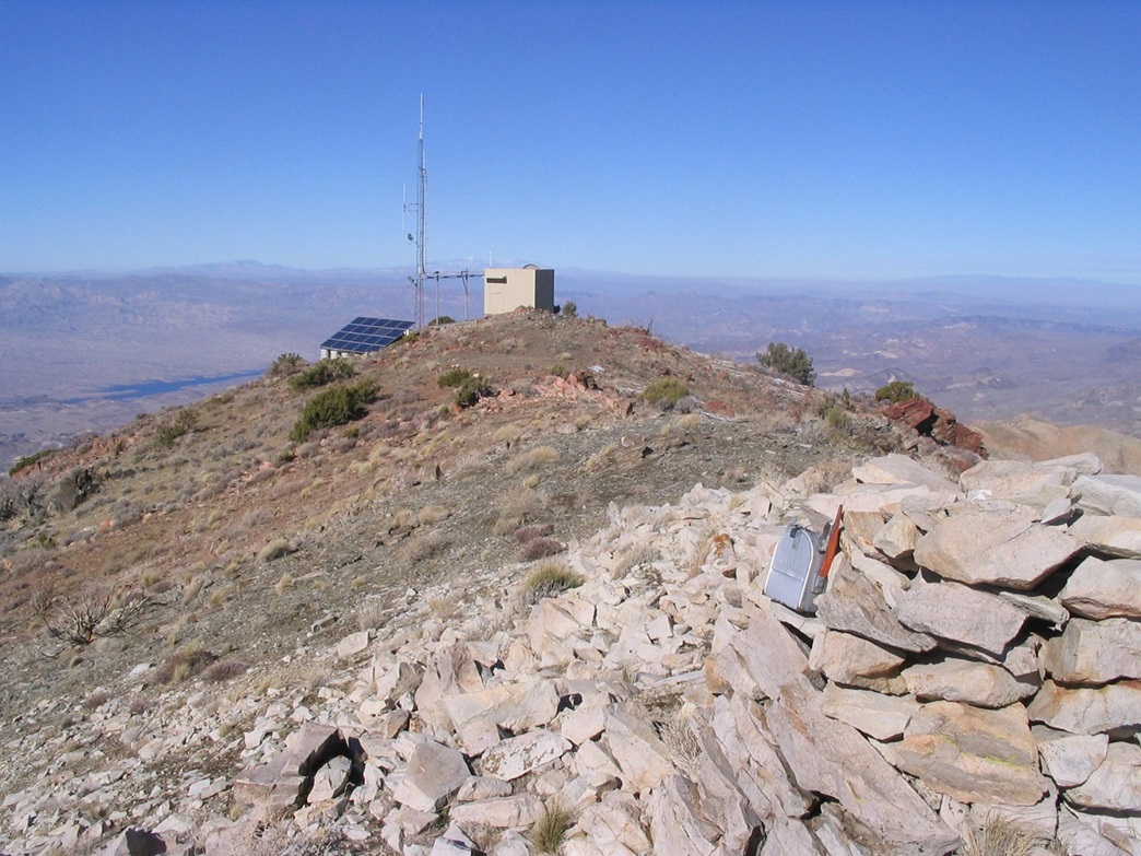
Around the backside, the ground had less snow, but it was frozen in places. I traversed a slope, then worked up a gully, gaining about 40 feet to the rocks at its crest. I found a convenient ramp that brought me out of the gully and back onto the range crest. From here the summit was a quarter-mile away but obstacle-free. I went up another slope, past one more simple rock section, then came upon the buildings and solar-panels atop the peak. The true summit lies a short ways beyond, marked by a large rock cairn and mailbox.
I spent about 20 minutes up top, admiring the views. The best views were west, looking down 4,000 feet into the Colorado River Valley, and then across into Nevada and peaks in California. I could identify the Spirit, Kingston and McCullough Ranges easy, and even the snow-capped Mount Charleston to the northwest. To the east stood Mount Tipton directly across the way. The snowy ridges were pretty, especially from the south and west.
The log book had no signatures for all of 2007, the most recent being a group of Mohave County Sheriff's employees who helicoptered here in September 2006 to check their repeater box. Signatures went back over 25 years. Not too many people climb this peak, which surprised me given how easy it turned out to be. Of more immediate concern was the brisk air and the breeze that was cooling me down uncomfortably, so I got moving. It had taken me about 90 minutes to get here from my truck.
The hike down went quickly and I was able to remember my route down the chute. Once past that I jogged the remainder, taking time for photographs and admiring the views. I was back to my truck in less than an hour, not unreasonable given I probably only hiked a mile and a half each way. Back at my truck I was surprised to see another truck rumbling up the road. It was an Arizona Fish & Game biologist. She was real sweet and genuinely surprised to see anyone up here. She was up here to track a herd of bighorn, and said I was the first person she'd ever seen up here. I asked if the land is closed to the public and she said not at all, just that no one comes up here ever.
After our chat, I changed into dry clothes and made the 8-mile drive back to US-93. including drive times the entire journey took just under 4 hours. I was pleasantly surprised to have hiked this peak in what was supposed to have been a scouting mission. I was in Kingman by 2-ish, getting gas, then from there I made the long scenic drive down US-93 all the way into Phoenix, just in time for late-day traffic.
I can only assume the reason more people don't hike this fairly simple peak is its remoteness, lack of "flair", and most likely, a very unclear road net (and access point) leading to the peak. Those without any maps who want to hike this peak on the spur of the moment would be hard-pressed to know where to exit off the highway. Otherwise, there is nothing barring anyone from a fun short half-day adventure up here. Just beware the mines.
|