The Mountains of Arizona
• www.surgent.net
|
| Mount Tipton |
• Highpoint: Cerbat Mountains • Mount Tipton Wilderness • Mohave County |
|
Date: April 2, 2011
• Elevation: 7,148 feet
• Prominence: 3,628 feet
• Distance: 8 miles
• Time: 7 hours and 45 minutes
• Gain: 3,400 feet
• Conditions: Breezy and warm with high clouds
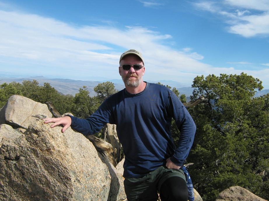
• Teammates: Adam Helman
Arizona
•
Main
&149
AZ P1K
•
PB
Mount Tipton is the highest peak of the Cerbat Mountains northwest of Kingman. It is the highest and most prominent mountain north of the Hualapais and south of the Grand Canyon, and had been on my "want" list for a long time. However, its distance from home usually dampens my motivation to go all that way to climb it. What I needed was a good excuse. I knew Adam Helman was planning a trip to that part of the state, so we arranged to meet and finally tackle Mount Tipton, plus another 2,000-foot prominence peak of interest, Peacock Peak. The plan was to meet him at the Mount Tipton Wilderness boundary Friday evening for our Saturday hike.
I left work on Friday and headed directly to Kingman. There's no easy way out of Phoenix in that direction. Even though Wickenburg is about 45 miles from the city, traffic usually makes it a 90-minute ordeal. Then there's US-93, which is scenic but always under construction and full of too many fools heading to Vegas. By the time I got to Interstate-40 and then into Kingman, I was exhausted and frazzled.
In Kingman, I stopped for groceries, then got gas at a Terrible Herbst station. I put the nozzle into the hole and got the gas flowing, then when I turned to get the squeegee for the windshield, the tension cord on the nozzle yanked it back out, spritzing gasoline all over me. The nozzle was one of the older types from the 1970s or 80s. Ooh man, I was pissed. I was drenched in gasoline. A worker on her smoke break sat there watching me. I was spitting mad.
I grabbed a change of clothes from my bag and went into the men's room to change, towel myself off, and run my gas-soaked clothes under the water faucet. I bagged them and hoped that they would stay damp. What do you do in a case like this? The guy at the counter couldn't have helped. Do I tell them to get some gas pumps from about 2000 or later? Serves me right for going to one of those low-rent gas stations to save a few cents. I have not returned to a Terrible Herbst station since. They have no stations in the Phoenix area, but they're all over Las Vegas, so when I am in Vegas, I simply go to a competing station.
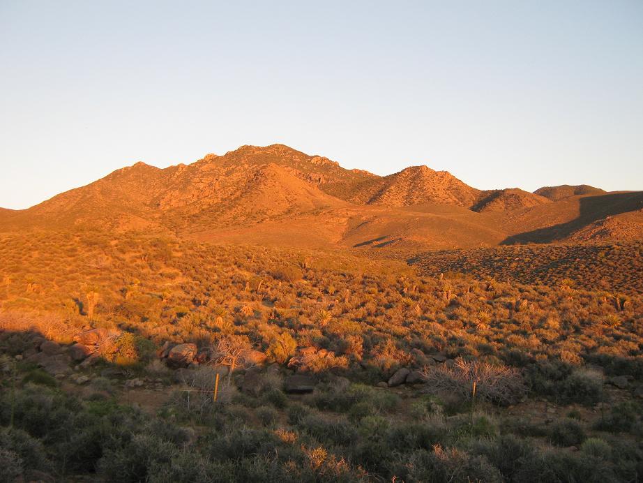
It was a relief to get out of Kingman, up US-93 for another 30 miles to Dolan Springs, and along the dirt roads to the wilderness boundary, where Adam was already parked and getting his dinner ready. It was about 6:30 p.m. and the sun was low in the west, giving nice color to the Cerbats behind us. I was able to park in a scant pull-out (the road itself is in poor shape for the last mile or so). Adam and I caught up on things, then when it got dark, we both camped in our respective vehicles. It was a warm night and I didn't need a blanket at all.
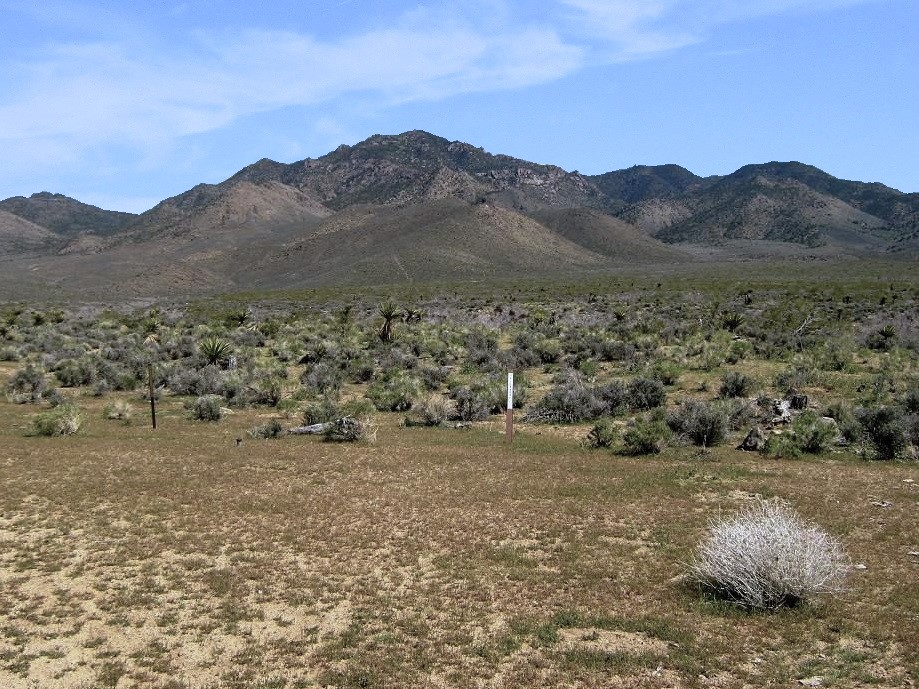
Given a little heat wave we were been having (100 F in Phoenix the day I left, the second-earliest 100-degree day on record), we had reasonable concern about how it may affect us on the hike up Mount Tipton. We agreed to start hiking 20 minutes before first light. We had the advantage that the sun would be behind the range until later in the morning. When we awoke at 5 a.m., it was breezy but barely cool, mid 60s. We started the hike at 5:35 a.m., walking up an old road for about a mile, figuring we could navigate this section easily in the pre-dawn. Well, we got a few hundred yards in and then lost the road. We hiked up a sandy wash for a ways, then onto a brushy bench, where Adam's GPS helped us figure out where we needed to go. We found the road again after about 15 minutes, and hiked it to a highpoint. Our little off-route excursion cost us 10 minutes. (We'd discover how we made this error on our descent, so read on.)
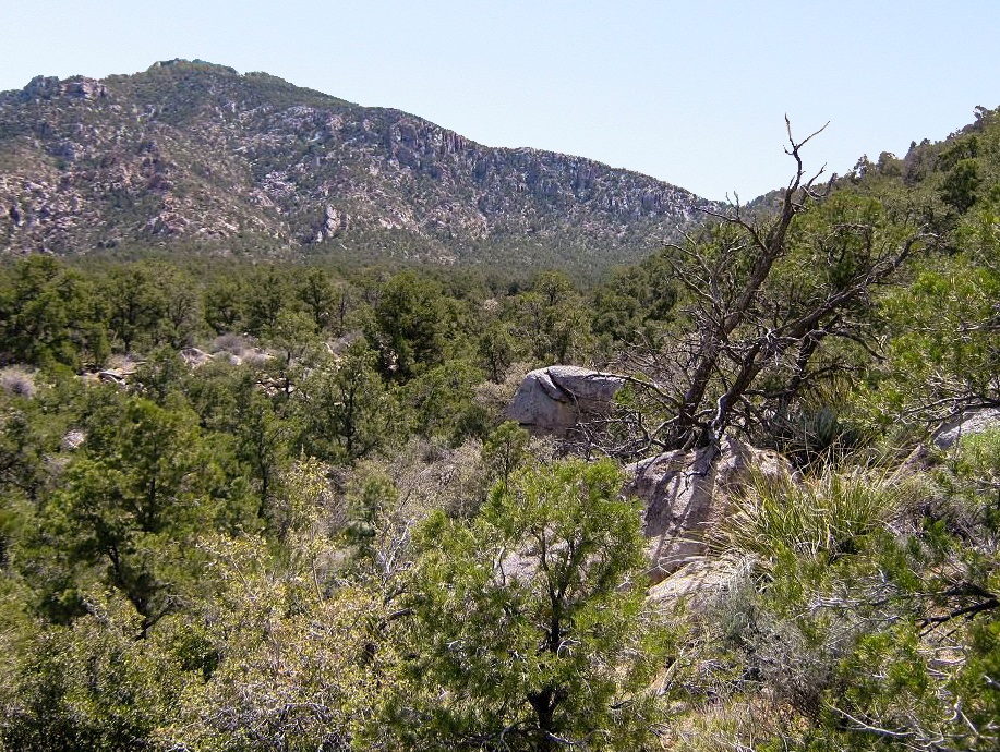
We left the road and started cross-country, traveling southeast amid knee-high scrub and rocky ground, aiming for the base of a slope beneath "Hill 5313" which we nicknamed "Triangular Peak" for its symmetrical cone shape. When the brush started to get thick, we angled left and dropped into a rocky wash. We saw a few cairns, but they weren't necessary to stay on course, just confirmation others had gone this way. The gully was pitched leniently, and not as brushy as other gullies, so we made good time.
Our goal was a saddle at elevation 5,300 southeast of "Hill 5534". Adam's GPS reported this segment (from the road to this saddle) as 1.35 miles. From our vehicles we'd gained a little over 1,300 feet in about 2.4 miles. The sun was up and there was a strong breeze blowing, but we still had shade and the temperatures were still pleasant. We took an extended rest here at the saddle.
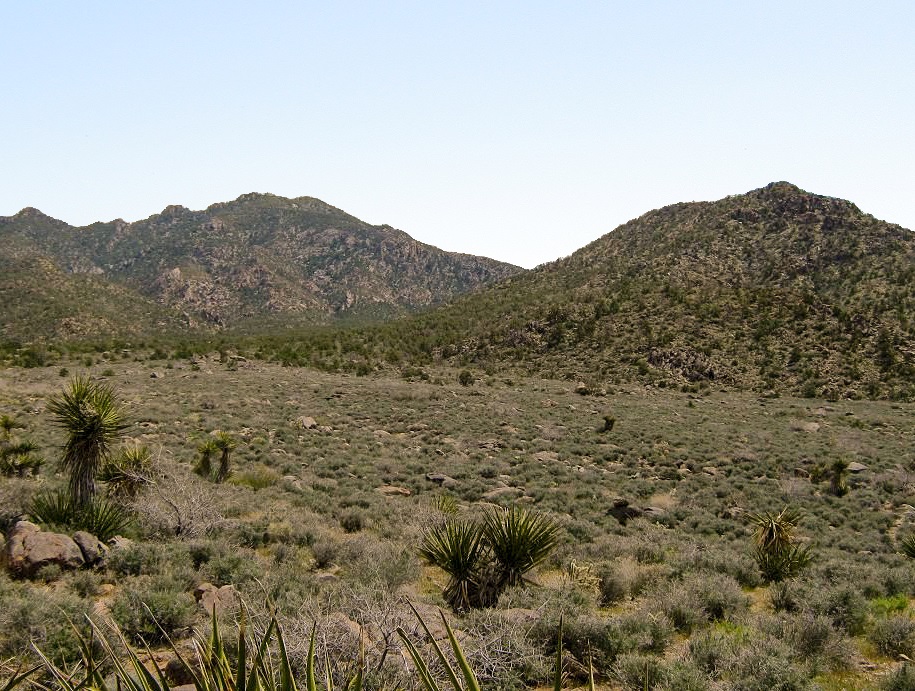
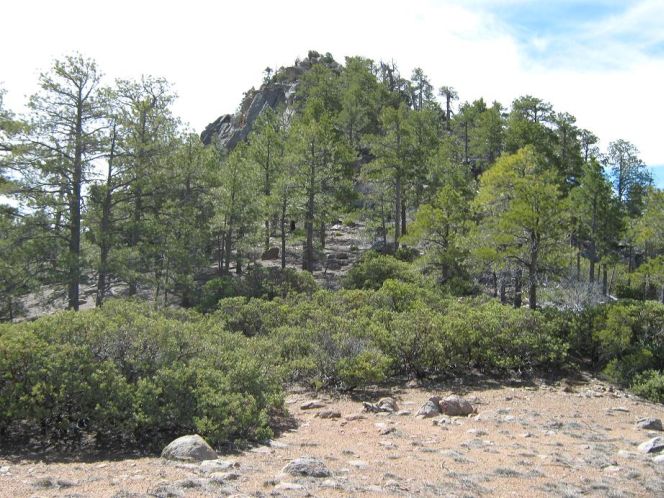
The next segment was a short but steep and brushy hill to the southeast. We charged up this hill, plowing through the tree branches, woody scrub, grass, cactus and rocks to gain the top of the hill and onto a ridge that leads to the top. Some cairns up here gave us a little comfort in knowing we weren't completely off route. The summit ridge was visible again above us, with the actual peak still 1,550 feet above us in a little over a mile, meaning sustained steep grades amid brush. Ugh. So we moved upward, trying to surmise paths in the thick brush.
We angled left toward rock outcroppings, but mostly stayed on the ridge's south (our right) as we ascended. The brush was thick but not impossible, just annoying. We'd grunt up 300 vertical feet, take a few minutes to drink or enter a waypoint, and proceed. At about 6,800 feet we came upon a large rocky slope where the grades moderated and the brush lightened. We actually ascended the final portion of this ridge directly underneath the northern sub-summit of Tipton, topped out onto a small saddle, battled through a thicket of mountain oak, then came to the saddle below Mount Tipton's summit, a rocky mound covered in moderate pine forest.
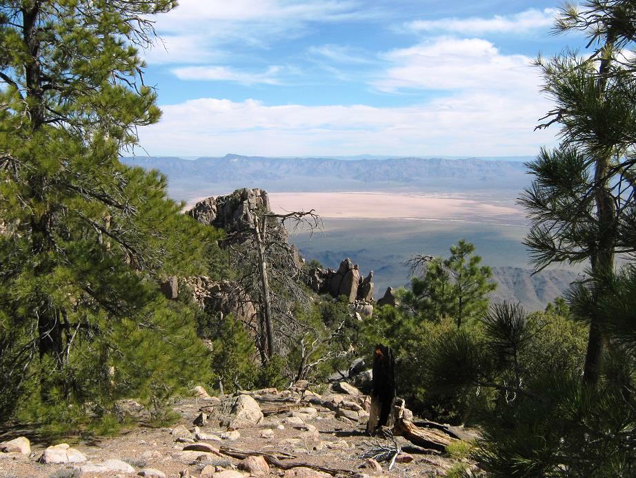
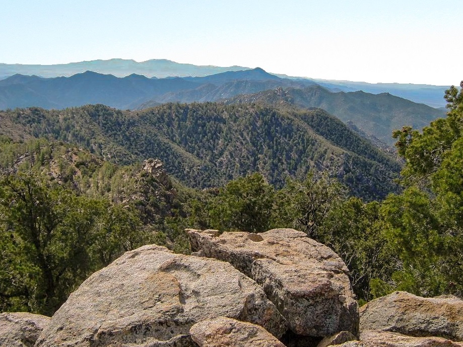
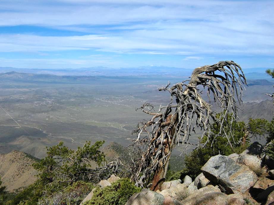
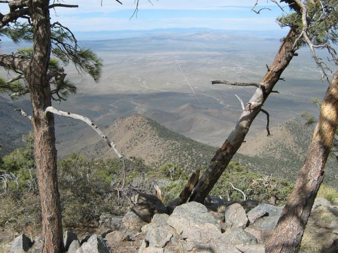
Adam went ahead to the top while I rested, then I slowly ambled up to greet Adam at the summit rocks. We arrived here about 9:30 a.m., a four-hour ascent. We took a break here, looking out all over creation at the various peaks and desert valleys. Snow-clad Mount Charleston was visible to the northwest, in Nevada. We could see peaks into California and of course, the surrounding Arizona ranges. West of us we could see the grid-work of roads of Dolan Springs below us, while east we could see the sandy Red Lake Playa and the Grand Wash Cliffs rising behind it. North and south views were dominated by the spine of the Cerbat Range, a multitude of brushy, forested nameless summits, many with dramatic rocky profiles.
After 25 minutes we started the trek down, hoping the weather would behave for us. Up this high it was very pleasant, even slightly cool. But now, as the sun rose, we could feel the heat starting to build. We descended to the saddle below the summit, then angled a little more northwesterly to put ourselves on the main western ridge again, but a little more of a north tack than on our ascent.
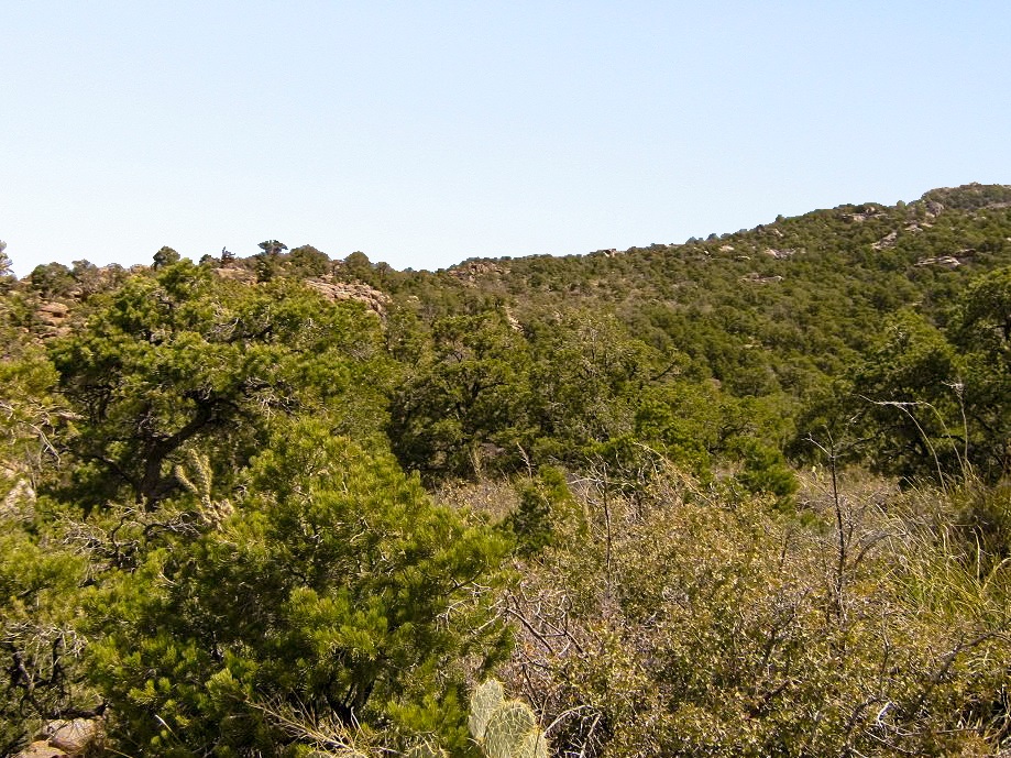
We found the going here to be a lot more open, at least for the initial 500 vertical feet of drop, much less brushier than we had coming up. This worked great since we were able to lose a lot of elevation fast. We hit the brush again at about 6,000-feet elevation, and had to battle our way down to the 5,600-foot point we had come up on our ascent. Nevertheless, we had come down faster than we thought, which was great. The hike down the steep slope back to the saddle was brushy and slow, but we arrived shortly and had another long break.
From the saddle we descended the gully, just hopping from rock to rock and avoiding the brush, until we were out in the open again, now able to see "Hill 4288" where we had left the road earlier in the day. It was warm, but not terribly so, with a strong breeze that helped cool us. We ascended out of the gully onto the raised slopes and hiked back to the road. A few feet later, we spooked our first snake of the day. We heard a rattle coming from a bush alongside the road, but couldn't see the snake. We knew better than to "verify". The rattle was sufficient.
We walked the road back to our vehicles. It meandered past what looked like an old gravel pit, then became indistinct and then disappeared on us at the sandy wash, where we'd lost it earlier in the morning. In truth, there is no road of any sort for about 60 feet. If coming up, the road will "end" at a sandy wash. It resumes again on the other side about 30 feet farther east, but we wouldn't have seen this on our ascent in the darkness. We were back to our vehicles at 1:30, a 7-hour, 45-minute hike.
We took time to relax, get things in order and get ready to leave. From here, we exited back through Dolan Springs into Kingman, and killed time at a McDonalds in town before driving out to our next peak's trailhead, the western slopes of Peacock Peak, about 20 miles northeast of Kingman.
Overall, the hike up Tipton was grueling and tedious with the brush, but never cliffy or technical. We may have ascended a little quicker had we known to follow the west ridge on a more northerly tack. Others have commented that the brush wasn't bad, but some (in the log book) had mentioned the "incredible" brush. It may lessen at different times of the year. I enjoyed this hike and was happy to finally have Mount Tipton in the books.
Frankly, I am surprised we didn't scare up more snakes than the one we did.
|


|