The Mountains of Arizona
• www.surgent.net
|
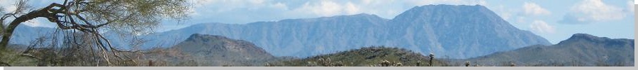
| Harcuvar Peak |
• Harcuvar Mountains • Bureau of Land Management • La Paz County |
|
Date: December 19, 2008
• Elevation: 4,618 feet
• Prominence: 2,048 feet
• Distance: 7 miles
• Time: 5 hours
• Gain: 2,400 feet
• Conditions: Cold and sunny
• Teammates: Scott Casterlin
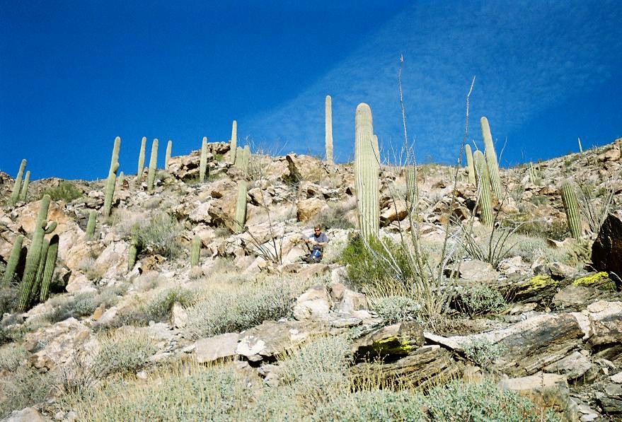
The Harcuvar Mountains are in La Paz County, north of the Harquahala Mountains. The two ranges hem in the McMullen Valley and the towns of Salome and Wenden, about 90 minutes west of Phoenix. Harcuvar Peak is not the highest point of its range. That honor goes to Smith Peak, which I climbed back in 2006. However, Harcuvar Peak has a more noticeable profile, appearing as a big trapezoidal-shaped mountain with a flat, serrated ridge. There are no trails to the summit. This one has to be earned through sheer gruntwork, but it has no cliffs or other obstacles.
Scott Casterlin was in town attending to some business and he had a day open, so we decided to visit Harcuvar Peak. I had just completed a semester of teaching at ASU and had a couple of slack days before heading west to California for family visits, so I had some time free, too. He drove to my home in Chandler and by 6:15 in the morning we were on the road west, now in my truck. We took Interstate-10 to the Salome Road exit, then Salome Road into Salome the town, about 90 miles total.
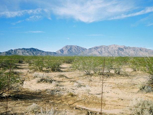
Harcuvar Peak is visible north of town, but the easier access (as far as we know) is from the nearby town of Wenden, about 5 miles northeast along US-60. Salome and Wenden are ringed by cotton farms, and the grid of roads north of the highway can be a bit confusing since roads "end" randomly or sometimes lead into someone's homestead. We made some educated guesses, and eventually found a decent route into the Harcuvar foothills. Most of Arizona had been hit by a big rainstorm the past couple of days, and there were puddles and mud on these dirt roads.
At the railroad tracks in Wenden on Alamo Road, we went north 1.4 miles onto what would be the 71-1/2 Road alignment (it was unmarked). We went left (west) onto this road, which cuts diagonally off of Alamo Road and fronts an irrigation canal. We followed this farm road 1.6 miles. In places the mud was thick and there were big puddles of standing water, but my truck made through the mess in good shape, albeit with a lot of mud. I drove 1.6 miles on this canal frontage to where the farms end. The road continues west as a desert track, paralleling a barbed-wire fence. This road went west two more miles to a corner of fences, where a cattle-grate opening allows for a right turn onto a northbound track.
Unfortunately the rain had eroded the road and left about a 10-inch berm to get up and over the cattle grate. We got out and kicked the berm down a little so that it had a slantier profile, and then I eased the truck in 4-wheel drive over the berm, with Casterlin spotting me in case I might high-center. Now northbound, we followed this track a mile in and out of many small arroyos and creekbeds, then a dog-leg left up the main track for two more miles as the road slowly entered into the broad canyon south of Harcuvar Peak.
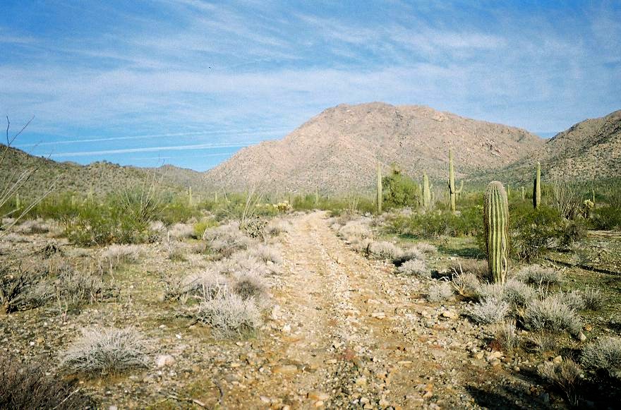
We parked at a turn-around with a fire pit roughly two miles south of the peak. The road continues from here but steeply descends into the main wash emanating from this canyon, then up the other side. Up to here the road had been passable, and the mud, rock and sand sections were not too bad, but I definitely needed my truck's high clearance and 4-wheel drive capabilities. However, the road into and out of the major wash north of my parking spot was way too rough for my truck. It was about 9:15 when we stopped and within 15 minutes had our shoes on and packs ready, and up we started.
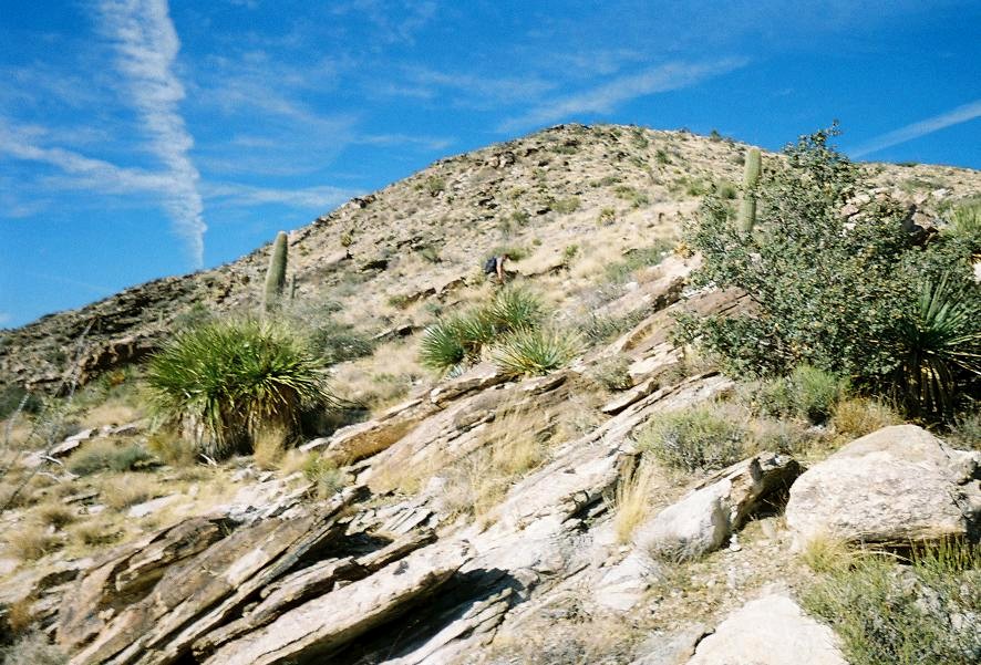
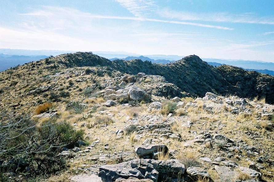
The initial portion of the hike was up the remaining road toward a low pass in the distance. We covered about two miles in an hour and walked all the way to the end of the road, thinking there may be some footpath from here and possibly one to the ridge, but there was none. Instead, we started up a prominent southeast ridge that looked gentle. My GPS had us at 3,200 feet elevation, an 800-foot gain above where we parked, but still 1,300 feet below the summit. I psyched myself up for this ridge grunt. They're never very fun but at least you gain elevation quickly. As usual, we hoped this ridge would "go" and not lead us into some impassable cliffs.
The ridge looked steep down low. Usually we would see a big rock jumble up ahead, so we'd march to these rocks see what was ahead, which was usually another rock jumble. The terrain was open enough so that we could avoid the cactus. The rocks were loose and the recent rains left the hillside muddy and loose in places, so we took it step-by-step and very carefully. After 45 minutes, we had gained 700 feet and suddenly the slopes opened up, although it was still quite steep. A distinctive "dark rock" sat above us on the ridge and we aimed for it. This segment covered another 200 vertical feet and was probably the trickiest segment since we were on steep open slope and the rocks were often apt to roll or slide when we stepped on them.
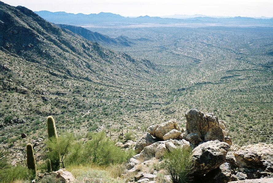
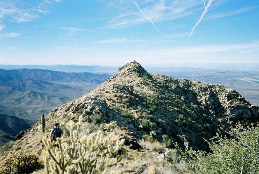
At this dark rock, we now had an excellent view of our remaining climb: a much gentler slope of another 200 feet to gain the summit ridge, and from there a short up-and-down walk to the westernmost of the four summit bumps that lie along the ridge. The westernmost summit is a fairly pronounced point of rock with a USGS benchmark and a cairn on it. We arrived here slightly before noon, less than 2.5 hours of hiking. The weather was nice, mostly clear with high clouds, but chilly, in the high 40s with a stiff breeze at times.
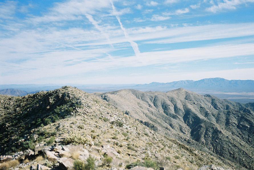
We took a 20-minute break here and tried to pick out surrounding features and distant ranges. The Hualapais were north but other peaks north and east were harder to figure. Way way off to the northeast we think we saw the snow-covered peaks near Flagstaff. South of us was the Harquahalas and off to the southwest we could see Signal and Cunningham Peaks.
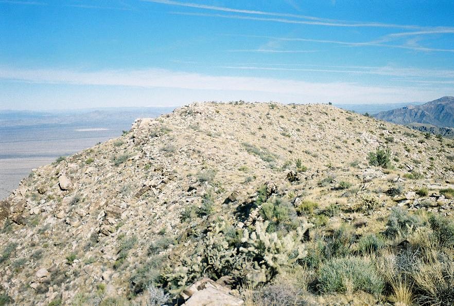
When the wind picked up, the chill was severe and I was itching to get moving just to stay warm. We opted to check out the other summit bumps. The northeasternmost of the summits seemed as high and when we walked over to it, there was a register placed in a small cairn there, with the comments that this point may be higher than the cairned highpoint we were just at. We also noted exactly three names in the register: two from 2002, one from 2007, and now Scott and I for 2008. Now, perhaps those who climb Harcuvar aim for the cairned peak and call it good, but still the lack of signatures suggests this peak may get climbed at most just once or twice per year.
The hike down went well considering the steepness and occasional slips and slides. Other than a few cactus spines, we both made good time down the ridge and back to the road and my truck. Scott said the time as 2:30, meaning a five hour journey overall. I was actually slightly surprised we did it as fast as we did. I bashed the truck out over the desert tracks, had one more run through the mudpits on the farm roads and then back on pavement. We drove into Salome so I could inspect my truck for anything out of the ordinary. My truck was covered in mud from the door handles down, and it was totally bitchen rad, so I let it stay that way for a week before I cleaned it.
We drove back to Interstate-10 and got some Subway sandwiches in Tonopah, then battled Phoenix Friday-night traffic back to my home, arriving about 6 p.m. Scott got his stuff into his car and left soon after, while I showered and vegged the rest of the night. My thanks as always to Scott for company and skill on the peaks.
I figured more people would climb Harcuvar but given the condition of the roads getting close to the foothills, maybe that keeps a handful away. Although the range is public (BLM) land, some of the farm roads may be private, although section-line roads are generally publicly accessible. The roads in dry condition seem to be solid but 4-wheel drive is absolutely vital to get close to the peak given the numerous sandy sections and creek-crossings. I was pleasantly surprised how well the hike had gone and am happy to have completed this peak.
After a rest-day back home I re-packed the truck and headed west, this time to Blythe for a tangle with Big Maria Mountain, and from there, some family time with my folks and my brother's wife and kids in the snow in Wrightwood.
|

|