The Mountains of Arizona
• www.surgent.net
|
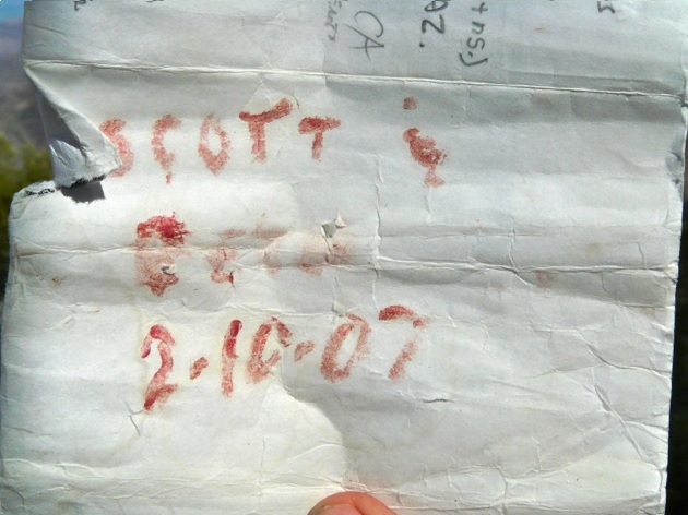
| Cunningham Mountain |
• Highpoint: Dome Rock Mountains • Bureau of Land Management • La Paz County |
|
Date: February 10, 2007
• Elevation: 3,316 feet
• Prominence: 2,136 feet
• Distance: 3.4 miles
• Time: 4 hours, 30 minutes
• Gain: 1,790 feet
• Conditions: Overcast and cool
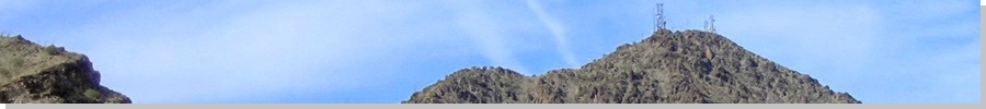
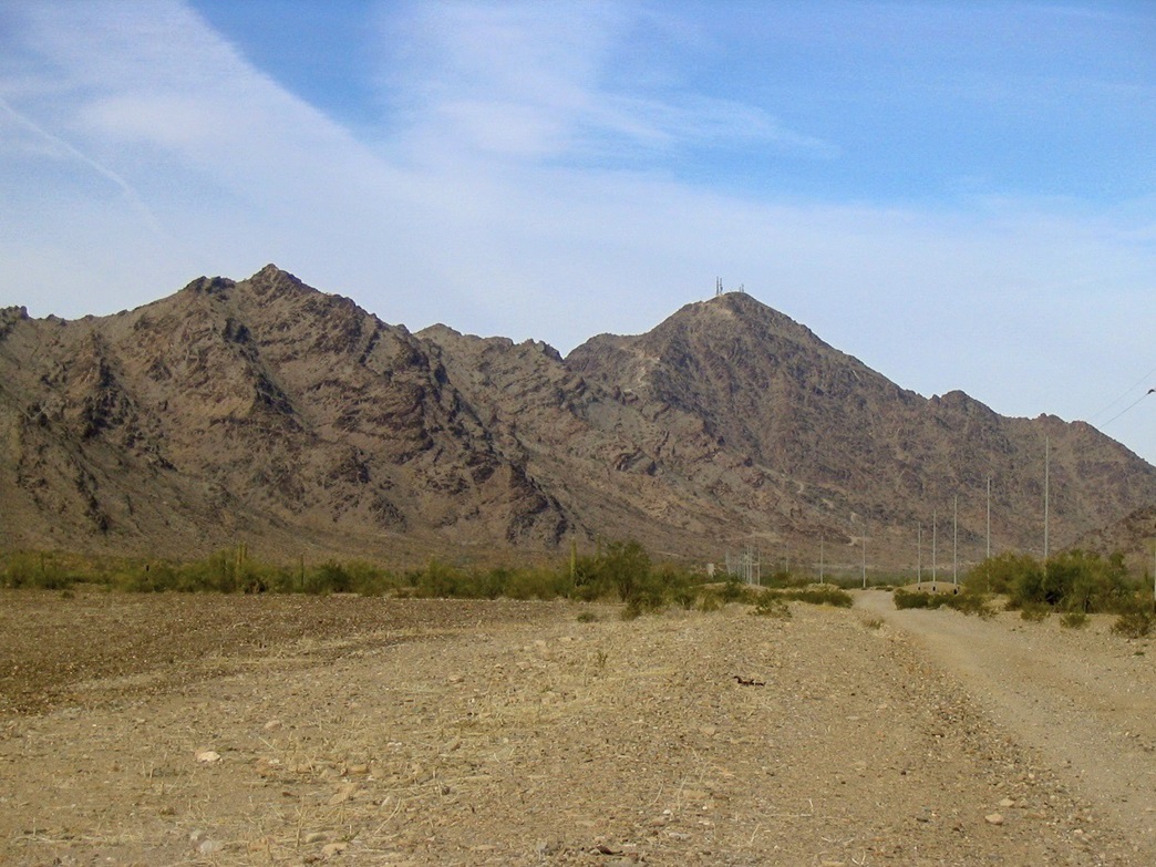
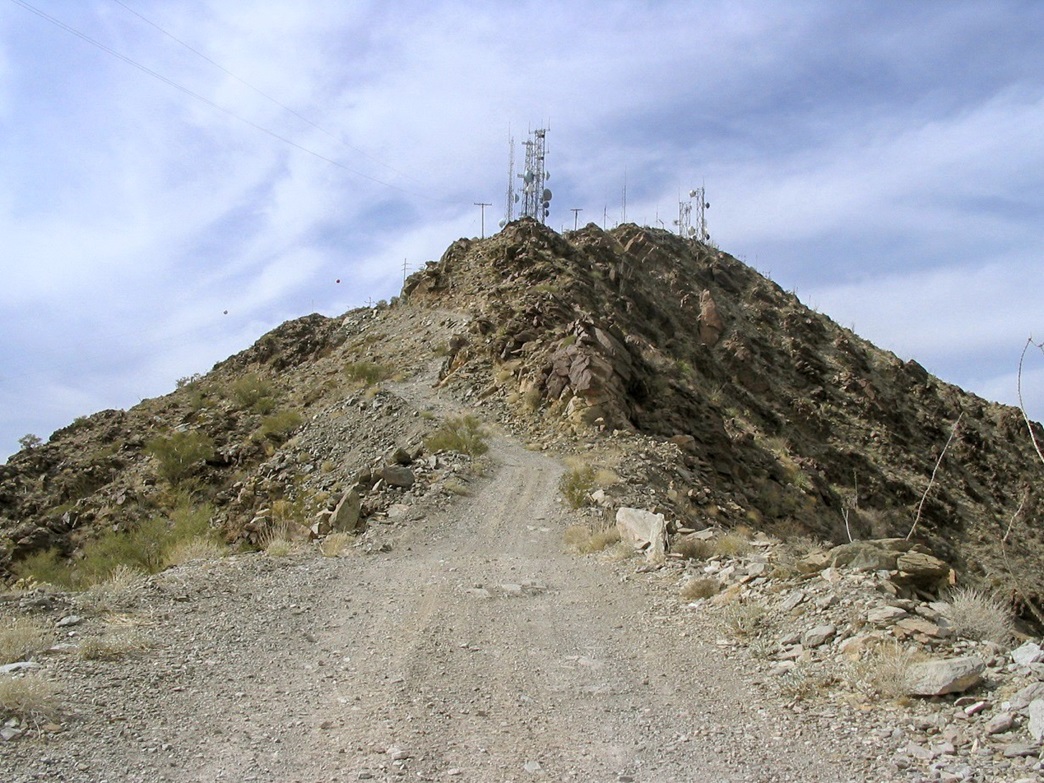
Cunningham Mountain is the highest point of the Dome Rock Mountains that straddle the Colorado River in Western Arizona. The peak is visible from Interstate-10, looking south from Blythe or from Quartzsite. It is the obvious high peak with all the towers. A rough dirt road goes to the top, so climbing it is not difficult.
Given its location, the only plausible time to hike this peak is in winter, so βð and I decided to spend Valentine's Weekend at a cool old motel called Scheffler's Motel in the town of Salome. This is where we spent our Valentine's Day of 2004, while hiking Harquahala Mountain. It's sort-of run down, but maintains a retro vibe from the 1940s. Plus, it's cheap. From here, Cunningham Mountain is about a 45-mile drive. We arrived the previous night.
We got moving at 9:30 a.m. today, in no hurry. We followed US-60 to Quartzsite where we stopped for drinks, then US-95 south for eight miles to the El Paso Gas Line Road near a set of large power lines and a red-and-white valve system, presumably for the gas line. Turning right on the Gas Line Road, we traveled another 7 miles into the range. We took this good dirt road slowly, stopping often for photos. We came to a four-way junction near the Copper Bottom Mine, and turned left, driving the side road for about a quarter-mile to a sharp bend near a locked gate, elevation 1,650 feet.
I parked off the road here, butting back into a space near a small rock outcrop that had the added bonus of keeping the truck invisible from below. Across the way were a few people and vehicles, hanging around doing something we couldn't tell. During the day we saw a few quadrunners and motorbikes, plus jeeps and trucks. However, no one seemed interested in our mountain. The big draw seems to be the Copper Bottom Mine. There are still some buildings there. A number of side roads not shown on the map attract the quads and motorbikes.
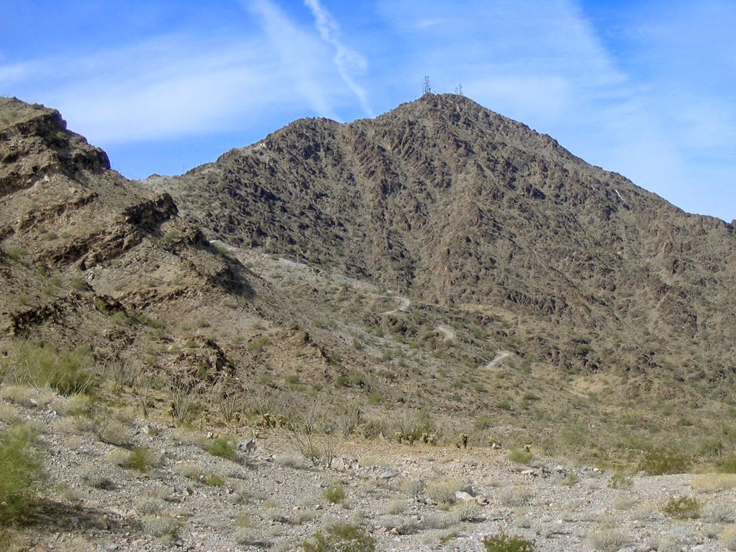
The hike to the top was as easy as it looked on the map. Once past the locked gate, the road goes steeply uphill and never lets up. The road switchbacks sharply, with tight turns and few level spots. We saw evidence of a recent hiker and some quads that drove this road possibly within the past week. The main summit mass is always visible to the west, although the true summit stays hidden behind foreground rocks.
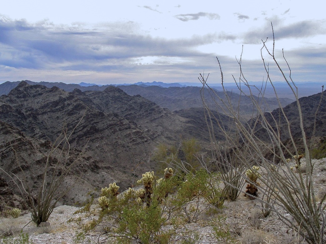
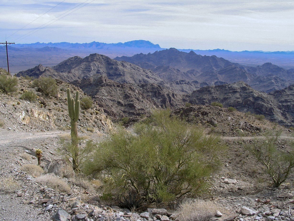
We took a break after thirty minutes, then pushed on to where the road meets the main ridge at elevation 2,460 feet, where we took another break, roughly about a mile up and the half-way point of the hike. Here, we had wonderful views looking south into the rest of the range, with its craggy peaks and sharp ridges. It certainly did occur to us that despite the road's general lack of beauty, it allowed for an easy way to the top. Otherwise, a climb of Cunningham would be one long rock scramble, with cactus too.
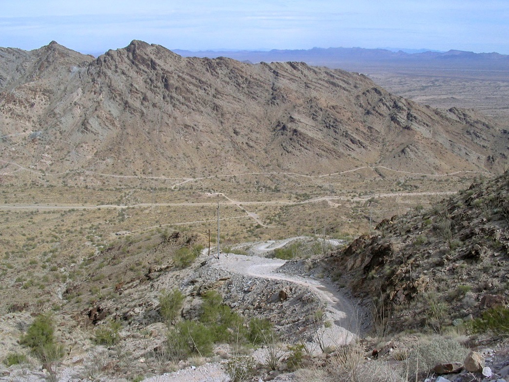
From the ridge, we could see the road continue upwards, cut into the side of the ridge and zig-zagging through the rock outcrops. We plodded forward, taking another break after another 30 minutes at an overlook, this time to the north and east where we could see our truck, all tiny, way down below. Power lines line the route, and some were "humming", either by the wind or probably by the electrons pumping through them. In spots along the road, there were exposed veins of glossy-white quartz.
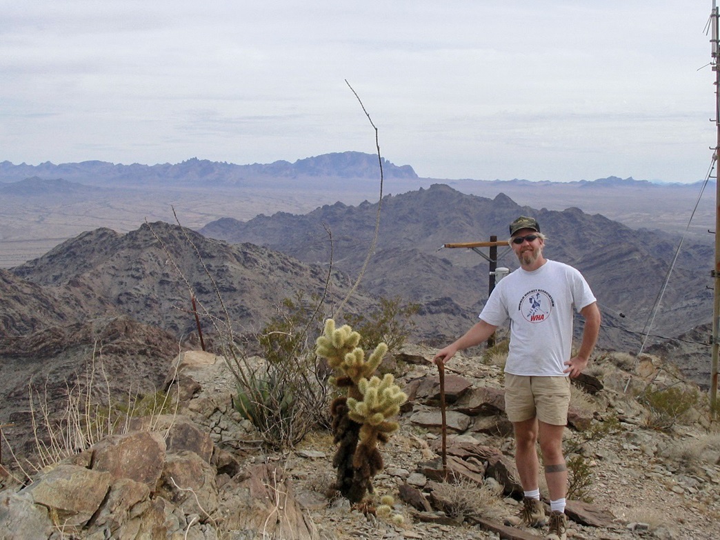
We continued forward to a sharp right turn from where we could see the top, now just a few hundred feet up ahead. I went ahead for the last 100 feet, but waited below the top for βð so we could walk the final few feet together. We took a break beside the summit rockpile and gatorade-bottle register. Lacking a pencil, we signed in with colored lip gloss. My WHA t-shirt kept me warm.
The summit is full of towers and little buildings, running on generators and timers so that there was always a din of engines and humming fans going on. The views were excellent in all directions. The day had started cloudy and had become more overcast, but we could still see peaks off on all horizons. The Dome Rock Range itself dominated the north and south views, and we could make out Interstate-10 as it winds through the range about five miles north of our position. The town of Quartzsite and its thousands of RVs spread out to the northeast, while Blythe and its farms were to the west. The Colorado River was a blue squiggle on the valley floor.
Mountains I could make out were Signal Peak directly east, with Castle Dome Peak to the southeast. We could even make out the broad hump of Harquahala Mountain to the northeast. Many other peaks and ranges lay in all directions, too many to name. It had taken us exactly two hours to reach the top, covering 1,800 feet of gain in about two miles. We spent 40 minutes resting and eating. I taped m'lady's knees for the hike down.
We took the downhills slow, hiking together to help one another in case of a slip. The weather had become cooler under the clouds, with a steady light wind. In time we were back to our truck, where we changed out of our hiking clothes (including my nifty WHA t-shirt) and got rolling back toward Salome. We celebrated with salmon and cheese bread sandwiches, plus episodes of Law and Order, one after another.
Cunningham Mountain was an enjoyable hike. In the cooler months it's an easy dayhike, and the road makes for an easy straight-shot to the top. The El Paso Gas Line Road is pretty good, although a low-slung passenger car would struggle the final mile into the range due to rocky segments, and sand and steepness where the road dips into and out of the washes. These washes can fill with water and debris during the summer monsoon, but being here in summer anyway is a fool's errand. For a winter hike, it's perfect.
|


|