
The Mountains of Arizona
• www.surgent.net
|
| Smith Peak |
• Highpoint: Harcuvar Mountains • La Paz County |
|
Date: January 8, 2006
• Elevation: 5,242 feet
• Prominence: 2,792 feet
• Distance: 10 miles
• Time: 4 hours and 10 minutes
• Gain: 2,600 feet
• Conditions: Dry, clear and gorgeous
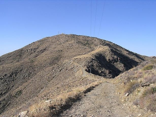
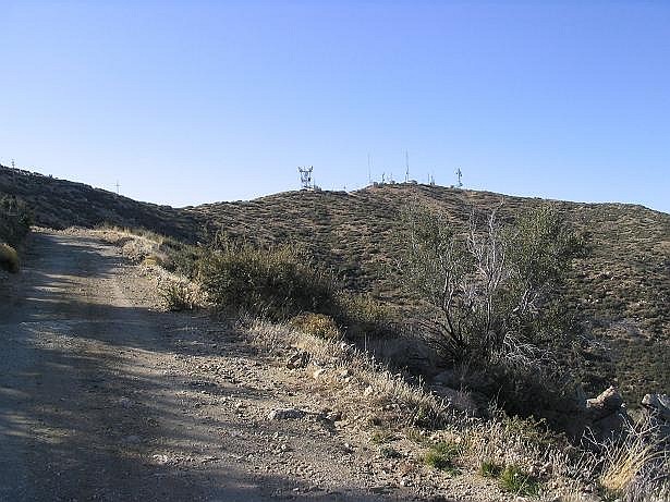
Smith Peak is the highpoint of the Harcuvar Mountains in northeast La Paz County, a few miles northwest of the little farming town of Aguila. The range is typical for a lower-desert range, with rocky slopes, cactus, and no big trees to be seen. The summit is home to a grouping of towers, necessitating a road to the top for the workers. Thus, hiking this peak is simple, but still a good workout.
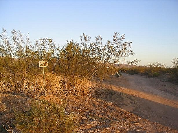
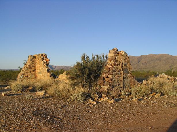
My wife was out of state visiting her family, and I had time off from work, and the day was stunningly clear and dry for early January. Smith Peak wasn't too far to drive, so I got up early and drove to Aguila, about 80 miles northwest of Phoenix, then a series of local dirt roads and desert tracks to the access road leading into the range. This last road is marked by a metallic sign saying "Smith Pk". The road turns and follows a gravelly wash for a couple miles, soft enough so that stopping might actually get the vehicle stuck. After the gravel wash, the road regains the desert terrain, bypasses an old stone ruin, and aims for the lower slopes of the range.
Were I brave enough, I could have driven the road all the way to the top. However, I wanted a hike, and once I started up the steepening slopes, I parked at the first wide spot I could find. This left me about five road miles northeast of the summit. I locked up the truck, shouldered my day pack, and started walking.
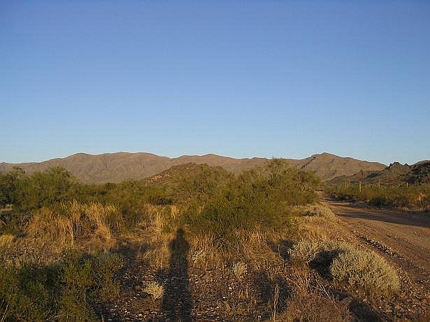
From my truck, I walked the road as it switchbacked twice, gaining a small saddle. I continued up another short steep section and to another saddle, near a hill with Benchmark "Bullard", not to be confused with Bullard Peak, which is southeast of the range. I had hiked a mile to this saddle, gaining about 900 feet. I could see the rest of the route from here, with the towers atop Smith Peak visible about 3 miles west. I took a lengthy break here.
The next couple of miles went quick as the road gained and dropped gently along the range crest. In another 40 minutes, I came upon power lines and the junction of a much-older road that is still shown on the Smith Peak map (the road I was on is not shown and is obviously newer). From here on to the top, the new road and this old road braided with one another. In one section I opted to follow the old road as a short cut. It was considerably steeper but still walkable. Otherwise I stayed on the newer road. The route eventually drops about 200 feet to a pass at 4,700 feet, then starts a steep slog up the remaining segment to the top.
I could see the buildings up top and figured I was basically there, but to my mild chagrin, when I passed a bend I saw I still had about another half-mile to go, as the towers were strung out over a wide segment of the summit. I arrived at the summit at 10:45 a.m. I found the register and noted I was the second person to visit in two days. I had seen some fresh prints coming up ... and then I was amused to see that yesterday's visitor was Nick Scouras, one of my teammates on the Mazatzal Peak climb from November. What a small world.
I signed in and had a small lunch in the lee of a building. The views of the deserts and nearby ranges were amazing in this clear weather. The Harquahala Mountains were immediately south. A dust cloud was kicking up near Salome to the west. The ranges and plateaus of western Yavapai and southern Mohave Counties were to the north. Way off on the northern horizon stood snowbound Humphreys Peak. I didn't spend too long up top, though, and got moving within 15 minutes. The air was chilly.
The hike down went fast. The gradients were easy, but there were some uphill parts to contend with as well. In many places I jog-walked, and I was back to my truck within 90 minutes, coming back at 12:30. I took the downhill drive slowly, worried a little about a tire that has a very slow leak. But everything was fine. I had a Subway sandwich in Wickenburg. The teenager worker said I looked like I'd been working all day. When I said I'd been hiking, he asked, honestly, if I did this "on purpose". He then got into a discussion with a co-worker about Dungeons and Dragons. I was home by 4-ish battling some traffic along the way.
|


|