The Mountains of Arizona
• www.surgent.net
|
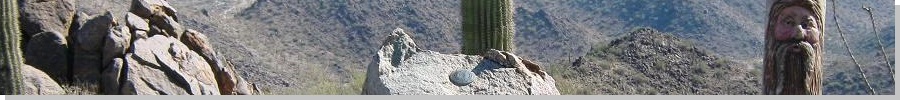
| Estrella Benchmark |
• Maricopa Mountains • Sonoran Desert National Monument • Maricopa County |
|
Date: November 6, 2011
• Elevation: 2,766 feet
• Prominence: 1,032 feet
• Distance: 8 miles
• Time: 4 hours and 15 minutes
• Gain: 1,240 feet
• Conditions: Clear and cold
Arizona
•
Main
•
AZ P1K
•
PB
•
USGS BM Datasheet
Estrella Benchmark is one of many bumps in the Maricopa Mountains, now encompassed within the Sonoran Desert National Monument. The peak is about three miles from the nearest road, state highway AZ-238, about midway between Maricopa (the town) and Gila Bend. This peak is not to be confused with the much larger Sierra Estrella Range, which runs parallel to the Maricopa Range, about 20 more miles east.
In May of last year, I visited here for the first time, along with Dr. Marvin Bittinger, professor emeritus at IUPUI and author of Calculus and Its Applications. I was brought on as co-author for the 10th edition which we worked on during 2010. Marv also likes to hike and explore the deserts around Phoenix. Before it got too hot, we drove out this way to hike the flat trails into the range. Marv was tickled to see a rattlesnake while hiking --- it was his first rattler sighting in the wild. I enjoyed the hike and also eyeballed the surrounding peaks, noting a way up to Estrella Benchmark's summit for a future trip.
A storm came in on Friday, with winds and blowing dust, followed by a lot of rain Friday and Saturday. Most of Saturday was cloudy and very cool, so Beth and I stayed in, catching the new Harold and Kumar movie that night. I got up early the next morning (Sunday—today) and drove 45 miles to the trailhead, arriving at 7:45 a.m. I took the usual route through Maricopa, then state route 238 west about 22 miles to the small parking area. It s not well-marked, just some signs set back in suggesting something is here.
The trailhead is actually an old road which encircles the whole range, but the BLM closed the road back in 2008 due to off-road vehicle damage. The downside is that the parking area is just a few feet off the main highway. Not too many people travel this highway, and Marv and I had no trouble with vandals back in 2010, so I hoped for the best for my hike today.
The weather was spectacular: low 50s when I rolled in, and crystal clear. The whole place was quiet (except for the occasional motorist and the train that came through every 20 minutes or so). This trailhead is called "The Boulders", named for a set of large boulders piled up about a mile in, invisible from the main road. My peak of interest was set farther back, with some nearby peaks looking higher for the moment. I got dressed, locked everything up, and started walking at 8 a.m.
The old road is the trail for at least the first two miles of the journey. It takes off at a northwest angle, with a small rocky hill, elevation 1,653 feet, off in the distance. It's about a mile to this hill, and I covered this portion in 15 minutes. Past the hill I walked more, coming to a road junction (this is where the actual "boulders" are) after another half-mile, then left (west) on a side road about another half-mile past the junction. All this went well and I made good time. The conditions were beautiful, the air heavy with the scents of the desert plants, enhanced by the recent rain.
When it felt right, I left the road and started walking northwest cross-country, aiming for a small jumble of rocks at the east foot of Peak 2461. This cross-country portion went well, as the ground was open, mostly free of brush, and gently pitched. To here, I had covered about 2.75 miles and had only gained about 200 feet since starting.
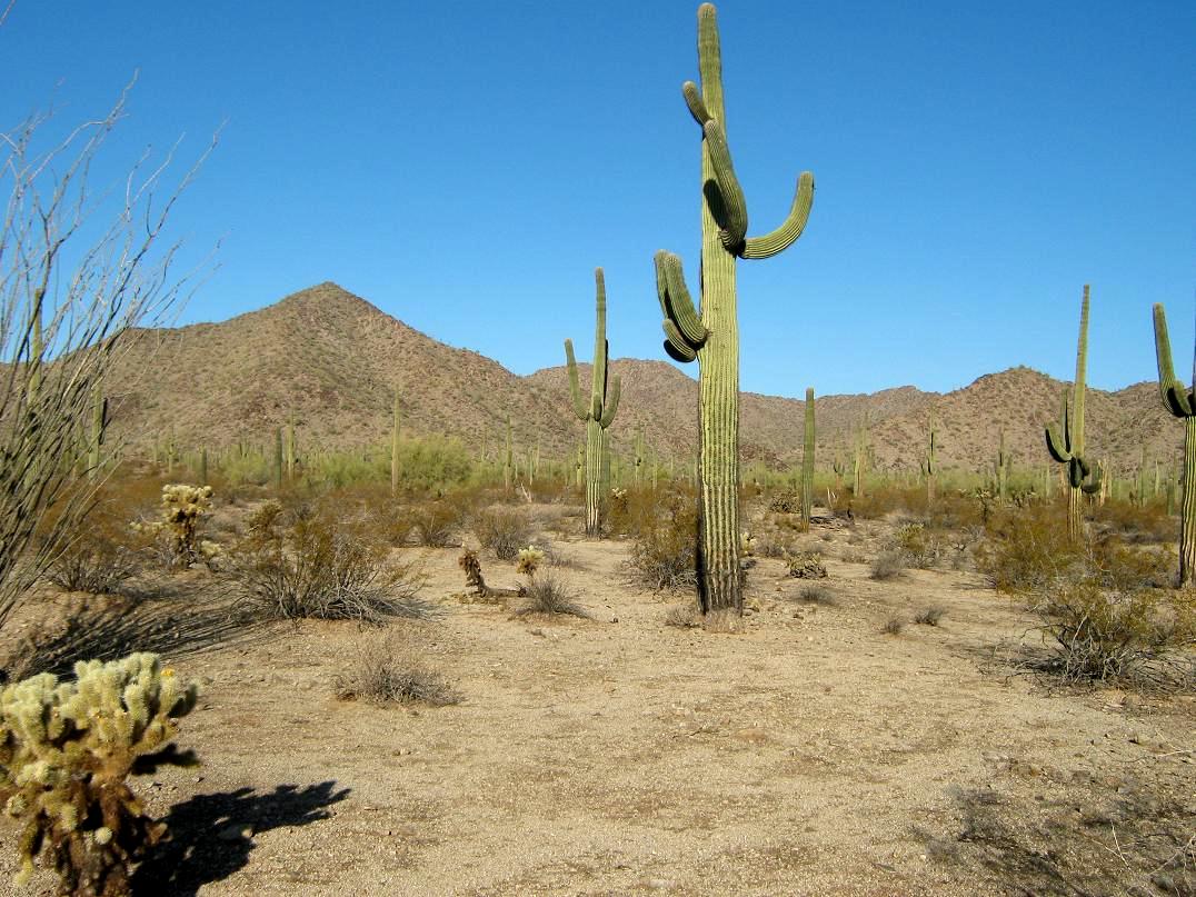
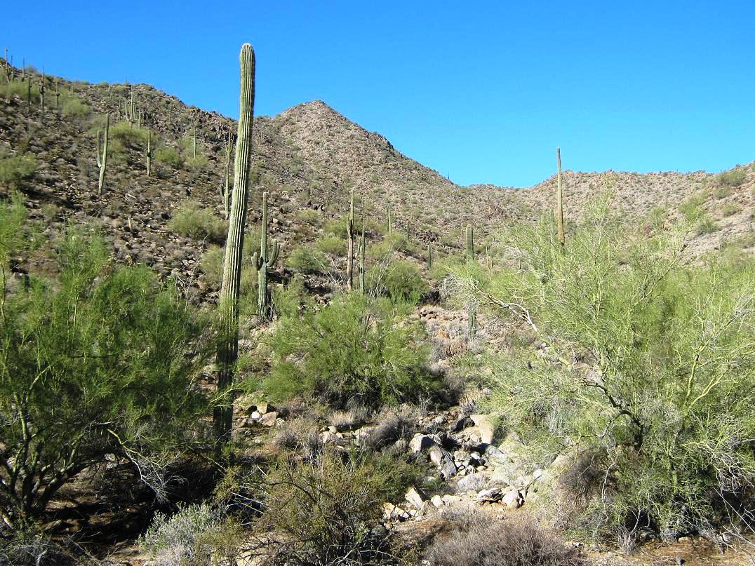
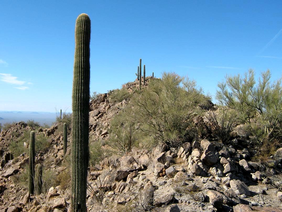
I passed through a forest of saguaro cactus, many standing up to 30 feet tall. The path of least resistance generally led northwest, and slowly my way became constricted with the foothills on my left, and a large, deep-cut drainage on my right. I went as far as I could in this way before I was essentially forced to drop into the drainage. For the next mile, this drainage would be my route.
For the first few hundred yards, the drainage was easy and efficient. It was wide with a sandy bottom and few obstacles. Here and there it would tighten up, get rocky, or come to a stand of palo verde, whose branches and sub-branches intertwine with one another, creating barriers. When possible, I d bypass these sections and in a few cases, ascend out of the drainage for a spell, then drop back in when convenient.
The drainage curves with the natural lay of the land, cutting east at one point, then curling around the east-foot of a small ridge and buttress coming off the summit. I was close, but I still had close to a thousand vertical feet to go, and things were getting rockier and brushier. Although not bad by usual standards, I was slowed a little by these obstacles.
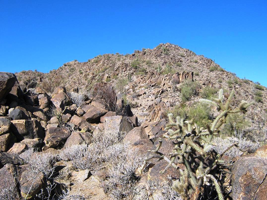
I kept at this for another half mile, moving west up the drainage, aiming toward a saddle north of the summit. This was my plan, but at one point I found myself angling left out of the drainage, high enough that I decided to leave the drainage altogether and make a beeline upslope. This went well, the slope being steep but rocky, just enough to create convenient "stairs", with the grasses forming into mats that also helped with traction. I quickly gained 250 feet to put me on this east ridge, roughly at 2,460 feet elevation, and no more than a quarter mile from the top, which was visible just up the way.
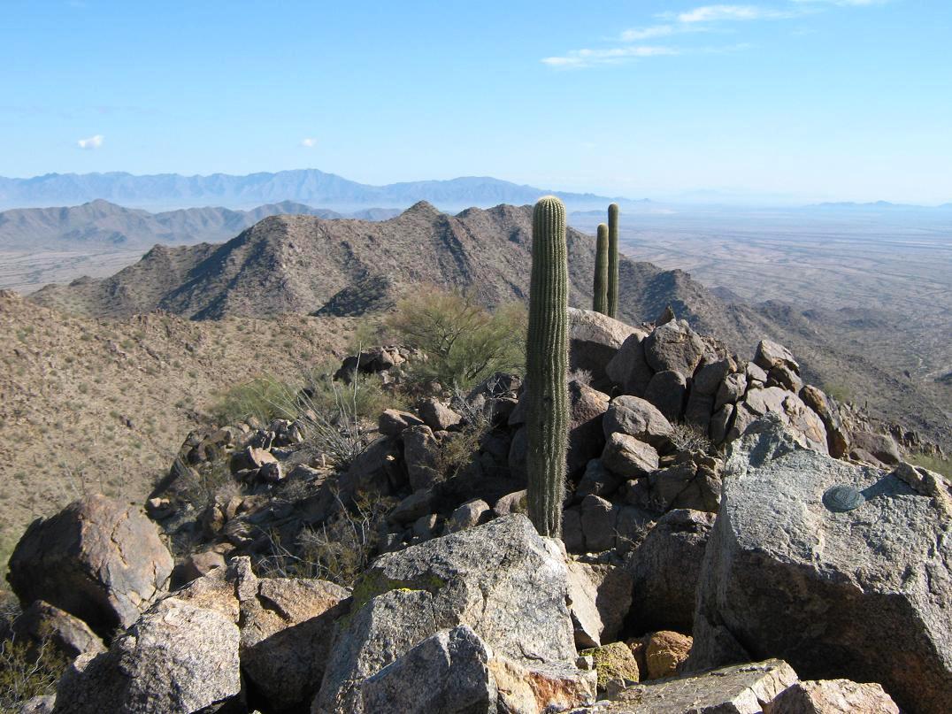
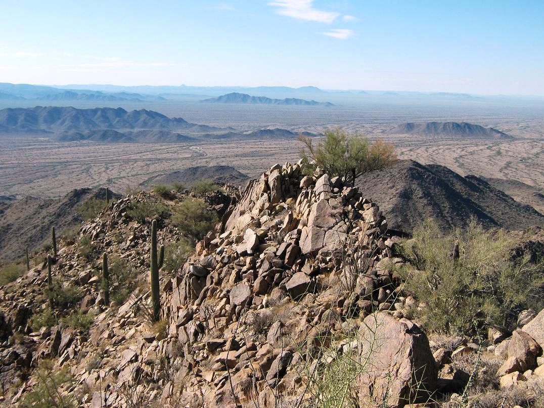
The ridge-walk to the summit consisted of getting up, around and down about five separate rock pinnacles. None were technical, but they were scrambly and slow going as I had to scan a route, and pick my way through the barriers. When the brush closed in, I had little choice but to barge through it. Nevertheless, I managed each little subsummit fine, and arrived to the true summit at 10:20 a.m. The top is "only" 2,766 feet, low enough for saguaro, and a couple were right there on the top. It s rare for these giant cacti to be exactly on a mountaintop, so this was especially nice.
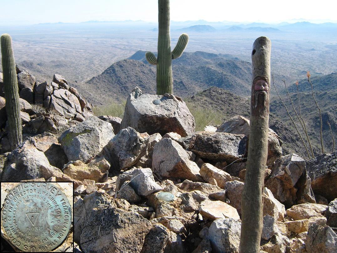
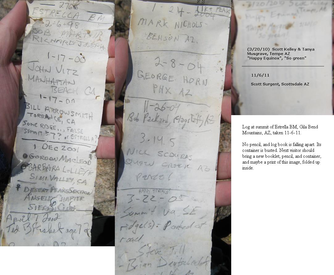
The top is rocky (no surprise), with the benchmark embedded onto a flat rock, and a witness marker slightly higher on a nearby rock. The register was placed here in 1998 and held just about 15 names, most of whom I know. However, the bottle it was held in was busted. I took photos of the pages, and signed myself in "electronically" as there was no pencil to be found. I wrapped up the pages in a plastic bag, stuffed it all back in the bottle, and hoped for the best. The last visitors were here in March 2010, and before them, in 2007. The next person may need to take a new booklet, pencil and bottle because I suspect what's there now won't last.
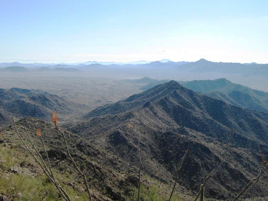
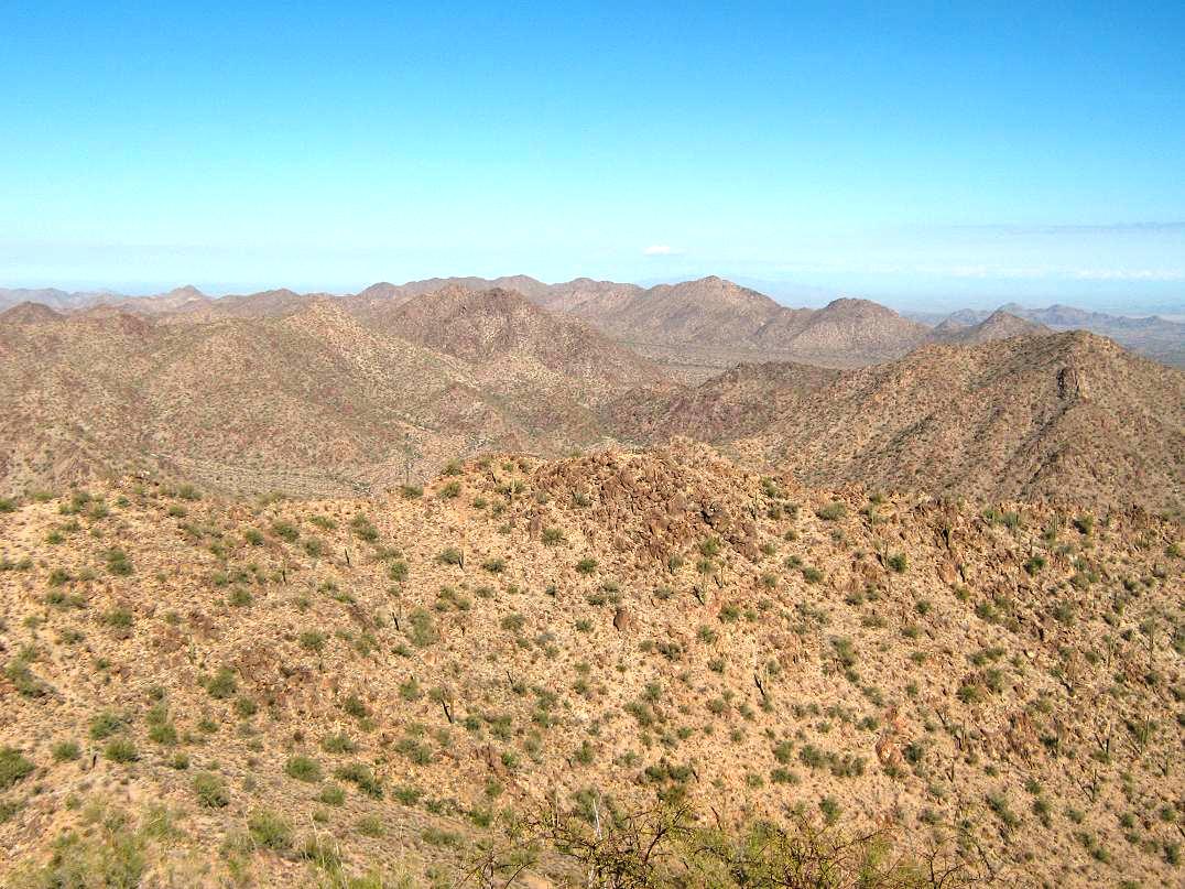
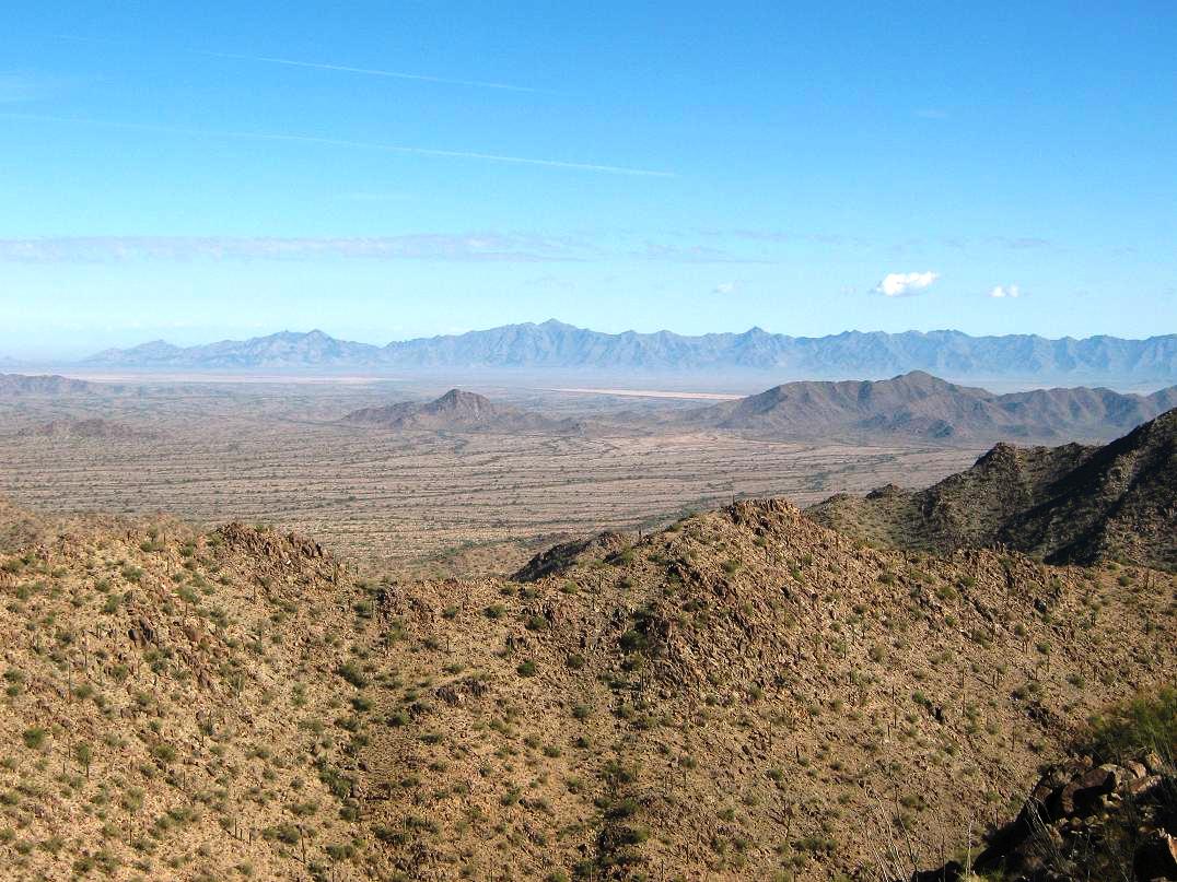
I took a longer break than usual. The weather was brilliant, and so were the views. In all directions were beautiful mountain ranges and broad desert valleys. Looking west were the Gila Bend Mountains and its notable summit, Woolsey Peak. North were the Maricopas and Margies Peak. Out east, the Sierra Estrella formed one continuous wall. South was the blocky summit of Maricopa Mountain, this range's highest point. I spent about 25 minutes up here, enjoying the views, the weather and the solitude.
Coming down, I decided to descend north off the peak to the saddle that I had originally been aiming for. I dropped about 250 feet to it with no problems, then descended the easy slopes back into the drainage. I dodged the usual trees, shrubs, cactus and rocks as best I could and shortly, was back to where I had left the drainage about an hour ago. I made great time on the hike out, ascended out of the drainage back onto the desert plane and took a break at the Boulders. Although navigation is easy, Hill 1653 served as a good landmark on the trek out. I tended to follow the lay of the land since it was easy, but had to correct myself a few times to get back to the road. I was back to my truck about 12:15, and happy to see it still there, unmolested.
This is a nice hike, and overall, the obstacles don't present an unnecessary challenge. Very few people hike this peak, and the log at the trailhead shows maybe 2 or 3 people come here on any given weekend in the cool months. Most only hike to the boulders or to the top of a hill immediate to the parking area, where a flag flies on top this hill. In summer, of course, it's too hot.
|


|