The Mountains of Arizona
• www.surgent.net
|
| Hayes Peak |
• Highpoint: Sierra Estrella • Highpoint: Gila River Indian Reservation • Maricopa County |
|
Date: November 21, 2009
• Elevation: 4,512 feet
• Prominence: 3,212 feet
• Distance: 9 miles
• Time: 11 hours
• Gain: 4,190 feet net
• Conditions: Clear and calm with mild temperatures
• Teammates: Adam Helman, Chris Gilsdorf & John Klein
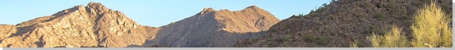
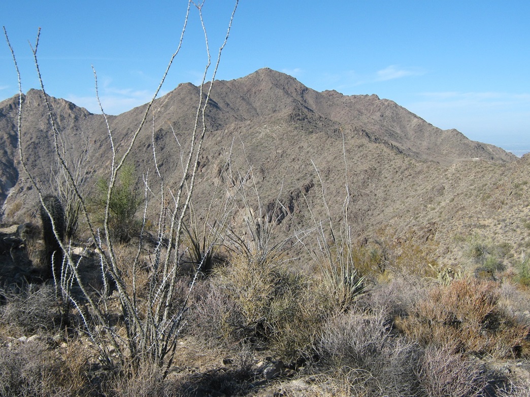
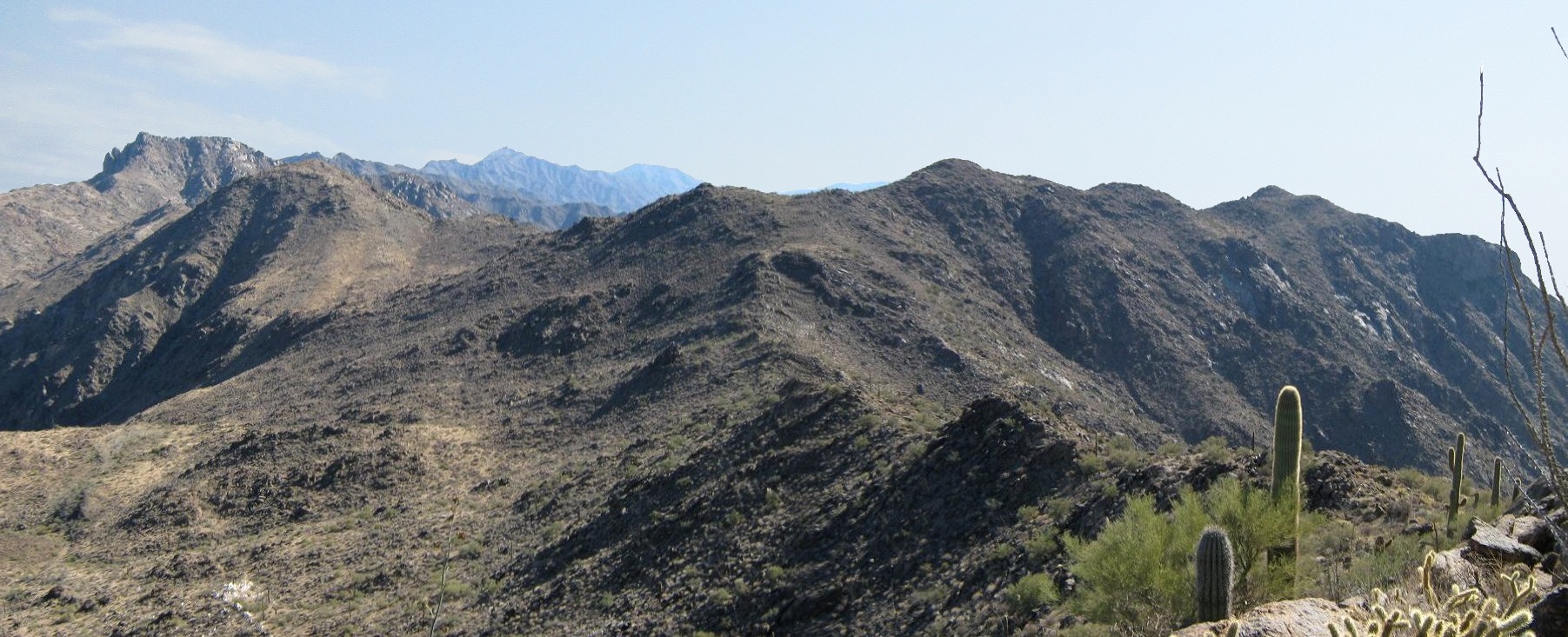
The Sierra Estrella ("Star Mountains") are the most prominent and visible mountains south of the Phoenix metropolitan area. The mountains run on a southeast-northwest alignment, with the north half inside Maricopa County, the south half in Pinal County. The summit lies in the north half, within Maricopa County, and is easily visible from virtually everywhere in Phoenix.
Access to the peak is limited by a couple factors: the Gila River Indian Reservation encompasses the spine of the range (including the summit) and its eastern slopes. The western slopes are a mix of BLM land, private land, and portions enclosed within the Estrella Mountain Park. There is no trail to the peak, and the roads on the west side are primitive and sandy.
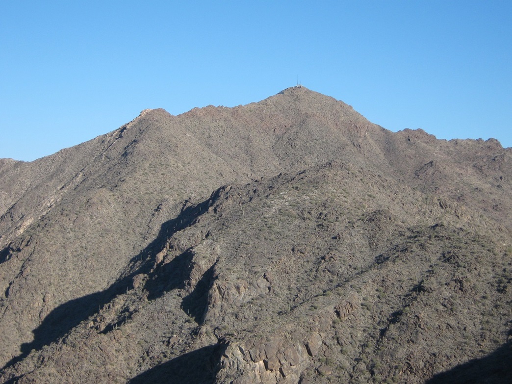
The summit is known as Hayes Peak, in honor of the late Ira Hayes, a native of nearby Sacaton, a U. S. Marine, and one of the flag-raisers captured in the iconic photograph taken on Iwo Jima, during World War II. But this name is not official. It appears on some mapping programs, but not on others. Most printed maps do not cite the summit by this name (if they cite the summit at all). The other common name is simply Sierra Estrella Peak.
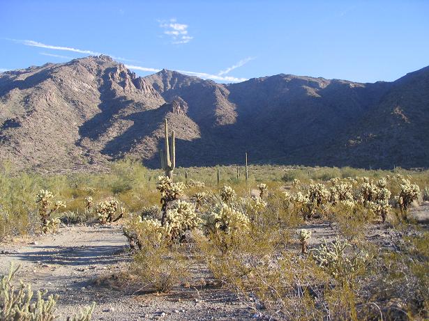
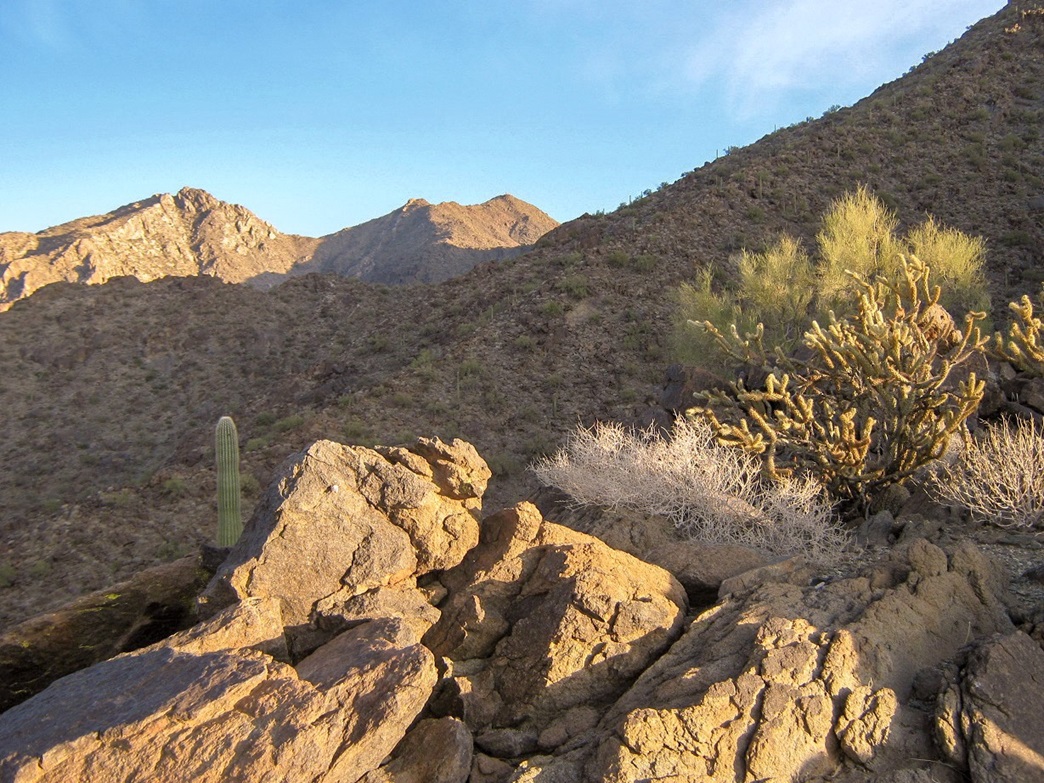
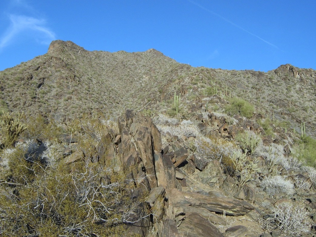
Despite its proximity to Phoenix, only a handful of people climb this peak in any given year. It is a tough grind up rocky and brushy slopes. There exist routes that do not involve cliffs or other obstacles. Thus, the climb itself is easy from a technical standpoint, but difficult from a practical standpoint. The bad roads, the lack of a trail, the relentlessly steep, brushy slopes mean that it requires a lot of effort to gain this summit. A strong sense of route-finding is vital.
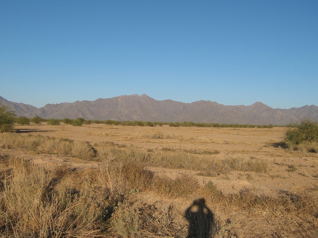
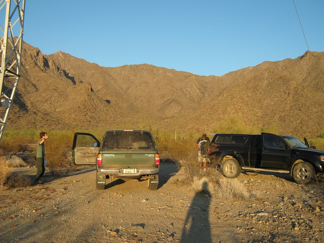
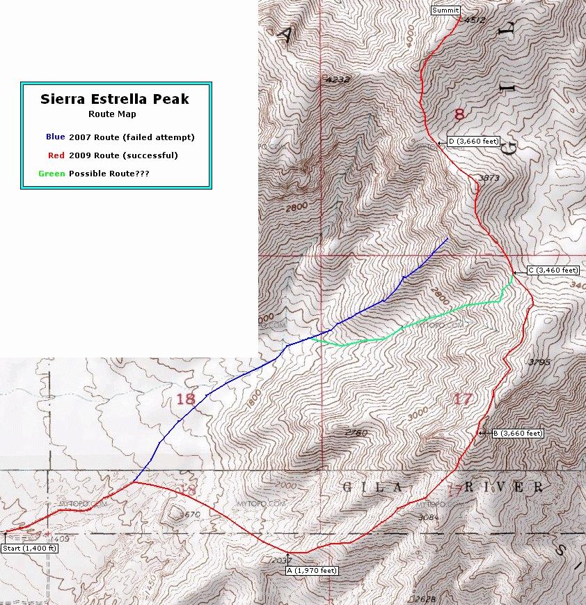
I first attempted this peak in January 2007, with Scott Casterlin, John Hamann and a couple Tucson-area climbers whose names I forget. We met in Maricopa, followed state route AZ-238 west to the little school off all by itself near the town of Mobile. Here, we went north to where the pavement ended, then northwest along Komatke Road and the El Paso Gas Line Road for a number of miles. We then followed Bullard Road, Chandler Heights Road and the Ocotillo Road alignment. The drive was an ordeal by itself. Sections were sandy and all of the roads were barely maintained. We parked at the east terminus of Ocotillo Alignment near power lines, southwest of the peak.
The day was cold (the high would only reach about 48 degrees F), but clear. We followed a line that was essentially a direct approach to the peak. The climbing at first was easy, but the ridge we were on had such a short profile that we were encountering 10-foot, 20-foot and higher cliff bands, most Class 3, some low-Class 4. I started to lag, and finally called it a day at about the 3,800-foot level. The others went on to the top.
As I hiked down, John came upon me and we hiked out together. We were back to the vehicles, the time still not yet noon. We waited for the others, but the wait went on for hours. We were getting concerned, and I had decided that I would call in the rescue guys if they weren't out by sundown. They finally stumbled back to the cars about 5 p.m.. They said they had got into some bad slopes and cliffs up high.
I disagreed with the approach ridge from the start, but everyone else seemed intent on it. There is a much longer ridge to the south that goes up to the range crest. That ridge looked a lot friendlier than the one we had been on. I decided that when I come back, I want to follow that longer ridge. My second attempt would wait almost three years, late November 2009, when Adam Helman, Chris Gilsdorf, John Klein and I teamed to retry this summit. For Adam, it would be his second attempt too. He simply got lost on the approach roads his first time.
Chris and I drove to Mobile along AZ-238, meeting Adam who had come in from San Diego. We followed the same net of roads as I had taken in 2007, but found them to be in much worse shape. The Gas Line Road was now blocked by a series of sand berms, put up by bulldozers. Maybe the city (Goodyear) doesn't want people taking this road. Well, we did, but it required driving through soft sand in low 4-wheel drive. The three of us arrived in the late afternoon, and John arrived a few hours later from Tucson.
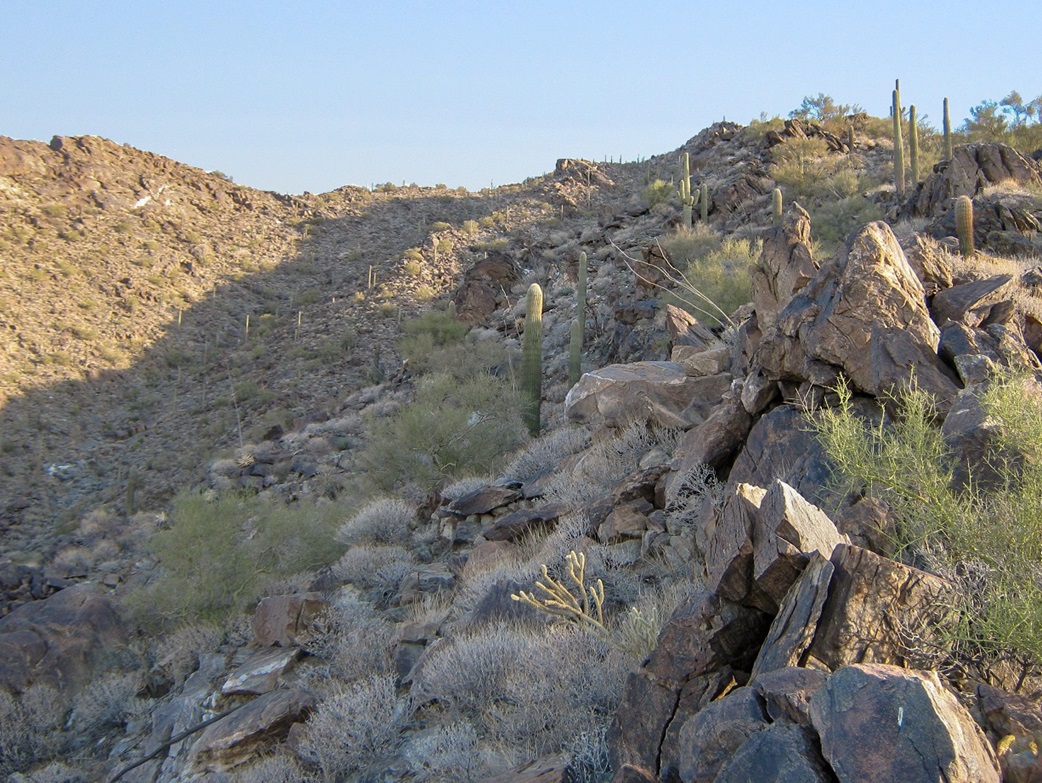
We awoke early and started the hike at 6:30 a.m., with enough light so that we did not need flashlights or headlamps. We walked up to the end of the road, then went southeast across open desert toward a lowpoint, elevation 1,970 feet, along the ridge we'd be following up to the main range crest. We crossed a number of arroyos before arriving to this saddle (marked as "A" on the accompanying annotated map). We covered a mile in 40 minutes, gaining 600 feet. Looking up at the rest of the ridge, we could see mostly barrier-free climbing ahead. There were rock fins and outcrops, but nothing appearing to be a show-stopper.
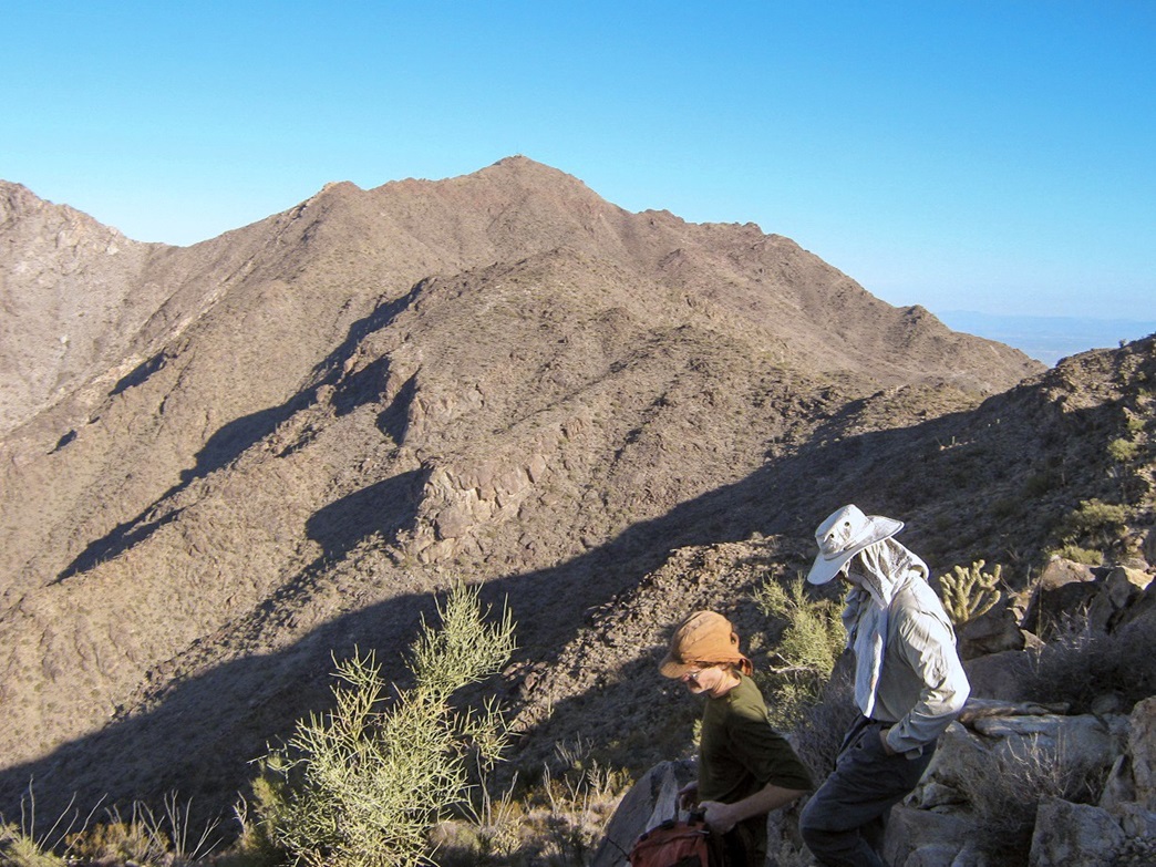
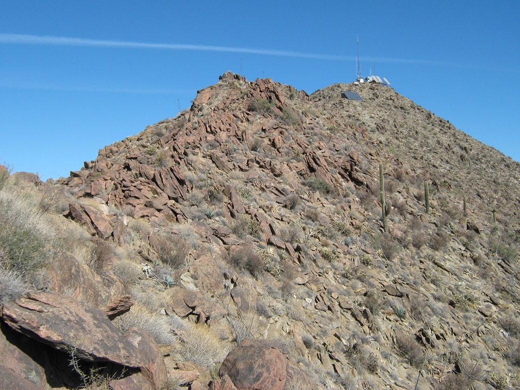
The next destination was a knob, elevation 3,660 feet, marked "B" on the map. From A to B, we gained over 1,700 feet. It was steep and brushy, and we started to string out here, me being the slowpoke. I came upon the rest of the crew at the knob around 9:00 a.m. So far, 2,200 feet of climbing in the books. The summit was now visible, "only" 850 feet higher, but requiring a long traverse across the main range crest. We still had a lot of work to do, and I was rushing. This would nearly do me in for the rest of the climb.
We strung out again as we approached our next waypoint, a saddle north of Point 3,795, the saddle itself with an elevation of 3,460 feet. We should have stayed high, but instead, it "looked" faster to traverse across the west-facing slopes on a rhumb line to the next saddle. This was a big mistake. The slopes were loose and brushy, and I was constantly gaining and losing fifteen, twenty and thirty feet over and over again to bypass obstacles. What would have taken twenty minutes had we stayed high took nearly an hour, and I expended a lot of extra energy. I was moving slower than even I would have liked, and growing a little concerned about my pace, too.
John and Adam had already gone ahead, while Chris would stay back for me, although he didn't have to. As we started to ascend the slopes to gain the next ridgepoint, I started to experience charley horses and cramping in my legs. It was painful and slowed me even more. It was all I could do to get up Point 3,873 and down to the saddle beyond it. I was in excruciating pain. If I sat and rubbed my legs, they'd calm down and I'd feel better again. When I started moving, they'd seize and cramp.
I was now on the saddle just 400 feet below the summit. John and Adam had already summitted and were on their way down. The four of us had a powwow, about what to do with the slow guy. I felt awful for creating this inconvenience for everyone. However, I was too effing close to not go for the top, and I really didn't want to come back a third time for this peak. My legs were killing me, but I was going to drag my ass up the peak one way or another.
It was agreed: John would carry on ahead, Adam could do as he pleased, while Chris would graciously hang with me while I forced myself up the remaining slopes to top out. Six hours after having started, I tagged the top, took a couple photos, marvelled at the view of Phoenix, then started right back down.
The hike down was better in that I didn't need to use the muscle groups that were cramping on me. I was able to keep a consistent pace. We descended to the saddle, back up to Point 3,873 and down to Saddle 3,460, where Adam was kindly waiting for us. Any uphill movement brought back the cramps. We needed to re-ascend to Point 3,660, the top of the ascent ridge from this morning. I had no choice but to barge uphill and deal with the cramps and pain. I'd sit down and massage my legs, hike a few more yards, repeat, and in time, I hobbled to Point 3,660. It was 3 p.m..
The descent back down to the 1,970-foot saddle went slow. I was out of gas, exhausted, and as you have gathered by now, my legs hurt. The steep slope made every step a slow one since the rock would often roll out from under me, and I could barely stand as it was. I had to take many breaks and I fell flat on my caboose a couple times. Finally, back down to the low saddle, we stopped and met up with Adam, then the three of us walked the easy terrain across the arroyos back to the road, and from there back to our vehicles, just as the sun was setting. I was damn relieved to be done with this ordeal. My legs were killing me. I was utterly spent, and apologized to the others—and thanked them too—for being patient with me under these circumstances.
John had been back at his truck for hours by now and he was happy to see us. We stood around and talked briefly, but didn't waste too much time. I gulped down drinks from my cooler and massaged my legs, but we decided to get moving as by now it was dark and we wanted to be back on the pavement before too long. John mentioned that his GPS had tracked our gross elevation change for the day to be 4,700 feet, which includes all uphill sections, both on the ascent and descent. That was surprising at first but would explain a lot: 4,700 feet is a lot, averaging out to over 1,000 feet per mile.
Once back to pavement, we drove north toward Interstate-10, where we split ways. I drove back home to my wife and kitties, with two store-bought fruit pies for my wife. I took a bath to soothe the sore legs, ate a whole bag of chips (for the salt?), and slept like a log that night. I was happy to be home.
It felt great to finally climb Sierra Estrella. I no longer have to view the peak every day of my life and let it bug me that I haven't climbed it. The route we chose worked well and was never more technical than brushy class-2. We had no cliffs whatsoever, nothing that couldn't be bypassed. I felt vindicated in a way from my 2007 failure, now knowing there is a better way to the top that avoids cliffs entirely. This is one of the toughest peak I have climbed in Arizona. In terms of effort, ruggedness, length, height, steepness, rocks, this peak has it in abundance. The views are superb and the Estrellas have a well-earned reputation for their ruggedness. I can't imagine more than a handful of people climb the peak in a given year. As Chris said, you have to really earn this peak. We most certainly did.
On the descent, I peered down the slopes below Point 3,795 and they looked consistent, no cliffs or rocky obstacles. There was a time I was considering descending that way, but the concern of getting stuck prompted us to not try it. It's marked green on the map, and I suggest some brave hikers consider this approach as a possible way to gain the high ridge yet save some distance in the process. As for me, I am never going back to the summit. Once is enough.
Update: Since I posted this report and updated the page at Summitpost, a few hikers have followed the "Green" route with success, mentioning that it works very well with no impediments. Thus, I think it has become the default route up this peak. It's still a long grind, but certainly a little easier than what we did.
The summit's name, "Hayes Peak", does not appear on most maps and may still be an unofficial name, but it is used in enough places on the internet so that it is apparently the de-facto official name. We know that if it appears enough times on the internet, it must be true. I'll do my little part to ensure this name sticks and becomes official some time soon.
Ira Hayes, a Pima Indian and a member of the Gila River Indian Community, was born in Sacaton and gained fame as one of the flag-raisers in the photograph taken on Iwo Jima, during the second World War. Fame was his curse, and he died early at age 32, in January 1955. I think naming this peak after him is a splendid idea and I hope it becomes the official name, whenever the official mountain namers get around to making it official.
Officially, access to the peak is only allowed if the Gila River Indian Reservation people give permission, which they won't. But the west slopes lie on BLM or state lands. You'll cross the reservation boundary somewhere high on the ridges, but the Gila River Reservation do not have signs or fences or sentries up there. Thus, if you go, be aware of these facts, and be a good steward of the land, leaving it cleaner than you found it.
|


|